|
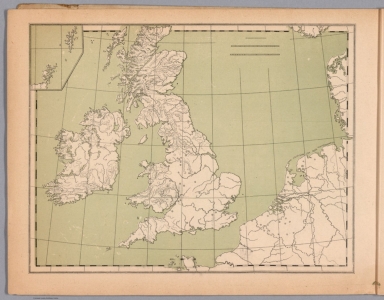
Author
Fer, Nicolas de, 1646-1720
Full Title
Les isles Britanniques, ou sont les Royaumes d'Angleterre et d'Ecosse, et d ' Irlande : Avec les costes Septentrionales de France et Celles des Pais Bas. Par N. de Fer.Avec privilege du Roy 1705 A Paris ... Charles Inselin Sculp. (to accompany) Petit et Nouveau Atlas. A Paris,1697.
List No
13012.020
Note
Engraved hand colored in outline Detailed map of England, Ireland, Scotland and Wales, with French coast and part of Netherlands. Shows political and administrative divisions, landmarks and place names. Includes index and compass rose.
Author
Mariette, Pierre-Jean, 1603-1657
Full Title
Nouissima Descriptio Angliae Scotiae et Hiberniae. Mariette excudit. (to acompany: Theatre geographique de France ... A Paris, Chez Pierre Mariette, M.DC. LIII (1653)). (inset) Oreades Insulae
List No
13021.060
Note
Engraved map of British Isles. Showing political boundaries, major cities, towns, villages, landmarks, forests, rivers and mountains. Relief shown pictorially. Includes decorative cartouche and vignettes of Sailing ships and sea monsters.
Author
[Reynolds, James, Emslie, John]
Full Title
Physical map of the British Isles and the surrounding seas. Drawn & Engraved by John Emslie. Published by James Reynolds, 174, Strand London, Decr. 13th. 1851. (to accompany) Reynolds introduction to natural philosophy. (insets) Meteorology of the British Isles. (with) Section from Beach Head to Cape Wrath. (with) Section from Dingle Bay to Yarmouth.
List No
13033.030
Note
Hand colored engraved map. Depicts the physical geomorphology of Great Britain and Ireland, including the depths of the sea surrounding the British Isles, and tidal action. Relief shown by isolines. Includes explanatory text.
Author
[Reynolds, James, Emslie, John]
Full Title
Principal eminences of the British Islands. Drawn & Engraved by John Emslie. London. Published by James Reynolds, 174, Strand. March 3, 1852. (to accompany) Reynolds introduction to natural philosophy.
List No
13033.033
Note
Hand colored engraved view of the highest mountains in England, Scotland, Wales and Ireland, as well as the heights of other significant locations in the British Isles. Includes notes: "The smaller figures denote the geological formations of the hills" and landmarks.
Author
[Brion de La Tour, Louis, 1743 – 1803, Desnos, Louis Charles]
Full Title
Les Isles Britanniques, Assujetties aux Observations Astronomiques ... Par le Sr. Brion. A Paris, chez le Sr. Desnos. 1786. (to accompany) Atlas general, civil, ecclesiastique et militaire, methodique et elementaire pour l'etude de la geographie et de l'histoire ... par M. Brion, dirige par le sr. Desnos … A Paris 1786.
List No
13129.029
Note
Engraved hand color map. Inset: Supplement: Shetland and Orkney Islands. Includes decorative engraved title cartouche and border. Shows political boundaries. Relief shown pictorially.
Author
[Wyld, James, 1812-1887, Wyld, James, 1790-1836]
Full Title
Map of the United Kingdom of Great Britain and Ireland. By James Wyld. London. Published by James Wyld. (to accompany) A new general atlas of modern geography : consisting of a complete collection of maps of the four quarters of the globe ...
List No
13170.011
Note
Engraved map, hand colored in outline. Inset: Shetland Is. Includes statistical table. Covering all of England, Scotland, Ireland, and Wale. Showing political and administrative boundaries, railroads, towns and cities. Relief is shown by hachures.
Author
[Lizars, William Home, 1788-1859, Lizars, Daniel]
Full Title
British Islands. Published by T. Brown & W. & D. Lizars, Edinr. (to accompany) New Edinburgh general atlas ... The maps drawn and engraved by W. & D. Lizars.
List No
13230.011
Note
Hand color engraved map. Shows administrative and political boundaries. Relief shown by hachures. Prime meridian is London.
Author
Faden, William, 1749-1836
Full Title
Britanniae Facies Antiqua. Published by W. Faden. Jany 1, 1819. Hatchett, sc. (to accompany) Atlas minimus universalis, or, A geographical abridgement ancient and modern of the several parts of the earth ... Second edition. Jan 1, 1821.
List No
13243.021
Note
Double page outline hand color copperplate engraved ancient map of the British Isles. Relief shown pictorially.
Author
Faden, William, 1749-1836
Full Title
United Kingdom of Great Britain and Ireland with the adjacent Islands. Published by W. Faden. Jany. 1,1819. W. Palmer sculp. (to accompany) Atlas minimus universalis, or, A geographical abridgement ancient and modern of the several parts of the earth ... Second edition. Jan 1, 1821.
List No
13243.035
Note
Double page outline hand color copperplate engraved map. Shows political boundaries. Prime meridian is London. Relief shown pictorially.
Author
Faden, William, 1749-1836
Full Title
England and Wales or South Britain. Published by W. Faden. Jany. 1,1819. W. Palmer sculp. (to accompany) Atlas minimus universalis, or, A geographical abridgement ancient and modern of the several parts of the earth ... Second edition. Jan 1, 1821.
List No
13243.036
Note
Double page outline hand color copperplate engraved map. Shows political boundaries. Prime meridian is London. Relief shown pictorially.
Author
Faden, William, 1749-1836
Full Title
Scotland or North Britain. Published by W. Faden. Jany. 1,1819. W. Palmer sculp. (to accompany) Atlas minimus universalis, or, A geographical abridgement ancient and modern of the several parts of the earth ... Second edition. Jan 1, 1821.
List No
13243.037
Note
Double page outline hand color copperplate engraved map, with inset: Shetland Isles. Shows administrative boundaries. Prime meridian is London. Relief shown pictorially.
Author
Faden, William, 1749-1836
Full Title
Ireland divided into provinces and counties. Published by Willm. Faden. Jany. 1,1819. Palmer sculp. (to accompany) Atlas minimus universalis, or, A geographical abridgement ancient and modern of the several parts of the earth ... Second edition. Jan 1, 1821.
List No
13243.038
Note
Double page outline hand color copperplate engraved map, Shows administrative boundaries. Prime meridian is London. Relief shown pictorially.
Author
[Lapie, Pierre, M. 1779-1850, Lapie, Alexandre Emile]
Full Title
Carte des Iles Britanniques comprenant l'Angleterre, l'Ecosse et l'Irlande. Dressee par M. Lapie, Colonel d'Etat Major et M. Lapie fils, Chef d'Escon. au meme Corps. Paris,1851. Chez P. C. Lehuby. Grave par Pierre Tardieu. (to accompany) Atlas Universel de Geographie ancienne et moderne ...1851.
List No
13244.031
Note
Engraved map. Outline hand color. Relief shown by hachures. Prime meridian is Paris. In upper left margin: Atlas universel.
Author
[Berghaus, Heinrich, 1797-1884, Sohr, Karl, Flemming, Carl]
Full Title
Grossbritannien und Ireland. Entw. u. gez. von F. Handtke. Thomas lith. Druck u. Verlag von C. Flemming in Glogau. (to accompany) Vollstandiger Universal-Handatlas der neueren Erdbeschreibung ,,, Heinrich Berghaus ... 1859.
List No
13250.071
Note
Hand colored in outline map. Relief shown by hachures. Includes legend, administrative and elevation tables.
Author
[Chatelain Henri, 1684-1743, Gueudeville, Nicolas]
Full Title
Carte pour l'intelligence de l'histoire d'Angleterre : ou remarque les conquestes de cette monarchie dans la plus part des etats de l'Europe ... Tome 2. No. 45. (to accompany) Atlas Historique ... Seconde partie. Tome III. A Amsterdam, chez L'Honore & Chatelain. M DCC XX (1720).
List No
13272.246
Note
Engraved map of the British Isles and Central Europe, with inset map from Europe to Asia Minor. Includes two family trees for the House of York and William The Conqueror, historical text and tables. Vol. 2 called "Tome II, Premiere partie". Vol. 3 called "Tome II, seconde partie."
Author
[Chatelain Henri, 1684-1743, Gueudeville, Nicolas]
Full Title
Carte du gouvernement militaire dAngleterre : ou l'on represente l'etat des officiers de guerre et celui des forces de terre et de mer. Tome 2. No.52. (to accompany) Atlas Historique ... Seconde partie. Tome III. A Amsterdam, chez L'Honore & Chatelain. M DCC XX (1720).
List No
13272.263
Note
Engraved map of the military government of British Isles, 16x15 on sheet 45x53, with 2 vignettes above left and right, showing the military officers of the British Isles. Descriptive text and tables in the lower half. Vol. 2 called "Tome II, Premiere partie". Vol. 3 called "Tome II, seconde partie."
Author
Vuillemin, Alexandre
Full Title
Geographie commerciale et industrielle : Nouvelle Carte Illustree des Isles Britanniques (Grande Bretagne, Ecosse, Irlande) : Presentant les Divisions Territoriales et Physiques, la Distribution geographique des Plantes Cultivees, les villes industrielles, les ports commerciaux, les mines exploitees les chemins de fer, les routes et les canaux. Dressee par A. Vuillemin. Gravee par Langevin. Paris, Chez Fatout, Editeur. 1861. Grave sur acier, la topographie par Gerin, le trait au burin par F. Lefevre. Les Eaux Gravees a la Mecanique par Mme. Fontaine Les illustrations dessinees par A. Testard et gravees par Guesnu. Imprime par Mangeon. Paris. (to accompany) Atlas illustre de geographie commerciale et industrielle.
List No
13376.009
Note
Engraved outline hand color map, Insets: Iles Shetland; Iles Anglo Normandes. Includes 14 vignettes views of the industrial cities and the commercial ports. Showing Physical Geography, General Distribution of Cultivated Plants, trading and manufacturing towns, important factories, coal mines, roads, railways and canals. Includes legend, tables and notes.
Author
Andriveau-Goujon, Eugene
Full Title
Isles Britanniques. Paris - 1862. E. Andriveau-Goujon, Editeur. Rue du Bac. 21. Grave le Trait par Smith ; les montagnes par Gerin ; les Ecritures par P. Rousset. Les Eaux par Mme Fontaine - Paris Impie de Louis Antoine. (to accompany) Atlas classique et universel de geographie ancienne et moderne ... Nouvelle edition. 1863.
List No
13421.026
Note
Hand color map, with inset map: inset of Shetland Isles. Shows political and administrative boundaries. Relief shown by hachures. Includes legend, table and explanation.
Author
Stieler, Adolf
Full Title
Die Brittischen Inseln 1825. (to accompany) Atlas ofver alla verldens delar. Upsala, Palmblad & Co. 1825.
List No
13428.011
Note
Engraved hand colored in outline map. Shows administrative and political boundaries.
Author
Silishchensky, Mitrofan Ivanovich 1878 - 1944
Full Title
Velikobritaniya i Irlandiya. Ekonomichesko-Politicheskaia karta. Prof. M. I. Silishchenskiy. Gos. Kartogr. Institut NTU-VSNKH-SSR. Kartografiya Leningrad. (to accompany) Geograficheskiy atlas Chast 1.
List No
13461.038
Note
Economical and political map of Great Britain and Ireland.Includes legend.
Author
Hafız Ali Eşref
Full Title
Jazayer Britannia = British Isles. (to accompany) Yeni atlas = First atlas. Mülâzim-i evvel Hafız Ali Eşref. Paris. 1285 (1868).
List No
13529.016
Note
Color map, with inset map of Shetland. Shows political boundaries.
Author
Ramzi, Muhammad
Full Title
(Outline map of British Isles). Umumi jughrafia atlasi = Atlas of general geography. Assar Muhammad Ramzi, Maktab Harbiye Matbaa si. Mulayiyuh sanah 1328 (1910).
List No
13532.020
Note
Outline map of British Isles. With inset map. Some places marked in red pencil.
Author
Ramzi, Muhammad
Full Title
(Outline map of British Isles). Umumi jughrafia atlasi = Atlas of general geography. Assar Muhammad Ramzi, Maktab Harbiye Matbaa si. Mulayiyuh sanah 1328 (1910).
List No
13532.021
Note
Outline map of British Isles. With inset map. Some places marked in red pencil. Copy 2.
Author
[Sydow, Emil von., 1812-1873, Wagner, Hermann, 1840-1929]
Full Title
Britische Inseln, Danemark. Gotha : Justus Perthes. Sydow-Wagners method. Schul-Atlas. XXI.
List No
13557.111
Note
2 maps on 1 sheet. Covers Great Britain, Ireland and Denmark. With 2 insets: London. Mittel-England. Vereinfachte Kegelprojektion.
Author
[Sydow, Emil von., 1812-1873, Wagner, Hermann, 1840-1929]
Full Title
Britische Inseln, Danemark. Gotha : Justus Perthes. Sydow-Wagners method. Schul-Atlas. XXII.
List No
13558.109
Note
2 maps on 1 sheet. Covers Great Britain, Ireland and Denmark. With 2 insets: London. Mittel-England. Vereinfachte Kegelprojektion.
Author
[Sydow, Emil von., 1812-1873, Wagner, Hermann, 1840-1929]
Full Title
Nordseelander. Gotha : Justus Perthes. Sydow-Wagners method. Schul-Atlas. XXIII.
List No
13559.114
Note
Map of North Sea region, covers: British Isles, Denmark and Netherlands. Vereinfachte Kegelprojektion.
Author
[Spruner von Merz, Karl, 1803-1892., Menke, Heinrich Theodor]
Full Title
Die Britischen Inseln : bis auf Wilhelm den Eroberer 1066. Von K. v. Spruner. B. H. del. Spruner-Menke Hist. Hand-Atlas No. 58. Gotha : Justus Perthes 1876.
List No
13561.084
Note
Map of the British Isles to the time of William the Conqueror, 1066. With 2 insets: Die Reiche und Völker der Britischen Inseln im VIIIten Jahrhundert; Das gebiet Firth of Forth.
Author
[Spruner von Merz, Karl, 1803-1892., Menke, Heinrich Theodor]
Full Title
Die Britischen Inseln : 1066 bis 1485, von Wilhelm dem Eroberer to Regierungsantritt des Hauses Tudor. Von K. v. Spruner. B. H. del. Spruner-Menke Hist. Hand-Atlas No. 59. Gotha : Justus Perthes 1876.
List No
13561.085
Note
Map of the British Isles 1066 to 1485. With 7 insets.
Author
[Spruner von Merz, Karl, 1803-1892., Menke, Heinrich Theodor]
Full Title
Die Britischen Inseln : nach ihrer kirchlichen Eintheilung vom Anfange des XII Jahrhunderts bis zur Reformation. Von K. v. Spruner. Gezeichnet v. B. Hassenstein. Spruner-Menke Hist. Hand-Atlas No. 60. Gotha : Justus Perthes 1876.
List No
13561.086
Note
Map of the ecclesiastical divisions of the British Isles. With 2 insets: Die Britischen Inseln : nach ihrer kirchlichen Eintheilung in der Angelsachsischen zeit. Kirchliche Eintheilung England's seit 1543.
Author
[Spruner von Merz, Karl, 1803-1892., Menke, Heinrich Theodor]
Full Title
Die Britischen Inseln : von 1485 bis 1830. Von K. v. Spruner, Rev. v. Th. Menke. Gezeichnet v. B. Hassenstein. Spruner-Menke Hist. Hand-Atlas No. 61. Gotha : Justus Perthes 1873.
List No
13561.087
Note
Map of the British Isles from 1485 to 1830. With 3 insets.
Author
Stieler, Adolf, 1775–1836
Full Title
Die Britischen Inseln Und Das Umliegende Meer. Von A. Petermann. Bearbeitet von Ernst Debes. Gestochen von A. Hanemann. Gestochen v. Poppey u. Stichart. Stieler's Hand-Atlas No. 45. Gotha: Justus Perthes 1875.
List No
13563.064
Note
Outline color map. With inset maps: Helgoland. London und Umgegend. Crystall-Palast. And view of Rockall.
Author
Brue, Adrien Hubert, 1786-1832
Full Title
Nouvle Carte Geo-Hydrographique des Isles Britanniques, ou Royaume Uni de Grande Bretagne et d'Irlande, divisé par provinces & comtes, avec les principales routes. A Paris, chez Ch. Picquet ... An 11 (1803). 2. Edition An 12. 1804. (to accompany) Atlas physique et politique des cinq parties du monde, par H. Brue.
List No
13565.019
Note
2nd. edition, outline hand color geohydrographic map of Great Britain and Ireland. Insets: Isles de Sheland. Echelle de 15 lieues comⁿes de France. Includes text "Observations", Relief shown by hachures. Depth shown by soundings.
Author
[Pasa, Ali Seref, Esref, Hafiz Ali]
Full Title
Iinkiltira = Britain. 1310 (1894). Tabie ve Nnashiri Hasan Ferid. (to accompany) Yeni cografya atlasi - ىگى جغرافىا آطلسى = New geographical atlas. Dersa'adet (Istanbul), 1307-1309 (1891-1893).
List No
13621.023
Note
Map of Great Britain and Ireland.
Author
[Baranov, Anatolij Nikolaevič, Soviet Union. Glavnoe upravlenie geodezii i kartografii]
Full Title
Великобритания и Ирландия = Velikobritaniia i Irlandiia. 97-98. Atlas Mira : 1954. Район Лондона
List No
13682.111
Note
Physical and political map of Great Britain and Ireland. Relief shown by gradient tints, contours and spot heights. Depth shown by bathymetric tints, isolines and soundings.
Author
Cassini, Gio. Ma. (Giovanni Maria), 1745-approximately 1824
Full Title
(48) Le Isole Britanniche o sieno li Regni di Inghilterra, Scozia et Irlanda delineati sulle ultime osservazioni. In Roma, presso la Calcografia Camerale, 1796.
List No
14000.142
Note
Relief shown pictorially. Includes decorative title cartouche and bar scales. With inset: (Isole Schetland). In Volume II.
Author
Cassini, Gio. Ma. (Giovanni Maria), 1745-approximately 1824
Full Title
(55) Le Isole Britanniche antiche cioe' la Britannia Maggiore o sia Albione e la Britannia Minore o sia Ivernia. In Roma, presso la Calcografia Camerale, 1799.
List No
14000.227
Note
Relief shown pictorially. Includes decorative title cartouche and bar scales. In Volume III.
Author
Andriveau-Goujon, E. (Eugène), 1832-1897
Full Title
(5) Iles Britanniques. Paris, 1876, E. Andriveau-Goujon, éditeur, Rue du Bac, 4. Paris, Impie. de Louis Antoine, Rue des Noyers, 70; gravé le trait par Smith; les montagnes par Gérin; les escritures par P. Rousset; les eaux par Mme. Fontaine.
List No
14008.008
Note
Hand-colored, engraved map of Scandinavia, showing political boundaries, roads and railroad lines (with decorative border). Includes legend and 3 bar scales. Features "Observations" text, including translations into French. "No. 5" in upper right; "Atlas usuel, No. 5" and "Atlas universel, No. 18" in lower right. With inset: (Isles Shetland).
Author
Stanford, Edward, 1827-1904
Full Title
12. The monthly rainfall and temperature of the British Isles : January -- February -- March -- April -- May -- June -- July -- August -- September -- October -- November -- December. London: Edward Stanford, 55 Charing Cross, S.W. Stanford's Geogl. Estabt.
List No
14053.011
Note
Twelve maps of the British Isles, in colored lithograph and on double plate. Maps, identical in geography, show monthly rainfall and temperature, from January to December. Includes two bar scales. With descriptive text: 12 sections on temperature (one for each month), as well as one section describing rainfall throughout the year. In addition, first map, January, provides explanation of isotherms and rainfall contours. Each map has inset: Shetland. Each map 16 x 13 cm, on sheet 56 x 68 cm. In Vol. I.
Author
Stanford, Edward, 1827-1904
Full Title
13. Statistical maps of the British Isles : Population map of the British Isles, showing the relative densities, by counties -- Death rate map of the British Isles, showing the annual death rate, by counties -- Disease map of the British Isles, showing by counties the proportion of the population who die annually from zymotic diseases -- Disease map of the British Isles, showing by counties the proportion of the population who die annually from diseases of the nervous system -- Disease map of the British Isles, showing by counties the proportion of the population who die annually from diseases of the respiratory system -- Disease map of the British Isles, showing by counties the proportion of the population who die annually from phthisis -- Religion map of the British Isles : Established churches in England & Wales and in Scotland; Protest! Church of Ireland, 1881 -- Religion map of the British Isles : Dissenters, 1881 -- Religion map of the British Isles : Roman Catholics in the counties of England & Wales, Scotland & Ireland, 1881 -- Language map of the British Isles, showing proportion of the population of each county in Ireland, Scotland & Wales speaking Gaelic & Cymraic or Welsh ... -- Corn crops map of the British Isles, showing by counties the proportion of land under corn -- Grass land map of the British Isles, showing by counties the proportion of land under pasture (including clover &c. under rotation). London: Edward Stanford, 55 Charing Cross, S.W. Stanford's Geogl. Estabt.
List No
14053.012
Note
Twelve maps of the British Isles, in colored lithograph and on double plate. Maps, identical in geography, show various statistics. Each map includes a legend and descriptive text. Each map has inset: Shetland. Each map 16 x 13 cm, on sheet 56 x 68 cm. In Vol. I.
Author
Stanford, Edward, 1827-1904
Full Title
7. A stereographical map of the British Isles. London: Edward Stanford, 55 Charing Cross, S.W. Stanford's Geographical Establishment.
List No
14053.065
Note
Topographical map of the British Isles, in colored lithograph. Shows roads, topography and drainage. Relief illustrated by shading. Includes two bar scales. With inset: Shetland Islands. 59 x 46 cm, on sheet 71 x 55 cm. In Vol. II.
Author
Stanford, Edward, 1827-1904
Full Title
8. A hydrographical map of the British Isles. London: Edward Stanford, 55 Charing Cross, S.W. Stanford's Geographical Establishment.
List No
14053.066
Note
Hydrographical map of the British Isles, in colored lithograph. Shows political boundaries, railways, fishing stations, canals, annual rainfall, drainage, streams and rivers, mouths of rivers, and river basins, labeled with name and area, e.g.: Thames 5244. Includes multiple legends, as well as a bar scale and a scale statement: 1/1,600,000 of nature (about 25 miles to an inch). Table: Explanation of the letters in diagram and numerical account of the length and fall of the rivers. With inset: Diagram showing the comparative fall of the principal rivers of the British Isles. 63 x 52 cm, on sheet 71 x 55 cm. In Vol. II.
Author
Stanford, Edward, 1827-1904
Full Title
9. A geological map of the British Isles. London: Edward Stanford, 55 Charing Cross, S.W. Stanford's Geographical Establishment.
List No
14053.067
Note
Geological map of the British Isles, in colored lithograph. Shows railways, drainage, and geological character of land. Includes a legend indicating geological periods (tertiary, cretaceous, jurassic, etc.), as well as two bar scales. With inset: Shetland Islands. 59 x 46 cm, on sheet 71 x 55 cm. In Vol. II.
Author
Stanford, Edward, 1827-1904
Full Title
10. A parlimentary map of the British Isles, showing the electoral divisions as described in the Redistribution of Seats Act, 1885. London: Edward Stanford, 55 Charing Cross, S.W. Stanford's Geographical Establishment.
List No
14053.068
Note
Parlimentary map of the British Isles, in colored lithograph. Shows political boundaries according to electoral divisions described in the Redistribution of Seats Act, 1885. Includes a legend, as well as a bar scale. With 3 insets: Shetland Islands -- Parlimentary boroughs within The Metropolis Local Management Act area -- Parts of South Lancashire and West Yorkshire enlarged. 59 x 46 cm, on sheet 71 x 55 cm. In Vol. II.
Author
Stanford, Edward, 1827-1904
Full Title
11. A railway map of the British Isles. London: Edward Stanford, 55 Charing Cross, S.W. Stanford's Geographical Establishment.
List No
14053.069
Note
Railway map of the British Isles, in colored lithograph. Shows towns, railways, with frequency of train travel, as well as water routes, with distances. Includes a legend, as well as a bar scale. With inset: Shetland Islands. 59 x 50 cm, on sheet 71 x 55 cm. In Vol. II.
Author
Stanford, Edward, 1827-1904
Full Title
3. Orographical map of the British Isles. London, Edward Stanford, 55, Charing Cross. Stanford's Geogl. Estabt.
List No
14081.008
Note
Steel-engraved map, in color, of the British Isles. Relief illustrated with hachures. Shows place names, topography and drainage. Features elevation in feet and soundings in fathoms. Includes a legend and a bar scale. With latitudinal and longitudinal lines. 31 x 27 cm, on sheet 38 x 29 cm.
Author
Stanford, Edward, 1827-1904
Full Title
4. Rainfall and river basin map of the British Isles. London, Edward Stanford, 55, Charing Cross. Stanford's Geogl. Estabt.
List No
14081.009
Note
Steel-engraved map, in color, of the British Isles. Relief illustrated with hachures. Shows place names, topography and drainage. Features rainfall, river basins, and soundings in fathoms. Includes a legend and a bar scale, as well as explanatory text. With latitudinal and longitudinal lines. 31 x 27 cm, on sheet 38 x 29 cm.
Author
Radó, Sándor, 1899-1981
Full Title
Die Wirtschaft Grossbritanniens -- Nationalitäten in Irland.
List No
14253.109
Note
Two political maps of the British Isles, in color, focusing on the economies (according to productivity), as well as the nationalities of residents in Ireland. Each map includes a legend and a bar scale. Scales, respectively: 1:8,000,000 -- 1:8,000,000. Titles beneath each map; translate to: The UK economy -- Nationalities in Ireland. Together, maps are 20 x 29 cm, on sheet 26 x 34 cm. Accompanied by descriptive text on facing page.
Author
Duval, Henri (Henri Louis Nicolas), 1783-1854
Full Title
Tableau historique et géographique des Royaumes d'Angleterre et d'Écosse. Par Henri Duval, Chevalier de la Légion-d'Honneur; Professeur d'Histoire, de Géographie, de Belles-Lettres, etc., etc. Delloye, Libraire, Place de la Bourse, No 13. Tous les Exemplaires ont le Timbre de l'Auteur. Imprimerie de Terzuolo, Successeur de M. Plassan, Rue de Vaugirard, No 11.
List No
14254.019
Note
Engraved, hand-colored map of the British Isles and vicinity, showing political boundaries, cities, topography, coastlines and routes of travel. Title translates to: Historical and geographic table of the Kingdoms of England and Scotland. Includes latitudinal and longitudinal lines. Accompanied by descriptive text in tables within margins. Tables are color-coded in association with each region shown, such as blue for England. Also features broader texts on the entire area shown: Précis historique [= Historical background], "Généalogie des rois d'Angleterre et d'Écosse" [= Genealogy of the kings of England and Scotland],"Presonnages célèbres" [= Famous people], and a chronology, spanning from 53 "Av. J. C. Descente de Jules César" [= Av. J. C. Descent of Julius Caesar], to 1838 "Soulévement du Canada" [= Uprising of Canada]. Additionally, provides information on British colonies around the world, population, religions, economy, climate, mountains and rivers, etc. With addresses in top corners: L'Auteur, Rue des Martyrs, no 23, Chaussée-d'Antin -- Adopté pour les maisons Royles d'Éducation de la Légion-d'Honneur. Map is 17 x 14 cm, on sheet 42 x 61 cm. In second section: Histoire et géographie modernes [= Modern history and geography].
Author
Borghi, Bartolomeo, 1750-1821
Full Title
L'Isole Britanniche, dell'A. B. Borghi. Firenze 1816. Agp. Costa Inc.
List No
14255.031
Note
Engraved political map of the British Isles, with hand-colored outlines delineating boundaries. Title translates to: [The British Isles]. Shows political boundaries, topography, drainage, coastlines, islands and routes of travel. Relief shown pictorially. With latitudinal and longitudinal lines. Imprint beneath title. Map is 30 x 22 cm, on sheet 47 x 35 cm. Descriptive text appears on prior plates (27-28).
Author
[Pawley, Neele, Samuel John, 1758-1824, Neele, George, Pinnock and Maunder]
Full Title
United Kingdom. Neele sculp. Published Jany. 1st. 1819, by Pinnock & Maunder Strand.
List No
14326.008
Note
Map of the United Kingdom and vicinity. Shows political boundaries, cities, topography, major lakes and drainage, coastlines and islands. Relief shown with hachures. Includes latitudinal and longitudinal lines, as well as a compass rose and bar scale, given in British statute miles. Hand-colored engraving, including illustration of clouds with sunbeams behind title. Map is 27 x 21 cm, on sheet 34 x 26 cm.
|