|
REFINE
Browse All : Images of British Columbia from 1884
1-6 of 6
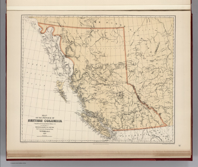
Alaskan Boundary Tribunal; Mohun, Edward Facsimile: Map of the Province of Britis... 1884 0009.032 Related Author
[Alaskan Boundary Tribunal, Mohun, Edward]
Full Title
(Facsimile) Map of the Province of British Columbia, Compiled and drawn by Edward Mohun, C.E. by Direction of the Honorable W. Smithe. Chief Commissioner of Lands and Works. Victoria, B.C. 1884. Dawson Brothers, Montreal. Photo. Lith. by A. Hoen & Co. Baltimore, MD. Engraved & Printed by Bartholomew Edinburgh.
List No
0009.032
Note
Tinted.
Alaskan Boundary Tribunal; Selwyn, Alfre... Facsimile: Official British Columbia Map... 1884 0009.033 Related Author
[Alaskan Boundary Tribunal, Selwyn, Alfred R.C.]
Full Title
(Facsimile) Geological and Natural History Survey of Canada (portion). Alfred R.C. Selwyn L.L.D., F.R.S., Director. Map of the Dominion of Canada. Geologically Colored from Surveys made by the Geological Corps, 1842-1882. Photo. Lith. by A. Hoen & Co. Baltimore, MD.
List No
0009.033
Note
Relief shown by hachures.
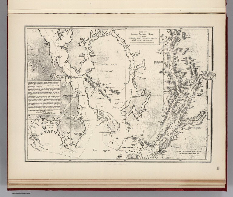
Alaskan Boundary Tribunal; British Admir... Facsimile: Cordova Bay to Cross Sound. P... 1884 0009.034 Related Author
[Alaskan Boundary Tribunal, British Admiralty]
Full Title
(Facsimile) Part of British Admiralty Chart. No. 2431. Cordova Bay to Cross Sound. 1865 Corrections to 1884. Photo. Lith. by A. Hoen & Co. Baltimore, MD.
List No
0009.034
Note
Relief shown by hachures.
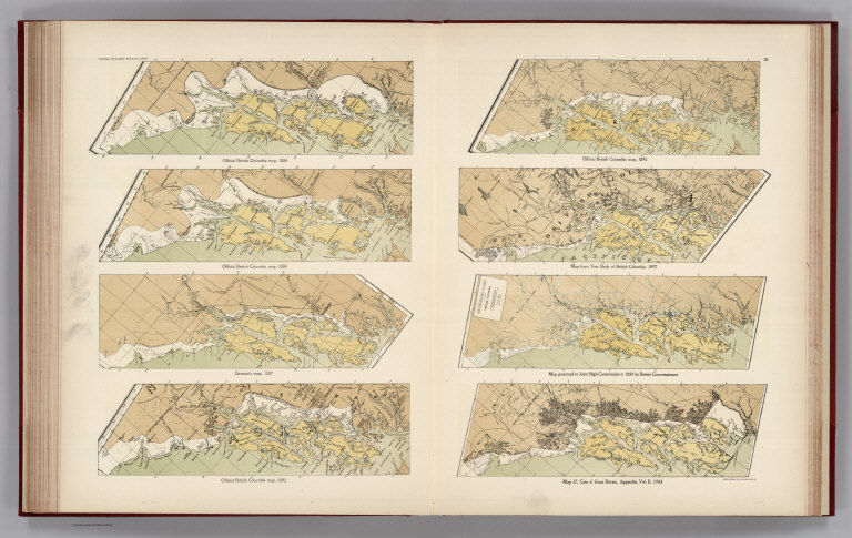
Author
Alaskan Boundary Tribunal
Full Title
(Facsimiles) (Eight Comparison Maps Southern Alaskan Coast 1884-1903 (portions)): Official British Columbia map, 1884; Official British Columbia map, 1895; Official British Columbia map, 1884; Map of Year Book of British Columbia, 1897; Dawson's map, 1887; Map presented to Joint High Commission in 1898 by British Commissioners; Official British Columbia map, 1893; Map 37, Case of Great Britain, Appendix, Vol. II, 1903. Alaskan Boundary Tribunal, 1903. 28. Andrew B. Graham. Photo-Litho. Washington.D.C.
List No
0009.071
Note
Maps from various sources on the same scale.
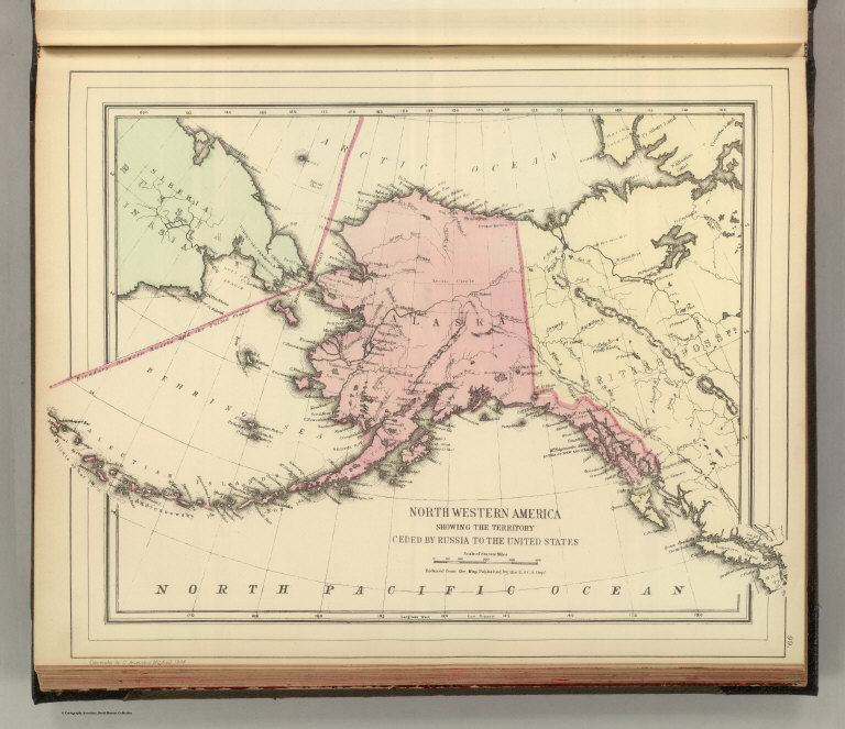
Author
Mitchell, Samuel Augustus Jr.
Full Title
Northwestern America showing the territory ceded by Russia to the United States. Reduced from the map published by the U.S.C.S. Dept. Copyright by S. Augustus Mitchell 1884.
List No
0592.052
Note
Hand colored. Relief shown by hachures and spot heights. Shows settlements, rivers, etc.
Author
[Henderson, C.F., Brand, T.S.]
Full Title
H.M.S. "Swiftsure." From Esquimalt to San Francisco Nov. 1884.
List No
5124.040
1-6 of 6
|