|
Author
[Spruner von Merz, Karl, 1803-1892., Menke, Heinrich Theodor]
Full Title
Reich der Franke unter den Merowingern : und bis auf Karl den Grossen 486-768. Von Th. Menke. Gezeichnet von F. Hein. Spruner-Menke Hist. Hand-Atlas No. 29. Gotha : Justus Perthes 1876.
List No
13561.055
Note
Map of the Kingdom of Franks under the Merovingians up to the time of Charlemagne 486-768. With 9 insets.
Author
Andriveau-Goujon, E. (Eugène), 1832-1897
Full Title
(18) Palestine ancienne & moderne d'aprés les sources les plus authentiques. Par E. Andriveau-Goujon. Paris, 1876. E. Andriveau-Goujon, éditeur. Rue du Bac, 4. Paris, imprimie. Ch. Chardon; gravé: le trait par Smith; les montagnes par Gérin; les ecritures par P. Rousset; les eaux par Mme. Fontaine.
List No
14008.022
Note
Hand-colored, engraved map of the Holy Land, showing political boundaries, roads and railroads (with decorative border). Includes legend, index, as well as 4 bar scales and a scale statement. Features translations into French. "No. 18" in upper right. "Atlas usuel, No. 23" and "Atlas universel, No. 36" in lower right. With 5 insets: (Egypt; Palestine; Arabie) -- (Golfe de Suez) -- (Niveau de la Méditerranée) -- ([Profile of mountains in vicinity of Jerusalem]) -- Jérusalem d'aprés le plan de G. Williams.
Author
Andriveau-Goujon, E. (Eugène), 1832-1897
Full Title
(22) Carte générale de l'Océanie. Publiée E. Andriveau-Goujon, 4, Rue du Bac, Paris, 1876. Impie. de Louis Antoine; gravé par Ch. Smith et Gérin; les eaux par Mme. Fontaine.
List No
14008.026
Note
Hand-colored, engraved map of Oceania, including the East Indies, Australia, New Zealand, and other others, showing the borders between the seas and oceans (on double plate with decorative border). Includes legend indicating European colonies (English, French, Dutch, Spanish and Portuguese). "No. 22" in upper right. With 3 insets: Iles Nouka-Hiva -- Iles Taïti -- Terres Australes.
Author
Andriveau-Goujon, E. (Eugène), 1832-1897
Full Title
(24) Carte générale des États-Unis et du Mexique comprenant l'Amérique centrale et les Antilles. E. Andriveau-Goujon, éditeur. Paris, Rue du Bac, 4. Nouvelle édition, 1876.
List No
14008.028
Note
Hand-colored, engraved map of the United States, Mexico, Central America and the Antilles, showing railroads and water routes (on double plate with decorative border). Includes legend indicating European colonies (French, English, Dutch, Danish, Spain and Swedish), as well as 4 bar scales. "No. 24" in upper right. With 4 insets: États de l'Amérique Centrale -- Entré de New-York -- Carte des rapports entre l'Europe & l'Amérique -- Petites Antilles et Nord de l'Amérique du Sud.
Author
Williams, G. Washington
Full Title
Williams' Copper - Plate Map Of The United States, Canada, Mexico, Central America, West Indies, &c. Published by John M. Atwood, 402 Locust Street, Philadelphia. Printed by F. Bourquin, 31 So. 6th Street, Phila. Copyright 1876 by G. Washington Williams.
List No
3030.002
Author
Stanford, Edward
Full Title
(Covers to) Stanford's Handy Map of the United States Distinguishing The Unsettled Territories; The Railways; The Cities & Towns according to Population; also the State Capitals & County Towns. London: Edward Stanford, 55 Charing Cross, S.W., March 1st. 1876.
List No
2348.001
Author
Stanford, Edward
Full Title
Stanford's Handy Map of the United States Distinguishing The Unsettled Territories; The Railways; The Cities & Towns according to Population; also the State Capitals & County Towns. London: Edward Stanford, 55 Charing Cross, S.W., March 1st. 1876.
List No
2348.002
Author
三宅秀一編 [Shūichi MIYAKE].
Full Title
萬國地誌畧暗射掲圖 / 亜非利加之部 [Topographical Record of the Nations / Africa].
List No
15156.000
Note
Meiji 9 [1876].
Author
三宅秀一編 [Shūichi MIYAKE].
Full Title
萬國地誌畧暗射掲圖 / 亜細亜之部 [Topographical Record of the Nations / Asia].
List No
15157.000
Note
Meiji 9 [1876].
Author
[Brault, Louis-Deìsireì-Leìon (1839 - 1885), Depot de la Marine]
Full Title
Octobre, Novembre, Decembre. Atlantique Sud - Cartes De La Direction Et De L'Intensite Probables Des Vents Par L. Brault . . . 1876
List No
15038.000
Author
[France. Ministère des travaux publics. Administration des routes, France. Direction des cartes, plans et archives et de la statistique graphique, École nationale des ponts et chaussées (France)]
Full Title
Dakar. (1876). 5e Série. Pl. XVI. Ministère des Travaux Publics. Ecole des Ponts et Chaussées. Lith. A. Simon, 13, R. du Val-de-Grâce. Paris.
List No
14306.133
Note
Map showing the port of Dakar, Senegal, in 1876. Title translates to: Tunis and its surroundings. Features topography, vegetation, streets, bridges, drainage, docks and soundings, with depths given in meters. Relief shown with hachures. Includes a bar scale and compass rose, with north oriented toward top of sheet. Descriptive text throughout. Lithograph in black, white and blue. Map is 27 x 22 cm, on sheet 40 x 50 cm. Appears in Cinquième livraison.
Author
[Maurice Dore & Co., Emslie, Charles]
Full Title
Map of the Leonard Tract Berkeley. The Future Great Suburb of San Francisco.
List No
10611.001
Author
[Maurice Dore & Co., Emslie, Charles]
Full Title
300 Lots Will be Sold at Auction by Maurice Dore & Co. Auctioneers... San Francisco on Wednesday October 18th, 1876.
List No
10611.002
Author
Mayer, Alexander
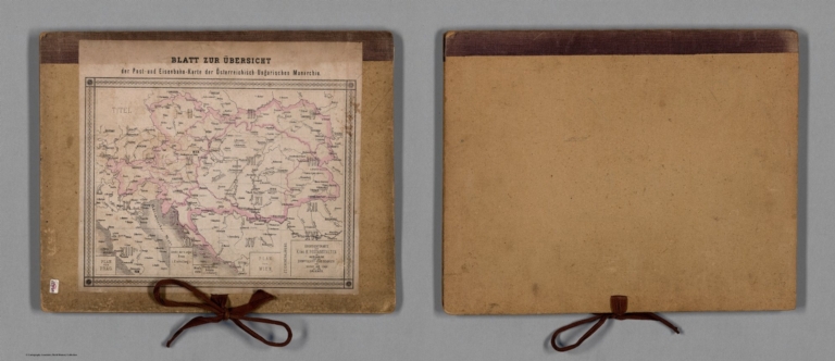
Full Title
(Covers to) Post- und Eisenbahn-Karte der Osterreichisch-Ungarischen Monarchie. Herausgegeben vom Post-Cours-Boureau des K.K. Handelsministeriums In XVI. Blättern, im Maasse 1: 576,000. Entworfen vom k.k. Postrathe A. Mayer. Gezeichnet von K. K. Postloffizialen Joh. Gottwald u. Jos. Broditzky. Druck u. verlag v. R. v. Walheim in Wien.
List No
13387.001
Note
Loose cover with ties and index sheet on the cover.
Author
Mayer, Alexander
Full Title
(Index Page to) Post- und Eisenbahn-Karte der Osterreichisch-Ungarischen Monarchie. Herausgegeben vom Post-Cours-Boureau des K.K. Handelsministeriums In XVI. Blättern, im Maasse 1: 576,000. Entworfen vom k.k. Postrathe A. Mayer. Gezeichnet von K. K. Postloffizialen Joh. Gottwald u. Jos. Broditzky. Druck u. verlag v. R. v. Walheim in Wien.
List No
13387.002
Note
Index to Postal and railway system map of the Austro-Hungarian Empire.
Author
Mayer, Alexander
Full Title
(Title Page to) Post- und Eisenbahn-Karte der Osterreichisch-Ungarischen Monarchie. Herausgegeben vom Post-Cours-Boureau des K.K. Handelsministeriums In XVI. Blättern, im Maasse 1: 576,000. Entworfen vom k.k. Postrathe A. Mayer. Gezeichnet von K. K. Postloffizialen Joh. Gottwald u. Jos. Broditzky. Druck u. verlag v. R. v. Walheim in Wien.
List No
13387.003
Note
Title page and part of map of Germany.
Author
Mayer, Alexander
Full Title
(Composite Map) Post- und Eisenbahn-Karte der Osterreichisch-Ungarischen Monarchie. Herausgegeben vom Post-Cours-Boureau des K.K. Handelsministeriums In XVI. Blättern, im Maasse 1: 576,000. Entworfen vom k.k. Postrathe A. Mayer. Gezeichnet von K. K. Postloffizialen Joh. Gottwald u. Jos. Broditzky. Druck u. verlag v. R. v. Walheim in Wien.
List No
13387.019
Note
Composite map, sheet 1-16 of : Post- und Eisenbahn-Karte der Osterreichisch-Ungarischen Monarchie.
Author
France. Ministere de l'interieur. Service de la carte de France et de la statistique graphique
Full Title
Population ... 1851-1876. Dressee d'apres les renseignements fournis par le 1er. Bureau de la Division de l'Administration generale et departmentale. Grave par Erhard, Paris. Imp. Erhard. (in upper margin) Ministere de l'interieur : Administration departemmentale et communale. Statistique graphique - 1881. (inset) Corse.
List No
13086.004
Note
Color map of France, Shows administrative divisions. With color coded statistical table.
Author
Andriveau-Goujon, Eugène
Full Title
Environs de Paris dans un rayon de 30 kilomètres
List No
10193.001
Note
Ancient forts are colored red.
Author
[Bachelder, John Badger, 1825-1894, Warren, G.K., Humphreys, A. A.]
Full Title
Map of the battle field of Gettysburg, July 1st, 2nd, 3rd 1863. First day battle. Published by authority of the Hon. the Secretary of War, Office of the Chief of Engineers U.S. Army. 1876. Positions of troops compiled and added for the government by John B. Bachelder. Topography engraved by Julius Bien, 16 Park Place N. Y. Position & lettering by Louis E. Newman, 36 Vesey St., N.Y. Printed by Endicott & Co., New York.
List No
11605.001
Note
First map of the battle field of Gettysburg, July 1st, 1863. Relief shown by contours, form lines and spot heights. Scale:1:12,000. 1 in. represents 1000 ft. Shows Gettysburg environs, place names, the position of the troops by color and signal stations Includes notes. "The survey was ordered by Brevet Major General A.A. Humphreys, Chief of Engineers, and conducted under Brevet Major General G.K. Warren, Major of Engineers."
Author
[Bachelder, John Badger, 1825-1894, Warren, G.K., Humphreys, A. A.]
Full Title
Map of the battle field of Gettysburg, July 1st, 2nd, 3rd 1863. First day battle. Published by authority of the Hon. the Secretary of War, Office of the Chief of Engineers U.S. Army. 1876. Positions of troops compiled and added for the government by John B. Bachelder. Topography engraved by Julius Bien, 16 Park Place N. Y. Position & lettering by Louis E. Newman, 36 Vesey St., N.Y. Printed by Endicott & Co., New York.
List No
11605.002
Note
Second map of the battle field of Gettysburg, July 2nd, 1963. Relief shown by contours, form lines and spot heights. Scale:1:12,000. 1 in. represents 1000 ft. Shows Gettysburg environs, place names, the position of the troops by color and signal stations Includes notes. "The survey was ordered by Brevet Major General A.A. Humphreys, Chief of Engineers, and conducted under Brevet Major General G.K. Warren, Major of Engineers."
Author
[Bachelder, John Badger, 1825-1894, Warren, G.K., Humphreys, A. A.]
Full Title
Map of the battle field of Gettysburg, July 1st, 2nd, 3rd 1863. First day battle. Published by authority of the Hon. the Secretary of War, Office of the Chief of Engineers U.S. Army. 1876. Positions of troops compiled and added for the government by John B. Bachelder. Topography engraved by Julius Bien, 16 Park Place N. Y. Position & lettering by Louis E. Newman, 36 Vesey St., N.Y. Printed by Endicott & Co., New York.
List No
11605.003
Note
Third map of the battle field of Gettysburg, July 3rd, 1963. Relief shown by contours, form lines and spot heights. Scale:1:12,000. 1 in. represents 1000 ft. Shows Gettysburg environs, place names, the posi+tion of the troops by color and signal stations Includes notes. "The survey was ordered by Brevet Major General A.A. Humphreys, Chief of Engineers, and conducted under Brevet Major General G.K. Warren, Major of Engineers."
Author
U.S. General Land Office
Full Title
(Covers to) Department of the Interior, General Land Office. Geographical and political atlas of the states and territories of the United States of America in which the Public Land Surveys are now in operation. S.S. Burdett, Commissioner. Washington City. 1876. Julius Bien, Photolith. & Print.
List No
11179.001
Note
Atlas in 20 plates,19 color maps. Including:1- New Mexico. 2-Idaho. 3-Kansas. 4-Washington. 5-Louisiana. 6-Dakota. 7-Nebraska. 8-Wyoming. 9- Arizona. 10-Utah. 11-Nevada. 12-Indian Territory.- 13-Oregon. 14-Montana. 15-Florida. 16-California in 2 shoots. 17-Minnesota. 18-Colorado. Maps showing land offices, townships subdivided, county seats, cities, towns, boundaries of land districts, railroad limits, military reservations, boundaries of counties, and Indian reservations. "Compiled from the official records of the General Land Office and other sources by C. Roeser, Principal Draughtsman G.L.O."
Author
Wheeler, G.M.
Full Title
Topographical Map Of The Yosemite Valley And Vicinity. Preliminary Edition. Part Of East Central California. Mountain Drawing by J.E. Weyss; Lettering by J. Franke. From Topographical Plat by Lt. Macomb, Nov. 30, 1883. Julius Bien & Co. Photo. lith. Expeditions Of 1878-79, Under the Command of Capt. Geo. M. Wheeler, Corps of Engineers, U.S. Army. U.S. Geographical Surveys West Of The 100th Meridian.
List No
2738.110
Note
Yosemite valley in hachures with light cream tint.
Author
[Scott, M.M., Vierge, Daniel]
Full Title
Le Tour du Monde en un Clin d'Oeil. Supplement du numero du Monde du la 1er. Janvier 1876 - Dessin de M.M. Scott et Vierge, gravure de M. Meaulle. (on lower center) Monde illustre. Paris. Imprimerie typographique de A. Bourdilliat, 13 Quat Voltaire. - 3189. (on left and right lower corner of map) H. Scott. (and) Vierge(and) F. Mealle, Sc. (on upper margins) Se vend 1 france, y compris le numero du 1er Janvier. Bureaux: 13, quai Voltaire, 13, a Paris.
List No
8030.000
Note
Pictorial view of the world. Originally issued uncolored, color was added later. Map is projected as a view from space and details the world roughly from the Equator to the North Pole and from California to India. Flora, fauna, historic events, cultural artifacts, and indigenous people are represented pictorially. The Sargasso Sea is illustrated in the middle of the Atlantic. Includes inset views illustrate places and moments of special interest including mirages in the Pacific, a ship burning at sea, Niagara Falls, Chicago, oil wells, gold mining, Hindu cremation, Chinese Junks, Tuareg warriors, an avalanche, etc. also includes lists of the nations and maritime flags. Shows sketches of some 79 individuals in 'traditional costumes'. To either side of the main view are flags of major nations, sailing ships, volcanoes, and other imagery. Include an ice free polar sea north of Greenland labeled 'Mer Libre?' No doubt this is a nod to hopes that a Northwest Passage might still exist. Union Pacific and Trans-Atlantic shipping lanes are noted. The achievements of various explorers are noted in both Africa and the Arctic.
Author
[Gibbes, C.D., Holt, Warren]
Full Title
Map of the States of California and Nevada. Carefully Compiled from the Latest Authentic Sources. California by Julius H. Von Schmidt, Arthur W. Keddie, and C.D. Gibbes, C.E.'s. Nevada by Chas. Drayton Gibbes C.E. Comprising Information obtained from the U.S. Coast and Land Surveys; State Geological Surveys, By Prof. J.D. Whitney; Railroad Surveys And The Results of Explorations Made By Brevet Lieut. Col. R.S. Williamson, U.S.A., Henry DeGroot, C.D. Gibbes, And Others. Entered ... 1876 by Warren Holt ... California.
List No
6716.000
Note
Third (?) edition. Some changes from the 1871 edition. Wheat does not list editions later than 1869, and Vogdes only lists 1869, 1876, and 1882.
Author
[Andreas, A. T. (Alfred Theodore), 1839-1900, Baskin, Forster and Company]
Full Title
(Covers to) Illustrated historical atlas of the State of Indiana. Published by Baskin, Forster & Co. Lakeside Building Chicago, Ills. 1876. Engraved & Printed by Chas. Shober & Co. Props. of Chicago Lithographing Co.
List No
0019A
Note
A.T. Andreas is the "hidden" author due to his bankruptcy. Atlas is bound in half leather black cloth covered boards with "Illustrated Historical Atlas Of The State Of Indiana 1876" stamped in gilt. Most maps printed in full color, a few hand col.
Author
[Andreas, A. T. (Alfred Theodore), 1839-1900, Baskin, Forster and Company]
Full Title
(Title Page to) Illustrated historical atlas of the State of Indiana. Published by Baskin, Forster & Co. Lakeside Building Chicago, Ills. 1876. Engraved & Printed by Chas. Shober & Co. Props. of Chicago Lithographing Co.
List No
0019B
Note
A.T. Andreas is the "hidden" author due to his bankruptcy. Atlas is bound in half leather black cloth covered boards with "Illustrated Historical Atlas Of The State Of Indiana 1876" stamped in gilt. Most maps printed in full color, a few hand col.
Author
[Andreas, A. T. (Alfred Theodore), 1839-1900, Baskin, Forster and Company]
Full Title
(Index Page to) Illustrated historical atlas of the State of Indiana. Published by Baskin, Forster & Co. Lakeside Building Chicago, Ills. 1876. Engraved & Printed by Chas. Shober & Co. Props. of Chicago Lithographing Co.
List No
0019C
Note
A.T. Andreas is the "hidden" author due to his bankruptcy. Atlas is bound in half leather black cloth covered boards with "Illustrated Historical Atlas Of The State Of Indiana 1876" stamped in gilt. Most maps printed in full color, a few hand col.
Author
[Andreas, A. T. (Alfred Theodore), 1839-1900, Baskin, Forster and Company]
Full Title
(Index Page to) Illustrated historical atlas of the State of Indiana. Published by Baskin, Forster & Co. Lakeside Building Chicago, Ills. 1876. Engraved & Printed by Chas. Shober & Co. Props. of Chicago Lithographing Co.
List No
0019D
Note
A.T. Andreas is the "hidden" author due to his bankruptcy. Atlas is bound in half leather black cloth covered boards with "Illustrated Historical Atlas Of The State Of Indiana 1876" stamped in gilt. Most maps printed in full color, a few hand col.
Author
[Andreas, A. T. (Alfred Theodore), 1839-1900, Baskin, Forster and Company]
Full Title
Geological map of Indiana. Climatological map of Indiana. (Published by Baskin, Forster & Co. Lakeside Building Chicago, Ills. 1876. Engraved & Printed by Chas. Shober & Co. Props. of Chicago Lithographing Co.)
List No
0019.001
Note
Two lithographed, hand col. maps. Climatological map shows mean annual temperature isolines.
Author
[Andreas, A. T. (Alfred Theodore), 1839-1900, Baskin, Forster and Company]
Full Title
Western Hemisphere. (Published by Baskin, Forster & Co. Lakeside Building Chicago, Ills. 1876. Engraved & Printed by Chas. Shober & Co. Props. of Chicago Lithographing Co.)
List No
0019.002
Note
Lithographed map. Full hand col. Relef shown by hachures. Includes 5 illustrations in margin.
Author
[Andreas, A. T. (Alfred Theodore), 1839-1900, Baskin, Forster and Company]
Full Title
Eastern Hemisphere. (Published by Baskin, Forster & Co. Lakeside Building Chicago, Ills. 1876. Engraved & Printed by Chas. Shober & Co. Props. of Chicago Lithographing Co.)
List No
0019.003
Note
Lithographed map. Full hand col. Relief shown by hachures. Includes 5 illustrations in margin.
Author
[Andreas, A. T. (Alfred Theodore), 1839-1900, Baskin, Forster and Company]
Full Title
Congressional districts. Judicial districts (Indiana. Published by Baskin, Forster & Co. Lakeside Building Chicago, Ills. 1876. Engraved & Printed by Chas. Shober & Co. Props. of Chicago Lithographing Co.)
List No
0019.004
Note
Two lithographed full col. maps.
Author
[Andreas, A. T. (Alfred Theodore), 1839-1900, Baskin, Forster and Company]
Full Title
Senatorial districts. Representative districts (Indiana. Published by Baskin, Forster & Co. Lakeside Building Chicago, Ills. 1876. Engraved & Printed by Chas. Shober & Co. Props. of Chicago Lithographing Co.)
List No
0019.005
Note
Two lithographed full col. maps.
Author
[Andreas, A. T. (Alfred Theodore), 1839-1900, Baskin, Forster and Company]
Full Title
New railroad map of the United States and Dominion of Canada. (Published by Baskin, Forster & Co. Lakeside Building Chicago, Ills. 1876. Engraved & Printed by Chas. Shober & Co. Props. of Chicago Lithographing Co.)
List No
0019.006
Note
Lithographed map. Hand col. Relief shown by hachures. Includes farm scene below title.
Author
[Andreas, A. T. (Alfred Theodore), 1839-1900, Baskin, Forster and Company]
Full Title
Population - United States census, 1870. German population. Irish population. (Published by Baskin, Forster & Co. Lakeside Building Chicago, Ills. 1876. Engraved & Printed by Chas. Shober & Co. Props. of Chicago Lithographing Co.)
List No
0019.007
Note
Two col. lithographed maps.
Author
[Andreas, A. T. (Alfred Theodore), 1839-1900, Baskin, Forster and Company]
Full Title
Population - United States census, 1870. Density of population. Foreign population. Colored population. British American population. Swedish and Nowegian population. (Published by Baskin, Forster & Co. Lakeside Building Chicago, Ills. 1876. Engraved & Printed by Chas. Shober & Co. Props. of Chicago Lithographing Co.)
List No
0019.008
Note
Five col. lithographed maps. Three maps include inset maps of western states at reduced scale.
Author
[Andreas, A. T. (Alfred Theodore), 1839-1900, Baskin, Forster and Company]
Full Title
Agricultural productions colored by grades to show quantity raised in localities. From the ninth census. Wheat, hay, corn, cotton, tobacco. (Published by Baskin, Forster & Co. Lakeside Building Chicago, Ills. 1876. Engraved & Printed by Chas. Shober & Co. Props. of Chicago Lithographing Co.)
List No
0019.009
Note
Five col. lithographed maps.
Author
[Andreas, A. T. (Alfred Theodore), 1839-1900, Baskin, Forster and Company]
Full Title
Vital statistics, United States census, 1870. Deaths from consumption, deaths from malarial diseases, deaths from enteric cerebro-spinal and typhus fevers, deaths from intestinal diseases. (Published by Baskin, Forster & Co. Lakeside Building Chicago, Ills. 1876. Engraved & Printed by Chas. Shober & Co. Props. of Chicago Lithographing Co.)
List No
0019.010
Note
Four col. lithographed maps. Each includes inset map of western states at reduced scale.
Author
[Andreas, A. T. (Alfred Theodore), 1839-1900, Baskin, Forster and Company]
Full Title
Richmond Agricultural Works, Richmond, Ind. (with inset view) Sales Room. (with) Res. of Hon. Wm. Baxter. (with) Residence of David Sutton. (with) "Ingle Side," residence of L.L. Lawrence. (with portrait) Hon. Wm. Baxter. (Published by Baskin, Forster & Co. Lakeside Building Chicago, Ills. 1876. Engraved & Printed by Chas. Shober & Co. Props. of Chicago Lithographing Co.)
List No
0019.011
Note
Lithographed view, with 4 smaller views and 1 portrait. Includes names of officers and directors of the Company.
Author
[Andreas, A. T. (Alfred Theodore), 1839-1900, Baskin, Forster and Company]
Full Title
New sectional and township map of Indiana. Published by Baskin, Forster & Co. Lakeside Building Chicago, 1876. (Engraved & Printed by Chas. Shober & Co. Props. of Chicago Lithographing Co.)
List No
0019.012
Note
Lithographed map. Counties hand col. Shows post offices, railroads, proposed railroads, etc.
Author
[Andreas, A. T. (Alfred Theodore), 1839-1900, Baskin, Forster and Company]
Full Title
Earlham College, Richmond, Ind. (with) Residence of T. Henry Davis, M.D., Richmond, Ind. (with) Residence of Rev. Abel Johnson ... Liberty Tp., Wells Co., Ind. (Published by Baskin, Forster & Co. Lakeside Building Chicago, 1876. Engraved & Printed by Chas. Shober & Co. Props. of Chicago Lithographing Co.)
List No
0019.013
Note
Lithographed view, with 2 inset views.
Author
[Andreas, A. T. (Alfred Theodore), 1839-1900, Baskin, Forster and Company]
Full Title
Map of Steuben County (Indiana. Published by Baskin, Forster & Co. Lakeside Building Chicago, 1876. Engraved & Printed by Chas. Shober & Co. Props. of Chicago Lithographing Co.)
List No
0019.014
Note
Lithographed col. map. Shows townships and sections, land owners, farm houses, etc.
Author
[Andreas, A. T. (Alfred Theodore), 1839-1900, Baskin, Forster and Company]
Full Title
Town of Angola, Steuben Co., Ind. (with) Corp. town Fremont, Steuben Co. (with) Village of Pleasant Lake, Steuben Co., Ind. (with) Butler, De Kalb Co., Ind. (with) Village of Orland, Steuben Co., Ind. (Published by Baskin, Forster & Co. Lakeside Building Chicago, 1876. Engraved & Printed by Chas. Shober & Co. Props. of Chicago Lithographing Co.)
List No
0019.015
Note
Lithographed col. map. Includes 4 inset maps. Variously show wards, tracts, selected buildings, cemetery, etc.
Author
[Andreas, A. T. (Alfred Theodore), 1839-1900, Baskin, Forster and Company]
Full Title
Map of Lagrange County. (with) La Grange ... (with) Lima ... (Published by Baskin, Forster & Co. Lakeside Building Chicago, 1876. Engraved & Printed by Chas. Shober & Co. Props. of Chicago Lithographing Co.)
List No
0019.016
Note
Lithographed col. map. Includes 4 inset maps. Variously show wards, tracts, selected buildings, cemetery, etc. Lima later called Howe.
Author
[Andreas, A. T. (Alfred Theodore), 1839-1900, Baskin, Forster and Company]
Full Title
Map of Elkhart County. (Published by Baskin, Forster & Co. Lakeside Building Chicago, 1876. Engraved & Printed by Chas. Shober & Co. Props. of Chicago Lithographing Co.)
List No
0019.017
Note
Lithographed col. map. Shows townships and sections, railroads, etc.
Author
[Andreas, A. T. (Alfred Theodore), 1839-1900, Baskin, Forster and Company]
Full Title
"Oak Grove Farm" residence of George Nebeker, President Farmers Bank, Covington, Indiana ... (with) Residences of Drs. C.V. & G.S. Jones ... (with) Residence of J.H. Spence ... (Published by Baskin, Forster & Co. Lakeside Building Chicago, 1876. Engraved & Printed by Chas. Shober & Co. Props. of Chicago Lithographing Co.)
List No
0019.018
Note
Lithograph view, with 2 inset views.
Author
[Andreas, A. T. (Alfred Theodore), 1839-1900, Baskin, Forster and Company]
Full Title
Town of Elkhart, Elkhart Co. (with) Goshen, Elkhart Co. (with) Argos, Marshall Co. (with) Bourbon, Marshall Co. (Published by Baskin, Forster & Co. Lakeside Building Chicago, 1876. Engraved & Printed by Chas. Shober & Co. Props. of Chicago Lithographing Co.)
List No
0019.019
Note
Lithographed col. map with 3 inset maps. Show landowners, tracts, etc.
Author
[Andreas, A. T. (Alfred Theodore), 1839-1900, Baskin, Forster and Company]
Full Title
Map of St. Joseph County. (Published by Baskin, Forster & Co. Lakeside Building Chicago, 1876. Engraved & Printed by Chas. Shober & Co. Props. of Chicago Lithographing Co.)
List No
0019.020
Note
Lithographed col. map. Shows farmhouses, railroads, etc.
Author
[Andreas, A. T. (Alfred Theodore), 1839-1900, Baskin, Forster and Company]
Full Title
Map of La Porte County. (Published by Baskin, Forster & Co. Lakeside Building Chicago, 1876. Engraved & Printed by Chas. Shober & Co. Props. of Chicago Lithographing Co.)
List No
0019.021
Note
Lithographed col. map. Shows farmhouses, selected landowners, railroads, etc.
Author
[Andreas, A. T. (Alfred Theodore), 1839-1900, Baskin, Forster and Company]
Full Title
Plan of South Bend, St. Joseph Co. (with) Plan of Mishawaka, St. Joseph Co. (with) Plan of Bremen, Marshall Co. (with) Plan of Syracuse, Kosciusko Co. (Published by Baskin, Forster & Co. Lakeside Building Chicago, 1876. Engraved & Printed by Chas. Shober & Co. Props. of Chicago Lithographing Co.)
List No
0019.022
Note
Lithographed col. map. Shows wards, block numbers, etc. Insets variously show land owners, tracts, block numbers, etc.
Author
[Andreas, A. T. (Alfred Theodore), 1839-1900, Baskin, Forster and Company]
Full Title
Northern Indiana Normal School buildings, Valparaiso, Indiana. (Published by Baskin, Forster & Co. Lakeside Building Chicago, 1876. Engraved & Printed by Chas. Shober & Co. Props. of Chicago Lithographing Co.)
List No
0019.023
Note
Lithographed view. Includes text.
Author
[Andreas, A. T. (Alfred Theodore), 1839-1900, Baskin, Forster and Company]
Full Title
Map of Porter County. (with) Corporate town of Chesterton ... (with) Village of Hebron ... (Published by Baskin, Forster & Co. Lakeside Building Chicago, 1876. Engraved & Printed by Chas. Shober & Co. Props. of Chicago Lithographing Co.)
List No
0019.024
Note
Lithographed col. map. Shows townships and sections, farmhouses, landowners, etc. With 2 inset maps showing tract names, block numbers, etc.
Author
[Andreas, A. T. (Alfred Theodore), 1839-1900, Baskin, Forster and Company]
Full Title
Map of Lake County. (with) Lowell ... (with) Hobart ... (with) Crown Point ... (Published by Baskin, Forster & Co. Lakeside Building Chicago, 1876. Engraved & Printed by Chas. Shober & Co. Props. of Chicago Lithographing Co.)
List No
0019.025
Note
Lithographed map. Shows townships and sections, farmhouses, landowners, etc. With 3 inset maps variously showing tract names, block numbers, etc.
Author
[Andreas, A. T. (Alfred Theodore), 1839-1900, Baskin, Forster and Company]
Full Title
City of Valparaiso. (with) Monticello, White Co. (with) Francesville, Jasper Co. (with) Reynolds, White Co. (with) Brookston, White Co. (with) Winamac, Pulaski Co. (Published by Baskin, Forster & Co. Lakeside Building Chicago, 1876. Engraved & Printed by Chas. Shober & Co. Props. of Chicago Lithographing Co.)
List No
0019.026
Note
Lithographed col. map with 5 inset maps. Variously show tract names, block numbers, etc.
Author
[Andreas, A. T. (Alfred Theodore), 1839-1900, Baskin, Forster and Company]
Full Title
City of La Porte, La Porte Co. Michigan City, La Porte Co. (Published by Baskin, Forster & Co. Lakeside Building Chicago, 1876. Engraved & Printed by Chas. Shober & Co. Props. of Chicago Lithographing Co.)
List No
0019.027
Note
Two col. lithographed maps. Show wards, tracts, block numbers, cemeteries, fairgrounds, etc.
Author
[Andreas, A. T. (Alfred Theodore), 1839-1900, Baskin, Forster and Company]
Full Title
Map of Starke County. (with) Knox ... (with) North Judson ... (with) San Pierre ... (Published by Baskin, Forster & Co. Lakeside Building Chicago, 1876. Engraved & Printed by Chas. Shober & Co. Props. of Chicago Lithographing Co.)
List No
0019.028
Note
Col. lithographed map. Shows farms, landowners, railroads, etc. Three inset maps variously show tracts, block numbers, etc.
Author
[Andreas, A. T. (Alfred Theodore), 1839-1900, Baskin, Forster and Company]
Full Title
Map of Marshall County. (Published by Baskin, Forster & Co. Lakeside Building Chicago, 1876. Engraved & Printed by Chas. Shober & Co. Props. of Chicago Lithographing Co.)
List No
0019.029
Note
Col. lithographed map. Shows Indian reservations, farms, landowners, railroads, etc.
Author
[Andreas, A. T. (Alfred Theodore), 1839-1900, Baskin, Forster and Company]
Full Title
(Portraits of) Hon. Thomas A. Hendricks Governor of Indiana, A.B. Cunningham, W.A. Bonham, Luther Wolfe, Jas W.F. Gerrish, Charles Scholl, Clarence A. Buskirk, Jas. H. Smart, James B. Black, Jno. E. Neff, Leonidas Sexton, W.A. Porter, E. Henderson, B.G. Shaw, Jason B. Brown, J.C. Clarke, Wm. Reader, William L. Matthews, Nim. Headington. (Published by Baskin, Forster & Co. Lakeside Building Chicago, 1876. Engraved & Printed by Chas. Shober & Co. Props. of Chicago Lithographing Co.)
List No
0019.030
Note
Lithograph with 19 portraits of public and other prominent men.
Author
[Andreas, A. T. (Alfred Theodore), 1839-1900, Baskin, Forster and Company]
Full Title
Plan of Warsaw, Kosciusko Co., Ind. (with) Plan of Pierceton, Kosciusko Co. (with) Plan of Plymouth, Marshall Co. (Published by Baskin, Forster & Co. Lakeside Building Chicago, 1876. Engraved & Printed by Chas. Shober & Co. Props. of Chicago Lithographing Co.)
List No
0019.031
Note
Col. lithograph map with 2 inset maps. Variously show section lines, wards, tracts, blocks, buildings, cemetery, etc.
Author
[Andreas, A. T. (Alfred Theodore), 1839-1900, Baskin, Forster and Company]
Full Title
Map of Kosciusko County. (Published by Baskin, Forster & Co. Lakeside Building Chicago, 1876. Engraved & Printed by Chas. Shober & Co. Props. of Chicago Lithographing Co.)
List No
0019.032
Note
Col. lithograph map. Shows townships and sections, farms, landowners, railroads, etc.
Author
[Andreas, A. T. (Alfred Theodore), 1839-1900, Baskin, Forster and Company]
Full Title
Map of Noble County. (Published by Baskin, Forster & Co. Lakeside Building Chicago, 1876. Engraved & Printed by Chas. Shober & Co. Props. of Chicago Lithographing Co.)
List No
0019.033
Note
Col. lithograph map. Shows townships and sections, farms, Indian reservation, railroads, etc.
Author
[Andreas, A. T. (Alfred Theodore), 1839-1900, Baskin, Forster and Company]
Full Title
Residence of Judge Samuel Hanna, Lewis St., Ft. Wayne, Indiana. (with) Res. of H.C. Hanna ... (with) Res. of Micheal (sic) Hedekin ... (Published by Baskin, Forster & Co. Lakeside Building Chicago, 1876. Engraved & Printed by Chas. Shober & Co. Props. of Chicago Lithographing Co.)
List No
0019.034
Note
Lithograph view with 2 inset views.
Author
[Andreas, A. T. (Alfred Theodore), 1839-1900, Baskin, Forster and Company]
Full Title
Kendallville, Noble Co. Ligonier, Noble Co. Map of Waterloo, De Kalb Co. Ind. Garrett, De Kalb Co., Ind. (Published by Baskin, Forster & Co. Lakeside Building Chicago, 1876. Engraved & Printed by Chas. Shober & Co. Props. of Chicago Lithographing Co.)
List No
0019.035
Note
Four col. lithographed maps on 1 sheet. Variously show wards, block numbers, buildings, etc.
Author
[Andreas, A. T. (Alfred Theodore), 1839-1900, Baskin, Forster and Company]
Full Title
Map of De Kalb County. (Published by Baskin, Forster & Co. Lakeside Building Chicago, 1876. Engraved & Printed by Chas. Shober & Co. Props. of Chicago Lithographing Co.)
List No
0019.036
Note
Col. lithographed map. Shows townships and sections, farm houses, landowners, railroads, etc.
Author
[Andreas, A. T. (Alfred Theodore), 1839-1900, Baskin, Forster and Company]
Full Title
Columbia City, Whitley Co., Ind. (with) Albion, Noble Co. (with) Churubusco, Whitley Co. (Published by Baskin, Forster & Co. Lakeside Building Chicago, 1876. Engraved & Printed by Chas. Shober & Co. Props. of Chicago Lithographing Co.)
List No
0019.037
Note
Col. lithographed map, with 2 inset maps. Variously show tracts, block numbers, landowners, etc.
Author
[Andreas, A. T. (Alfred Theodore), 1839-1900, Baskin, Forster and Company]
Full Title
Map of Allen County. (Published by Baskin, Forster & Co. Lakeside Building Chicago, 1876. Engraved & Printed by Chas. Shober & Co. Props. of Chicago Lithographing Co.)
List No
0019.038
Note
Col. lithographed map. Shows townships and sections, farmhouses, landowners, railroads, etc.
Author
[Andreas, A. T. (Alfred Theodore), 1839-1900, Baskin, Forster and Company]
Full Title
Map of the City of Fort Wayne, Allen Co. (with) Cedarville ... (with) Sheldon ... (with) Arcola ... (with) Corp. Town New Haven ... (Published by Baskin, Forster & Co. Lakeside Building Chicago, 1876. Engraved & Printed by Chas. Shober & Co. Props. of Chicago Lithographing Co.)
List No
0019.039
Note
Col. lithographed map. Shows wards, buildings, lot numbers, etc. With 4 inset maps showing tracts, etc.
Author
[Andreas, A. T. (Alfred Theodore), 1839-1900, Baskin, Forster and Company]
Full Title
Map of Whitley County. (Published by Baskin, Forster & Co. Lakeside Building Chicago, 1876. Engraved & Printed by Chas. Shober & Co. Props. of Chicago Lithographing Co.)
List No
0019.040
Note
Col. lithographed map. Shows townships and sections, Indian reservations, farm houses, landowners, railroads, etc.
Author
[Andreas, A. T. (Alfred Theodore), 1839-1900, Baskin, Forster and Company]
Full Title
Map of Auburn, De Kalb Co., Ind. (with) Harlan-Maysville ... (with) Corp. Town Monroeville ... (with) Edwardsburg ... (with) Huntertown ... (with) Hamilton ... (Published by Baskin, Forster & Co. Lakeside Building Chicago, 1876. Engraved & Printed by Chas. Shober & Co. Props. of Chicago Lithographing Co.)
List No
0019.041
Note
Col. lithographed map. Shows wards, tracts, etc. The 5 inset maps variously show land owners, tracts, etc.
Author
[Andreas, A. T. (Alfred Theodore), 1839-1900, Baskin, Forster and Company]
Full Title
Map of Fulton County. (with) Rochester, Fulton Co. (Published by Baskin, Forster & Co. Lakeside Building Chicago, 1876. Engraved & Printed by Chas. Shober & Co. Props. of Chicago Lithographing Co.)
List No
0019.042
Note
Col. lithographed map. Shows townships and sections, farm houses, land owners, etc. Inset map of Rochester shows tracts, buildings, etc.
Author
[Andreas, A. T. (Alfred Theodore), 1839-1900, Baskin, Forster and Company]
Full Title
Residence of Henry Baker, near Ft. Wayne, Indiana. Residence of Mrs. Sol. D. Bayless ... James Lillie ... J.H. Jones ... Fort Wayne, Ind. ... Geo. W. Nusbaum ... Springfield, Allen Co., Indiana. (Published by Baskin, Forster & Co. Lakeside Building Chicago, 1876. Engraved & Printed by Chas. Shober & Co. Props. of Chicago Lithographing Co.)
List No
0019.043
Note
Lithograph with 5 views.
Author
[Andreas, A. T. (Alfred Theodore), 1839-1900, Baskin, Forster and Company]
Full Title
Map of Pulaski County. (Published by Baskin, Forster & Co. Lakeside Building Chicago, 1876. Engraved & Printed by Chas. Shober & Co. Props. of Chicago Lithographing Co.)
List No
0019.044
Note
Col. lithographed map. Shows townships and sections, farm houses, railroad, etc.
Author
[Andreas, A. T. (Alfred Theodore), 1839-1900, Baskin, Forster and Company]
Full Title
(Portraits of) Saml. Hanna, Peter Heller, B.S. Woodworth, Henry Burgess, D. Bayless, Asa Fairfield, Thomas Tigar, Reub. Williams, H.R. Burnham, Eliza Hanna, Laura Suttenfield, Christian Parker, Simon Edsall, Jacob Fry, F.S. Aveline, Thomas Washburn, J.H. Jones, Herman H. Nierman (and) Henry Baker, Ft. Wayne (and) Columbia City. (Published by Baskin, Forster & Co. Lakeside Building Chicago, 1876. Engraved & Printed by Chas. Shober & Co. Props. of Chicago Lithographing Co.)
List No
0019.045
Note
Lithograph with 19 portraits of public and other prominent people.
Author
[Andreas, A. T. (Alfred Theodore), 1839-1900, Baskin, Forster and Company]
Full Title
Map of Jasper County. (with) Plan of Remington, Jasper Co. (with) Plan of Rensselaer, Jasper Co. (Published by Baskin, Forster & Co. Lakeside Building Chicago, 1876. Engraved & Printed by Chas. Shober & Co. Props. of Chicago Lithographing Co.)
List No
0019.046
Note
Col. lithographed map. Shows townships and sections, landowners, farm houses, railroad, etc. Inset maps show block numbers, tract names, cemeteries, etc.
Author
[Andreas, A. T. (Alfred Theodore), 1839-1900, Baskin, Forster and Company]
Full Title
Map of Newton County. (with) Goodland, Newton Co. (with) Corporate Town of Kentland, Newton Co. (Published by Baskin, Forster & Co. Lakeside Building Chicago, 1876. Engraved & Printed by Chas. Shober & Co. Props. of Chicago Lithographing Co.)
List No
0019.047
Note
Col. lithographed map. Shows townships and sections, landowners, rural buildings, railroad, etc. Inset maps show block numbers, tract names, etc.
Author
[Andreas, A. T. (Alfred Theodore), 1839-1900, Baskin, Forster and Company]
Full Title
Map of White County. (Published by Baskin, Forster & Co. Lakeside Building Chicago, 1876. Engraved & Printed by Chas. Shober & Co. Props. of Chicago Lithographing Co.)
List No
0019.048
Note
Col. lithographed map. Shows townships and sections, landowners, rural buildings, railroad, etc.
Author
[Andreas, A. T. (Alfred Theodore), 1839-1900, Baskin, Forster and Company]
Full Title
Map of Cass County. (Published by Baskin, Forster & Co. Lakeside Building Chicago, 1876. Engraved & Printed by Chas. Shober & Co. Props. of Chicago Lithographing Co.)
List No
0019.049
Note
Col. lithographed map. Shows townships and sections, landowners, rural buildings, railroad, etc.
Author
[Andreas, A. T. (Alfred Theodore), 1839-1900, Baskin, Forster and Company, Durant, Samuel W.]
Full Title
Plan of Logansport, Cass Co. by S.W. Durant, C.E., St. Charles, Ill. (Published by Baskin, Forster & Co. Lakeside Building Chicago, 1876. Engraved & Printed by Chas. Shober & Co. Props. of Chicago Lithographing Co.)
List No
0019.050
Note
Col. lithographed map. Shows lot numbers and landowners of large parcels, tract names, etc. Relief shown by hachures.
Author
[Andreas, A. T. (Alfred Theodore), 1839-1900, Baskin, Forster and Company]
Full Title
Residence and mill of L. & J. Keller, North Judson, Stark Co., Dry goods and clothing store, L. & J. Keller ..., Residence of Mrs. M. Boydston, Warsaw ..., Irvin Love ... Washington Tp., Grant Co., ... C.H. Reeve ... Plymouth, Indiana ..., "Ravine Farm", residence of G.N. Fitch, Logansport, Indiana, "Island Home", Logansport, residence of Horace P. Biddle... (Published by Baskin, Forster & Co. Lakeside Building Chicago, 1876. Engraved & Printed by Chas. Shober & Co. Props. of Chicago Lithographing Co.)
List No
0019.051
Note
Lithograph with 7 views.
Author
[Andreas, A. T. (Alfred Theodore), 1839-1900, Baskin, Forster and Company]
Full Title
Map of Miami County. (with) Plan of Bunker Hill, Miami Co. (with) Corporate Town of Xenia, Miami Co. (Published by Baskin, Forster & Co. Lakeside Building Chicago, 1876. Engraved & Printed by Chas. Shober & Co. Props. of Chicago Lithographing Co.)
List No
0019.052
Note
Col. lithograph. Shows townships and sections, landowners, rural buildings, railroad, etc. Inset maps show tracts, etc. Xenia later called Converse.
Author
[Andreas, A. T. (Alfred Theodore), 1839-1900, Baskin, Forster and Company]
Full Title
City of Peru, Miami Co., Ind. (with) Lagro, Wabash Co. (with) Wabash City, Wabash Co. (Published by Baskin, Forster & Co. Lakeside Building Chicago, 1876. Engraved & Printed by Chas. Shober & Co. Props. of Chicago Lithographing Co.)
List No
0019.053
Note
Col. lithographed map. Shows tracts, etc.
Author
[Andreas, A. T. (Alfred Theodore), 1839-1900, Baskin, Forster and Company]
Full Title
Map of Wabash County. (Published by Baskin, Forster & Co. Lakeside Building Chicago, 1876. Engraved & Printed by Chas. Shober & Co. Props. of Chicago Lithographing Co.)
List No
0019.054
Note
Col. lithograph. Shows townships and sections, landowners, rural buildings, railroad, etc.
Author
[Andreas, A. T. (Alfred Theodore), 1839-1900, Baskin, Forster and Company]
Full Title
Huntington City, Huntington Co., Ind. (with) Warren, Huntington Co. (with) Roanoke, Huntington Co. (with) Mt. Aetna, Huntington Col. (with) Corporate Town of Bluffton, Wells Co. (Published by Baskin, Forster & Co. Lakeside Building Chicago, 1876. Engraved & Printed by Chas. Shober & Co. Props. of Chicago Lithographing Co.)
List No
0019.055
Note
Col. lithograph. Variously show wards, tracts, etc.
Author
[Andreas, A. T. (Alfred Theodore), 1839-1900, Baskin, Forster and Company]
Full Title
Map of Huntington County. (Published by Baskin, Forster & Co. Lakeside Building Chicago, 1876. Engraved & Printed by Chas. Shober & Co. Props. of Chicago Lithographing Co.)
List No
0019.056
Note
Col. lithograph. Shows townships and sections, landowners, rural buildings, railroad, etc.
Author
[Andreas, A. T. (Alfred Theodore), 1839-1900, Baskin, Forster and Company]
Full Title
Map of Wells County. (with) Ossian, Wells Co. (Published by Baskin, Forster & Co. Lakeside Building Chicago, 1876. Engraved & Printed by Chas. Shober & Co. Props. of Chicago Lithographing Co.)
List No
0019.057
Note
Col. lithograph. Shows townships and sections, landowners, rural buildings, railroad, etc.
Author
[Andreas, A. T. (Alfred Theodore), 1839-1900, Baskin, Forster and Company]
Full Title
Map of Adams County. (Published by Baskin, Forster & Co. Lakeside Building Chicago, 1876. Engraved & Printed by Chas. Shober & Co. Props. of Chicago Lithographing Co.)
List No
0019.058
Note
Col. lithograph. Shows townships and sections, landowners, rural buildings, railroad, etc.
Author
[Andreas, A. T. (Alfred Theodore), 1839-1900, Baskin, Forster and Company]
Full Title
Corporate Town of Decatur, Adams Co. (with) Mexico, Miami Co. (with) Denver, Miami Co. (with) Corporate Town of Geneva, Adams Co. (Published by Baskin, Forster & Co. Lakeside Building Chicago, 1876. Engraved & Printed by Chas. Shober & Co. Props. of Chicago Lithographing Co.)
List No
0019.059
Note
Col. lithograph. Show tracts, etc.
Author
[Andreas, A. T. (Alfred Theodore), 1839-1900, Baskin, Forster and Company]
Full Title
Map of Jay County. (Published by Baskin, Forster & Co. Lakeside Building Chicago, 1876. Engraved & Printed by Chas. Shober & Co. Props. of Chicago Lithographing Co.)
List No
0019.060
Note
Col. lithograph. Shows townships and sections, landowners, rural buildings, railroad, etc.
Author
[Andreas, A. T. (Alfred Theodore), 1839-1900, Baskin, Forster and Company]
Full Title
Plan of Portland, Jay Co., Ind. (with) Plan of Camden, Jay Co. (with) Plan of Redkey, Jay Co. (with) Plan of Dunkirk, Jay Co. (with) Plan of Union City, Randolph Co. (with) Plan of Winchester, Randolph Co. (Published by Baskin, Forster & Co. Lakeside Building Chicago, 1876. Engraved & Printed by Chas. Shober & Co. Props. of Chicago Lithographing Co.)
List No
0019.061
Note
Col. lithograph. Variously show landowners, wards, tracts, block numbers, etc.
Author
[Andreas, A. T. (Alfred Theodore), 1839-1900, Baskin, Forster and Company]
Full Title
Map of Blackford County. (with) Corp. Town, Montpelier, Blackford Co. (with) Hartford City, Blackford Co. (Published by Baskin, Forster & Co. Lakeside Building Chicago, 1876. Engraved & Printed by Chas. Shober & Co. Props. of Chicago Lithographing Co.)
List No
0019.062
Note
Col. lithograph. Shows townships and sections, landowners, rural buildings, railroad, etc. Hartford City map scale (ca. 1:9,600), shows wards, etc. Montpelier map shows tracts, etc.
Author
[Andreas, A. T. (Alfred Theodore), 1839-1900, Baskin, Forster and Company]
Full Title
Residence of Jonas Votaw, near Portland, Jay County, Indiana. (with) Adams Co. Court House, Decatur, Indiana. (with) Residence of David Studabaker, Decatur, Adams Co., Indiana. (Published by Baskin, Forster & Co. Lakeside Building Chicago, 1876. Engraved & Printed by Chas. Shober & Co. Props. of Chicago Lithographing Co.)
List No
0019.063
Note
Lithograph with 3 views.
Author
[Andreas, A. T. (Alfred Theodore), 1839-1900, Baskin, Forster and Company]
Full Title
Map of Grant County. (Published by Baskin, Forster & Co. Lakeside Building Chicago, 1876. Engraved & Printed by Chas. Shober & Co. Props. of Chicago Lithographing Co.)
List No
0019.064
Note
Col. lithograph. Shows townships and sections, landowners, rural buildings, railroad, etc.
Author
[Andreas, A. T. (Alfred Theodore), 1839-1900, Baskin, Forster and Company]
Full Title
City of Kokomo, Howard Co. (with) Corp. Town of Marion, Grant Co. (with) Corp. Town Jonesboro, Grant Co. (with) Corporate Town of Fairmount, Grant Co. (Published by Baskin, Forster & Co. Lakeside Building Chicago, 1876. Engraved & Printed by Chas. Shober & Co. Props. of Chicago Lithographing Co.)
List No
0019.065
Note
Col. lithograph. Shows wards, etc. Inset maps variously show wards, tracts, etc.
Author
[Andreas, A. T. (Alfred Theodore), 1839-1900, Baskin, Forster and Company]
Full Title
Map of Howard County. (with) Russiaville, Howard Co. (Published by Baskin, Forster & Co. Lakeside Building Chicago, 1876. Engraved & Printed by Chas. Shober & Co. Props. of Chicago Lithographing Co.)
List No
0019.066
Note
Col. lithograph. Shows townships and sections, landowners, rural buildings, railroads, etc. Includes 3 illustrations.
Author
[Andreas, A. T. (Alfred Theodore), 1839-1900, Baskin, Forster and Company]
Full Title
Delphi & Pittsburg with suburban towns, Carroll Co. (with) Corporate town of Chauncey... (with) Village of Clarksville ... (with) Village of West Point (all) Tippecanoe Co. (Published by Baskin, Forster & Co. Lakeside Building Chicago, 1876. Engraved & Printed by Chas. Shober & Co. Props. of Chicago Lithographing Co.)
List No
0019.067
Note
Col. lithograph. Shows wards, lot numbers, canal, railroads, etc. Inset maps tracts, etc. Chauncey later called West Lafayette.
Author
[Andreas, A. T. (Alfred Theodore), 1839-1900, Baskin, Forster and Company]
Full Title
Map of Carroll County. (Published by Baskin, Forster & Co. Lakeside Building Chicago, 1876. Engraved & Printed by Chas. Shober & Co. Props. of Chicago Lithographing Co.)
List No
0019.068
Note
Col. lithograph. Shows townships and sections, rural buildings, railroads, etc.
Author
[Andreas, A. T. (Alfred Theodore), 1839-1900, Baskin, Forster and Company]
Full Title
Residence, beer-garden and brewery of C.L. Centlivre, Fort Wayne, Indiana. (Published by Baskin, Forster & Co. Lakeside Building Chicago, 1876. Engraved & Printed by Chas. Shober & Co. Props. of Chicago Lithographing Co.)
List No
0019.069
Note
Lithograph.
Author
[Andreas, A. T. (Alfred Theodore), 1839-1900, Baskin, Forster and Company]
Full Title
Plan of La Fayette. (with) Battle Ground City, Tippecanoe Co. (with) Village of Dayton, Tippecanoe Co. (Published by Baskin, Forster & Co. Lakeside Building Chicago, 1876. Engraved & Printed by Chas. Shober & Co. Props. of Chicago Lithographing Co.)
List No
0019.070
Note
Col. lithograph. Shows wards, etc. Inset maps tracts, etc. Inset maps show tracts, etc.
|


![萬國地誌畧暗射掲圖 / 亜非利加之部 [Topographical Record of the Nations / Africa].](https://www.davidrumsey.com/rumsey/Size2/RUMSEY~8~1/199/15156000.jpg)
![萬國地誌畧暗射掲圖 / 亜細亜之部 [Topographical Record of the Nations / Asia].](https://www.davidrumsey.com/rumsey/Size2/RUMSEY~8~1/199/15157000.jpg)