|
Author
[Garlato, Giambattista, Kier, Giuseppe]
Full Title
Pianta della regia citta di Venezia e sue isole vicine. Pubblicata da Giuseppe Kier ... dis. et incisa da Giambatti ta Garlato ..
List No
15823.000
Author
Cumplido, Ignacio
Full Title
(Covers to) Tercer calendario portatil de I. Cumplido, para el anÞo de 1838 : arreglado al meridiano de Mexico.
List No
15538.001
Author
Cumplido, Ignacio
Full Title
(Title page to) Tercer calendario portatil de I. Cumplido, para el anÞo de 1838 : arreglado al meridiano de Mexico.
List No
15538.002
Author
[Cumplido, Ignacio, Calvo, D. Rafael Maria]
Full Title
Plano general de la Ciudad de Mexico aumentado y corregido en lo mas notable por el teniente coronel retirado D. Rafael Maria Calvo en enero de 1837
List No
15538.003
Author
Cumplido, Ignacio
Full Title
(Text page to) Tercer calendario portatil de I. Cumplido, para el anÞo de 1838 : arreglado al meridiano de Mexico.
List No
15538.004
Note
A guide to the principal establishments of Mexico City.
Author
[IRISH RAILWAY COMMISSION, HARNESS, Henry Drury (1804 - 1883), Griffith, Richard John (1784-1878), LARCOM, Thomas Aiskew (1801 - 1879)]
Full Title
(Covers to) Irish Railway Commission. Maps / Presented to both Houses of Parliament by command of Her Majesty. 1838. [Atlas to accompany 2d. Report of the Railway Commissioners, Ireland].
List No
15443.001
Author
[IRISH RAILWAY COMMISSION, HARNESS, Henry Drury (1804 - 1883), Griffith, Richard John (1784-1878), LARCOM, Thomas Aiskew (1801 - 1879)]
Full Title
(Title page to) Irish Railway Commission. Maps / Presented to both Houses of Parliament by command of Her Majesty. 1838. [Atlas to accompany 2d. Report of the Railway Commissioners, Ireland].
List No
15443.002
Author
[IRISH RAILWAY COMMISSION, LARCOM, Thomas Aiskew (1801 - 1879)]
Full Title
I. Map of Ireland to accompany the Report of the Railway Commissioners 1838. Shewing the lines laid down Under the Direction of the Commissioners and those proposed by Private Parties. / Prepared & Engraved under the direction of Lieu.t Larcom Royal Eng.rs May 1837.
List No
15443.003
Author
[IRISH RAILWAY COMMISSION, HARNESS, Henry Drury (1804 - 1883)]
Full Title
II. Map of Ireland to accompany the Report of the Railway Commissioners shewing the comparative Density of Population. Constructed under the Direction of the Commissioners by Henry D. Harness Lt. Royal Engineers 1837.
List No
15443.004
Author
[IRISH RAILWAY COMMISSION, HARNESS, Henry Drury (1804 - 1883)]
Full Title
III. Map of Ireland, to accompany the Report of the Railway Commissioners shewing the relative Quantities of Traffic in different Directions. Constructed under the Direction of the Commissioners by Henry D. Harness Lt. Royal Engineers 1837.
List No
15443.005
Author
[IRISH RAILWAY COMMISSION, HARNESS, Henry Drury (1804 - 1883)]
Full Title
IV. Map of Ireland, to accompany the Report of the Railway Commissioners shewing the relative Number of Passengers in different Directions by regular Public Conveyances. Constructed under the Direction of the Commissioners by Henry D. Harness Lt. Royal Engineers 1837.
List No
15443.006
Author
[IRISH RAILWAY COMMISSION, Griffith, Richard John (1784-1878)]
Full Title
V. Geological Map of Ireland to accompany the Report of the Railway Commissioners 1837 / Shewing the lines laid down Under the Direction of the Commissioners and those proposed by Joint Stock Companies.
List No
15443.007
Author
[IRISH RAILWAY COMMISSION, LARCOM, Thomas Aiskew (1801 - 1879)]
Full Title
VI. Map of England and Ireland, Explanatory of that part of the Report of the Railway Commissioners, which relates to communication between London and Dublin, and other parts of Ireland. / Prepared & Engraved under the direction of Lieu.t Larcom Royal Eng.rs May 1837.
List No
15443.008
Author
[Reymann, Daniel Gottfried, Flemming, Carl]
Full Title
2 Netz und Arcona
List No
10605.002
Author
[Reymann, Daniel Gottfried, Flemming, Carl]
Full Title
1 Wieck
List No
10605.001
Author
[Reymann, Daniel Gottfried, Flemming, Carl]
Full Title
3 Musterblatt u. Rützenhagen
List No
10605.003
Author
[Reymann, Daniel Gottfried, Flemming, Carl]
Full Title
4 Leba
List No
10605.004
Note
Date estimated
Author
[Reymann, Daniel Gottfried, Flemming, Carl]
Full Title
14 Maasstabe u. Langenhagen
List No
10605.019
Author
Bradford, Thomas G.
Full Title
Comparative lengths of rivers. (inset) Distribution of vegetables, and snow line. (to accompany) A Comprehensive Atlas, Geographical, Historical & Commercial. By T.G. Bradford. Boston: American Stationers' Company. Entered ... 1835, by Thos. G. Bradford ... Massachusetts.
List No
2120.015
Note
In full color. View showing the comparative Lengths of the Principal Rivers in North and South America, Europe, Asia and Africa. The rivers have been necessarily straightened to indicate the lengths of the rivers. Also showing comparative heights of mountains, snow level, and distribution of vegetation in each zone.
Author
Tallis, John, 1817-1876
Full Title
(Covers to) No. 1.] King William Street, London Bridge.
List No
14002.003
Note
Front cover of paper wrappers, in pink, to No. 1.] King William Street, London Bridge. Includes full title and imprint, and advertises: Any street already published may be had separately, on a sheet of letter paper for correspondence with country friends, for three half-pence each sheet.
Author
Tallis, John, 1817-1876
Full Title
(Contents to) Tallis's street directory : King William Street, London Bridge.
List No
14002.004
Note
Directory to No. 1.] King William Street, London Bridge. Lists names of businesses and residents in order of appearance. On verso of front cover, in pink.
Author
Tallis, John, 1817-1876
Full Title
(Text Page to) No. 1.] King William Street, London Bridge (1).
List No
14002.005
Note
First of six pages of text to No. 1.] King William Street, London Bridge. Page 1 of historical and descriptive text, beginning: New London Bridge was commenced in 1825, and completed in 1831, at the expense of the city, and is one of the most noble bridges in the world ... [surrounded by advertisements].
Author
Tallis, John, 1817-1876
Full Title
(Text Page to) No. 1.] King William Street, London Bridge (2).
List No
14002.006
Note
Second of six pages of text to No. 1.] King William Street, London Bridge. Page 2 of historical and descriptive text, beginning: New London Bridge was commenced in 1825, and completed in 1831, at the expense of the city, and is one of the most noble bridges in the world ... [surrounded by advertisements].
Author
Tallis, John, 1817-1876
Full Title
No. 1.] King William Street, London Bridge.
List No
14002.007
Note
Engraved map shows profile of buildings on each side of the street, with one side appearing upside-down on the page. Includes an ancillary overview map placing the location of the street within its London neighborhood. With an engraved view featuring: New London Bridge, commenced July 5, 1825, opened August 1, 1832. No. 1 accompanied by a directory (on verso of front cover), as well as four pages of historical and descriptive text, beginning: New London Bridge was commenced in 1825, and completed in 1831, at the expense of the city, and is one of the most noble bridges in the world ... [surrounded by advertisements]. Cover advertises: Any street already published may be had separately, on a sheet of letter paper for correspondence with country friends, for three half-pence each sheet. Bound in pink paper wrappers.
Author
Tallis, John, 1817-1876
Full Title
(Composite of) No. 1.] King William Street, London Bridge.
List No
14002.674
Note
Engraved map shows profile of buildings on each side of the street, with one side appearing upside-down on the page. Buildings indexed according to numbers in directory (on verso of front cover). Includes an ancillary overview map placing the location of the street within its London neighborhood. With an engraved view featuring: Rowland's Macassar Oil and Kalydor Warehouse. No. 33 accompanied by four pages of historical and descriptive text, beginning: Hatton Garden is a straight, broad, and handsome street of well built brick buildings, intended for private residences; but the lower part of many of them are converted into warehouses ... [surrounded by advertisements]. Cover advertises: Any street already published may be had separately, on a sheet of letter paper for correspondence with country friends, for three half-pence each sheet. Bound in beige paper wrappers.
Author
Tallis, John, 1817-1876
Full Title
(Text Page to) No. 1.] King William Street, London Bridge (3).
List No
14002.008
Note
Third of six pages of text to No. 1.] King William Street, London Bridge. Page 3 of historical and descriptive text, beginning: New London Bridge was commenced in 1825, and completed in 1831, at the expense of the city, and is one of the most noble bridges in the world ... [surrounded by advertisements].
Author
Tallis, John, 1817-1876
Full Title
(Text Page to) No. 1.] King William Street, London Bridge (4).
List No
14002.009
Note
Fourth of six pages of text to No. 1.] King William Street, London Bridge. Page 4 of historical and descriptive text, beginning: New London Bridge was commenced in 1825, and completed in 1831, at the expense of the city, and is one of the most noble bridges in the world ... [surrounded by advertisements].
Author
Tallis, John, 1817-1876
Full Title
(Text Page to) No. 1.] King William Street, London Bridge (5).
List No
14002.010
Note
Fifth of six pages of text to No. 1.] King William Street, London Bridge. Includes advertisements. On verso of back cover, in pink.
Author
Tallis, John, 1817-1876
Full Title
(Text Page to) No. 1.] King William Street, London Bridge (6).
List No
14002.011
Note
Sixth of six pages of text to No. 1.] King William Street, London Bridge. Includes advertisements. On back cover of paper wrappers, in pink.
Author
Karacsay, Fedor
Full Title
Karta Crnegore = Kharīṭ mamlakit Qirṭagh = Carte du pays de Montenegro. Dressee d'apres des operations geogetiques sur les lieux et recherches les plus soigneuses par Mr. le Comte Fedor de Karacsay, colonel au service d'Autriche. Grave par P. Allodi.
List No
13396.000
Author
Mancini, Raffaele
Full Title
Mappamondo costrutto su quello di Gardner, accresiuto di tutte le nuove scopoerte e Dedicato A.S. M. Ferdinando II Re del Regno dell Due Sicile
List No
10406.000
Note
Eight sheets joined. Based on James Gardner's 1825 world map (see our 4755.000) but updated. "Monumental Wall Map of the World, published by Official State Engineer Raffaele Mancini in Naples and dedicated to the King of the Two Sicilies. This colossal production was created specially for the court of King Ferdinando II of the Two Sicilies. It provides a remarkably large image of globe during the 1830s, a time of great transition and development, particularly in the Americas, Africa and Oceania. A sumptuous, expensive production, it was issued in only a very small print run, and is today exceptionally rare, this being 1 of only 3 known surviving examples. In creating the present map, Mancini employed James Gardner's 1825 World map as a model, although, with significant cartographic updates. Gardner drew his cartographic details from Aaron Arrowsmith's 1814 World Map on a Globular Projection featuring 36-inch hemispheres. Mancini's production is done to the same gargantuan scale as Gardner's map, which is regarded as perhaps "one of the largest World Maps produced in the early 1800's". His map represents one of the last great examples of Italian royal court patronage of cartography in Italy, which for centuries had maintained a tradition responsible for many of the world s finest and most historically important maps and globes. The production of the present map would have been very expensive and labor intensive, and would certainly have been funded as a special commission for the court of Ferdinando II. " (Ruderman)
Author
[Wyld, James, 1812-1887, Wyld, James, 1790-1836]
Full Title
(Title Page to) A new general atlas of modern geography : consisting of a complete collection of maps of the four quarters of the globe : delineating their physical features and colored to show the limits of their respective states : including also the latest geographical & nautical discoveries. London: Published by James Wyld, Charing Cross East, Geographer to the King.
List No
13170.002
Author
[Wyld, James, 1812-1887, Wyld, James, 1790-1836]
Full Title
Orbis veteribus notus. Auctore D' Anville. Published by Jas. Wyld. 1838. (to accompany) A new general atlas of modern geography : consisting of a complete collection of maps of the four quarters of the globe ... London: Published by James Wyld, Charing Cross East, Geographer to the King.
List No
13170.004
Note
Double page outline hand color engraved map of the Ancient World, published by James Wyld. Covers all of Europe, Asia Minor, Arabia and India, much of Northern Africa, and parts of Southeast Asia. Title and place names in Latin. Relief shown pictorially. Includes a diagram of wind directions, decorative title cartouche and text.
Author
[Wyld, James, 1812-1887, Wyld, James, 1790-1836]
Full Title
The World on Mercators projection. By James Wyld. 1837. London : Published by James Wyld. (to accompany) A new general atlas of modern geography : consisting of a complete collection of maps of the four quarters of the globe ...
List No
13170.005
Note
Folded engraved, hand-colored in outline map of the world from the early 19th century, it depicts most of the world's broad geographical outlines. Greenland and Antarctica appear much larger relative to land masses near the equator than they actually are. Relief shown by hacures.
Author
[Wyld, James, 1812-1887, Wyld, James, 1790-1836]
Full Title
Eastern Hemisphere. Published by Jas. Wyld. 1838. (to accompany) A new general atlas of modern geography : consisting of a complete collection of maps of the four quarters of the globe ...
List No
13170.006
Note
Circular double page engraved map, hand colored in outline. Relief shown pictorially.
Author
[Wyld, James, 1812-1887, Wyld, James, 1790-1836]
Full Title
Western Hemisphere. Published by Jas. Wyld. 1838. (to accompany) A new general atlas of modern geography : consisting of a complete collection of maps of the four quarters of the globe ...
List No
13170.007
Note
Circular double page engraved map, hand colored in outline. Relief shown pictorially.
Author
[Wyld, James, 1812-1887, Wyld, James, 1790-1836]
Full Title
Northern Hemisphere. Published by Jas. Wyld. 1838. (to accompany) A new general atlas of modern geography : consisting of a complete collection of maps of the four quarters of the globe ...
List No
13170.008
Note
Circular double page engraved map, hand colored in outline. Relief shown pictorially. Prime meridian is Greenwich.
Author
[Wyld, James, 1812-1887, Wyld, James, 1790-1836]
Full Title
Southern Hemisphere. London. Published by Jas. Wyld. (to accompany) A new general atlas of modern geography : consisting of a complete collection of maps of the four quarters of the globe ...
List No
13170.009
Note
Circular double page engraved map, hand colored in outline. Relief shown pictorially. Prime meridian is Greenwich.
Author
Vorobiyov. P.
Full Title
Zemnoy ploskosharyu, sostavlennomu dlya St. Peterburgskogo gorizonta i meridiana. 1838... Vorobiyov P. Sankt. Peterburg.
List No
13122.000
Note
Double hemisphere world map, showing projection of the Earth's sphere based on St. Petersburg horizon and meridian. by P. Vorobiyov. Ruderman - "large format, separately issued Russian map of the world. The projection puts St. Petersburg at the center of the right hand hemisphere and the St. Petersburg antipode at the center of the other. According to the map it was published with permission of the Military Topographic Depo, according to the surveys by Captain P. Vorobyev. Pyotr Vorobyev also authored a pamphlet that was intended as a tutorial for the present map, it was published in 1838 and titled: Описание употребления земного плоскошария, составленного для санкт-петербургского горизонта и меридиана ("Instruction on how to use the flat projection of the Earth, adjusted for the St. Petersburg horizon and meridian"). Vorobyev issued an additional map, focusing on the Russian Empire, which was to be used as a supplement to the present" (see our 13121.000)
Author
[Woerl, Joseph Edmund (1803-1865), Herder, Bartholomew]
Full Title
(Covers to) Atlas von Central Europa : Enthaltend das Konigreich Frankreich ; die nordstl. Provinzen von Spanien, die Konigreiche der Niederlande und Belgien nebst dem Grossherzogthum Luxemburg, die Konigreiche Preussen, Hannover, Danemark, Sachsen, Bayern, Wurttemberg ... Entworfen im masstabe 1:500,000 von Dr. J.E. Woerl. Freiburg im Breisgau. Herder'sche Verlagshandlung.
List No
10094.002
Note
Atlas of Central Europe by Joseph Edmund Woerl in 60 sheets. each 45x52 or smaller, dissected into 6 sections, backed with linen, folded and placed in cardboard case 25x20, with title "Karte von Central-Europa" in gold on spine. Sheet 8 includes Title with text, inset map, and tables of population of provinces, towns and islands. Maps showing roads, railroads, cities, towns, landmarks, canals, fortifications, forests, rivers and mountains. Relief shown by hachures. Depth shown by bathymetric lines and soundings. Includes inset maps: Environs de Paris -- Plan de Strasbourg -- Plan de Lyon -- Plan de Bordeaux -- Plan de Rouen -- [Bruxelles-Louvain-Nivelles] -- Plan de Nantes -- Plan d'Orléans -- Contorni di Milano -- Planta di Firenze -- Planta topografica della città di Roma.Includes a separate index sheet "Assemblage zur Karte von Central - Europe. Masstab 1:500,000. Verlag von Herder in Freiburg I. B." Maps are the earliest of two-color lithography. As late as 1870 this atlas rendered important service to the German army, It is also an outstanding example of early lithographic map printing. Woerl seems to have pioneered a method of using color lithography, he used a red lithographic stone for a second overlay printing and may have used a unique combination of lithography and engraving to produce these maps. Imprint of some maps are in French. Library lacks sheets 26 and 59.
Author
[Woerl, Joseph Edmund (1803-1865), Herder, Bartholomew, Weiss, J.H.]
Full Title
(Composite map) Atlas von Central Europa : Enthaltend das Konigreich Frankreich ; die nordstl. Provinzen von Spanien, die Konigreiche der Niederlande und Belgien nebst dem Grossherzogthum Luxemburg, die Konigreiche Preussen, Hannover, Danemark, Sachsen, Bayern, Wurttemberg ... Entworfen im masstabe 1:500,000 von Dr. J.E. Woerl. Freiburg im Breisgau. Herder'sche Verlagshandlung.
List No
10094.065
Note
Composite of the sheets 1-60 of Atlas von Central Europa .
Author
[Woerl, Joseph Edmund, Herder, Benjamin]
Full Title
(Composite of) Sheets 1 - 12 Das Koenigreich Wuerttemberg Das Grossherzogthum Baden und die Fuurstenthuumer Hohenzollern : entworfen und bearbeitet im Maasstabe 1:200 000 in 12 Blaettern von I.E. Woerl.
List No
6829.016
Note
All 12 sheets of the Wuerttemberg map joined together.
Author
[Woerl, Joseph Edmund, Herder, Benjamin]
Full Title
Composite: Karte von Sudwest-Deutschland u. dem Alpenlande
List No
6829.030
Note
Composite image of all sheets of the Karte von Sudwest-Deutschland u. dem Alpenlande
Author
[Abel, Henry J., Young, James H.]
Full Title
(Covers to) Traveller's & Emigrant's Guide to Wisconsin & Iowa. By Henry I. Abel. Accompanied With A New and Improved Map of those Territories. With The Addition of Parts of Illinois, Indiana, and Michigan.
List No
4046B
Author
[Abel, Henry J., Young, James H.]
Full Title
Map of the Settled Part of Wisconsin Territory compiled from the Latest Authorities by Aug. Mitchell. Philadelphia. Improved and Published by Henry J. Abel, of Wis. Ter. Compiled and Engraved by J.H. Young, Philada. 1838. (with) The Entire Territory of Wisconsin. As Established by Act of Congress. April 10, 1836.
List No
4046.001
Note
Maps in full color by county.
Author
[Abel, Henry J., Young, James H.]
Full Title
(Text Page in) Traveller's & Emigrant's Guide to Wisconsin & Iowa. By Henry I. Abel. Accompanied With A New and Improved Map of those Territories. With The Addition of Parts of Illinois, Indiana, and Michigan.
List No
4046A
Note
Note to the emigrants from the American Transportation Company.
Author
Arrowsmith, John
Full Title
(Covers to) The London atlas of universal geography, exhibiting the physical & political divisions of the various countries of the World, constructed from original materials. Is most respectfully dedicated to his venerable friend John Middleton Esqr. As a testimony of gratitude and esteem, by his much obliged & humble servant, John Arrowsmith, F.R.G.S. & R.A.S. 35, Essex Street, Strand, London. London, pubd. by J. Arrowsmith ... 1838.
List No
0036A
Note
Covers are dark blue half blue leather cloth covered boards with "Arrowsmith's London Atlas. Incorporated Law Society 1832" embossed on the spine in gilt.
Author
Arrowsmith, John
Full Title
(Title Page to) The London atlas of universal geography, exhibiting the physical & political divisions of the various countries of the World, constructed from original materials. Is most respectfully dedicated to his venerable friend John Middleton Esqr. As a testimony of gratitude and esteem, by his much obliged & humble servant, John Arrowsmith, F.R.G.S. & R.A.S. 35, Essex Street, Strand, London. London, pubd. by J. Arrowsmith ... 1838.
List No
0036B
Note
3rd edition. 1837 (state 4 Verner) of the British North America map. Most of the maps are dated 1832 and 1834. The maps of Brit. N.A., Upper and Lower Canada, are dated 1837, America is 1835, all others are earlier. This atlas is remarkable for its understated elegance and clarity. It is one of the first truly "modern" atlases of the nineteenth century. All maps have outline color except for the full color geological map of England and Wales. Covers are dark blue half blue leather cloth covered boards with "Arrowsmith's London Atlas. Incorporated Law Society 1832" embossed on the spine in gilt.
Author
Arrowsmith, John
Full Title
(Preface, Contents to) The London atlas of universal geography, exhibiting the physical & political divisions of the various countries of the World, constructed from original materials. Is most respectfully dedicated to his venerable friend John Middleton Esqr. As a testimony of gratitude and esteem, by his much obliged & humble servant, John Arrowsmith, F.R.G.S. & R.A.S. 35, Essex Street, Strand, London. London, pubd. by J. Arrowsmith ... 1838.
List No
0036C
Note
"Preface to the London atlas" and "Contents." Dated 1835.
Author
Arrowsmith, John
Full Title
Orbis Veteribus Notus, auctore J. Arrowsmith. London, pubd. 15 Feby. 1832, by J. Arrowsmith, 35 Essex Street, Strand.
List No
0036.001
Note
Engraved map. Hand colored boundaries. Relief shown by hachures. (Mercator projection)
Author
Arrowsmith, John
Full Title
The World, on Mercators projection by J. Arrowsmith. London, pubd. 15 Feby. 1835 by J. Arrowsmith, 35 Essex Street, Strand.
List No
0036.002
Note
Engraved map. Hand colored boundaries. Relief shown by hachures. Inset maps: Lands contiguous to the North Pole drawn to the equatorial scale of the map -- Lands contiguous to the South Pole drawn to the equatorial scale of the map.
Author
Arrowsmith, John
Full Title
Europe, by J. Arrowsmith. London, pubd. 15 Feby. 1832 by J. Arrowsmith, 35 Essex Street, Strand.
List No
0036.003
Note
Engraved map. Hand colored boundaries. Relief shown by hachures.
Author
Arrowsmith, John
Full Title
England, by J. Arrowsmith. London, pubd. 15 Feby. 1832 by J. Arrowsmith, 35 Essex Street, Strand.
List No
0036.004
Note
Engraved map. County boundaries hand colored. Relief shown by hachures.
Author
Arrowsmith, John
Full Title
The inland navigation, rail roads, geology and minerals of England & Wales, by J. Arrowsmith. London, pubd. 15 Feby. 1834 by J. Arrowsmith, 35 Essex Street, Strand.
List No
0036.005
Note
Engraved map. Geologic units hand colored. Relief shown by hachures. Includes explanation and relief profiles.
Author
Arrowsmith, John
Full Title
Scotland, by J. Arrowsmith. London, pubd. 15 Feby. 1834 by J. Arrowsmith, 35 Essex Street, Strand.
List No
0036.006
Note
Engraved map. County boundaries hand colored. Relief shown by hachures.
Author
Arrowsmith, John
Full Title
Ireland, by J. Arrowsmith. London, pubd. 15 Feby. 1832 by J. Arrowsmith, 35 Essex Street, Strand.
List No
0036.007
Note
Engraved map. County boundaries hand colored. Relief shown by hachures. Includes inset map showing the provinces.
Author
Arrowsmith, John
Full Title
Sweden & Norway, by J. Arrowsmith. London, pubd. 15 Feby. 1832 by J. Arrowsmith, 35 Essex Street, Strand.
List No
0036.008
Note
Engraved map. Hand colored boundaries. Relief shown by hachures. Includes inset.
Author
Arrowsmith, John
Full Title
Denmark, by J. Arrowsmith. (with Iceland). London, pubd. 15 Feby. 1832 by J. Arrowsmith, 35 Essex Street, Strand.
List No
0036.009
Note
Engraved map. Hand colored boundaries. Relief shown by hachures. Includes Holstein and Lauenburg.
Author
Arrowsmith, John
Full Title
Holland & Belgium, by J. Arrowsmith. London, pubd. 15 Feby. 1832 by J. Arrowsmith, 35 Essex Street, Strand.
List No
0036.010
Note
Engraved map. Hand colored boundaries. Relief shown by hachures. Covers also Luxembourg.
Author
Arrowsmith, John
Full Title
France, by J. Arrowsmith. (with) Sketch of France divided into provinces. (with) Corsica. London, pubd. 15 Feby. 1834 by J. Arrowsmith, 35 Essex Street, Strand.
List No
0036.011
Note
Engraved map. Department boundaries hand colored. Relief shown by hachures.
Author
Arrowsmith, John
Full Title
Western Germany, by J. Arrowsmith. London, pubd. 15 Feby. 1832 by J. Arrowsmith, 35 Essex Street, Strand.
List No
0036.012
Note
Engraved map. Hand colored boundaries. Relief shown by hachures.
Author
Arrowsmith, John
Full Title
Prussia & Poland, by J. Arrowsmith. London, pubd. 15 Feby. 1834 by J. Arrowsmith, 35 Essex Street, Strand.
List No
0036.013
Note
Engraved map. Hand colored boundaries. Relief shown by hachures.
Author
Arrowsmith, John
Full Title
Russia & Poland, by J. Arrowsmith. London, pubd. 15 Feby. 1832 by J. Arrowsmith, 35 Essex Street, Strand.
List No
0036.014
Note
Engraved map. Hand colored boundaries. Relief shown by hachures.
Author
Arrowsmith, John
Full Title
Austrian Empire, by J. Arrowsmith. London, pubd. 15 Feby. 1832 by J. Arrowsmith, 35 Essex Street, Strand.
List No
0036.015
Note
Engraved map. Hand colored boundaries. Relief shown by hachures.
Author
Arrowsmith, John
Full Title
Switzerland &c. and the passes of the Alps, by J. Arrowsmith. London, pubd. 15 Feby. 1832 by J. Arrowsmith, 35 Essex Street, Strand.
List No
0036.016
Note
Engraved map. Hand colored boundaries. Relief shown by hachures.
Author
Arrowsmith, John
Full Title
North Italy &c. and the passes of the Alps & Apennines, by J. Arrowsmith. (with) Sardinia. London, pubd. 15 Feby. 1834 by J. Arrowsmith, 35 Essex Street, Strand.
List No
0036.017
Note
Engraved map. Hand colored boundaries. Relief shown by hachures.
Author
Arrowsmith, John
Full Title
South Italy, by J. Arrowsmith. (with) The Maltese Islands. London, pubd. 15 Feby. 1832 by J. Arrowsmith, 35 Essex Street, Strand.
List No
0036.018
Note
Engraved map. Hand colored boundaries. Relief shown by hachures.
Author
Arrowsmith, John
Full Title
Turkey in Europe, by J. Arrowsmith. London, pubd. 15 Feby. 1832 by J. Arrowsmith, 35 Essex Street, Strand.
List No
0036.019
Note
Engraved map. Hand colored boundaries. Relief shown by hachures.
Author
Arrowsmith, John
Full Title
Greece and the Ionian Islands, by J. Arrowsmith. London, pubd. 15 Feby. 1832 by J. Arrowsmith, 35 Essex Street, Strand.
List No
0036.020
Note
Engraved map. Hand colored boundaries. Relief shown by hachures.
Author
Arrowsmith, John
Full Title
Spain & Portugal, by J. Arrowsmith. London, pubd. 15 Feby. 1832 by J. Arrowsmith, 35 Essex Street, Strand.
List No
0036.021
Note
Engraved map. Hand colored boundaries. Relief shown by hachures. Includes inset of Minorca.
Author
Arrowsmith, John
Full Title
Africa, by J. Arrowsmith. London, pubd. 15 Feby. 1834 by J. Arrowsmith, 35 Essex Street, Strand.
List No
0036.022
Note
Engraved map. Hand colored boundaries. Relief shown by hachures.
Author
Arrowsmith, John
Full Title
North Western Africa, by J. Arrowsmith. London, pubd. 15 Feby. 1834 by J. Arrowsmith, 35 Essex Street, Strand.
List No
0036.023
Note
Engraved map. Hand colored boundaries. Relief shown by hachures.
Author
Arrowsmith, John
Full Title
Cape of Good Hope, by J. Arrowsmith. London, pubd. 15 Feby. 1836 by J. Arrowsmith, 35 Essex Street, Strand.
List No
0036.024
Note
Engraved map. Hand colored boundaries. Relief shown by hachures. Northeastern part on separate sheet, pasted on. "This map is with permission copied from the original M.S. drawing in the Colonial Office, compiled by Mr. Herbert, Senr."
Author
Arrowsmith, John
Full Title
Nubia and Abyssinia, by J. Arrowsmith. London, pubd. 15 Feby. 1832 by J. Arrowsmith, 35 Essex Street, Strand.
List No
0036.025
Note
Engraved map. Hand colored boundaries. Relief shown by hachures.
Author
Arrowsmith, John
Full Title
Egypt, by J. Arrowsmith. London, pubd. 15 Feby. 1832 by J. Arrowsmith, 35 Essex Street, Strand.
List No
0036.026
Note
Engraved map. Hand colored boundaries. Relief shown by hachures.
Author
Arrowsmith, John
Full Title
Asia, by J. Arrowsmith. London, pubd. 15 Feby. 1832 by J. Arrowsmith, 35 Essex Street, Strand.
List No
0036.027
Note
Engraved map. Hand colored boundaries. Relief shown by hachures.
Author
Arrowsmith, John
Full Title
Turkey in Asia, by J. Arrowsmith. London, pubd. 15 Feby. 1832 by J. Arrowsmith, 35 Essex Street, Strand.
List No
0036.028
Note
Engraved map. Hand colored boundaries. Relief shown by hachures.
Author
[Arrowsmith, John, Burnes, Alexander, Sir.]
Full Title
Central Asia; comprising Bokhara, Cabool, Persia, the River Indus, & countries eastward of it. Constructed from numerous authentic documents, but principally from the original M.S. surveys of Lieut. Alex. Burnes, F.R.S. to whom this map is most respectfully dedicated, by his obliged servant, J. Arrowsmith. June 1834. London, pubd. 16 June by J. Arrowsmith, 35 Essex Street, Strand.
List No
0036.029
Note
Engraved map. Hand colored boundaries. Relief shown by hachures. Shows routes of Alexander Burnes. Eastern portion is a past-on on printed on thin paper.
Author
Arrowsmith, John
Full Title
India, by J. Arrowsmith. London, pubd. 15 Feby. 1832 by J. Arrowsmith, 35 Essex Street, Strand.
List No
0036.030
Note
Engraved map. Hand colored boundaries. Relief shown by hachures.
Author
Arrowsmith, John
Full Title
Burmah, Siam, and Cochin China, by J. Arrowsmith. London, pubd. 15 Feby. 1832 by J. Arrowsmith, 35 Essex Street, Strand.
List No
0036.031
Note
Engraved map. Hand colored boundaries. Relief shown by hachures.
Author
Arrowsmith, John
Full Title
China, by J. Arrowsmith. London, pubd. 15 Feby. 1832 by J. Arrowsmith, 35 Essex Street, Strand.
List No
0036.032
Note
Engraved map. Hand colored boundaries. Relief shown by hachures.
Author
Arrowsmith, John
Full Title
Northern Asia, from the Himalaya Mountains to the Arctic Ocean, by J. Arrowsmith. (London, pubd. 1832? by J. Arrowsmith, 35 Essex) Street, Strand.
List No
0036.033
Note
Engraved map. Hand colored boundaries. Relief shown by hachures. Left section of the map has a panel tipped in showing Tibet (obscures most of imprint)
Author
Arrowsmith, John
Full Title
Asiatic Archipelago, by J. Arrowsmith. London, pubd. 15 Feby. 1832 by J. Arrowsmith, 35 Essex Street, Strand.
List No
0036.034
Note
Engraved map. Hand colored boundaries. Relief shown by hachures. Note discusses the possession of the Island of Singapore by the British. Second note below the island of Lombock states, "Volcano of Tumbora in Sumbawa Island. A tremendous eruption of this Vol. exceeding any thing (sic) on record of the same nature, took place, April 1815...(240 miles West of the Vol.) ashes fell to the depth of 8 inches."
Author
Arrowsmith, John
Full Title
Map of the discoveries in Australia, copied from the latest M.S. surveys in the Colonial Office. By permission dedicated to the right Honble. Viscount Goderich, H.M. principal Secretary of State for the Colonies and President of the Royal Geographical Society, by his lordships obliged servant J. Arrowsmith. (with) The colony of Western Australia ... London, pubd. 15 Feby. 1834 by J. Arrowsmith, 35 Essex Street, Strand.
List No
0036.035
Note
Engraved map. Hand colored boundaries. Relief shown by hachures. Includes list of tracks of travellers from 1817 to 1830. Map also shows Cunningham's tracks of 1831-32. Also includes regional map.
Author
[Arrowsmith, John, Roe, John Septimus]
Full Title
Discoveries in Western Australia from documents furnished to the Colonial Office by J.S. Roe Esqre., Survr. Genl. (with) Guildford. (with) Fremantle. (with) Perth. (with) Kelmscott. (with) Augusta. By permission dedicated to R.W. Hay Esqre., one of H.M. under secretaries of state for the colonies, by his obliged servant J. Arrowsmith. London, pubd. May 31st, 1833 by J. Arrowsmith, 35 Essex Street, Strand.
List No
0036.036
Note
Engraved map. Hand colored boundaries. Relief shown by hachures. Includes descriptive notes.
Author
Arrowsmith, John
Full Title
Van Diemens Land, by J. Arrowsmith. London, pubd. 15 Feby. 1834 by J. Arrowsmith.
List No
0036.037
Note
Engraved map. Hand colored boundaries. Relief shown by hachures. "This map is with permission copied from the original M.S. surveys in the Colonial Office, and in the Van Diemen's Land Company's Office."
Author
Arrowsmith, John
Full Title
Pacific Ocean, by J. Arrowsmith. London, pubd. 15 Feby. 1832 by J. Arrowsmith, 35 Essex Street, Strand.
List No
0036.038
Note
Engraved map. Hand colored boundaries. Relief shown by hachures. Mercator projection.
Author
Arrowsmith, John
Full Title
America, by J. Arrowsmith. London, pubd. 15 Feby. 1835 by J. Arrowsmith, 35 Essex Street, Strand.
List No
0036.039
Note
Engraved map. Hand colored boundaries. Relief shown by hachures.
Author
Arrowsmith, John
Full Title
British North America, by permission dedicated to the honble. Hudsons Bay Company, containing the latest information which their documents furnish. By their obedient servant J. Arrowsmith. London, pubd. 15 Feby. 1837 by J. Arrowsmith, 35 Essex Street, Strand.
List No
0036.040
Note
Engraved map. Hand colored boundaries. Relief shown by hachures.
Author
Arrowsmith, John
Full Title
Upper Canada &c., by J. Arrowsmith. London, pubd. 15 Feby. 1837 by J. Arrowsmith, 35 Essex Street, Strand.
List No
0036.041
Note
Engraved map. Hand colored boundaries. Relief shown by hachures. Also covers New York and parts of Ohio, Pennsylvania, West Virginia, New Jersey, Connecticut, Massachusetts and Vermont.
Author
Arrowsmith, John
Full Title
Lower Canada, New Brunswick, Nova Scotia, Prince Edwards Id., Newfoundland, and a large portion of the United States. By J. Arrowsmith. London, pubd. 15 Feby. 1837 by J. Arrowsmith, 35 Essex Street, Strand.
List No
0036.042
Note
Engraved map. Hand colored boundaries. Relief shown by hachures. Newfoundland shown in inset. Includes New Hampshire, Maine Rhode Island and parts of adjacent states.
Author
Arrowsmith, John
Full Title
United States, by J. Arrowsmith. London, pubd. 15 Feby. 1834 by J. Arrowsmith, 35 Essex Street, Strand.
List No
0036.043
Note
Engraved map. Hand colored boundaries. Relief shown by hachures. Covers area east of the 98th parallel.
Author
Arrowsmith, John
Full Title
Mexico, by J. Arrowsmith. (with) Mexico, shewing the connection with the ports of Acapulco, Vera Cruz & Tampico. London, pubd. 15 Feby. 1832 by J. Arrowsmith, 35 Essex Street, Strand.
List No
0036.044
Note
Engraved map. Hand colored boundaries. Relief shown by hachures. Shows states and provinces, roads, Indian tribes, etc.
Author
Arrowsmith, John
Full Title
West Indies, by J. Arrowsmith. London, pubd. 15 Feby. 1832 by J. Arrowsmith, 35 Essex Street, Strand.
List No
0036.045
Note
Engraved map. Hand colored boundaries. Relief shown by hachures. Covers also Central America. Includes inset.
Author
Arrowsmith, John
Full Title
South America, by J. Arrowsmith. London, pubd. 15 Feby. 1834 by J. Arrowsmith, 35 Essex Street, Strand.
List No
0036.046
Note
Engraved map. Hand colored boundaries. Relief shown by hachures.
Author
Arrowsmith, John
Full Title
Colombia, dedicated to Colonel Belford Hinton Wilson, late Aid de Camp to the Liberator Simon Bolivar, by his obliged servant, by J. Arrowsmith. London, pubd. 15 Feby. 1834 by J. Arrowsmith, 35 Essex Street, Strand.
List No
0036.047
Note
Engraved map. Hand colored boundaries. Relief shown by hachures.
Author
Arrowsmith, John
Full Title
Peru & Bolivia, by J. Arrowsmith. London, pubd. 15 Feby. 1834 by J. Arrowsmith, 35 Essex Street, Strand.
List No
0036.048
Note
Engraved map. Hand colored boundaries. Relief shown by hachures. Shows settlements, roads, Indian tribes, etc.
Author
Arrowsmith, John
Full Title
Brazil, by J. Arrowsmith. London, pubd. Feby. 15, 1832 by J. Arrowsmith, 35 Essex Street, Strand.
List No
0036.049
Note
Engraved map. Hand colored boundaries. Relief shown by hachures. Shows political divisions, roads, Indian tribes, etc. Includes the Guianas, Paraguay and Uruguay.
Author
Arrowsmith, John
Full Title
This map of the United Provinces of La Plata, the Banda Oriental, & Chile, is drawn principally from M.S.S. furnished by Woodbine Parish, Esqr., F.R.S., many years H.M. Consul General & Charge d'Affaires at Buenos Ayres, to whom it is dedicated by his obliged servant J. Arrowsmith. London, pubd. 15 Feby. 1834 by J. Arrowsmith, 35 Essex Street, Strand.
List No
0036.050
Note
Engraved map. Hand colored boundaries. Relief shown by hachures. Shows settlements, roads, Indian tribes, etc. Includes Paraguay and parts of Bolivia and Brazil.
Author
Bradford, Thomas G.
Full Title
(Covers to) An Illustrated Atlas, Geographical, Statistical, And Historical, Of The United States And The Adjacent Countries. By T.G. Bradford. Boston: Weeks, Jordan, And Company. New York: Wiley And Putnam. (on verso) Entered ... 1838, by Thomas G. Bradford ... Massachusetts. Cambridge: Stereotyped And Printed By Folsom, Wells, And Thurston, Printers To The University.
List No
0089A
Author
Bradford, Thomas G.
Full Title
New York. Engraved by G.W. Boynton.
List No
0089.001
Note
Map in full color. Areas are numbered but have no corresponding reference list. Six places are named including the City Hall, the Merchants Exchange, and the New York Hospital.
Author
Bradford, Thomas G.
Full Title
(Title Page One to) An Illustrated Atlas, Geographical, Statistical, And Historical, Of The United States And The Adjacent Countries. By T.G. Bradford. Boston: Weeks, Jordan, And Company. New York: Wiley And Putnam. (on verso) Entered ... 1838, by Thomas G. Bradford ... Massachusetts. Cambridge: Stereotyped And Printed By Folsom, Wells, And Thurston, Printers To The University.
List No
0089B
Note
Beautifully illustrated full color title page.
Author
Bradford, Thomas G.
Full Title
(Title Page Two to) An Illustrated Atlas, Geographical, Statistical, And Historical, Of The United States And The Adjacent Countries. By T.G. Bradford. Boston: Weeks, Jordan, And Company. New York: Wiley And Putnam. (on verso) Entered ... 1838, by Thomas G. Bradford ... Massachusetts. Cambridge: Stereotyped And Printed By Folsom, Wells, And Thurston, Printers To The University.
List No
0089C
Note
Title page without decoration. On the verso is the copyright date of 1838.
Author
Bradford, Thomas G.
Full Title
(Contents to) An Illustrated Atlas, Geographical, Statistical, And Historical, Of The United States And The Adjacent Countries. By T.G. Bradford. Boston: Weeks, Jordan, And Company. New York: Wiley And Putnam. (on verso) Entered ... 1838, by Thomas G. Bradford ... Massachusetts. Cambridge: Stereotyped And Printed By Folsom, Wells, And Thurston, Printers To The University.
List No
0089D
Author
Bradford, Thomas G.
Full Title
North America. Entered ... 1838, by T.G. Bradford ... Massachusetts. Engraved by G.W. Boynton.
List No
0089.002
Note
Map in full color.
Author
Bradford, Thomas G.
Full Title
Upper Canada. Entered ... 1838, by T.G. Bradford ... Massachusetts. Engraved by G.W. Boynton.
List No
0089.003
Note
Map in full color.
Author
Bradford, Thomas G.
Full Title
Lower Canada and New Brunswick. (inset) Nova Scotia. Entered ... 1838, by T.G. Bradford ... Massachusetts. Engraved by G.W. Boynton.
List No
0089.004
Note
Map in full color.
Author
Bradford, Thomas G.
Full Title
United States. Entered ... 1838, by T.G. Bradford ... Massachusetts.
List No
0089.005
Note
Map in full color by state or territory.
Author
Bradford, Thomas G.
Full Title
Washington. Louisville and Jeffersonville. New Orleans. Cincinnati. Entered ... 1838, by T.G. Bradford ... Massachusetts.
List No
0089.006
Note
Four city maps in full color. The map of Washington includes numbered locations including the Capitol, the State Department, Departments of War, Navy, and the Treasury, as well as the General Post Office.
Author
Bradford, Thomas G.
Full Title
Maine. Entered ... 1838, by T.G. Bradford ... Massachusetts. Engraved by G.W. Boynton.
List No
0089.007
Note
Map in full color.
Author
Bradford, Thomas G.
Full Title
New Hampshire. Entered ... 1838, by T.G. Bradford ... Massachusetts. Engraved by G.W. Boynton.
List No
0089.008
Note
Map in full color by county.
Author
Bradford, Thomas G.
Full Title
Vermont. Entered ... 1838, by T.G. Bradford ... Massachusetts. Engraved by G.W. Boynton.
List No
0089.009
Note
Map in full color by county.
Author
Bradford, Thomas G.
Full Title
Massachusetts. Entered ... 1838, by T.G. Bradford ... Massachusetts. Engraved by G.W. Boynton.
List No
0089.010
Note
Map in full color by county.
Author
Bradford, Thomas G.
Full Title
Boston. Engraved by G.W. Boynton.
List No
0089.011
Note
Map in full color. Scale given in rods with the length of a rod being 16.5 feet.
Author
Bradford, Thomas G.
Full Title
Rhode Island. Entered ... 1838, by T.G. Bradford ... Massachusetts. Engraved by G.W. Boynton.
List No
0089.012
Note
Map in color by county.
Author
Bradford, Thomas G.
Full Title
Connecticut. Entered ... 1838, by T.G. Bradford ... Massachusetts. Engraved by G.W. Boynton.
List No
0089.013
Note
Map in color.
Author
Bradford, Thomas G.
Full Title
New York. Entered ... 1838, by T.G. Bradford ... Massachusetts. Engraved by G.W. Boynton.
List No
0089.014
Note
Map in full color by county.
Author
Bradford, Thomas G.
Full Title
New Jersey. Entered ... 1838, by Thos. Gordan ... New Jersey. Reduced from T. Gordan's Map of N. Jersey, with part of the adjoining States. Engraved by G.W. Boynton.
List No
0089.015
Note
Map in full color by county.
Author
Bradford, Thomas G.
Full Title
Pennsylvania. Entered ... 1838 ... Massachusetts. Engraved by G.W. Boynton.
List No
0089.016
Note
Map in full color by county.
Author
Bradford, Thomas G.
Full Title
Philadelphia. Entered ... 1838, by T.G. Bradford ... Massachusetts. Engraved by G.W. Boynton.
List No
0089.017
Note
In full color.
Author
Bradford, Thomas G.
Full Title
Ohio. Entered ... 1838, by T.G. Bradford ... Massachusetts.
List No
0089.018
Note
In full color.
Author
Bradford, Thomas G.
Full Title
Indiana. Entered ... 1838, by T.G. Bradford ... Massachusetts. Engraved by G.W. Boynton.
List No
0089.019
Note
In full color.
Author
Bradford, Thomas G.
Full Title
Illinois. Entered ... 1838, by T.G. Bradford ... Massachusetts. Engraved by G.W. Boynton.
List No
0089.020
Note
In full color.
Author
Bradford, Thomas G.
Full Title
Michigan. (inset) Northwest Part of Michigan. Entered ... 1838, by T.G. Bradford ... Massachusetts. Engraved by G.W. Boynton.
List No
0089.021
Note
In full color.
Author
Bradford, Thomas G.
Full Title
Delaware. Entered ... 1838, by T.G. Bradford ... Massachusetts. Drawn by F. Lucas, Jr. Engraved by G.W. Boynton.
List No
0089.022
Note
In full color.
Author
Bradford, Thomas G.
Full Title
Maryland. (inset) Western section of Maryland. Entered ... 1838, by T.G. Bradford ... Massachusetts. Engraved by G.W. Boynton.
List No
0089.023
Note
In full color.
Author
Bradford, Thomas G.
Full Title
Baltimore. Entered ... 1838, by T.G. Bradford ... Massachusetts. Engraved by G.W. Boynton.
List No
0089.024
Note
In full color. Baltimore College and Battle Monument are noted.
Author
Bradford, Thomas G.
Full Title
Virginia. Entered ... 1838, by T.G. Bradford ... Massachusetts. Engraved by G.W. Boynton.
List No
0089.025
Note
In full color.
Author
Bradford, Thomas G.
Full Title
Kentucky. Entered ... 1838, by T.G. Bradford ... Massachusetts. Engraved by G.W. Boynton.
List No
0089.026
Note
In full color.
Author
Bradford, Thomas G.
Full Title
North Carolina. Entered ... 1838, by T.G. Bradford ... Massachusetts. Engraved by G.W. Boynton.
List No
0089.027
Note
In full color.
Author
Bradford, Thomas G.
Full Title
Tennessee. Entered ... 1838, by T.G. Bradford ... Massachusetts. Engraved by G.W. Boynton.
List No
0089.028
Note
In full color.
Author
Bradford, Thomas G.
Full Title
South Carolina. Entered ... 1838, by T.G. Bradford ... Massachusetts. Engraved by G.W. Boynton.
List No
0089.029
Note
In full color.
Author
Bradford, Thomas G.
Full Title
Georgia. Entered ... 1838, by T.G. Bradford ... Massachusetts. Engraved by G.W. Boynton.
List No
0089.030
Note
In full color.
Author
Bradford, Thomas G.
Full Title
Florida. Entered ... 1838, by T.G. Bradford ... Massachusetts. Engraved by G.W. Boynton.
List No
0089.031
Note
In full color.
Author
Bradford, Thomas G.
Full Title
Alabama. Entered ... 1838, by T.G. Bradford ... Massachusetts. Engraved by G.W. Boynton.
List No
0089.032
Note
In full color.
Author
Bradford, Thomas G.
Full Title
Mississippi. Entered ... 1838, by T.G. Bradford ... Massachusetts. S. Stiles Sherman & Smith, New York.
List No
0089.033
Note
In full color.
Author
Bradford, Thomas G.
Full Title
Louisiana. Entered ... 1838, by T.G. Bradford ... Massachusetts. Engraved by G.W. Boynton.
List No
0089.034
Note
In full color.
Author
Bradford, Thomas G.
Full Title
Arkansas. Entered ... 1838, by T.G. Bradford ... Massachusetts. Engraved by G.W. Boynton.
List No
0089.035
Note
In full color.
Author
Bradford, Thomas G.
Full Title
Missouri. Entered ... 1838, by T.G. Bradford ... Massachusetts. Engraved by G.W. Boynton.
List No
0089.036
Note
In full color.
Author
Bradford, Thomas G.
Full Title
Iowa and Wisconsin. (inset) Part of Wisconsin and Iowa. Entered ... 1838, by T.G. Bradford ... Massachusetts. Engraved by G.W. Boynton.
List No
0089.037
Note
In full color.
Author
Bradford, Thomas G.
Full Title
Texas. Entered ... 1838, by T.G. Bradford ... Massachusetts. Engraved by G.W. Boynton.
List No
0089.038
Note
In full color.
Author
Bradford, Thomas G.
Full Title
West Indies. (inset) Bermudas. Entered ... 1838, by T.G. Bradford ... Massachusetts. Engraved by G.W. Boynton.
List No
0089.039
Note
In full color.
Author
Mitchell, Samuel Augustus
Full Title
(Covers to) Mitchell's Compendium Of The Internal Improvements Of The United States; Comprising General Notices Of All The Most Important Canals and Rail-Roads... Philadelphia: Published By Mitchell & Hinman, No. 6, North-Fifth Street. 1838. (on verso) Entered ... 1835, by Mitchell & Hinman ... Pennsylvania. Stereotyped by John Fagan ... Philadelphia. (with) Mitchell's Map Of The United States Showing the Principal Travelling, Turnpike and Common Roads ... Philadelphia: Published By S. Augustus Mitchell. 1838. Sold by Mitchell & Hinman. No. 6 North Fifth Street. Entered ... 1835, by S. Augustus Mitchell... Pennsylvania. (with 8 inset maps).
List No
0521.001
Note
The second edition. No obvious changes noted from the 1835 edition of the map. Full color. 84 Page book is bound into patterned teal blue cloth covers with "The American Traveller, And Guide Through The United States." on cover label. Four page catalogue of Mitchell's maps.
Author
Mitchell, Samuel Augustus
Full Title
(Title Page to) Mitchell's Compendium Of The Internal Improvements Of The United States; Comprising General Notices Of All The Most Important Canals and Rail-Roads... Philadelphia: Published By Mitchell & Hinman, No. 6, North-Fifth Street. 1838. (on verso) Entered ... 1835, by Mitchell & Hinman ... Pennsylvania. Stereotyped by John Fagan ... Philadelphia. (with) Mitchell's Map Of The United States Showing the Principal Travelling, Turnpike and Common Roads ... Philadelphia: Published By S. Augustus Mitchell. 1838. Sold by Mitchell & Hinman. No. 6 North Fifth Street. Entered ... 1835, by S. Augustus Mitchell... Pennsylvania. (with 8 inset maps).
List No
0521.002
Note
The second edition. No obvious changes noted from the 1835 edition of the map. Full color. 84 Page book is bound into patterned teal blue cloth covers with "The American Traveller, And Guide Through The United States." on cover label. Four page catalogue of Mitchell's maps.
Author
Mitchell, Samuel Augustus
Full Title
Mitchell's Map Of The United States Showing the Principal Travelling, Turnpike and Common Roads ... Philadelphia: Published By S. Augustus Mitchell. 1838. Sold by Mitchell & Hinman. No. 6 North Fifth Street. Entered ... 1835, by S. Augustus Mitchell... Pennsylvania. (with 8 inset maps. (with) Mitchell's Compendium Of The Internal Improvements Of The United States; Comprising General Notices Of All The Most Important Canals and Rail-Roads... Philadelphia: Published By Mitchell & Hinman, No. 6, North-Fifth Street. 1838. (on verso) Entered ... 1835, by Mitchell & Hinman ... Pennsylvania. Stereotyped by John Fagan ... Philadelphia.
List No
0521.003
Note
The second edition. No obvious changes noted from the 1835 edition of the map. Full color. 84 Page book is bound into patterned teal blue cloth covers with "The American Traveller, And Guide Through The United States." on cover label. Four page catalogue of Mitchell's maps.
Author
Society for the Diffusion of Useful Knowledge (Great Britain)
Full Title
Ireland, north sheet. Published by the Society for the Diffusion of Useful Knowledge, 59 Lincolns Inn Fields March 15th. 1838. Engraved by J. & C. Walker. (London: Chapman and Hall, 1844)
List No
0890.026
Note
Engraved map. County boundaries hand col. Relief shown by hachures. Includes table of round towers.
Author
Society for the Diffusion of Useful Knowledge (Great Britain)
Full Title
Ireland (south sheet). Published by the Society for the Diffusion of Useful Knowledge, 59 Lincolns Inn Fields March 15th. 1838. Engraved by J. & C. Walker. (London: Chapman and Hall, 1844)
List No
0890.027
Note
Engraved map. County boundaries hand col. Relief shown by hachures and spot heights. Includes statistical table giving population and population per square mile, and table of "Superficies of the lakes".
Author
Society for the Diffusion of Useful Knowledge (Great Britain)
Full Title
France III. Published under the superintendence of the Society for the Diffusion of Useful Knowledge. J. & C. Walker sculpt. Published by Baldwin & Cradock, 47 Paternoster Row, March 1, 1831. (London: Chapman and Hall, 1844)
List No
0890.034
Note
Engraved map. Relief shown by hachures. Covers southern France.
Author
[Smith, Philip, 1817-1885, Society for the Diffusion of Useful Knowledge (Great Britain)]
Full Title
Ancient Spain & Portugal, Hispania or Iberia. By Philip Smith, Univ. Coll., London. Published under the superintendence of the Society for the Diffusion of Useful Knowledge. J. & C. Walker, sculpt. London, published by Chapman & Hall, 186, Strand, Decr. 1st. 1838. (1844)
List No
0890.044
Note
Engraved map. Relief shown by hachures. Provincial borders hand col.
Author
[Smith, Philip, 1817-1885, Society for the Diffusion of Useful Knowledge (Great Britain)]
Full Title
Spain & Portugal. By Philip Smith, Univ. Coll., London. Published under the superintendence of the Society for the Diffusion of Useful Knowledge. J. & C. Walker, sculpt. London, published by Chapman & Hall, 186, Strand, Decr. 1st. 1838. (1844)
List No
0890.045
Note
Engraved map. Relief shown by hachures. Provincial borders hand col.
Author
Society for the Diffusion of Useful Knowledge (Great Britain)
Full Title
Western Siberia, Independent Tartary, Khiva, Bokhara &c. J. & C. Walker sculpt. Published by the Society for the Diffusion of Useful Knowledge, 59 Lincolns Inn Fields, Novr. 20th. 1838. (London: Chapman & Hall, 1844)
List No
0890.089
Note
Engraved map. Relief shown by hachures. Boundaries and lakes hand col. Two insets show continuations of map. Sources: Klaproth, Burnes, Piadischev and others.
Author
Society for the Diffusion of Useful Knowledge (Great Britain)
Full Title
Eastern Siberia. Engraved by J. & C. Walker. Published by the Society for the Diffusion of Useful Knowledge, 59 Lincolns Inn Fields, June 1st. 1838. (London: Chapman & Hall, 1844)
List No
0890.090
Note
Engraved map. Relief shown by hachures. Boundaries hand col. Sources: Piadischev, Lutke and others.
Author
Society for the Diffusion of Useful Knowledge (Great Britain)
Full Title
Siberia and Chinese Tartary. Engraved by J. & C. Walker. Published by the Society for the Diffusion of Useful Knowledge, 59 Lincolns Inn Fields, June 15th. 1838. (London: Chapman & Hall, 1844)
List No
0890.091
Note
Engraved map. Relief shown by hachures. Boundaries hand col. Sources: Piadischev and J. Arrowsmith.
Author
Society for the Diffusion of Useful Knowledge (Great Britain)
Full Title
Bokhara, Cabool, Beloochistan &c. Engraved by J. & C. Walker. Published for the Society for the Diffusion of Useful Knowledge by Chapman & Hall, 186 Strand, Augst. 15th. 1838 (1844)
List No
0890.092
Note
Engraved map. Relief shown by hachures. Boundaries hand col.
Author
Society for the Diffusion of Useful Knowledge (Great Britain)
Full Title
South America sheet V. Patagonia. (with) Isle of Georgia. (with) The South Shetlands and Orkneys. Published under the superintendence of the Society for the Diffusion of Useful Knowledge. Engraved by J. & C. Walker. London, published by Chapman & Hall, 186 Strand, April 2nd, 1838. (1844) Printed by J. & C. Walker.
List No
0890.152
Note
Engraved map. Relief shown by hachures and spot heights. Boundaries hand col. Covers also the Falkland Islands. David Rumsey Collection copy incorrectly bound in atlas as no. 154 (should be 153)
Author
Society for the Diffusion of Useful Knowledge (Great Britain)
Full Title
The islands of New Zealand. Engraved by J. & C. Walker. Published by the Society for the Diffusion of Useful Knowledge, 59 Lincolns Inn Fields, Novr. 26th. 1838. (London: Chapman & Hall, 1844)
List No
0890.158
Note
Engraved map. Relief shown by hachures and spot heights. Coasts, lakes hand col.
Author
Society for the Diffusion of Useful Knowledge (Great Britain)
Full Title
The environs of Edinburgh. (Published under the superintendence of the Society for the Diffusion of Useful Knowledge). B.R. Davies sculpt. London, published by Baldwin & Cradock, 47 Paternoster Row, March 1838. (London: Chapman & Hall, 1844)
List No
0890.175
Note
Engraved map. Hand col. Relief shown by hachures and spot heights.
Author
Society for the Diffusion of Useful Knowledge (Great Britain)
Full Title
Stockholm. 1838. Published under the superintendence of the Society for the Diffusion of Useful Knowledge. Drawn by W.B. Clarke, archt. Engraved by B.R. Davies, 16 George Str., London University. Published by Baldwin & Cradock, Paternoster Row, July 1, 1836 (sic). (London: Chapman & Hall, 1844)
List No
0890.203
Note
Engraved map. Relief shown by hachures. Hand col. Inset: View of Stockholm from the Island of Langholmen.
Author
Society for the Diffusion of Useful Knowledge (Great Britain)
Full Title
Venice. Venezia. Venedig. Drawn by W.B. Clarke. Engraved by B.R. Davies, 16 George Street, Euston Squ. Published by the Society for the Diffusion of Useful Knowledge, 59 Lincoln's Inn Fields, July 15, 1838. (London: Chapman & Hall, 1844)
List No
0890.207
Note
Engraved map on 2 sheets. Hand col. Insets: Plan of the environs of Venice showing the lagunes, &c. &c. &c. -- View of the Mint, St. Mark's Church, the Palace, &c. Includes drawings of 12 building and other structure facades.
Author
[Andriveau-Goujon, J., Soulier, E.]
Full Title
(Covers to) Atlas Elementaire Simplifie De Geographie Ancienne Et Moderne, Par E. Soulier (De Sauve), Professeur, Et J. Andriveau-Goujon. Approuve par le Conseil royal de l'Universite de France ... Paris. Chez Andriveau-Goujon, Geographe-Editeur, Rue Du Bac, 17.
List No
0940A
Note
Date is estimate. Bound in teal blue marbled paper covered boards with a green leather spine embossed with "Atlas De Geographie" in gilt.
Author
[Andriveau-Goujon, J., Soulier, E]
Full Title
(Title Page to) Atlas Elementaire Simplifie De Geographie Ancienne Et Moderne, Par E. Soulier (De Sauve), Professeur, Et J. Andriveau-Goujon. Approuve par le Conseil royal de l'Universite de France ... Paris. Chez Andriveau-Goujon, Geographe-Editeur, Rue Du Bac, 17.
List No
0940B
Author
[Andriveau-Goujon, J., Soulier, E.]
Full Title
Atlas Elementaire Simplifie. Publie par J. Andriveau-Goujon.
List No
0940.001
Note
Several diagrams showing planetary relationships.
Author
[Andriveau-Goujon, J., Soulier, E.]
Full Title
Notions Preliminaires. Atlas Elementaire Simplifie. Publie par J. Andriveau-Goujon.
List No
0940.002
Note
Shows map projections, symbols, longitude, latitude, and molten core of the earth.
Author
[Andriveau-Goujon, J., Soulier, E.]
Full Title
Mappemonde en Deux Hemispheres. Atlas Elementaire Simplifie. Publie par J. Andriveau-Goujon.
List No
0940.003
Note
Shows western and eastern hemispheres, tables of principal mountains, small map of polar hemispheres, and triangular diagram of the five parts of the world: Europe, Oceania, Africa, America, and Asia. Date is estimate. Prime meridian Paris. Relief shown by shading.
Author
[Andriveau-Goujon, J., Soulier, E.]
Full Title
Europe. Atlas Elementaire Simplifie. Publie par J. Andriveau-Goujon. E. Soulier del. A Paris, chez Andriveau-Goujon, Editeur, Rue du Bac, No. 17.
List No
0940.004
Note
Date is estimate. Prime meridian Paris. Relief shown by hachures. Mountain diagram across bottom of map.
Author
[Andriveau-Goujon, J., Soulier, E.]
Full Title
Asie. Atlas Elementaire Simplifie. Publie par J. Andriveau-Goujon. E. Soulier del. A Paris, chez Andriveau-Goujon, Editeur, Rue du Bac, No. 17.
List No
0940.005
Note
Relief shown by hachures. Paris prime meridian. Diagram of mountains across bottom of map.
Author
[Andriveau-Goujon, J., Soulier, E.]
Full Title
Afrique. Atlas Elementaire Simplifie. Publie par J. Andriveau-Goujon. E. Soulier del. A Paris, chez Andriveau-Goujon, Editeur, Rue du Bac, No. 17.
List No
0940.006
Note
Relief shown by hachures. Paris prime meridian. Includes unexplored regions. Diagram of mountains across bottom of map.
Author
[Andriveau-Goujon, J., Soulier, E.]
Full Title
Oceanie. Atlas Elementaire Simplifie. Publie par J. Andriveau-Goujon. E. Soulier del. A Paris, chez Andriveau-Goujon, Editeur, Rue du Bac, No. 17.
List No
0940.007
Note
Relief shown by hachures. Paris prime meridian. Diagram of mountains across bottom of map.
Author
[Andriveau-Goujon, J., Soulier, E.]
Full Title
Amerique du Nord. Atlas Elementaire Simplifie. Publie par J. Andriveau-Goujon. E. Soulier del. A Paris, chez Andriveau-Goujon, Editeur, Rue du Bac, No. 17. (inset) Aleutian Islands.
List No
0940.008
Note
Relief shown by hachures. Paris prime meridian. Diagram of mountains across bottom of map.
Author
[Andriveau-Goujon, J., Soulier, E.]
Full Title
Amerique du Sud. Atlas Elementaire Simplifie. Publie par J. Andriveau-Goujon. E. Soulier del. A Paris, chez Andriveau-Goujon, Editeur, Rue du Bac, No. 17.
List No
0940.009
Note
Relief shown by hachures. Paris prime meridian. Diagram of mountains along left (west) side of map.
Author
[Andriveau-Goujon, J., Soulier, E.]
Full Title
France. Atlas Elementaire Simplifie. Publie par J. Andriveau-Goujon. E. Soulier del. A Paris, chez Andriveau-Goujon, Editeur, Rue du Bac, No. 17.
List No
0940.010
Note
Relief shown by hachures. Paris prime meridian. Diagram of mountains across bottom of map. List of provinces keyed to map. Colored by province with department boundaries shown.
Author
[Andriveau-Goujon, J., Soulier, E.]
Full Title
France. Atlas Elementaire Simplifie. Publie par J. Andriveau-Goujon. E. Soulier del. A Paris, chez Andriveau-Goujon, Editeur, Rue du Bac, No. 17.
List No
0940.011
Note
Relief shown by hachures. Paris prime meridian. Diagram of mountains shown across bottom of map. List of provinces keyed to map. Colored by department.
Author
[Andriveau-Goujon, J., Soulier, E.]
Full Title
Migrations des Peuples. Atlas Elementaire Simplifie. Publie par J. Andriveau-Goujon. E. Soulier del. A Paris, chez Andriveau-Goujon, Editeur, Rue du Bac, No. 17. Revu par Mr. Hase, Membre de l'Institut.
List No
0940.012
Note
Relief shown by hachures. Shows routes and settlement locations of various peoples in Europe, North Africa, and Asia. Contains short explanatory text.
Author
[Andriveau-Goujon, J., Soulier, E.]
Full Title
Anciens Empires Jusqua Alexandre. Atlas Elementaire Simplifie. Publie par J. Andriveau-Goujon. E. Soulier del. A Paris, chez Andriveau-Goujon, Editeur, Rue du Bac, No. 17. Revu par Mr. Hase, Membre de l'Institut.
List No
0940.013
Note
Relief shown by hachures. Paris prime meridian. Shows in color various kingdoms and empires, listed and dated.
Author
[Andriveau-Goujon, J., Soulier, E.]
Full Title
Egypte, Syrie, Asie Mineure. (inset) Palestine. Atlas Elementaire Simplifie. Publie par J. Andriveau-Goujon. E. Soulier del. A Paris, chez Andriveau-Goujon, Editeur, Rue du Bac, No. 17. Revu par Mr. Hase, Membre de l'Institut.
List No
0940.014
Note
Relief shown by hachures. Paris prime meridian.
Author
[Andriveau-Goujon, J., Soulier, E.]
Full Title
Grece et ses Colonies. (inset) Mediterranean region. (inset) Environs d'Athenes. Atlas Elementaire Simplifie. Publie par J. Andriveau-Goujon. E. Soulier del. A Paris, chez Andriveau-Goujon, Editeur, Rue du Bac, No. 17. Revu par Mr. Hase, Membre de l'Institut.
List No
0940.015
Note
Relief shown by hachures. Paris prime meridian. Inset of the Mediterranean shows seven clusters of labeled colonies.
Author
[Andriveau-Goujon, J., Soulier, E.]
Full Title
Gaule. Italie Ancienne. Atlas Elementaire Simplifie. Publie par J. Andriveau-Goujon. E. Soulier del. A Paris, chez Andriveau-Goujon, Editeur, Rue du Bac, No. 17. Revu par Mr. Hase, Membre de l'Institut.
List No
0940.016
Note
Relief shown by hachures. Paris prime meridian.
Author
[Andriveau-Goujon, J., Soulier, E.]
Full Title
Empire Romain. Atlas Elementaire Simplifie. Publie par J. Andriveau-Goujon. E. Soulier del. A Paris, chez Andriveau-Goujon, Editeur, Rue du Bac, No. 17. Revu par Mr. Hase, Membre de l'Institut.
List No
0940.017
Note
Relief shown by hachures. Paris prime meridian. Shows divisions of the empire.
Author
[Andriveau-Goujon, J., Soulier, E.]
Full Title
Invasion des Barbares. Atlas Elementaire Simplifie. Publie par J. Andriveau-Goujon. E. Soulier del. A Paris, chez Andriveau-Goujon, Editeur, Rue du Bac, No. 17. Revu par Mr. Hasf, Membre de l'Institut.
List No
0940.018
Note
Relief shown by hachures. Paris prime meridian. Shows dated invasion routes of the Barbarians.
Author
[Andriveau-Goujon, J., Soulier, E.]
Full Title
L'Europe au Temps des Croisades. (inset) Antioch. (inset) Jerusalem en 1099. Atlas Elementaire Simplifie. Publie par J. Andriveau-Goujon. E. Soulier del. A Paris, chez Andriveau-Goujon, Editeur, Rue du Bac, No. 17. Revu par Mr. Hase, Membre de l'Institut.
List No
0940.019
Note
Relief shown by hachures. Paris prime meridian. Shows routes of the 1st, 3rd, 4th, 7th, and 8th Crusades. Table of structures keyed to inset maps of Antioch and Jerusalem.
Author
[Andriveau-Goujon, J., Soulier, E.]
Full Title
Europe Historique. Atlas Elementaire Simplifie. Publie par J. Andriveau-Goujon. E. Soulier del. A Paris, chez Andriveau-Goujon, Editeur, Rue du Bac, No. 17. Revu par Mr. Hase, Membre de l'Institut.
List No
0940.020
Note
Four maps on one sheet showing Europe in 800 (Charlemagne), 1556 (Charles VIIIth), 1789, and 1812. Relief shown by hachures.
Author
[Andriveau-Goujon, J., Soulier, E.]
Full Title
France Historique. Atlas Elementaire Simplifie. Publie par J. Andriveau-Goujon. E. Soulier del. A Paris, chez Andriveau-Goujon, Editeur, Rue du Bac, No. 17. Revu par Mr. Hase, Membre de l'Institut.
List No
0940.021
Note
Relief shown by hachures. Nine maps on one sheet each showing France and portions of surrounding countries in A.D. 481, 507, 888, 987, 1152, 1422, 1485, 1648, and 1713.
Author
[Andriveau-Goujon, J., Soulier, E.]
Full Title
Hollande et Belgique. Suede et Danemark. (inset) Islande. (inset) Iles Feroe. Atlas Elementaire Simplifie. Publie par J. Andriveau-Goujon. A Paris, chez Andriveau-Goujon, Editeur, Rue du Bac, No. 17.
List No
0940.022
Note
Relief shown by hachures. Two maps on one sheet.
Author
[Andriveau-Goujon, J., Soulier, E.]
Full Title
Russie D'Europe. Empire Russe. Atlas Elementaire Simplifie. Publie par J. Andriveau-Goujon. A Paris, chez Andriveau-Goujon, Editeur, Rue du Bac, No. 17.
List No
0940.023
Note
Relief shown by hachures. Paris prime meridian. Two maps on one sheet. Second map in polar projection.
Author
[Andriveau-Goujon, J., Soulier, E.]
Full Title
Iles Britanniques. (inset) Iles Shetland. Atlas Elementaire Simplifie. Publie par J. Andriveau-Goujon. A Paris, chez Andriveau-Goujon, Editeur, Rue du Bac, No. 17.
List No
0940.024
Note
Relief shown by hachures. Paris prime meridian.
Author
[Andriveau-Goujon, J., Soulier, E.]
Full Title
Etats Secondaires de L'Allemagne. Atlas Elementaire Simplifie. Publie par J. Andriveau-Goujon. E. Soulier del. A Paris, chez Andriveau-Goujon, Editeur, Rue du Bac, No. 17.
List No
0940.025
Note
Relief shown by hachures. Paris prime meridian. List of 39 states of Allemagne, keyed to map.
Author
[Andriveau-Goujon, J., Soulier, E.]
Full Title
Monarchie Prussienne. Atlas Elementaire Simplifie. Publie par J. Andriveau-Goujon. E. Soulier del. A Paris, chez Andriveau-Goujon, Editeur, Rue du Bac, No. 17.
List No
0940.026
Note
Relief shown by hachures. Paris prime meridian.
Author
[Andriveau-Goujon, J., Soulier, E.]
Full Title
Empire D'Autriche. Atlas Elementaire Simplifie. Publie par J. Andriveau-Goujon. E. Soulier del. A Paris, chez Andriveau-Goujon, Editeur, Rue du Bac, No. 17.
List No
0940.027
Note
Relief shown by hachures. Paris prime meridian.
Author
[Andriveau-Goujon, J., Soulier, E.]
Full Title
Suisse et Etats Sardee. (inset) Sardaigne. Atlas Elementaire Simplifie. Publie par J. Andriveau-Goujon. A Paris, chez Andriveau-Goujon, Editeur, Rue du Bac, No. 17.
List No
0940.028
Note
Relief shown by hachures. Paris prime meridian. Shows Swiss cantons and Italian states.
Author
[Andriveau-Goujon, J., Soulier, E.]
Full Title
Atlas Elementaire Simplifie. Publie par J. Andriveau-Goujon. E. Soulier del. A Paris, chez Andriveau-Goujon, Editeur, Rue du Bac, No. 17.
List No
0940.029
Note
Relief shown by hachures. Paris prime meridian. List of Spanish provinces and divisions in 1833, keyed to map.
Author
[Andriveau-Goujon, J., Soulier, E.]
Full Title
Italie. Atlas Elementaire Simplifie. Publie par J. Andriveau-Goujon. A Paris, chez Andriveau-Goujon, Editeur, Rue du Bac, No. 17.
List No
0940.030
Note
Relief shown by hachures. Paris prime meridian.
Author
[Andriveau-Goujon, J., Soulier, E.]
Full Title
Empire Ottoman. (inset) Grece. Atlas Elementaire Simplifie. Publie par J. Andriveau-Goujon. A Paris, chez Andriveau-Goujon, Editeur, Rue du Bac, No. 17.
List No
0940.031
Note
Relief shown by hachures. Paris prime meridian.
Author
Tanner, Henry S.
Full Title
Texas.
List No
0980.039
Author
[Woerl, Joseph Edmund (1803-1865), Herder, Bartholomew]
Full Title
(Covers to) Atlas von Central Europa : Enthaltend das Konigreich Frankreich ; die nordstl. Provinzen von Spanien, die Konigreiche der Niederlande und Belgien nebst dem Grossherzogthum Luxemburg, die Konigreiche Preussen, Hannover, Danemark, Sachsen, Bayern, Wurttemberg ... Entworfen im masstabe 1:500,000 von Dr. J.E. Woerl. Freiburg im Breisgau. Herder'sche Verlagshandlung.
List No
10094.001
Note
Atlas of Central Europe by Joseph Edmund Woerl in 60 sheets. each 45x52 or smaller, dissected into 6 sections, backed with linen, folded and placed in cardboard case 25x20, with title "Karte von Central-Europa" in gold on spine. Sheet 8 includes Title with text, inset map, and tables of population of provinces, towns and islands. Maps showing roads, railroads, cities, towns, landmarks, canals, fortifications, forests, rivers and mountains. Relief shown by hachures. Depth shown by bathymetric lines and soundings. Includes inset maps: Environs de Paris -- Plan de Strasbourg -- Plan de Lyon -- Plan de Bordeaux -- Plan de Rouen -- [Bruxelles-Louvain-Nivelles] -- Plan de Nantes -- Plan d'Orléans -- Contorni di Milano -- Planta di Firenze -- Planta topografica della città di Roma.Includes a separate index sheet "Assemblage zur Karte von Central - Europe. Masstab 1:500,000. Verlag von Herder in Freiburg I. B." Maps are the earliest of two-color lithography. As late as 1870 this atlas rendered important service to the German army, It is also an outstanding example of early lithographic map printing. Woerl seems to have pioneered a method of using color lithography, he used a red lithographic stone for a second overlay printing and may have used a unique combination of lithography and engraving to produce these maps. Imprint of some maps are in French. Library lacks sheets 26 and 59.
Author
[Woerl, Joseph Edmund (1803-1865), Herder, Bartholomew, Weiss, J.H.]
Full Title
La Savoie : Geneve. Dressee par Woerl et grave sous sa direction. Lithographie de B. Herder a Freiburg en Brisgau. (to accompany) Atlas von Central Europa. Entworfen im masstabe 1:500,000 von Dr. J.E. Woerl. Freiburg im Breisgau. Herder'sche Verlagshandlung.
List No
10094.003
Note
Color lithography map. Show roads, railroads, counties, cities, towns, landmarks, canals, fortifications, rivers, forests and mountains. Relief shown by hachures.
Author
[Woerl, Joseph Edmund (1803-1865), Herder, Bartholomew, Weiss, J.H.]
Full Title
Milano. Entworfen und bearbeitet von Woerl, gestochen unter seiner Leitung. Lithographie von B. Herder a Freiburg en Breisgau. (to accompany) Atlas von Central Europa. Entworfen im masstabe 1:500,000 von Dr. J.E. Woerl. Freiburg im Breisgau. Herder'sche Verlagshandlung.
List No
10094.004
Note
Color lithography map. Show roads, railroads, counties, cities, towns, landmarks, canals, fortifications, rivers, forests and mountains. Relief shown by hachures.
Author
[Woerl, Joseph Edmund (1803-1865), Herder, Bartholomew, Weiss, J.H.]
Full Title
Venezia. Entworfen und bearbeitet von Woerl, gestochen unter seiner Leitung. Lithographie von B. Herder a Freiburg en Breisgau. (to accompany) Atlas von Central Europa. Entworfen im masstabe 1:500,000 von Dr. J.E. Woerl. Freiburg im Breisgau. Herder'sche Verlagshandlung.
List No
10094.005
Note
Color lithography map. Show roads, railroads, counties, cities, towns, landmarks, canals, fortifications, rivers, forests and mountains. Relief shown by hachures. Depth shown by bythymetic contours and soundings.
Author
[Woerl, Joseph Edmund (1803-1865), Herder, Bartholomew, Weiss, J.H.]
Full Title
Marseille - Nizza. Dressee par Woerl et grave sous sa direction. Lithographie de B. Herder a Freiburg en Brisgau. (to accompany) Atlas von Central Europa. Entworfen im masstabe 1:500,000 von Dr. J.E. Woerl. Freiburg im Breisgau. Herder'sche Verlagshandlung.
List No
10094.006
Note
Color lithography map. Show roads, railroads, counties, cities, towns, landmarks, canals, fortifications, rivers, forests and mountains. Relief shown by hachures.
Author
[Woerl, Joseph Edmund (1803-1865), Herder, Bartholomew, Weiss, J.H.]
Full Title
Genova. Entworfen und bearbeitet von Woerl, gestochen unter seiner Leitung. Lithographie von B. Herder a Freiburg en Breisgau. (to accompany) Atlas von Central Europa. Entworfen im masstabe 1:500,000 von Dr. J.E. Woerl. Freiburg im Breisgau. Herder'sche Verlagshandlung. (inset) Contorni di Milano.
List No
10094.007
Note
Color lithography map. Show roads, railroads, counties, cities, towns, landmarks, canals, fortifications, rivers, forests and mountains. Relief shown by hachures. Depth shown by bathymetric contours and soundings.
Author
[Woerl, Joseph Edmund (1803-1865), Herder, Bartholomew, Weiss, J.H.]
Full Title
Florenz. Entworfen und bearbeitet von Woerl, gestochen unter seiner Leitung. Lithographie von B. Herder a Freiburg en Breisgau. (to accompany) Atlas von Central Europa. Entworfen im masstabe 1:500,000 von Dr. J.E. Woerl. Freiburg im Breisgau. Herder'sche Verlagshandlung. (inset) Pianta di Firenze. 1:30,000.
List No
10094.008
Note
Color lithography map. Show roads, railroads, counties, cities, towns, landmarks, canals, fortifications, rivers, forests and mountains. Relief shown by hachures. Depth shown by bathymetric contours and soundings.
Author
[Woerl, Joseph Edmund (1803-1865), Herder, Bartholomew, Weiss, J.H.]
Full Title
Corsica. Dressee par Woerl et grave sous sa direction. 1833. Lithographie de B. Herder a Freiburg en Brisgau. (to accompany) Atlas von Central Europa. Entworfen im masstabe 1:500,000 von Dr. J.E. Woerl. Freiburg im Breisgau. Herder'sche Verlagshandlung.
List No
10094.009
Note
Color lithography map. Show roads, railroads, cities, towns, landmarks, canals, fortifications, rivers, forests and mountains. Relief shown by hachures.
Author
[Woerl, Joseph Edmund (1803-1865), Herder, Bartholomew, Weiss, J.H.]
Full Title
Rom. Entworfen und bearbeitet von Woerl, gestochen unter seiner Leitung. Lithographie von B. Herder a Freiburg en Breisgau. (to accompany) Atlas von Central Europa. Entworfen im masstabe 1:500,000 von Dr. J.E. Woerl. Freiburg im Breisgau. Herder'sche Verlagshandlung. (inset) Planta topografica della citta di Roma. 1:30,000.
List No
10094.010
Note
Color lithography map, with detalied plan of Rome. Show roads, railroads, cities, towns, landmarks, canals, fortifications, rivers, forests and mountains. Relief shown by hachures.
Author
[Woerl, Joseph Edmund (1803-1865), Herder, Bartholomew]
Full Title
(Title Page to) Carte De La France, Compsee de Vingt Cinq Feuilles...
List No
10094.011
Note
Section title page for the subsection Carte de la France consisting of 25 sheets of the larger Atlas of Central Europe by Joseph Edmund Woerl in 60 sheets.
Author
[Woerl, Joseph Edmund (1803-1865), Herder, Bartholomew, Weiss, J.H.]
Full Title
Strasbourg - Carlsruhe. Dressee par Woerl et grave sous sa direction. Lithographie de B. Herder a Freiburg en Brisgau. (to accompany) Atlas von Central Europa. Entworfen im masstabe 1:500,000 von Dr. J.E. Woerl. Freiburg im Breisgau. Herder'sche Verlagshandlung.
List No
10094.012
Note
Color lithography map. Show roads, railroads, counties, cities, towns, landmarks, canals, fortifications, rivers, forests and mountains. Relief shown by hachures.
Author
[Woerl, Joseph Edmund (1803-1865), Herder, Bartholomew, Weiss, J.H.]
Full Title
Paris. Dressee par Woerl et grave sous sa direction. Lithographie de B. Herder a Freiburg en Brisgau. (to accompany) Atlas von Central Europa. Entworfen im masstabe 1:500,000 von Dr. J.E. Woerl. Freiburg im Breisgau. Herder'sche Verlagshandlung.
List No
10094.013
Note
Color lithography map. Show roads, railroads, counties, cities, towns, landmarks, canals, fortifications, rivers, forests and mountains. Relief shown by hachures.
Author
[Woerl, Joseph Edmund (1803-1865), Herder, Bartholomew, Weiss, J.H.]
Full Title
Rouen. J.H. Weiss del. et dir. Lithographie de B. Herder a Freiburg en Brisgau. (to accompany) Atlas von Central Europa. Entworfen im masstabe 1:500,000 von Dr. J.E. Woerl. Freiburg im Breisgau. Herder'sche Verlagshandlung.
List No
10094.014
Note
Color lithography map. Show roads, railroads, counties, cities, towns, landmarks, canals, fortifications, population, rivers, forests and mountains. Relief shown by hachures. Depth shown by bathymetric lines.
Author
[Woerl, Joseph Edmund (1803-1865), Herder, Bartholomew]
Full Title
Cherbourg. Dressee par Woerl et grave sous sa direction. Lithographie de B. Herder a Freiburg en Brisgau. (to accompany) Atlas von Central Europa. Entworfen im masstabe 1:500,000 von Dr. J.E. Woerl. Freiburg im Breisgau. Herder'sche Verlagshandlung.
List No
10094.015
Note
Color lithography map. Show roads, railroads, counties, cities, towns, landmarks, canals, fortifications, population, rivers, forests and mountains. Relief shown by hachures. Depth shown by bathymetric lines.
Author
[Woerl, Joseph Edmund (1803-1865), Herder, Bartholomew]
Full Title
Brest, Quimper. Dressee par Woerl et grave sous sa direction. Lithographie de B. Herder a Freiburg en Brisgau. (to accompany) Atlas von Central Europa. Entworfen im masstabe 1:500,000 von Dr. J.E. Woerl. Freiburg im Breisgau. Herder'sche Verlagshandlung.
List No
10094.016
Note
Color lithography map. Show roads, railroads, counties, cities, towns, landmarks, canals, fortifications, rivers, forests and mountains. Relief shown by hachures. Depth shown by bathymetric lines.
Author
[Woerl, Joseph Edmund (1803-1865), Herder, Bartholomew, Weiss, J.H.]
Full Title
Nantes. Lithographie von B. Herder a Freiburg en Breisgau. (to accompany) Atlas von Central Europa. Entworfen im masstabe 1:500,000 von Dr. J.E. Woerl. Freiburg im Breisgau. Herder'sche Verlagshandlung.
List No
10094.017
Note
Color lithography map. Show roads, railroads, counties, cities, towns, landmarks, canals, fortifications, rivers, forests and mountains. Relief shown by hachures.
Author
[Woerl, Joseph Edmund (1803-1865), Herder, Bartholomew, Weiss, J.H.]
Full Title
Orleans. Lithographie von B. Herder a Freiburg en Breisgau. (to accompany) Atlas von Central Europa. Entworfen im masstabe 1:500,000 von Dr. J.E. Woerl. Freiburg im Breisgau. Herder'sche Verlagshandlung.
List No
10094.018
Note
Color lithography map. Show roads, railroads, counties, cities, towns, landmarks, canals, fortifications, rivers, forests and mountains. Relief shown by hachures.
Author
[Woerl, Joseph Edmund (1803-1865), Herder, Bartholomew, Weiss, J.H.]
Full Title
Dijon. Lithographie von B. Herder a Freiburg en Breisgau. (to accompany) Atlas von Central Europa. Entworfen im masstabe 1:500,000 von Dr. J.E. Woerl. Freiburg im Breisgau. Herder'sche Verlagshandlung.
List No
10094.019
Note
Color lithography map. Show roads, railroads, counties, cities, towns, landmarks, canals, fortifications, rivers, forests and mountains. Relief shown by hachures.
Author
[Woerl, Joseph Edmund (1803-1865), Herder, Bartholomew, Weiss, J.H.]
Full Title
Besancon - Basel. Dressee par Woerl et grave sous sa direction. Lithographie de B. Herder a Freiburg en Brisgau. (to accompany) Atlas von Central Europa. Entworfen im masstabe 1:500,000 von Dr. J.E. Woerl. Freiburg im Breisgau. Herder'sche Verlagshandlung.
List No
10094.020
Note
Color lithography map. Show roads, railroads, counties, cities, towns, landmarks, canals, fortifications, rivers, forests and mountains. Relief shown by hachures.
Author
[Woerl, Joseph Edmund (1803-1865), Herder, Bartholomew, Weiss, J.H.]
Full Title
La Rochelle. Dressee par Woerl et grave sous sa direction. Lithographie de B. Herder a Freiburg en Brisgau. (to accompany) Atlas von Central Europa. Entworfen im masstabe 1:500,000 von Dr. J.E. Woerl. Freiburg im Breisgau. Herder'sche Verlagshandlung.
List No
10094.021
Note
Color lithography map. Show roads, railroads, counties, cities, towns, landmarks, canals, fortifications, rivers, forests and mountains. Relief shown by hachures. Depth shown by bathymetic contours and soundings.
Author
[Woerl, Joseph Edmund (1803-1865), Herder, Bartholomew, Weiss, J.H.]
Full Title
Limoges. Dressee par Woerl et grave sous sa direction. Lithographie de B. Herder a Freiburg en Brisgau. (to accompany) Atlas von Central Europa. Entworfen im masstabe 1:500,000 von Dr. J.E. Woerl. Freiburg im Breisgau. Herder'sche Verlagshandlung.
List No
10094.022
Note
Color lithography map. Show roads, railroads, counties, cities, towns, landmarks, canals, fortifications, rivers, forests and mountains. Relief shown by hachures.
Author
[Woerl, Joseph Edmund (1803-1865), Herder, Bartholomew, Weiss, J.H.]
Full Title
Lyon. Dressee par Woerl et grave sous sa direction. Lithographie de B. Herder a Freiburg en Brisgau. (to accompany) Atlas von Central Europa. Entworfen im masstabe 1:500,000 von Dr. J.E. Woerl. Freiburg im Breisgau. Herder'sche Verlagshandlung.
List No
10094.023
Note
Color lithography map. Show roads, railroads, counties, cities, towns, landmarks, canals, fortifications, rivers, forests and mountains. Relief shown by hachures.
Author
[Woerl, Joseph Edmund (1803-1865), Herder, Bartholomew, Weiss, J.H.]
Full Title
Bayonne. Dressee par Woerl et grave sous sa direction. Lithographie de B. Herder a Freiburg en Brisgau. (to accompany) Atlas von Central Europa. Entworfen im masstabe 1:500,000 von Dr. J.E. Woerl. Freiburg im Breisgau. Herder'sche Verlagshandlung. (inset) Environs de Paris.
List No
10094.024
Note
Color lithography map. Show roads, railroads, counties, cities, towns, landmarks, canals, fortifications, rivers, forests and mountains. Relief shown by hachures. Depth shown by bathymetric contours.
Author
[Woerl, Joseph Edmund (1803-1865), Herder, Bartholomew, Weiss, J.H.]
Full Title
Toulouse. Dressee par Woerl et grave sous sa direction. Lithographie de B. Herder a Freiburg en Brisgau. (to accompany) Atlas von Central Europa. Entworfen im masstabe 1:500,000 von Dr. J.E. Woerl. Freiburg im Breisgau. Herder'sche Verlagshandlung.
List No
10094.025
Note
Color lithography map. Show roads, railroads, counties, cities, towns, landmarks, canals, fortifications, rivers, forests and mountains. Relief shown by hachures.
Author
[Woerl, Joseph Edmund (1803-1865), Herder, Bartholomew, Weiss, J.H.]
Full Title
Montpellier. Dressee par Woerl et grave sous sa direction. Lithographie de B. Herder a Freiburg en Brisgau. (to accompany) Atlas von Central Europa. Entworfen im masstabe 1:500,000 von Dr. J.E. Woerl. Freiburg im Breisgau. Herder'sche Verlagshandlung.
List No
10094.026
Note
Color lithography map. Show roads, railroads, counties, cities, towns, landmarks, canals, fortifications, rivers, forests and mountains. Relief shown by hachures.
Author
[Woerl, Joseph Edmund (1803-1865), Herder, Bartholomew, Weiss, J.H.]
Full Title
Pampluna. Dressee par Woerl et grave sous sa direction. Lithographie de B. Herder a Freiburg en Brisgau. (to accompany) Atlas von Central Europa. Entworfen im masstabe 1:500,000 von Dr. J.E. Woerl. Freiburg im Breisgau. Herder'sche Verlagshandlung.
List No
10094.027
Note
Color lithography map. Show roads, railroads, counties, cities, towns, landmarks, canals, fortifications, rivers, forests and mountains. Relief shown by hachures.
Author
[Woerl, Joseph Edmund (1803-1865), Herder, Bartholomew, Weiss, J.H.]
Full Title
Lerida. Dressee par Woerl et grave sous sa direction. Lithographie de B. Herder a Freiburg en Brisgau. (to accompany) Atlas von Central Europa. Entworfen im masstabe 1:500,000 von Dr. J.E. Woerl. Freiburg im Breisgau. Herder'sche Verlagshandlung.
List No
10094.028
Note
Color lithography map. Show roads, railroads, counties, cities, towns, landmarks, canals, fortifications, rivers, forests and mountains. Relief shown by hachures.
Author
[Woerl, Joseph Edmund (1803-1865), Herder, Bartholomew, Weiss, J.H.]
Full Title
Perpignan. Dressee par Woerl et grave sous sa direction. Lithographie de B. Herder a Freiburg en Brisgau. (to accompany) Atlas von Central Europa. Entworfen im masstabe 1:500,000 von Dr. J.E. Woerl. Freiburg im Breisgau. Herder'sche Verlagshandlung. (insets) Plan de Nantes. 1:30,000. (with) Plan d'Orleans. 1:30,000.
List No
10094.029
Note
Color lithography map. Show roads, railroads, counties, cities, towns, landmarks, canals, fortifications, rivers, forests and mountains. Relief shown by hachures.
Author
[Woerl, Joseph Edmund (1803-1865), Herder, Bartholomew, Weiss, J.H.]
Full Title
Toulon. Dressee par Woerl et grave sous sa direction. 1833. Lithographie de B. Herder a Freiburg en Brisgau. (to accompany) Atlas von Central Europa. Entworfen im masstabe 1:500,000 von Dr. J.E. Woerl. Freiburg im Breisgau. Herder'sche Verlagshandlung. (insets) Plan de Strasbourg. 1:30,000. (with) Plan d'Lyon. 1:30,000. (with) Plan de Bordeaux. 1:30,000. (with) Plan de Rouen. 1:30,000.
List No
10094.030
Note
Color lithography map, with 4 insets, with key to public places and landmarks. Show roads, railroads, cities, towns, landmarks, canals, fortifications, rivers, forests and mountains. Relief shown by hachures.
Author
[Woerl, Joseph Edmund (1803-1865), Herder, Bartholomew]
Full Title
Krakau. Entworfen und bearbeitet von Woerl, gestochen unter seiner Leitung. Lithographie von B. Herder a Freiburg en Breisgau. (to accompany) Atlas von Central Europa. Entworfen im masstabe 1:500,000 von Dr. J.E. Woerl. Freiburg im Breisgau. Herder'sche Verlagshandlung.
List No
10094.031
Note
Color lithography map. Show roads, railroads, counties, cities, towns, landmarks, canals, fortifications, rivers, forests and mountains. Relief shown by hachures.
Author
[Woerl, Joseph Edmund (1803-1865), Herder, Bartholomew]
Full Title
Glatz. Entworfen und bearbeitet von Woerl, gestochen unter seiner Leitung. Lithographie von B. Herder a Freiburg en Breisgau. (to accompany) Atlas von Central Europa. Entworfen im masstabe 1:500,000 von Dr. J.E. Woerl. Freiburg im Breisgau. Herder'sche Verlagshandlung.
List No
10094.032
Note
Color lithography map. Show roads, railroads, counties, cities, towns, landmarks, canals, fortifications, rivers, forests and mountains. Relief shown by hachures.
Author
[Woerl, Joseph Edmund (1803-1865), Herder, Bartholomew]
Full Title
Dresden. Entworfen und bearbeitet von Woerl, gestochen unter seiner Leitung. Lithographie von B. Herder a Freiburg en Breisgau. (to accompany) Atlas von Central Europa. Entworfen im masstabe 1:500,000 von Dr. J.E. Woerl. Freiburg im Breisgau. Herder'sche Verlagshandlung.
List No
10094.033
Note
Color lithography map. Show roads, railroads, counties, cities, towns, landmarks, canals, fortifications, rivers, forests and mountains. Relief shown by hachures.
Author
[Woerl, Joseph Edmund (1803-1865), Herder, Bartholomew, Weiss, J.H.]
Full Title
Wien. Entworfen und bearbeitet von Woerl, gestochen unter seiner Leitung. Lithographie von B. Herder a Freiburg en Breisgau. (to accompany) Atlas von Central Europa. Entworfen im masstabe 1:500,000 von Dr. J.E. Woerl. Freiburg im Breisgau. Herder'sche Verlagshandlung.
List No
10094.034
Note
Color lithography map. Show roads, railroads, counties, cities, towns, landmarks, canals, fortifications, rivers, forests and mountains. Relief shown by hachures.
Author
[Woerl, Joseph Edmund (1803-1865), Herder, Bartholomew, Weiss, J.H.]
Full Title
Passau. Entworfen und bearbeitet von Woerl, gestochen unter seiner Leitung. Lithographie von B. Herder a Freiburg en Breisgau. (to accompany) Atlas von Central Europa. Entworfen im masstabe 1:500,000 von Dr. J.E. Woerl. Freiburg im Breisgau. Herder'sche Verlagshandlung.
List No
10094.035
Note
Color lithography map. Show roads, railroads, counties, cities, towns, landmarks, canals, fortifications, rivers, forests and mountains. Relief shown by hachures.
Author
[Woerl, Joseph Edmund (1803-1865), Herder, Bartholomew, Weiss, J.H.]
Full Title
Stuttgart - Munchen. Entworfen und bearbeitet von Woerl, gestochen unter seiner Leitung. Lithographie von B. Herder a Freiburg en Breisgau. (to accompany) Atlas von Central Europa. Entworfen im masstabe 1:500,000 von Dr. J.E. Woerl. Freiburg im Breisgau. Herder'sche Verlagshandlung.
List No
10094.036
Note
Color lithography map. Show roads, railroads, counties, cities, towns, landmarks, canals, fortifications, rivers, forests and mountains. Relief shown by hachures.
Author
[Woerl, Joseph Edmund (1803-1865), Herder, Bartholomew, Weiss, J.H.]
Full Title
Constanz. Entworfen und bearbeitet von Woerl, gestochen unter seiner Leitung. Lithographie von B. Herder a Freiburg en Breisgau. (to accompany) Atlas von Central Europa. Entworfen im masstabe 1:500,000 von Dr. J.E. Woerl. Freiburg im Breisgau. Herder'sche Verlagshandlung.
List No
10094.037
Note
Color lithography map. Show roads, railroads, counties, cities, towns, landmarks, canals, fortifications, rivers, forests and mountains. Relief shown by hachures.
Author
[Woerl, Joseph Edmund (1803-1865), Herder, Bartholomew, Weiss, J.H.]
Full Title
Salzburg. Entworfen und bearbeitet von Woerl, gestochen unter seiner Leitung. Lithographie von B. Herder a Freiburg en Breisgau. (to accompany) Atlas von Central Europa. Entworfen im masstabe 1:500,000 von Dr. J.E. Woerl. Freiburg im Breisgau. Herder'sche Verlagshandlung.
List No
10094.038
Note
Color lithography map. Show roads, railroads, counties, cities, towns, landmarks, canals, fortifications, rivers, forests and mountains. Relief shown by hachures.
Author
[Woerl, Joseph Edmund (1803-1865), Herder, Bartholomew, Weiss, J.H.]
Full Title
Gratz. Entworfen und bearbeitet von Woerl, gestochen unter seiner Leitung. Lithographie von B. Herder a Freiburg en Breisgau. (to accompany) Atlas von Central Europa. Entworfen im masstabe 1:500,000 von Dr. J.E. Woerl. Freiburg im Breisgau. Herder'sche Verlagshandlung.
List No
10094.039
Note
Color lithography map. Show roads, railroads, counties, cities, towns, landmarks, canals, fortifications, rivers, forests and mountains. Relief shown by hachures.
Author
[Woerl, Joseph Edmund (1803-1865), Herder, Bartholomew, Weiss, J.H.]
Full Title
Carlstadt. Entworfen und bearbeitet von Woerl, gestochen unter seiner Leitung. Lithographie von B. Herder a Freiburg en Breisgau. (to accompany) Atlas von Central Europa. Entworfen im masstabe 1:500,000 von Dr. J.E. Woerl. Freiburg im Breisgau. Herder'sche Verlagshandlung.
List No
10094.040
Note
Color lithography map. Show roads, railroads, counties, cities, towns, landmarks, canals, fortifications, rivers, forests and mountains. Relief shown by hachures. Depth shown by bathymetric contours and soundings.
Author
[Woerl, Joseph Edmund (1803-1865), Herder, Bartholomew]
Full Title
Christiansand & Thisted. Dressee par Woerl, grave sous sa. direction. Lithographie de B. Herder a Freiburg en Breisgau. (to accompany) Atlas von Central Europa. Entworfen im masstabe 1:500,000 von Dr. J.E. Woerl. Freiburg im Breisgau. Herder'sche Verlagshandlung.
List No
10094.041
Note
Color lithography map. Show roads, cities, towns, landmarks, canals, fortifications, rivers and mountains. Relief shown by hachures. Depth shown by bathymetric lines and soundings.
Author
[Woerl, Joseph Edmund (1803-1865), Herder, Bartholomew]
Full Title
Gotheburg. Entworfen und bearbeitet von Woerl, gestochen unter seiner Leitung. Lithographie von B. Herder a Freiburg en Breisgau. (to accompany) Atlas von Central Europa. Entworfen im masstabe 1:500,000 von Dr. J.E. Woerl. Freiburg im Breisgau. Herder'sche Verlagshandlung.
List No
10094.042
Note
Color lithography map. Show roads, cities, towns, landmarks, canals, fortifications, rivers and mountains. Relief shown by hachures. Depth shown by bathymetric lines and soundings.
Author
[Woerl, Joseph Edmund (1803-1865), Herder, Bartholomew]
Full Title
Viborg. Entworfen und bearbeitet von Woerl, gestochen unter seiner Leitung. Lithographie von B. Herder a Freiburg en Breisgau. (to accompany) Atlas von Central Europa. Entworfen im masstabe 1:500,000 von Dr. J.E. Woerl. Freiburg im Breisgau. Herder'sche Verlagshandlung.
List No
10094.043
Note
Color lithography map. Show roads, cities, towns, landmarks, canals, fortifications, rivers and mountains. Relief shown by hachures. Depth shown by bathymetric lines and soundings.
Author
[Woerl, Joseph Edmund (1803-1865), Herder, Bartholomew]
Full Title
Kjobenhavn. Entworfen und bearbeitet von Woerl, gestochen unter seiner Leitung. Lithographie von B. Herder a Freiburg en Breisgau. (to accompany) Atlas von Central Europa. Entworfen im masstabe 1:500,000 von Dr. J.E. Woerl. Freiburg im Breisgau. Herder'sche Verlagshandlung.
List No
10094.044
Note
Color lithography map. Show roads, cities, towns, landmarks, canals, fortifications, rivers and mountains. Relief shown by hachures. Depth shown by bathymetric lines and soundings.
Author
[Woerl, Joseph Edmund (1803-1865), Herder, Bartholomew]
Full Title
I. Bornholm - Christianstad. Dressee par Woerl, grave sous sa. direction. Lithographie de B. Herder a Freiburg en Breisgau. (to accompany) Atlas von Central Europa. Entworfen im masstabe 1:500,000 von Dr. J.E. Woerl. Freiburg im Breisgau. Herder'sche Verlagshandlung.
List No
10094.045
Note
Color lithography map. Show roads, cities, towns, landmarks, canals, fortifications, rivers and mountains. Relief shown by hachures. Depth shown by bathymetric lines and soundings.
Author
[Woerl, Joseph Edmund (1803-1865), Herder, Bartholomew]
Full Title
Danzig. Entworfen und bearbeitet von Woerl, gestochen unter seiner Leitung. Lithographie von B. Herder a Freiburg en Breisgau. (to accompany) Atlas von Central Europa. Entworfen im masstabe 1:500,000 von Dr. J.E. Woerl. Freiburg im Breisgau. Herder'sche Verlagshandlung.
List No
10094.046
Note
Color lithography map. Show roads, cities, towns, landmarks, canals, fortifications, rivers and mountains. Relief shown by hachures. Depth shown by bathymetric lines and soundings.
Author
[Woerl, Joseph Edmund (1803-1865), Herder, Bartholomew]
Full Title
Koenigsberg. Entworfen und bearbeitet von Woerl, gestochen unter seiner Leitung. Lithographie von B. Herder a Freiburg en Breisgau. (to accompany) Atlas von Central Europa. Entworfen im masstabe 1:500,000 von Dr. J.E. Woerl. Freiburg im Breisgau. Herder'sche Verlagshandlung.
List No
10094.047
Note
Color lithography map. Show roads, rialroads, cities, towns, landmarks, canals, fortifications, rivers and mountains. Relief shown by hachures. Depth shown by bathymetric lines.
Author
[Woerl, Joseph Edmund (1803-1865), Herder, Bartholomew]
Full Title
Tonningen. Entworfen und bearbeitet von Woerl, gestochen unter seiner Leitung. Lithographie von B. Herder a Freiburg en Breisgau. (to accompany) Atlas von Central Europa. Entworfen im masstabe 1:500,000 von Dr. J.E. Woerl. Freiburg im Breisgau. Herder'sche Verlagshandlung.
List No
10094.048
Note
Color lithography map. Show roads, railroads, cities, towns, landmarks, canals, fortifications, rivers and mountains. Relief shown by hachures. Depth shown by bathymetric lines and soundings.
Author
[Woerl, Joseph Edmund (1803-1865), Herder, Bartholomew]
Full Title
Lubeck. Entworfen und bearbeitet von Woerl, gestochen unter seiner Leitung. Lithographie von B. Herder a Freiburg en Breisgau. (to accompany) Atlas von Central Europa. Entworfen im masstabe 1:500,000 von Dr. J.E. Woerl. Freiburg im Breisgau. Herder'sche Verlagshandlung.
List No
10094.049
Note
Color lithography map. Show roads, railroads, cities, towns, landmarks, canals, fortifications, rivers and mountains. Relief shown by hachures. Depth shown by bathymetric lines and soundings.
Author
[Woerl, Joseph Edmund (1803-1865), Herder, Bartholomew]
Full Title
Stettin. Entworfen und bearbeitet von Woerl, gestochen unter seiner Leitung. Lithographie von B. Herder a Freiburg en Breisgau. (to accompany) Atlas von Central Europa. Entworfen im masstabe 1:500,000 von Dr. J.E. Woerl. Freiburg im Breisgau. Herder'sche Verlagshandlung.
List No
10094.050
Note
Color lithography map. Show roads, railroads, cities, towns, landmarks, canals, fortifications, rivers and mountains. Relief shown by hachures. Depth shown by bathymetric lines and soundings.
Author
[Woerl, Joseph Edmund (1803-1865), Herder, Bartholomew]
Full Title
Marienwerder. Entworfen und bearbeitet von Woerl, gestochen unter seiner Leitung. Lithographie von B. Herder a Freiburg en Breisgau. (to accompany) Atlas von Central Europa. Entworfen im masstabe 1:500,000 von Dr. J.E. Woerl. Freiburg im Breisgau. Herder'sche Verlagshandlung.
List No
10094.051
Note
Color lithography map. Show roads, railroads, cities, towns, landmarks, canals, fortifications, rivers and mountains. Relief shown by hachures. Depth shown by bathymetric lines and soundings.
Author
[Woerl, Joseph Edmund (1803-1865), Herder, Bartholomew]
Full Title
Warschau. Entworfen und bearbeitet von Woerl, gestochen unter seiner Leitung. Lithographie von B. Herder a Freiburg en Breisgau. (to accompany) Atlas von Central Europa. Entworfen im masstabe 1:500,000 von Dr. J.E. Woerl. Freiburg im Breisgau. Herder'sche Verlagshandlung.
List No
10094.052
Note
Color lithography map. Show roads, railroads, cities, towns, landmarks, canals, fortifications, rivers and mountains. Relief shown by hachures.
Author
[Woerl, Joseph Edmund (1803-1865), Herder, Bartholomew]
Full Title
Radom. Entworfen und bearbeitet von Woerl, gestochen unter seiner Leitung. Lithographie von B. Herder a Freiburg en Breisgau. (to accompany) Atlas von Central Europa. Entworfen im masstabe 1:500,000 von Dr. J.E. Woerl. Freiburg im Breisgau. Herder'sche Verlagshandlung.
List No
10094.053
Note
Color lithography map. Show roads, railroads, cities, towns, landmarks, canals, fortifications, rivers, forests and mountains. Relief shown by hachures.
Author
[Woerl, Joseph Edmund (1803-1865), Herder, Bartholomew]
Full Title
Posen. Entworfen und bearbeitet von Woerl, gestochen unter seiner Leitung. Lithographie von B. Herder a Freiburg en Breisgau. (to accompany) Atlas von Central Europa. Entworfen im masstabe 1:500,000 von Dr. J.E. Woerl. Freiburg im Breisgau. Herder'sche Verlagshandlung.
List No
10094.054
Note
Color lithography map. Show roads, railroads, cities, towns, landmarks, canals, fortifications, rivers and mountains. Relief shown by hachures.
Author
[Woerl, Joseph Edmund (1803-1865), Herder, Bartholomew]
Full Title
Berlin. Entworfen und bearbeitet von Woerl, gestochen unter seiner Leitung. Lithographie von B. Herder a Freiburg en Breisgau. (to accompany) Atlas von Central Europa. Entworfen im masstabe 1:500,000 von Dr. J.E. Woerl. Freiburg im Breisgau. Herder'sche Verlagshandlung.
List No
10094.055
Note
Color lithography map. Show roads, railroads, cities, towns, landmarks, canals, fortifications, rivers and mountains. Relief shown by hachures.
Author
[Woerl, Joseph Edmund (1803-1865), Herder, Bartholomew]
Full Title
Braunschweig. Entworfen und bearbeitet von Woerl, gestochen unter seiner Leitung. Lithographie von B. Herder a Freiburg en Breisgau. (to accompany) Atlas von Central Europa. Entworfen im masstabe 1:500,000 von Dr. J.E. Woerl. Freiburg im Breisgau. Herder'sche Verlagshandlung.
List No
10094.056
Note
Color lithography map. Show roads, railroads, cities, towns, landmarks, canals, fortifications, rivers and mountains. Relief shown by hachures.
Author
[Woerl, Joseph Edmund (1803-1865), Herder, Bartholomew]
Full Title
Weimar. Entworfen und bearbeitet von Woerl, gestochen unter seiner Leitung. Lithographie von B. Herder a Freiburg en Breisgau. (to accompany) Atlas von Central Europa. Entworfen im masstabe 1:500,000 von Dr. J.E. Woerl. Freiburg im Breisgau. Herder'sche Verlagshandlung.
List No
10094.057
Note
Color lithography map. Show roads, railroads, counties, cities, towns, landmarks, canals, fortifications, rivers, forests and mountains. Relief shown by hachures.
Author
[Woerl, Joseph Edmund (1803-1865), Herder, Bartholomew]
Full Title
Koln. Entworfen und bearbeitet von Woerl, gestochen unter seiner Leitung. Lithographie von B. Herder a Freiburg en Breisgau. (to accompany) Atlas von Central Europa. Entworfen im masstabe 1:500,000 von Dr. J.E. Woerl. Freiburg im Breisgau. Herder'sche Verlagshandlung.
List No
10094.058
Note
Color lithography map. Show roads, railroads, counties, cities, towns, landmarks, canals, fortifications, rivers, forests and mountains. Relief shown by hachures.
|


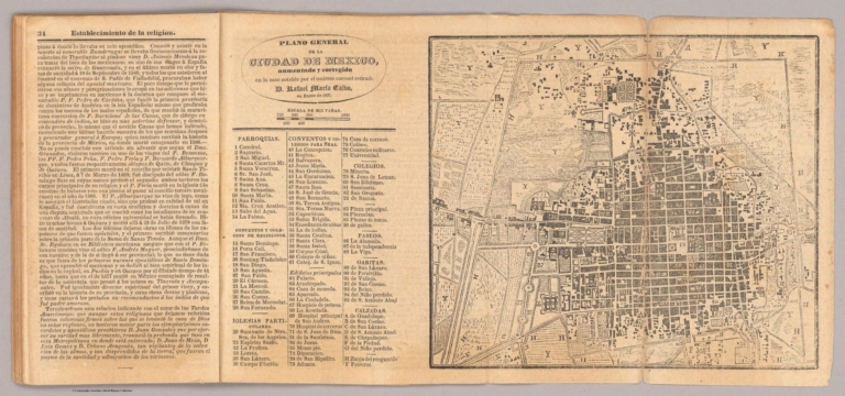
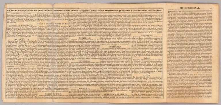
![Covers: Irish Railway Commission. Maps / Presented to both Houses of Parliament by command of Her Majesty. 1838. [Atlas to accompany 2d. Report of the Railway Commissioners, Ireland].](https://www.davidrumsey.com/rumsey/Size2/RUMSEY~8~1/205/15443001.jpg)
![Title: Irish Railway Commission. Maps / Presented to both Houses of Parliament by command of Her Majesty. 1838. [Atlas to accompany 2d. Report of the Railway Commissioners, Ireland].](https://www.davidrumsey.com/rumsey/Size1/RUMSEY~8~1/205/15443002.jpg)


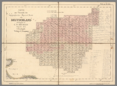
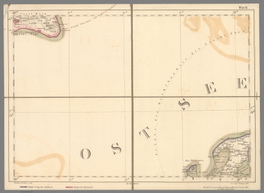

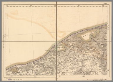


![Covers: No. 1.] King William Street, London Bridge.](https://www.davidrumsey.com/rumsey/Size2/RUMSEY~8~1/179/14002003.jpg)

![Text: No. 1.] King William Street, London Bridge (1).](https://www.davidrumsey.com/rumsey/Size2/RUMSEY~8~1/179/14002005.jpg)
![Text: No. 1.] King William Street, London Bridge (2).](https://www.davidrumsey.com/rumsey/Size2/RUMSEY~8~1/179/14002006.jpg)
![No. 1.] King William Street, London Bridge.](https://media.davidrumsey.com/MediaManager/srvr?mediafile=/Size3/RUMSEY~8~1/179/14002007.jpg)
![Composite: No. 1.] King William Street, London Bridge.](https://media.davidrumsey.com/MediaManager/srvr?mediafile=/Size4/RUMSEY~8~1/179/14002674.jpg)
![Text: No. 1.] King William Street, London Bridge (3).](https://www.davidrumsey.com/rumsey/Size2/RUMSEY~8~1/179/14002008.jpg)
![Text: No. 1.] King William Street, London Bridge (4).](https://www.davidrumsey.com/rumsey/Size2/RUMSEY~8~1/179/14002009.jpg)
![Text: No. 1.] King William Street, London Bridge (5).](https://www.davidrumsey.com/rumsey/Size2/RUMSEY~8~1/179/14002010.jpg)
![Text: No. 1.] King William Street, London Bridge (6).](https://www.davidrumsey.com/rumsey/Size2/RUMSEY~8~1/179/14002011.jpg)