|
Author
Doolittle, Amos
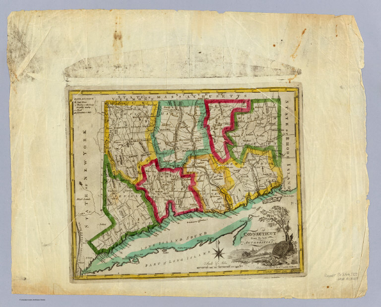
Full Title
Connecticut from the best authorities. Delineated & engraved by A. Doolittle, N. Haven. (Philadelphia: Robert DeSilver, 1827)
List No
0237.000
Note
Reprint of the Connecticut map from Mathew Carey's 1818 edition General Atlas. No changes from the 1818 edition. Thin paper similar to pocket map paper. Outline color by county. Relief shown pictorially. Shows counties, towns, settlements, roads, etc. Illustrated cartouche. Prime meridian: Philadelphia.
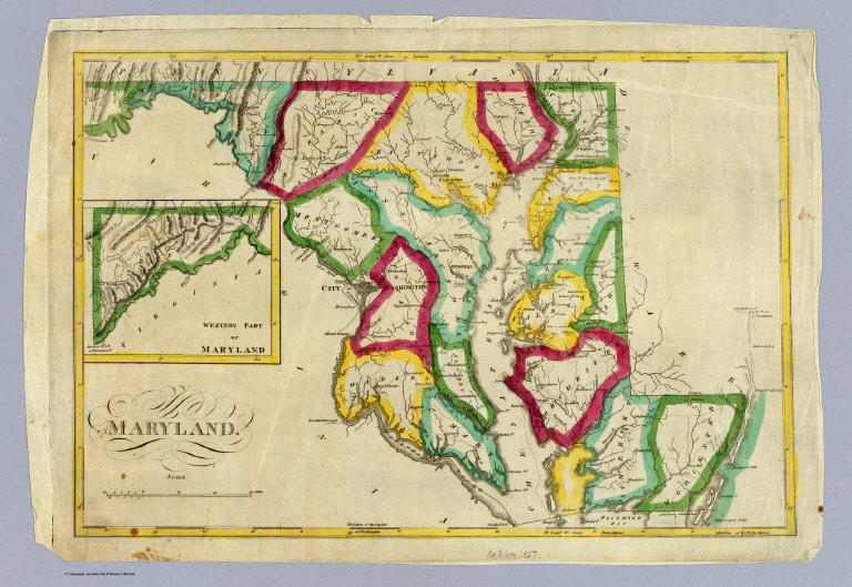
Full Title
Maryland. (inset) Western part of Maryland. (Philadelphia: Robert DeSilver, 1827)
List No
0238.000
Note
Reissue from M. Carey's 1818 edition General Atlas. No changes from the 1818 edition. Outline color by county. Relief shown by hachures. Shows counties, settlements, roads, etc. Prime meridians: London and Philadelphia.
Full Title
The state of Georgia. Gridley sc. (Philadelphia: Robert DeSilver, 1827)
List No
0239.000
Note
Updated from M. Carey's 1818 edition General Atlas. Many changes: coastline, rivers, counties, towns. Map is missing a piece in the upper right corner -- supplied in facsimile. Outline color by county. Relief shown by hachures. "20." Prime meridians: Philadelphia and London.
Author
DeSilver, Robert
Full Title
(Covers to) The State of Massachusetts.
List No
0240.001
Note
Reissue of M. Carey 1818 edition General Atlas. Map is folded into red stamped card covers 13x7 with "Massachusets" misspelled in gilt. This is the same coloring and watermark as the six DeSilver maps issued as separates (see Pennsylvania). No changes from the 1818 Carey plate.
Author
DeSilver, Robert
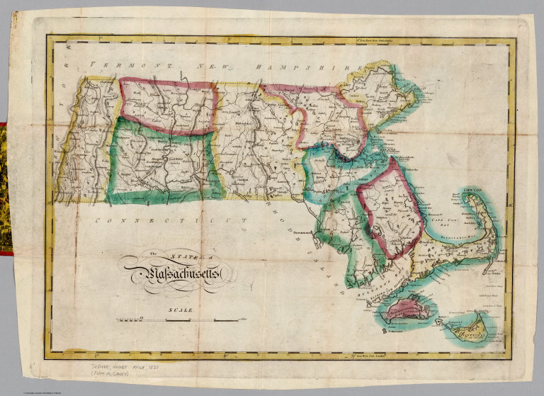
Full Title
The State of Massachusetts.
List No
0240.002
Note
Outline color map. Relief shown by hachures. Prime meridians are Philadelphia and London.
Full Title
The state of Ohio with part of Upper Canada, &c. (Philadelphia: Robert DeSilver, 1827)
List No
0241.000
Note
Reissue from M. Carey's 1818 edition General Atlas. No changes from the 1818 edition. Outline color by county. Shows counties, settlements, roads, etc. Prime meridians: London and Philadelphia. "24."
Author
Finley, Anthony
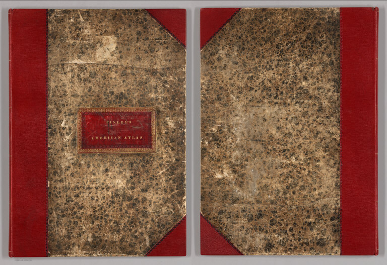
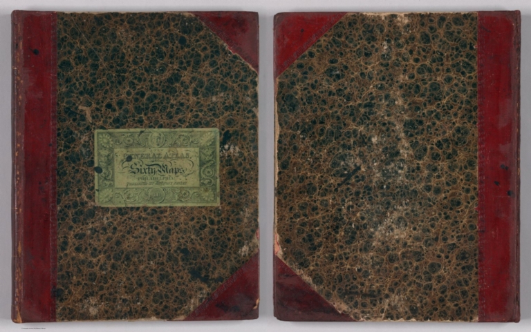
Full Title
(Covers to) A New American Atlas, Designed Principally To Illustrate The Geography Of The United States Of North America; In Which Every County In Each State And Territory Of The Union Is Accurately Delineated, As Far As At Present Known: The Whole Compiled From The Latest And Most Authentic Information. Philadelphia: Published By Anthony Finley, At The North-East Corner Of Chestnut And Fourth Streets. 1826.
List No
0279.001
Note
Bound in half leather marbled paper covered boards with red leather label stamped with "Finley's American Atlas" in gilt.
Author
Finley, Anthony
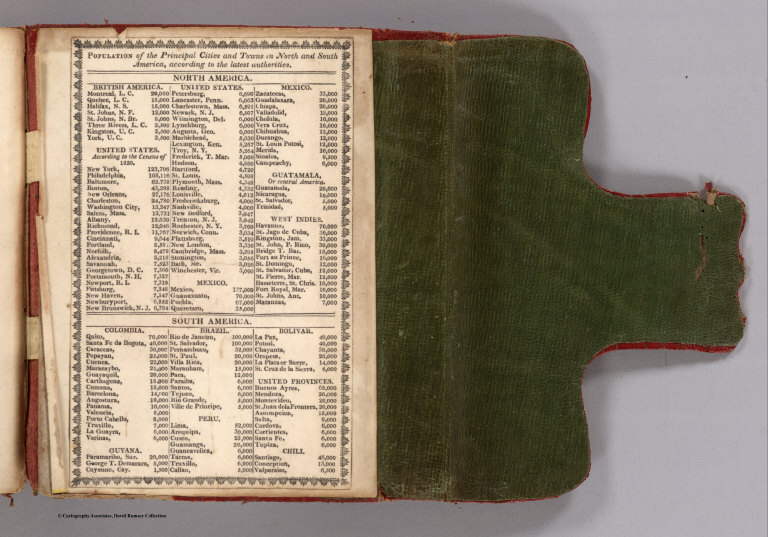
Full Title
(Statistical Table inside front cover) Population of Principal Cities and Towns, North and South America.
List No
0279.002
Note
Pasted in liner. Date uncertain, table based on Census of 1820.
Author
Finley, Anthony
Full Title
(Title Page) A New American Atlas, Designed Principally To Illustrate The Geography Of The United States Of North America; In Which Every County In Each State And Territory Of The Union Is Accurately Delineated, As Far As At Present Known: The Whole Compiled From The Latest And Most Authentic Information. Philadelphia: Published By Anthony Finley, At The North-East Corner Of Chestnut And Fourth Streets. 1826.
List No
0279.003
Author
Finley, Anthony
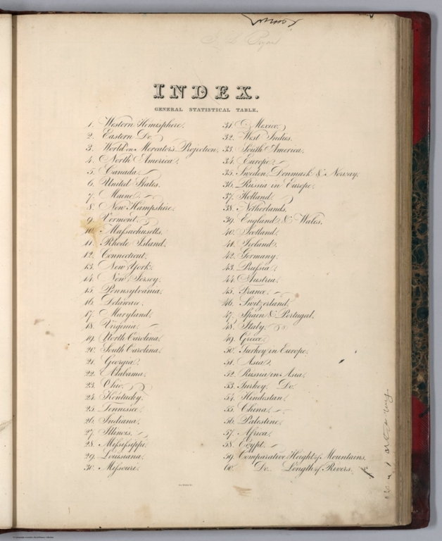
Full Title
(Index Page) Index.
List No
0279.004
Author
Finley, Anthony
Full Title
Map of North America including All the Recent Geographical Discoveries, 1827.
List No
0279.005
Author
Finley, Anthony
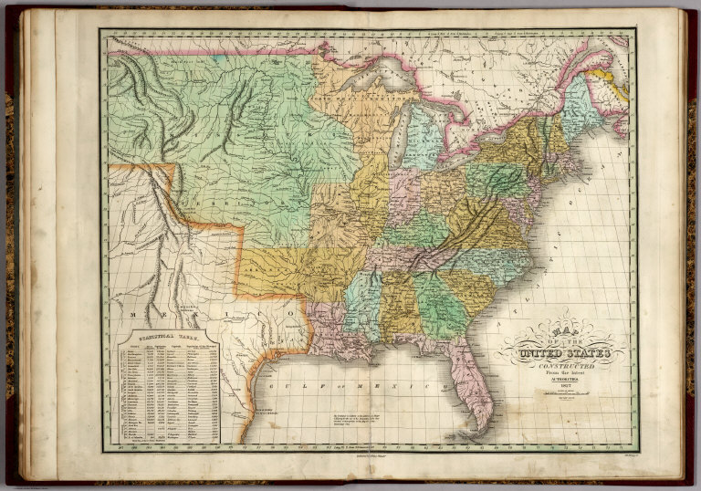
Full Title
Map of the United States, Constructed from the Latest Authorities, 1827.
List No
0279.006
Author
Finley, Anthony
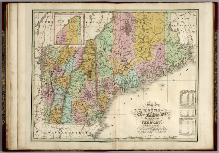
Full Title
Map of Maine, New Hampshire, and Vermont, Compliled from the Latest Authorities.
List No
0279.007
Note
Date estimated.
Author
Finley, Anthony
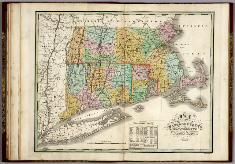
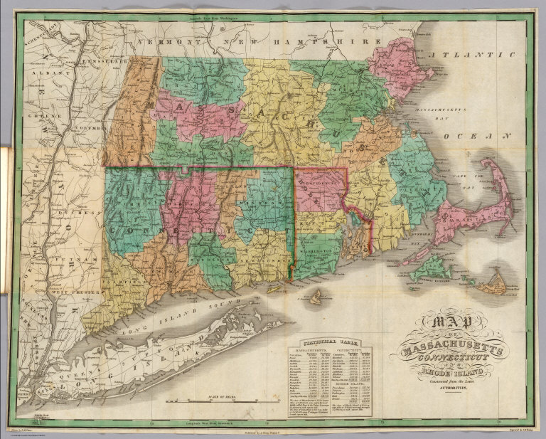
Full Title
Map of Massachusetts, Connecticut, and Rhode Island, Constructed from the Latest Authorities.
List No
0279.008
Note
Date estimated.
Author
Finley, Anthony
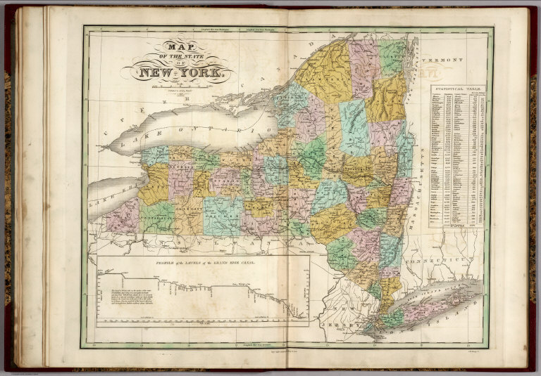
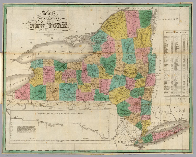
Full Title
Map of the State of New York, 1827. (inset) Profile of the Levels of the Grand Erie Canal.
List No
0279.009
Author
Finley, Anthony
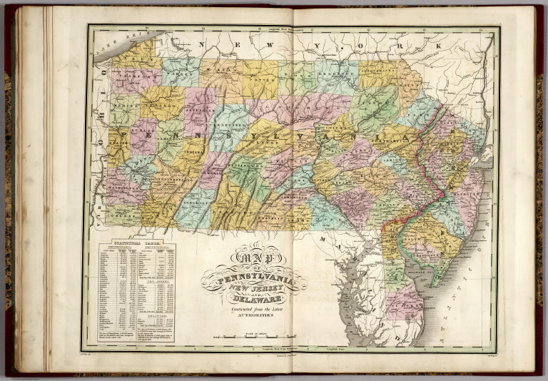
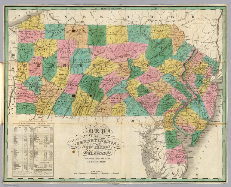
Full Title
Map of Pennsylvania, New Jersey, and Delaware, Constructed from the Latest Authorities.
List No
0279.010
Note
Date estimated.
Author
Finley, Anthony
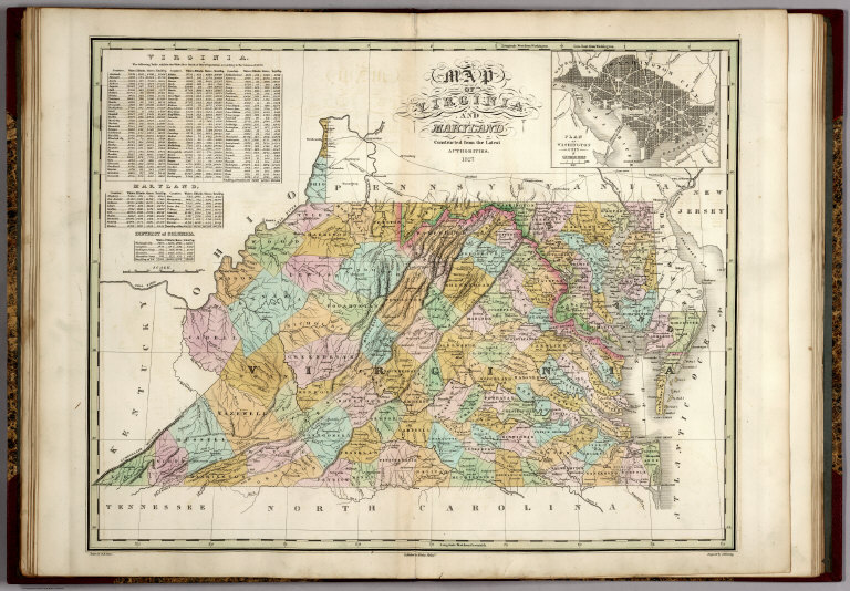
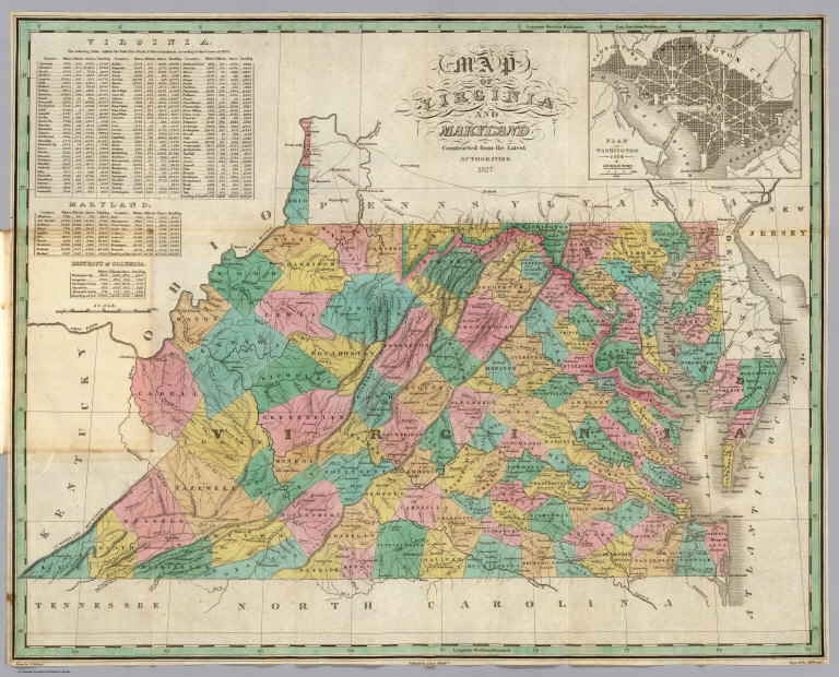
Full Title
Map of Virginia and Maryland, Constructed from the Latest Authorities, 1827. (inset) Plan of Washington City & Georgetown.
List No
0279.011
Author
Finley, Anthony
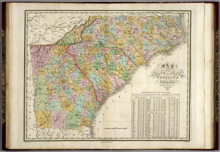
Full Title
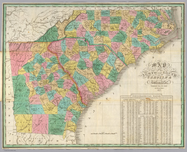
Map of North and South Carolina and Georgia, Constructed from the Latest Authorities, 1827.
List No
0279.012
Author
Finley, Anthony
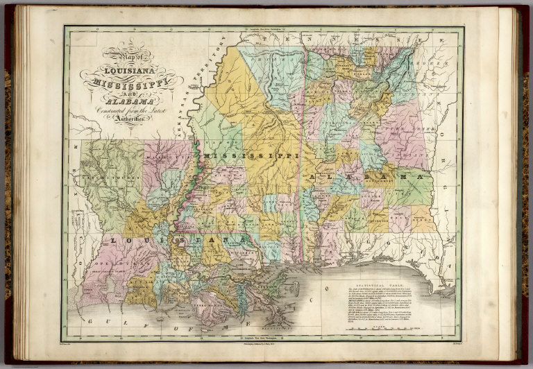
Full Title
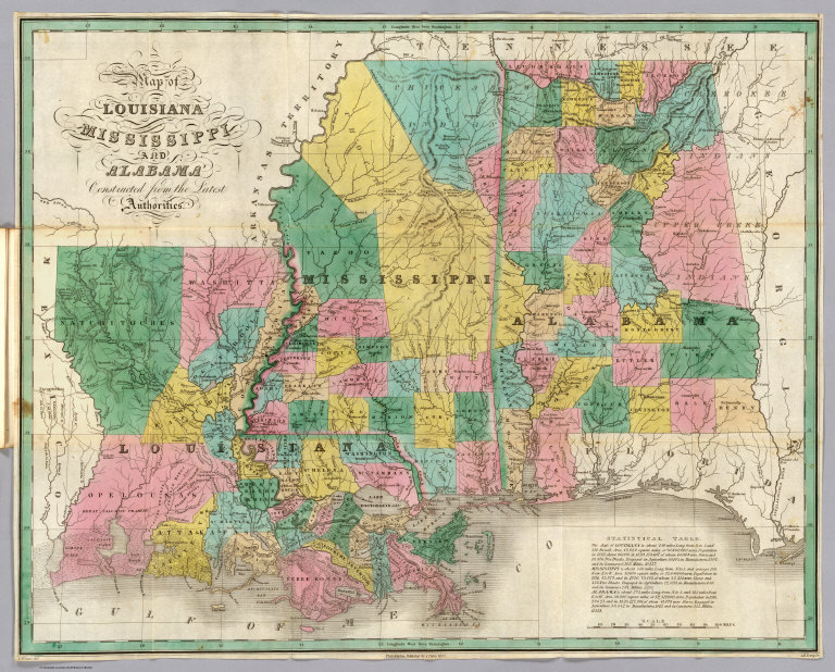
Map of Louisiana, Mississippi, and Alabama, Constructed from the Latest Authorities.
List No
0279.013
Author
Finley, Anthony
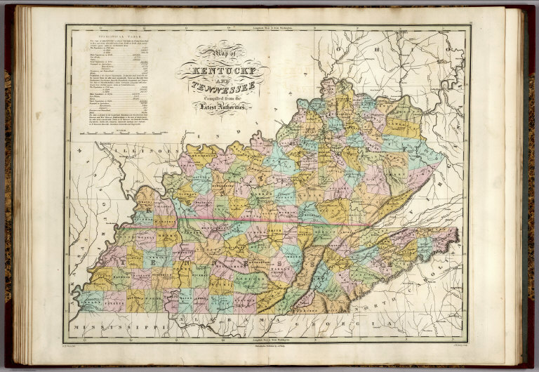
Full Title
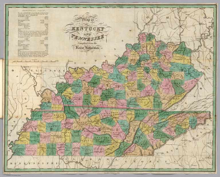
Map of Kentucky and Tennessee, Constructed from the Latest Authorities.
List No
0279.014
Note
Date estimated.
Author
Finley, Anthony
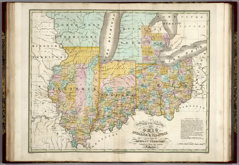
Full Title
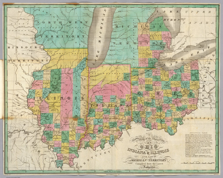
Map of the States of Ohio, Indiana & Illinois and Part of the Michigan Territory, Complied from the Latest Athorities.
List No
0279.015
Author
Finley, Anthony
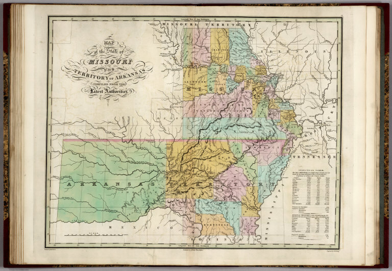
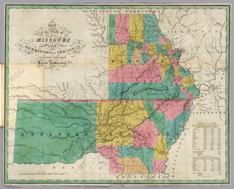
Full Title
Map of the State of Missouri and the Territory of Arkansas, Compiled from the Latest Authorities.
List No
0279.016
Note
Date estimated.
Author
Finley, Anthony
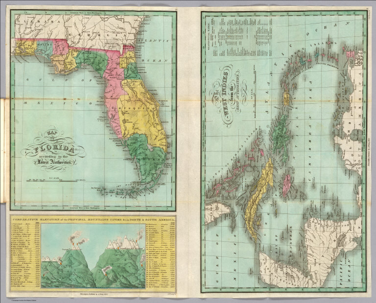
Full Title
Map of Florida, According to the Latest Authorities. Comparative Elevation of the Principal Mountains, Cities, &c. in North & South America.
List No
0279.017
Author
Finley, Anthony
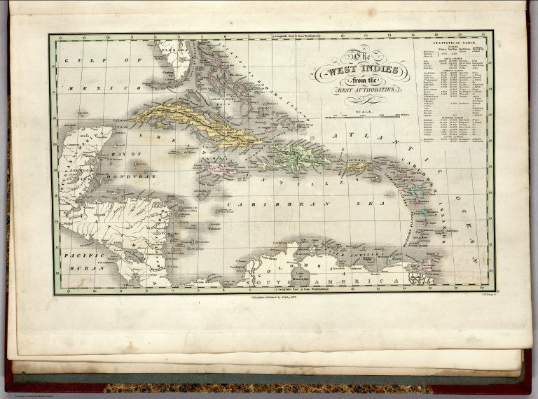
Full Title
The West Indies from the Best Authorities.
List No
0279.018
Author
Finley, Anthony
Full Title
Map of South America According to the Latest and Best Authorities, 1827.
List No
0279.019
Author
Finley, Anthony
Full Title
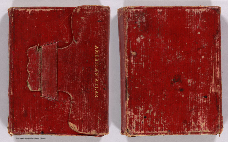
(Covers to) American Atlas (Pocket Atlas).
List No
0280A
Note
Maps folded in red leather pocket case with "American Atlas" embossed on flap. John Grigg also issued this pocket atlas with his name on a red cover.
Author
Finley, Anthony
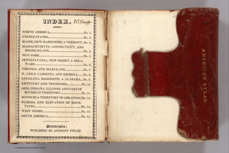
Full Title
(Front Lining to) American Atlas (Pocket Atlas). Index.
List No
0280B
Author
Finley, Anthony
Full Title
Map of North America including All the Recent Geographical Discoveries, 1827. Drawn by D.H. Vance. Published by A. Finley, Philada. Engraved by J.H. Young.
List No
0280.001
Note
Relief shown by hachures. Prime meridian Washington. Table of population of countries.
Author
Finley, Anthony
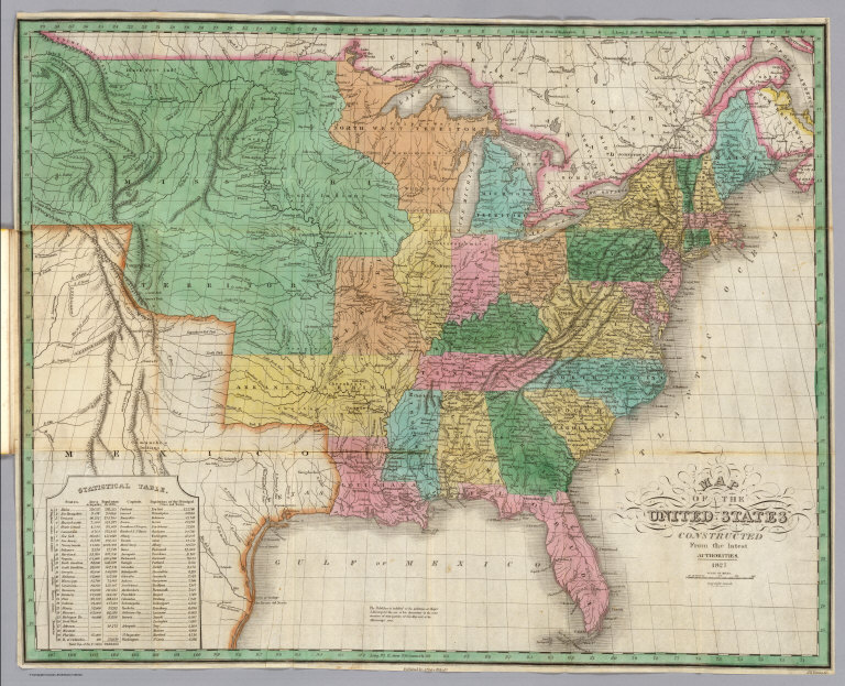
Full Title
Map of the United States Constructed from the Latest Authorities. 1827. Copyright secured. Published by A. Finley, Philada. Engraved by J.H. Young.
List No
0280.002
Note
Relief shown by hachures. Prime meridian Washington. Statistical table of state attributes. Cites contributions of Mjor S.H. Long to information west of the Mississippi River.
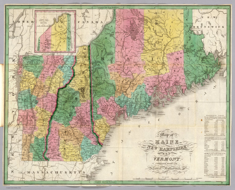
Author
Finley, Anthony
Full Title
Map of Maine, New Hampshire, and Vermont Compiled from the Latest Authorities. Drawn by D.H. Vance. Published by A. Finley, Philada.
List No
0280.003
Note
Relief shown by hachures. Prime meridian Washington. Statistical table for each state.
Author
Finley, Anthony
Full Title
Map of Massachusetts, Connecticut, and Rhode Island Constructed from the Latest Authorities. Drawn by D.H. Vance. Published by A. Finley, Philada. Engraved by J.H. Young.
List No
0280.004
Note
Relief shown by hachures. Prime meridian Washington. Statistical table for each state.
Author
Finley, Anthony
Full Title
Map of the State of New York. Published by A. Finley, Philada. 1927. Copyright secured by Law. Engraved by J.H. Young. (inset) Profile of the Levels of the Grand Erie Canal. Drawn by D.H. Vance. Published by A. Finley, Philada. Engraved by J.H. Young.
List No
0280.005
Note
Relief shown by hachures. Prime meridian Washington. Statistical table for state.
Author
Finley, Anthony
Full Title
Map of Pennsylvania, New Jersey, and Delaware, Constructed from the Latest Authorities. Drawn by D.H. Vance. Published by A. Finley, Philada. Engraved by J.H. Young.
List No
0280.006
Note
Relief shown by hachures. Prime meridian Washington. Statistical table for state.
Author
Finley, Anthony
Full Title
Map of Virginia and Maryland, Constructed from the Latest Authorities. 1827. (inset) Plan of Washington City & Georgetown. Drawn by D.H. Vance. Published by A. Finley, Philada. Engraved by J.H. Young.
List No
0280.007
Note
Relief shown by hachures. Prime meridian Washington. Statistical tables for each state.
Author
Finley, Anthony
Full Title
Map of North and South Carolina, and Georgia, Constructed from the Latest Authorities. 1827. Copyright secured. Published by A. Finley, Philada. 1827. J.H. Young Sculp.
List No
0280.008
Note
Relief shown by hachures. Prime meridian Washington. Statistical table for state.
Author
Finley, Anthony
Full Title
Map of Louisiana, Mississippi, and Alabama. Constructed from the Latest Authorities. D.H. Vance Del., Philadelphia Published by A. Finley 1827. J.H. Young Sc.
List No
0280.009
Note
Relief shown by hachures. Prime meridian Washington. Statistical table for each state. Marshlands along Gulf of Mexico well shown.
Author
Finley, Anthony
Full Title
Map of Kentucky and Tennessee, compiled for the Latest Authorities. D.H. Vance Del., Philadelphia Published by A. Finley. J.H. Young Sculp.
List No
0280.010
Note
Relief shown by hachures. Prime meridian Washington. Statistical table for each state.
Author
Finley, Anthony
Full Title
Map of the States of Ohio, Indiana, & Illinois, and Part of the Michigan Territory, Compiled from the Latest Authorities. D.H. Vance Del., Philada. Published by A. Finley 1827. J.H. Young Sc.
List No
0280.011
Note
Relief shown by hachures. Prime meridian Washington. Statistical table for each state.
Author
Finley, Anthony
Full Title
Map of the States of Missouri and Territory of Arkansas, Compiled from the Latest Authorities. Drawn by D.H. Vance. Published by A. Finley, Philadelphia. Engraved by J.H. Young.
List No
0280.012
Note
Relief shown by hachures. Prime meridian Washington. Statistical table for each state.
Author
Finley, Anthony
Full Title
Map of Florida according to the Latest Authorities. The West Indies from the Best Authorities. Comparative Elevation of the Principal Mountains, Cities, &c. in North and South America. Drawn by D.H. Vance. Published by A. Finley, Philadelphia. Engraved by J.H. Young.
List No
0280.013
Note
Two maps and one diagram on one sheet. Relief shown by hachures. Prime meridian Washington. Florida map at scale 1:3,284,000. West Indies map at scale 1:9,467,000.
Author
Finley, Anthony
Full Title
Map of South America according to the Latest and Best Authorities. 1827. D.H. Vance del. Published by A. Finley Philada. J.H. Young, Sc.
List No
0280.014
Note
Relief shown by hachures. Prime meridian Washington.
Author
Finley, Anthony
Full Title
Text Page: (Back Lining: (Table)) Population of Principal Cities and Towns.
List No
0280C
Author
Finley, Anthony
Full Title
(Covers to) A New General Atlas Comprising a Complete Set of Maps, representing the Grand Divisions Of The Globe, Together with the several Empires, Kingdoms, and States in the World; Compiled from the Best Authorities, and corrected by the Most Recent Discoveries. Philadelphia: Published by Anthony Finley. 1827. (title page only) Written And Engraved By Jos. Perkins.
List No
0282.001
Note
This 1827 of the New general atlas was issued with substantial county changes in the developing states since the second 1824 issue. The atlas was first issued in 1824, with editions published annually to 1834. Each succeeding year new maps were added and others updated. This atlas bound in half leather marbled paper covered boards covers with a green label printed with "A New General Atlas, Containing Sixty Maps. Philadelphia: Published By Anthony Finley." and "Finley General Atlas" stamped in gold on the spine. Engraved title page "written and engraved by Jos. Perkins", index and statistical table; 58 hand colored maps engraved by Young & Delleker and 2 engraved hand colored tables.
Author
Finley, Anthony
Full Title
(Index Page to) A New General Atlas Comprising a Complete Set of Maps, representing the Grand Divisions Of The Globe, Together with the several Empires, Kingdoms, and States in the World; Compiled from the Best Authorities, and corrected by the Most Recent Discoveries. Philadelphia: Published by Anthony Finley. 1827. (title page only) Written And Engraved By Jos. Perkins.
List No
0282.003
Note
This 1827 of the New general atlas was issued with substantial county changes in the developing states since the second 1824 issue. The atlas was first issued in 1824, with editions published annually to 1834. Each succeeding year new maps were added and others updated. This atlas bound in half leather marbled paper covered boards covers with a green label printed with "A New General Atlas, Containing Sixty Maps. Philadelphia: Published By Anthony Finley." and "Finley General Atlas" stamped in gold on the spine. Engraved title page "written and engraved by Jos. Perkins", index and statistical table; 58 hand colored maps engraved by Young & Delleker and 2 engraved hand colored tables.
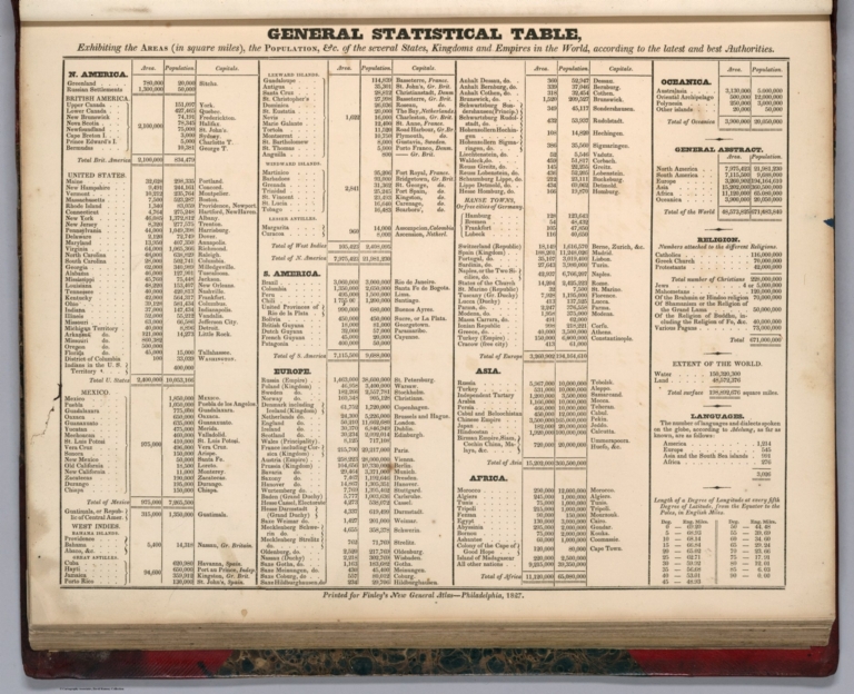
Author
Finley, Anthony
Full Title
(Statistical Diagram) General Statistical Table. Printed for Finley's New general atlas, Philadelphia, 1827. (to accompany) A New General Atlas Comprising a Complete Set of Maps, representing the Grand Divisions Of The Globe, Together with the several Empires, Kingdoms, and States in the World; Compiled from the Best Authorities, and corrected by the Most Recent Discoveries. Philadelphia: Published by Anthony Finley. 1827. (title page only) Written And Engraved By Jos. Perkins.
List No
0282.004
Note
This 1827 of the New general atlas was issued with substantial county changes in the developing states since the second 1824 issue. The atlas was first issued in 1824, with editions published annually to 1834. Each succeeding year new maps were added and others updated. This atlas bound in half leather marbled paper covered boards covers with a green label printed with "A New General Atlas, Containing Sixty Maps. Philadelphia: Published By Anthony Finley." and "Finley General Atlas" stamped in gold on the spine. Engraved title page "written and engraved by Jos. Perkins", index and statistical table; 58 hand colored maps engraved by Young & Delleker and 2 engraved hand colored tables.
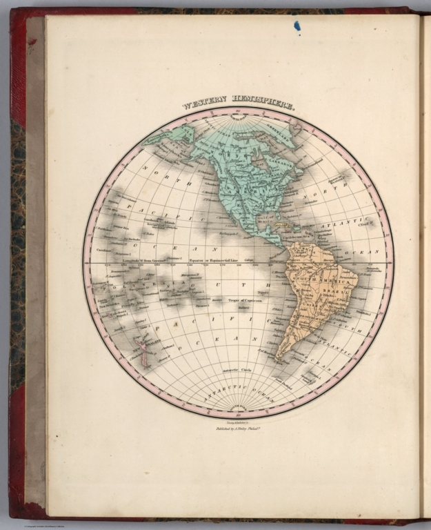
Author
Finley, Anthony
Full Title
Western Hemisphere. Young & Delleker Sc. Published by A. Finley, Philada. (to accompany) A New General Atlas Comprising a Complete Set of Maps, representing the Grand Divisions Of The Globe ... Philadelphia: Published by Anthony Finley. 1827.
List No
0282.005
Note
Full color map by continents on sheet 35x27. Relief shown pictorially.
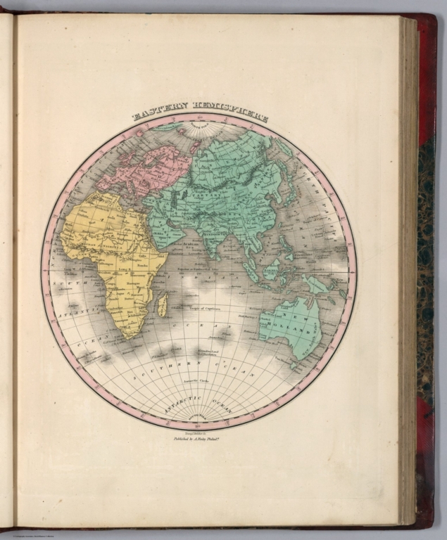
Author
Finley, Anthony
Full Title
Eastern Hemisphere. Young & Delleker Sc. Published by A. Finley, Philada. (to accompany) A New General Atlas Comprising a Complete Set of Maps, representing the Grand Divisions Of The Globe ... Philadelphia: Published by Anthony Finley. 1827.
List No
0282.006
Note
Full color map by continents on sheet 35x27. Relief shown pictorially.
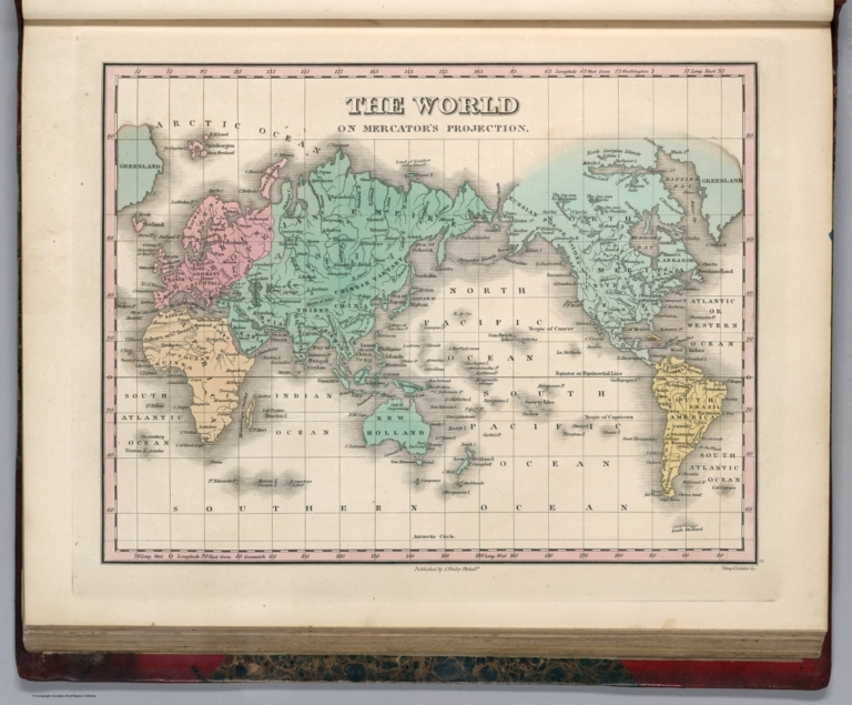
Author
Finley, Anthony
Full Title
The World On Mercator's Projection. Young & Delleker Sc. Published by A. Finley, Philada. (to accompany) A New General Atlas Comprising a Complete Set of Maps, representing the Grand Divisions Of The Globe ... Philadelphia: Published by Anthony Finley. 1827.
List No
0282.007
Note
Full color map by continents on sheet 35x27. Prime meridians are Washington and Greenwich.
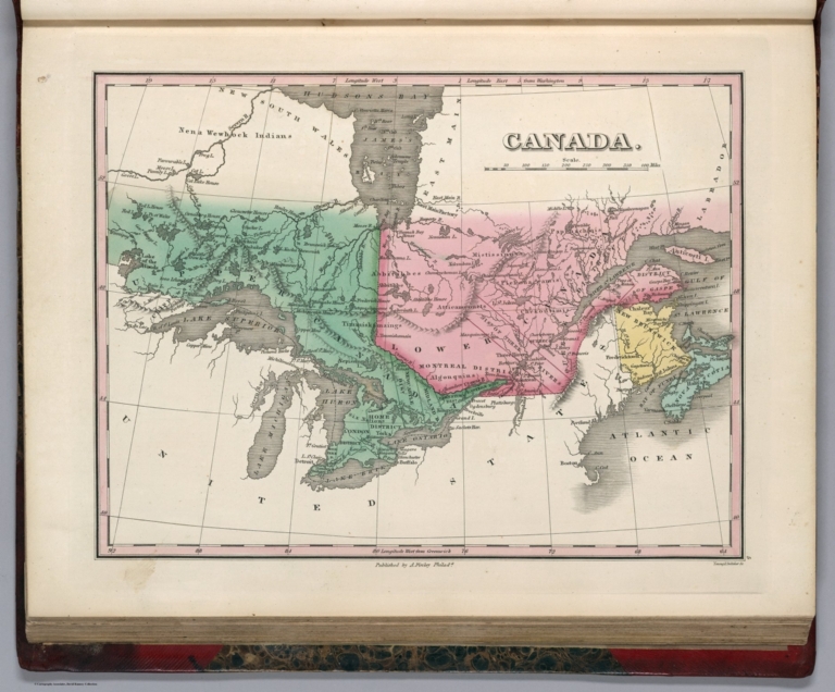
Author
Finley, Anthony
Full Title
Canada. Young & Delleker Sc. Published by A. Finley, Philada. (to accompany) A New General Atlas Comprising a Complete Set of Maps, representing the Grand Divisions Of The Globe ... Philadelphia: Published by Anthony Finley. 1827.
List No
0282.009
Note
Full color map on sheet 35x27. Relief shown pictorially. Prime meridians are Washington and Greenwich. Shows administrative divisions, major cities, capitals, rivers and ports.
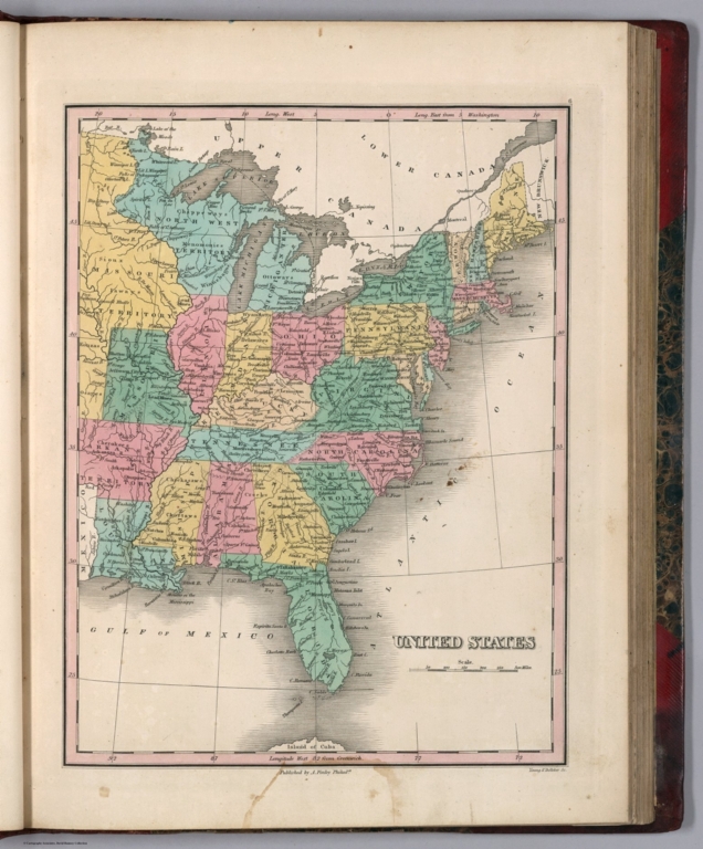
Author
Finley, Anthony
Full Title
United States. Young & Delleker Sc. Published by A. Finley, Philada. (to accompany) A New General Atlas Comprising a Complete Set of Maps, representing the Grand Divisions Of The Globe ... Philadelphia: Published by Anthony Finley. 1827.
List No
0282.010
Note
Full color map by state or territory on sheet 35x27. Relief shown pictorially. Prime meridians are Washington and Greenwich. Shows major cities, capitals, roads, rivers and ports.
|