|
Author
Depot General de la Marine
Full Title
(Covers to) Hydrographie Française 5
List No
15934.179
Note
Hydrographie Française 5
Author
[Depot General de la Marine, Beautemps-Beaupré, Charles François, 1766-1854]
Full Title
Carte Des Cotes De France (Partie Comprise Entre Mimizan Et La Frontiere D'Espagne)
List No
15934.180
Note
Hydrographie Française 5
Author
[Depot General de la Marine, Beautemps-Beaupré, Charles François, 1766-1854]
Full Title
Carte Particuliere Des Cotes De France (Environs De Bayonne, Fosse De Cap Breton)
List No
15934.181
Note
Hydrographie Française 5
Author
[Depot General de la Marine, Beautemps-Beaupré, Charles François, 1766-1854]
Full Title
Plan Du Cours De L'Adour depuis Bayonne jusqu'a son Embouchure.
List No
15934.182
Note
Hydrographie Française 5
Author
[Depot General de la Marine, Beautemps-Beaupré, Charles François, 1766-1854]
Full Title
Carte Des Cotes De France (Partie Comprise Entre Bayonne Et La Cote D'Espagne)
List No
15934.183
Note
Hydrographie Française 5
Author
[Depot General de la Marine, Beautemps-Beaupré, Charles François, 1766-1854]
Full Title
Plan De La Baie De Saint Jean De Luz
List No
15934.184
Note
Hydrographie Française 5
Author
[Depot General de la Marine, Beautemps-Beaupré, Charles François, 1766-1854]
Full Title
Plan De La Baie De Fontarabie
List No
15934.185
Note
Hydrographie Française 5
Author
[Depot General de la Marine, Tofino de San Miguel, Vicente, 1732-1795]
Full Title
Port Du Passage d'apres le Plan leve en 1788 par Tofino
List No
15934.186
Note
Hydrographie Française 5
Author
[Depot General de la Marine, Tofino de San Miguel, Vicente, 1732-1795]
Full Title
Baie Port et Ville De St. Sebastien Capitale du Guipuzcoa.
List No
15934.187
Note
Hydrographie Française 5
Author
[Depot General de la Marine, Tofino de San Miguel, Vicente, 1732-1795]
Full Title
Anse et Barre De Bilbao
List No
15934.188
Note
Hydrographie Française 5
Author
[Depot General de la Marine, Tofino de San Miguel, Vicente, 1732-1795]
Full Title
Port De Santona
List No
15934.189
Note
Hydrographie Française 5
Author
[Depot General de la Marine, Tofino de San Miguel, Vicente, 1732-1795]
Full Title
Port De Santander
List No
15934.190
Note
Hydrographie Française 5
Author
[Depot General de la Marine, Tofino de San Miguel, Vicente, 1732-1795]
Full Title
Anse De Gijon
List No
15934.191
Note
Hydrographie Française 5
Author
[Depot General de la Marine, Tofino de San Miguel, Vicente, 1732-1795]
Full Title
Havre De Vivero (with) Havre De Ribadeo (with) Port De Cedeira
List No
15934.192
Note
Hydrographie Française 5
Author
Depot General de la Marine
Full Title
Havre De Barquero et Estaca De Vares
List No
15934.193
Note
Hydrographie Française 5
Author
[Depot General de la Marine, Tofino de San Miguel, Vicente, 1732-1795]
Full Title
Cotes D'Espagne Partie De La Galice depuis le Cap Ortegal jusqu'au Cap Silleiro
List No
15934.194
Note
Hydrographie Française 5
Author
[Depot General de la Marine, Tofino de San Miguel, Vicente, 1732-1795]
Full Title
Paln Des Havres De Ferrol, Betanze, et La Corogne
List No
15934.195
Note
Hydrographie Française 5
Author
[Depot General de la Marine, Tofino de San Miguel, Vicente, 1732-1795]
Full Title
Port De Ferrol
List No
15934.196
Note
Hydrographie Française 5
Author
[Depot General de la Marine, Tofino de San Miguel, Vicente, 1732-1795]
Full Title
Port De Camarinas
List No
15934.197
Note
Hydrographie Française 5
Author
[Depot General de la Marine, Tofino de San Miguel, Vicente, 1732-1795]
Full Title
Anse et Havre De Corcubion depuis le Cap Finisterre jusqu'a le Pte. de Caldebarcos
List No
15934.198
Note
Hydrographie Française 5
Author
[Depot General de la Marine, Tofino de San Miguel, Vicente, 1732-1795]
Full Title
Plan Du Havre De Pontevedra et des Iles de Ons et de Onza
List No
15934.199
Note
Hydrographie Française 5
Author
[Depot General de la Marine, Tofino de San Miguel, Vicente, 1732-1795]
Full Title
Havre De Vigo
List No
15934.200
Note
Hydrographie Française 5
Author
[Depot General de la Marine, Franzini, Marino Miguel, 1779-1861]
Full Title
Plan Reduite De La Cote De Portugal De pis le Cap Silleiro jusqu'a la Barre de Huelba
List No
15934.201
Note
Hydrographie Française 5 With 9 inset charts of Leichoes, Porto, Aveiro, Figueira, S. Martinho, Peniche, Berlingues, Setuval, Lagos, and Portimaon.
Author
[Depot General de la Marine, Franzini, Marino Miguel, 1779-1861]
Full Title
Plan De La Barre De Lisbone et des Cotes adjacentes
List No
15934.202
Note
Hydrographie Française 5
Author
Depot General de la Marine
Full Title
Carte De La Cote Meridionale De Portugal Et D"espagne Depuis le Cap St. Vincent jusqu'a la Baie de Gibraltar
List No
15934.203
Note
Hydrographie Française 5
Author
[Depot General de la Marine, Raoul, A.M., Givry, Alexandra P.]
Full Title
Plan Hydrographique De La Baie De Cadiz
List No
15934.204
Note
Hydrographie Française 5
Author
[Depot General de la Marine, Tofino de San Miguel, Vicente, 1732-1795]
Full Title
Carte Du Detroit De Gibraltar
List No
15934.205
Note
Hydrographie Française 5
Author
[Depot General de la Marine, Tofino de San Miguel, Vicente, 1732-1795]
Full Title
Carte De La Baie De Gibraltar
List No
15934.206
Note
Hydrographie Française 5
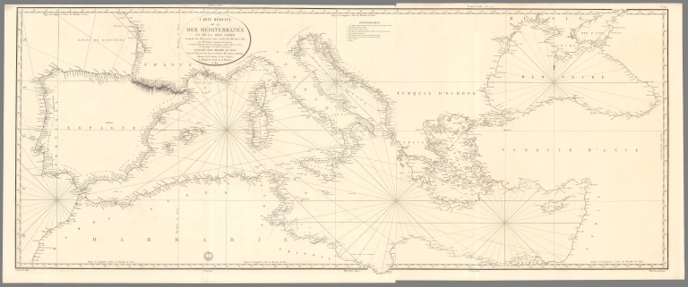
Author
Depot General de la Marine
Full Title
Carte Reduite De La Mer Mediterranee Et De La Mer Noire
List No
15934.207
Note
Hydrographie Française 5
Author
Depot General de la Marine
Full Title
(2) (Carte Reduite De La Mer Mediterranee Et De La Mer Noire)
List No
15934.208
Note
Hydrographie Française 5
Author
Depot General de la Marine
Full Title
(Composite map of) Carte Reduite De La Mer Mediterranee Et De La Mer Noire Premiere Feuille.et Deuxieme Feuille
List No
15934.209
Note
Hydrographie Française 5
Author
Depot General de la Marine
Full Title
Cote Meridionale D'Espagne depuis Cadiz jusqu'au Cap de Palos et Cote Septentrionale D'Afrique
List No
15934.210
Note
Hydrographie Française 5
Author
Depot General de la Marine
Full Title
Plan Du Mouillage De Tarifa (with) Plan De La Baie D'Algesiras (with) Plan Du Mouillage De Marbella (with) Plan Du Mouillage De Frangerola
List No
15934.211
Note
Hydrographie Française 5 - 4 charts on one sheet. Date estimated
Author
Depot General de la Marine
Full Title
Plan Du Port De Malaga (with) Mouillage de la Tour Molinos (with) Mouillage de Nerja
List No
15934.212
Note
Hydrographie Française 5 - 3 charts on one sheet. Date estimated
Author
Depot General de la Marine
Full Title
Anse de la Herradura (with) Anse des Berengueles (with) Mouillage de Almunecar (with) Anse de Belilla
List No
15934.213
Note
Hydrographie Française 5 - 4 charts on one sheet. Date estimated
Author
Depot General de la Marine
Full Title
Plage De Salobrena (with) Plan De Cala-Honda (with) Mouillage Du Chateau De Ferro (with) Mouillage D'Adra
List No
15934.214
Note
Hydrographie Française 5 - 4 charts on one sheet. Date estimated
Author
Depot General de la Marine
Full Title
Cote Meridionale D"Espagne Depuis la Tour de Belerma jusqu'a celle de las Sentinas (with) Mouillage De Roquetas (with) Mouillage D'Almeria (with) Mouillage de St. Francisco de Paula ou Corraletes
List No
15934.215
Note
Hydrographie Française 5 - 4 charts on one sheet. Date estimated
Author
Depot General de la Marine
Full Title
Plan De L'Anse St. Joseph Et Du Port Genois (with) Anse De Los Escullos ou Mahomet Arraez (with) Port De San Pedro a l'Est du Cap de Gate (with) Mouillage De La Carbonera
List No
15934.216
Note
Hydrographie Française 5 - 4 charts on one sheet. Date estimated
Author
Depot General de la Marine
Full Title
Plan du Port et Village De Las Aguilas (with) Mouillage Du Mont De Cope (with) Anses D'Almazarron et De La Subida (with) Anse De Portus Situee a Cinq Milles a l'Est de Cartagene
List No
15934.217
Note
Hydrographie Française 5 - 4 charts on one sheet. Date estimated
Author
Depot General de la Marine
Full Title
Plan de la Ville, du Port et de l'Arsenal De Carthagene, a la Cote Orientale d'Espagne
List No
15934.218
Note
Hydrographie Française 5
Author
Depot General de la Marine
Full Title
Port De Por Man a l'Est de Cartagene (with) Mouillage De L'Ile Grosa Pres du Cap Palos (with) Anse De Torre Vieja (with) Muillage de Lugar Nuevo et de L'Ile Tabarca
List No
15934.219
Note
Hydrographie Française 5 - 4 charts on one sheet. Date estimated
Author
Depot General de la Marine
Full Title
Cote Orientale D'Espagne Depuis le Cap de Paloa jusqu'au Cap de Creux avec les Iles Maiorque Minorque Et Yvice et partie de la Cote d'Afrique
List No
15934.220
Note
Hydrographie Française 5
Author
Depot General de la Marine
Full Title
Baie D'Alicante (with) Rade de Benidorme (with) Mouillage D'Altea
List No
15934.221
Note
Hydrographie Française 5 - 3 charts on one sheet. Date estimated
Author
Arrowsmith, John, 1790-1873
Full Title
(Covers to) The London atlas, 1861.
List No
14506.001
Note
Covers to The London atlas of universal geography. Bound in black leather with gilt title, border, and spine title.
Author
Arrowsmith, John, 1790-1873
Full Title
(Title Page to) The London atlas of universal geography, exhibiting the physical & political divisions of the various countries of the world, constructed from original materials. Is most respectfully dedicated to his venerable friends John Middleton Esqr. as a testimony of gratitude and esteem, by his much obliged & humble servant, John Arrowsmith, F.R.G.S. & R.A.S. 10, Soho Square, London. London, pubd. by J. Arrowsmith, 10 Soho Square, 1858.
List No
14506.002
Note
Title page to The London atlas of universal geography.
Author
Arrowsmith, John, 1790-1873
Full Title
(Contents to) Contents.
List No
14506.003
Note
Manuscript table of contents to The London atlas of universal geography. Lists maps by title with associated plate numbers.
Author
Arrowsmith, John, 1790-1873
Full Title
The world, on Mercator's projection, by John Arrowsmith. London, pubd. Augt. 22nd. 1861, by J. Arrowsmith, 10 Soho Square.
List No
14506.008
Note
Composite world map. Shows countries, regions and cities, topography, bodies of water, drainage, deserts, coastlines and islands. Relief shown with hachures. Features exploration routes with names of explorers and dates of their voyages. Includes latitudinal and longitudinal lines. Descriptive notes throughout. With two inset maps: [South Pole] -- [North Pole]. Hand-colored engraving. All together, map is 64 x 109 cm, on two double sheets, together 68 x 112 cm.
Author
Arrowsmith, John, 1790-1873
Full Title
The inland navigation, rail roads, geology, and minerlas of England & Wales, by J. Arrowsmith. London, pubd. 15 Feby. 1842, by J. Arrowsmith, 10 Soho Square.
List No
14506.011
Note
Map representing England and Wales. Shows counties, cities, railways, topography, bodies of water, drainage, coastlines and islands. Relief shown with hachures. Includes a legend, table of geological groups, lines of navigation, and latitudinal and longitudinal lines, as well as bar scales given in geographical and English miles. Hand-colored engraving. Map is 63 x 50 cm, on double sheet 68 x 56 cm.
Author
Arrowsmith, John, 1790-1873
Full Title
Official map of railways in England and Scotland, shewing the existing lines & those in progress; from the maps prepared, by the authority of the Commissioners of Railways; (presented to both houses of parliament) and from the other documents; by John Arrowsmith. 1858. London, pubd. July 1st, 1858, by J. Arrowsmith, 10 Soho Square.
List No
14506.014
Note
Composite map of railways in England and Scotland. Shows counties, cities, railways, bodies of water, drainage, coastlines and islands. Relief shown with hachures. Includes a legend, latitudinal and longitudinal lines, as well as a bar scale given in English miles. Hand-colored engraving. Hand-colored engraving. All together, map is 106 x 67 cm, on two double sheets, together 68 x 112 cm.
Author
Arrowsmith, John, 1790-1873
Full Title
Southern portion of the Crimea, from surveys made by order of the Russian government. John Arrowsmith, 10 Soho Square. London. Pubd. 6th June 1854, by John Arrowsmith, 10 Soho Square.
List No
14506.028
Note
Map representing the southern part of Crimea. Shows political boundaries, cities, roads, topography, bodies of water, drainage, coastlines and islands. Relief shown with hachures. Includes latitudinal and longitudinal lines, as well as bar scales given in English miles and Russian versts. Includes informational text throughout. With two inset maps: [Black Sea.] -- Sebastapol inlet & harbour from Russian survey. Hand-colored engraving. Map is 61 x 78 cm, on fold-out sheet 68 x 84 cm.
Author
Arrowsmith, John, 1790-1873
Full Title
Map of the Ionian Islands and Malta : Compiled from surveys & original documents in the colonial office, the ordnance department &c by John Arrowsmith. London. Pubd. 8th. August. 1858, by John Arrowsmith, 10 Soho Square.
List No
14506.036
Note
Map representing the Ionian Islands of Greece, and Malta. Shows political boundaries, cities, roads, topography, bodies of water, drainage, coastlines, and islands. Relief shown with hachures. Includes latitudinal and longitudinal lines, as well as a bar scale given in English miles. With informational text and three ancillary maps: [Cerigo.] -- Map of the Maltese Islands from actual surveys. -- [Map of sailing routes between Cairo, Malta, Ionian Islands, London, and various points in Europe]. Hand-colored engraving. Map is 62 x 53 cm, on double sheet 68 x 56 cm.
Author
Arrowsmith, John, 1790-1873
Full Title
(Composite map of) Map of the West coast of Africa comprising Guinea, and the British possessions at Sierra Leone, on the Gambia and the Gold Coast, together with the countries within the courses of the rivers Senegal, Gambia & Kowara, compiled from official documents, by J. Arrowsmith, 1858. London. Pubd. 17th April 1858, by John Arrowsmith, 10 Soho Square.
List No
14506.042
Note
Composite map representing West Africa. Shows political boundaries, cities, roads, topography, deserts, bodies of water, drainage, coastlines, and islands. Relief shown with hachures. Includes latitudinal and longitudinal lines. Hand-colored engraving.
Author
Arrowsmith, John, 1790-1873
Full Title
Madagascar, from original drawings, sketches, diaries & oral information; by J.A. Lloyd Esqre. F.R.S., F.R.G.S. &c. &c. Survr. Genl. of the Maurituus. John Arrowsmith 10 Soho Square, 1850. Lond. Pubd. Feby. 5th. 1850. by John Arrowsmith, 10 Soho Square.
List No
14506.048
Note
Map representing Madagascar. Shows political boundaries, indigenous territory, cities, roads, topography, bodies of water, drainage, coastlines, and islands. Relief shown with hachures. Includes latitudinal and longitudinal lines. With a plan and view of Hova Fort Tamatave. With inset map: Plan of an attack on the defences & town of Tamatave by H.M. Ship Conway, Captn. W. Kelly, in concert with the French Corvettes Berceau & Zelée, Commodore Desfossés & Commander Fierick, June 15th. 1845. Hand-colored engraving. Map is 63 x 49 cm, on double sheet 68 x 56 cm.
Author
Fraser, F.A. Mackenzie
Full Title
To Lieut. Genl. the honble. Sir Charles Colville G.C.B. G.C.H. K.C.T&S. &c. &c. &c. Late governor and commander in chief of Mauritius and its dependencies. This map is by permission, most respectfully dedicated by his much obliged and very obedient servant F.A. Mackenzie Fraser Major H.P. unattached sometime Mily. Secy. afterwards acting Dy. Adjt. Genl. in that Island. 1835. Engraved by WH. Lizars. Edinr.
List No
14506.049
Note
Map representing Mauritius. Shows cities, roads, topography, coastlines, and islands. Relief shown with hachures. Includes a legend, a compass rose with north oriented toward top of sheet, X and X lines, as well as a bar scale given in English miles. With three tables: Population in 1827. -- Returns of sugar exported. -- Table of height of principal mountains. Hand-colored engraving. Map is 61 x 48 cm, on double sheet 68 x 56 cm.
Author
Arrowsmith, John, 1790-1873
Full Title
Nubia and Abyssinia, by J. Arrowsmith. London. Pubd. 15 Feby. 1858, by J. Arrowsmith, 10 Soho Square.
List No
14506.050
Note
Map representing current-day Eritrea, Ethiopia, Djibouti, and parts of Sudan, Yemen, Somalia, and Saudi Arabia. Shows political boundaries, indigenous territory, cities, roads, topography, deserts, bodies of water, drainage, coastlines, and islands. Relief shown with hachures. Includes latitudinal and longitudinal lines, as well as bar scales given in geographical and English miles. Hand-colored engraving. Map is 51 x 60 cm, on double sheet 56 x 68 cm.
Author
Arrowsmith, John, 1790-1873
Full Title
The Caspian Sea, Khivah, and the surrounding country. Compiled from the best sources by John Arrowsmith. London, pubd. Jany. 1st. 1858, by John Arrowsmith, 10, Soho Square.
List No
14506.056
Note
Map representing current-day Uzbekistan, Kazakhstan, and Turkmenistan. Shows political boundaries, cities, roads, topography, deserts, bodies of water, drainage, coastlines, and islands. Relief shown with hachures. Includes latitudinal and longitudinal lines. Hand-colored engraving. Map is 63 x 52 cm, on double sheet 68 x 56 cm.
Author
Arrowsmith, John, 1790-1873
Full Title
India, by J. Arrowsmith. London. Pubd. 15 Feby. 1857, by J. Arrowsmith, 10 Soho Square.
List No
14506.057
Note
Map representing current-day India, Nepal, Bhutan, Bangladesh, Sri Lanka, and Republic of Maldives. Shows political boundaries, cities, roads, topography, bodies of water, drainage, coastlines, and islands. Relief shown with hachures. Includes a legend, latitudinal and longitudinal lines, as well as bar scales given in cosses, geographical and English miles. Hand-colored engraving. Map is 62 x 52 cm, on double sheet 67 x 56 cm.
Author
[Arrowsmith, John, 1790-1873, Murchison, Roderick Impey, Sir, 1792-1871, Yule, Henry, Sir, 1820-1889]
Full Title
(Composite map of) This new map of Burma and the regions adjacent; is inscribed to Sir Roderick Murchison, P.R.G.S. &c. &c. &c. By H. Yule, Captn. Bengal Engrs. London, 1857. John Arrowsmith.
List No
14506.063
Note
Composite map representing current-day Myanmar and part of Thailand. Shows political boundaries, cities, roads, topography, bodies of water, drainage, coastlines, and islands. Relief shown with hachures. Includes a glossary and informational text, as well as latitudinal and longitudinal lines, as well as a bar scale given in English miles. Hand-colored engraving.
Author
[Arrowsmith, John, 1790-1873, Roe, John Septimus, 1797-1878]
Full Title
Cockburn Sound, by J.S. Roe Esqr. London. Pubd. Jany. 1842, by John Arrowsmith, 10 Soho Square.
List No
14506.076
Note
Nautical chart representing Cockburn Sound, Australia. Shows property ownership, cities, roads, topography, water depths, bodies of water, drainage, coastlines, and islands. Relief shown with hachures. Includes informational text, navigation routes, as well as a compass rose with north oriented toward top of sheet, and a bar scale given in nautical miles. With five four ancillary maps: Kingstown (In Rottnest I.) -- King Georges Sound with its harbours; from Captn. Flanders' survey (1802) improved by documentsin the Colonial Office to 1833. -- [Point William.]. -- Survey of the coast about Peel Harbour by J.S. Roe, Esqr. Survr. Genl. 1838. Hand-colored engraving. Map is 52 x 32 cm, on sheet 56 x 39 cm.
Author
[Arrowsmith, John, 1790-1873, Urquhart, W. S. (William Spence), 1877-1964, Read, C.R.]
Full Title
Trigonometrical survey of the gold bearing region near Mount Alexander in the province of Victoria, Australia. By W.S. Urquhart, Depy. Survr. Genl. with additions by C.R. Read Esqr. John Arrowsmith, 10 Soho Square. London, Published July 4th, 1853, by John Arrowsmith, 10 Soho Square.
List No
14506.079
Note
Map representing the region near Mount Alexander, Australia. Shows political boundaries, cities, roads, topography, bodies of water, and drainage. Relief shown with hachures. Includes a legend, informational text, a compass rose with north oriented toward top of sheet, as well as a bar scale given in English miles. With two ancillary maps: [Victoria.] -- Plan of Ballarat Township shewing the gold diggings surveyed by W.S. Urquhart Asst, Surr. Hand-colored engraving. Map is 71 x 38 cm, on fold-out sheet 77 x 56 cm.
Author
[Arrowsmith, John, 1790-1873, Frome, Captain]
Full Title
South Australia shewing the division into counties of the settled portions of the province with situation of mines of copper & lead from the surveys of Captn. Frome Rl. Engrs. Survr. Genl. of the Colony 1858. John Arrowsmith 10 Soho Square. London, Pubd. 20 March 1858, by John Arrowsmith, 10 Soho Square. for Duttons "South Australia, and its Mines."
List No
14506.082
Note
Map representing the central coast of South Australia. Shows political boundaries, cities, roads, mines, topography, bodies of water, drainage, coastlines, and islands. Relief shown with hachures. Includes informational text, as well as latitudinal and longitudinal lines. With inset map: Plan of Port Adelaide with soundings. 1846. Soundings taken at low water. With ancillary map: [Australia]. Hand-colored engraving. Map is 62 x 51 cm, on double sheet 67 x 56 cm.
Author
[Arrowsmith, John, 1790-1873, Light, Wm.]
Full Title
The district of Adelaide, South Australia; as divided into country sections. From the trigonometrical surveys of Colonel Light late Survr. Genl. John Arrowsmith 10 Soho Square. 1839. London, Published Feb. 18th 1840, by John Arrowsmith, 10 Soho Square.
List No
14506.085
Note
Map representing Adelaide, Australia. Shows property boundaries, roads, topography, drainage, and coastlines. Relief shown with hachures. Includes a legend, a compass rose with north oriented toward top of sheet, as well as a bar scale given in miles. Hand-colored engraving. Map is 62 x 51 cm, on double sheet 67 x 56 cm.
Author
[Arrowsmith, John, 1790-1873, McLaren, J.]
Full Title
Country South of Adelaide from O’Halloran Hill to Mt. Terrible including district C. and portions of districts B. and D. Surveyed by J. Mc. Laren Esqr. John Arrowsmith 10 Soho Square 1840. London, Published Septr. 1st. 1842, by John Arrowsmith, 10, Soho Square.
List No
14506.086
Note
Map representing the current-day suburbs south of Adelaide, Australia. Shows property boundaries, roads, topography, drainage, and coastlines. Relief shown with hachures. Includes a compass rose with north oriented toward top of sheet, as well as a bar scale given in chains and miles. Hand-colored engraving. The southernmost section of the map appears on a loose sheet inserted here in the volume. All together, map is 69 x 50 cm, on double sheet 67 x 56 cm and loose sheet 23 x 56 cm.
Author
Arrowsmith, John, 1790-1873
Full Title
The harbour and city of Auckland the capital of New Zealand with the districts of the rivers Kai Para, Waitemata, Tamaki, Wairoa, Waihou, or Thames, Mercury Bay Kawia, Piako, Waipa, Waikato, Manakao, Tauranga, &c. compiled from various Surveys. By John Arrowsmith. London Pubd. 2nd June 1842. by John Arrowsmith, 10 Soho Square.
List No
14506.087
Note
Map representing Auckland, New Zealand. Shows topography, drainage, coastlines, islands, and depths. Relief shown with hachures. Includes latitudinal and longitudinal lines. With two inset maps: Auckland, the capital of New Zealand. Surveyed by Felton Mathew Esqr. Survr. Genl. of New Zealand, 1841. -- Trigonometrical survey of the harbour of Waitemata, & the Isthmus which separates the waters of the Thames from those of Manakao. By Capt. Owen Stanley R.N. & Felton Mathew Esqr. 1841. Hand-colored engraving. Map is 63 x 53 cm, on double sheet 68 x 56 cm.
Author
Arrowsmith, John, 1790-1873
Full Title
Map and chart of Norfolk Island from the actual survey, 1840. London. Pubd. 15th June 1842 - by J. Arrowsmith, 10 Soho Square.
List No
14506.089
Note
Map representing Norfolk Island, Australia. Shows political boundaries, cities, roads, topography, drainage, coastlines, islands, and water depths. Relief shown with hachures. Includes informational text, a compass rose with north oriented toward top of sheet, as well as a bar scale given in chains and English miles. With ancillary map: Phillip Island. Hand-colored engraving. Map is 47 x 61 cm, on double sheet 56 x 68 cm.
Author
Arrowsmith, John, 1790-1873
Full Title
The provinces of British Columbia & Vancouver Island; with portions of the United States & Hudson's Bay territories, compiled from original documents by John Arrowsmith. 1859. London. Pubd. 1st June 1859, by John Arrowsmith, 10 Soho Square.
List No
14506.096
Note
Map representing Vancouver Island and British Columbia, Canada. Shows political boundaries, roads, cities, topography, bodies of water, drainage, coastlines, and islands. Relief shown with hachures. Includes informational text, latitudinal and longitudinal lines, as well as bar scales given in geographical and English miles. With ancillary map: Queen Charlotte Islands. Hand-colored engraving. Map is 60 x 53 cm, on double sheet 68 x 56 cm.
Author
[Arrowsmith, John, 1790-1873, Franklin, John, 1786-1847, Parry, William Edward, Sir, 1790-1855, M'Clintock, Francis Leopold, Sir, 1819-1907]
Full Title
Sir John Franklin's Arctic discoveries, between Baffin Bay & Cape Bathurst, combined with those of Sir Edward Parry in 1819 and the several searching expeditions, concluding with that of Sir Francis L.M. Clintock in 1859. Constructed by John Arrowsmith. London. Published Jan. 17, 1860, by J. Arrowsmith, 10 Soho Square.
List No
14506.098
Note
Map representing the Arctic Archipelago, also known as Nunavat and the Northwest Territories, Canada. Shows cities, topography, bodies of water, drainage, coastlines, and islands. Relief shown with hachures. Includes a legend, informational and historical text, expedition routes, latitudinal and longitudinal lines, as well as bar scales given in geographical and English miles. With two inset maps: Sketch of Bellot Strait by Capt. Allen Young. -- [Union Bay]. Hand-colored engraving. Map is 52 x 65 cm, on double sheet 56 x 68 cm.
Author
[Arrowsmith, John, 1790-1873, Franklin, John, 1786-1847, Parry, William Edward, Sir, 1790-1855, M'Clintock, Francis Leopold, Sir, 1819-1907]
Full Title
The Arctic Shores of America and part of Asia; shewing the tracks & discoveries of H.M.S. Hela & Griper, from Baffin Bay to Melville Island, commanded by Sir Edw Party 1819 & 20. & of H.M.S. Investigator, from Behring Strait to Mercy Bay, commanded by Capt. McClure, 1850, 51, 52 & 53. Completing the discovery of the North West Passage. also the coasts discovered or examined by the officers of the expeditions sent in search of Sir John Franklin. Drawn from official documents by John Arrowsmith, 10 Soho Square. London, pubd. 1859 by J. Arrowsmith, 10 Soho Square. -- Discoveries in the Arctic Sea, between Baffin Bay & Cape Bathurst, from Official documents. Drawn by J. Arrowsmith. London, pubd. 1859 by J. Arrowsmith, 10 Soho Square.
List No
14506.099
Note
Two maps representing the Arctic, joined at the center. Shows cities, bodies of water, drainage, coastlines, and islands. Includes a legend, informational and historical text, expedition routes, latitudinal and longitudinal lines. Hand-colored engraving. Together, maps are 21 x 64 cm, on double sheet 56 x 68 cm.
Author
[Arrowsmith, John, 1790-1873, Rae, John, 1813-1893, Parry, William Edward, Sir, 1790-1855]
Full Title
Discoveries of the honble. Hudson's Bay Cos. Arctic expedition, to the north of Repulse Bay; conducted by John Rae Esq 1846 & 1847; also his late journey from Repulse Bay, crossing by Franklin Isthmus to Rae Strait 1853-4. Shewing in connection, the discoveries made by Parry, Ross, Back, & the honble. Company's expedition conducted by Dease & Simpson 1838-1839. Adjusted & drawn by John Arrowsmith. London, Pub Jany. 1st 1848, by John Arrowsmith, 10 Soho Square - additions to 1854.
List No
14506.100
Note
Map representing the Arctic Archipelago, also known as Nunavat and the Northwest Territories, Canada. Shows cities, topography, bodies of water, drainage, coastlines, and islands. Relief shown with hachures. Includes a legend, informational and historical text, expedition routes, latitudinal and longitudinal lines, as well as a bar scale given in English miles. With ancillary map: Continuation of the River Quoich to Chesterfield Inlet Discovered & Surveyed by Dr. Rae 1853. Hand-colored engraving. Map is 51 x 61 cm, on double sheet 56 x 68 cm.
Author
[Arrowsmith, John, 1790-1873, Rae, John, 1813-1893]
Full Title
Chart of the Arctic coast, examined by Rae in Spring & Summer 1851. London, Pubd. June 10th 1852 by John Arrowsmith 10 Soho Square. J. Arrowsmith.
List No
14506.101
Note
Map representing the Southern part of the Arctic Archipelago, also known as Nunavat and the Northwest Territories, Canada. Shows cities, topography, bodies of water, drainage, coastlines, and islands. Relief shown with hachures. Includes a legend, historical text, expedition routes, as well as latitudinal and longitudinal lines. Hand-colored engraving. Map is 32 x 72 cm, on fold-out sheet 56 x 80 cm.
Author
Arrowsmith, John, 1790-1873
Full Title
Map of Vancouver Island and the adjacent coasts, compiled from the surveys of Vancouver, Kellett, Simpson, Galiano, Valdez &c.&c.&c. by J. Arrowsmith. London, Pubd. April 14th 1858, by J. Arrowsmith, 10, Soho Square.
List No
14506.102
Note
Map representing Vancouver Island, Canada and the surrounding coastline. Shows political boundaries, cities, topography, bodies of water, drainage, coastlines, and islands. Relief shown with hachures. Includes informational text, latitudinal and longitudinal lines, as well as bar scales given in geographical and English miles. With three inset maps: Victoria district. -- Plan of Friendly Cove, in Nootka Sound, by Sir Edwd. Belcher. -- Continuation of Admiralty Inlet & Puget Sound. With ancillary map: [World]. Hand-colored engraving. Map is 53 x 61 cm, on double sheet 56 x 67 cm.
Author
[Arrowsmith, John, 1790-1873, Pemberton, J. Despard (Joseph Despard), 1821-1893]
Full Title
(Composite map of) The South Eastern districts of Vancouver Island, from a trigonometrical survey made by order of the honble hudsons bay company. by J. D. Pemberton, Engr. & Survr. to the Company. London, Published 2d. Octr. 1855 by John Arrowsmith, 10 Soho Square.
List No
14506.105
Note
Map representing the Southeastern part of Vancouver Island, Canada. Shows property ownership, cities, roads, topography, bodies of water, drainage, coastlines, and islands. Relief shown with hachures. Includes informational text, latitudinal and longitudinal lines, as well as bar scales given in chains and English miles. With ancillary map: [Gulf of Georgia]. Hand-colored engraving. Map is 43 x 64 cm, on double sheet 56 x 68 cm.
Author
Arrowsmith, John, 1790-1873
Full Title
(Composite map of) Map of the Eastern townships of lower Canada, drawn principally from actual survey for the British American Land Company, by A. Wells. Provincial Land Survr. Dedicated to the Govenor, deputy Governor & Court of Directors of the above company. By John Arrowsmith. London, Published May 22d. 1842, by J.Arrowsmith, 10 Soho Square.
List No
14506.113
Note
Composite map representing the Southeastern part of Québec, Canada. Shows political boundaries, cities, roads, topography, bodies of water, and drainage. Relief shown with hachures. Includes a legend, informational text, latitudinal and longitudinal lines, as well as bar scales given in English miles and French leagues.
Author
Arrowsmith, John, 1790-1873
Full Title
Map of Texas, compiled from Surveys recorded in the Land Office of Texas, and other Official Surveys, by John Arrowsmith. Soho Square, London. London Pubd. 8th June, 1858, by John Arrowsmith. 10 Soho Square.
List No
14506.117
Note
Map representing Texas, United States of America. Shows political boundaries, topography, cities, roads, bodies of water, drainage, coastlines, and islands. Relief shown with hachures. Includes latitudinal and longitudinal lines, as well as a bar scale given in English miles. With inset map: Plan of Galveston Bay from a M.S. With ancillary map: [Western United States and Mexico]. Map is 62 x 51 cm, on double sheet 68 x 56 cm.
Author
Arrowsmith, John, 1790-1873
Full Title
Map of the Bahama Islands from official documents compiled by John Arrowsmith. London Pubd. May 10th. 1858, by John Arrowsmith, 10 Soho Square.
List No
14506.120
Note
Map representing the Bahamas. Shows political boundaries, cities, roads, bodies of water, drainage, coastlines, islands, and depths. Includes latitudinal and longitudinal lines, as well as a bar scale given in English miles. With two inset maps: Island of New Providence. -- Nassau. Map is 49 x 64 cm, on double sheet 56 x 68 cm.
Author
[Arrowsmith, John, 1790-1873, Fitzroy, Robert, 1805-1865]
Full Title
The Falkland Islands, surveyed by Captns. Robert Fitz Roy R.N. William Robinson, R.N. and Barth W. James Sullivan, R.N. 1848. John Arrowsmith 10 Soho Square 1849. London, Pub 15 Augt. 1849, by John Arrowsmith, 10 Soho Square.
List No
14506.131
Note
Map representing the Falkland Islands. Shows cities, roads, bodies of water, drainage, coastlines, islands, and depths. Includes a legend,as well as latitudinal and longitudinal lines. With ancillary map: [The World]. Map is 50 x 62 cm, on double sheet 56 x 67 cm.
Author
[Arrowsmith, John, 1790-1873, Fitzroy, Robert, 1805-1865]
Full Title
The registration districts of the metropolis 1843. John Arrowsmith, 10 Soho Square.
List No
14506.132
Note
Map representing London. Shows districts, roads, buildings, parks, and drainage. Includes a legend and informational text. Map is 53 x 67 cm, on double sheet 56 x 68 cm.
Author
Depot General de la Marine
Full Title
(Covers to) Hydrographie Française 4
List No
15934.137
Note
Hydrographie Française 4
Author
[Depot General de la Marine, Beautemps-Beaupré, Charles François, 1766-1854]
Full Title
Carte Particuliere Des Cotes De France (Baie De Quiberon Et Morbihan)
List No
15934.138
Note
Hydrographie Française 4
Author
[Depot General de la Marine, Beautemps-Beaupré, Charles François, 1766-1854]
Full Title
Plan Des Entrees Du Morbihan Et De La Rivierie De Crac'h
List No
15934.139
Note
Hydrographie Française 4
Author
[Depot General de la Marine, Beautemps-Beaupré, Charles François, 1766-1854]
Full Title
Carte Particuliere Des Cotes De France (Belle-Ile, Presqu'ille De Quiberon, Iles Houat Et Haedik, Pte Du Gtand Mont
List No
15934.140
Note
Hydrographie Française 4
Author
[Depot General de la Marine, Beautemps-Beaupré, Charles François, 1766-1854]
Full Title
Carte Particuliere Des Cotes De France (Partie Comprise Entre La Pointe Du Grand-Mont Et La Pointe Du Croisic)
List No
15934.141
Note
Hydrographie Française 4
Author
[Depot General de la Marine, Beautemps-Beaupré, Charles François, 1766-1854]
Full Title
Plan De La Rade Et Du Port De Penerf
List No
15934.142
Note
Hydrographie Française 4
Author
[Depot General de la Marine, Beautemps-Beaupré, Charles François, 1766-1854]
Full Title
Plan De L'Entree De La Vilaine
List No
15934.143
Note
Hydrographie Française 4
Author
[Depot General de la Marine, Beautemps-Beaupré, Charles François, 1766-1854]
Full Title
Plan De La Rade Et Du Port Du Croisic
List No
15934.144
Note
Hydrographie Française 4
Author
[Depot General de la Marine, Beautemps-Beaupré, Charles François, 1766-1854]
Full Title
Carte Des Cotes De France (Embouchure De La Loire)
List No
15934.145
Note
Hydrographie Française 4
Author
[Depot General de la Marine, Beautemps-Beaupré, Charles François, 1766-1854]
Full Title
(North Sheet) Carte Particuliere Des Cotes De France (Embouchure De La Loire)
List No
15934.146
Note
Hydrographie Française 4
Author
[Depot General de la Marine, Beautemps-Beaupré, Charles François, 1766-1854]
Full Title
(South Sheet) Carte Particuliere Des Cotes De France (Embouchure De La Loire)
List No
15934.147
Note
Hydrographie Française 4 No title on this sheet.
Author
[Depot General de la Marine, Beautemps-Beaupré, Charles François, 1766-1854]
Full Title
(Composite map of) (North and South Sheets) Carte Particuliere Des Cotes De France (Embouchure De La Loire)
List No
15934.148
Note
Hydrographie Française 4
Author
[Depot General de la Marine, Beautemps-Beaupré, Charles François, 1766-1854]
Full Title
Carte Particuliere Des Cotes De France (Cours De La Loire, Depuis Nantes Jusqu'a Son Embouchure)
List No
15934.149
Note
Hydrographie Française 4
Author
[Depot General de la Marine, Beautemps-Beaupré, Charles François, 1766-1854]
Full Title
lan Des Rades De Saint Nazaire Et De Mindin (Embouchure De La Loire)
List No
15934.150
Note
Hydrographie Française 4
Author
[Depot General de la Marine, Beautemps-Beaupré, Charles François, 1766-1854]
Full Title
Carte Particuliere Des Cotes De France (Baie De Bourgneuf Et Goulet De Fromantine)
List No
15934.151
Note
Hydrographie Française 4
Author
[Depot General de la Marine, Beautemps-Beaupré, Charles François, 1766-1854]
Full Title
Plan Du Goulet De Fromantine
List No
15934.152
Note
Hydrographie Française 4
Author
[Depot General de la Marine, Beautemps-Beaupré, Charles François, 1766-1854]
Full Title
Carte Particuliere Des Cotes De France (Ile D'Yeu, Pont D'Yeu Et Goulet De Fromantine)
List No
15934.153
Note
Hydrographie Française 4
Author
Depot General de la Marine
Full Title
Plan De La Rade Et Du Port De Saint Gilles Sur Vie (with) Plan Du Port Breton (Ile D'Yeu)
List No
15934.154
Note
Hydrographie Française 4
Author
[Depot General de la Marine, Beautemps-Beaupré, Charles François, 1766-1854]
Full Title
Carte Des Cotes De France (Partie Comprise Entre L'Ile D'Yeu Et La Pointe Des Baleines)
List No
15934.155
Note
Hydrographie Française 4
Author
[Depot General de la Marine, Beautemps-Beaupré, Charles François, 1766-1854]
Full Title
Carte Particuliere Des Cotes De France (Partie Orientale De L'Ile D'Yeu, Pont D'Yeu Et Environs De Saint Gilles Sur Vie)
List No
15934.156
Note
Hydrographie Française 4
Author
[Depot General de la Marine, Beautemps-Beaupré, Charles François, 1766-1854]
Full Title
Plan Du Port Et De La Rade Des Sables D'Olonne
List No
15934.157
Note
Hydrographie Française 4
Author
[Depot General de la Marine, Beautemps-Beaupré, Charles François, 1766-1854]
Full Title
Carte Particuliere Des Cotes De France (Environs Des Sables D'Olonne Et Entree Du Pertuis Breton)
List No
15934.158
Note
Hydrographie Française 4
Author
[Depot General de la Marine, Beautemps-Beaupré, Charles François, 1766-1854]
Full Title
Carte Des Cotes De France (Pwetuis-Breton, D'Antioche Et Pertuis De Maumusson
List No
15934.159
Note
Hydrographie Française 4
|