|
Author
[Hughes, William, 1818-1876, Bartholomew, John, 1831-1893]
Full Title
The world on a plane of a meridian. -- The world on the plane of the equator. -- The world on the plane of the horizon of London. By J. Bartholomew, F.R.G.S. George Philip & Son, London & Liverpool.
List No
14487.004
Note
Three maps representing the world, with hemispheres divided between the Western and Eastern Hemispheres, as well as the Southern and Northern Hemispheres, on both the plane of the equator, and the plane of the horizon of London. Maps show political boundaries, cities, topography, bodies of water, drainage, coastlines, and islands. Relief shown with hachures. Maps include latitudinal and longitudinal lines. Scales differ. Colored lithograph. Together, maps are 50 x 60 cm, on double sheet 56 x 70 cm.
Author
[Hughes, William, 1818-1876, Bartholomew, John, 1831-1893]
Full Title
The world on Mercator's projection. By J. Bartholomew, F.R.G.S. George Philip & Son, London & Liverpool.
List No
14487.005
Note
Map representing the world. Shows political boundaries, cities, topography, bodies of water, drainage, coastlines, and islands. Relief shown with hachures. Includes sailing routes and distances. With latitudinal and longitudinal lines. Colored lithograph. Map is 51 x 63 cm, on double sheet 56 x 70 cm.
Author
Hughes, William, 1818-1876
Full Title
The British Empire in 1864 : On a uniform scale of 1:20,000,000 : North America -- The British Islands -- India -- Ascension -- St. Helena -- Falkland -- Bermuda -- Mauritius -- Sketch map of the world, showing the relative positions of the various portions of The British Empire. -- Gibraltar -- Malta -- Heligoland -- Aden -- Hong Kong -- Labuan -- New Zealand -- West Indies -- West Africa -- South Africa -- Norfolk -- Australia. By W. Hughes, F.R.G.S. George Philip & Son, London & Liverpool.
List No
14487.007
Note
Twenty-one maps representing the British Empire in 1864. Maps show political boundaries, cities, bodies of water, drainage, coastlines, and islands. Maps include latitudinal and longitudinal lines, as well as bar scales given in English miles and kilometers. With statistical tables showing square meters and population for each map. Colored lithograph. Together, maps are 51 x 61 cm, on double sheet 56 x 70 cm.
Author
Duval, Henri (Henri Louis Nicolas), 1783-1854
Full Title
Mappemonde de géographie moderne. Par Henri Duval, Chevalier de la Légion-d'Honneur; Professeur d'Histoire, de Géographie, de Belles-Lettres, etc., etc. Gravé par Laguillermie rue des Noyers No. 56. Delloye, Libraire, Rue des Filles St. Thomas, No 13, Place de la Bourse. Tous les Exemplaires ont le Timbre de l'Auteur. La lettre gravé par Blanchard.
List No
14254.013
Note
Engraved, hand-colored world map as two circular hemispheres: Eastern and Western, showing political boundaries, cities, topography, coastlines, ocean currents and routes of travel. Title translates to: Modern geography world map. Includes latitudinal and longitudinal lines, as well as a legend. Accompanied by descriptive text - surface area, population and political divisions - in circles within margins. Circles are color-coded in association with each continent, such as green for North America and orange for South America. Also features texts describing the oceans and "Climats astronomiques" [= astronomical climates]. Rings around the hemispheres delineate climatic zones, such as "glaciale artique" [= frigid arctic] and "torride" [= torrid]. With addresses in top corners: L'Auteur, Rue des Martyrs, no 23, Chaussée-d'Antin -- Adopté pour les maisons Royles d'Éducation de la Légion-d'Honneur. Map is 34 x 56 cm, on sheet 42 x 61 cm. In second section: Histoire et géographie modernes [= Modern history and geography].
Author
Schedel, Hartmann (1440-1514)
Full Title
Blat XIII (Nuremberg Chronicle) Register DES BUCHS DER CRO=NICKEN und geschichten mit figure…
List No
15906.024
Author
Blondeau, active 18th century-19th century
Full Title
[World map].
List No
14318.002
Note
Seven figures together on one plate, each illustrating a different element of the earth, and beyond. Fig. 1 and 2 shows five classes of animals. Fig. 3 is a celestial map showing the solar system with the sun centered and surrounded by seven planets (Mercury, Venus, Earth, Mars, Jupiter, Saturn and Uranus). Fig. 4 is a terrestrial map, with generalized features - such as Terre [= land] and Mer [= sea] - rather than specific place names. Fig. 5 and 6 depict the Western and Eastern Hemispheres, each as a circle. Finally, Fig. 7 presents a sample bar scale. With a legend indicating the signs for each planet pictured. Hand-colored engraving. "Pl. I" in upper right margin. Map is 18 x 15 cm, on sheet 21 x 17 cm.
Author
Blondeau, active 18th century-19th century
Full Title
Mappe-Monde our carte generale de la terre. Blondeau sculp.
List No
14318.003
Note
World map with the Western and Eastern Hemispheres as two circles. Shows continental boundaries, coastlines, major lakes, drainage and islands. Includes latitudinal and longitudinal lines. With inset map: [Earth's revolution around the sun]. Inset features the annual rotating angle of sunlight, as well as the equinoxes and solstices. Hand-colored engraving. Map is 20 x 36 cm, on fold-out sheet 22 x 42 cm.
Author
Andriveau-Goujon, Eugene
Full Title
Courants et mouvements generaux de la mer : D'apres le Lt. F. Maury. Publiee par J. Andriveau-Goujon, Paris, 21, Rue du Bac. Imp. Lemercier. (to accompany) Atlas classique et universel de geographie ancienne et moderne ... Nouvelle edition. 1863.
List No
13421.018
Note
Hand color map of the world, with inset: Diagramme des vents et profil de l'atmosphere. Shows direction of wind currents. Includes color coded reference.
Author
Andriveau-Goujon, Eugene
Full Title
Courants de l'atmosphere. D'apres le Lt. F. Maury. Publiee par E. Andriveau-Goujon, Paris, 21, Rue du Bac. Imp. Lemercier. Litho. Chromog.ie. (to accompany) Atlas classique et universel de geographie ancienne et moderne ... Nouvelle edition. 1863.
List No
13421.021
Note
Hand color map of the world. Shows direction of wind currents. Includes color coded reference.
Author
Andriveau-Goujon, Eugene
Full Title
Mappemonde en deux hemispheres. 1862. Publiee par E. Andriveau-Goujon, Rue du Bac. 21. Paris. Grave par Ch. Dyonette. Ecrit par P. Rousset. Impie. de Louis Antoine. (to accompany) Atlas classique et universel de geographie ancienne et moderne ... Nouvelle edition. 1863.
List No
13421.022
Note
Hand color folded double atmosphere map of the world. Shows European colonies. Relief shown by hachures.
Author
Andriveau-Goujon, Eugene
Full Title
Pavillons et cocardes des principales puissances du globe : d'apres des documens officiels. Publie a Paris par J. Andriveau-Goujon, Rue du Bac, no. 21, 1860. Paris, Impie. Chardon Jne. (to accompany) Atlas classique et universel de geograparphie ancienne et moderne ... Nouvelle edition. 1863.
List No
13421.064
Note
Color chart of flags and rosettes.
Author
Radó, Sándor, 1899-1981
Full Title
Die Angfänge des Imperialistischen Zeitalters (um 1875).
List No
14253.010
Note
Political world map, in color, showing the colonial possessions of imperialist powers in 1875: Great Britain, France, Russia and the United States. Includes a legend, as well as a text box decoding abbreviations for places where full names do not fit, such as "Afgh." for "Afghanistan". Title in lower margin; translates to: The beginnings of the imperialist age (around 1875). 20 x 30 cm, on sheet 26 x 34 cm. Accompanied by descriptive text on facing page.
Author
Radó, Sándor, 1899-1981
Full Title
Die erste Aufteilung der Welt (1875-1914).
List No
14253.012
Note
Political world map, in color, showing international boundaries between 1875 and 1914 (before World War I). Includes a legend, as well as a text box decoding abbreviations, such as "br." for "britisch". Title in lower margin; translates to: The first partition of the world (1875-1914). 20 x 30 cm, on sheet 26 x 34 cm. Accompanied by descriptive text on facing page.
Author
Radó, Sándor, 1899-1981
Full Title
Der Weltkrieg (1914-1918).
List No
14253.014
Note
Political world map, in color, showing international boundaries during World War I, distinguishing the Central Powers, Allied Powers, and neutral states. Includes a legend, as well as a text box decoding abbreviations, such as "T." for "Türkei". Title in lower margin; translates to: The World War (1914-1918). 20 x 30 cm, on sheet 26 x 34 cm. Accompanied by descriptive text on facing page.
Author
Radó, Sándor, 1899-1981
Full Title
Die zweite Aufteilung der Welt (1919-1929).
List No
14253.016
Note
Political world map, in color, showing international boundaries between 1919 and 1929 (after World War I). For imperialist powers - Great Britain, France, the United States, Japan, Italy and the Soviet Union - map distinguishes the motherland and colonies, as well as areas of influence and interest. Includes a legend, as well as a text box decoding abbreviations, such as "jap." for "japanisch". Title in lower margin; translates to: The Second Partition of the World (1919-1929). 20 x 30 cm, on sheet 26 x 34 cm. Accompanied by descriptive text on facing page.
Author
Radó, Sándor, 1899-1981
Full Title
Die Aufteilung der Deutschen Kolonien -- Die Währungskrise nach dem Weltkriege.
List No
14253.024
Note
Two political world maps, in black and white, showing, first: the divisions of German colonies amongst Great Britain, France, Belgium and Japan; and second: the geographic locations of the currency crisis resulting from World War I. Each map includes a legend. Second map has a text box decoding abbreviations, such as "Par." for "Paraguay". Titles to the right of each map, translate to: The division of the German colonies. -- The currency crisis after the World War. Together, maps are 22 x 23 cm, on sheet 26 x 34 cm. Accompanied by descriptive text on facing page. (Date inferred according to historical event described in latter title.)
Author
Radó, Sándor, 1899-1981
Full Title
Das Rüsten zum Nächsten Krieg.
List No
14253.026
Note
Political world map, in color, showing military preparations for the next World War, quantifying manpower and weaponry. Includes a legend, as well as a text box decoding abbreviations, such as "R." for "Rumanien". Title in lower margin; translates to: Preparing for the next war. 20 x 30 cm, on sheet 26 x 34 cm. Accompanied by descriptive text on facing page.
Author
Radó, Sándor, 1899-1981
Full Title
Die Grossmachtstellung des Britischen Reiches.
List No
14253.029
Note
Political world map, in color, showing the geographical reach of the British Empire by delineating the boundaries of Great Britain, as well as its colonies and areas of influence and interest. Includes a legend, as well as a text box decoding abbreviations, such as "Pol." for "Polöstina". Title in lower margin; translates to: The great power of the British Empire. 20 x 30 cm, on sheet 26 x 34 cm. Accompanied by descriptive text on facing page.
Author
[Sydow, Emil von., 1812-1873, Wagner, Hermann, 1840-1929]
Full Title
Gradnetz -Entwurfe. Unter Benutzung des ehemaligen. Entwurfs von H. Wagner. Gotha : Justus Perthes. Sydow-Wagners method. Schul-Atlas XXIII.
List No
13559.017
Note
Maps of the surface of the earth with graticule, representing meridians and parallel circles. Includes explanation of projections.
Author
[Sydow, Emil von., 1812-1873, Wagner, Hermann, 1840-1929]
Full Title
Erdansichten. Gotha : Justus Perthes. Sydow-Wagners method. Schul-Atlas XXIII.
List No
13559.021
Note
Hemispheric maps of the world, with insets: Land hemisphere, Water hemisphere. Map of South Pole.
Author
[Sydow, Emil von., 1812-1873, Wagner, Hermann, 1840-1929]
Full Title
Tektonik und Geologie der Erde. Gotha : Justus Perthes. Sydow-Wagners method. Schul-Atlas XXIII.
List No
13559.023
Note
Tectonic map of the world, with 4 insets at the scale of 1:100,000,000. Including: North America; South America; Africa; Australia and Indonesia. Showing principal tectonic regions. Includes color coded tectonic classification for continental and oceanic.
Author
[Sydow, Emil von., 1812-1873, Wagner, Hermann, 1840-1929]
Full Title
Temperatur, Luftdruck, Winde. Gotha : Justus Perthes. Sydow-Wagners method. Schul-Atlas. XXIII.
List No
13559.025
Note
Six maps on 1 sheet, showing Temperature, air pressure and wind in January and July. Includes 4 insets of air circulation in Northern and Southern Hemispheres.
Author
[Sydow, Emil von., 1812-1873, Wagner, Hermann, 1840-1929]
Full Title
Niederschlage, Klimate. Gotha : Justus Perthes. Sydow-Wagners method. Schul-Atlas. XXIII.
List No
13559.027
Note
3 maps on 1 sheet. a: Durchschnittliche Jajrliche Niederschlagshöhe. b: Regenzeiten. c. Klimate. Showing average annual and seasonal rainfall and climate map of the world. "Eckerts flächentreue sinuslinien projektion". Includes explanation of the climate formulas from map 9c, on verso.
Author
[Sydow, Emil von., 1812-1873, Wagner, Hermann, 1840-1929]
Full Title
Meeresströmungen und Pflanzenverein Reiche, Tierwelt. Gotha : Justus Perthes. Sydow-Wagners method. Schul-Atlas. XXIII.
List No
13559.030
Note
3 maps of the world on 1 sheet. a: Naturliche Pflanzenvereinsreiche. b. Stromungen des Indischen Ozeans in Juli. c. Tiergeographiche Gliederung der Erdoberflache. Showing Ocean currents, and distribution of the wildlife and plant Kingdoms. Includes explanation of the map 10c, on verso.
Author
[Sydow, Emil von., 1812-1873, Wagner, Hermann, 1840-1929]
Full Title
Die Wirtschaft der Erde. Gotha : Justus Perthes. Sydow-Wagners method. Schul-Atlas. XXIII.
List No
13559.036
Note
6 maps on 1 sheet, showing the world economy, agricultural zones, farming, and industry.
Author
Hoffmann, Johann
Full Title
(Composite map of) 14 Hoffmann Maps
List No
15665.001
Author
[Hoffmann, Johann, Seifried, J.H.]
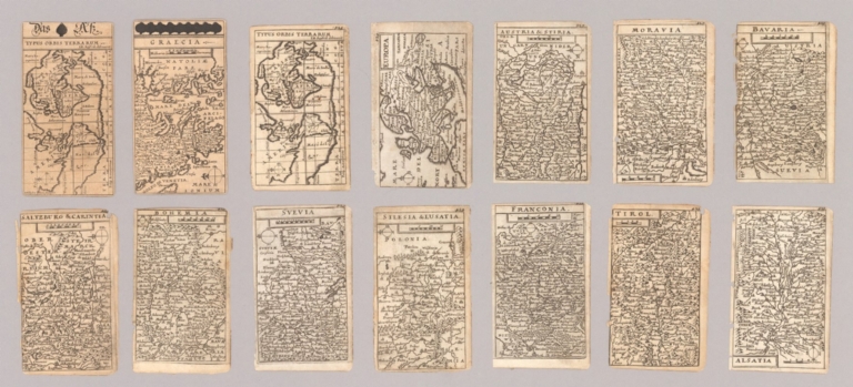
Full Title
Typus Orbis Terrarum
List No
15665.002
Note
Map of the world used a playing card. Part of Europaelsch-Geographlsche Spiel-charte
Author
[Hoffmann, Johann, Seifried, J.H.]
Full Title
Typus Orbis Terrarum
List No
15665.004
Note
This map is the same as the map used in "Europaelsch-Geographlsche Spiel-charte" but appeared in the book "Catholischer Raphael/ Das 1st: Cathollsches Rels-Bet-Buchlein..." published in 1677.
Author
Hoffmann, Johann
Full Title
(Composite map of) 52 images of "Europaelsch-Geographlsche Spiel-charte"
List No
15665.016
Note
This is a composite image of 52 reproductions of the "Europaelsch-Geographlsche Spiel-charte" from the collection of the National Library of Norway https://www.nb.no/en/
Author
Cram, George Franklin, 1841-1928
Full Title
Chart of the world on Mercator's Projection.
List No
14372.316
Note
Map of the world on Mercator's Projection. Shows political boundaries, cities, railroads, topography, bodies of water, drainage, coastlines, islands and ocean currents. Relief shown with hachures. Maps include latitudinal and longitudinal lines. Provides figures for square milage and population. Six inset maps: Principal cities of the old world : London -- Paris -- Berlin -- St. Petersburg -- Vienna -- Cairo. With statistical tables on national wealth, debts and militaries in margin. Colored lithograph. Map is 38 x 44 cm, on double sheet 45 x 67 cm.
Author
Cram, George Franklin, 1841-1928
Full Title
Chart of the world showing distances saved by the Interoceanic Canal, of Nicaragua and Costa Rica.
List No
14372.361
Note
Map of the world showing the Interoceanic Canal [Nicaraguan Canal], of Nicaragua and Costa Rica. Shows cities, topography, bodies of water, drainage, coastlines, islands and water routes with distances. Relief shown with hachures. Includes a legend, as well as latitudinal and longitudinal lines. Inset map: [Nicaragua]. With table: Table showing distances in miles between commercial ports of the world and distances saved by the Nicaragua Canal. Colored lithograph. Map is 25 x 40 cm, on sheet 33 x 45 cm.
Author
Andriveau-Goujon, E. (Eugène), 1832-1897
Full Title
(1) Mappemonde en deux hémispheres. 1878. Publiée par E. Andriveau-Goujon, Rue du Bac, 4, Paris. Gravé par Ch. Dyonnet; ecrit par P. Rousset; Paris, Impie. de Louis Antoine, Rue des Noyers, 70.
List No
14008.004
Note
Hand-colored, engraved world map in two hemispheres: occidental and oriental (on double plate with decorative border). Includes text at bottom: Colonies Européennes : Angleterre, France, Espagne, Portugal, Hollande, Danemark. "No. 1" in upper right.
Author
[Sydow, Emil von., 1812-1873, Wagner, Hermann, 1840-1929]
Full Title
Gradnetz -Entwurfe. Unter benutzung des ehemaligen. Entworfen v. H. Wagner. Gotha : Justus Perthes. Sydow-Wagners method. Schul-Atlas. XXI.
List No
13557.018
Note
Maps of the surface of the earth with graticule, representing meridians and parallel circles. Includes explanation of projections.
Author
[Sydow, Emil von., 1812-1873, Wagner, Hermann, 1840-1929]
Full Title
Erdansichten. Gotha : Justus Perthes. Sydow-Wagners method. Schul-Atlas. XXI.
List No
13557.022
Note
Hemispheric maps of the world. insets: Land hemisphere, Water hemisphere and Antarctica.
Author
[Sydow, Emil von., 1812-1873, Wagner, Hermann, 1840-1929]
Full Title
Tektonik und Geologie der Erde. Gotha : Justus Perthes. Sydow-Wagners method. Schul-Atlas. XXI.
List No
13557.024
Note
Tectonic map of the world, with 4 insets at the scale of 1:100,000,000: North America; South America; Africa; Australia and Indonesia. Showing principal tectonic regions. Includes color coded tectonic classification for continental and oceanic.
Author
[Sydow, Emil von., 1812-1873, Wagner, Hermann, 1840-1929]
Full Title
Temperatur, Luftdruck, Winde. Gotha : Justus Perthes. Sydow-Wagners method. Schul-Atlas. XXI.
List No
13557.026
Note
Six maps on 1 sheet, showing Temperature, air pressure and wind in January and July. Includes 4 insets of air circulation in Northern and Southern Hemispheres.
Author
[Sydow, Emil von., 1812-1873, Wagner, Hermann, 1840-1929]
Full Title
Niederschlage, Klimate. Gotha : Justus Perthes. Sydow-Wagners method. Schul-Atlas. XXI.
List No
13557.028
Note
3 maps on 1 sheet. a: Durchschnittliche Jajrliche Niederschlagshöhe. b: Regenzeiten. c. Klimate. Showing average annual and seasonal rainfall and climate map of the world. "Eckerts flächentreue sinuslinien projektion". Includes explanation of the climate formulas from map 8c, on verso.
Author
[Sydow, Emil von., 1812-1873, Wagner, Hermann, 1840-1929]
Full Title
Bevolkerungs- und Rassenverteilung, Polit, Herrschaft. Gotha : Justus Perthes. Sydow-Wagners method. Schul-Atlas. XXI.
List No
13557.034
Note
3 maps of the world on 1 sheet, Showing the Distribution of the Human Race and the geographical population density of the world.
Author
[Sydow, Emil von., 1812-1873, Wagner, Hermann, 1840-1929]
Full Title
Sprachen und Religionen. Gotha : Justus Perthes. Sydow-Wagners method. Schul-Atlas. XXI.
List No
13557.036
Note
Map of the world, with 4 insets. Showing the distribution of the languages,religions and races.
Author
[Sydow, Emil von., 1812-1873, Wagner, Hermann, 1840-1929]
Full Title
Das Deutschtum auf der Erde. Gotha : Justus Perthes. Sydow-Wagners method. Schul-Atlas : 21 Auflage. 1940.
List No
13557.038
Note
Map of the world, with 10 insets. Showing the spread of Germans on Earth.
Author
W. & A.K. Johnston Limited
Full Title
Orbis veteribus notus. Edinburgh W. & A.K. Johnston ; Glasgow; Robert Weir ; Lumsden & Son.
List No
14296.010
Note
Map of the eastern hemisphere, according to ancient geographical knowledge (from a western perspective). Title, in Latin; translates to: [The world known to the ancients]. Shows continental boundaries, cities, routes, topography, deserts, drainage, coastlines and routes of exploration, as well as "Terra incognita, according to Ptolemey". Relief shown pictorially. Includes latitudinal and longitudinal lines, as well as three bar scales and an elaborate compass rose. "Longit ab Ins: Fortun. versus Orientum." Map is 21 x 29 cm, on sheet 27 x 35 cm. Hand-colored engraving. In first section of atlas, Ancient maps.
Author
W. & A.K. Johnston Limited
Full Title
The world on Mercator's projection. Edinburgh W. & A.K. Johnston ; Glasgow Robert Weir ; Lumsden & Son.
List No
14296.016
Note
Map of the world. Shows political boundaries, cities, routes, topography, deserts, drainage, coastlines and islands. Relief shown pictorially. Includes latitudinal and longitudinal lines. "Long. East from Greenwich." Map is 29 x 43 cm, on sheet 35 x 54 cm. Hand-colored engraving on double plate. In second section of atlas, Modern maps.
Author
W. & A.K. Johnston Limited
Full Title
Table of the comparative heights of the principal mountains in the world. Edinburgh; W. & A.K. Johnston ; Glasgow; Robert Weir ; Lumsden & Son.
List No
14296.055
Note
Chart of mountain heights around the world. Shows elevations of peaks - in thousands of feet - from tallest to shortest. Peaks indexed with letters; explanatory table at upper right, providing the name of each mountain and its location (according to country), and height in feet. Includes volcanoes, which are indicated by puffs of smoke. Descriptive note, beginning: The region of perpetual snow begins under the equator at 15,747 feet above the level of the sea ... With two inset charts: Passes of the Alps, above the level of the sea -- Altitude of towns, above the level of the sea. Chart is 21 x 29 cm, on sheet 27 x 35 cm. Black and white engraving. Unnumbered plate. In second section of atlas, Modern maps.
Author
W. & A.K. Johnston Limited
Full Title
Table of the comparative lengths of the principal rivers in the world. Edinburgh; W. & A.K. Johnston ; Glasgow; Robert Weir ; Lumsden & Son.
List No
14296.056
Note
Chart of river lengths around the world. Shows lengths of rivers - in thousands of miles - from longest to shortest. River representations indexed with letters; explanatory table at lower left, providing the name of each river, its mouth and course, such as - for the Amazon River - the Atlantic Ocean and South America, respectively, as well as its length in miles. Chart is 21 x 29 cm, on sheet 27 x 35 cm. Black and white engraving. Unnumbered plate. In second section of atlas, Modern maps.
Author
Philip, George, 1870-1937.
Full Title
The World on a Plane of a Meridian.
List No
15487.004
Note
The world in hemispheres.
Author
Philip, George, 1870-1937.
Full Title
The World on Mercator's Projection.
List No
15487.005
Author
Elwe, Jan Barend
Full Title
(Title Page to) Atlas. Amstelædami, Chés J. B. Elwe.
List No
14478.002
Note
Title page to Atlas der wereld. Features a scene of Poseidon and other figures observing a terrestrial globe, with Atlas holding a celestial globe in the background, and cherubs in flight above, together holding a banner with the title. Hand-colored engraving. Imprint at bottom.
Author
Elwe, Jan Barend
Full Title
Planisphere representant toute l'etendue du monde dans l'ordre qu'on a suivi dans ce livre.
List No
14478.015
Note
World map, in circular format with the North Pole at the center. Title translates to: Planisphere representing the entire expanse of the world in the order we have followed in this book. Shows continents, countries, bodies of water, drainage, coastlines and islands. Includes latitudinal and longitudinal lines. Map sits of the shoulders of Atlas, who appears within his own scenery. Hand-colored engraving. Map is 43 x 27 cm, on sheet 58 x 34 cm.
Author
Elwe, Jan Barend
Full Title
Mappe mondi ou description du globe terrestre & aquatique suivant les Dernieres & Meilleures. A Amsterdam. Chés J. B. Elwe. MDCCXCII.
List No
14478.017
Note
World map, in circular format, featuring both the Western and Eastern Hemispheres. Shows continents, countries, cities, topography, bodies of water, drainage, coastlines and islands. Relief shown pictorially. Includes latitudinal and longitudinal lines. With vignettes of figures, fauna and flora in the margins. Hand-colored engraving. Map is 47 x 62 cm, on double sheet 58 x 70 cm.
Author
Mager, Henri
Full Title
No. 1 Planisphere.
List No
15537.003
Note
Date estimated.
|


![[World map].](https://www.davidrumsey.com/rumsey/Size2/RUMSEY~8~1/205/14318002.jpg)