|
REFINE
Browse All : World Atlas of Naples (Italy)
1-33 of 33
Author
Ortelius, Abraham, 1527-1598
Full Title
Regni Neapolitani Verissima Secvndum Antiqvorum Et Recentiorum Traditionem Descriptio, Pyrrho Ligorio Avct. Cum privilegio.
List No
10000.083
Author
[Arnald, George, Society for the Diffusion of Useful Knowledge (Great Britain)]
Full Title
Naples. Napoli. Published under the superintendance of the Society for the Diffusion of Useful Knowledge. (Drawn by) W.B. Clarke, arch: dir: T. Bradley sc. Published by Baldwin & Cradock, March 1835. (London: Chapman & Hall, 1844)
List No
0890.191
Note
Engraved map. Relief shown by hachures. Hand col. Inset views: Castello nuovo , Castello St. Elmo -- Naples from the hill of Posilipo, from a painting by G. Arnald, Esq. A.R.A.
Author
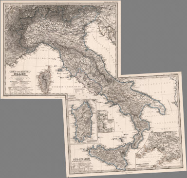
[Stieler, Adolf, Petermann, A.]
Full Title
Stieler's Hand-Atlas ... No. 34b. Sud-Italien. (insets) Neapel und Umgegend. Sardinien. Palermo.
List No
0960.061
Author
[Stieler, Adolf, Petermann, A.]
Full Title
(Composite of) Stieler's Hand-Atlas ... Italien.
List No
0960.108
Author
[Santini, Paolo, Robert de Vaugondy, Didier, 1723-1786, Robert de Vaugondy, Gilles, 1688-1766]
Full Title
23. Partie Septentrionale du Royaume de Naples.
List No
12039.103
Author
[Santini, Paolo, Robert de Vaugondy, Didier, 1723-1786, Robert de Vaugondy, Gilles, 1688-1766]
Full Title
24. Partie Meridionale du Royaume de Naples. (inset) Malta.
List No
12039.104
Author
Seutter, Matthaeus, 1678-1756
Full Title
48. Neapolis Regnum.
List No
12041.152
Author
Jaillot, Alexis Hubert, 1632?-1712
Full Title
Le Royaume de Naples.
List No
12044.122
Note
Date as on map sheet or, if absent, 1695.
Author
Jaillot, Alexis Hubert, 1632?-1712
Full Title
Le Royaume de Naples (northern sheet).
List No
12044.123
Note
Date as on map sheet or, if absent, 1695.
Author
Jaillot, Alexis Hubert, 1632?-1712
Full Title
Le Royaume de Naples (southern sheet).
List No
12044.124
Note
Date as on map sheet or, if absent, 1695.
Author
Jaillot, Alexis Hubert, 1632?-1712
Full Title
(Composite Map) Le Royaume de Naples.
List No
12044.125
Note
Date as on map sheet or, if absent, 1695.
Author
Weber, Don Carlo
Full Title
Carte des Environs de la Ville et du Golfe de Naples. (insets) Plan du Cratere (Vesuvius). Coupe du Cratere (Vesuvius).
List No
12100.045
Author
[Braun, Georg, 1541-1622, Hogenberg, Franz, 1539-1590]
Full Title
Vol I (47) Neapolis (Naples)
List No
12126.098
Note
In this last edition of Volume I, van der Krogt 41:1.1 (1640), the preliminary section is reduced to Braun's forward and the Hittorp letter. The London map/view is not present and instead is found at the beginning of Volume V.
Author
[Braun, Georg, 1541-1622, Hogenberg, Franz, 1539-1590]
Full Title
Vol V (65) Neapolis (Naples).
List No
12126.621
Note
In this last edition of Volume V, van der Krogt 41:1.5 (1640), the preliminary matter after the title page is dropped.
Author
Heck, Johann Georg, -1857
Full Title
Plate 40. Lissabon (Lisboa). Neapel (Napoli).
List No
12190.278
Author
Fer, Nicolas de, 1646-1720
Full Title
Le Royaume de Naples. (inset) L'Isle de Sardagne.
List No
12201.081
Author
Fer, Nicolas de, 1646-1720
Full Title
Les Environs de la Ville de Naples.
List No
12201.083
Author
Homann, Johann Baptist, 1663-1724
Full Title
Regni Neapolis.
List No
12499.089
Author
Luffman, John, 1756-1846
Full Title
Bay of Naples. Engraved for Luffman's Select plans of the principal cities, ports, harbours, forts, &c. in the world. London. Engraved and published March 1, 1800, by John Luffman.
List No
13189.035
Note
Hand colored chart. Shows fortifications. Relief shown pictorially. Prime meridian is London. Depth shown by soundings. Includes historical text at the foot of map.
Author
[Baranov, Anatolij Nikolaevič, Soviet Union. Glavnoe upravlenie geodezii i kartografii]
Full Title
Рим, Неаполь = Rim, Neapol'. 114. Atlas Mira : 1954.
List No
13682.127
Note
2 maps on 1 sheet. Including Rome and Naples. Showing administrative boundaries, populated areas, roads, railways and rivers. Relief shown by gradient tints, contours and spot heights. Depth shown by bathymetric tints, isolines and soundings.
Author
Duval, Henri (Henri Louis Nicolas), 1783-1854
Full Title
Tableau historique et géographique du Royaume de Naples et de Sicile. Par Henri Duval, Chevalier de la Légion-d'Honneur; Professeur d'Histoire, de Géographie, de Belles-Lettres, etc., etc. Gravé par Laguillermie. Delloye, Libraire, Place de la Bourse, No 13. Tous les Exemplaires ont le Timbre de l'Auteur. Imprimerie de Terzuolo, Successeur de M. Plassan, Rue de Vaugirard, No 11.
List No
14254.031
Note
Engraved, hand-colored map of the Kingdom of Naples and Sicily, and vicinity, showing political boundaries, cities, topography, coastlines and routes of travel. Title translates to: Historical and geographical table of the Kingdom of Naples and Sicily. Includes latitudinal and longitudinal lines. Accompanied by descriptive text in tables within margins. Tables are color-coded in association with each region shown, such as pink for Naples. Also features broader texts on the entire area shown: Précis historique [= Historical background], "Généalogie" [= Genealogy], "Presonnages célèbres" [= Famous people], and a chronology, spanning from 440 "Les Vandales s'emparent de la Sicile" [= The Vandals take over Sicily], to 1837 "Choléra à Naples. Rév. à Palerme et dans les Abruzzes. Incen. du th. St. Charles" [= Cholera in Naples. Rev. in Palermo and Abruzzo]. Additionally, provides information on population, religions, economy, climate, mountains and rivers, etc. With addresses in top corners: L'Auteur, Rue des Martyrs, no 23, Chaussée-d'Antin -- Adopté pour les maisons Royles d'Éducation de la Légion-d'Honneur. Map is 17 x 15 cm, on sheet 42 x 61 cm. In second section: Histoire et géographie modernes [= Modern history and geography].
Author
[Weekly Dispatch, Dower, John, active 1838-1846?]
Full Title
Naples : Southern portion and Sicily. Northern portion. / by John Dower, F. R. G. S. ; drawn & engraved by John Dower, Pentonville Road, London ; Day & Son Lithrs. to The Queen.
List No
14360.174
Note
Map of Naples, Italy (southern portion and Sicily, and northern sheets). Shows political boundaries, cities, battle sites, railways, roads, canals, topography, bodies of water, drainage and islands. Relief shown with hachures. Includes latitudinal and longitudinal lines, as well as legends and bar scales given in English, geographical and Italian miles. With inset map: The Maltese Islands. Hand-colored lithograph. Map is 61 x 43 cm, on two sheets, together 69 x 48 cm. Sheets presented in sequence. Appears in Vol. II : Foreign.
Author
Imhof, Eduard, 1895-1986
Full Title
Rom und Albanerberge -- Neapel und Umgebung.
List No
14401.054
Note
Two maps of Italy, featuring Rome, the Alban Hills and Naples, in 1969. Maps show surrounding cities, topography, bodies of water, drainage, coastlines, islands and water depths. Relief shown with shading and spot heights. Maps include latitudinal and longitudinal lines, legends, bar scales and scale statements (scales differ). Colored lithograph. Together, maps are 29 x 17 cm, on sheet 33 x 22 cm. Maps appear in section entitled Italien : Einzelne Landschaften und Städte [= Italy : Individual landscapes and cities].
Author
[Elwe, Jan Barend, Sanson, Nicolas, 1600-1667]
Full Title
Le Royaume de Naples divisé en douze provinces par Sanson. Corrigée après les nouvelles observations du Sr. d'Anville et autres geographes. A Amsterdam. Chez Jan Bt. Elwe. MDCCXCII.
List No
14478.024
Note
Map of Naples, Italy, and vicinity. Shows countries, regions, cities, topography, vegetation, bodies of water, drainage, coastlines and islands. Relief shown pictorially. Includes a compass rose with north oriented toward top of sheet, five bar scales, latitudinal and longitudinal lines. With a decorative cartouche. Hand-colored engraving. Map is 43 x 52 cm, on double sheet 58 x 70 cm.
Author
Munster, Sebastian, 1448–1552
Full Title
Neapolis
List No
15058.101
Author
Munster, Sebastian, 1448–1552
Full Title
Neapolis
List No
15058.104
Author
Schedel, Hartmann (1440-1514)
Full Title
Blat XLII Neapolis (Naples) (Nuremberg Chronicle) Register DES BUCHS DER CRO=NICKEN und geschichten mit figure…
List No
15906.053
Author
USSR (Union of Soviet Socialist Republics).
Full Title
(Map Title Page) 73-74. Italy. 75. Rome, Naples.
List No
1603.084
Author
USSR (Union of Soviet Socialist Republics).
Full Title
75. Rome, Naples. The World Atlas.
List No
1603.086
Note
Vicinity maps.
Author
[Cram, George, Wood Brothers]
Full Title
Naples (Italy). (to accompany) The Columbian World's Fair atlas ... Published for: Wood Brothers Cash Store ... Unadilla, New York.
List No
1773.117
Note
Detailed color map. Shows roads, prominent buildings, monuments, etc.
Author
[Cram, George Franklin, Murray-Aaron, Eugene, 1852-1941.]
Full Title
Naples (Italy). (to accompany) Cram's atlas of the world, ancient and modern : new census edition -- indexed.
List No
1910.183
Note
Detailed plan of Naples in color. Shows roads, railroads, major public buildings, landmarks, ports, parks, etc. Relief shown by hachures.
Author
Johnston, W. & A.K.
Full Title
South Italy and the Island of Sardinia. (with) Naples and Capri. Keith Johnston's General Atlas. Sept. 1911. Engraved, Printed, and Published by W. & A.K. Johnston, Limited, Edinburgh & London.
List No
2763.019
Note
Counties and states outlined in color. Relief shown by hachures. One inset. Three scales.
Author
[Arnald, George, Meyer, Joseph, 1796-1856, Society for the Diffusion of Useful Knowledge (Great Britain)]
Full Title
Neapel, Napoli, 1845. (with view) Castello nuovo, Castello St. Elmo. (with view) Aus der Geographischen Graviranstalt des Bibliograph. Instituts zu Hildburghausen, Amsterdam, Paris u. Philadelphia, (1860)
List No
4807.028
Note
Engraved map. Relief shown by hachures. Inset views: Castello nuovo , Castello St. Elmo -- Neapel vom Hugel des Pausilipp (from a painting by G. Arnald, Esq. A.R.A.) Copied from the 1835 map published by the Society for the Diffusion of Useful Knowledge, London. "Meyer's Handatlas No. 56."
1-33 of 33
|