|
Author
Arrowsmith, John
Full Title
Prussia & Poland, by J. Arrowsmith. London, pubd. 15 Feby. 1834 by J. Arrowsmith, 35 Essex Street, Strand.
List No
0036.013
Note
Engraved map. Hand colored boundaries. Relief shown by hachures.
Author
Brue, Adrien Hubert, 1786-1832
Full Title
Carte des Iles Britanniques anciennes par A. Brue ... Carte de la Germanie ancienne, de la Rhetie, de la Pannonie et du Norique par A. Brue, Geographe du Roi ... Paris, 1827. Chez l'Auteur, rue des Macons-Sorbonne, no. 9, et chez les principaux m(archan)ds de cartes geographiques.
List No
0096.011
Note
Two hand colored engraved maps. Relief shown by hachures. Scale of Germanie ancienne is ca. 1:5,200,000. Prime meridian: Paris.
Author
Brue, Adrien Hubert, 1786-1832
Full Title
Carte generale de l'Empire d'Allemagne, des royaumes de Hongrie, de Gallicie, de Prusse, et des Provinces-Unies de Pays-Bas; en 1789. Redigee pour la lecture de l'histoire du moyen age, par A. Brue, Geographe du Roi. Paris, 1826. A Paris, Chez l'Auteur, rue des Macons-Sorbonne, no. 9, et chez les principaux m(archan)ds de cartes geographiques.
List No
0096.030
Note
Hand colored engraved map. Relief shown by hachures. Prime meridian: Paris.
Author
Brue, Adrien Hubert, 1786-1832
Full Title
Carte generale de l'Empire d'Autriche, de la Monarchie Prussienne, de la Confederation Germanique et du Royme. de Pologne, par A.H. Brue, Geographe de S.A.R. Monsieur. A Paris, Chez l'Auteur, rue des Macons Sorbonne, no. 9, et chez les principaux marchands de geographie. Novembre 1821.
List No
0096.031
Note
Hand colored engraved map. Relief shown by hachures. Prime meridian: Paris.
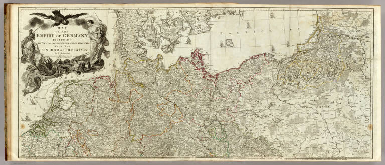
Author
Delarochette, Louis Stanislas d'Arcy
Full Title
Map of the Empire of Germany, including all the states comprehended under that name: with the Kingdom of Prussia, &c. (Northern section). By L. Delarochette. (T. Kitchin, sculpt.) London, printed for Robt. Sayer, Map & Print Seller, opposite Fetter Lane in Fleet Street, (1790?)
List No
0411.022
Note
Engraved map in outline color. Printed on 2 sheets with titles: The Circles of Westphalia, and Lower Saxony, with the western parts of the Circle of Upper Saxony, and the northern parts of the Circle of Upper Rhine, part of Sweden, and Denmark; the United Provinces, and part of the Netherlands -- Eastern parts of Brandenburg and Saxony, with Pomerania, Prussia, Lusatia, and the northern parts of Silesia; part of Sweden, Samogitia, Lithuania, and Poland. Shows vegetation, banks, etc. Relief shown pictorially. Prime meridian: Ferro. Ornamental title cartouche. David Rumsey Collection copy mounted as 1 sheet.
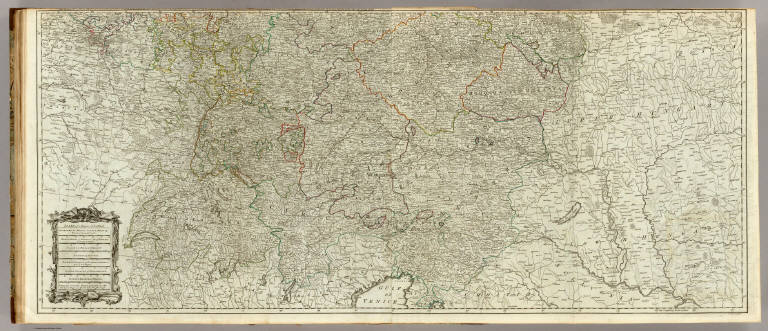
Author
Delarochette, Louis Stanislas d'Arcy
Full Title
(Map of the Empire of Germany, including all the states comprehended under that name: with the Kingdom of Prussia, &c. Southern section. By L. Delarochette). T. Kitchin, sculpt. (London, printed for Robt. Sayer, Map & Print Seller, opposite Fetter Lane in Fleet Street, 1790?)
List No
0411.023
Note
Engraved map in outline color. Printed on 2 sheets with titles: The Circles of Lower Rhine, Franconia, Swabia, Bavaria, with the southern parts of the Circles of ... -- Eastern parts of Bohemia, and of the Circle of Austria ... Shows vegetation, etc. Relief shown pictorially. Prime meridian: Ferro. Ornamental title cartouche. David Rumsey Collection copy mounted as 1 sheet; portions of sheet titles in upper margin missing.
Author
Delarochette, Louis Stanislas d'Arcy
Full Title
(Composite of) Map of the Empire of Germany, including all the states comprehended under that name: with the Kingdom of Prussia, &c. By L. Delarochette. T. Kitchin, sculpt. London, printed for Robt. Sayer, Map & Print Seller, opposite Fetter Lane in Fleet Street, (1790?)
List No
0411.024
Note
Engraved map in outline color. Printed on 4 sheets. Shows vegetation, banks, etc. Relief shown pictorially. Prime meridian: Ferro. Ornamental title cartouche. David Rumsey Collection copy mounted as 2 sheets; portions of sheet titles in upper margin of lower sheets missing.
Author
Lizars, William Home, 1788-1859
Full Title
Upper Saxony. Partly belonging to Prussia. Published by W. Lizars, Edinburgh. (to accompany) Lizars' Edinburgh Geographical General Atlas ... 1841.
List No
0438.033
Note
Double page engraved hand colored in outline map. Relief shown by hachures. Shows towns, roads, rivers, forests and mountains.
Author
Mitchell, Samuel Augustus
Full Title
Prussia and the German States. Entered ... 1879 by S. Augustus Mitchell ... Washington. (1880)
List No
0586.062
Note
Hand colored. Relief shown by hachures. Shows political divisions, settlements, railroads, rivers, etc. Prime meridians: Greenwich and Washington.
Author
Mitchell, Samuel Augustus Jr.
Full Title
Prussia, and the German States. Copyright by S. Augustus Mitchell 1884.
List No
0592.064
Note
Hand colored. Relief shown by hachures. Shows political divisions, settlements, railroads, rivers, etc. Prime meridians: Greenwich and Washington.
Full Title
Prussia, and the German States. Copyright 1887 by Wm. M. Bradley & Bro. (1890)
List No
0594.062
Note
Hand colored. Relief shown by hachures. Shows political divisions, settlements, railroads, rivers, etc. Prime meridians: Greenwich and Washington.
Author
Pinkerton, John, 1758-1826
Full Title
Prussian Dominions. Drawn under the direction of Mr. Pinkerton by L. Hebert. Neele sculpt. 352 Strand. London: published August 1st. 1810, by Cadell & Davies, Strand & Longman, Hurst, Rees, Orme, & Brown, Pater Noster Row.
List No
0732.018
Note
Engraved map. Full hand col. Relief shown by hachures. "Pinkerton's modern atlas."
Author
Reichard, C. G.
Full Title
Deutschland von C.G. Reichard. Nurnberg, bei Friedrich Campe. (1822)
List No
0844.014
Note
Map with outline hand coloring. Relief shown by hachures. Includes key "Deutscher Bund" in upper margin. Prime meridian: Ferro.
Author
Society for the Diffusion of Useful Knowledge (Great Britain)
Full Title
Germany general map. Engraved by J. & C. Walker. Published by the Society for the Diffusion of Useful Knowledge, 59 Lincolns Inn Fields Augt. 1st, 1840. (London: Chapman & Hall, 1844)
List No
0890.050
Note
Engraved map. Relief shown by hachures. Country borders hand col. Covers Germany, Switzerland, and Austria-Hungary. Includes population table.
Author
Society for the Diffusion of Useful Knowledge (Great Britain)
Full Title
Germany. Deutschland III. Baden, Wurtemberg, Bavaria, Tyrol, and Switzerland. Eastern part of the Prussian States. Published under the superintendence of the Society for the Diffusion of Useful Knowledge. J. & C. Walker sculpt. London, published by Baldwin & Cradock, 47 Paternoster Row, June 1st. 1832. (London: Chapman & Hall, 1844)
List No
0890.053
Note
Engraved map. Relief shown by hachures and spot heights. Political division borders hand col. Sources: Raglovich, Keller and Fallon.
Author
[Touring club italiano, Funk & Wagnalls Company.]
Full Title
(Legend to) Germania, Polonia, Cecoslovacchia, Austria, Ungheria, Deutsches Reich, Polska, Ceskoslovensko, Osterreich, Magyarorszag. Propr. Artistico-letteraria del T.C.I. Ufficio cartografico del T.C.I. (1929)
List No
1012BD
Note
Explanation to map.
Author
[Touring club italiano, Funk & Wagnalls Company.]
Full Title
Germania, Polonia, Cecoslovacchia, Austria, Ungheria, Deutsches Reich, Polska, Ceskoslovensko, Osterreich, Magyarorszag. Propr. Artistico-letteraria del T.C.I. Ufficio cartografico del T.C.I. (1929)
List No
1012.026
Note
Color map. Relief shown by hachures and spot heights; depths by isolines. Includes inset of Silesia at 1:500.000 scale.
Author
[Touring club italiano, Funk & Wagnalls Company.]
Full Title
(Legend to) Germania, Deutsches Reich, foglio nord. Propr. Artistico-letteraria del T.C.I. Ufficio cartografico del T.C.I. (1929)
List No
1012BE
Note
Explanation to map.
Author
[Touring club italiano, Funk & Wagnalls Company.]
Full Title
Germania, Deutsches Reich, foglio nord. Propr. Artistico-letteraria del T.C.I. Ufficio cartografico del T.C.I. (1929)
List No
1012.027
Note
Color map. Relief shown by hachures and spot heights; depths by isolines. Includes insets at 1:250,000 scale of the Koln, Berlin, Aachen, Hamburg, Dresden and Leipzig regions, and at 1:500,000 scale of the Ruhr Basin and the Chemnitz region.
Author
[Touring club italiano, Funk & Wagnalls Company.]
Full Title
(Legend to) Germania, Deutsches Reich, foglio sud, et Austria, Osterreich. Propr. Artistico-letteraria del T.C.I. Ufficio cartografico del T.C.I. (1929)
List No
1012BF
Note
Explanation to map.
Author
[Touring club italiano, Funk & Wagnalls Company.]
Full Title
Germania, Deutsches Reich, foglio sud, et Austria, Osterreich. Propr. Artistico-letteraria del T.C.I. Ufficio cartografico del T.C.I. (1929)
List No
1012.028
Note
Color map. Relief shown by hachures and spot heights. Includes insets at 1:250,000 scale of the Graz, Vienna and Munich regions; at 1:500,000 of part of the Rhineland; and at 1:750,000 of the Nurnberg, Freiburg and Stuttgart regions.
Author
[Andriveau-Goujon, J., Lapie, M. (Pierre), 1779-1850]
Full Title
Carte d'Allemagne, comprenant la Confederation Germanique. Dressee par le Chev. Lapie, Geographer. Dedies et presentes Au Roi. A Paris ... 1829. Grave par Chamouin. Ecrit par Lallemand. (to accompany) Atlas de choix ou Recueil de cartes de geographie ancienne et moderne.
List No
11124.027
Note
Double page outline hand color engraved map of Germany. Shows administrative divisions, towns, villages, roads, rivers, lakes, canals, etc. Relief shown by hachures. Includes index. Prime meridian is Paris.
Author
[Ptolemy, Claudius, Ruscelli,Girolamo, Rosaccio, Giuseppe]
Full Title
Tabvla Evropae IIII. Della Geografia di Tolomeo. Libro secondo. (to accompany) Geographia di Clavdio Tolomeo alessandrino, tradotta di Greco nell'idioma volgare Italiano da Girolamo Ruscelli ... In Venetia, MDXCIX (1599) Appresso gli heredi di M. Sessa.
List No
11299.010
Note
Engraved map of Germany. Relief shown pictorially.
Author
[Lattre, Jean, 1743 -1793, Le Rouge, Georges-Louis]
Full Title
Le Royaume de Prusse, suivant les nouvelles observations ... Publie a Paris par et Chez le Sr. Le Rouge ingenieur geographe... 1742. (to accompany) Atlas Geographique contenant la Mappemonde et les quatre parties, avec les differents Etats, avec apprpbation & privilage du Roy MDCC.LXIII (1763).
List No
11335.031
Note
Engraved outlined hand color map. Includes administrative divisions, place names and ornamental title cartouche. Relief shown pictorially.
Author
Euler, Leonhard, 1707-1783
Full Title
Tab: Geogr: Circ. Franconiae Dimid. Saxoniae Superioris Regni Bohemiae March Lusatiae Ac Duc Silesiae, ad emendatiora quae adhuc prodierunt exempla jussu Reg Acad Scient et Eleg Litt. Boruss descripta. (to accompany) Atlas geographicus omnes orbis terrarum regiones = Atlas geographique representant en XLI cartes toutes les regions de la terre ... Berolini : Ex officina Michaelis MDCCLIII (1753).
List No
11392.033
Note
Hand colored copperplate engraving map on 2 sheets. Covers part of Poland, Germany and the Czech Republic. Showing Political and administrative boundaries, mountains, rivers, lakes, cities, and principal towns. Relief shown pictorially. In lower right corner: 16. Francken, Bohmen, Maehren, Schlesien, Lausnitz.
Author
[Ptolemy, Claudius, Gastaldi, Giacomo, Mattioli, Pietro Andrea, 1500-1577, Pedrezano, Giovanbattista]
Full Title
Germania nova tabula MDXXXXII. (to accompany) Ptolemeo. La geografia di Claudio Ptolemeo alessandrino ... In Venetia, ... per Gioan. Baptista Pedrezano ... Anni x. M.D.XLVIII (1548).
List No
11479.029
Note
Engraved modern map of Germany. Covers from the Netherlands to Poland in the North and Germany and part of Hungary in the South. Shows cities, towns, rivers and mountains. Relief shown pictorially.
Author
Zatta, Antonio, active 1757-1797
Full Title
La Lusazia divisa Ne' Suoi Stati : Di Nuova Projezione. Venezia 1780. Presso Antonio Zatta. (to accompany) Atlante novissimo ... Tomo II. Con privilegio dell Eccelimo Senato. (tomo I-IV).
List No
11598.094
Note
Engraved hand-colored in outline, double-page map of Lusatia region, Central Europe, with decorative title cartouche. Shows administrative divisions, cities, towns, forests, rivers and mountains. Relief shown pictorially. Map no. in upper margin "F. X".
Author
[Sohr, Karl, Berghaus, Heinrich, 1797-1884, Handtke, Friedrich, 1815-1879, Klein, H.J.]
Full Title
Tirol mit Vorarlberg und Furstenthum Liechtenstein. Druck und Verlag von Carl Flemming in Glogau. (to accompany) Sohr-Berghaus Hand-Atlas uber alle Theile der Erde. Neu bearbeitet von F. Handtke, Achte vermehrte und verbesserte Auflage. No. 38. (inset) Innsbruck.
List No
11640.042
Note
Outline color lithograph engraving double page map, color coded by region. Relief shown by hachures. Prime meridians are Greenwich and Ferro. Includes legend and table.
Author
Visscher, Nicolaes, 1649-1702.
Full Title
S. Imperium Romano-Germanicum : oder Teutschland mit seinen angrantzenden Konigreichen und Provincien. Neulich entworffen und theils gezeichnet durch Julium Reichelt ... aber aussgefuhrt und aussgegeben durch Nicolaum Visscher zu Amsteldam. A. Hogeboom sculp. (to accompany) Atlas minor sive totius orbis terrarum contracta delinea ex conatibus Nico. Visscher. 1690. (half title page) Atlas Minor sive Geographia Compendiosa, qua Orbis Terrarum.
List No
11755.022
Note
Hand colored in outline engraved map. Covering the central part of Europe with Germany in the center and the Netherlands in west. Includes decorative cartouche. Showing administrative boundaries, cities, towns, waterways, forests, lakes, mountains and landmarks. Relief shown pictorially.
Author
[Wyld, James, 1812-1887, Wyld, James, 1790-1836]
Full Title
Map of the Germanic confederated states including the Kingdom of Prussia : as settled by the Act of Congress at Vienna, June 9th, 1815. London. Published by Jas. Wyld. 1838. (to accompany) A new general atlas of modern geography : consisting of a complete collection of maps of the four quarters of the globe ...
List No
13170.024
Note
Folded engraved map, hand colored in outline. Covers Northern and Central Europe showing the boundaries of the Netherlands, Denmark, Prussia, Poland, the Austrian Empire, Hanover, Bavaria, Nassau, Wurtemburg, Switzerland and Saxony. Relief shown pictorially. Includes table of the states composing the Germanic confederation.
Author
[Lapie, Pierre, M. 1779-1850, Lapie, Alexandre Emile]
Full Title
Carte d'Allemagne comprenant la Confederation Germanique, l'Empire d'Autriche, le Royaume de Prusse et le Royaume de Pologne. Dressee par M. Lapie, Colonel d'Etat Major et M. Lapie fils, Chef d'Escon. au meme Corps. Paris,1851. Chez P. C. Lehuby. Grave par Pierre Tardieu. (to accompany) Atlas Universel de Geographie ancienne et moderne ...1851.
List No
13244.032
Note
Engraved map. Outline hand color. Relief shown by hachures. Prime meridian is Paris. In upper left margin: Atlas universel. Includes index.
Author
[Lattre, Jean, 1743 -1793, Rizzi Zannoni, Giovanni Antonio Bartolomeo, 1736-1814]
Full Title
L'Alemagne : divisee par cercles. Par Mr. Rizzi Zannoni ... A Paris, Chez Lattre graveur. (to accompany) Atlas moderne ou collection de cartes sur toutes les parties du globe terrestre.
List No
13420.020
Note
Engraved outlined hand color map Germany. Shows political and administrative boundaries and place names. Relief shown pictorially. Includes ornamental title cartouche.
Author
[Lattre, Jean, 1743 -1793, Rizzi Zannoni, Giovanni Antonio Bartolomeo, 1736-1814]
Full Title
Carte de l'Empire d'Alemagne avec les Etats de Boheme. Dressee d'apres la carte de l'Academie Royale de Berlin et d'apres plusieurs autres. Par Mr. Rizzi Zannoni de l'Acad. Rle. des Sc. et Belles Let. de Gottingue. A Paris, Chez Lattre. Dediee et presentee a S.E. Monseigneur J.D. Almoreau Tiepolo Ambassadeur Ordinaire pour la Serenissime Republique. De Venise à la Cour de France. (to accompany) Atlas moderne ou collection de cartes sur toutes les parties du globe terrestre.
List No
13420.021
Note
Sheet 1 of map of German Empire on 4 sheets. Engraved outlined hand color. Title from sheet 16. Includes dedication note. Shows political and administrative boundaries and place names. Relief shown pictorially. Includes ornamental title cartouche.
Author
[Lattre, Jean, 1743 -1793, Rizzi Zannoni, Giovanni Antonio Bartolomeo, 1736-1814]
Full Title
Carte de l'Empire d'Alemagne avec les Etats de Boheme. Dressee d'apres la carte de l'Academie Royale de Berlin et d'apres plusieurs autres. Par Mr. Rizzi Zannoni de l'Acad. Rle. des Sc. et Belles Let. de Gottingue. A Paris, Chez Lattre. Dediee et presentee a S.E. Monseigneur J.D. Almoreau Tiepolo Ambassadeur Ordinaire pour la Serenissime Republique. De Venise à la Cour de France. (to accompany) Atlas moderne ou collection de cartes sur toutes les parties du globe terrestre.
List No
13420.022
Note
Sheet 2 of map of German Empire on 4 sheets. Engraved outlined hand color. Title from sheet 16. Includes dedication note. Shows political and administrative boundaries and place names. Relief shown pictorially. Includes ornamental title cartouche.
Author
[Lattre, Jean, 1743 -1793, Rizzi Zannoni, Giovanni Antonio Bartolomeo, 1736-1814]
Full Title
Carte de l'Empire d'Alemagne avec les Etats de Boheme. Dressee d'apres la carte de l'Academie Royale de Berlin et d'apres plusieurs autres. Par Mr. Rizzi Zannoni de l'Acad. Rle. des Sc. et Belles Let. de Gottingue. A Paris, Chez Lattre. Dediee et presentee a S.E. Monseigneur J.D. Almoreau Tiepolo Ambassadeur Ordinaire pour la Serenissime Republique. De Venise à la Cour de France. (to accompany) Atlas moderne ou collection de cartes sur toutes les parties du globe terrestre.
List No
13420.023
Note
Sheet 3 of map of German Empire on 4 sheets. Engraved outlined hand color. Title from sheet 16. Includes dedication note. Shows political and administrative boundaries and place names. Relief shown pictorially. Includes ornamental title cartouche.
Author
[Lattre, Jean, 1743 -1793, Rizzi Zannoni, Giovanni Antonio Bartolomeo, 1736-1814]
Full Title
Carte de l'Empire d'Alemagne avec les Etats de Boheme. Dressee d'apres la carte de l'Academie Royale de Berlin et d'apres plusieurs autres. Par Mr. Rizzi Zannoni de l'Acad. Rle. des Sc. et Belles Let. de Gottingue. A Paris, Chez Lattre. Dediee et presentee a S.E. Monseigneur J.D. Almoreau Tiepolo Ambassadeur Ordinaire pour la Serenissime Republique. De Venise à la Cour de France. (to accompany) Atlas moderne ou collection de cartes sur toutes les parties du globe terrestre.
List No
13420.024
Note
Sheet 4 of map of German Empire on 4 sheets. Engraved outlined hand color. Title from sheet 16. Includes dedication note. Shows political and administrative boundaries and place names. Relief shown pictorially. Includes ornamental title cartouche.
Author
[Lattre, Jean, 1743 -1793, Rizzi Zannoni, Giovanni Antonio Bartolomeo, 1736-1814]
Full Title
(Composite Map) Carte de l'Empire d'Alemagne avec les Etats de Boheme. Dressee d'apres la carte de l'Academie Royale de Berlin et d'apres plusieurs autres. Par Mr. Rizzi Zannoni de l'Acad. Rle. des Sc. et Belles Let. de Gottingue. A Paris, Chez Lattre. Dediee et presentee a S.E. Monseigneur J.D. Almoreau Tiepolo Ambassadeur Ordinaire pour la Serenissime Republique. De Venise à la Cour de France. (to accompany) Atlas moderne ou collection de cartes sur toutes les parties du globe terrestre.
List No
13420.025
Note
1 map on 4 sheets. Engraved outlined hand color.
Author
Andriveau-Goujon, Eugene
Full Title
Allemagne ou Europe Centrale. Paris - 1862. E. Andriveau-Goujon. Rue du Bac. 21. Le chemins de fer par Alfred Potiquet. Dressee et dessinee par A. Vuillemin. Le chemins de fer par Alfred Potiquet. Grave par Smith; Gerin; Dalmont. Imp. Louis Antoine. (to accompany) Atlas classique et universel de geograparphie ancienne et moderne ... Nouvelle edition. 1863.
List No
13421.038
Note
Hand color map. Shows administrative boundaries, roads and railroads. Relief shown by hachures. Includes legend and table of abbreviations.
Author
Hafız Ali Eşref
Full Title
Avusturya : Almanyaye Janubi = Austria = Southern Germany. (to accompany) Yeni atlas = First atlas. Mülâzim-i evvel Hafız Ali Eşref. Paris. 1285 (1868).
List No
13529.019
Note
Color map. Shows political boundaries.
Author
[Sydow, Emil von., 1812-1873, Wagner, Hermann, 1840-1929]
Full Title
Berlin. Hamburger Hafen. Gotha : Justus Perthes. Sydow-Wagners method. Schul-Atlas. XXIII.
List No
13559.064
Note
2 city plans on 1 sheet.
Author
[Sydow, Emil von., 1812-1873, Wagner, Hermann, 1840-1929]
Full Title
Schlesien und Protektorat-Ostteil. Gotha : Justus Perthes. Sydow-Wagners method. Schul-Atlas. XXIII.
List No
13559.079
Note
Map of Silesia and Protectorate Eastern Part. With inset: Oberschlesisches industriegebiet. Vereinfachte Kegelprojektion.
Author
Stieler, Adolf, 1775–1836
Full Title
Deutschland, Ubersicht Des Deutschen Reichs. Entw. v. Hm. Berghaus, gez. v. G. Hirth. Stieler's Hand-Atlas No. 17. Gotha: Justus Perthes 1875.
List No
13563.024
Note
Outline color map of Germany, Austria, Switzerland, parts of Poland and Hungary. German States are numbered with an accompanying key.
Author
Stieler, Adolf, 1775–1836
Full Title
Das Deusche Reich und seine nachbarlander zur ubersicht der eisenbahnen und dampffahrten. Bearbeitet von C. Vogel. Abgeschlossen in Marz. Gestochen von H. Eberhardt, Stieler's Hand-Atlas No. 18. Gotha: Justus Perthes 1875.
List No
13563.025
Note
Outline color map of Germany and neighboring countries, showing railway system and steam ship routes.
Author
Stieler, Adolf, 1775–1836
Full Title
Nord-Westliches Deutschland, Niederlande Und Belgien. Bearbeitet von C. Vogel. Gest v. W. Alt, Berge v. E. Kratz. Stieler's Hand-Atlas No. 19. Gotha: Justus Perthes 1874.
List No
13563.026
Note
Outline color map of Northwestern Germany, the Netherlands and Belgium in outline color. 2 inset maps of the area surrounding Frankfurt and Lubeck.
Author
Stieler, Adolf, 1775–1836
Full Title
Nord-Ostliches Deutschland : bearbeitet von C. Vogel. Stieler's Hand-Atlas No. 20. Gotha: Justus Perthes 1875.
List No
13563.027
Note
Outline color map of Northeastern Germany.
Author
Stieler, Adolf, 1775–1836
Full Title
Sachsen, Thuringen und benachbarte Lander. Special-Karte. Bearbeitet von C. Vogel. gest v. W. Alt, Berge v. C. Jungmann. Stieler's Hand-Atlas No. 23. Gotha: Justus Perthes 1875.
List No
13563.030
Note
Outline color map of central Europe including Thuringia and Saxony, Germany. Map covers Hungary and Czech Republic. With inset profile of mountain ranges with elevations.
Author
[Baranov, Anatolij Nikolaevič, Soviet Union. Glavnoe upravlenie geodezii i kartografii]
Full Title
Центральная Европа = TSentral'naia Evropa. 118-119. Atlas Mira : 1954.
List No
13682.132
Note
Physical and political map of Central Europe. Showing political boundaries. Relief shown by gradient tints, contours and spot heights. Depth shown by bathymetric tints, isolines and soundings.
Author
Radó, Sándor, 1899-1981
Full Title
Die Wirtschaft Deutschlands, Österreichs, der Schweiz und der Niederlande.
List No
14253.101
Note
Political map of Central Europe, in color, showing the economies (according to productivity) of Germany, Austria, Switzerland and the Netherlands, in terms of production. Includes a legend and a bar scale. Title in right margin, translates to: The economies of Germany, Austria, Switzerland and the Netherlands. 24 x 26 cm, on sheet 26 x 34 cm. Accompanied by descriptive text on facing page.
Author
Imhof, Eduard, 1895-1986
Full Title
[Übersichtskarte].
List No
14401.043
Note
Overview map of Central Europe, including Germany, in 1969. Shows cities, railways, roads, topography, valleys, vegetation, bodies of water, drainage, coastline, islands and water depths. Relief shown with shading and spot heights. Includes latitudinal and longitudinal lines, a legend, bar scale and scale statement. Colored lithograph. Map is 29 x 39 cm, on double sheet 33 x 44 cm. (Title taken from table of contents.) Appears in section entitled Deutschland und Mitteleuropa [= Germany and Central Europe].
Full Title
Deutschland physikalisch. (Richard Andree. Herausgegeben von der Geographischen Anstalt von Velhagen & Klasing in Leipzig. 1881)
List No
1494.014
Note
Colored map. Relief shown by hachures, spot heights and altitude tints. Shows rivers, lakes, canals, cities, etc. "X.1880."
|


![[Übersichtskarte].](https://www.davidrumsey.com/rumsey/Size2/RUMSEY~8~1/199/14401043.jpg)
