|
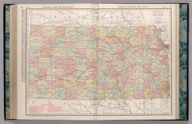
Author
Appleton, D. & Co.
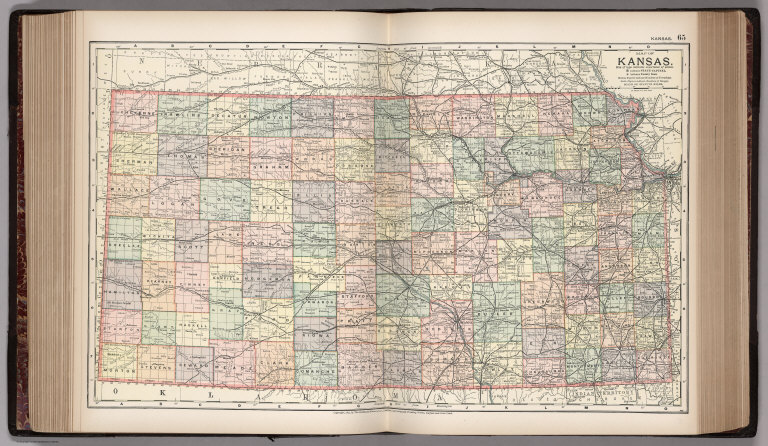
Full Title
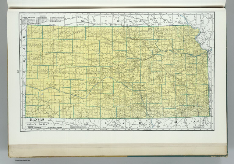
Map of Kansas. Copyright 1891 by Matthews-Northrup Co. ... Buffalo, New York. (to accompany) The Library Atlas Of Modern Geography ... New York, D. Appleton And Company 1892. (on upper margin) Kansas. 65.
List No
0026.170
Note
Color map. Shows county boundaries and county seat, capital, railways, roads, etc. "Size of type indicates importance of the places". Includes notes. Prime meridians are Greenwich and Washington.
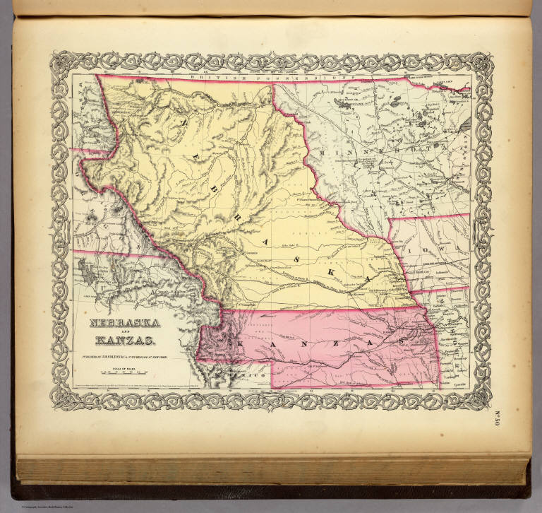
Author
Colton, G.W.
Full Title
Nebraska And Kanzas. Published By J.H. Colton & Co. No. 172 William St. New York. Entered ... 1855 by J.H. Colton & Co. ... New York. No. 50.
List No
0149.055
Note
In full color by state. Nebraska extends from the western banks of the Missouri to the Rocky Mountains from east to west and from the northern border of the US to the 40th parallel from north to south. Route of the proposed Pacific Railroad shown.
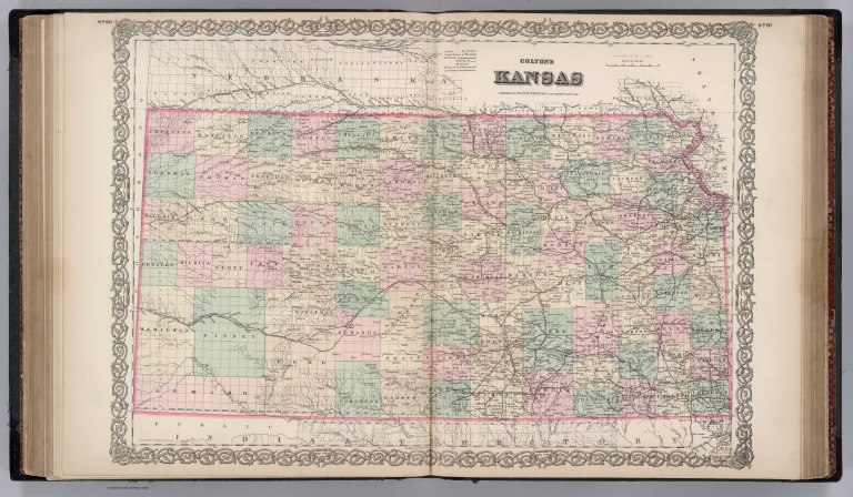
Author
Colton, G.W.
Full Title
Colton's Map of Kansas, Nebraska, Dakota & Indian Territory. Published By J. H. Colton. No. 172 William St. New York.
List No
0151.058
Note
Map showing the boundaries in color. Prime meridians are Greenwich and Washington D.C.
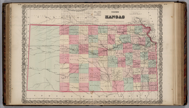
Author
Colton, G.W.
Full Title
Colton's Kansas. Published By G. W & C. B. Colton & Co. No. 172 William St. New York.
List No
0152.063
Note
Prime meridians are Washington D.C. and Greenwich.
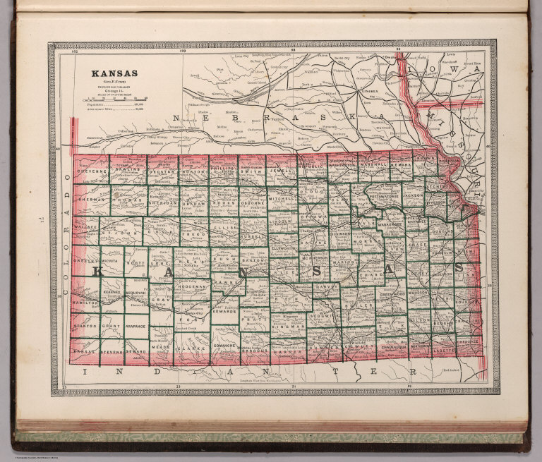
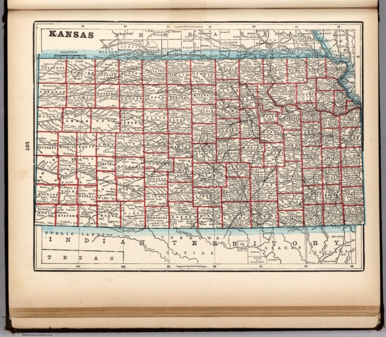
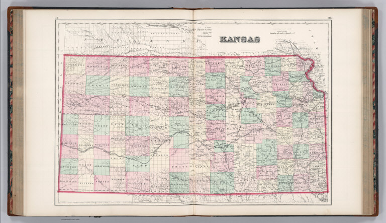
Author
Cram, George Franklin
Full Title
Kansas.
List No
0210.044
Note
Prime meridians Greenwich and Washington.
Author
Gray, O.W.
Full Title
Gray's Atlas Map of Kansas.
List No
0310.071
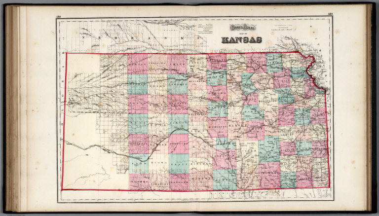
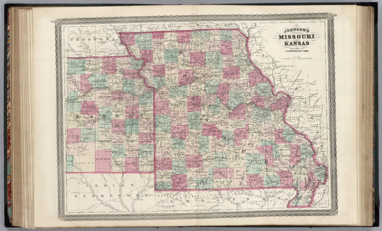
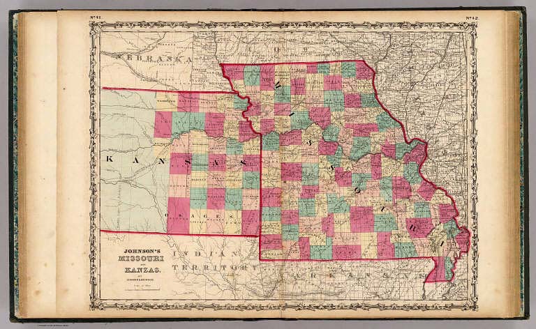
Author
Johnson, A.J.
Full Title
Johnson's Missouri And Kansas By Johnson And Ward.
List No
0352.039
Note
Full color by county or region, with heavy outlines around the states. Includes three vignettes: Santa Fe from the Great Missouri Trail, Spearing Fish, and Fire on the Prairie. Shows railroads, roads, and Indian reservations. Prime meridians are Greenwich and Washington D.C. Relief shown by hachures.
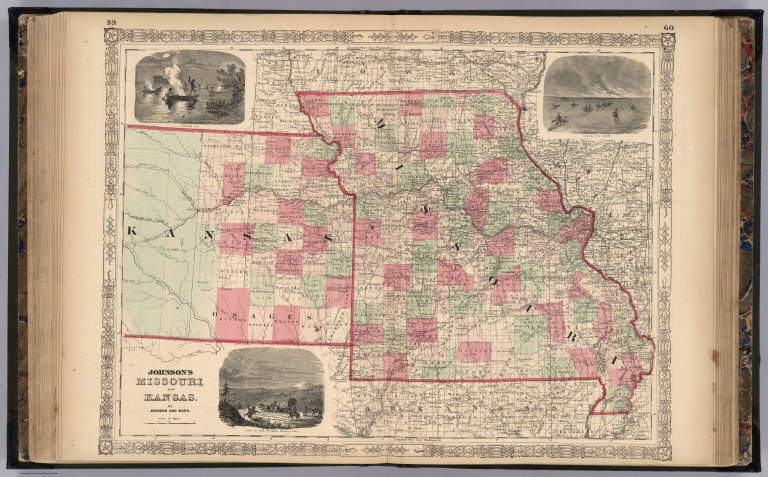
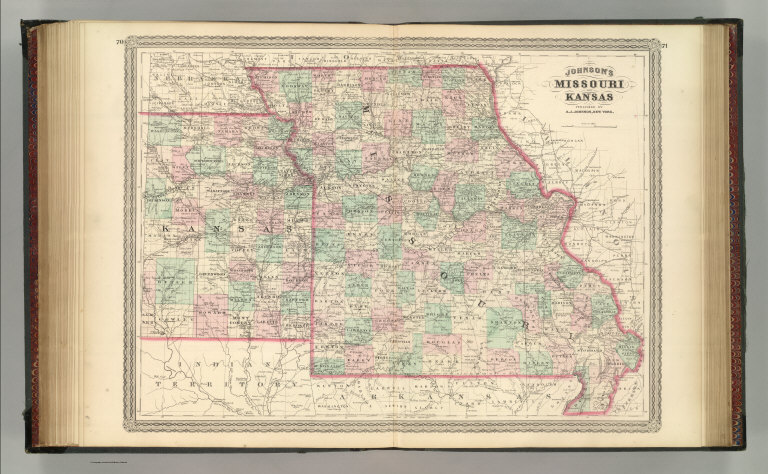
Author
Johnson, A.J.
Full Title
Johnson's Missouri and Kansas. Entered ... 1865.
List No
0358.044
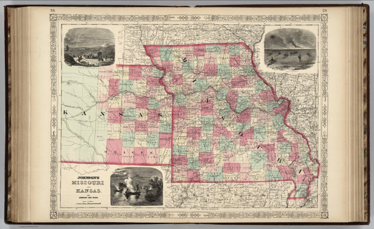
Author
Johnson, A.J.
Full Title
Johnson's Missouri And Kansas By Johnson And Ward.
List No
0535.037
Note
In full color by county or region. Includes three vignettes: Santa Fe from the Great Missouri Trail, Spearing Fish, and Fire on the Prairie. Relief shown by hachures. Meridians Greenwich and Washington D.C.
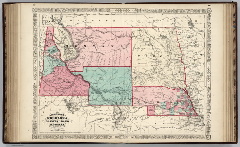
Author
Johnson, A.J.
Full Title
Johnson's Nebraska, Dakota, Idaho, and Montana Published By Johnson And Ward.
List No
0535.039
Note
Relief shown by hachures. Meridians Greenwich and Washington D.C.
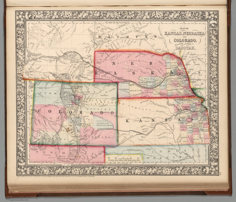
Author
Mitchell, Samuel Augustus Jr.
Full Title
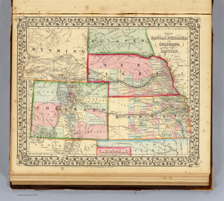
Map of Kansas, Nebraska and Colorado. Showing also the southern portion of Dacotah. Drawn & Engraved by W.H. Gamble Philada. Entered ... 1861 by S. Augustus Mitchell, Jr. ... Pennsylvania.
List No
0572.037
Note
Full color map by county. Shows settlements, Indian tribes, railroads, etc. Covers also parts of Wyoming, Iowa, Indian Territory, New Mexico and Texas. Relief shown by hachures. Prime meridians are Greenwich and Washington, D.C.
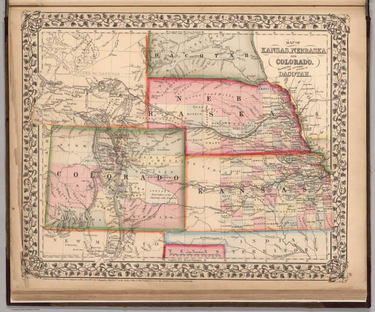
Author
Mitchell, Samuel Augustus Jr.
Full Title
Map of Kansas, Nebraska and Colorado. Showing the Southern Portion of Dacotah. Drawn and Engraved by W.H. Gamble Philada. Entered ... 1867 by S. Augustus Mitchell, Jr. ... Pennsylvania.
List No
0579.040
Note
Color map by state and county. Relief shown by hachures. Prime meridians are Greenwich and Washington, D.C.
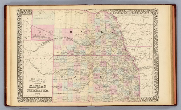
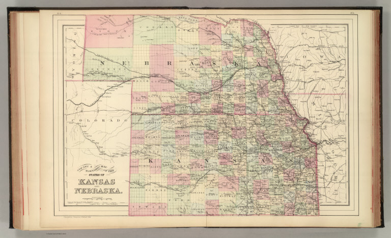
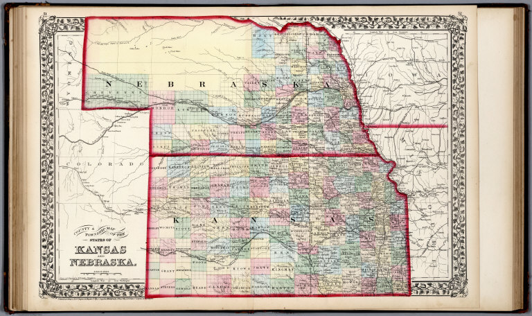
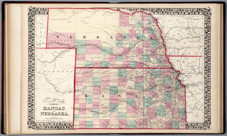
Author
Mitchell, Samuel Augustus
Full Title
County & township map of the states of Kansas and Nebraska. Drawn and engraved by W.H. Gamble, Philadelphia. Entered ... 1879 by S. Augustus Mitchell ... Washington. (1880)
List No
0586.041
Note
Hand colored. Shows settlements, railroads, rivers, etc. Prime meridians: Greenwich and Washington.
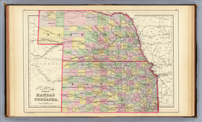
Author
Mitchell, Samuel Augustus Jr.
Full Title
County & township map of the states of Kansas and Nebraska. Copyright by S. Augustus Mitchell 1884.
List No
0592.043
Note
Hand colored. Shows settlements, rivers, railroads, etc. Prime meridians: Greenwich and Washington.
Full Title
County & township map of the states of Kansas and Nebraska. Copyright 1887 by Wm. M. Bradley & Bro. (1890)
List No
0594.041
Note
Hand colored. Shows settlements, rivers, railroads, etc. Prime meridians: Greenwich and Washington.
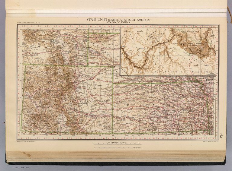
Author
[Touring club italiano, Funk & Wagnalls Company.]
Full Title
Stati Uniti, United States of America, Colorado, Kansas. (with San Francisco, Oakland, Berkeley region). Propr. Artistico-letteraria del T.C.I. Ufficio cartografico del T.C.I. (1929)
List No
1012.076
Note
Color map. Relief shown by hachures and spot heights. Includes inset map of the Grand Canyon at 1:1,000,000.
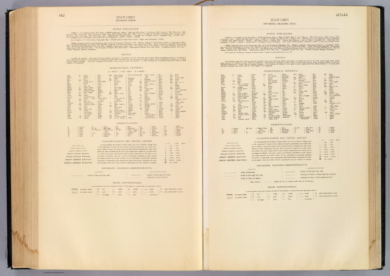
Author
[Touring club italiano, Funk & Wagnalls Company.]
Full Title
(Legend to) Stati Uniti, United States of America, Colorado, Kansas ... New Mexico, Oklahoma, Texas. Propr. Artistico-letteraria del T.C.I. Ufficio cartografico del T.C.I. (1929)
List No
1012CT
Note
Explanation to maps (2 facing sheets)
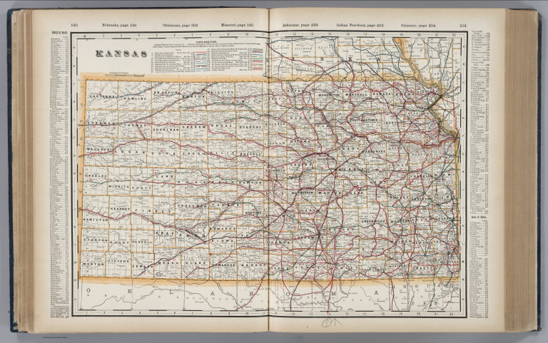
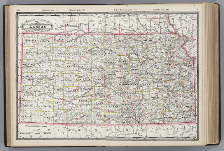
Author
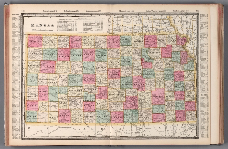
Cram, George Franklin, 1841-1928
Full Title
Kansas. 1899, by Geo. F. Cram.
List No
14372.107
Note
Map of Kansas. Shows political boundaries, counties, towns, railroads, topography, bodies of water, drainage, coastlines and islands. Relief shown with hachures. Includes key with explanation, latitudinal and longitudinal lines, as well as a bar scale given in miles. With alphanumeric grid corresponding to "Index of Kansas" on pages 192-197 and 200. Colored lithograph. Map is 39 x 55 cm, on double sheet 45 x 67 cm. "Index of maps" and "Index of cities" in margins, providing navigation for atlas as a whole.
Author
Colton, G.W.
Full Title
Colton's Kansas. Published By G. W & C. B. Colton & Co., No. 182 William St. New York.
List No
1550.058
Note
Prime meridians are Washington D.C. and Greenwich.
USSR (Union of Soviet Socialist Republic... 206-207. United States of America, South... 1967 1603.218 Related Author
USSR (Union of Soviet Socialist Republics).
Full Title
206-207. United States of America, South Central. The World Atlas.
List No
1603.218
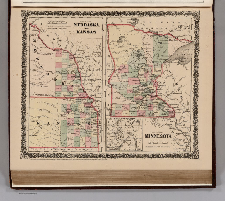
Author
[Colton, G.W., Fisher, Richard Swainson]
Full Title
Nebraska and Kansas. Minnesota. (inset) vicinity, of the Falls of St. Anthony.
List No
1690.120
Author
[Cram, George, Wood Brothers]
Full Title
Kansas. (to accompany) The Columbian World's Fair atlas ... Published for: Wood Brothers Cash Store ... Unadilla, New York.
List No
1773.065
Note
Outline hand color map. Shows state and county boundaries, cities and towns. Prime meridians are Greenwich and Washington.
Author
Hammond, C.S.
Full Title
Kansas. 5366.
List No
1954.092
Delavault, A.; Vandermaelen, Philippe, 1... Parties, Etats-Unis et Nouv. Mexique. Am... 1827 2212.253 Related Author
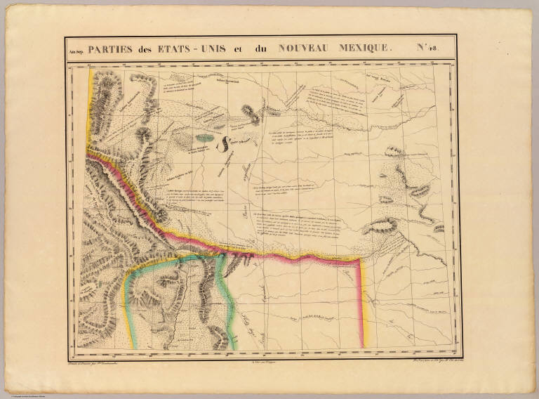
[Delavault, A., Vandermaelen, Philippe, 1795-1869]
Full Title
Parties des Etats-Unis et du Nouveau Mexique. Amer. Sep. no. 48. Dressee et dessinee par Ph. Vandermaelen. La lettre par Ph. Lippens. Desee. sur pierre et Lithie. par H. Ode, Avril 1825. (Quatrieme partie. - Amer. sept. Bruxelles. 1827)
List No
2212.253
Note
Hand col. lithographed map. Relief shown by hachures. Shows Indian tribes with populations. Covers parts of Colorado, Kansas, Nebraska, Texas, New Mexico and Oklahoma.
Jones, C.H.; Hamilton, T.H.; Williams, J... Illinois, Missouri, Kansas, Arkansas, an... 1873 2307.020 Related Author
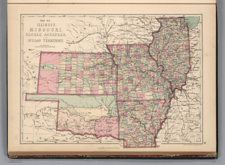
[Jones, C.H., Hamilton, T.H., Williams, J.David]
Full Title
Map of Illinois, Missouri, Kansas, Arkansas, and Indian Territory.
List No
2307.020
Note
Relief shown in hachures.
Author
Colton, G.W.
Full Title
Colton's Kansas and Nebraska.
List No
2441.110
Author
Mitchell, Samuel Augustus
Full Title
Map of Kansas, Nebraska and Colorado. Showing also the southern portion of Dacotah. Drawn and engraved by W.H. Gamble, Philada. Entered ... 1870 by S. Augustus Mitchell, Jr. ... Pennsylvania.
List No
2483.036
Note
Hand colored. Relief shown by hachures. Shows counties, settlements, Indian tribes, railroads, etc. Covers also parts of Wyoming, Iowa, Indian Territory, New Mexico and Texas. Prime meridians: Greenwich and Washington.
Author
Mitchell, Samuel Augustus
Full Title
A New Map of Nebraska, Kansas, New Mexico and Indian Territories. Published by Charles Desilver, Philadelphia. Entered ... 1856 by Charles Desilver ... Pennsylvania.
List No
2514.040
Note
Full color map by state and region. Shows capitals, cities and towns, military and trading posts and routes of Pacific railroads. Relief shown by hachures.
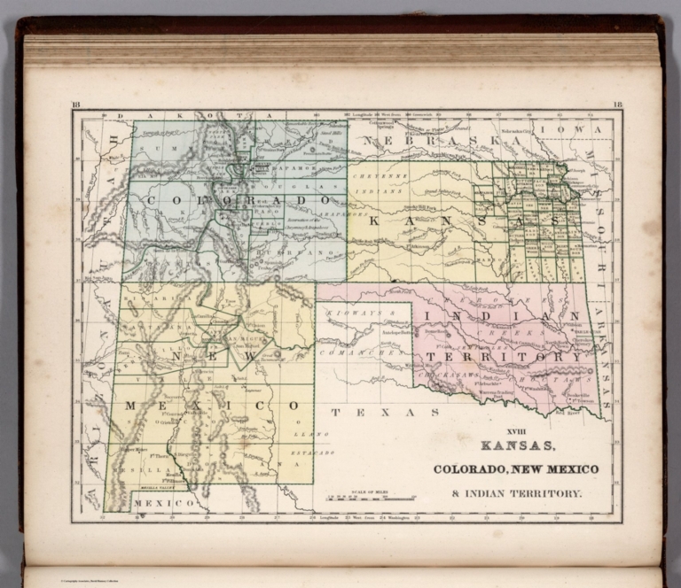
Mitchell, Samuel Augustus Jr., 1792-1868 Map No. XVIII. Kansas, Colorado, New Mex... 1865 2516.018 Related Author
Mitchell, Samuel Augustus Jr., 1792-1868
Full Title
Kansas, Colorado, New Mexico & Indian Territory. (to accompany) Mitchell's New Reference Atlas for the Use of Colleges, Libraries, Families and Counting Houses. Philadelphia: Published By E.H. Butler & Co. 1865.
List No
2516.018
Note
Hand colored map. Relief shown by hachures. Showing administrative divisions, major cities, Indian reservations,rivers, lakes, and mountains. Prime meridians are Greenwich and Washington.
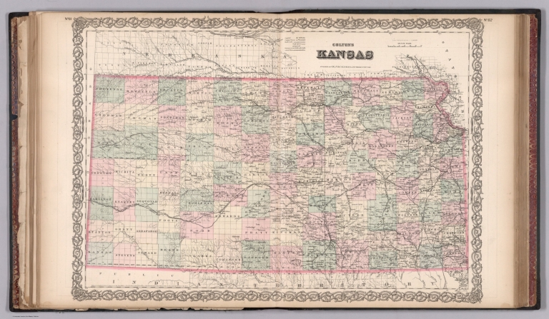
Author
Rand McNally and Company
Full Title
Kansas.
List No
2790.220
Author
Rand McNally and Company
Full Title
Relief Map of Kansas.
List No
2790.222
Author
Cram, George Franklin
Full Title
Kansas.
List No
2809.028
Note
Locations of banking towns shown by red circles. Railroads are indicated by numbers and colors and patterns, and each railroad has the same number and color and pattern in every state through which it passes. All railroads on each map are in a list keyed to the map. Border of map has a table of contents for the atlas. Relief shown by hachures. Prime meridians Washington D.C. and Greenwich.
Author
Johnson, A.J.
Full Title
Johnson's Missouri And Kanzas By Johnson & Browning. No. 41-42.
List No
2905.026
Note
In full color by county or region.
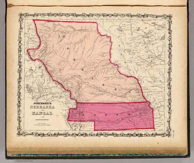
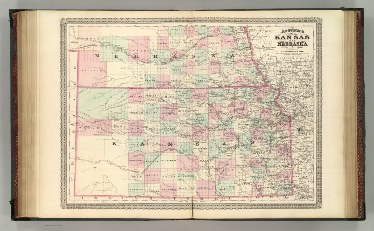
Author
Johnson, A.J.
Full Title
Johnson's Nebraska And Kansas. By Johnson & Browning. No. 44.
List No
2905.028
Note
Kansas in bright pink and Nebraska in light pink. Nebraska stretches from the British Possessions (now Canada) to just south of Longs Peak (now in Colorado).
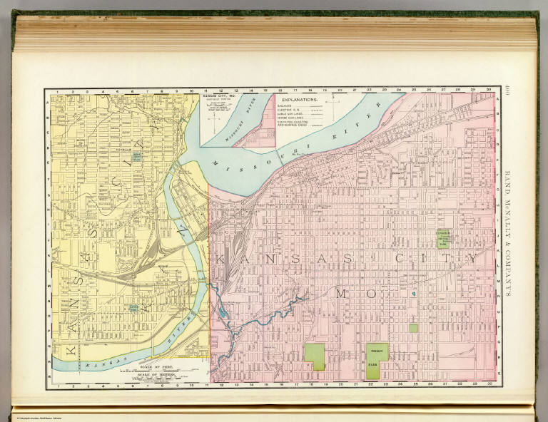
Author
Rand McNally and Company
Full Title
Rand, McNally & Co.'s business atlas map of Kansas City. Copyright, 1893, Rand, McNally & Co. (Chicago, 1897)
List No
3565.129
Note
Col. map. Covers Kansas City, Kansas and Kansas City, Mo. Shows major buildings, parks, etc. Inset: Kansas City, Mo. northeast portion. Scale (ca. 1:38,100). "Rand, McNally & Company's" in margin.
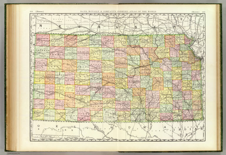
Author
Rand McNally and Company
Full Title
Rand, McNally & Co.'s New business atlas map of Kansas. Copyright, 1888, by Rand, McNally & Co. (Chicago, 1897)
List No
3565.134
Note
Col. map. Title in margin: Rand, McNally & Company's Indexed atlas of the world. Kansas.
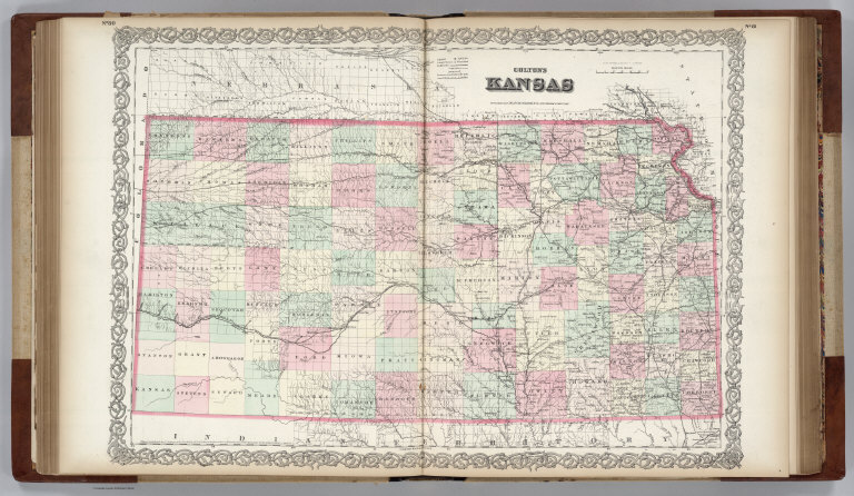
Author
Colton, G.W.
Full Title
Colton's Kansas.
List No
3800.113
Author
Mitchell, Samuel Augustus Jr.
Full Title
County & township map of the states of Kansas and Nebraska. Drawn and engraved by W.H. Gamble. Entered ... 1874, by S. Augustus Mitchell ... Washington.
List No
3804.042
Note
Hand colored map by county and town, with explanation. Shows state capitals, settlements, roads, railroads, rivers,etc. Prime meridians are Greenwich and Washington.
Author
[Gray, Ormando Willis, Colton, G. Woolworth]
Full Title
Kansas.
List No
3888.046
Note
Prime meridians Washington D.C. and Greenwich.
Author
Mitchell, Samuel Augustus
Full Title
A New Map of Nebraska, Kansas, New Mexico, and Indian Territories. Published By Charles Desilver, Philadelphia. Entered according to Act of Congress in the year 1856 by Charles Desilver in the Clerk's office if the District Court of the Eastern District of Pennsylvania. 38.
List No
4557.037
Note
Counties tinted in color. Meridian Washington and Greenwich. Relief shown by hachures. Shows tribes fo Native Americans.
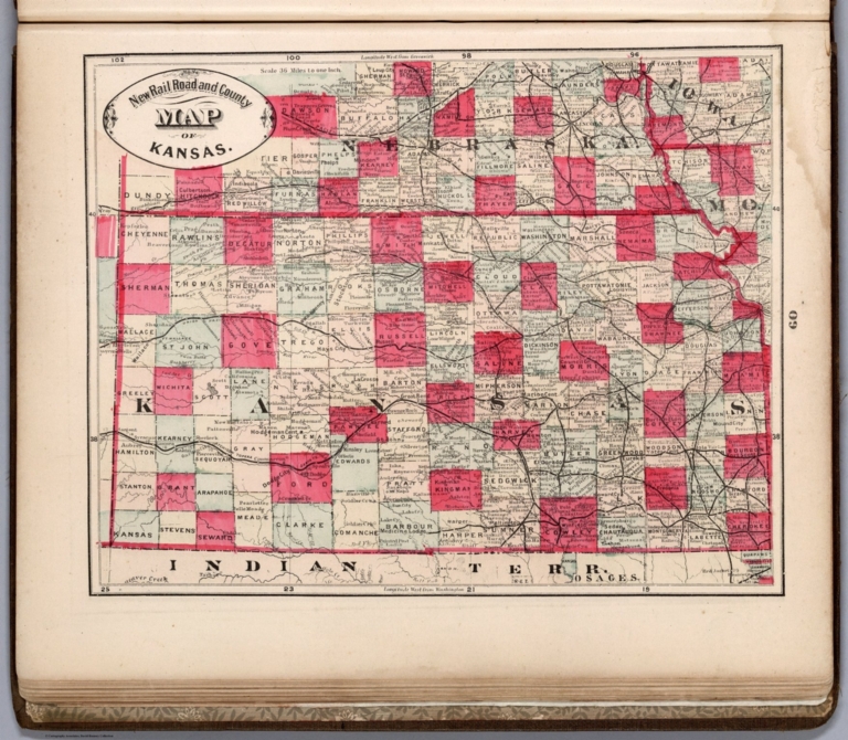
Author
Cram, George Franklin
Full Title
New Rail Road and County Map of Kansas.
List No
4558.045
Author
Mitchell, Samuel Augustus Jr.
Full Title
County and township map of the States of Kansas and Nebraska. Drawn and Engraved by W.H. Gamble Philadelphia. Entered ... 1876 by S. Augustus Mitchell, . ... Washington.
List No
4564.043
Note
Full color map by county. Shows rivers and creeks, etc. Prime meridians are Greenwich and Washington.
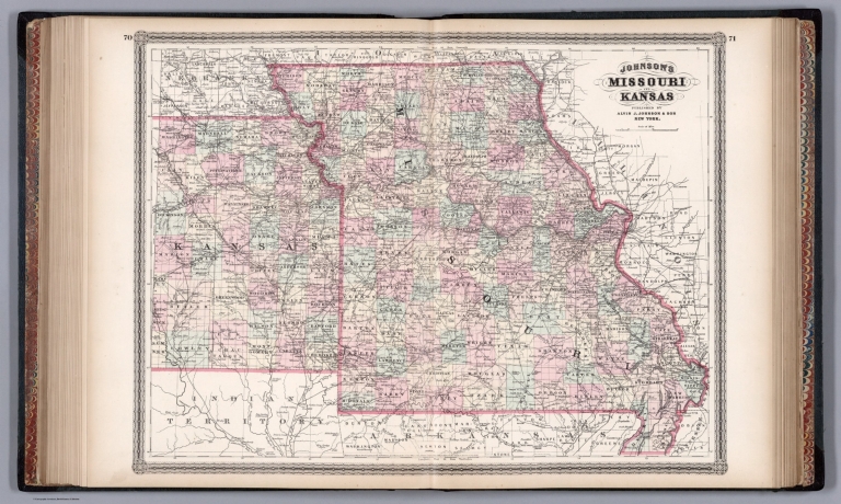
Author
Johnson, A.J.
Full Title
Johnson's Missouri and Kansas. Published by A. J. Johnson, New York. 70. 71. Entered according to the Act of Congress, in the year 1865, by A.J. Johnson in the Clerk's Office of the District Court of the United States for the Southern District of New York.
List No
4574.034
Note
Engraved color map with counties and districts differentiated by color. Shows roads and railroads.
Author
Johnson, A.J.
Full Title
Johnson's Kansas and Nebraska. Published by A. J. Johnson, New York. Entered according to the Act of Congress, in the year 1870, by A.J. Johnson in the Clerk's Office of the District Court of the United States for the Southern District of New York.
List No
4574.035
Note
Engraved color map with counties and districts differentiated by color. Shows roads and railroads.
Author
Colton, G.W.
Full Title
Colton's Kansas. Published By G. W & C. B. Colton & Co., No. 172 William St. New York.
List No
4587.063
Note
Prime meridians are Washington D.C. and Greenwich.
Author
Cram, George Franklin
Full Title
Railroad and County Map of Kansas. Geo. F. Cram. Engraver and Publisher, Chicago.
List No
4727.027
Note
Prime meridians Washington D.C. and Greenwich. Relief shown by hachures. With printed color.
Author
Colton, G.W.
Full Title
Colton's Map of Kansas, Nebraska, Dakota & Indian Territory. Published by G.W. & C.B. Colton & Co., No. 172 William St. New York.
List No
4825.056
Note
Counties shown in color. Prime meridians are Greenwich and Washington D.C.
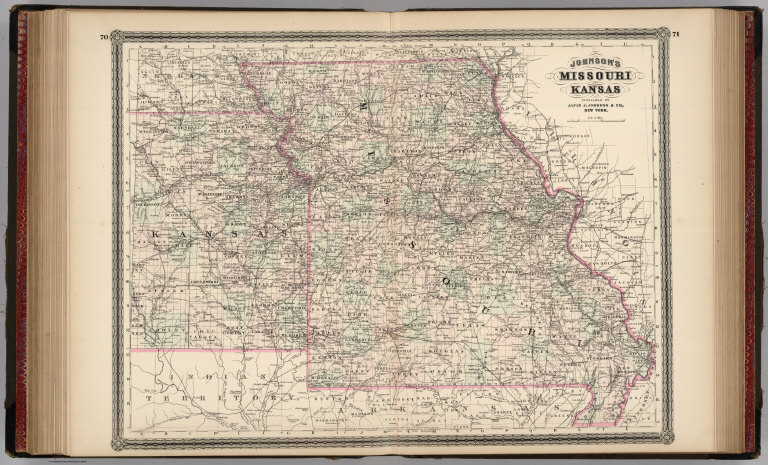
Author
Johnson, A.J.
Full Title
Johnson's Missouri and Kansas. Published by Alvin J. Johnson & Co., New York. 70. 71. Entered according to the Act of Congress, in the year 1865, by A.J. Johnson in the Clerk's Office of the District Court of the United States for the Southern District of New York.
List No
4828.048
Note
Engraved color map with counties and districts differentiated by color. Shows roads and railroads.
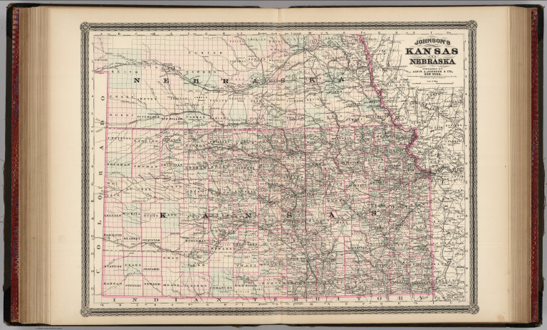
Author
Johnson, A.J.
Full Title
Johnson's Kansas and Nebraska. Published by Alvin J. Johnson & Co., New York. Entered according to the Act of Congress, in the year 1870, by A.J. Johnson in the Clerk's Office of the District Court of the United States for the Southern District of New York.
List No
4828.049
Note
Engraved color map with counties and districts differentiated by color. Shows roads and railroads.
Author
Johnson, Alvin Jewett, 1827-1884.
Full Title
Johnson's Missouri And Kansas. Published by Alvin J. Johnson & Son, New York. Entered ... 1865, by A.J. Johnson ... New York. (to accompany) Johnson's New Illustrated Family Atlas Of The World ... MDCCCLXXX (1880).
List No
4830.090
Note
Engraved hand colored in outline map on 2 sheets. Shows state and county boundaries, towns, villages, roads, railroads, canals, lakes and rivers. Depth shown by isolines. Prime meridians are Greenwich and Washington.
|