|
Author
[Depot General de la Marine, Beautemps-Beaupré, Charles François, 1766-1854]
Full Title
Carte Particuliere De La Chaussee De Sein Et Du Passage Du Raz De Sein
List No
15934.123
Note
Hydrographie Française 3
Author
Depot General de la Marine
Full Title
Plan Du Tevennec (Raz de Sein) Leve en 1817 (with) Plan Du Port De L'Ile De Sein
List No
15934.124
Note
Hydrographie Française 3 Two charts on one sheet.
Author
[Depot General de la Marine, Beautemps-Beaupré, Charles François, 1766-1854]
Full Title
Carte Particuliere Des Cotes De France (Baie D"Audierne)
List No
15934.125
Note
Hydrographie Française 3
Author
Depot General de la Marine
Full Title
Plan Du Port D'Audierne Lefe en 1818 (with) Plan De L'Anse De La Torche (Baie d'Audierne) Leve en 1818
List No
15934.126
Note
Hydrographie Française 3 Two charts on one sheet.
Author
[Depot General de la Marine, Beautemps-Beaupré, Charles François, 1766-1854]
Full Title
Plan Des Roches De Penmarch
List No
15934.127
Note
Hydrographie Française 3
Author
[Depot General de la Marine, Beautemps-Beaupré, Charles François, 1766-1854]
Full Title
Des Cotes De France (Partie Comprise Entre Le Raz De Sein Et Lorient)
List No
15934.128
Note
Hydrographie Française 3
Author
[Depot General de la Marine, Beautemps-Beaupré, Charles François, 1766-1854]
Full Title
Carte Particuliere Des Cotes De France (Iles De Glenan, Baie De La Forest, Anse De Benodet Et Partie Des Roches De Penmarch)
List No
15934.129
Note
Hydrographie Française 3
Author
[Depot General de la Marine, Beautemps-Beaupré, Charles François, 1766-1854]
Full Title
Plan De L'Entree De L'Odet (Riviere de Quimper)
List No
15934.130
Note
Hydrographie Française 3
Author
Depot General de la Marine
Full Title
Plan Du Port De Loctudy (Entree de la Riviere de Pont-l'Abbe) Leve en 1818
List No
15934.131
Note
Hydrographie Française 3
Author
[Depot General de la Marine, Beautemps-Beaupré, Charles François, 1766-1854]
Full Title
Plan De Concarneau
List No
15934.132
Note
Hydrographie Française 3
Author
Depot General de la Marine
Full Title
Carte Particuliere Des Cotes De France (Entree Du Port De Lorent, Ile De Groix, Anse Du Pouldu, Entree De L'Aven Et Basse Jaune
List No
15934.133
Note
Hydrographie Française 3
Author
Depot General de la Marine
Full Title
Plan Des Passes Et Rades De Lorient Et De Port-Louis
List No
15934.134
Note
Hydrographie Française 3
Author
[Depot General de la Marine, Beautemps-Beaupré, Charles François, 1766-1854]
List No
15934.135
Note
Hydrographie Française 3
Author
[Depot General de la Marine, Beautemps-Beaupré, Charles François, 1766-1854]
Full Title
Carte Particuliere Des Cotes De France (Entree Du Port De Lorient, Presqu'ile De Quiberon Et Partie Septentle. De Belle-Ile)
List No
15934.136
Note
Hydrographie Française 3
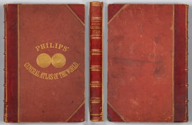
Author
Hughes, William, 1818-1876
Full Title
(Covers to) Philips' general atlas of the world.
List No
14487.001
Note
Covers to Philips' general atlas of the world. Bound in boards with red leather spine and corners. With gilt title on front cover and spine. Front cover features a world map, presented as spherical Northern and Southern Hemispheres.
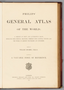
Author
Hughes, William, 1818-1876
Full Title
(Title Page to) Philips' general atlas of the world; a series of new and authentic maps, engraved from original drawings, compiled from national surveys and the woks of eminent travellers and explorers. Edited by William Hughes, F.R.G.S. Accompanied by a valuable index of reference. London: George Philip and Son, 32, Fleet Street; Liverpool: Caxton Buildings, South John Street.
List No
14487.002
Note
Title page to Philips' general atlas of the world. Includes a description of contents, statement of responsibility, and imprint.
Author
[Hughes, William, 1818-1876, Bartholomew, John, 1831-1893]
Full Title
The world on a plane of a meridian. -- The world on the plane of the equator. -- The world on the plane of the horizon of London. By J. Bartholomew, F.R.G.S. George Philip & Son, London & Liverpool.
List No
14487.004
Note
Three maps representing the world, with hemispheres divided between the Western and Eastern Hemispheres, as well as the Southern and Northern Hemispheres, on both the plane of the equator, and the plane of the horizon of London. Maps show political boundaries, cities, topography, bodies of water, drainage, coastlines, and islands. Relief shown with hachures. Maps include latitudinal and longitudinal lines. Scales differ. Colored lithograph. Together, maps are 50 x 60 cm, on double sheet 56 x 70 cm.
Author
[Hughes, William, 1818-1876, Bartholomew, John, 1831-1893]
Full Title
The world on Mercator's projection. By J. Bartholomew, F.R.G.S. George Philip & Son, London & Liverpool.
List No
14487.005
Note
Map representing the world. Shows political boundaries, cities, topography, bodies of water, drainage, coastlines, and islands. Relief shown with hachures. Includes sailing routes and distances. With latitudinal and longitudinal lines. Colored lithograph. Map is 51 x 63 cm, on double sheet 56 x 70 cm.
Author
Hughes, William, 1818-1876
Full Title
The British Empire in 1864 : On a uniform scale of 1:20,000,000 : North America -- The British Islands -- India -- Ascension -- St. Helena -- Falkland -- Bermuda -- Mauritius -- Sketch map of the world, showing the relative positions of the various portions of The British Empire. -- Gibraltar -- Malta -- Heligoland -- Aden -- Hong Kong -- Labuan -- New Zealand -- West Indies -- West Africa -- South Africa -- Norfolk -- Australia. By W. Hughes, F.R.G.S. George Philip & Son, London & Liverpool.
List No
14487.007
Note
Twenty-one maps representing the British Empire in 1864. Maps show political boundaries, cities, bodies of water, drainage, coastlines, and islands. Maps include latitudinal and longitudinal lines, as well as bar scales given in English miles and kilometers. With statistical tables showing square meters and population for each map. Colored lithograph. Together, maps are 51 x 61 cm, on double sheet 56 x 70 cm.
Author
Hughes, William, 1818-1876
Full Title
Industrial map of the British Islands exhibiting the chief localities of manufacturing and commercial industry : With the ratio of population in the different counties, and the towns classified according to their respective populations. By W. Hughes, F.R.G.S. George Philip & Son, London & Liverpool.
List No
14487.008
Note
Map representing industry in the British Isles. With two ancillary maps: Map showing the distribution of the chief mineral productions of The British Islands. -- Map showing the comparative density of population in the different parts of the British Islands. Maps show county boundaries, railways, cities, bodies of water, canals, drainage, coastlines, and islands. Maps include latitudinal and longitudinal lines, as well as a legend and bar scales given in English miles and kilometers. With one inset map: Shetland Isds. Colored lithograph. Together, maps are 61 x 51 cm, on double sheet 70 x 56 cm. With handwritten annotations in red.
Author
[Hughes, William, 1818-1876, Bartholomew, John, 1831-1893]
Full Title
Russia in Europe. By J. Bartholomew, F.R.G.S. George Philip & Son, London & Liverpool.
List No
14487.020
Note
Map representing Russia in Europe. Shows political boundaries, cities, topography, railways, roads, bodies of water, drainage, coastlines, and islands. Relief shown with hachures. Includes latitudinal and longitudinal lines, as well as a legend and bar scales given in English miles, geographical miles, kilometers, and Russian versts. Colored lithograph. Map is 61 x 52 cm, on double sheet 70 x 56 cm.
Author
[Hughes, William, 1818-1876, Weller, Edward, 1819-1884]
Full Title
Asia. By Edwd. Weller, F.R.G.S. George Philip & Son, London & Liverpool.
List No
14487.025
Note
Map representing Asia. Shows political boundaries, cities, topography, roads, bodies of water, drainage, and coastlines. Relief shown with hachures. Includes latitudinal and longitudinal lines, as well as bar scales given in English miles and kilometers. Colored lithograph. Map is 55 x 61 cm, on double sheet 56 x 70 cm.
Author
Hughes, William, 1818-1876
Full Title
Turkey in Asia with Russian Armenia and the countries on the Caucasus. By W. Hughes, F.R.G.S. George Philip & Son, London & Liverpool.
List No
14487.026
Note
Map representing Turkey in Asia. Shows political boundaries, cities, topography, railways, roads, bodies of water, drainage, and coastlines. Relief shown with hachures. Includes latitudinal and longitudinal lines, as well as bar scales given in English miles and kilometers. With: Explanation of terms. Colored lithograph. Map is 51 x 64 cm, on double sheet 56 x 70 cm.
Author
[Hughes, William, 1818-1876, Bartholomew, John, 1831-1893]
Full Title
India. By J. Bartholomew, F.R.G.S. George Philip & Son, London & Liverpool.
List No
14487.028
Note
Map representing India. Shows political boundaries, cities, topography, roads, bodies of water, drainage, and coastlines. Relief shown with hachures. Includes latitudinal and longitudinal lines, as well as a legend, and bar scales given in English miles, geographical miles, and kilometers. With one inset map: Continuation of the eastern provinces, (further India). With: Explanation of colours. Colored lithograph. Map is 62 x 51 cm, on double sheet 70 x 56 cm.
Author
[Hughes, William, 1818-1876, Weller, Edward, 1819-1884]
Full Title
Africa. By Edwd. Weller, F.R.G.S. George Philip & Son, London & Liverpool.
List No
14487.031
Note
Map representing Africa. Shows political boundaries, cities, topography, bodies of water, drainage, and coastlines. Relief shown with hachures. Includes latitudinal and longitudinal lines, as well as bar scales given in English miles and kilometers. Colored lithograph. Map is 53 x 61 cm, on double sheet 56 x 70 cm.
Author
[Hughes, William, 1818-1876, Weller, Edward, 1819-1884]
Full Title
North America. By Edwd. Weller, F.R.G.S. George Philip & Son, London & Liverpool.
List No
14487.032
Note
Map representing North America. Shows political boundaries, cities, topography, bodies of water, drainage, and coastlines. Relief shown with hachures. Includes latitudinal and longitudinal lines, as well as bar scales given in English miles and French kilometers. With one inset map: British Columbia. Colored lithograph. Map is 62 x 54 cm, on double sheet 70 x 56 cm.
Author
[Hughes, William, 1818-1876, Bartholomew, John, 1831-1893]
Full Title
The United States of North America. (North Eastern Division.) By J. Bartholomew, F.R.G.S. George Philip & Son, London & Liverpool.
List No
14487.034
Note
Map representing the Northeast part of the United States of America. Maps show political boundaries, cities, topography, railways, bodies of water, drainage, and coastlines. Relief shown with hachures. Maps include latitudinal and longitudinal lines, as well as bar scales given in English miles, geographical miles, and kilometers. With one inset map: Sketch showing the whole area of the United States. Colored lithograph. Together, maps are 51 x 65 cm, on double sheet 56 x 70 cm.
Author
[Hughes, William, 1818-1876, Bartholomew, John, 1831-1893]
Full Title
The Pacific states, the territories and a portion of the north-western states. (United States, No.II (Western Division.). By J. Bartholomew, F.R.G.S. George Philip & Son, London & Liverpool.
List No
14487.035
Note
Map representing the Western part of the United States of America. Shows political boundaries, cities, indigenous territory, topography, railways, bodies of water, drainage, and coastlines. Relief shown with hachures. Includes latitudinal and longitudinal lines, as well as bar scales given in English miles, geographical miles, and kilometers. Colored lithograph. Map is 52 x 62 cm, on double sheet 56 x 70 cm.
Author
[Hughes, William, 1818-1876, Bartholomew, John, 1831-1893]
Full Title
United States of North America : (South Eastern Division.) The Confederate states, with the border states & the adjoining portion of the federal states. By J. Bartholomew, F.R.G.S. George Philip & Son, London & Liverpool.
List No
14487.036
Note
Map representing the Southeast part of the United States of America. Shows political boundaries, cities, indigenous territory, topography, railways, bodies of water, drainage, and coastlines. Relief shown with hachures. Includes latitudinal and longitudinal lines, as well as bar scales given in English miles, geographical miles, and kilometers. Colored lithograph. Map is 52 x 61 cm, on double sheet 56 x 70 cm.
Author
[Hughes, William, 1818-1876, Bartholomew, John, 1831-1893]
Full Title
Australia. By J. Bartholomew, F.R.G.S. George Philip & Son, London & Liverpool.
List No
14487.040
Note
Map representing Australia. Shows political boundaries, cities, topography, deserts, bodies of water, drainage, coastlines, and islands. Relief shown with hachures. Includes latitudinal and longitudinal lines, as well as bar scales given in English miles, geographical miles, and kilometers. Colored lithograph. Map is 52 x 61 cm, on double sheet 56 x 70 cm.
Author
[Hughes, William, 1818-1876, Bartholomew, John, 1831-1893]
Full Title
New South Wales, Victoria, Queensland, and South Australia. By J. Bartholomew, F.R.G.S. George Philip & Son, London & Liverpool.
List No
14487.041
Note
Map representing Eastern Australia. Shows political boundaries, cities, topography, deserts, bodies of water, drainage, coastlines, and islands. Relief shown with hachures. Includes latitudinal and longitudinal lines, as well as bar scales given in English miles, geographical miles, and kilometers. Colored lithograph. Map is 61 x 52 cm, on double sheet 70 x 56 cm.
Author
Hughes, William, 1818-1876
Full Title
Polynesia. : New Zealand -- The Ladrones or Mariana Islands. -- The Sandwich Islds. -- The Galapogos Is. -- The New Hebrides and Santa Cruz Islands. -- The Feejee, Friendly, and Samoa Islands. -- The Marquesas, Society Islands, and Low Archipelago. By W. Hughes, F.R.G.S. George Philip & Son, London & Liverpool.
List No
14487.042
Note
Seven maps representing Polynesia. Maps show political boundaries, cities, topography, bodies of water, drainage, coastlines, and islands. Relief shown with hachure lines and peak heights. Maps include latitudinal and longitudinal lines, as well as bar scales given in English miles and kilometers; scales differ. New Zealand map indexed to indicate the territories of indigenous peoples. With three inset maps: Norfolk I. -- Enlarged map of Auckland and the adjacent country. -- Enlarged plan of the country round Dunedin : and the eastern portion of the Otago gold-fields. Colored lithograph. Together, maps are 52 x 62 cm, on double sheet 56 x 70 cm.
Author
Depot General de la Marine
Full Title
(Covers to) Hydrographie Française 2
List No
15934.048
Note
Hydrographie Française 2
Author
[Depot General de la Marine, Downie, Murdo]
Full Title
Carte Particuliere De La Cote Orientale D'Ecosse depuis St. Abb's Head jusqu'a Duncansby Head
List No
15934.049
Note
Hydrographie Française 2
Author
[Depot General de la Marine, Moore, Hamilton]
Full Title
Carte Particuliere De La Cote Orientale D'Angleterre depuis le Cap Gibraltar jusqu'a Golfe d'Edinburg
List No
15934.050
Note
Hydrographie Française 2
Author
[Depot General de la Marine, Moore, Hamilton]
Full Title
Cote Orientale D'Angleterre depuis Lowestoft, jusqu'a et compris L'Embouchure de l'Humber
List No
15934.051
Note
Hydrographie Française 2
Author
[Depot General de la Marine, Spence, Graeme, Thomas, George]
Full Title
Plan De La Baie De Hollesley
List No
15934.052
Note
Hydrographie Française 2
Author
[Depot General de la Marine, MacKenzie, M.M., Spence, Graeme, Thomas, George]
Full Title
Carte Des Entrees De La Tamise
List No
15934.053
Note
Hydrographie Française 2
Author
[Depot General de la Marine, Spence, Graeme, Thomas, George]
Full Title
Carte De La Rade Des Dunes
List No
15934.054
Note
Hydrographie Française 2
Author
[Depot General de la Marine, Johnstone, Captain, Tapper, M.]
Full Title
Carte De La Cote Meridionale D'Angleterre Depuis Douvres jusqu'a Winchelsea.
List No
15934.055
Note
Hydrographie Française 2
Author
[Depot General de la Marine, Spence, Graeme, Murray, Johm]
Full Title
Carte De La Cote Meridionale D'Angleterre Depuis Winchesea jusqu'a Beachy-Head
List No
15934.056
Note
Hydrographie Française 2
Author
[Depot General de la Marine, Murray, Johm]
Full Title
Carte De La Cote Meridionale D'Angleterre Depuis New Shoreham jusqu'a Selsea Bill
List No
15934.057
Note
Hydrographie Française 2
Author
[Depot General de la Marine, MacKenzie, Murdoch]
Full Title
Carte De Selsea-Bill, Des Owers, et Des Ports De Chichester Et Emsworth.
List No
15934.058
Note
Hydrographie Française 2
Author
[Depot General de la Marine, MacKenzie, Murdoch]
Full Title
Carte Des Rades De Ste Helene Et Spithead. Faisant suite a celle de Selsea-Bill.
List No
15934.059
Note
Hydrographie Française 2
Author
[Depot General de la Marine, MacKenzie, Murdoch]
Full Title
(Composite map of) Carte Des Rades De Ste Helene Et Spithead (and) Carte De Selsea-Bill
List No
15934.060
Note
Hydrographie Française 2
Author
[Depot General de la Marine, MacKenzie, Murdoch]
Full Title
Plan Des Rades Ste Helene, Spithead, et des Ports Portsmouth et Langstone
List No
15934.061
Note
Hydrographie Française 2
Author
[Depot General de la Marine, MacKenzie, Murdoch]
Full Title
Plan D'Une Partie De L'Ile De Wight et De La Cote De Hampshire Depuis la Pointe Gillker jusqu'au Chateau de Calshot
List No
15934.062
Note
Hydrographie Française 2
Author
[Depot General de la Marine, MacKenzie, Murdoch]
Full Title
Plan De La Riviere De Southampton
List No
15934.063
Note
Hydrographie Française 2
Author
[Depot General de la Marine, Price, William]
Full Title
Carte De L'Ile De Wight et De La Cote Adjacente De Hampshire
List No
15934.064
Note
Hydrographie Française 2
Author
[Depot General de la Marine, MacKenzie, Murdoch]
Full Title
Plan De La Partie Occidentale Du Canal qui separe L'Ile De Wight, De La Cote De Hampshire.
List No
15934.065
Note
Hydrographie Française 2
|