|
Author
Shipov, Nikolai
Full Title
Стенная карта Европейской России с изображением народов и их промыслов (Wall Map European Russia With Images of Peoples and Their Crafts. 35d Edition. Corrected and Expanded.
List No
15969.000
Author
Burr, David H., 1803-1875
Full Title
Map of the counties of New York, Queens, Kings and Richmond. By David H. Burr. Published by the Surveyor General, pursuant to an Act of the Legislature. Entered according to an Act of Congress Jany. 5th. 1829 by David H. Burr of the State of New York. Engd. by Rawdon, Clark & Co., Albany & Rawd
List No
15069.000
Note
Date estimated. Population figures are later than the 1839 edition.
Author
Wightman
Full Title
Wightman's Map Of New York.
List No
15070.000
Author
Colton, J.H.
Full Title
Map Of The Countries Mentioned In The New Testament And The Travels Of The Apostles with Ancient and Modern Names from the most Authentic Sources. Published By J.H. Colton, 86 Cedar St. New York. 1852. Drawn by G.W. Colton. Engraved by D.G. Johnson. (inset) A General Map of the Countries Mentioned In The Bible.
List No
3628.000
Author
Lentell, J.N.
Full Title
Lentell’s New Railroad, Township, & Educational Map of the State of California.
List No
15929.000
Author
Smith, J. Calvin
Full Title
Map Of The United States Of America Including Canada and a large portion of Texas: Showing the Base Meridian and Township Lines of the U.S. Surveys, The lands allotted to the Indian Tribes west of the Mississippi, The Various Internal Improvements &c. Compiled from surveys of the United States Land Office, and various other authentic sources. By J. Calvin Smith. New York, Published by Sherman & Smith, 122 Broadway. 1845. Entered ... 1843 by Geo. E. Sherman & J. Calvin Smith ... New York. Engraved and Printed by Sherman & Smith, New York ... (inset) Map Of North America By J. Calvin Smith. (inset) Southern Part Of Florida.
List No
0910.000
Author
[Power, James B., Asher & Adams]
Full Title
Power & Thornton's civil & congressional township map of the state of Minnesota : giving the names & boundaries of organized townships, location of cities, villages, post offices, railroads and main traveled roads.
List No
15887.000
Author
Mitchell, Samuel Augustus
Full Title
Mitchell's New National Map Exhibiting The United States With The North American British Provinces, Sandwich Islands, Mexico And Central America, Together with Cuba and other West India Islands. Philadelphia, Published By S. Augustus Mitchell. 1856. Engraved by W. Williams, Map Engraver Philadelphia. Constructed And Engraved By W. Williams, 33 South Fifth St. Philadelphia. Entered ... 1855 by S. Augustus Mitchell Jr. ... Pennsylvania. (inset) Map Of The World On The Mercator Projection ... (inset) Map Of The World On The Globular Projection ... (inset) Map Of The Sandwich Islands ...
List No
2292.000
Author
Colton, J.H.
Full Title
Colton's New Steel Plate Map Of New England. Published By W.E. And A.A. Baker & Company. 172 William Street, New York. 1860. Manufactured by J.H. Colton ... Engraved at J.H. Colton's Map Establishment by J.P. Cox, F.H. King, I. Devoe, J.H. Goldthwaite. Border by W.S. Barnard. Steel Plates. J.P. Cox, sc. Entered ... 1860 by J.H. Colton ... New York. (inset) The United States Of America. Entered ... 1855, by J.H. Colton ... New York. (inset) Map Of Boston And Adjacent Cities.
List No
3153.000
Author
Walling, H.F.
Full Title
Map Of The State Of Vermont From Surveys Under The Direction Of H.F. Walling. Published By Johnson & Browning, No. 172 William St. New York. Entered ... 1859 by H.F. Walling ... New York. (inset) Geological Map Of The State Of Vermont. Compiled by Albert D. Hager. 1859. (with 31 additional inset maps).
List No
3616.000
Author
Mitchell, Samuel Augustus
Full Title
Mitchell's National Map of the American Republic Or United States Of North America. Together with Maps of the Vicinities Of Thirty-Two Of The Principal Cities And Towns in the Union. Published by S. Augustus Mitchell, Philadelphia. N.E. corner of Market and Seventh Streets. 1846. Drawn by J.H. Young. Engraved by J.H. Brightly. Entered ... 1842, by S. Augustus Mitchell ... Pennsylvania. (inset) Map Of the Southern Part Of Florida. (inset) Map Of The State Of Texas. (inset) Map Of Oregon Territory. (inset) Map Of The North-Eastern Boundary Of The United States ... (bordered by 32 additional inset maps).
List No
3796.000
Author
Presdee & Edwards
Full Title
Map Of The Village Of Brattleboro, Windham County Vermont. Published By Presdee & Edwards, Civil Engineers, 71 Wall St. New York & 87 Washington Street, Jersey City. 1852. Lith. Of Sarony & Major, New York.
List No
5116.000
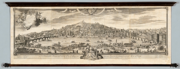
Author
[Cleric, François, Poilly, François]
Full Title
Vue d'une partie de la ville de Lion dessignee dans le maison de Mrs. les Chanoines regulliers de St. Antoine.
List No
15885.000
Author
[Grégorie, R. P, Seraucourt, Claude]
Full Title
Plan Géometral de la Ville de Lyon
List No
15886.000
Author
[Claps, Manuel J., Peuser, Talleres J.]
Full Title
(Covers to) Mapa de los Ferrocarriles de la República Argentina. Compilado y publicado por la Administración General de los Ferrocarriles del Estado. Segunda edición, corregida y aumentada, 1930. Ing. Manuel J. Claps, Administrador General de los FF. CC. del Estado (1).
List No
14290.001
Note
Covers to Mapa de los Ferrocarriles de la República Argentina, published in 1930 by the Administración General de los Ferrocarriles del Estado. Bound in brown board with embossed, gilded title, statement of responsibility and imprint on front cover. Verso of front cover decorated with purple moire-patterned end paper. Interior of both front and back covers have gilded ornamental borders.
Author
[Claps, Manuel J., Peuser, Talleres J.]
Full Title
Mapa de los Ferrocarriles de la República Argentina. Compilado y publicado por la Administración General de los Ferrocarriles del Estado. Segunda edición, corregida y aumentada, 1930. Manuel J. Claps, Administrador General ; Talleres J. Peuser, Buenos Aires.
List No
14290.002
Note
Colored railway map of Argentina. Shows political boundaries, cities and towns, railway routes and stations, topography, lakes, drainage, salt flats, marshlands, coastlines and islands. Relief shown with hachures. Includes latitudinal and longitudinal lines, a bar scale and a legend indicating different railway lines. With twenty-four inset maps showing city plans: Parana -- Mendoza -- Santiago del Estero -- Rosario -- Buenos Aires y partidos limitrofes -- Santa Fe -- Córdoba -- Jujuy -- Corrientes -- Resistencia -- Comodoro Rivadavia -- Viedma ; Carmen de Patagones -- Bahía Blanca -- San Juan -- Tucuman -- Puerto Deseado -- San Antonio Oeste -- Catamarca -- La Rioja -- Formosa -- Diamante -- San Luis -- Salta -- La Plata. Each corner of the map has the seal of the Administración General del Estado. Map segmented in forty-eight rectangles and mounted on folded linen. Map is 274 x 148 cm, on sheet 289 x 160 cm, folded to 37 x 27 cm. Folded map housed within board covers.
Author
Marión, Juan
Full Title
(Covers to) Mapa comercial de las Repúblicas Argentina, Chile, Uruguay y Paraguay. Oficina Cartografica de Juan Marión - Colussi, Calle Chile No 942, Buenos Aires (1).
List No
14291.001
Note
Covers to Mapa comercial de las Repúblicas Argentina, Chile, Uruguay y Paraguay published in 1930 by the Oficina Cartografica de Juan Marión. Bound in red board with embossed, gilded title and imprint on front cover, as well as embossed decorative border. Verso of front cover decorated with orange marbled end paper.
Author
Marión, Juan
Full Title
Mapa geografico-comercial con la red completa de ferrocarriles de la Republicas Argentina, Chile, Uruguay y Paraguay. Construdido con los datos mas recientes por Ing. I. Marion-Colussi. Buenos Aires, 1919. Oficina Cartografica de Juan Marion, Colussi, Calle Chile 942, Buenos Aires ; Tipo-Lito Ernesto Bianchi, San Martin 543, Buenos Aires.
List No
14291.002
Note
Colored railway map of Argentina, Chile, Uruguay and Paraguay. Shows political boundaries, cities and towns, railway routes and stations, topography, lakes, drainage, jungles, salt flats, marshlands, coastlines and islands. Relief shown with hachures. Includes latitudinal and longitudinal lines, a bar scale, compass rose and a legend indicating different railway lines. With eight inset maps: Bolivia y parte norte de Chile -- Parte sur de Argentina y Chile -- Mendoza -- Bahia Blanca -- Alrededores de Buenos Aires -- Planisferio. World map includes distances between international ports. Map segmented in thirty-six rectangles and mounted on folded linen. Map is 191 x 134 cm, on sheet 213 x 148 cm, folded to 36 x 25 cm. Folded map housed within board covers.
Author
Buckingham, David W.
Full Title
Map OF THE CITY OF NEW HAVEN, FROM ACTUAL SURVEY, by D. W. Buckingham, COUNTY SURVEYOR
List No
15785.000
Author
Propaganda Department of the Imperial Japanese Navy (海軍省海軍軍事普及部)
Full Title
海國日本圖繪 紀元二千六百年紀念 / [Depiction of Maritime Japan, to Commemorate the 2600th Anniversary of the Imperial Family].
List No
15730.000
Author
Church, A. F. (Ambrose F.)
Full Title
Topographical township map Inverness County, Nova Scotia
List No
15663.000
Note
Scanned reproduction of the original 4 sheet lithographic map.
Author
Chenteau, (T.)
Full Title
Carte philosophique et mathematique dediee a Son Altesse Royale Monseigneur le Due Charles Alexandre de Lorraine et de Bar &c. Par son Tres Humble et Obeissant Serviteur T. du Chenteau. Accompagnee du Calendrier Magique et Perpetuel contenant la contemplation des choses les plus profondes et les plus secrettes avec la connaissance complette de la philosophie, le tout dessine et grave dans un nouvel ordre, rectifie et combine avec les articles du titre suivant. Par Monsieur T ... du Chenteau Mathematicien, le Miroir de toute la Nature, Harmonie du Macrocosme avec le Microcosme, la Science cabalistique, nrnnerique et theosophique. (Philosophical and mathematical map dedicated to His Royal Highness Monsignor the Due Charles Alexandre de Lorraine et de Bar &c. By his Most Humble and Obedient Servant T. du Chenteau. Accompanied by the Magical and Perpetual Calendar containing the contemplation of the deepest and most secret things with the complete knowledge of philosophy, the whole drawn and engraved in a new order, rectified and combined with the articles of the following title. By Monsieur T ... du Chenteau Mathematician, the Mirror of all Nature, Harmony of the Macrocosm with the Microcosm, Cabalistic, Neurological and Theosophical Science.)
List No
15603.000
Author
[Harrison, Richard Edes, Nystrom (Firm)]
Full Title
(Clear roll down layer) World : landform sculptural relief by Richard Edes Harrison
List No
15594.001
Note
Date estimated.
Author
[Harrison, Richard Edes, Nystrom (Firm)]
Full Title
World : landform sculptural relief by Richard Edes Harrison
List No
15594.002
Note
Date estimated.
Author
[Church, A. F. (Ambrose F.), Walling, Henry Francis, 1825-1888]
Full Title
Topographical township map of Halifax County, Nova Scotia / from actual surveys made, drawn, & engraved by and under the direction of H.F. Walling. Map of Nova Scotia and adjacent provinces
List No
15598.000
Author
Kiepert, Heinrich, 1818-1899
Full Title
(Covers to) Wandkarte zur Erlauterung der biblischen Erdkunde alten und neuen Testaments. im Auftrage der stadtischen Schuldeputation zu Berlin zum Schulgebrauch bearbeitet von H. Kiepert. Vier blatter. Maasstab 1 : 3,000,000. Berlin, Verlag von Dietrich Reimer. 1872. Lith v. C.L. Ohmann. (inset) Die Wuste zwischen AEgypten und Canaan mit der Halbinsel des Sinai im dreifachen Massstabe der Hauptkarte.
List No
13094.001
Note
Kiepert's school wall map of the biblical geography of the Old and New Testaments, on sheet 98x129 dissected and mounted on linen, folded into covers 32x49, with title pasted on front cover. Includes inset map of the Sinai Peninsula. Map depicts the Near and Middle East during biblical times, extends from Rome to the Persian Gulf and the Red Sea. The Holly Land in the center is shaded in pink. Shows the Twelve Tribes territories dotted with names of numerous cities and locations. The four sets of colored lines mark the travels of Paul the Apostle. Relief shown by shading. Prime meridian is Ferro.
Author
Kiepert, Heinrich, 1818-1899
Full Title
Wandkarte zur Erlauterung der biblischen Erdkunde alten und neuen Testaments. im Auftrage der stadtischen Schuldeputation zu Berlin zum Schulgebrauch bearbeitet von H. Kiepert. Vier blatter. Maasstab 1 : 3,000,000. Berlin, Verlag von Dietrich Reimer. 1872. Lith v. C.L. Ohmann. (inset) Die Wuste zwischen AEgypten und Canaan mit der Halbinsel des Sinai im dreifachen Massstabe der Hauptkarte.
List No
13094.002
Note
Kiepert's school wall map of the biblical geography of the Old and New Testaments, on sheet 98x129 dissected and mounted on linen, folded into covers 32x49, with title pasted on front cover. Includes inset map of the Sinai Peninsula. Map depicts the Near and Middle East during biblical times, extends from Rome to the Persian Gulf and the Red Sea. The Holly Land in the center is shaded in pink. Shows the Twelve Tribes territories dotted with names of numerous cities and locations. The four sets of colored lines mark the travels of Paul the Apostle. Relief shown by shading. Prime meridian is Ferro.
Author
Whitaker & Ray Co.
Full Title
Grapho-Relief Map of the Bay Counties compiled from the latest and most accurate Official Data
List No
15460.000
Note
Copyright is 1907, so there were likely earlier issues.
Author
Scott and Child
Full Title
Indexed Map of the City and County of San Francisco Showing Official Grades and Subdivisions. Compiled from Latest Public and Private Data by Scott and Child Map Publishers Anglo Building 18th & Mission St's S.F. Phone Market 3638.
List No
15429.000
Author
Garcia Cubas, Antonio, 1832-1912
Full Title
Plano Topográfico de la ciudad de Mexico formado por el Ingeniero… con las nuevas calles abiertas hasta la fecha y los ferrocarriles. 1903. Mexico [Paris]. publicado por la Antigua Librería de M. Murguía, 2, Coliseo Viejo, 2
List No
15399.000
Note
Engraved by L. Poulmaire, 1 calle Vaulequin, Paris
Author
Arrowsmith, Samuel
Full Title
Map of Africa Constructed for the Use of the National Schools of Ireland, under the Direction of the Commissioners, by S. Arrowsmith, Hydrographer to the King
List No
15196.000
Author
Arrowsmith, Aaron
Full Title
[Western Hemisphere, Map of the World on a Globular Projection Exhibiting Particularly the Nautical Researches of Capn. James Cook, F.R.S. with all the Recent Discoveries to the Present Time carefully Drawn by A. Arrowsmith . . . ]
List No
15293.000
Author
Arrowsmith, Aaron
Full Title
[Eastern Hemisphere, Map of the World on a Globular Projection Exhibiting Particularly the Nautical Researches of Capn. James Cook, F.R.S. with all the Recent Discoveries to the Present Time carefully Drawn by A. Arrowsmith . . . ]
List No
15294.000
Author
[A.J. Nystrom & Co., Dimond, Stanley, Beamer, Miles]
Full Title
(Covers to) Citizenship For Democracy Charts
List No
15184.001
Author
[A.J. Nystrom & Co., Dimond, Stanley, Beamer, Miles]
Full Title
1. Uncle Sam Grows Up
List No
15184.002
Author
[A.J. Nystrom & Co., Dimond, Stanley, Beamer, Miles]
Full Title
2. The United States - A Good Place to Live
List No
15184.003
Author
[A.J. Nystrom & Co., Dimond, Stanley, Beamer, Miles]
Full Title
3. Growth of Communication by Generations
List No
15184.004
Author
[A.J. Nystrom & Co., Dimond, Stanley, Beamer, Miles]
Full Title
4. Growth of Transportation by Generations
List No
15184.005
Author
[A.J. Nystrom & Co., Dimond, Stanley, Beamer, Miles]
Full Title
5. The People of the United States
List No
15184.006
Author
[A.J. Nystrom & Co., Dimond, Stanley, Beamer, Miles]
Full Title
6. Population Trends
List No
15184.007
Author
[A.J. Nystrom & Co., Dimond, Stanley, Beamer, Miles]
Full Title
7. Immigration and Naturalization
List No
15184.008
Author
[A.J. Nystrom & Co., Dimond, Stanley, Beamer, Miles]
Full Title
8. How Crowded are the Countries of the World
List No
15184.009
Author
[A.J. Nystrom & Co., Dimond, Stanley, Beamer, Miles]
Full Title
9. Living in a Democratic Country
List No
15184.010
Author
[A.J. Nystrom & Co., Dimond, Stanley, Beamer, Miles]
Full Title
10. Living in a Totalitarian or Communistic Country
List No
15184.011
Author
[A.J. Nystrom & Co., Dimond, Stanley, Beamer, Miles]
Full Title
11. How Communists Gain Control of Noncommunist Governments
List No
15184.012
Author
[A.J. Nystrom & Co., Dimond, Stanley, Beamer, Miles]
Full Title
12. Freedom of Enterprise
List No
15184.013
Author
[A.J. Nystrom & Co., Dimond, Stanley, Beamer, Miles]
Full Title
13. Energy of the United States
List No
15184.014
Author
[A.J. Nystrom & Co., Dimond, Stanley, Beamer, Miles]
Full Title
14. The Kinds of Work We Do
List No
15184.015
Author
[A.J. Nystrom & Co., Dimond, Stanley, Beamer, Miles]
Full Title
15. How the Social Security Administration Works
List No
15184.016
Author
[A.J. Nystrom & Co., Dimond, Stanley, Beamer, Miles]
Full Title
16. Division of United States Income
List No
15184.017
|


![海國日本圖繪 紀元二千六百年紀念 / [Depiction of Maritime Japan, to Commemorate the 2600th Anniversary of the Imperial Family].](https://www.davidrumsey.com/rumsey/Size2/RUMSEY~8~1/205/15730000.jpg)


![[Western Hemisphere, Map of the World on a Globular Projection...]](https://www.davidrumsey.com/rumsey/Size2/RUMSEY~8~1/199/15293000.jpg)
![[Eastern Hemisphere, Map of the World on a Globular Projection...]](https://www.davidrumsey.com/rumsey/Size2/RUMSEY~8~1/199/15294000.jpg)


