|
REFINE
Browse All : Wall Map of New Jersey
1-3 of 3
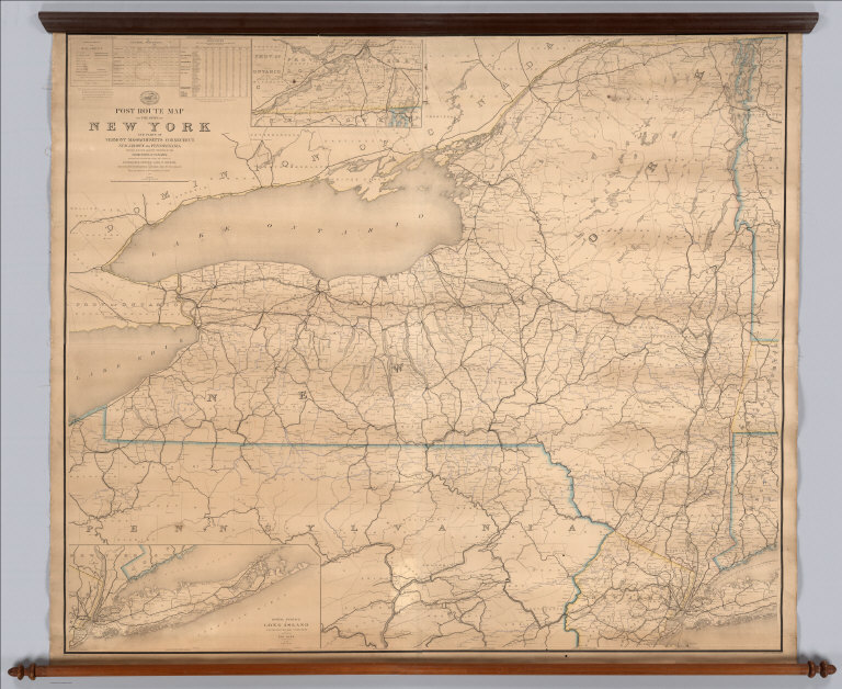
United States. Post Office Department; N... Post Route Map Of The State Of New York 1872 2268.000 Related Author
[Nicholson, W. L., United States. Post Office Department]
Full Title
Post Route Map Of The State Of New York And Parts Of Vermont, Massachusetts, Connecticut, New Jersey And Pennsylvania, Showing Also The Adjacent Portions Of The Dominion Of Canada. Designed And Constructed Under The Orders Of Postmaster General Alex. W. Randall And Second Asst. Postmaster General Geo. Wm. McLellan By W.L. Nicholson, Topographer Of P.O. Dept. 1868. Drawn by Paul Goepel. Engraved by D. McClelland, Washn. D.C. (seal) Post Office Department United States Of America "With Celerity, Certainty And Security." (inset) Prov. Of Ontario. (inset) Postal Service Of Long Island With The Principal Mail Connections Of The City Of New York.
List No
2268.000
Note
In the Explanation of the Mail Service note, it reads "The Service on this Diagram brought up to the date of Aug. 1st 1872", with most of the date in ms. Outline color by state. Brown top and bottom rollers.
Author
Colton, J. H.
Full Title
Colton's Map of New Jersey. Prepared for the State Insurance Company, Office No.9 Exchange Place, Jersey City. Entered ... 1855 by J.H. Colton & Co. ... New York. C.O. Jones 76 Cedar St. N.Y. (advertisement above map) The State Insurance Company. Stock Company. Charter Perpetual. Office Jersey City, 9 Exchange Place ...
List No
2287.000
Note
Colton sold his maps for uses like this. The map is surrounded by advertisements for the Insurance Company. Full color by county. With black top and bottom rollers.
Author
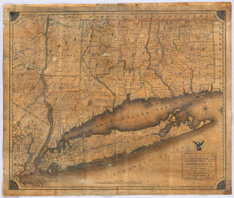
Damerum, William
Full Title
Map of the Southern part of the State of New York including Long Island, the Sound, the State of Connecticut, part of the State of New Jersey and Islands adjacent. Compiled from actual late Surveys. Designed, Drawn and Published 1815 by Wm. Damerum, General Surveyor, New York. Copy Secured. P. Maverick sct.
List No
2676.000
Note
Streeter's copy. Engraved by P. Maverick. Thompson: "A handsome engraving, quite rare." See Never's 1852 edition for a resurrection of this plate 37 years later (see our copy, #2562), and Stebbins map of 1859, still using this map as a base. The sixteen stars that surround the eagle above the title supposedly represent the number of states in the union in 1815. Outline color by county.
1-3 of 3
|