|
REFINE
Browse All : View and Title Page
1-31 of 31
Author
[Barker, Henry Aston, Burford, Robert]
Full Title
(Title page to) Description of the view of Venice, taken, and painted by Messrs. Barker and Burford, from the Piazza di S. Marco : with a representation of the carnival : now exhibiting in their Panorama, Strand
List No
15930.002
Author
Siebold, Phillip Franz von
Full Title
1. [Titelbild zum ganzen Werk]
List No
15438.006
Author
Cadolle, August (1782-1849)
Full Title
(Title page to) Vues de Moscou. Dediees a Sa Majeste Alexandre 1er. Empereur et Autocrate de Toutes Les Russies, Roi de Pologne, etc., etc. Dessinees par A. Cadolle...Avec Texte.
List No
15327.002
Author
[Panckoucke, C. L. F. (Charles Louis Fleury), 1780-1844, France. Commission des sciences et arts d'Egypte]
Full Title
Fac-Simile Des Monumens Coloriés De L'Égypte D'après Le Tableau De C.L.F. Panckoucke, Chevalier De La Légion d'Honneur, Editeur De La Description De l'Egypte, 2.E Edition. 1825. Antiquites Tome Premier.
List No
10404.007
Note
Antiquites I
Author
[El Lissitsky, Rodionov, F. E.]
Full Title
(Title page to) Raboche-Krest’ianskaia Krasnaia Armiia. [Red Army of Workers and Peasants].
List No
15162.004
Author
Blaeu, Willem Janszoon, 1571-1638
Full Title
(Title Page to) Het Licht der Zee-vaert daerinne claersyck beschreven ende afghebeeldet werdé, alle de Custen end Havenen; vande Westersche, Noordsche, Oostersche ende Middelandsche Zee'n. Dock van vele Landen, Eylanden ende plaetsen van Guinea, Brasilien, Oost ende West-Indien. Wt de alderbeste Zeebeschryvers gheschriften (als Locas Ians z. Waghenaer ende meer andere) eenfdeels vergadert: maer uyt vele ervarene Zeevaerders schriften ende mondtlycke verclaringhen van alle verlopen ghebetert, ende met veel nieuwe beschryvinghen ende Caerten seer vermeerdert. Alles ghedeelt in vier boecken, waer van yders inhoudt voor elck uytghedruckt staet. Hier zyn byghevoeght (beneffens eene onderwysinghe in de conste der Zeevaert) nieuwe tafelen van der zonnen declinatie, gherekent uyt de observation van Tyche Brahe, ende gherecht op de Meridiaen van Amsterdam. Midsgaders nieuwe tafelenende onderwys van't recht ghebruyck der Noordsterre ende andere vaste sterren alle Zeevarende luyden te nut ghedaen. Door Willem Ians Zoon. Tot Amsterdam. Anno 1620.
List No
14351.002
Note
Title page to Het Licht der Zee-vaert. Includes an engraved illustration of two figures, as well as a view showing the port of Amsterdam. Title translates (loosely) to: The Light of the Sea, which is described and depicted; all the coasts and the ports of the Western, Northern, Eastern and Mediterranean Seas. Docks of many countries, islands and the places of Guinea, Brazil, East and the West Indies. With the best sea writings … with many new descriptions … Everything is divided into four books … Here are new tables of the sun’s declination, based on the observation of Tyche Brahe …
Author
Emslie, John, 1813-1875
Full Title
Title Page: A popular description of the steam engine, designed to convey a clear idea of the principle and action of that wonderful machine. London: James Reynolds, 174, Strand.
List No
14330.003
Note
Title page to A popular description of the steam engine. Appears on the cover of 16-page text booklet within portfolio. Booklet preceded by Double action condensing steam engine and followed by ... . Date penciled beneath imprint: C. 1848. With pasted newsprint description of work, taken from "The Daily Telegraph ; W. Oct. 26, 1892." which is handwritten in ink beneath clipping. Descriptive text begins: In a compact little volume Mr. Clement E. Stretton, C.E., tells the story of "The Locomotive Engine and its development". (Page number inferred.)
Author
Hermelin, Samuel Gustaf Benzelstierna
Full Title
(Title Page to) Geographiske chartor ofver Swerige : med Hans Maje. Konung Gustaf den Fjerde Adolphs allernadigste tillstand : utgifne af Friherre S.G. Hermelin. Forsta Ufdelningen, De Norda Landsorter. Stockholm 1797. (to accompany) Geografiske kartor ofver Swerige. 1805.
List No
13427.003
Note
Title page to the 1st. department: The Northern Countryside. Consists of maps 1-5. Includes view of Kadrija jock waterfall in northern countryside Sweden. Drawn by C. Wallman. Engraved by Fr. Akrel and dedication statement.
Author
Hermelin, Samuel Gustaf Benzelstierna
Full Title
(Title Page to) Geografiske chartor ofver Swerige : med Hans Majts Konung Gustaf den fjerde Adolphs allernadigste tillstand, utgifne af Friherre S.G. Hermelin. Andra afdelningen: Storfurstendomet Finland. Stockholm 1799. (to accompany) Geografiske kartor ofver Swerige. 1805.
List No
13427.009
Note
Title page to the 2nd. department: Grand Duchy of Finland. Consists of maps 6-11. With view of Wermasvuori to Sjoarne Jokijar and Umolanselka, drawn by C.P. Hallstrom. Engraved by J.F. Martin.
Author
Ogilby, John, 1600-1676
Full Title
(Frontispiece) Britannia Vol 1.
List No
9735.002
Note
First edition, large paper copy. Chubb: "This is the first survey of the roads of England and Wales. It is composed of 102 copper plates and 200 pages of text. The maps are engraved on strips representing bands of ribbon of about 2 1/2 inches in width. On most plates six strip maps are given; but in some cases there are seven. They show the main roads only with the side roads indicated. The distances are shown in miles along the roads, and the villages and mansions named, and in some cases the names of residents are given." Ogilby was one of the finest mapmakers of his day in England and he intended to publish two additional volumes in this series: a volume of city views and a volume of topographical descriptions of all of England and Wales. Ogilby's method of strip maps to show roads was copied well into the twentieth century. While it is familiar to us today, in 1675 it was a radical departure from conventional cartographic methods.
Author
[Montenegro, Roberto, Ludkins, Fred, Terry, T. Philip, Martinez, Judith]
Full Title
(Title Page) A Map of Mexico. (View) Nayarit.
List No
7859.002
Note
Includes dramatic illustration of Nayarit. Foldout.
Author
[Gunnison, J.W., Preuss, C., Stansbury, Howard]
Full Title
(Title Page to) Exploration and Survey of the Valley of the Great Salt Lake of Utah, including a Reconnoissance of a new Route through the Rocky Mountains. By Howard Stansbury ... (with view) Fort Utah on the Timpanogas - Valley of the Great Salt Lake. Philadelphia: Lippincott, Grambo & Co. 1852.
List No
0950B
Note
Title page with facing view by A. Fay.
Author
Burr, David H., 1803-1875
Full Title
(Title Page to) An atlas of the State of New York, containing a map of the State and of the several counties ... under the superintendance & direction of Simeon DeWitt, Surveyor General, pursuant to an Act of the Legislature, and also the physical geography of the State & of the several counties & statistical tables of the same, by David H. Burr. (with) View on the Hudson near Fishkill. New York, published by David H. Burr. 1829. Engravd. by Rawdon, Clark & Co. Albany & Rawdon, Wright & Co., New York.
List No
0103C
Note
This atlas is the second atlas published in the 19th century of one of the individual states in the U.S., preceded only by Mill's Atlas of South Carolina, issued in 1825, and followed closely, also in 1829, by Greenleaf's Atlas of the State of Maine (Ristow, p96). This copy is the 1st edition, second state, actually published in 1832. Howard Welsh rescued this copy which was obviously about to be broken up and disbound. When we acquired it from his estate it was completely disbound; subsequently we had it rebound and restored. The Map of the City and County of New York is dated 2nd. ed., 1832 ; Haskell 725 lists this as appearing in the 1829 ed. of the Atlas. Therefore, we can presume that there are two 1829 eds., the first state with this map dated 1829 (Haskell 721) and the second state which is this copy with the 1832 map (Haskell 725). The Map of New York State is also dated 1832. All other maps are dated 1829. Full hand painted color. Bound in half leather marbled paper covered boards with "New York Atlas" stamped in gilt on the spine.
Author
Powell, John Wesley, 1834-1902
Full Title
(Title Page to) Canyons of the Colorado by J.W. Powell, Ph.D., LL.D., ... With many illustrations. Meadville, Pa. Flood & Vincent. The Chautauqua-Century Press, M DCCC XCV. (with frontispiece: Portrait of) J.W. Powell. (on verso) Copyright, 1895 By Flood & Vincent.
List No
0740B
Note
Color title page and facing portrait. First complete narrative. 100 copies printed. Scarce. Cloth covered boards with "Canyons of the Colorado. J.W. Powell" engraved on the cover.
Author
[Photomap Company, First National Trust and Savings Bank of Pasadena]
Full Title
(Covers to) Aerial photomap of Pasadena. Published free for distribution by the First National Trust and Savings Bank of Pasadena. Western Litho. Co. Los Angeles.
List No
13216.001
Note
Aerial view of Pasadena, on sheet 80x80, folded to 21x11. Taken from an altitude of 8,000 feet. Shows business and residential sections, orchards, roads, railroads and electric railways. Includes key to Photomap and index to streets. Title from cover. Text and photos on verso.
Author
Hermelin, Samuel Gustaf Benzelstierna
Full Title
(Title Page to) Geografiske chartor ofver Swerige : Utgifne af Friherre S.G. Hermelin. Tredje afdelningen: Svea rike. Stockholm 1801. (to accompany) Geografiske kartor ofver Swerige. 1805.
List No
13427.016
Note
Title page to the 3rd. part: Covering Sweden. Consists of maps 12-18. With view of "Utsigt af Stockholms stad", drawn and engraved by J.F. Martin.
Author
Hermelin, Samuel Gustaf Benzelstierna
Full Title
(Title Page to) Med Kongl. Majts. Nadigste Tillstand : Geografiske kartor ofver Swerige : Utgifne af Friherre S.G. Hermelin. Fjerde afdelningen : Gotarike. Stockholm 1807. (to accompany) Geografiske kartor ofver Swerige. 1805.
List No
13427.024
Note
Title page to the fourth part: Covering Gota Kingdom. Consists of maps 19-30. With view of "Utseende af Trapplager vid Halleberg i Westergotland", engraved by C. Akrel.
Author
[Nusret, Milford Haven, Louis Alexander Mountbatten, Marquis of, 1854-1921]
Full Title
(Title Page to) [Martin'in manevra levhasiyla Batenberg'in rota müs'irinin sûret-i istimaline mahsûs talimat].
List No
14475.003
Note
Title page to [Martin'in manevra levhasiyla Batenberg'in rota müs'irinin sûret-i istimaline mahsûs talimat]. Text in Arabic, printed in black and red. Translated in handwritten annotation into Turkish, which translates to: Martin's maneuvering plate and Batenberg's instruction for the use of navigation. Facing page has a hand-drawn illustration in pencil, including arrows indicating directions.
Author
Everts & Kirk
Full Title
(Title Page to) The official state atlas of Nebraska. Compiled from government surveys, county records and personal investigations. (with view of the State Capitol). Philadelphia, Everts & Kirk, 1885. (on verso) Copyright, 1885, Everts & Kirk.
List No
2719B
Note
Lithograph, b&w.
Author
[Everts & Co., Haskell & Wood, L.H. Everts & Co.]
Full Title
(Title Page to) The official state atlas of Kansas compiled from government surveys, county records and personal investigations. Philadelphia. L.H. Everts & Co. 1887. (on verso:) Copyright, 1887, L.H. Everts & Co. (with view:) State Capitol, Topeka, Kan. Haskell & Wood, Arch's. F.F. Goist Sc.
List No
2818B
Note
Huge atlas, many maps and views, scarce. With 340 numbered pages (plus many unnumbered pages) of maps and views this must be the largest State Atlas published (Andreas' Iowa has 250 pages of maps and views). The views show the remarkable development of the state over two decades after the Civil War. Many large folding maps of cities are included. Bound in new burgandy cloth covered boards with "The Official Atlas Of Kansas 1887" stamped in gilt. Maps hand painted in full color.
Author
Andreas, A. T. (Alfred Theodore), 1839-1900
Full Title
(Title Page to) An illustrated historical atlas of the State of Minnesota. (with view:) Lake Emily, Le Sueur Co., Minn. near St. Peter. Published by A.T. Andreas, Lakeside Building, Chicago, Ills. 1874. Chas. Shober & Co. Proprietors of Chicago Lith. Co.
List No
3034B
Note
Special ed. with three city views added, as issued. This deluxe ed. added views of Minneapolis, St. Paul, and Winona. It is bound in embossed red cloth covers (green for the regular ed.) with marbled end papers. The regular ed. was a much larger press run and was distributed to all the schools in the state. This special ed. is rare, especially with the views still present. This copy is from the collection of the former Governor of Minnesota, Elmer Andersen. Hand painted and printed in full color. Front and back covers stamped with "Illustrated historical atlas of the State of Minnesota. 1874" in gilt.
Author
Reynolds & Proctor
Full Title
(Title Page to) Illustrated atlas of Sonoma County, California. Compiled and published from personal examinations, official records and actual surveys. Published by Reynolds & Proctor, Santa Rosa, Cal. Entered ... 1897, by Reynolds & Proctor, Santa Rosa, Cal. (1898)
List No
3341B
Note
Lithographed title page, b&w with view of the "Court House."
Author
[Cook, James, 1728-1779, Furneaux, Tobias, 1735-1781, Hodges, William, 1744-1797]
Full Title
(Title Page to) A voyage towards the South Pole, and round the World. Performed in His Majesty's ships the Resolution and Adventure, in the years 1772, 1773, 1774, and 1775. Written by James Cook, Commander of the Resolution ... In two volumes illustrated with maps and charts ... The second edition. (with portrait) Captain James Cook, F.R.S. Painted by Wm. Hodges. Engraved by J. Basire, 1777. London: Printed for W. Strahan; and T. Cadell in the Strand. MDCCLXXVII.
List No
3404.001
Note
Engraved illustration faces t.p. and measures 29 x 22 cm.
Author
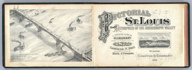
[Compton, Richard J., Dry, Camille N.]
Full Title
(Title Page to) Pictorial St. Louis, the great metropolis of the Mississippi Valley; a topographical survey drawn in perspective A.D. 1875, by Camille N. Dry, designed & edited by Rich. J. Compton. St. Louis. Compton & Company, 1876. Western Engraving Co. St. Louis.
List No
4209B
Note
Lithographed title page with small view of Eads Bridge. Facing frontispiece is larger bird's-eye view of the bridge by C.N. Dry. "I consider this an excellent and faithful representation of the bridge. Apl. 30th, 1874. Jas. B. Eads."
Author
[Beers, J.B. & Co., H.W. Burgett and Company]
Full Title
(Title Page to) Illustrated topographical and historical atlas of the State of Vermont. (with view:) State House, Montpelier, Vt. Published by H.W. Burgett & Co. 36 Vesey Street, New-York. 1876. Entered ... 1876 by H.W. Burgett & Co. ... Washington D.C. Engraved & printed by J.B. Beers & Co. 36 Vesey St. N.Y.
List No
4633B
Note
This scarce atlas is styled after the Andreas atlases of Iowa and Minnesota, although the views are more frequently of commercial establishments than homes or farms. It is very well done, and the only known production of H.W. Burgett. County maps in full color by township. Covers are half leather black cloth covered boards with "Illustrated Combination Atlas Of Vermont. 1876. Freedom And Unity" embossed in gilt on the front and back. Irregular paging.
Author
[Glover, E. S., Illustrated Directory Company]
Full Title
(Title Page to) The illustrated directory; a monthly magazine of American cities. Published by the Illustrated Directory Co. ... Copyrighted 1894, by Eli S. Glover. Vol 1, no. 2. Jan. 1895. Market St., San Francisco, from water front to Second St. (with view: Market St., south side, Ferry Bldg. to Steuart St.)
List No
4642D
Note
Title page with view of drawn illustrations of building street fronts and business establishments. Includes key.
Author
[Glover, E. S., Illustrated Directory Company]
Full Title
(Title Page to) The illustrated directory; a monthly magazine of American cities. Published by the Illustrated Directory Co. ... Copyrighted 1894, by Eli S. Glover. Vol 1, no. 3. Feb. 1895. Market St., San Francisco, continuous from Second to Fifth St. (with view) Market St. - south side - from Second to New Montgomery St.
List No
4642F
Note
Title page with view of drawn illustrations of building street fronts and business establishments. Includes key.
Author
[Glover, E. S., Hicks-Judd Company]
Full Title
(Title Page to) The illustrated directory; a monthly magazine of American cities. Published by the Hicks-Judd Co. Copyright 1895, by Eli S. Glover. Vol 1, no. 4. March, 1895. Market St., San Francisco, continuous from Fifth St. to Tenth St. (with view) Market St. - south side - from Fifth St. west.
List No
4642H
Note
Title page with view of drawn illustrations of building street fronts and business establishments. Includes key.
Author
[Glover, E. S., Hicks-Judd Company]
Full Title
(Title Page to) The illustrated directory; a monthly magazine of American cities. Published by the Hicks-Judd Co. Copyright 1895, by Eli S. Glover. Vol 1, no. 8. September, 1895. Front St. - north from Market St. to Clay St. Pine St. - west from Market St. to Kearny St. (with view) Front St. - west side - from Market to Pine St.
List No
4642P
Note
Title page with view of drawn illustrations of building street fronts and business establishments. Includes key.
Author
Hayes, Eli L.
Full Title
(Title Page to) Illustrated atlas of the Upper Ohio River and Valley from Pittsburgh, Pa. to Cincinnati, Ohio. From United States official and special surveys compiled & drawn for the publishers by E.L. Hayes, assisted by E.F. Hayes, C.M. Beresford, assisted by S.A. Charpiot, F.L. Sanford, J.H. Sherman. Published by Titus, Simmons & Titus, 27 South Sixth Street Phila. 1877. Eng. by Worley & Bracher, 27 So. Sixth St. Phila, Pa. Printed by H.J. Toudy & Co. 623 Commerce St. Phila, Pa. Oldach & Mergenthaler Binders, S.E. Cor. 4th & Cherry Sts. Phila. Entered ... 1877, by Titus Simmons & Titus ... Washington. (view by) A. Ruger, del ...
List No
4975B
Note
Includes "View on the Ohio River taken from near East Liverpool, embracing parts of Ohio, West Virginia & Pennsylvania, A. Ruger del." This is perhaps the most extraordinary "county atlas" produced in the 19th century. Although it is a regional atlas in scope, covering both sides of the Ohio River from Pittsburgh to Cincinnati, in format it is county atlas with views, maps, and advertising directories of the local towns, cities, residences, and businesses along the river. There are 26 double page maps of the Ohio River, plus an index sheet, that are beautifully drawn and colored, as well as numerous maps of towns and cities on the river. The views frequently show the river and river boat traffic, the inside and outside of factories (an inside view of a glass blowing factory is amazing), and farms and residences. There are large fold out maps of Pittsburgh and Cincinnati. When taken all together, the effect is stunning. This atlas has become rare, with few copies surviving the "breaker's" temptation to cut it up. Rieger rates it "of extraordinary importance" and "extremely scarce." Bound in half leather dark brown cloth covered boards with "Illustrated Atlas Of The Upper Ohio River & Valley. From Pittsburgh Pa. To Cincinnati O. Titus, Simmons & Titus." stamped in gold. Full and outline color.
Author
Klinckowstrom, Axel Leonhard
Full Title
Title Page to: Atlas til Friherre Klinckowstroms Bref om de Forente Staterne. (Stockholm) Stente af C. Muller, (1824)
List No
5757B
Note
Gray paper cover with title: Atlas till (sic) Friherre Klinkowstroms (sic) Bref om de Forenta Staterna. View on title page: Presidentons i de Forente Staterna recidence i Washington. Pl. 11 "Esquisse af Wards taffla i Earles galleri i Philadelphia" is photocopy. To accompany the author's Bref om de forente Staterne, forfattade under en resa till Amerika aren 1818, 1819, 1820 (Stockholm: Ecksteinska tryckeriet, 1824)
1-31 of 31
|

![1. [Titelbild zum ganzen Werk]](https://www.davidrumsey.com/rumsey/Size1/RUMSEY~8~1/205/15438006.jpg)


![Title: Raboche-Krest’ianskaia Krasnaia Armiia. [Red Army of Workers and Peasants].](https://media.davidrumsey.com/MediaManager/srvr?mediafile=/Size3/RUMSEY~8~1/199/15162004.jpg)


![Title: [Martin'in manevra levhasiyla Batenberg'in rota müs'irinin sûret-i istimaline mahsûs talimat].](https://www.davidrumsey.com/rumsey/Size2/RUMSEY~8~1/205/14475003.jpg)