|
REFINE
Browse All : Title Page of Virginia
1-6 of 6
Author
Rand McNally and Company
Full Title
(Title Page to) Rand, McNally & Co.'s Virginia and West Virginia. (with 19 page index) Rand, McNally & Co.'s Indexed Maps Of Virginia And West Virginia ... Chicago: Rand, McNally & Co., Printers And Engravers, 77 & 79 Madison Street. (on verso) Entered ... 1877, by Rand, McNally & Co. ... Washington.
List No
0747.002
Note
Gazetteer. Very early Rand McNally pocket map. The map is from the Business Atlas of 1877. Printed outline color by county. Folded into red cloth covers 15.5x9 with "Rand, McNally & Co's. Indexed Map of Virginia And West Virginia." stamped in gilt.
Author
U.S. Coast Survey
Full Title
(Title Page to) Part of Henrico County Virginia from Smith's Map in the collection of the U.S. Coast Survey Office. (Another title below) Part of Henrico County from Smith's Map of Virginia with additions of Topography from Surveys made under the direction of Genl A.A. Humphreys, Chief Topl Engr. Army of Potomac. Photographed at the U.S. Coast Survey Office July 1862. (title on verso) Map of Part of Henrico County Virga. ...
List No
3846.002
Note
Contemporary photographic copy. Slightly different in title (which is in ms.) than the LOC copy. Mounted on linen with a ms label. Shows woodlands, roads and trails, rivers, streams, and householders' names in rural areas.
Author
[U.S. War Department, Weyss, John E.]
Full Title
(Title Page to) Military Maps Illustrating the Operations of the Armies Of The Potomac & James May 4th 1864 to April 9th 1865 including Battlefields of the Wilderness, Spottsylvania, North Anna, Totopotomoy, Cold Harbor, The Siege Of Petersburg And Richmond Battle-fields of Five Forks ... Maps partially prepared by order of Lieut. Genl. U.S. Grant ... Surveys and Maps were executed under the direction of Bvt. Brig. Genl. N. Michler ... and Bvt. Lieut. Col. P.S. Michie ... prepared for publication by Bvt. Brig. Genl. N. Michler ... under the authority of the Hon. Secretary of War. The Surveys and Maps relating to the Battle-fields ... under orders of Brig. & Bvt. Maj. Genl. A.A. Humphreys ...
List No
3881A
Note
Cover sheet of a series of 17 maps (see our #3880, #5343-5357).
Author
Hutchins, Thomas
Full Title
(Title Page to) A Topographical Description Of Virginia, Pennsylvania, Maryland, And North Carolina, Comprehending The Rivers Ohio, Kenhawa, Sioto, Cherokee, Wabash, Illinois, Mississippi, &c ... Published by Thomas Hutchins ... With A Plan of the Rapids of the Ohio, A Plan of the several Villages in the Illinois Country, A table of the Distances between Fort Pitt and the Mouth of the Ohio, all Engraved upon Copper ... London: Printed for the Author, and Sold by J. Almon, opposite Burlington House, in Piccadilly. MDCCLXXVIII.
List No
5045A
Note
First edition, second issue. Streeter: "Hutchins' work is one of the most valuable sources on the West during the British period." The book describes the country portrayed on Hutchins' "New Map of the Western Parts of Virginia, Pennsylvania, Maryland and North Carolina..." which was issued separately but at the same time as the book. With two folding maps, "A Plan of the Rapids, in the River Ohio" and "A Plan of the several Villages in the Illinois Country..."
Author
[Hotchkiss, Jed., Waddell, Joseph Addison]
Full Title
(Title Page to) Historical atlas of Augusta County, Virginia. Maps from original surveys, by Jed. Hotchkiss., Top. Eng. Its annals, by Joseph A. Waddell. Physiography, by Jed. Hotchkiss. Illustrated. Chicago, Ill.: Waterman, Watkins & Co., 1885. (on verso) Shepard & Johnston, Printers, 140-6 Monroe St., Chicago.
List No
5747B
Note
93 p. , illus., col. maps, ports. Brown morocco leather (with new black morocco spine and tips). In gilt on cover and blind stamped on back cover: Illustrated historical atlas of Augusta County, Virginia. 1885." David Rumsey Collection copy lacks geological map.
Author
[Hotchkiss, Jed., Waddell, Joseph Addison]
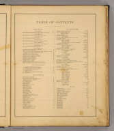
Full Title
(Contents to) Historical atlas of Augusta County, Virginia. Maps from original surveys, by Jed. Hotchkiss., Top. Eng. Its annals, by Joseph A. Waddell. Physiography, by Jed. Hotchkiss. Illustrated. Chicago, Ill.: Waterman, Watkins & Co., 1885.
List No
5747C
Note
Table of contents.
1-6 of 6
|