|
REFINE
Browse All : Title Page from 1845
1-26 of 26
Author
Fremont John Charles, 1813-1890
Full Title
(Title Page to) Report of The Exploring Expedition to The Rocky Mountains in the Year 1842, and to Oregon & North California In The Years 1843-44. By Brevet Capt. J. C. Fremont Of The Corps Of Topographical Engineers Under the orders of Col. J.J. Abert, Chief Of The Topographical Bureau. Printed by order of the Senate of the United States. Washington : Gales and Seaton, Printers. 1845.
List No
13406.002
Author
Fremont, J.C.
Full Title
(Title Page to) Report of The Exploring Expedition to The Rocky Mountains in the Year 1842, and to Oregon and North California in the Years 1843-'44.
List No
1833A
Author
[Smith, J. Calvin, Colton, J.H.]
Full Title
(Title Page to) The Western Tourist Or Emigrant's Guide Through The States of Ohio, Michigan, Indiana, Illinois, And Missouri, And The Territories Of Wisconsin And Iowa ... Accompanied with a Correct Map, showing the Township lines of the United States' Surveys ... New York: Published by J.H. Colton, 86 Cedar-Street. 1845. (on verso) Entered ... 1839, by J.H. Colton ... New-York.
List No
0190.002
Note
The first edition was 1839 by Smith, published by Colton. According to Howes, Smith's name was dropped from the title in 1843, however his name remained on the map. Compared to the 1839 map, there are many new counties in all the states and territories. Full color map bound in back and entitled, "Guide Through Ohio, Michigan, Indiana, Illinois, Missouri, Wisconsin & Iowa. Showing the Township lines of the United States Surveys ... By J. Calvin Smith. New York. Published by J.H. Colton, 86 Cedar St." At bottom, "Entered ... 1840, by J.C. Smith ... New York." 119 page guide book. Bound with brown linen and embossed on cover, "The Western Tourist and Emigrant's Guide Published by J.H. Colton. 1845."
Author
Woodbridge, William C.
Full Title
(Title Page to) Modern Atlas, Physical, Political And Statistical; Exhibiting On Separate Maps, The Physical And Political Characteristics Of Countries, The Prevailing Religions, Forms Of Government And Degrees Of Civilization, The Climates And Productions Of The Earth, And The Comparative Size Of Countries, Towns, Rivers And Mountains; Accompanied By Geographical And Statistical Tables. By William C. Woodbridge ... Entered ... 1843, by W.C. Woodbridge ... Massachusetts. Hartford. Published By Belknap And Hamersley.
List No
1229.002
Note
Physical maps and Political maps. Maps by J.M. Atwood, W. Williams, C. Pelton. Maps are without color or hand painted in full and outline color. Covers are heavy brown paper printed with "School Atlas, To Accompany The Modern School Geography, By William C. Woodbridge ... Hartford: Published By Belknap & Hamersley. Entered ... 1843, by William C. Woodbridge ... Massachusetts. Case, Tiffany & Co. Printers, Hartford, Conn."
Author
Tanner, Henry S.
Full Title
(Title Page to) The Traveller's Hand Book for the State of New York, The Province of Canada, and Parts of the Adjoining States ... By Which Every Interesting Object on the Leading Routes is Brought into View. With Maps, Etc. Third Edition. By H.S. Tanner. New York: Published at the Geographical Establishment ... 1845. (on verso) Entered ... 1843, by H.S. Tanner ... New York.
List No
2036.002
Note
"Map of the State of New York ... 1845" - no maker listed. Map in the rear of Hudson River and Vicinity is missing the top 7/8. (See Disturnell's Traveller's Guide to New York.... 1836 for a complete copy of the Hudson map, also Disturnell's Hudson River Guide, 1839). Catalogue of T.R. Tanner's publications in rear - lists the Universal Atlas. The New York State map, in full color, has the maker's name erased from the plate below the neat line; it appears to be a litho copy, updated, of Finley's 1826 American Atlas map of New York State. Bound with blue cloth covers and title embossed on front.
Author
[Breese, Samuel, 1802-1873, Morse, Sidney E. (Sidney Edwards), 1794-1871]
Full Title
(Title Page, Contents to) Morse's North American atlas. Containing the following beautifully colored maps ... New York: Published by Harper & Brothers, 82 Cliff Street. Entered ... 1842, by Sidney E. Morse and Samuel Breese ... New York.
List No
2301B
Note
The first Cerographic Atlas of the United States. Originally Issued in three parts starting in 1842 and ending in 1845 (although Woodward states that it cannot be determined how many parts were issued, our copy indicates three parts), This copy is the 1845 edition, which is a reissue of the 1842 - 1845 edition with some changes to the maps and the addition of color. Library of Congress copy (Phillips, 1228) and this copy have no Oregon map and no separate map of Iowa, as issued. When the atlas was issued in parts (Phillips, 1383) there was an Oregon map and an Iowa map listed. However, this 1845 ed. adds 6 maps not in the 1st ed.: North America, Canada east, Canada west, Nova Scotia - New Brunswick &c., West India Islands, and Wisconsin Southern Part. Printed in full color. Bound in half leather floral textured brown cloth covered boards, titled "Morse's North American Atlas" in gilt.
Author
[Mitchell, Samuel Augustus, Young, James H.]
Full Title
(Title Page to) Mitchell's Traveller's Guide Through The United States, Containing The Principal Cities, Towns, &c. ... Illustrated By An Accurate Map Of The United States. Philadelphia: Thomas, Cowperthwait, & Co. 253 Market Street. (on verso) Entered ... 1836, by Mitchell & Hinman ... Pennsylvania. Stereotyped by John Fagan ... Philadelphia. (with map) Mitchell's Travellers Guide Through The United States. A Map Of The Roads, Distances, Steam Boat & Canal Routes &c. By J.H. Young. Philadelphia. Published by S. Augustus Mitchell. 1845. Engraved On Steel By J.H. Young And D. Haines. Entered ... 1834 by S. Augustus Mitchell ... Pennsylvania. (with 8 inset maps).
List No
3052.002
Note
No obvious map changes from the 1844 edition. The text is still unchanged from the 1843 edition. Outline color. Covers are stamped black leather 13.5x8.5 with "Mitchell's Travellers Guide Through The United States" in gilt.
Author
[Norman, B.M., Moellhausen, Henry]
Full Title
(Title page to) Norman's New Orleans and Environs: Containing a Brief Historical Sketch of the Territory and State of Louisiana, and the City of New Orleans, From the Earliest Period to the Present Time ... With a Correct and Improved Plan of the City ... New Orleans: Published by B.M. Norman. ... 1845. (on verso) Entered ... 1845, by B.M. Norman ... New York.
List No
3413.004
Note
Map is "Norman's Plan of New Orleans & Environs" by Henry Moellhausen. The map was also issued separately in covers (see ad at end of book). Norman published Persac's Chart of the Lower Mississippi River in 1858 (see our copy). Two small maps are included in the text: "New Orleans in 1728" and "Environs of New Orleans." Cloth covered boards with "Norman's New Orleans and Environs" in gilt on cover.
Author
[United States Exploring Expedition (1838-1842), Wilkes, Charles, 1798-1877]
Full Title
(Title page to) Atlas. Narrative of the United States Exploring Expedition During the Years 1838, 1839, 1840, 1841, 1842. By Charles Wilkes, U.S.N. Commander Of The Expedition, Member Of The American Philosophical Society, Etc. In Five Volumes, And An Atlas. Philadelphia: Lea & Blanchard. 1845. (on verso) Entered ... 1844, By Charles Wilkes ... District of Columbia.
List No
4442B
Note
William Reynold's copy with over 100 notations. Reynold's penciled notations challenge Wilkes' narrative repeatedly and seem to lay the basis for the Memorial of Officers published in 1847 (and tipped in this set). Includes vol 6, Ethnography and Philology, by Horatio Hale, with the Ethnographical Map of Oregon. Most maps without color. Maps are spread across other volumes besides the one entitled "Atlas." All text volumes bound with brown cloth and embossed with an eagle on the front and the title on the spine.
Author
[United States Exploring Expedition (1838-1842), Wilkes, Charles, 1798-1877]
Full Title
(Title Page to) Narrative of the United States Exploring Expedition During the Years 1838, 1839, 1840, 1841, 1842. By Charles Wilkes, U.S.N. Commander of the Expedition, member of the American Philosophical Society, etc. In Five Volumes, and an atlas. Vol. I. Philadelphia: Lea & Blanchard. 1845. (on verso) Entered ... 1844, By Charles Wilkes ... District of Columbia.
List No
4442F
Author
[United States Exploring Expedition (1838-1842), Wilkes, Charles, 1798-1877]
Full Title
(Title Page to) Narrative of the United States Exploring Expedition During the Years 1838, 1839, 1840, 1841, 1842. By Charles Wilkes, U.S.N. Commander of the Expedition, member of the American Philosophical Society, etc. In Five Volumes, and an atlas. Vol. II. Philadelphia: Lea & Blanchard. 1845. (on verso) Entered ... 1844, By Charles Wilkes ... District of Columbia.
List No
4442H
Author
[United States Exploring Expedition (1838-1842), Wilkes, Charles, 1798-1877]
Full Title
(Title Page to) Narrative of the United States Exploring Expedition During the Years 1838, 1839, 1840, 1841, 1842. By Charles Wilkes, U.S.N. Commander of the Expedition, member of the American Philosophical Society, etc. In Five Volumes, and an atlas. Vol. III. Philadelphia: Lea & Blanchard. 1845. (on verso) Entered ... 1844, By Charles Wilkes ... District of Columbia.
List No
4442J
Author
[United States Exploring Expedition (1838-1842), Wilkes, Charles, 1798-1877]
Full Title
(Title Page to) Narrative of the United States Exploring Expedition During the Years 1838, 1839, 1840, 1841, 1842. By Charles Wilkes, U.S.N. Commander of the Expedition, member of the American Philosophical Society, etc. In Five Volumes, and an atlas. Vol. IV. Philadelphia: Lea & Blanchard. 1845. (on verso) Entered ... 1844, By Charles Wilkes ... District of Columbia.
List No
4442L
Author
[United States Exploring Expedition (1838-1842), Wilkes, Charles, 1798-1877]
Full Title
(Title Page to) Narrative of the United States Exploring Expedition During the Years 1838, 1839, 1840, 1841, 1842. By Charles Wilkes, U.S.N. Commander of the Expedition, member of the American Philosophical Society, etc. In Five Volumes, and an atlas. Vol. V. Philadelphia: Lea & Blanchard. 1845. (on verso) Entered ... 1844, By Charles Wilkes ... District of Columbia.
List No
4442N
Author
[Breese, S., Morse, Sidney E. (Sidney Edwards), 1794-1871]
Full Title
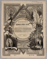
(Title Page/Contents to) Morse's North American Atlas ... New York: Published By Harper & Brothers, 82 Cliff Street. Entered ... 1842, by Sidney E. Morse and Samuel Breese ... New York. (second illustrated title page) Morse's Cerographic Maps. Plan Of Publication ... Each number will contain four coloured Maps ... If practicable, from two to three numbers will be issued every month ... The first ten numbers will form a comprehensive and elegant North American Atlas for the Library, the Counting House, and the School room ... New-York. Harper And Brothers, 82 Cliff Street. 1845 ... Price 25 Cts.
List No
4861.003
Note
The nine original parts of four colored maps each, in illustrated printed wrappers, of Morse's North American Atlas. Each part is dated 1845, so we assume they were all issued in that year, one or two a month. The "Plan of Publication" on the front wrapper of each part calls for ten numbers, but only nine were issued. The wraps are decorated with a palm tree, fir tree, bear, giraffe, and four seals for each of the continents. The cheap price of the product is stressed: "Each number will contain four coloured Maps, the price of which will be twenty five cents, being about one fourth the cost of copper plate Maps of similar size." After publication of the parts, Morse also issued the complete atlas bound (see our #2301). This nine part issue is to be distinguished from the earlier three part issue of 32 uncolored maps as supplements to the New York Observer (see our #4180). This copy with the signature and ms index of Robert Rantoul of Beverly, Massachusetts, noted lawyer and reformer. Printed full color. This copy is folded into green cloth covered boards which slips into a quarter leather green cloth covered folio box titled "Morse's North American Atlas - 9 Original Parts - New York, 1845" in gold along the spine.
Author
[Breese, S., Morse, Sidney E. (Sidney Edwards), 1794-1871]
Full Title
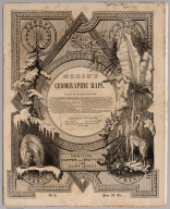
(Title Page/Contents to) Morse's Cerographic Maps. No.1. Plan Of Publication ... Each number will contain four coloured Maps ... If practicable, from two to three numbers will be issued every month ... The first ten numbers will form a comprehensive and elegant North American Atlas for the Library, the Counting House, and the School room ... Contents of No. I. Indian Territory. Northern Texas. New Mexico. Wisconsin. Michigan. Arkansas. New-York. Harper And Brothers, 82 Cliff Street. 1845 ... Price 25 Cts.
List No
4861.004
Note
1st. part of the nine original parts of four colored maps each, in illustrated printed wrappers, of Morse's North American Atlas. Each part is dated 1845, so we assume they were all issued in that year, one or two a month. The "Plan of Publication" on the front wrapper of each part calls for ten numbers, but only nine were issued. The wraps are decorated with a palm tree, fir tree, bear, giraffe, and four seals for each of the continents. The cheap price of the product is stressed: "Each number will contain four coloured Maps, the price of which will be twenty five cents, being about one fourth the cost of copper plate Maps of similar size." After publication of the parts, Morse also issued the complete atlas bound (see our #2301). This nine part issue is to be distinguished from the earlier three part issue of 32 uncolored maps as supplements to the New York Observer (see our #4180). This copy with the signature and ms index of Robert Rantoul of Beverly, Massachusetts, noted lawyer and reformer. Printed full color. This copy is folded into green cloth covered boards which slips into a quarter leather green cloth covered folio box titled "Morse's North American Atlas - 9 Original Parts - New York, 1845" in gold along the spine.
Author
[Morse, Sidney E. (Sidney Edwards), 1794-1871, Breese, Samuel]
Full Title
(Title Page/Contents to) Morse's Cerographic Maps. No.3. Plan Of Publication ... Each number will contain four coloured Maps ... If practicable, from two to three numbers will be issued every month ... The first ten numbers will form a comprehensive and elegant North American Atlas for the Library, the Counting House, and the School room ... Contents of No. III. Pennsylvania. California. Illinois. North Carolina. New-York. Harper And Brothers, 82 Cliff Street. 1845 ... Price 25 Cts.
List No
4861.021
Note
3rd. part of the nine original parts of four colored maps each, in illustrated printed wrappers, of Morse's North American Atlas. Each part is dated 1845, so we assume they were all issued in that year, one or two a month. The "Plan of Publication" on the front wrapper of each part calls for ten numbers, but only nine were issued. The wraps are decorated with a palm tree, fir tree, bear, giraffe, and four seals for each of the continents. The cheap price of the product is stressed: "Each number will contain four coloured Maps, the price of which will be twenty five cents, being about one fourth the cost of copper plate Maps of similar size." After publication of the parts, Morse also issued the complete atlas bound (see our #2301). This nine part issue is to be distinguished from the earlier three part issue of 32 uncolored maps as supplements to the New York Observer (see our #4180). This copy with the signature and ms index of Robert Rantoul of Beverly, Massachusetts, noted lawyer and reformer. Printed full color. This copy is folded into green cloth covered boards which slips into a quarter leather green cloth covered folio box titled "Morse's North American Atlas - 9 Original Parts - New York, 1845" in gold along the spine.
Author
[Morse, Sidney E. (Sidney Edwards), 1794-1871, Breese, Samuel]
Full Title
(Title Page/Contents to) Morse's Cerographic Maps. No.4. Plan Of Publication ... Each number will contain four coloured Maps ... If practicable, from two to three numbers will be issued every month ... The first ten numbers will form a comprehensive and elegant North American Atlas for the Library, the Counting House, and the School room ... Contents of No. IV. Texas. Kentucky. Tennessee. Indiana. South Carolina. New-York. Harper And Brothers, 82 Cliff Street. 1845 ... Price 25 Cts.
List No
4861.029
Note
Fourth part of the nine original parts of four colored maps each, in illustrated printed wrappers, of Morse's North American Atlas. Each part is dated 1845, so we assume they were all issued in that year, one or two a month. The "Plan of Publication" on the front wrapper of each part calls for ten numbers, but only nine were issued. The wraps are decorated with a palm tree, fir tree, bear, giraffe, and four seals for each of the continents. The cheap price of the product is stressed: "Each number will contain four coloured Maps, the price of which will be twenty five cents, being about one fourth the cost of copper plate Maps of similar size." After publication of the parts, Morse also issued the complete atlas bound (see our #2301). This nine part issue is to be distinguished from the earlier three part issue of 32 uncolored maps as supplements to the New York Observer (see our #4180). This copy with the signature and ms index of Robert Rantoul of Beverly, Massachusetts, noted lawyer and reformer. Printed full color. This copy is folded into green cloth covered boards which slips into a quarter leather green cloth covered folio box titled "Morse's North American Atlas - 9 Original Parts - New York, 1845" in gold along the spine.
Author
[Morse, Sidney E. (Sidney Edwards), 1794-1871, Breese, Samuel]
Full Title
(Title Page/Contents to) Morse's Cerographic Maps. No.5. Plan Of Publication ... Each number will contain four coloured Maps ... If practicable, from two to three numbers will be issued every month ... The first ten numbers will form a comprehensive and elegant North American Atlas for the Library, the Counting House, and the School room ... Contents of No. V. Mexico. Central America. Yucatan. Mississippi, Canada West. Vermont. New Hampshire. New-York. Harper And Brothers, 82 Cliff Street. 1845 ... Price 25 Cts.
List No
4861.037
Note
Fifth part of the nine original parts of four colored maps each, in illustrated printed wrappers, of Morse's North American Atlas. "Content of No. V" pasted on title page. On upper margin: "Rob Rantoul Sept. 1846". Each part is dated 1845, so we assume they were all issued in that year, one or two a month. The "Plan of Publication" on the front wrapper of each part calls for ten numbers, but only nine were issued. The wraps are decorated with a palm tree, fir tree, bear, giraffe, and four seals for each of the continents. The cheap price of the product is stressed: "Each number will contain four coloured Maps, the price of which will be twenty five cents, being about one fourth the cost of copper plate Maps of similar size." After publication of the parts, Morse also issued the complete atlas bound (see our #2301). This nine part issue is to be distinguished from the earlier three part issue of 32 uncolored maps as supplements to the New York Observer (see our #4180). This copy with the signature and ms index of Robert Rantoul of Beverly, Massachusetts, noted lawyer and reformer. Printed full color. This copy is folded into green cloth covered boards which slips into a quarter leather green cloth covered folio box titled "Morse's North American Atlas - 9 Original Parts - New York, 1845" in gold along the spine.
Author
[Morse, Sidney E. (Sidney Edwards), 1794-1871, Breese, Samuel]
Full Title
(Title Page/Contents to) Morse's Cerographic Maps. No.6. Plan Of Publication ... Each number will contain four coloured Maps ... If practicable, from two to three numbers will be issued every month ... The first ten numbers will form a comprehensive and elegant North American Atlas for the Library, the Counting House, and the School room ... Contents of No. VI. New York. New York & vicinity. Florida West. Alabama. New-York. Harper And Brothers, 82 Cliff Street. 1845 ... Price 25 Cts.
List No
4861.045
Note
Sixth part of the nine original parts of four colored maps each, in illustrated printed wrappers, of Morse's North American Atlas. "Content of No. VI" pasted on title page. On upper margin: "Rob Rantoul Sept. 1846". On lower margin: No. 1, corrected to No. 6. Each part is dated 1845, so we assume they were all issued in that year, one or two a month. The "Plan of Publication" on the front wrapper of each part calls for ten numbers, but only nine were issued. The wraps are decorated with a palm tree, fir tree, bear, giraffe, and four seals for each of the continents. The cheap price of the product is stressed: "Each number will contain four coloured Maps, the price of which will be twenty five cents, being about one fourth the cost of copper plate Maps of similar size." After publication of the parts, Morse also issued the complete atlas bound (see our #2301). This nine part issue is to be distinguished from the earlier three part issue of 32 uncolored maps as supplements to the New York Observer (see our #4180). This copy with the signature and ms index of Robert Rantoul of Beverly, Massachusetts, noted lawyer and reformer. Printed full color. This copy is folded into green cloth covered boards which slips into a quarter leather green cloth covered folio box titled "Morse's North American Atlas - 9 Original Parts - New York, 1845" in gold along the spine.
Author
[Morse, Sidney E. (Sidney Edwards), 1794-1871, Breese, Samuel]
Full Title
(Title Page/Contents to) Morse's Cerographic Maps. No.7. Plan Of Publication ... Each number will contain four coloured Maps ... If practicable, from two to three numbers will be issued every month ... The first ten numbers will form a comprehensive and elegant North American Atlas for the Library, the Counting House, and the School room ... Contents of No. VII. Connecticut. Canada East. Georgia. North America. New-York. Harper And Brothers, 82 Cliff Street. 1845 ... Price 25 Cts.
List No
4861.053
Note
Seventh part of the nine original parts of four colored maps each, in illustrated printed wrappers, of Morse's North American Atlas. "Content of No. VII" pasted on title page. On upper margin: "Rob Rantoul Sept. 1846". On lower margin: No. 1, corrected to No. 7. Each part is dated 1845, so we assume they were all issued in that year, one or two a month. The "Plan of Publication" on the front wrapper of each part calls for ten numbers, but only nine were issued. The wraps are decorated with a palm tree, fir tree, bear, giraffe, and four seals for each of the continents. The cheap price of the product is stressed: "Each number will contain four coloured Maps, the price of which will be twenty five cents, being about one fourth the cost of copper plate Maps of similar size." After publication of the parts, Morse also issued the complete atlas bound (see our #2301). This nine part issue is to be distinguished from the earlier three part issue of 32 uncolored maps as supplements to the New York Observer (see our #4180). This copy with the signature and ms index of Robert Rantoul of Beverly, Massachusetts, noted lawyer and reformer. Printed full color. This copy is folded into green cloth covered boards which slips into a quarter leather green cloth covered folio box titled "Morse's North American Atlas - 9 Original Parts - New York, 1845" in gold along the spine.
Author
[Morse, Sidney E. (Sidney Edwards), 1794-1871, Breese, Samuel]
Full Title
(Title Page/Contents to) Morse's Cerographic Maps. No.8. Plan Of Publication ... Each number will contain four coloured Maps ... If practicable, from two to three numbers will be issued every month ... The first ten numbers will form a comprehensive and elegant North American Atlas for the Library, the Counting House, and the School room ... Contents of No. VIII. New Jersey. West India Islands. City of New York. Maryland and Delaware. New-York. Harper And Brothers, 82 Cliff Street. 1845 ... Price 25 Cts.
List No
4861.061
Note
Eight part of the nine original parts of four colored maps each, in illustrated printed wrappers, of Morse's North American Atlas. "Content of No. VIII" pasted on title page. On upper margin: "Rob Rantoul Sept. 1846". On lower margin: No. 1, corrected to No. 8. Each part is dated 1845, so we assume they were all issued in that year, one or two a month. The "Plan of Publication" on the front wrapper of each part calls for ten numbers, but only nine were issued. The wraps are decorated with a palm tree, fir tree, bear, giraffe, and four seals for each of the continents. The cheap price of the product is stressed: "Each number will contain four coloured Maps, the price of which will be twenty five cents, being about one fourth the cost of copper plate Maps of similar size." After publication of the parts, Morse also issued the complete atlas bound (see our #2301). This nine part issue is to be distinguished from the earlier three part issue of 32 uncolored maps as supplements to the New York Observer (see our #4180). This copy with the signature and ms index of Robert Rantoul of Beverly, Massachusetts, noted lawyer and reformer. Printed full color. This copy is folded into green cloth covered boards which slips into a quarter leather green cloth covered folio box titled "Morse's North American Atlas - 9 Original Parts - New York, 1845" in gold along the spine.
Author
[Morse, Sidney E. (Sidney Edwards), 1794-1871, Breese, Samuel]
Full Title
(Title Page/Contents to) Morse's Cerographic Maps. No.9. Plan Of Publication ... Each number will contain four coloured Maps ... If practicable, from two to three numbers will be issued every month ... The first ten numbers will form a comprehensive and elegant North American Atlas for the Library, the Counting House, and the School room ... Contents of No. IX. Manie. Massachusetts. Rhode Island. Louisiana. Virginia. New-York. Harper And Brothers, 82 Cliff Street. 1845 ... Price 25 Cts.
List No
4861.069
Note
Ninth part of the nine original parts of four colored maps each, in illustrated printed wrappers, of Morse's North American Atlas. "Content of No. IX" pasted on title page. On upper margin: "Rob Rantoul Sept. 1846". On lower margin: No. 1, corrected to No. 9. Each part is dated 1845, so we assume they were all issued in that year, one or two a month. The "Plan of Publication" on the front wrapper of each part calls for ten numbers, but only nine were issued. The wraps are decorated with a palm tree, fir tree, bear, giraffe, and four seals for each of the continents. The cheap price of the product is stressed: "Each number will contain four coloured Maps, the price of which will be twenty five cents, being about one fourth the cost of copper plate Maps of similar size." After publication of the parts, Morse also issued the complete atlas bound (see our #2301). This nine part issue is to be distinguished from the earlier three part issue of 32 uncolored maps as supplements to the New York Observer (see our #4180). This copy with the signature and ms index of Robert Rantoul of Beverly, Massachusetts, noted lawyer and reformer. Printed full color. This copy is folded into green cloth covered boards which slips into a quarter leather green cloth covered folio box titled "Morse's North American Atlas - 9 Original Parts - New York, 1845" in gold along the spine.
Author
Phelps & Ensign
Full Title
(Title Page to) Phelps & Ensign's Traveller's Guide Through the United States ... Illustrated By A New And Accurate Map Of The United States. New York: Phelps & Ensign, No. 7 Bowery. 1845. Entered .. 1838, by Phelps & Ensign .. New York. (with) Phelps & Ensign's Travellers' Guide, and Map of the United States ... New York, Published by T & E.H. Ensign, 1845. Engraved on Steel by J.Wells, Brooklyn L.I. Entered ... 1837 by Phelps & Squire ... New York. (with 16 inset maps).
List No
4951.002
Note
Phelps is dropped from the Map title; no other changes noted from the 1843 edition. Contains same sixteen inset maps showing the vicinities of New York, Philadelphia, Boston, Baltimore, New Orleans, Mobile, Cincinnati, St. Louis, Charleston, Pittsburg, Chicago, Detroit, Washington, and Niagara Falls, and the south part of Florida and north part of Maine. Outline color by state. Covers are stamped reddish brown leather with "Phelps & Ensign Travellers Guide Through The United States" in gilt. Prime meridian is Washington D.C.
Author
Tanner, Henry S.
Full Title
(Title Page to) A New Universal Atlas Containing Maps of the various Empires, Kingdoms, States and Republics Of The World. With a special map of each of the United States, Plans of Cities &c. Comprehended in seventy sheets and forming a series of One Hundred And Seventeen Maps, Plans And Sections, By H.S. Tanner ... Philadelphia, Published By Carey & Hart. 1844. Entered ... 1844, by Carey & Hart ... Pennsylvania. (title page by) J. Knight Sc. (vignette by) Humphreys.
List No
5363B
Note
Illustration of the First Landing of Columbus in the New World.
Author
Tanner, Henry S.
Full Title
(Title Page to) A new general atlas, comprising a complete set of maps representing the grand divisions of the globe, together with the several empires, kingdoms and states in the world; compiled from the best authorities, and corrected by the most recent discoveries. New York, Published at Tanner's Geographical Establishment, 1845. Written and engraved by Jos. Perkins.
List No
5745B
Note
Engraved maps. Full hand color. Half leather, dark green cloth. "Atlas" stamped on spine in gold. "Tanner's new universal atlas" stamped in gold on cover. Includes bookplate inside front cover: Tanner's Map Store, 236 Broadway, New York. Maps, guides, globes, atlases &c. &c. Lith. of Willis & Probst. 2 Wall St., New-York." A reissue of Finley's A New general atlas.
1-26 of 26
|