|
REFINE
Browse All : Separate Map and Boundaries from 1866
1-8 of 8
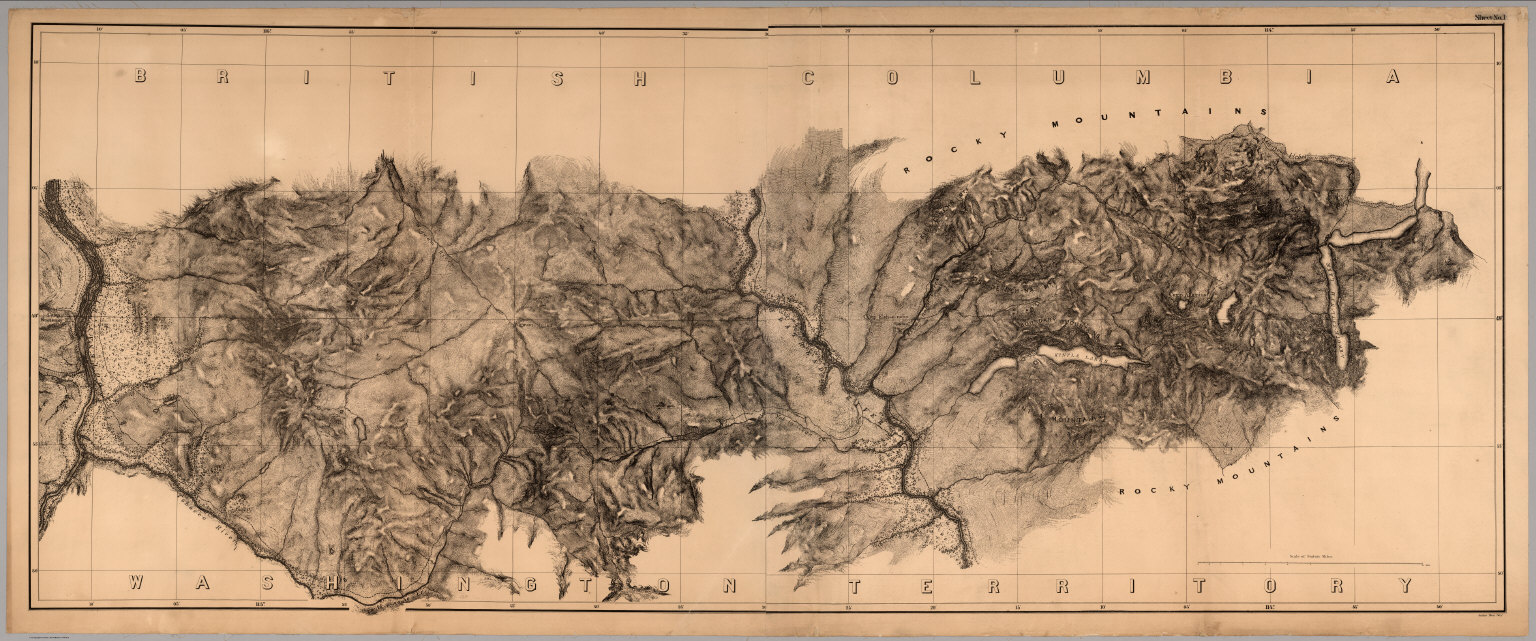
U.S. North West Boundary Survey; Campbel... Sheet No. 1. Photo-Lithographic Copy Of ... 1866 2889.001 Related Author
[U.S. North West Boundary Survey, Campbell, Archibald]
Full Title
Sheet No. 1. Photo-Lithographic Copy Of The Detailed Maps Of The North West Boundary ...Between The United States And The British Possessions Under the Treaty of June 15th 1846. (A-kwote-katl-nam Lake to Kootenay River, Washington Territory and British Columbia).
List No
2889.001
Note
Date estimated. Loose sheet but part of set of 7. Paper mounted on muslin. Relief shown in hachures.
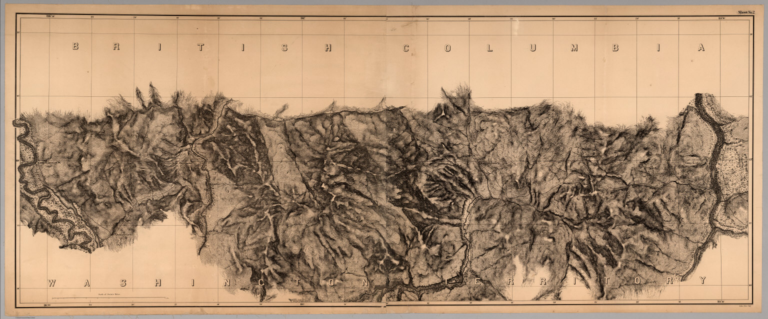
U.S. North West Boundary Survey; Campbel... Sheet No. 2. Photo-Lithographic Copy Of ... 1866 2889.002 Related Author
[U.S. North West Boundary Survey, Campbell, Archibald]
Full Title
Sheet No. 2. Photo-Lithographic Copy Of The Detailed Maps Of The North West Boundary ...Between The United States And The British Possessions Under the Treaty of June 15th 1846. (Kootenay River to Camp Kootenay W., Washington Territory and British Columbia).
List No
2889.002
Note
Date estimated. Loose sheet but part of set of 7. Paper mounted on muslin. Relief shown in hachures.
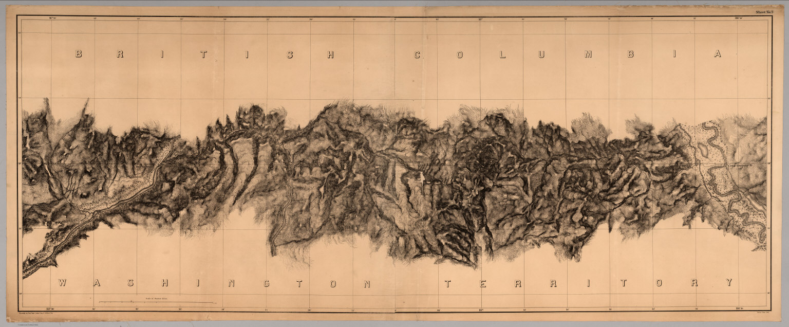
U.S. North West Boundary Survey; Campbel... Sheet No. 3. Photo-Lithographic Copy Of ... 1866 2889.003 Related Author
[U.S. North West Boundary Survey, Campbell, Archibald]
Full Title
Sheet No. 3. Photo-Lithographic Copy Of The Detailed Maps Of The North West Boundary ...Between The United States And The British Possessions Under the Treaty of June 15th 1846. (Camp Kootenay W. to Camp Columbia and Yome-tsin Creek, Washington Territory and British Columbia).
List No
2889.003
Note
Date estimated. Loose sheet but part of set of 7. Paper mounted on muslin. Relief shown in hachures.
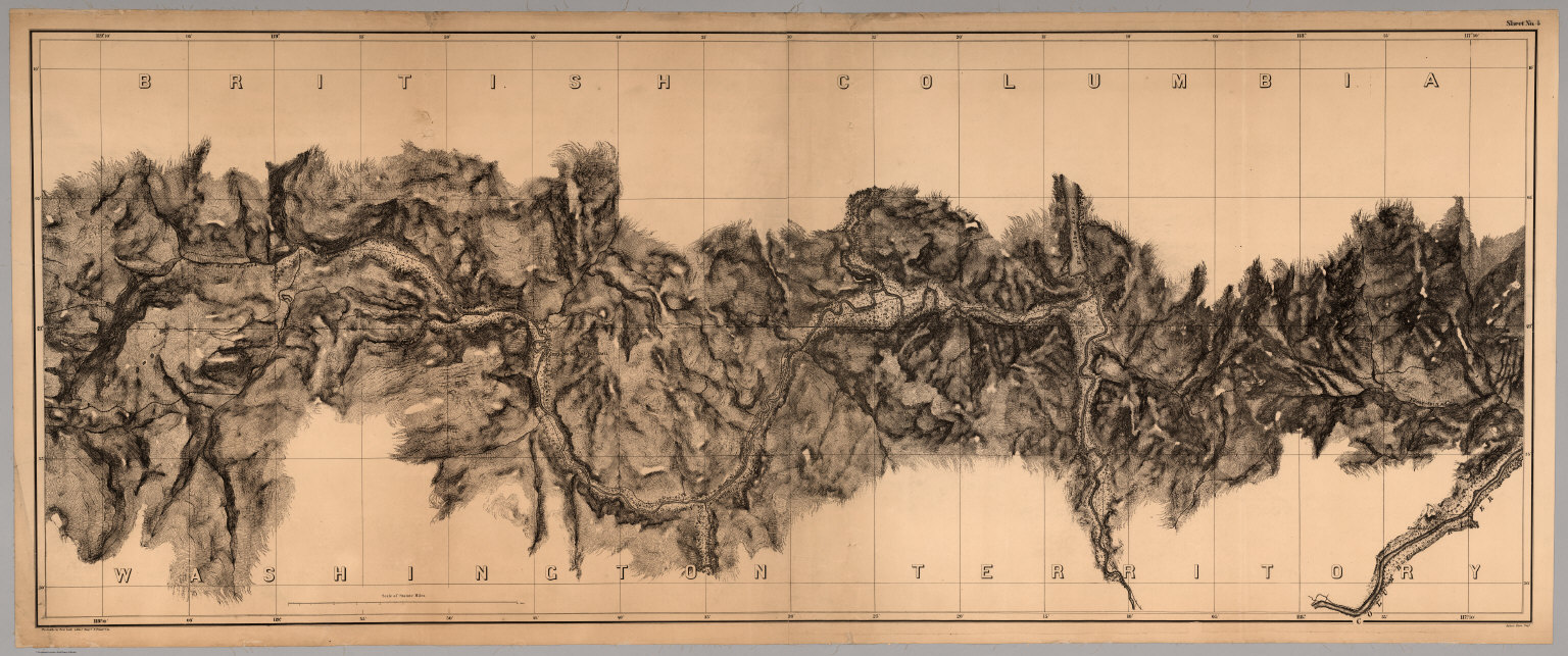
U.S. North West Boundary Survey; Campbel... Sheet No. 4. Photo-Lithographic Copy Of ... 1866 2889.004 Related Author
[U.S. North West Boundary Survey, Campbell, Archibald]
Full Title
Sheet No. 4. Photo-Lithographic Copy Of The Detailed Maps Of The North West Boundary ...Between The United States And The British Possessions Under the Treaty of June 15th 1846. (Little Dalles and Yome-tsin Creek to Rock Creek, Washington Territory and British Columbia).
List No
2889.004
Note
Date estimated. Loose sheet but part of set of 7. Paper mounted on muslin. Relief shown in hachures.
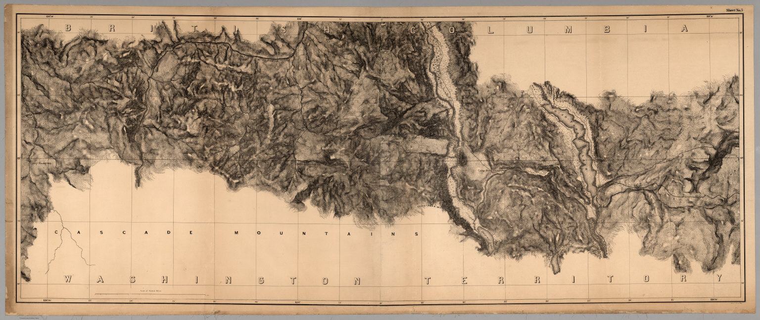
U.S. North West Boundary Survey; Campbel... Sheet No. 5. Photo-Lithographic Copy Of ... 1866 2889.005 Related Author
[U.S. North West Boundary Survey, Campbell, Archibald]
Full Title
Sheet No. 5. Photo-Lithographic Copy Of The Detailed Maps Of The North West Boundary ...Between The United States And The British Possessions Under the Treaty of June 15th 1846. (Camp O-so-yoos and O-so-yoos Lake to Camp Pa-say-ten, Washington Territory and British Columbia).
List No
2889.005
Note
Date estimated. Loose sheet but part of set of 7. Paper mounted on muslin. Relief shown in hachures.
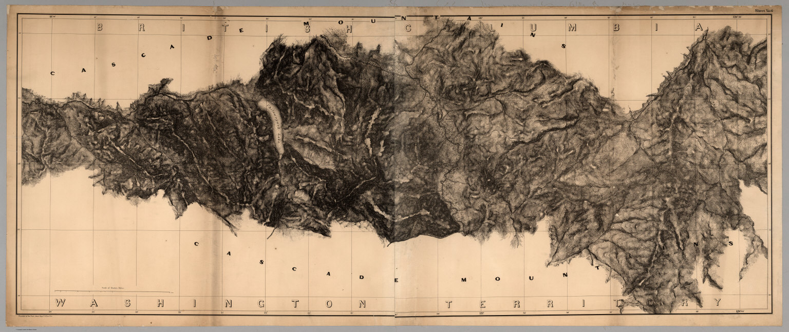
U.S. North West Boundary Survey; Campbel... Sheet No. 6. Photo-Lithographic Copy Of ... 1866 2889.006 Related Author
[U.S. North West Boundary Survey, Campbell, Archibald]
Full Title
Sheet No. 6. Photo-Lithographic Copy Of The Detailed Maps Of The North West Boundary ...Between The United States And The British Possessions Under the Treaty of June 15th 1846. (Camp Pa-say-ten to Chiloweyuck River, Washington Territory and British Columbia).
List No
2889.006
Note
Date estimated. Loose sheet but part of set of 7. Paper mounted on muslin. Relief shown in hachures.
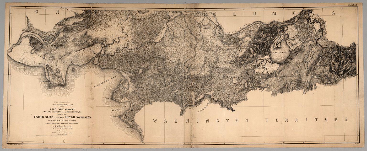
U.S. North West Boundary Survey; Campbel... Sheet No. 7. (Title Sheet) Photo-Lithogr... 1866 2889.007 Related Author
[U.S. North West Boundary Survey, Campbell, Archibald]
Full Title
Sheet No. 7. (Sheet with Title). Photo-Lithographic Copy Of The Detailed Maps Of The North West Boundary ...Between The United States And The British Possessions Under the Treaty of June 15th 1846. (Chiloweyuck River to Point Roberts, Washington Territory and British Columbia).
List No
2889.007
Note
Date estimated. Loose sheet but part of set of 7. Paper mounted on muslin. Relief shown in hachures.
U.S. North West Boundary Survey; Campbel... Composite: Sheets No. 1-7. Photo-Lithogr... 1866 2889.008 Related Author
[U.S. North West Boundary Survey, Campbell, Archibald]
Full Title
(Composite of) Sheets No. 1-7. Photo-Lithographic Copy Of The Detailed Maps Of The North West Boundary ...Between The United States And The British Possessions Under the Treaty of June 15th 1846. (A-kwote-katl-nam Lake to Point Roberts, Washington Territory and British Columbia).
List No
2889.008
Note
Date estimated. Loose sheets form set of 7. Paper mounted on muslin. Relief shown in hachures.
1-8 of 8
|