|
Author
Stanford, Edward
Full Title
The World
List No
15996.004
Note
Date estimated.
Author
Ramzi, Muhammad
Full Title
(Outline map of World). Umumi jughrafia atlasi = Atlas of general geography. Assar Muhammad Ramzi, Maktab Harbiye Matbaa si. Mulayiyuh sanah 1328 (1910).
List No
13532.003
Note
Outline map of the world by continent.
Author
Dewald, G. A. St.
Full Title
1. Die ostliche und westliche Halbkugel Der Erde. Mit vielen Abbildungen aus der mathematischen und physicen Geographie -- Entworfen und gezeichnet fur den Schulgebrauch von G. A. St. Dewald, lithogaphirt von E. Winckelmann.
List No
10797.002
Author
Dewald, G. A. St.
Full Title
2. Die ostliche und westliche Halbkugel Der Erde. Mit vielen Abbildungen aus der mathematischen und physicen Geographie -- Entworfen und gezeichnet fur den Schulgebrauch von G. A. St. Dewald, lithogaphirt von E. Winckelmann.
List No
10797.003
Author
Dewald, G. A. St.
Full Title
3. Die ostliche und westliche Halbkugel Der Erde. Mit vielen Abbildungen aus der mathematischen und physicen Geographie -- Entworfen und gezeichnet fur den Schulgebrauch von G. A. St. Dewald, lithogaphirt von E. Winckelmann.
List No
10797.004
Author
Dewald, G. A. St.
Full Title
4. Die ostliche und westliche Halbkugel Der Erde. Mit vielen Abbildungen aus der mathematischen und physicen Geographie -- Entworfen und gezeichnet fur den Schulgebrauch von G. A. St. Dewald, lithogaphirt von E. Winckelmann.
List No
10797.005
Author
Dewald, G. A. St.
Full Title
5. Die ostliche und westliche Halbkugel Der Erde. Mit vielen Abbildungen aus der mathematischen und physicen Geographie -- Entworfen und gezeichnet fur den Schulgebrauch von G. A. St. Dewald, lithogaphirt von E. Winckelmann.
List No
10797.006
Author
Dewald, G. A. St.
Full Title
6. Die ostliche und westliche Halbkugel Der Erde. Mit vielen Abbildungen aus der mathematischen und physicen Geographie -- Entworfen und gezeichnet fur den Schulgebrauch von G. A. St. Dewald, lithogaphirt von E. Winckelmann.
List No
10797.007
Author
Dewald, G. A. St.
Full Title
7. Die ostliche und westliche Halbkugel Der Erde. Mit vielen Abbildungen aus der mathematischen und physicen Geographie -- Entworfen und gezeichnet fur den Schulgebrauch von G. A. St. Dewald, lithogaphirt von E. Winckelmann.
List No
10797.008
Author
Dewald, G. A. St.
Full Title
8. Die ostliche und westliche Halbkugel Der Erde. Mit vielen Abbildungen aus der mathematischen und physicen Geographie -- Entworfen und gezeichnet fur den Schulgebrauch von G. A. St. Dewald, lithogaphirt von E. Winckelmann.
List No
10797.009
Author
Dewald, G. A. St.
Full Title
(Composite map of) 1-8. Die ostliche und westliche Halbkugel Der Erde. Mit vielen Abbildungen aus der mathematischen und physicen Geographie -- Entworfen und gezeichnet fur den Schulgebrauch von G. A. St. Dewald, lithogaphirt von E. Winckelmann.
List No
10797.010
Author
Levrault, F.G.
Full Title
Mappe-Monde Muette. Autorisee Par L'Universite.
List No
10623.000
Author
Ikbal Kutuphanesi Sahibi Huseyin
Full Title
(Map of the world) . (to accompany) Tajadud maktab atlasi = New school atlas. 1927-1345.
List No
13435.004
Note
Political map of the world, with time zones.
Author
[Brion de La Tour, Louis, 1743 – 1803, Desnos, Louis Charles]
Full Title
Mappe-monde : dressee pour l'etude de la geographie relativement aux auteurs les plus modernes. revue, corrigee et augmentee d'apres les nouvlles. observations astronomiques de Mrs. Tchirikcow et de l'Isle ; revue de nouveau par M. Brion ... 1786. A.P.D.R. (to accompany) Atlas general, civil, ecclesiastique et militaire, methodique et elementaire pour l'etude de la geographie et de l'histoire ... par M. Brion, dirige par le sr. Desnos … A Paris 1786.
List No
13129.014
Note
Double hemisphere map of the world, engraved hand color , with decorative cartouches and decorative engraved border. Includes dedication. Date from dedication.
Author
Young, J.
Full Title
The world with all the modern discoveries. By J. Young Geogr. Published as the Act directs 1st July 1778. (to accompany) A New Atlas Or a Compleat (sic) Set of Maps Representing the different Empires, Kingdoms & States of the Known World Including all the Modern Discoveries, By J. Young, A.M.
List No
2226.003
Note
1 folded map printed on 2 full sheets and two half sheets, exhibiting all of the new discoveries in the world with the tracks of the principal navigators. Shows political divisions, and major cities.
Author
Rutley, F.
Full Title
Andrews' Schoolroom Chart Of Geographical Illustrations. Thomas Murby, 32, Bouverie Street, Fleet Street, London. Designed by F. Rutley Esq, H.M. Geol. Survey. Drawn by Waldo Sargeant, Printed by W. Griggs. (inset) Map Of Europe Explanatory Of Geographical Terms. (untitled birds eye view illustrating land and water formations). (with 6 additional inset maps and 1 profile).
List No
0867.000
Note
Date is approximate. Maps include: Map Of Europe, untitled birds eye view of land formations, The Earth In Space, The World In Hemispheres, Zones (also showing mountains of the world), The Seasons, Hemispheres Shewing The Proportion Of Land To Water, and Points Of The Compass (showing rivers of the world). Profile is titled "Section Of The Earth's Crust." Full printed color. Map is dissected into 36 sections and is edged and backed with linen. Folds into marbled end sheets into a new rust cloth folding case 24x28 with "Andrews' Chart of Geographical Illustrations F. Rutley 1915" stamped in gold on the spine.
Author
Smiley, Thomas T.
Full Title
Atlantic Ocean.
List No
0902.001
Note
In full color. The map of the Atlantic Ocean includes a vignette of the landing of Columbus.
Author
Smiley, Thomas T.
Full Title
World Globular Projection.
List No
0902.002
Note
In full color. The World projections are surrounded by two sets of projections - one showing the hemispheres and a northern and southern polar projection. Four other insets explain circles, zones, parallels, and meridians. Vignette depicting two children representing history and science, with a sheath of wheat representing agriculture.
Full Title
The World. Published by Lincoln & Edmands, (1819)
List No
0004.001
Note
Uncolored engraved double hemisphere map. Small ancillary maps: Zones -- Circles -- Parallels -- Meridians.
Full Title
The World. G. Boynton Sc. Published by Lincoln & Edmands. (1832)
List No
0006.001
Note
Engraved double hemisphere map. Outline hand col. Insets: Comparative view of the principal lakes in the eastern continent -- Comparative view of the principal lakes of the western continent -- Zones -- Circles -- Parallels -- Meridians.
Full Title
The World. Philadelphia: Published by M. Carey and Son. 1820. (1825)
List No
0124.001
Note
Engraved double hemisphere map.
Author
Cornell, S. S. (Sarah S.)
Full Title
(Title Page to) Cornell's companion atlas to Cornell's high school geography: comprising a complete set of maps, designed for the student to memorize, together with numerous maps for reference, etc. By S.S. Cornell, corresponding member of the American Geographical and Statistical Society. New York: Published by D. Appleton and Company, 443 & 445 Broadway. 1864. Entered ... 1856, by S.S. Cornell ... Southern District of New York.
List No
0197C
Note
Includes table of contents.
Author
Cornell, S. S. (Sarah S.)
Full Title
(Preface to) Cornell's companion atlas to Cornell's high school geography: comprising a complete set of maps, designed for the student to memorize, together with numerous maps for reference, etc. By S.S. Cornell, corresponding member of the American Geographical and Statistical Society. New York: Published by D. Appleton and Company, 443 & 445 Broadway. 1864. Entered ... 1856, by S.S. Cornell ... Southern District of New York.
List No
0197D
Note
Includes list of "Important productions of the Earth together with the countries in which they are chiefly produced."
Author
Cornell, S. S. (Sarah S.)
Full Title
The World, showing its great river systems. Designed to accompany Cornell's High school geography. (with Lengths of rivers, heights of mountains). Engraved by Geo. Rae Smith, N.Y.. Entered ... 1856, by S.S. Cornell ... Southern District of New York. New York: D. Appleton & Co., 443 & 445 Broadway. (1864)
List No
0197.001
Note
Engraved double hemisphere map. Hand colored. Relief shown by hachures.
Author
Cornell, S. S. (Sarah S.)
Full Title
The World showing the diversities of the land surface. (with) Comparative view of the principal lakes & islands in the World. Entered ... 1855, by S.S. Cornell ... Southern District of New York. New York: D. Appleton & Co., 443 & 445 Broadway, (1864)
List No
0197.002
Note
Engraved map. Hand colored. Relief shown by hachures. Contents: Northern Hemisphere -- Southern Hemisphere. Comparative view maps have titles: Islands of the Western Hemisphere -- Lakes of the Western Hemisphere -- Lakes of the Eastern Hemisphere -- Islands of the Eastern Hemisphere. Includes 3 world time charts from London, San Francisco and Sydney.
Author
[Diercke, Carl, Gaebler, Eduard]
Full Title
Erdkarten in Mercatorprojektion. (to accompany) Diercke Schul-Atlas fur hohere Lehranstalten. "4" on the lower right margin.
List No
0243.016
Note
Six color maps on 2 pages. Showing annual isothermal activities, air pressure and winds in January and July.
Author
[Diercke, Carl, Gaebler, Eduard]
Full Title
Erdkarten in Mercatorprojektion. Diercke u. Gaebler, Schulatlas fur hohere Lehranstalten. Druck und Verlag : Braunschweig, George Westermann. (insets) Jahrliche Regenmenge ; Regenzeiten der Erde.
List No
0243.017
Note
Color map with 2 insets on 2 pages. Showing marine areas, ocean currents, annual rainfall, rain periods of earth.
Author
[Diercke, Carl, Gaebler, Eduard]
Full Title
Erdkarten in Mercatorprojektion. (to accompany) Diercke Schul-Atlas fur hohere Lehranstalten. "5" on the lower right margin.
List No
0243.018
Note
Six color maps on 2 pages. Showing dissemination of the most important animals, population, religions, cultures and Government systems in the world.
Author
[Diercke, Carl, Gaebler, Eduard]
Full Title
Erdkarten in Mercatorprojektion. Diercke u. Gaebler, Schulatlas fur hohere Lehranstalten. Druck und Verlag : Braunschweig, George Westermann. (insets) Verbreitung der Europaer ; Verbreitung der Deutschen.
List No
0243.019
Note
Color map, with 2 insets on 2 pages. Showing colonial possession of European States in color, transportation, railroads, telegraph cables, and caravan roads. Insets showing: dissemination of the Europeans, and dissemination of the German.
Author
[Fitch, George W., Weeks, Lydia S.]
Full Title
Western Hemisphere ... Eastern Hemisphere drawn by (to be filled in. By George W. Fitch. New York: Sheldon, Blakeman and Company, 115 Nassau Street. Entered ... 1850, by Huntington and Savage ... New York)
List No
0289.001
Note
Printed map form with title, grid lines and numbers or "mapping plate." Two maps on 1 sheet. Map data added including relief by hachures in pen-and-ink by Lydia S. Weeks.
Author
[Aspin, Jehoshaphat, 18th/19th cent., Gaultier, abbe (Aloisius Edouard Camille), 1746?-1818]
Full Title
(Title Page to) A complete course of geography, by means of instructive games, invented by the Abbe Gaultier. Collated with the author's last Paris edition, and digested for Europe conformably to the territorial arrangements of the Pacification of 1815, by Jehoshaphat Aspin. In three parts. The first part, containing the game of simple geography, for teaching the names and situations of the different countries and places of the Earth. The second part, containing a concise treatise on the artificial sphere. The third part, containing a geographical game, illustrative of ancient and modern history ... London: printed for John Harris and Son, corner of St. Paul's Church-yard. 1821. (on verso) London: printed by S. and R. Bentley, Dorset-Street, Fleet-Street.
List No
0294B
Note
Bound in half red leather brown boards with a paper label printed with "The Abbe Gaultier's Complete course of geography, by means of instructive games. Printed for John Harris, Corner of St. Paul's Church Yd. Dulau & Co. - Soho Sqe. & Didier, Balsover Street. G. King Sc." Maps are hand painted in full and outline color.
Author
[Aspin, Jehoshaphat, 18th/19th cent., Gaultier, abbe (Aloisius Edouard Camille), 1746?-1818]
Full Title
(Dedication Page) A complete course of geography, by means of instructive games, invented by the Abbe Gaultier. Collated with the author's last Paris edition, and digested for Europe conformably to the territorial arrangements of the Pacification of 1815, by Jehoshaphat Aspin. In three parts. The first part, containing the game of simple geography, for teaching the names and situations of the different countries and places of the Earth. The second part, containing a concise treatise on the artificial sphere. The third part, containing a geographical game, illustrative of ancient and modern history ... London: printed for John Harris and Son, corner of St. Paul's Church-yard. 1821. (with verso of title page) London: printed by S. and R. Bentley, Dorset-Street, Fleet-Street.
List No
0294C
Note
Verso of title page and facing dedication: To the right honorable Lady Amelia Spencer, youngest daughter of his Grace the Duke of Marlborough ... L'Abbe Gaultier.
Full Title
Appendix. General questions on geography; or a game ... A table of general questions after a method suggested by Lady Ch******e L*****r. Printed by S. & R. Bentley, Dorset Street, Fleet Street, London. (1821)
List No
0294D
Note
Page of tables and facing page containing a chart. "Page 23."
Author
[Gaultier, abbe (Aloisius Edouard Camille), 1746?-1818, Wauthier, J. M.]
Full Title
A plain map for the geographical game of Asia, Africa, America, and newly discovered islands, according to the method of the Abbe Gaultier. MDCCXCII.
List No
0294.013
Note
Engraved map. Hand colored. Relief shown pictorially. Outline map showing boundaries and unnamed rivers, mountains, cities, etc. Prime meridian: Ferro.
Author
[Gaultier, abbe (Aloisius Edouard Camille), 1746?-1818, Wauthier, J. M.]
Full Title
A new map of the World, according to the method of the Abbe Gaultier. By Mr. Wauthier, his pupil. 1799.
List No
0294.014
Note
Engraved double hemisphere map. Hand colored. Shows explorers' routes, etc. Prime meridian: Ferro.
Author
Grigg, John
Full Title
(Title Page to) Grigg's American school atlas, exhibiting the different grand divisions of the globe, together with a set of maps particularly adapted to illustrate the geography of North and South America, according to the political divisions of the present time. Drawn and engraved from the latest and best authorities. Philadelphia: John Grigg, No. 9 North Fourth Street. 1830.
List No
0315B
Author
Grigg, John
Full Title
(Contents to) Grigg's American school atlas, exhibiting the different grand divisions of the globe, together with a set of maps particularly adapted to illustrate the geography of North and South America, according to the political divisions of the present time. Drawn and engraved from the latest and best authorities. Philadelphia: John Grigg, No. 9 North Fourth Street. 1830.
List No
0315C
Note
Table of contents entitled "Index."
Full Title
Western Hemisphere. Eastern Hemisphere. J.H. Young Sc. (Philadelphia: John Grigg, No. 9 North Fourth Street. 1830)
List No
0315.001
Note
Engraved map. Full hand color. Relief shown pictorially.
Author
[Delamarche, Charles Francois, Lattre, Jean]
Full Title
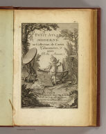
(Title Page to) Petit atlas moderne ou collection de cartes elementaires dedie a la jeunesse. A Paris, chez Delamarche, Geogr., Rue du Jardinet No. 13, vis a vis celle de l'Eperon. (ca. 1800)
List No
0421B
Note
Engraved illustrated title page showing cherub with globe, maps, surveying instruments, etc. Called "Frontispice" in table of contents.
Author
[Delamarche, Charles Francois, Lattre, Jean]
Full Title
(Contents Page to) Petit atlas moderne ou collection de cartes elementaires dedie a la jeunesse. A Paris, chez Delamarche, Geogr., Rue du Jardinet No. 13, vis a vis celle de l'Eperon. (ca. 1800)
List No
0421C
Note
"Table."
Author
[Delamarche, Charles Francois, Lattre, Jean]
Full Title
(Positions de la Sphere. A Paris, chez Delamarche, Geogr., ca. 1800)
List No
0421.001
Note
Nine engraved maps or illustrations on 1 sheet. Title from table of contents. Contents: Disque de la Lune -- L'Hemisphere de la Terre eclaire par le Soleil au solstice d'Ete -- L'Hemisphere de la Terre eclaire par le Soleil au solstice d'Hyver -- Disque du Soleil -- Eclipse de Soleil -- Horison droit -- Horison parallele -- Eclipse de Lune -- Horison oblique.
Author
[Delamarche, Charles Francois, Lattre, Jean]
Full Title
(Systemes. A Paris, chez Delamarche, Geogr., ca. 1800)
List No
0421.002
Note
Five engraved maps or illustrations on 1 sheet. Title from table of contents. Contents: Sphere armillaire -- Systeme de Ptolomee -- Systeme de Copernic -- Systeme de Ticho-Brahe -- Rose de boussole. Includes notes.
Full Title
Mappe-monde ou description du Globe Terrestre avec les nouvelles decouvertes. P.J. Picquet, sculpt. (A Paris, chez Delamarche, Geogr., ca. 1800)
List No
0421.003
Note
Engraved double hemisphere map. Outline hand coloring. Prime meridian: Ferro. "1."
Author
Melish, John
Full Title
(Title Page to) A New Juvenile Atlas, And Familiar Introduction To The Use Of Maps: With A Comprehensive View Of The Present State Of The Earth ... First American From The Latest London Edition, Corrected And Improved, By John Melish. Philadelphia, Printed For John Melish, John Vallance, And H.S. Tanner, No. 209, Chestnut-Street, By G. Palmer. 1814.
List No
0496.002
Note
With H.S. Tanner and John Vallance. Catalogue of Melish's publications. This is Melish's first school atlas, following in 1816, 1818, and 1820 by Melish's Universal School Atlas which uses seven of these maps, omitting England, Scotland, and Ireland, and adding a Hemispherical World Map (see our 4519.000 for the 1820 edition). Half leather, marbled paper covered boards, with gold title on spine - "Juvenile Atlas. 1814."
Author
Melish, John
Full Title
(Advertisement to) A New Juvenile Atlas, And Familiar Introduction To The Use Of Maps: With A Comprehensive View Of The Present State Of The Earth ... First American From The Latest London Edition, Corrected And Improved, By John Melish. Philadelphia, Printed For John Melish, John Vallance, And H.S. Tanner, No. 209, Chestnut-Street, By G. Palmer. 1814.
List No
0496.003
Note
Advertisement for the atlas, explaining the contents and intent "This work was originally published in London, by Laurie and Whittle... The American part has been altered in consequence of revolutions that have taken place in that quarter... " Half leather, marbled paper covered boards, with gold title on spine - "Juvenile Atlas. 1814."
Author
Melish, John
Full Title
Elementary Map. (engraved by) H.S. Tanner. Sc. Published ... 1814 by J. Melish. J. Vallance & H.S. Tanner. Philadelphia. (to accompany) A New Juvenile Atlas, And Familiar Introduction To The Use Of Maps: With A Comprehensive View Of The Present State Of The Earth ... First American From The Latest London Edition, Corrected And Improved, By John Melish. Philadelphia, Printed For John Melish, John Vallance, And H.S. Tanner, No. 209, Chestnut-Street, By G. Palmer. 1814.
List No
0496.004
Note
Full color map. Scale 60 Geographical Miles to 1 Degree. Followed by a study of Elementary Definitions, &c. Half leather, marbled paper covered boards, with gold title on spine - "Juvenile Atlas. 1814."
Author
Melish, John
Full Title
(Text Page to) Elementary Definitions, &c. (accompany to) Elementary Map. (engraved by) H.S. Tanner. Sc. Published ... 1814 by J. Melish. J. Vallance & H.S. Tanner. Philadelphia. (to accompany) A New Juvenile Atlas, And Familiar Introduction To The Use Of Maps: With A Comprehensive View Of The Present State Of The Earth ... First American From The Latest London Edition, Corrected And Improved, By John Melish. Philadelphia, Printed For John Melish, John Vallance, And H.S. Tanner, No. 209, Chestnut-Street, By G. Palmer. 1814.
List No
0496.005
Note
Text includes a study of Universe. Illustration showing the four seasons, the longest and shortest day. Half leather, marbled paper covered boards, with gold title on spine - "Juvenile Atlas. 1814."
Author
Melish, John
Full Title
(Text Page to) Description Of Maps. Of Maps In General. (to accompany) A New Juvenile Atlas, And Familiar Introduction To The Use Of Maps: With A Comprehensive View Of The Present State Of The Earth ... First American From The Latest London Edition, Corrected And Improved, By John Melish. Philadelphia, Printed For John Melish, John Vallance, And H.S. Tanner, No. 209, Chestnut-Street, By G. Palmer. 1814.
List No
0496.006
Note
Text includes the study of maps. Map projections. And To find The distance of one place to another. The Diagram showing the Globular and Mercator's Projection. Half leather, marbled paper covered boards, with gold title on spine - "Juvenile Atlas. 1814."
Author
Melish, John
Full Title
The World. On Mercator's Projection; With All The Latest Discoveries. (engraved by) H.S. Tanner. Sc. Published ... 1814 by J. Melish. J. Vallance & H.S. Tanner. Philadelphia. Map showing: "To find the Distance Of One Place From another." (to accompany) A New Juvenile Atlas, And Familiar Introduction To The Use Of Maps: With A Comprehensive View Of The Present State Of The Earth ... First American From The Latest London Edition, Corrected And Improved, By John Melish. Philadelphia, Printed For John Melish, John Vallance, And H.S. Tanner, No. 209, Chestnut-Street, By G. Palmer. 1814.
List No
0496.007
Note
The Triangular Scale marked A B C, under Indian Ocean serves universally "To find the distance of one place from another." The Roman numerals or figures, immediately above neatline denote the Hours, or Time, under the different Meridians... Outline colored map. The Half leather, marbled paper covered boards, with gold title on spine - "Juvenile Atlas. 1814." Prime meridian is London.
Author
Melish, John
Full Title
(Text Page to) Of The World In General. (to accompany) A New Juvenile Atlas, And Familiar Introduction To The Use Of Maps: With A Comprehensive View Of The Present State Of The Earth ... First American From The Latest London Edition, Corrected And Improved, By John Melish. Philadelphia, Printed For John Melish, John Vallance, And H.S. Tanner, No. 209, Chestnut-Street, By G. Palmer. 1814.
List No
0496.008
Note
Text includes a study of The Terrestrial Globe. The Geographical Divisions of the Earth. Climate and Seasons. The Half leather, marbled paper covered boards, with gold title on spine - "Juvenile Atlas. 1814."
|