|
REFINE
Browse All : School and Manuscript Map of Europe
1-26 of 26
Author
Logerot, A. (Auguste)
Full Title
[Map of Europe.] Ce 8 8bre 1856 ; A. Logerot.
List No
14489.003
Note
Manuscript map representing Europe. Shows select regions, mountain ranges, drainage, coastlines, and islands. Relief shown with hachure lines and shading. Indexed to indicate the names of mountain ranges. Ink, pencil, and watercolor on paper. Indexed to indicate locations such as the Tyrolean Alps and Saint-Gotthard Massif. Map is 24 x 30 cm, on sheet 24 x 32 cm.
Author
Logerot, A. (Auguste)
Full Title
[Map of Europe.] Ce 15 8bre 1856 ; A. Logerot.
List No
14489.004
Note
Manuscript map representing Europe. Shows select regions, cities, mountain ranges, drainage, coastlines, and islands. Relief shown with shading. Features watershed areas, which are differentiated by color. Indexed to indicate the names of mountains and lakes. Ink, pencil, and watercolor on paper. Map is 24 x 30 cm, on sheet 24 x 32 cm.
Author
شكوفه مقبل [Şukufe Mukbil]
Full Title
(Rivers of Europe)
List No
10992.002
Note
Dimensions are sheet size.
Author
شكوفه مقبل [Şukufe Mukbil]
Full Title
(Political map of Europe)
List No
10992.003
Note
Dimensions are sheet size.
Author
[Fitch, George W., Jamison, Joseph]
Full Title
Europe. Drawn by (to be filled in. By George W. Fitch. New York: Sheldon, Blakeman and Company, 115 Nassau Street. Entered ... 1850, by Huntington and Savage ... New York)
List No
0289.007
Note
Printed map form with title, grid lines and numbers or "mapping plate." Map data added including relief by hachures in pen-and-ink by Joseph Jamison. Prime meridians: Washington and Greenwich and Washington.
Author
Fitch, George W.
Full Title
Southern Europe. Drawn by (to be filled in. By George W. Fitch. New York: Sheldon, Blakeman and Company, 115 Nassau Street. Entered ... 1850, by Huntington and Savage ... New York)
List No
0289.008
Note
Printed map form with title, grid lines and numbers or "mapping plate." Drawn by (in pencil) M.E.H. Brooks. Mapping has not been added. Prime meridians: Washington and Greenwich.
Author
Hunt, Marianne
Full Title
Carte de l' Europe. 7 October, 1844. (to accompany) Cours de Geographie. Institution de Mme. Butler. Saint-Omer. Marianne Hunt. 1844.
List No
2503.005
Note
Hand color physical map of Europe as a continent, on page 27x34. Relief shown by hachurs. Includes notes.
Author
Hunt, Marianne
Full Title
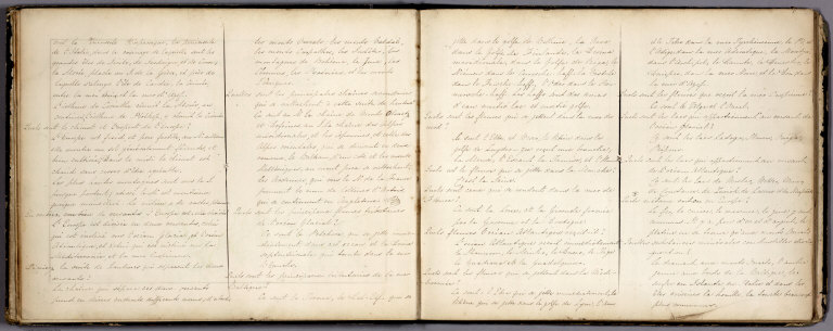
((Text Page to) Europe Physique. (to accompany) Cours de Geographie. Institution de Mme. Butler. Saint-Omer. Marianne Hunt. 1844.
List No
2503.006
Note
Continues text to physical geography of Europe.
Author
Hunt, Marianne
Full Title
((Text Page to) Europe Physique. (to accompany) Cours de Geographie. Institution de Mme. Butler. Saint-Omer. Marianne Hunt. 1844.
List No
2503.007
Note
Continues text to physical geography of Europe.
Author
Hunt, Marianne
Full Title
(Europe). (to accompany) Cours de Geographie. Institution de Mme. Butler. Saint-Omer. Marianne Hunt. 1844.
List No
2503.008
Note
Untitled political map of Europe. Outline hand color, on page 27x34. Outline hand color. Shows international boundaries, and major cities. Includes notes.
Author
Hunt, Marianne
Full Title
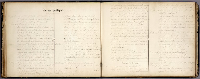
(Text Page to) Europe Politique. (to accompany) Cours de Geographie. Institution de Mme. Butler. Saint-Omer. Marianne Hunt. 1844.
List No
2503.009
Note
Text to political geography of Europe.
Author
Hunt, Marianne
Full Title
(Text Page to) Europe Politique. (to accompany) Cours de Geographie. Institution de Mme. Butler. Saint-Omer. Marianne Hunt. 1844.
List No
2503.010
Note
Text to political geography of Europe.
Full Title
L'Europe avec les confins. (1693)
List No
3658.013
Note
Engraved map. Continental boundaries hand colored. Includes column of text at left. On verso "E 1" and "8 ."
Full Title
(L'Europe avec les confins. 1693)
List No
3658.014
Note
Engraved map. Continental boundaries hand colored. Outline map to be filled in by student. On verso "E 1 R" and "9 ."
Full Title
Nom, maison, religion, etc. des souverains qui regnent en Europe. En Janvier 1695.
List No
3658.015
Note
Engraved map. Continental boundaries and Western European boundaries hand colored. Only place names are for some Western European countries. Includes column of text at left. On verso "E 2" and "10 ."
Full Title
(Nom, maison, religion, etc. des souverains qui regnent en Europe. 1695?)
List No
3658.016
Note
Engraved map. Continental boundaries and Western European boundaries hand colored. Outline map to be filled in by student. On verso "E 2 R" and "11 ."
Full Title
L'Europe. (Nom, maison, religion, etc. des souverains). 1755.
List No
3658.017
Note
Engraved map. Country boundaries hand colored. Has country names for Central, Northern and eastern Europe. Includes column of text at left. On verso "E 3" and "12 ." David Rumsey Collection copy: has pen-and-ink revisions to text, 1755.
Full Title
L'Europe. (Nom, maison, religion, etc. des souverains. 1695?)
List No
3658.018
Note
Engraved map. Country boundaries hand colored. Outline map to be filled in by student. On verso "E 3 R" and "13 ."
Full Title
L'Europe. (Nom, maison, religion, etc. des souverains). 1755.
List No
3658.019
Note
Engraved map. Country boundaries hand colored. Has country and island names for Southern Europe and Southern Russia. Includes column of text at left. On verso "E 4" and "14 ." David Rumsey Collection copy: has revisions in pen-and-ink to 1755.
Full Title
L'Europe. (Nom, maison, religion, etc. des souverains. 1695?)
List No
3658.020
Note
Engraved map. Country boundaries hand colored. Outline map to be completed to student. On verso "E 4 R" and "15 ."
Full Title
L'Europe avec les viles capitales des principales souverainetez. (1693)
List No
3658.021
Note
Engraved map. Country boundaries hand colored. Shows major cities with names. Includes column of text at left. On verso "E 5" and "16 ."
Full Title
L'Europe (avec les viles capitales des principales souverainetez. 1693)
List No
3658.022
Note
Engraved map. Country boundaries hand colored. Outline map showing location of major cities; to be filled in by student. On verso "E 5 R" and "17 ."
Full Title
L'Europe avec trois mers, trois fleuves & trois chaines de montagnes qui sont comunes a plus d'un pays. (1693)
List No
3658.023
Note
Engraved map. Country boundaries hand colored. Relief shown pictorially. Includes column of text at left. On verso "E 6" and "18 ."
Full Title
L'Europe (avec trois mers, trois fleuves & trois chaines de montagnes qui sont comunes a plus d'un pays. 1693)
List No
3658.024
Note
Engraved map. Country boundaries hand colored. Relief shown pictorially. Outline map to be filled in by student. On verso "E 6 R" and "19 ."
Full Title
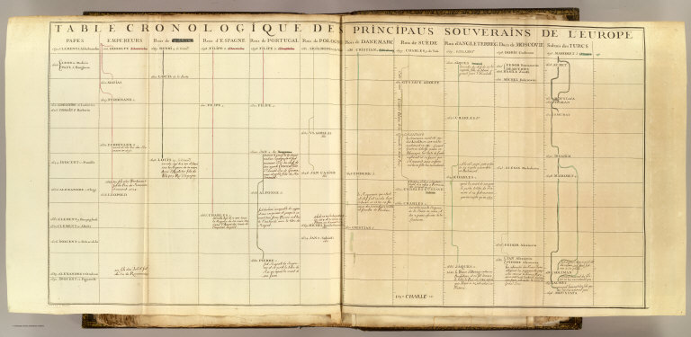
Table cronologique de principaus souverains de l'Europe. Grave par C. Vincent. (1697?)
List No
3658.062
Note
Engraved chart, hand colored. Latest date on chart is 1697. Has annotations in pen-and-ink. "84" on verso.
Full Title
Europe. (By Frances Bowen. 1810)
List No
4871.003
Note
Manuscript map. Pen-and-ink and watercolor. Relief shown pictorially.
1-26 of 26
|
![[Europe.]](https://www.davidrumsey.com/rumsey/Size2/RUMSEY~8~1/213/14489003.jpg)
![[Europe.]](https://www.davidrumsey.com/rumsey/Size2/RUMSEY~8~1/213/14489004.jpg)