|
REFINE
Browse All : School Atlas and Atlas Map of North Africa
1-4 of 4
Author
Duval, Henri
Full Title
Atlas Universel. Tableau historique et Geographique de Rome ancienne, Par Henri Duval, Chevr. de la Legion d'honneur, Professeur d'histoire, de geographie, de belles-lettres, &. Paris (1834), Chez l'Auteur, rue de la Chaussee d'Antin, No.15... Johanneau, Rue du Coq. No. 8 bis. ,,, Ate. Foucher.
List No
0254.003
Note
Map of Roman Empire with chronologies of historic events. Hand tinted text to match mapped areas. Relief shown with simple hachures.
Author
Stieler, Adolf
Full Title
Vorder Asien und Nordost-Africa : Gotha b. J. Perthes 1826. (to accompany) Atlas ofver alla verldens delar. Upsala, Palmblad & Co. 1825.
List No
13428.026
Note
Engraved hand colored in outline map. Shows political boundaries.
Author
Ruhle von Lilienstern, August
Full Title
Vom Senegal bis zum Bosphorus. Berlin 1925. von R.v.L.
List No
5759.023
Note
Shows relief in hachures, hydrography, settlements, and countries outlined in color.
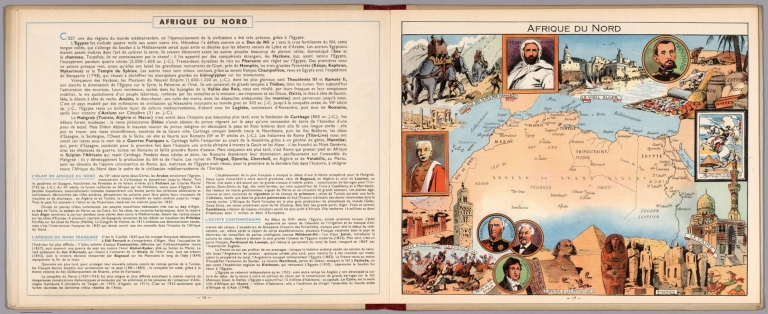
Author
[Pinchon, J.P., Perpillou, A.]
Full Title
(Text Page with Map) Afrique du Nord.
List No
7966.011
Note
Text and corresponding map with lavish vignettes of historic events, activities, crops, modes of transportation, structures, etc.
1-4 of 4
|