|
Author
Weiland, C. F. (Carl Ferdinand), 1782-1847
Full Title
Die Vereinigten Staaten von Nord America entworfen von C. F. Weiland. Weimar, im Verlag des Geograph. Instituts, 1828.
List No
14365.059
Note
Map of the United States, as of 1828. Shows political boundaries, cities, population, topography, bodies of water, drainage, coastlines, islands and territories of indigenous peoples. Relief shown with hachures. Includes latitudinal and longitudinal lines, as well as a legend and two bar scales. With hand-drawn annotation in blue colored pencil. Hand-colored engraving. Map is 30 x 43 cm, on sheet 45 x 57 cm. (Plate number taken from table of contents.)
Author
Silishchensky, Mitrofan Ivanovich 1878 - 1944
Full Title
Sev. Amer. Soyedinennyye shtaty, Meksika i Yuzhnaya. Kanada : Ekonomicheskaia karta. Prof. M. I. Silishchenskiy. "Geokartprom" Typo-Lithography and M.T. Dunaeva, Moscow. (to accompany) Geograficheskiy atlas Chast 1.
List No
13461.043
Note
Economic map of North. America. Covers part of Central America. Includes legend and tables.
Author
[Brion de La Tour, Louis, 1743 – 1803, Desnos, Louis Charles]
Full Title
Nouveau Mexique, Louisiane, Canada, et les Etats Unis. Par M. Brion. A Paris, chez le Sr. Desnos. A.P.D.R. 1786. (to accompany) Atlas general, civil, ecclesiastique et militaire, methodique et elementaire pour l'etude de la geographie et de l'histoire ... par M. Brion, dirige par le sr. Desnos … A Paris 1786.
List No
13129.057
Note
Engraved hand color map. Two long rivers run from California to the Rocky Mountain region. Shows American Indian settlements. Louisiana is divided into two regions, Floride, which contains all of the territory between the appellations and the Mississippi, and Louisiana proper. Relief shown pictorially. Includes note regarding explorations along the Northwest Coast of America. Includes decorative engraved title cartouche and border.
Author
[Brion de La Tour, Louis, 1743 – 1803, Desnos, Louis Charles]
Full Title
Carte Des Etats-Unis de l'Amerique Septentrionale, dressee d'apres des Cartes Anglaises; Par M. Brion. A Paris, chez le Sr. Desnos. (to accompany) Atlas general, civil, ecclesiastique et militaire, methodique et elementaire pour l'etude de la geographie et de l'histoire ... par M. Brion, dirige par le sr. Desnos … A Paris 1786.
List No
13129.061
Note
Unnumbered engraved hand color map of the United State, one of the earliest maps to name the United States (Etats Unis de L'Amerique Septentrionale. In the northwest, northwest, the "Countree des Six Nations" is depicted, as are many of the Indian territories. Includes decorative engraved title cartouche and border. Relief shown pictorially.
Author
Smiley, Thomas T.
Full Title
United States. (with) Eastern States.
List No
0902.004
Note
In full color by state or territory. Two inset vignettes: the signing of the Declaration of Independence and depictions of "commerce, manufacture and agriculture."
Full Title
United States. (with) New England States. Wightman Sc. Published by Lincoln & Edmands, Boston, (1819)
List No
0004.003
Note
Uncolored engraved map with inset. Relief shown pictorially. Prime meridians: London and Philadelphia.
Full Title
United States. H. Morse Sc. Published by Lincoln & Edmands, Boston. (1832)
List No
0006.003
Note
Engraved map. Outline hand col. Relief shown pictorially. Includes inset. Prime meridians: Washington and Greenwich.
Full Title
United States. J.G. Melish, del. (Philadelphia: Published by M. Carey & Son, 1825)
List No
0124.013
Note
Engraved map. Relief shown by hachures. Prime meridians: London and Washington.
Author
Cornell, S. S. (Sarah S.)
Full Title
Principal cities of the United States. Entered ... 1856, by S.S. Cornell ... Southern District of New York. Geo. Rae Smith, engraver, N.Y. New York: D. Appleton & Co., 443 & 445 Broadway. (1864)
List No
0197.005
Note
Seventeen engraved maps on 1 sheet. Contents: New York City and vicinity -- Portland -- Portsmouth -- Boston -- Providence -- Philadelphia -- Baltimore -- Washington City -- Charleston -- Savannah -- St. Louis -- Mobile -- New Orleans -- Chicago -- Cincinnati -- Detroit -- Buffalo & Niagara River. "Reference map."
Author
Cornell, S. S. (Sarah S.)
Full Title
United States. Designed to accompany Cornell's High school geography. Entered ... 1855, by S.S. Cornell ... Southern District of New York. New York: D. Appleton & Co., 443 & 445 Broadway. (1864)
List No
0197.006
Note
Engraved map. Hand colored. Relief shown by hachures. Prime meridians: Greenwich and Washington. David Rumsey Collection copy has additions in pencil.
Author
[Diercke, Carl, Gaebler, Eduard]
Full Title
Vereinigte Staaten und Mexiko. Diercke u. Gaebler, Schulatlas fur hohere Lehranstalten. Druck und Verlag : Braunschweig, George Westermann.
List No
0243.044
Note
Color map on 2 pages. Relief shown by hachures. Prime meridian is Greenwich.
Author
Duval, Henri
Full Title
Atlas Universel. Tableau historique et geographique de l'Amerique Septenrionales. Par Henri Duval, Chevalier de la Legion d'honneur, Professeur d'Histoire, de Geographie, de Belles-lettres, & &. Paris (1834), Chez l'Auteur, rue de la Chaussee d'Antin, No.15... Johanneau, Rue du Coq. 8 bis. ,,, Impie. lith. de E. Houbloup, rue Dauphine 22 et 24.
List No
0254.027
Note
Map of North America with descriptions of historic events and famous personages. Hand tinted text to match regions. Relief shown by simple hachures.
Author
[Fitch, George W., Weeks, Lydia S.]
Full Title
United States. Drawn by (to be filled in. By George W. Fitch. New York: Sheldon, Blakeman and Company, 115 Nassau Street. Entered ... 1850, by Huntington and Savage ... New York)
List No
0289.002
Note
Printed map form with title, grid lines and numbers or "mapping plate." Map data added including relief by hachures in pen-and-ink by Lydia S. Weeks. Prime meridians: Greenwich and Washington.
Full Title
United States. J.H. Young Sc. (Philadelphia: John Grigg, No. 9 North Fourth Street. 1830)
List No
0315.004
Note
Engraved map. Full hand color. Relief shown pictorially. Prime meridians: Greenwich and Washington.
Full Title
Etats-Unis de l'Amerique Seple. avec le Canada et la Floride. (A Paris, chez Delamarche, Geogr., ca. 1800)
List No
0421.024
Note
Engraved map. Outline hand coloring. Relief shown pictorially. Prime meridian: Ferro.
Author
Melish, John
Full Title
United States. (engraved by) H.S. Tanner. Sc. Published ... 1814 by J. Melish. J. Vallance & H.S. Tanner. Philadelphia. Includes References to the States. &c. (to accompany) A New Juvenile Atlas, And Familiar Introduction To The Use Of Maps: With A Comprehensive View Of The Present State Of The Earth ... First American From The Latest London Edition, Corrected And Improved, By John Melish. Philadelphia, Printed For John Melish, John Vallance, And H.S. Tanner, No. 209, Chestnut-Street, By G. Palmer. 1814.
List No
0496.030
Note
Outline colored map. The text for the United States is on the previous page (p. 22). Relief shown pictorially and by hachures. The Half leather, marbled paper covered boards, with gold title on spine - "Juvenile Atlas. 1814.
Author
Mitchell, Samuel Augustus
Full Title
Map of the United States and Texas. (with) Map of Mexico and Guatimala. Entered ... 1839, by S. Augustus Mitchell ... Pennsylvania.
List No
0522.002
Note
Without color. Dotted divisions between the states, territories, and countries. Mountains and deserts shown.
Author
Mitchell, Samuel Augustus
Full Title
Map of the United States and Texas Engraved to Illustrate Mitchell's School and Family Geography. No. 4. (with) Map of Mexico and Guatimala ... No. 5. Engraved by W. Williams. Entered ... 1839, by S. Augustus Mitchell ... Connecticut.
List No
0523.003
Note
In full color by state, territory, or country.
Full Title
United States. Engraved for Morse's School geography. (Published by Richardson & Lord. Sold also by Collins & Hannay, New-York, 1828)
List No
0627.004
Note
Engraved map. Outline hand colored. Relief shown by hachures. Shows states, settlements, rivers, etc. Prime meridians: Washington and Greenwich. Engraver name erased from plate.
Full Title
Outline of Asia. Outline of S. America. Outline of Africa. Outline of the U. States. Outline of N. America. (Published by Richardson & Lord. Sold also by Collins & Hannay, New-York, 1828)
List No
0627.008
Note
Five engraved outline maps. Hand colored.
Author
شكوفه مقبل [Şukufe Mukbil]
Full Title
(North and Central America with Railroads)
List No
10992.038
Note
Dimensions are sheet size.
Author
شكوفه مقبل [Şukufe Mukbil]
Full Title
(United States with railroads)
List No
10992.041
Note
Dimensions are sheet size.
Author
[Grenet, Abbe, Bonne, Rigobert]
Full Title
Les etats Unis de l'Amerique septentrionale, contenant en outre, les Isles Royale, de Terre Neuve, de St. Jean et l'Acadie; avec partie du Canada, de la Louisiane et de la Floride. Par M. Bonne, ingenieur - Hydrographe de la Marine. A' Venise, Par P. Santini. (to accompany) Atlas portatif a l'usage des colleges, pour servir a l'intelligence des auteurs classiques. 42.
List No
11172.045
Note
Copper engraved outline hand colored map. Shows the United States confined to east of the Appalachians, to the west is Louisiane. Map showing boundaries, numerous cities and towns. Prime meridians are Paris and Ferro. Relief shown pictorially.
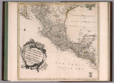
Author
Euler, Leonhard, 1707-1783
Full Title
Americae septentrionalis pars III. (to accompany) Atlas geographicus omnes orbis terrarum regiones = Atlas geographique representant en XLI cartes toutes les regions de la terre ... Berolini : Ex officina Michaelis MDCCLIII (1753).
List No
11392.052
Note
Part 3 of 4 part map of North America. Hand colored copperplate engraving map on 2 sheets. Covers the region from the Gulf Coast of the U.S. through Mexico to Honduras. Showing geographic features, rivers, lakes, mountains, cities, and principal towns. Relief shown pictorially. In lower right corner: 5. Novell America 3. theil.
Author
Lange, I. E.
Full Title
Charte von der vereinigten Staaten von Nord-America die vereinigten provinzen von N. Amerika, Neuhampshire, Massachusetsbay, Conecticut, rhodeisland, Newyork, Newjersey, Pensylvanien, Delaware, Maryland, Virginien, N.u. S. Carolina, Georgien, enthalten 35,000 quadr. Meilen, mit 9 Milion Menschen. (to accompany) Neuer hand und elementar atlas ... Entworfen von I.E. Lange. Leipzig 1809.
List No
11945.019
Note
Engraved and hand painted with outline color map of the United States provinces, including New Hampshire, Massachusets Bay, Conecticut, Rhode Island, New York, New Jersey, Pennsylvania, Delaware, Maryland, Virginia, N. and S. Carolina, Georgia, part of Florida and Canada. Contains 35,000 quadr. Miles, with 9 million people. Shows state boundaries, major cities, rivers and mountains. Relief shown by hachures. Prime meridian is London.
Author
Tanner, Henry Schenck, 1786-1858
Full Title
A Map of the United States of America.
List No
12139.009
Author
[Diercke, Carl, 1842-1913, Gaebler, Eduard, 1842-1911]
Full Title
S20. Vereinigte Staaten und Mexiko.
List No
12198.024
Author
Woodbridge, William C.
Full Title
United States And British Provinces. (engraved by) Perkins & Heath. London. Published by Whittaker, Treacher & Arnot.13 Ave-Maria-Lane, London. . (to accompany) Modern Atlas On A New Plan; To Accompany The System Of Universal Geography, By William Channing Woodbridge. Includes: Reference to Cities. Seats of Government. Large Town. Small Towns. Figures 1. 2. 3. &c refers to Classes. Colleges. Principal Roads. (note) The Western U.S. Territory extending to the Pacific Ocean is inhabited exclusively by Indians and Traders.
List No
1224.011
Note
Hand painted outline color map. Covers are quarter leather blue paper covered boards printed with "Modern Atlas On A New Plan; To Accompany The System Of Universal Geography, By William Channing Woodbridge. London: Published For The Proprietors, By Geo. B. Whittaker, Ave-Maria-Lane. 1828. Relief shown by hachures. Prime meridian is Greenwich.
Author
Woodbridge, William C.
Full Title
Physical Map Of The United States. Adapted To Woodbridge's Geography. Figures 1. 2, 3, 4., near Rivers Indicated their Rank. Entered ... 1843, by W.C. Woodbridge ... Massachusetts. Hartford. Published By Wm. Jas. Hamersley. (to accompany) Modern Atlas, Physical, Political And Statistical; Exhibiting On Separate Maps ... Includes 4 inset maps.
List No
1229.011
Note
Map showing the rivers, mountains, lakes, coastal cities and islands. Covers are heavy brown paper printed with "School Atlas, To Accompany The Modern School Geography, By William C. Woodbridge ... Hartford: Published By Belknap & Hamersley. Entered ... 1843, by William C. Woodbridge ... Massachusetts. Case, Tiffany & Co. Printers, Hartford, Conn." prime meridian is Washington D.C. Relief shown by hachures.
Author
Woodbridge, William C.
Full Title
Political Map Of The United States, Mexico And The British Provinces. Adapted To Woodbridge's Geography. Engraved by J.M. Atwood. N. York. Entered ... 1845, by W.C. Woodbridge ... Massachusetts. Hartford. Published By Wm. Jas. Hamersley. (to accompany) Modern Atlas, Physical, Political And Statistical; Exhibiting On Separate Maps ... (inset) Map Of Railways & Canals In The Middle States. (inset map) Michigan, Wisconsin, & Iowa. (inset map) District of Columbia.
List No
1229.012
Note
Map printed in hand painted outline color. Includes References and Explanations showing Cities, Inhabitants, Small and Large towns, Capitals, Canals and Railways. Covers are heavy brown paper printed with "School Atlas, To Accompany The Modern School Geography, By William C. Woodbridge ... Hartford: Published By Belknap & Hamersley. Entered ... 1843, by William C. Woodbridge ... Massachusetts. Case, Tiffany & Co. Printers, Hartford, Conn." Relief shown by hachures.
Author
Woodbridge, William C.
Full Title
Physical & Political Map Of The N. Eastern States. Adapted To Woodbridge's Geography. Drawn and Engrd. by Story & Atwood. N. York. Entered ... 1843, by W.C. Woodbridge ... Massachusetts. Hartford. Published By Wm. Jas. Hamersley. (to accompany) Modern Atlas, Physical, Political And Statistical; Exhibiting On Separate Maps ...
List No
1229.013
Note
Full color color. Includes References and Explanations showing Cities, Inhabitants, Small and Large towns, Universities or Colleges, Capitals, Canals and Railways. Covers are heavy brown paper printed with "School Atlas, To Accompany The Modern School Geography, By William C. Woodbridge ... Hartford: Published By Belknap & Hamersley. Entered ... 1843, by William C. Woodbridge ... Massachusetts. Case, Tiffany & Co. Printers, Hartford, Conn." Prime meridians are Greenwich and Washington D.C. Relief shown by hachures.
Author
Woodbridge, William C.
Full Title
Political Map Of the Northern Division Of The United States. Adapted To Woodbridge's Geography. Entered ... 1843, by W.C. Woodbridge ... Massachusetts. Hartford. Published By Wm. Jas. Hamersley. (to accompany) Modern Atlas, Physical, Political And Statistical; Exhibiting On Separate Maps ...
List No
1229.014
Note
Full color color. Includes References and Explanations showing Cities, Inhabitants, Small and Large towns, Universities or Colleges, Capitals, Canals and Railways. Covers are heavy brown paper printed with "School Atlas, To Accompany The Modern School Geography, By William C. Woodbridge ... Hartford: Published By Belknap & Hamersley. Entered ... 1843, by William C. Woodbridge ... Massachusetts. Case, Tiffany & Co. Printers, Hartford, Conn." Prime meridians are Greenwich and Washington D.C. Relief shown by hachures.
Author
Woodbridge, William C.
Full Title
Physical & Political Map Of the Southern Division Of The United States. Adapted To Woodbridge's Geography. Entered ... 1843, by W.C. Woodbridge ... Massachusetts. Hartford. Published By Wm. Jas. Hamersley. (to accompany) Modern Atlas, Physical, Political And Statistical; Exhibiting On Separate Maps ... (inset map) Vicinity of Charleston. (inset map) vicinity of New Orleans.
List No
1229.015
Note
Full color color. Includes References and Explanations showing Cities, Inhabitants, Small and Large towns, Universities or Colleges, Capitals, Canals and Railways, Head of navigation of Rivers. Covers are heavy brown paper printed with "School Atlas, To Accompany The Modern School Geography, By William C. Woodbridge ... Hartford: Published By Belknap & Hamersley. Entered ... 1843, by William C. Woodbridge ... Massachusetts. Case, Tiffany & Co. Printers, Hartford, Conn." Prime meridians are Greenwich and Washington D.C. Relief shown by hachures.
Author
Woodbridge, William C.
Full Title
Physical Map Of The United States. Adapted To Woodbridge's Geography. Figures 1, 2, 3, 4, Near Rivers, Indicate Their Ranks. Entered .. . 1843, by W.C. Woodbridge ... Massachusetts. Hartford. Published By Wm. Jas. Hamersley. Includes 5 inset maps.
List No
1231.011
Note
Map printed without color. Covers are heavy brown paper printed with "School Atlas, To Accompany The Modern School Geography, By William C. Woodbridge ... Hartford: Published By Wm. Jas. Hamersley. Entered ... 1843, by William C. Woodbridge ... Massachusetts. Case, Tiffany & Co. Printers, Hartford, Conn." Prime meridian is Washington D.C. Relief shown by hachures.
Author
Woodbridge, William C.
Full Title
Political Map Of The United States, Mexico And The British Provinces. Adapted To Woodbridge's Geography. Engraved by J. M. Atwood. N. York. Entered .. . 1845, by W.C. Woodbridge ... Massachusetts. Hartford. Published By Wm. Jas. Hamersley. (inset) Map of Railways & Canals In the Middle States. (inset map) Michigan, Wisconsin, Iowa, Minesota. (Inset map) District Of Columbia.
List No
1231.012
Note
Outline color map. Includes References and Explanations, Showing Cities, Inhabitants, Canals and Railways. Covers are heavy brown paper printed with "School Atlas, To Accompany The Modern School Geography, By William C. Woodbridge ... Hartford: Published By Wm. Jas. Hamersley. Entered ... 1843, by William C. Woodbridge ... Massachusetts. Case, Tiffany & Co. Printers, Hartford, Conn." Relief shown by hachures.
Author
Woodbridge, William C.
Full Title
Physical And Political Map Of The N. Eastern States. Adapted To Woodbridge's Geography. Drawn & Engd. by Story & Atwood. N. York. Entered .. . 1843, by W.C. Woodbridge ... Massachusetts. Hartford. Published By Wm. Jas. Hamersley.
List No
1231.013
Note
Full color map. Includes References and Explanations, showing Cities, Inhabitants, Universities or Colleges, Canals and Railways. Covers are heavy brown paper printed with "School Atlas, To Accompany The Modern School Geography, By William C. Woodbridge ... Hartford: Published By Wm. Jas. Hamersley. Entered ... 1843, by William C. Woodbridge ... Massachusetts. Case, Tiffany & Co. Printers, Hartford, Conn." Prime meridians are Greenwich and Washington D.C. Relief shown by hachures.
Author
Woodbridge, William C.
Full Title
Political Map Of The Northern Division Of the United States. Adapted To Woodbridge's Geography. Entered .. . 1843, by W.C. Woodbridge ... Massachusetts. Hartford. Published By Wm. Jas. Hamersley.
List No
1231.014
Note
Full color map. Includes References and Explanations, showing Cities, Inhabitants, Universities or Colleges, Canals and Railways. Covers are heavy brown paper printed with "School Atlas, To Accompany The Modern School Geography, By William C. Woodbridge ... Hartford: Published By Wm. Jas. Hamersley. Entered ... 1843, by William C. Woodbridge ... Massachusetts. Case, Tiffany & Co. Printers, Hartford, Conn." Prime meridians are Greenwich and Washington D.C. Relief shown by hachures.
Author
Woodbridge, William C.
Full Title
Physical & Political Map Of The Southern Division Of the United States. Adapted To Woodbridge's Geography. Entered .. . 1843, by W.C. Woodbridge ... Massachusetts. Hartford. Published By Wm. Jas. Hamersley. (inset map) Vicinity of Charleston. (inset map) Vicinity of New Orleans.
List No
1231.015
Note
Full color map. Includes References and Explanations, showing Cities, Inhabitants, Universities or Colleges, Canals and Railways. Covers are heavy brown paper printed with "School Atlas, To Accompany The Modern School Geography, By William C. Woodbridge ... Hartford: Published By Wm. Jas. Hamersley. Entered ... 1843, by William C. Woodbridge ... Massachusetts. Case, Tiffany & Co. Printers, Hartford, Conn." Prime meridians are Greenwich and Washington D.C. Relief shown by hachures.
Author
[Woodbridge, William C., Willard, Emma]
Full Title
United States.
List No
12497.006
Author
[Woodbridge, William C., Willard, Emma]
Full Title
The United States.
List No
12497.012
Author
Faden, William, 1749-1836
Full Title
British possessions in North America with the United States 1818. Published by Wm. Faden. Jany. 1st.,1819. W. Palmer, Sculp. (to accompany) Atlas minimus universalis, or, A geographical abridgement ancient and modern of the several parts of the earth ... Second edition. Jan 1, 1821.
List No
13243.071
Note
Double page outline hand color copperplate engraved map. Covers the area from the Gulf of St. Lawrence south to Florida and Louisiana. Shows political and administrative boundaries, cities and towns. Prime meridian is London. Relief shown pictorially.
Author
Faden, William, 1749-1836
Full Title
Mexico of Spanish Territories in North America. Published by Wm. Faden. Jany. 1st.,1819. T. Starling, Sculp. (to accompany) Atlas minimus universalis, or, A geographical abridgement ancient and modern of the several parts of the earth ... Second edition. Jan 1, 1821.
List No
13243.072
Note
Double page outline hand color copperplate engraved map, With inset: Continuation Southward. Prime meridian is Greenwich. Relief shown pictorially. Includes manuscript log in right margin.
Author
Stieler, Adolf
Full Title
Nord - America. (to accompany) Atlas ofver alla verldens delar. Upsala, Palmblad & Co. 1825.
List No
13428.028
Note
Engraved hand colored in outline map, including Canada, the United States and Central America. Inset: Nordostl. theil der verein staaten. Shows political boundaries. and northeastern states.
Author
Meḥmed Remzi
Full Title
Hokumat Muttahed Amrīka. Meksika = United State of America. Mexico. Cografya-yi ʻumumī atḷasi. stanbul : Mekteb-i Funun-ı Harbiye-i Sahanesi Matbaası, 1905=1323 h.
List No
13436.051
Note
Black and white outline map of United States and Mexico on 2 pages. Relief shown by hachures.
Author
Meḥmed Remzi
Full Title
(Outline map of the United States and Mexico). Umumi jughrafia atlasi = Atlas of general geography. Assar Muhammad Ramzi, Maktab Harbiye Matbaa si. Mulayiyuh sanah 1325 (1907).
List No
13534.015
Note
Outline map, covers part of Canada and Central America.
Author
Meḥmed Remzi
Full Title
(Outline map of the United States and Mexico). Umumi jughrafia atlasi = Atlas of general geography. Assar Muhammad Ramzi, Maktab Harbiye Matbaa si. Mulayiyuh sanah 1325 (1907).
List No
13534.016
Note
Outline map, covers part of Canada and Central America. Copy 2.
Author
Hossein
Full Title
(Outline map of Canada) .جغرافیای عمومی اطلسی = Atlas of general geography. Istanbul 1300 (1923).
List No
13686.025
Note
Outline color map of Canada, Greenland, Iceland, Alaska and the Great Lakes.
Author
Hossein
Full Title
(Outline map of the United States and Mexico) .جغرافیای عمومی اطلسی = Atlas of general geography. Istanbul 1300 (1923).
List No
13686.026
Note
Outline color map of the United States, Mexico and Central America and Caribbean.
Author
Imhof, Eduard, 1895-1986
Full Title
Vereinigte Staaten und Mexiko.
List No
14401.098
Note
Overview map of the United States and Mexico, in 1969. Shows cities, railways, roads, topography, bodies of water, drainage, coastlines, islands and water depths. Relief shown with shading and spot heights. Includes latitudinal and longitudinal lines, a legend, bar scale and scale statement. With inset map: Die Schweiz [Switzerland]. Colored lithograph. Map is 29 x 39 cm, on double sheet 33 x 44 cm. Appears in section entitled Nord- und Mittelamerika [= North and Central America].
Author
[Huntington, Francis Junius, 1802-1878, Huntington, Hezekiah, 1795-1865]
Full Title
United States. Entered ... 12th day of August 1830 by H. & F.J. Huntington ... Connecticut. Geo. Boynton, Sc., Boston.
List No
1902.005
Note
Engraved map. Hand colored. Relief shown pictorially. Prime meridians: Washington and Greenwich.
|