|
Author
Logerot, A. (Auguste)
Full Title
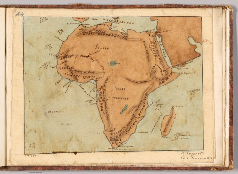
Afrique. A. Logerot ; Ce 8 Janvier 1856.
List No
14489.041
Note
Manuscript map representing Africa. Shows select regions, cities, mountain ranges, deserts, drainage, coastlines, and islands. Relief shown with shading. Ink, pencil, and watercolor on paper. Map is 22 x 28 cm, on sheet 24 x 31 cm. (Page number written as “43” for page 44 in volume.)
Author
[Ravenstein, August, Berlin Geographisch-Artistische Anstalt Ernst Schotte]
Full Title
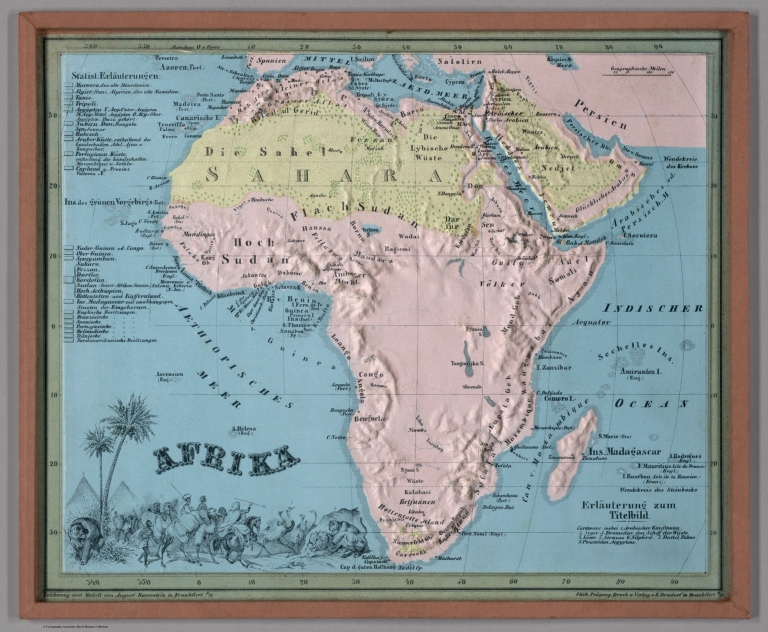
Afrika. Zeichnung u. Modell von August Ravenstein in Frankfurt a. M. Stich, Prägung, Druck u. Verlag von B. Dondorf in Frankfurt a. M.
List No
14473.009
Note
Relief map of Africa. Shows geographical regions, countries, cities, railways, topography, vegetation, bodies of water, drainage, coastlines, shoals and islands. Topography shown with raised relief. Includes a legend, bar scale given in miles, latitudinal and longitudinal lines, as well as statistical and descriptive notes. Additional legend for map appears on title page. With an indexed vignette of scenery, figures, fauna and flora. Colored lithograph. Map is 22 x 27 cm, within frame 24 x 28 cm. Within a series of eight maps comprising the school atlas, Plastischer Schul-Atlas.
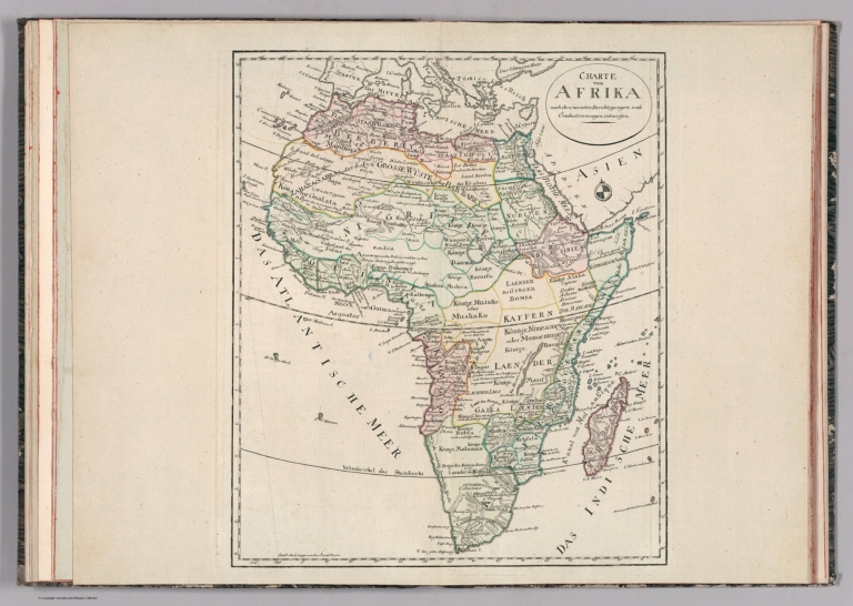
Author
Weiland, C. F. (Carl Ferdinand), 1782-1847
Full Title
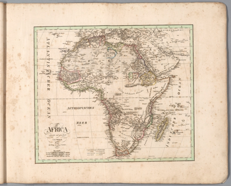
Africa entworfen und gezeichnet von C. F. Weiland. Weimar, im Verlag des Geogr. Instituts, 1827.
List No
14365.050
Note
Map of Africa, as of 1827. Shows political boundaries (including European colonies), cities, topography, deserts, bodies of water, drainage, coastlines, shoals and islands. Relief shown with hachures. Includes latitudinal and longitudinal lines, as well as a legend, three bar scales and descriptive text throughout. Hand-colored engraving. Map is 32 x 38 cm, on sheet 45 x 57 cm. (Plate number taken from table of contents.)
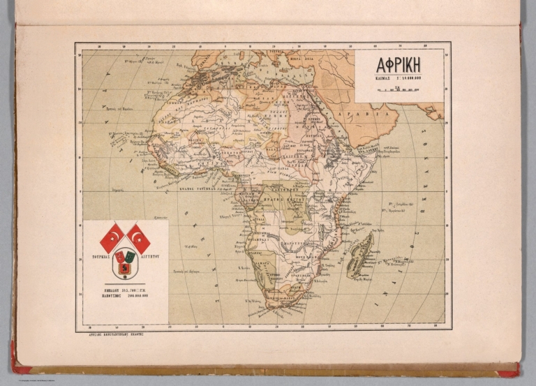
Silishchensky, Mitrofan Ivanovich 1878 -... 13. Afrika. Ekonomichesko-Politicheskaia... 1902 13461.026 Related Author
Silishchensky, Mitrofan Ivanovich 1878 - 1944
Full Title
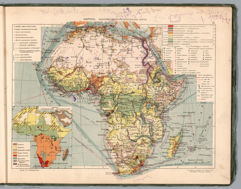
Afrika. Ekonomichesko-Politicheskaia karta. Prof. M. I. Silishchenskiy. Gos. Kartogr. Institut NTU-VSNKH-SSR. Kartografiya Leningrad. (to accompany) Geograficheskiy atlas Chast 1.
List No
13461.026
Note
Economical and political map of Africa. Includes legend and color coded key.
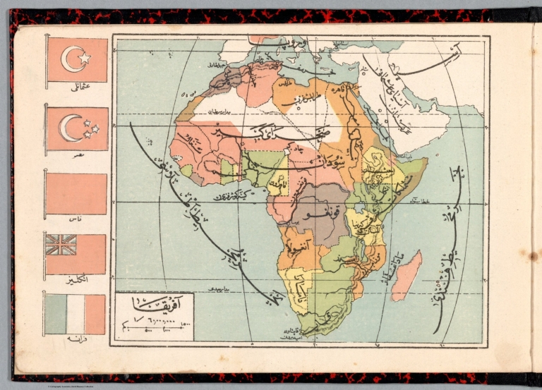
Author
Abdulqader, M.
Full Title
Afrika = Africa. (to accompany) Küçük Coğrafya = (School atlas of geography). ikinci kisim. Murtabi M. Abdulqader. 1325 (1907).
List No
13530.017
Note
Color map of Africa. Shows political boundaries, major cities, rivers and mountains. Relief shown by hachures. Includes vignettes of flags of various African countries.
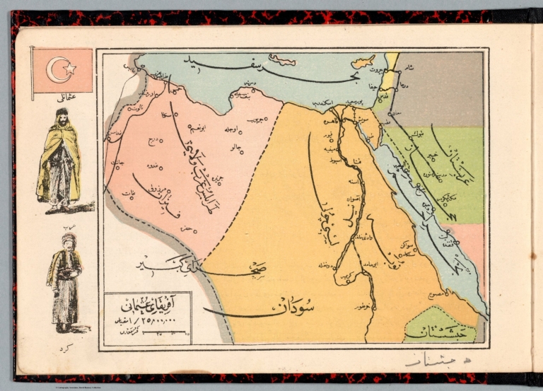
Author
Abdulqader, M.
Full Title
Afrika-i Osmanî. = Ottoman Empire in Africa. (to accompany) Küçük Coğrafya = (School atlas of geography). ikinci kisim. Murtabi M. Abdulqader. 1325 (1907).
List No
13530.019
Note
Color map of Ottoman Empire in Africa. Shows political boundaries, major cities, rivers and mountains. Relief shown by hachures. Includes vignettes of traditional costumes and Ottoman flag.
Author
Anestis Konstantinidis, 1846-190
Full Title
Afriki. Anésti konstantinidis Ekdotie (to accompany) Neótatos geografikos atlas. En Athēnais 1895.
List No
13551.020
Note
Map of Africa.
Author
Smiley, Thomas T.
Full Title
Africa.
List No
0902.011
Note
In full color by country or region. Vignette on African map depicts "Music & Dancing of the Negroes."
Full Title
Africa. (Published by Lincoln & Edmands, 1819)
List No
0004.008
Note
Uncolored engraved map. Relief shown pictorially.
Full Title
Africa. H. Morse Sc. Published by Lincoln & Edmands, Boston. (1832)
List No
0006.009
Note
Engraved map. Outline hand col. Relief shown pictorially. Prime meridians: Greenwich and Washington. Engraver name is very faint (erased from plate?)
Author
Arrowsmith, Aaron Jr.
Full Title
Africa. Africa, Cum Aegypto et Insulis. London, Published Jany. 2, 1828 by A. Arrowsmith Hydrographer to His Majesty, No. 10, Soho Square.
List No
0035.008
Note
Two Outline hand color maps. Includes note. Relief shown by hachures. prime meridian is Greenwich.
Author
Arrowsmith, Aaron Jr.
Full Title
Northern Africa. Africa Septentrionalis, Sive Regio Littoralis intra Solis Montem et Aegyptum sita. London, Published Jany. 2, 1828 by A. Arrowsmith Hydrographer to His Majesty, No. 10, Soho Square.
List No
0035.029
Note
Two hand color maps in 4 parts. Shows regional political boundaries, fine detail in naming the major cities, mountain ranges, lakes, and rivers. Relief shown by hachures. Prime meridian is Greenwich.
Full Title
Africa. Philad., Published by M. Carey & Son, 1820. (1825)
List No
0124.011
Note
Engraved map. Relief shown pictorially.
Author
Cartee, Cornelius S.
Full Title
Map of Africa. Designed To Accompany Cartee's "Elements Of Physical Geography. Engraved by G.W. Boynton. Entered ... 1856, by Hickling, Swan, And Brown ... Massachusetts. (to accompany) A School Atlas Of Physical Geography ... By Cornelius S. Cartee, A.M. M DCCC LVI.
List No
0129.010
Note
Hand color map. Includes explanation. Shows regions, cities, rivers. Relief shown by hachures and spot heights. Prime meridian is Greenwich.
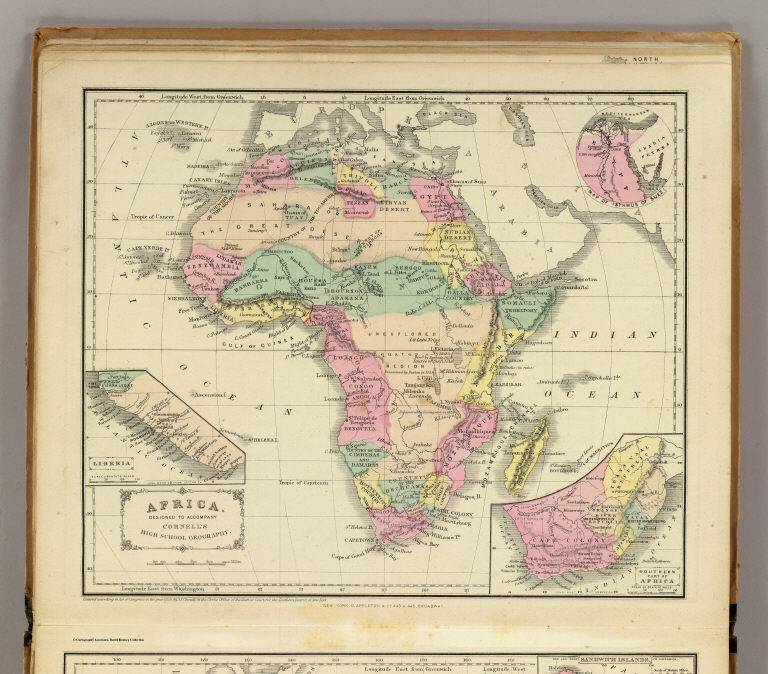
Author
Cornell, S. S. (Sarah S.)
Full Title
Africa. Designed to accompany Cornell's High school geography. (with) Map of Isthmus of Suez. (with) Liberia. (with) Southern part of Africa. Entered ... 1855, by S.S. Cornell ... Southern District of New York. New York: D. Appleton & Co., 443 & 445 Broadway. (1864)
List No
0197.025
Note
Engraved map with 3 insets. Hand colored. Relief shown by hachures. Prime meridians: Greenwich and Washington.
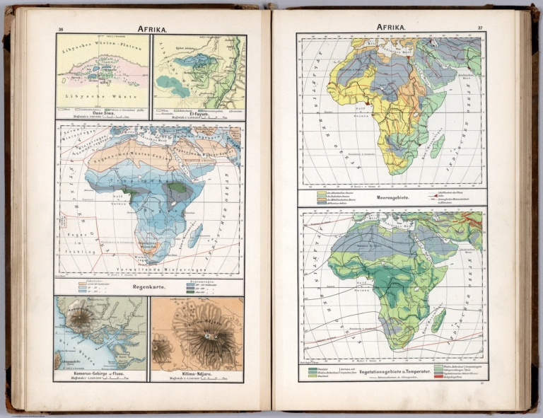
Author
[Diercke, Carl, Gaebler, Eduard]
Full Title
Afrika. Regenkarte. Meeresgebiete. Vegetationsgebiete u. temperatur. (to accompany) Diercke Schul-Atlas fur hohere Lehranstalten. (with 4 insets). "10" on the lower right margin.
List No
0243.030
Note
Three color maps with 4 insets on 2 pages. Insets: Oase Siwa, El-Fayum, Kamerun ..., Kilima - Ndjaro. Relief shown by hachures. Prime meridian is Greenwich.
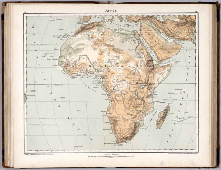
Author
[Diercke, Carl, Gaebler, Eduard]
Full Title
Afrika. Diercke u. Gaebler, Schulatlas fur hohere Lehranstalten. Druck und Verlag : Braunschweig, George Westermann.
List No
0243.031
Note
Color map. Relief shown by hachures. Prime meridian is Greenwich.
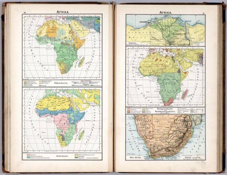
Author
[Diercke, Carl, Gaebler, Eduard]
Full Title
Afrika. Volkerkarte. Kulturkarte. Religionskarte und Bevolkerungesdichte. (to accompany) Diercke Schul-Atlas fur hohere Lehranstalten. (with 2 insets). "11" on the lower right margin.
List No
0243.032
Note
Three color maps with 2 insets on 2 pages. Insets: Nildelta, Sud-Afrika. Relief shown by hachures. Prime meridian is Greenwich.
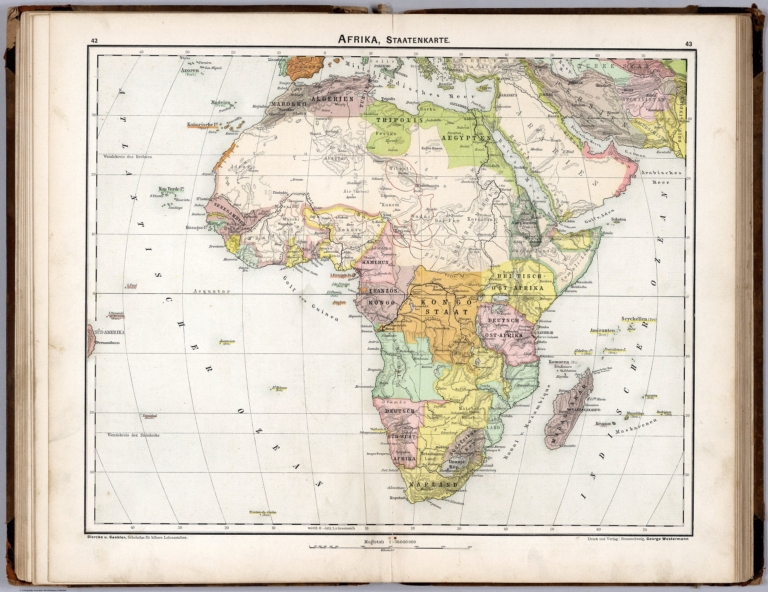
Author
[Diercke, Carl, Gaebler, Eduard]
Full Title
Afrika, Staatenkarte. Diercke u. Gaebler, Schulatlas fur hohere Lehranstalten. Druck und Verlag : Braunschweig, George Westermann.
List No
0243.033
Note
Color map on 2 pages. Shows political boundaries. Relief shown by hachures. Prime meridian is Greenwich.
Author
[Diercke, Carl, Gaebler, Eduard]
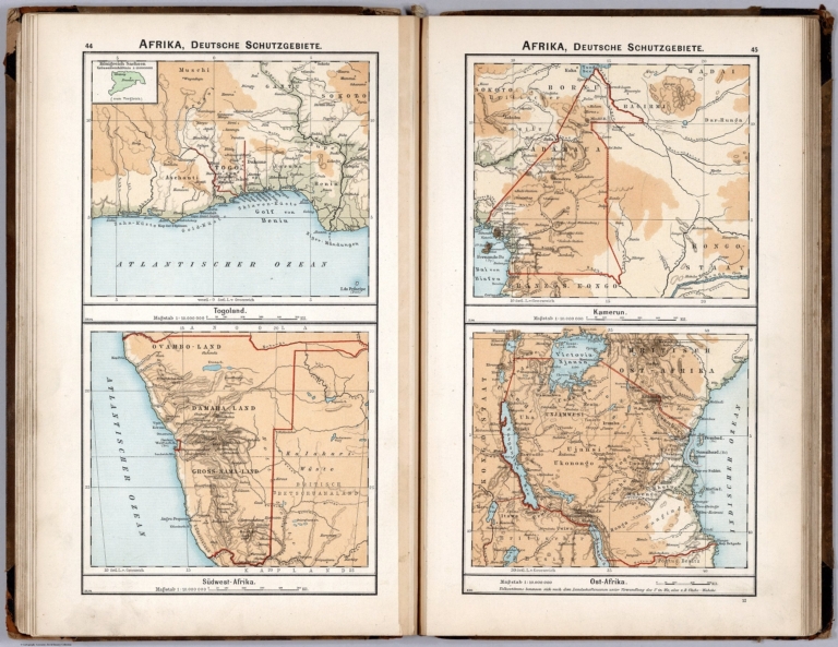
Full Title
Afrika, Deutsche Schutzgebiete. Togoland. Suewest-Afrika. XII.94. Kamerun. Ost-Afrika. II.96. (to accompany) Diercke Schul-Atlas fur hohere Lehranstalten. "12" on the lower right margin.
List No
0243.034
Note
Four color maps on 2 pages. Showing German colonies and protected areas in Togo, Southwest Africa, Cameroon, and East Africa. Relief shown by hachures. Prime meridian is Greenwich.
Author
[Diercke, Carl, Gaebler, Eduard]
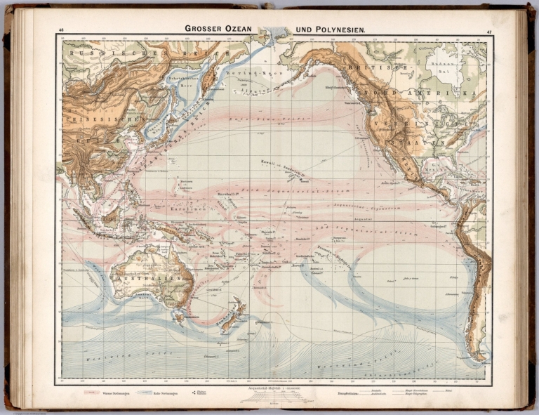
Full Title
Grosser Ozean und Polynesien. (to accompany) Diercke Schul-Atlas fur hohere Lehranstalten.
List No
0243.035
Note
Color maps on 2 pages. Showing Ocean currents, telegraph cables, etc. Relief shown by hachures. Prime meridian is Greenwich.
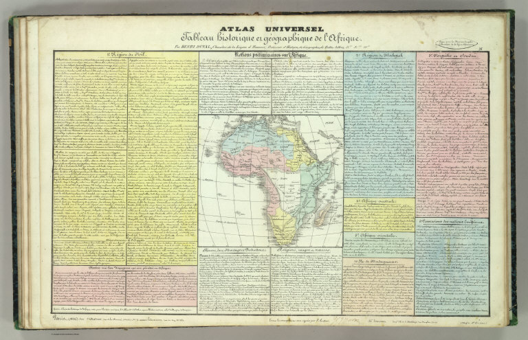
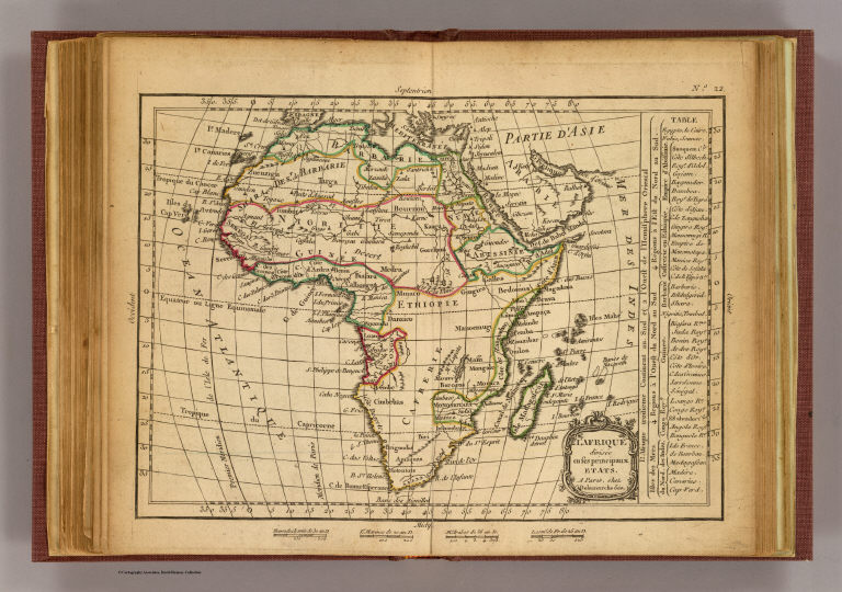
Author
Duval, Henri
Full Title
Atlas Universel. Tableau historique et geographique de l'Afrique. Par Henri Duval, Chevalier de la Legion d'honneur, Professeur d'Histoire, de Geographie, de Belles-lettres, & &. Paris (1834), Chez l'Auteur, rue de la Chaussee d'Antin, No.15... Johanneau, Rue du Coq. 8 bis. ,,, Impie. lith. de E. Houbloup, rue Dauphine 22 et 24.
List No
0254.026
Note
Hand tinted text to match regions. Relief shown by simple hachures.
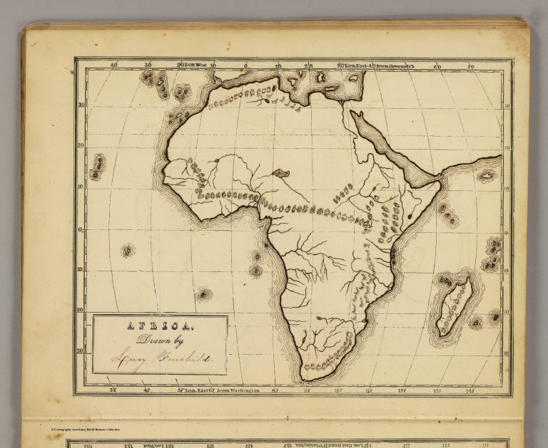
Author
[Fairchild, Lucy, Fitch, George W.]
Full Title
Africa. Drawn by (to be filled in. By George W. Fitch. New York: Sheldon, Blakeman and Company, 115 Nassau Street. Entered ... 1850, by Huntington and Savage ... New York)
List No
0289.011
Note
Printed map form with title, grid lines and numbers or "mapping plate." Map data added including relief by hachures in pen-and-ink by Lucy Fairchild. Prime meridians: Greenwich and Washington.
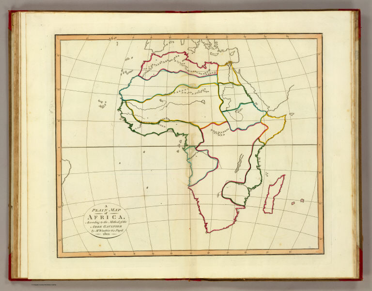
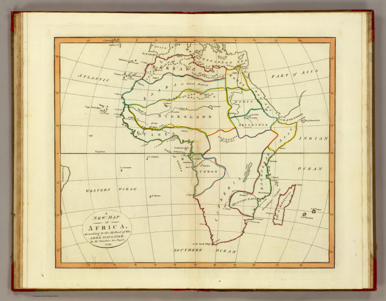
Author
[Gaultier, abbe (Aloisius Edouard Camille), 1746?-1818, Wauthier, J. M.]
Full Title
A plain map of Africa, according to the method of the Abbe Gaultier by Mr. Wauthier, his pupil. 1802.
List No
0294.009
Note
Engraved map. Hand colored. Relief shown pictorially. Outline map showing boundaries and unnamed countries, rivers, mountains, cities, etc. Prime meridian: Ferro.
Author
[Gaultier, abbe (Aloisius Edouard Camille), 1746?-1818, Wauthier, J. M.]
Full Title
A new map of Africa, according to the method of the Abbe Gaultier. By Mr. Wauthier, his pupil. 1799.
List No
0294.010
Note
Engraved map. Hand colored. Relief shown pictorially. Shows countries, rivers, mountains, cities, water bodies, etc. Prime meridian: Ferro.
Full Title
Africa. J.H. Young Sc. (Philadelphia: John Grigg, No. 9 North Fourth Street. 1830)
List No
0315.019
Note
Engraved map. Full hand color. Relief shown pictorially. Prime meridians: Greenwich and Washington.
Author
Delamarche, Charles Francois
Full Title
L'Afrique divisee en ses principaux etats. A Paris, chez Delamarche, Geo. (ca. 1800)
List No
0421.020
Note
Engraved map. Outline hand coloring. Relief shown pictorially. Prime meridian: Ferro.
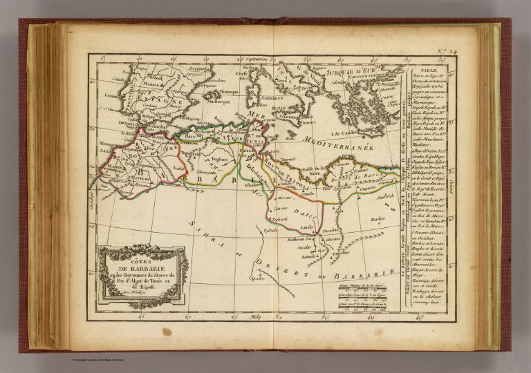
Full Title
Cotes de Barbarie ou les royaumes de Maroc, de Fez, d'Alger, de Tunis et de Tripoli. Avec privilege. (A Paris, chez Delamarche, Geogr., ca. 1800)
List No
0421.022
Note
Engraved map. Outline hand coloring. Relief shown pictorially. Prime meridian: Ferro.
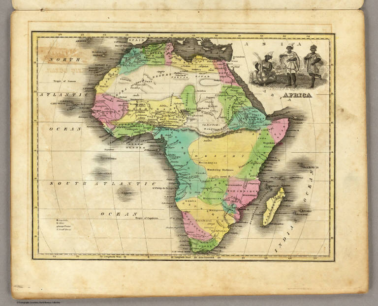
Author
Melish, John
Full Title
Africa. Published ... 1814 by J. Melish. J. Vallance & H.S. Tanner. Philadelphia. (to accompany) A New Juvenile Atlas, And Familiar Introduction To The Use Of Maps: With A Comprehensive View Of The Present State Of The Earth ... First American From The Latest London Edition, Corrected And Improved, By John Melish. Philadelphia, Printed For John Melish, John Vallance, And H.S. Tanner, No. 209, Chestnut-Street, By G. Palmer. 1814.
List No
0496.025
Note
Full color and outline colored map. Followed by four pages of text discussing a study of Africa in General and African countries. The Half leather, marbled paper covered boards, with gold title on spine - "Juvenile Atlas. 1814." Relief shown by hachures.
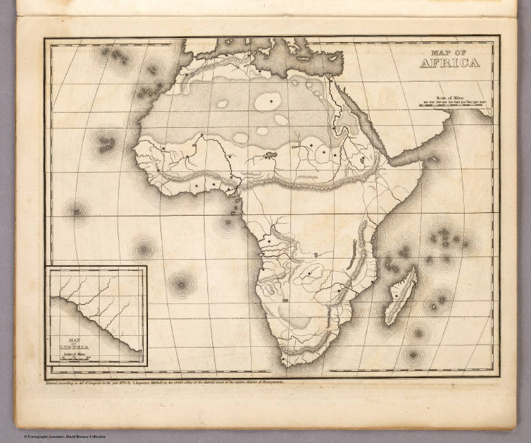
Author
Mitchell, Samuel Augustus
Full Title
Map of Africa (with) Map of Liberia. Entered ... 1839, by S. Augustus Mitchell ... Pennsylvania.
List No
0522.006
Note
Without color. Dotted divisions between countries. Capital cities shown by stars.
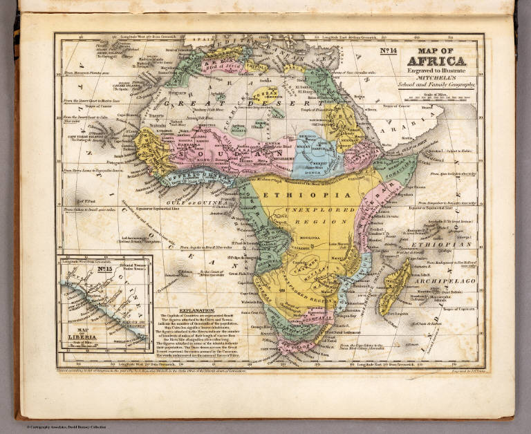
Author
Mitchell, Samuel Augustus
Full Title
Map of Africa. Engraved to Illustrate Mitchell's School and Family Geography. No. 14. (with) Map of Liberia. No. 15. Engraved by J.H. Young. Entered ... 1839, by S. Augustus Mitchell ... Connecticut.
List No
0523.011
Note
Includes the inset of Liberia. In full color by country or region. Explanation of symbols included.
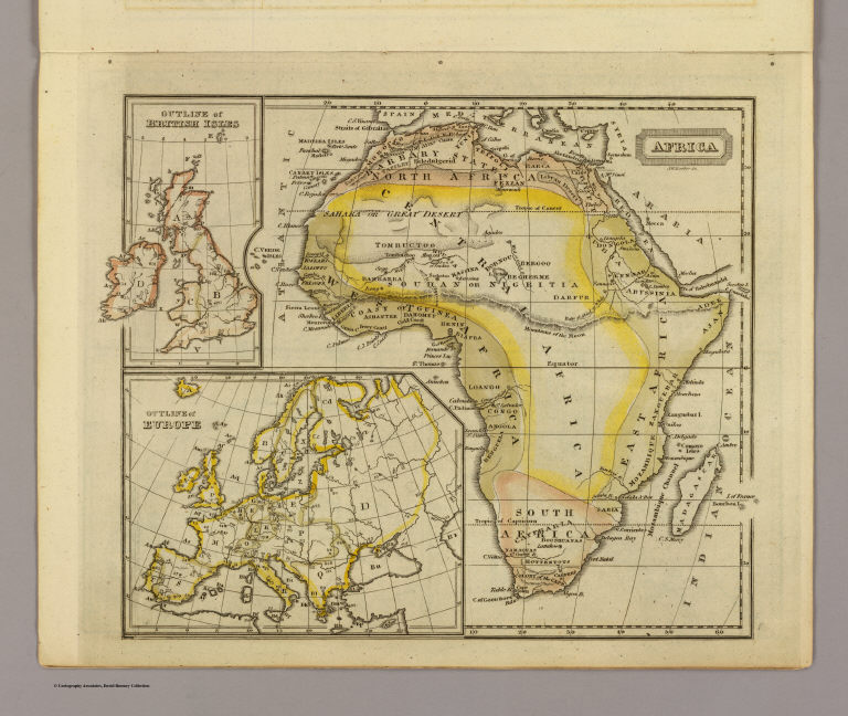
Full Title
Africa. J.W. Barber sc. (with) Outline of British Isles. (with) Outline of Europe. (Published by Richardson & Lord. Sold also by Collins & Hannay, New-York, 1828)
List No
0627.007
Note
Engraved map with 2 inset outline maps. Hand colored. Relief shown by hachures.
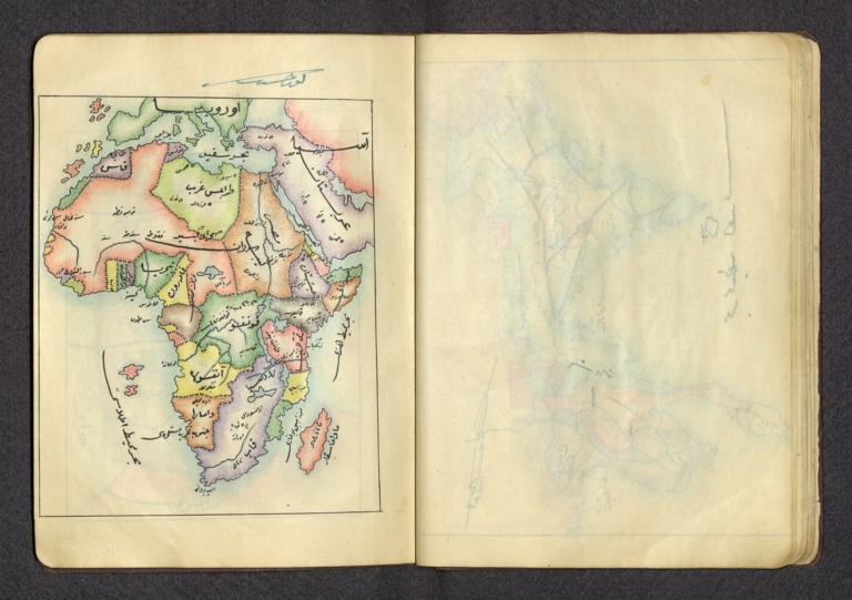
Author
شكوفه مقبل [Şukufe Mukbil]
Full Title
(Africa)
List No
10992.029
Note
Dimensions are sheet size.
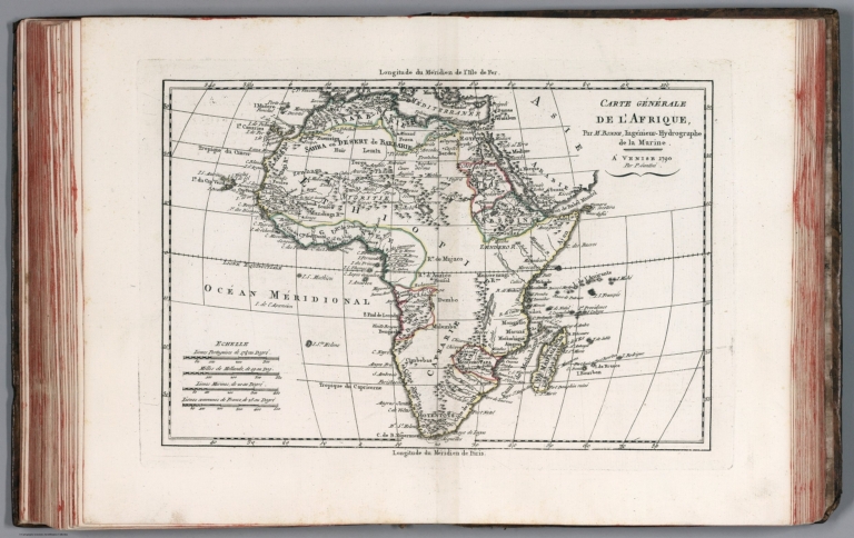
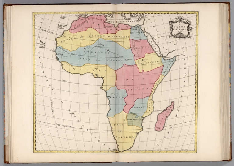
Author
[Grenet, Abbe, Bonne, Rigobert]
Full Title
Carte generale de l'Afrique. Par M. Bonne, ingenieur - Hydrographe de la Marine. A' Venise 1790, Par P. Santini. (to accompany) Atlas portatif a l'usage des colleges, pour servir a l'intelligence des auteurs classiques. 38.
List No
11172.041
Note
Copper engraved outline hand colored map. Showing boundaries, rivers, major cities, towns and villages. Prime meridians are Paris and Ferro. Relief shown pictorially.
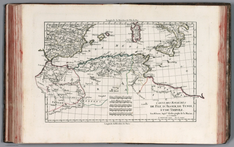
Author
[Grenet, Abbe, Bonne, Rigobert]
Full Title
Carte des royaumes de Fez, d'Alger, de Tunis, et de Tripoli. Par M. Bonne, ingenr. Hydrographe de la Marine. A' Venise 1791, Par P. Santini. (to accompany) Atlas portatif a l'usage des colleges, pour servir a l'intelligence des auteurs classiques. 39.
List No
11172.042
Note
Copper engraved outline hand colored map of North Africa from the Straits of Gibraltar over to Tripoli. Showing boundaries, rivers, major cities, towns and villages. Prime meridians are Paris and Ferro. Relief shown pictorially.
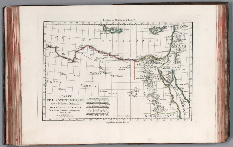
Author
[Grenet, Abbe, Bonne, Rigobert]
Full Title
Carte de l'Egypte moderne, Avec la partie Orientale des etats de Tripoli. Par M. Bonne, ingenieur - Hydrographe de la Marine. A' Venise 1791, Par P. Santini. (to accompany) Atlas portatif a l'usage des colleges, pour servir a l'intelligence des auteurs classiques. 40.
List No
11172.043
Note
Copper engraved outline hand colored map. Showing boundaries, rivers, major cities, towns and villages. Prime meridians are Paris and Ferro. Relief shown pictorially.
Author
Wells, Edward, 1667-1727
Full Title
A new map of Libya or old Africk shewing its general divisions, most remarkable countries or people, cities, townes, rivers, mountains &c. R. Spofforth sculp. (to accompany) A new sett of maps both of antient and present geography. 36.
List No
11181.039
Note
Copper engraved double page map of ancient Africa. Relief shown pictorially. Includes abbreviations.
Author
Wells, Edward, 1667-1727
Full Title
A new map of Africk shewing its present divisions, cheif cities or townes, rivers, mountains &c. R. Spofforth sculp. (to accompany) A new sett of maps both of antient and present geography. 37.
List No
11181.040
Note
Copper engraved double page map of present Africa. Relief shown pictorially. Includes abbreviations.
Author
Wells, Edward, 1667-1727
Full Title
A new map of the north part of antient Africa shewing the chiefe people, cities, towns, rivers, mountains, &c. in Mauritania, Numidia, Africa Propria, Libya Propria and Egypt. R. Spofforth sculp. (to accompany) A new sett of maps both of antient and present geography. 38.
List No
11181.041
Note
Copper engraved double page map of North Africa. Relief shown pictorially. Includes abbreviations and compass rose.
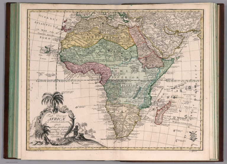
Author
[Euler, Leonhard, 1707-1783, Gericke, I.E.]
Full Title
Tab. Geogr. Africae : ad emendatiora : quae ad huc prodierunt exempla jusu Acad. Reg. Scient. et eleg. Litt. Pruss. descripta. I.E. Gericke, sc. Berol. (to accompany) Atlas geographicus omnes orbis terrarum regiones = Atlas geographique representant en XLI cartes toutes les regions de la terre ... Berolini : Ex officina Michaelis MDCCLIII (1753).
List No
11392.048
Note
Hand colored copperplate engraving map on 2 sheets. Showing political boundaries, geographic features, mountains, rivers, lakes, cities, and principal towns. Relief shown pictorially. In lower right corner: 1. Africa.
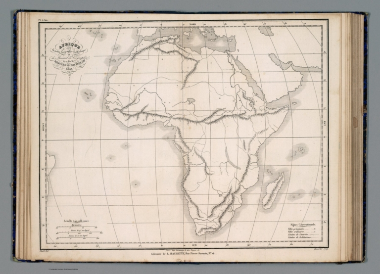
Author
[Meissas, Achille, 1799-187, Michelot, Auguste Jean Charles, 1792-1854]
Full Title
Afrique: pour la Petite geographie methodique et le Manuel de geographie de MM. Achille Meissas et Auguste Michelot. 1856. A la Librairie de L. Hachette. Grave sur Acier, par Dumortier, Ecrit par P.Rousset - Charle del. (to accompany) Petit atlas universel de geographie Ancienne du Moyen Age et Moderne et de geographie sacree.
List No
11740.014
Note
Colored in outline double page steel engraving map of Africa. Showing political divisions, capitals, major cities, rivers and mountains. Relief shown pictorially. In upper right: Atlas Complet. No. 5. Includes legend.
Author
[Meissas, Achille, 1799-187, Michelot, Auguste Jean Charles, 1792-1854]
Full Title
Afrique: pour la Petite geographie methodique et le Manuel de geographie de MM. Achille Meissas et Auguste Michelot. 1856. A la Librairie de L. Hachette. Charle del. Dumortier, Sculp. (to accompany) Petit atlas universel de geographie Ancienne du Moyen Age et Moderne et de geographie sacree.
List No
11740.015
Note
Outline map of Africa on 2 sheets, Supplement to Pl. 5. Political and administrative divisions, capitals and major cities are marked. Relief shown Pictorially. Includes legend.
Author
Lange, I. E.
Full Title
Charte von Afrika : nach den neuesten berichtigungen und Ortsbestimmungen entworfen. (to accompany) Neuer hand und elementar atlas ... Entworfen von I.E. Lange. Leipzig 1809.
List No
11945.007
Note
Engraved and hand painted with outline color map. Relief shown by hachures. Prime meridian is Ferro.
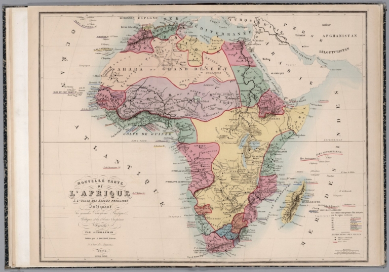
Author
Vuillemin, A.
Full Title
Nouvelle Carte de l'Afrique a l'Usage des Ecoles Primaires.
List No
12051.017
Author
Palairet, Jean
Full Title
Ie. Carte d'Afrique. 1754.
List No
12055.016
Author
Palairet, Jean
Full Title
2e. Carte d'Afrique. 1754.
List No
12055.017
Author
Homann, Johann Baptist, 1663-1724
Full Title
Africa.
List No
12138.038
Author
Tanner, Henry Schenck, 1786-1858
Full Title
Africa.
List No
12139.006
Author
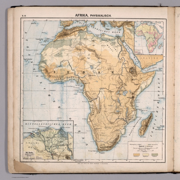
[Diercke, Carl, 1842-1913, Gaebler, Eduard, 1842-1911]
Full Title
S16. Afrika, Physikalisch.
List No
12198.020
Author
[Diercke, Carl, 1842-1913, Gaebler, Eduard, 1842-1911]
Full Title
S17. Afrika, Politisch.
List No
12198.021
|