|
Author
Mitchell, Samuel Augustus
Full Title
Map of North America. Entered ... 1839, by S. Augustus Mitchell ... Pennsylvania.
List No
0522.001
Note
Without color. Dotted divisions between countries. Map shows all of Canada, the United States, Mexico, Central America and the West Indies.
Author
Mitchell, Samuel Augustus
Full Title
Map of the United States and Texas. (with) Map of Mexico and Guatimala. Entered ... 1839, by S. Augustus Mitchell ... Pennsylvania.
List No
0522.002
Note
Without color. Dotted divisions between the states, territories, and countries. Mountains and deserts shown.
Author
Mitchell, Samuel Augustus
Full Title
Map of South America. Entered ... 1839, by S. Augustus Mitchell ... Pennsylvania.
List No
0522.003
Note
Without color. Dotted divisions between countries. Capital cities shown by stars.
Author
Mitchell, Samuel Augustus
Full Title
Map of Europe. Entered ... 1839, by S. Augustus Mitchell ... Pennsylvania.
List No
0522.004
Note
Without color. Dotted divisions between countries. Capital cities shown by stars.
Author
Mitchell, Samuel Augustus
Full Title
Map of Asia (with) Map of Palestine or the Holy Land. Entered ... 1839, by S. Augustus Mitchell ... Pennsylvania.
List No
0522.005
Note
Without color. Dotted divisions between countries. Capital cities shown by stars.
Author
Mitchell, Samuel Augustus
Full Title
Map of Africa (with) Map of Liberia. Entered ... 1839, by S. Augustus Mitchell ... Pennsylvania.
List No
0522.006
Note
Without color. Dotted divisions between countries. Capital cities shown by stars.
Author
Mitchell, Samuel Augustus
Full Title
Map of Oceanica. Entered ... 1839, by S. Augustus Mitchell ... Pennsylvania.
List No
0522.007
Note
Without color. Dotted divisions between countries or regions.
Author
Mitchell, Samuel Augustus
Full Title
The World on an Equatorial Projection. No. 1. Map of the Eastern & Western Hemispheres. (with) The World on a Polar Projection. No 2. Map of the Northern & Southern Hemispheres. Engraved by J.H. Young. Entered ... 1839, by S. Augustus Mitchell ... Connecticut.
List No
0523.001
Note
Maps in full color by continent. Four small insets explain zones, parallels, meridians, and circles.
Author
Mitchell, Samuel Augustus
Full Title
Map of North America Engraved to Illustrate Mitchell's School and Family Geography. No. 3. Engraved by J.H. Young. Entered ... 1839, by S. Augustus Mitchell ... Connecticut.
List No
0523.002
Note
In full color by country. Note included explaining the notations used on the map.
Author
Mitchell, Samuel Augustus
Full Title
Map of the United States and Texas Engraved to Illustrate Mitchell's School and Family Geography. No. 4. (with) Map of Mexico and Guatimala ... No. 5. Engraved by W. Williams. Entered ... 1839, by S. Augustus Mitchell ... Connecticut.
List No
0523.003
Note
In full color by state, territory, or country.
Author
Mitchell, Samuel Augustus
Full Title
Map of the New England or Eastern States. Engraved to Illustrate Mitchell's School and Family Geography. No. 6. Engraved by J.H. Young. Entered ... 1839, by S. Augustus Mitchell ... Connecticut.
List No
0523.004
Note
In full color by state. Includes explanation of symbols used to represent towns, railroads, canals and distance.
Author
Mitchell, Samuel Augustus
Full Title
Map of the Middle States. Engraved to Illustrate Mitchell's School and Family Geography. No. 7. Engraved by J.H. Young. Entered ... 1839, by S. Augustus Mitchell ... Connecticut.
List No
0523.005
Note
In full color by state. Includes explanation of symbols used to represent towns, railroads, canals and distance.
Author
Mitchell, Samuel Augustus
Full Title
Map of the Southern States. Engraved to Illustrate Mitchell's School and Family Geography. No. 8. Engraved by W. Williams. Entered ... 1839, by S. Augustus Mitchell ... Connecticut.
List No
0523.006
Note
In full color by state. Includes explanation of symbols used to represent towns, railroads, canals and distance.
Author
Mitchell, Samuel Augustus
Full Title
Map of the Western States. Engraved to Illustrate Mitchell's School and Family Geography. No. 9. Entered ... 1839, by S. Augustus Mitchell ... Connecticut.
List No
0523.007
Note
In full color by state. Includes explanation of symbols used to represent towns, railroads, canals and distance.
Author
Mitchell, Samuel Augustus
Full Title
Map of South America. Engraved to Illustrate Mitchell's School and Family Geography. No. 10. Engraved by J.H. Young. Entered ... 1839, by S. Augustus Mitchell ... Connecticut.
List No
0523.008
Note
In full color by country. Includes explanation of symbols used to represent towns, railroads, canals and distance.
Author
Mitchell, Samuel Augustus
Full Title
Map of Europe. Engraved to Illustrate Mitchell's School and Family Geography. No. 11. Engraved by J.H. Young. Entered ... 1839, by S. Augustus Mitchell ... Connecticut.
List No
0523.009
Note
In full color by country. Includes explanation of symbols used to represent towns, railroads, canals and distance.
Author
Mitchell, Samuel Augustus
Full Title
Map of Asia. Engraved to Illustrate Mitchell's School and Family Geography. No. 12. (with) Map of Palestine or the Holy Land. No. 13. Engraved by J.H. Young. Entered ... 1839, by S. Augustus Mitchell ... Connecticut.
List No
0523.010
Note
Map includes the inset of Palestine. In full color by country or region. Explanation of symbols included.
Author
Mitchell, Samuel Augustus
Full Title
Map of Africa. Engraved to Illustrate Mitchell's School and Family Geography. No. 14. (with) Map of Liberia. No. 15. Engraved by J.H. Young. Entered ... 1839, by S. Augustus Mitchell ... Connecticut.
List No
0523.011
Note
Includes the inset of Liberia. In full color by country or region. Explanation of symbols included.
Author
Mitchell, Samuel Augustus
Full Title
Map of Oceanica. Engraved to Illustrate Mitchell's School and Family Geography. No. 16. Engraved by J.H. Young. Entered ... 1839, by S. Augustus Mitchell ... Connecticut.
List No
0523.012
Note
In full color by country or region. Includes historical information about island discoveries.
Full Title
The World. J.W. Barber sc. (with) A view of the comparative lengths of the principal rivers ... (with) Table of the comparative heights of the principal mountains in the world. (Published by Richardson & Lord. Sold also by Collins & Hannay, New-York, 1828)
List No
0627.001
Note
Engraved double hemisphere map with diagrams and view. Hand colored.
Full Title
North America. J.W. Barber sc. (Published by Richardson & Lord. Sold also by Collins & Hannay, New-York, 1828)
List No
0627.002
Note
Engraved map. Outline hand colored. Relief shown by hachures.
Full Title
South America. J.W. Barber sc. (with) British Isles. (Published by Richardson & Lord. Sold also by Collins & Hannay, New-York, 1828)
List No
0627.003
Note
Engraved map with inset. Hand colored. Relief shown by hachures.
Full Title
United States. Engraved for Morse's School geography. (Published by Richardson & Lord. Sold also by Collins & Hannay, New-York, 1828)
List No
0627.004
Note
Engraved map. Outline hand colored. Relief shown by hachures. Shows states, settlements, rivers, etc. Prime meridians: Washington and Greenwich. Engraver name erased from plate.
Full Title
Europe. Engraved for Morse's School geography. (Published by Richardson & Lord. Sold also by Collins & Hannay, New-York, 1828)
List No
0627.005
Note
Engraved map. Hand colored. Relief shown by hachures.
Full Title
Asia. J.W. Barber sc. (with) Syria. (Published by Richardson & Lord. Sold also by Collins & Hannay, New-York, 1828)
List No
0627.006
Note
Engraved map. Hand colored. Relief shown by hachures.
Full Title
Africa. J.W. Barber sc. (with) Outline of British Isles. (with) Outline of Europe. (Published by Richardson & Lord. Sold also by Collins & Hannay, New-York, 1828)
List No
0627.007
Note
Engraved map with 2 inset outline maps. Hand colored. Relief shown by hachures.
Full Title
Outline of Asia. Outline of S. America. Outline of Africa. Outline of the U. States. Outline of N. America. (Published by Richardson & Lord. Sold also by Collins & Hannay, New-York, 1828)
List No
0627.008
Note
Five engraved outline maps. Hand colored.
Author
[Reynolds, James, Emslie, John]
Full Title
Geological map of the world. Drawn and engraved by John Emslie. Published by James Reynolds 174 Strand. London. (inset views) Ice barriers of the Polar Regions.(with) Coral Reefs. (with) Island of Cyclps Mediterranean. (with) Barren Island, Bay of Bengal. (with) Cape Pillar, Van Dieman's Land. (to accompany) Geological Diagrams.
List No
0848.011
Note
Hand color engraved map, shows the worldwide distribution of various rock types. Includes reference identifying: alluvium (sedimentary), igneous (primary, secondary & tertiary), metamorphic (changed) and volcanic.
Author
[Reynolds, James, Emslie, John]
Full Title
Geological map of England. London. Published by James Reynolds 174 Strand. Decr. 13th. 1849. (inset views) Slate quarries. (with) Coal mining. (with) The Needles Isle of Wight. (with cross section) Section of the Line A-B. (to accompany) Geological Diagrams.
List No
0848.012
Note
Hand color engraved map. Dhowing colour-coded areas of rock formations in England. with note: "Primary series colored blue, Secondary series green, Tertiary series yellow". Includes reference identifying the geologic rock formation, text, and cross section. Chart is one of a series of 44 educational charts drawn and engraved by John Emslie. The first geological map of Britain, indeed of any country in the world, was published by William Smith (1769-1839) in 1815.
Author
[Reynolds, James, Emslie, John]
Full Title
Geological map of Scotland. Drawn and engraved by John Emslie. London. Published by James Reynolds 174 Strand. (inset) Shetland Isles. (inset views) Strathaired, Skye Fissures left vacant by decomposed trap. (with) Granite Rocks to the south of Hillswick Ness Shetland. (with) Fingal's Cave, Island of Staffa. (with) Rock and Spindle standrews. (with) Remarkable cured Strata of slate new St. Abb's Head. (to accompany) Geological Diagrams.
List No
0848.013
Note
Hand color engraved map, showing areas of rock formations in Scotland. Includes colour-coded reference identifying the geologic rock formation, and note. Date estimated. Chart is one of a series of 44 educational charts drawn and engraved by John Emslie. The first geological map of Britain, indeed of any country in the world, was published by William Smith (1769-1839) in 1815.
Author
[Reynolds, James, Emslie, John]
Full Title
Geological map of Ireland. London. Published by James Reynolds 174 Strand. Decr. 13th. 1849. (inset views) Giant's Causeway. (with) The Twelve Pins, Connamara. (with) Fosilelk of Ireland. (to accompany) Geological Diagrams.
List No
0848.014
Note
Hand color engraved map. showing areas of rock formations in Ireland. Includes colour-coded reference identifying the geologic rock formation, and text. Date estimated. Chart is one of a series of 44 educational charts drawn and engraved by John Emslie. The first geological map of Britain, indeed of any country in the world, was published by William Smith (1769-1839) in 1815.
Author
شكوفه مقبل [Şukufe Mukbil]
Full Title
(Japan and Korea with railroads)
List No
10992.026
Note
Dimensions are sheet size.
Author
شكوفه مقبل [Şukufe Mukbil]
Full Title
(Indonesia)
List No
10992.027
Note
Dimensions are sheet size.
Author
شكوفه مقبل [Şukufe Mukbil]
Full Title
(Indochina)
List No
10992.028
Note
Dimensions are sheet size.
Author
شكوفه مقبل [Şukufe Mukbil]
Full Title
(Africa)
List No
10992.029
Note
Dimensions are sheet size.
Author
شكوفه مقبل [Şukufe Mukbil]
Full Title
(Tunisia with railroads)
List No
10992.030
Note
Dimensions are sheet size.
Author
شكوفه مقبل [Şukufe Mukbil]
Full Title
(Libya)
List No
10992.031
Note
Dimensions are sheet size.
Author
شكوفه مقبل [Şukufe Mukbil]
Full Title
(Egypt with railroads)
List No
10992.032
Note
Dimensions are sheet size.
Author
شكوفه مقبل [Şukufe Mukbil]
Full Title
(Morocco and Algiers)
List No
10992.033
Note
Dimensions are sheet size.
Author
شكوفه مقبل [Şukufe Mukbil]
Full Title
(South Africa)
List No
10992.034
Note
Dimensions are sheet size.
Author
شكوفه مقبل [Şukufe Mukbil]
Full Title
(Tanzania as a German Colony and Belgian Congo)
List No
10992.035
Note
Dimensions are sheet size.
Author
شكوفه مقبل [Şukufe Mukbil]
Full Title
(East Africa)
List No
10992.036
Note
Dimensions are sheet size.
Author
شكوفه مقبل [Şukufe Mukbil]
Full Title
(North and Central America)
List No
10992.037
Note
Dimensions are sheet size.
Author
شكوفه مقبل [Şukufe Mukbil]
Full Title
(North and Central America with Railroads)
List No
10992.038
Note
Dimensions are sheet size.
Author
شكوفه مقبل [Şukufe Mukbil]
Full Title
(Rivers of South America)
List No
10992.039
Note
Dimensions are sheet size.
Author
شكوفه مقبل [Şukufe Mukbil]
Full Title
(Canada)
List No
10992.040
Note
Dimensions are sheet size.
Author
شكوفه مقبل [Şukufe Mukbil]
Full Title
(United States with railroads)
List No
10992.041
Note
Dimensions are sheet size.
Author
شكوفه مقبل [Şukufe Mukbil]
Full Title
(Central America with railroads)
List No
10992.042
Note
Dimensions are sheet size.
Author
شكوفه مقبل [Şukufe Mukbil]
Full Title
(Central America)
List No
10992.043
Note
Dimensions are sheet size.
Author
شكوفه مقبل [Şukufe Mukbil]
Full Title
(The Caribbean)
List No
10992.044
Note
Dimensions are sheet size.
Author
شكوفه مقبل [Şukufe Mukbil]
Full Title
(South America with Railroads)
List No
10992.045
Note
Dimensions are sheet size. Has flag of Argentina on opposite page.
Author
شكوفه مقبل [Şukufe Mukbil]
Full Title
(Australia)
List No
10992.046
Note
Dimensions are sheet size.
Author
شكوفه مقبل [Şukufe Mukbil]
Full Title
(Papua New Guinea)
List No
10992.047
Note
Dimensions are sheet size.
Author
شكوفه مقبل [Şukufe Mukbil]
Full Title
(New Zealand and Tasmania)
List No
10992.048
Note
Dimensions are sheet size.
Author
شكوفه مقبل [Şukufe Mukbil]
Full Title
(Australia with neighboring islands and railroads)
List No
10992.049
Note
Dimensions are sheet size.
Author
شكوفه مقبل [Şukufe Mukbil]
Full Title
(Turkey)
List No
10992.050
Note
Dimensions are sheet size.
Author
[Grenet, Abbe, Bonne, Rigobert]
Full Title
Mappe monde en deux Hemispheres l'oriental et l'occidental. Par M. Bonne, Ingenieur - Hydrographe de la Marine. A' Venise 1788. Par P. Santini. (to accompany) Atlas portatif a l'usage des colleges, pour servir a l'intelligence des auteurs classiques. 1.
List No
11172.004
Note
Double-hemisphere outline hand color. Shows Eastern and Western Hemispheres and continents. Rivers, islands and cities, dated events and routes of major explorers shown.
Author
[Grenet, Abbe, Bonne, Rigobert]
Full Title
Carte reduite des terres et des mers du globe terrestre. Par M. Bonne, Ingenieur - Hydrographe de la Marine. A' Venise Par P. Santini 1789. (to accompany) Atlas portatif a l'usage des colleges, pour servir a l'intelligence des auteurs classiques. 2.
List No
11172.005
Note
Copper engraved outline hand colored world map. Shows Greenland and the Arctic are attached to North America. Alaska is shown with a rudimentary shape. The most interesting features are the large inland sea in the Pacific Northwest with its outlet named "Canal du Roi George" and a river connecting it to Hudson Bay. Above this is another large lake with a huge river flowing to the Pacific at "Is. San Carlos". Australia is named "Nouvelle Holland" and includes "Terre de Diemen". Numerous small islands are shown throughout the world. Prime meridians are Paris and Ferro.
Author
[Grenet, Abbe, Bonne, Rigobert]
Full Title
Carte de la direction des vent generaux et des Moussons. (to accompany) Atlas portatif a l'usage des colleges, pour servir a l'intelligence des auteurs classiques. 3.
List No
11172.006
Note
2 copper engraved outline hand colored maps on 1 sheet, centered on the equator. Shows the direction of winds and monsoons. The upper map shows Africa and Asia, with the Americas appearing on the lower map. Both extend to just beyond the Tropics of Capricorn and Cancer. Prime meridians is Paris.
Author
[Grenet, Abbe, Bonne, Rigobert]
Full Title
Carte generale de l'Europe. Par M. Bonne, Ingenieur - Hydrographe de la Marine. A' Venise Par P. Santini 1788. (to accompany) Atlas portatif a l'usage des colleges, pour servir a l'intelligence des auteurs classiques. 4.
List No
11172.007
Note
Copper engraved outline hand colored map. Prime meridians are Paris and Ferro. Relief shown pictorially.
Author
[Grenet, Abbe, Bonne, Rigobert]
Full Title
Carte royaumes d'Angleterre, d'Ecosse et d'Irlande. Par M. Bonne, Ingenieur - Hydrographe de la Marine. A' Venise Par P. Santini 1789. (to accompany) Atlas portatif a l'usage des colleges, pour servir a l'intelligence des auteurs classiques. 5.
List No
11172.008
Note
Copper engraved outline hand colored map. Covers Ireland, Scotland, Wales, England, and the Channel Islands. Highly detailed, showing towns, rivers and important roadways. Prime meridians are Paris and Ferro. Relief shown pictorially.
Author
[Grenet, Abbe, Bonne, Rigobert]
Full Title
Les royaumes de Danemark et de Norwege, avec celui de Suede. Par M. Bonne, Ingenieur - Hydrographe de la Marine. A' Venise Par P. Santini 1788. (to accompany) Atlas portatif a l'usage des colleges, pour servir a l'intelligence des auteurs classiques. 6.
List No
11172.009
Note
Copper engraved outline hand colored map. Covers Kingdoms of Denmark, Norway and Sweden. Highly detailed, showing political boundaries, towns, rivers and important roadways. Prime meridians are Paris and Ferro. Relief shown pictorially.
Author
[Grenet, Abbe, Bonne, Rigobert]
Full Title
Partie Europeenne de l'Empire de Russie. Par M. Bonne, Ingenieur - Hydrographe de la Marine. A' Venise Par P. Santini 1788. (to accompany) Atlas portatif a l'usage des colleges, pour servir a l'intelligence des auteurs classiques. 7.
List No
11172.010
Note
Copper engraved outline hand colored map of Russian Empire. Highly detailed, showing towns, rivers and important roadways. Prime meridians are Paris and Ferro. Relief shown pictorially.
Author
[Grenet, Abbe, Bonne, Rigobert]
Full Title
Nouvelle carte de la Siberie. Par M. Bonne, Ingenieur - Hydrographe de la Marine. A' Venise Par P. Santini. (to accompany) Atlas portatif a l'usage des colleges, pour servir a l'intelligence des auteurs classiques. 8.
List No
11172.011
Note
Copper engraved outline hand colored map. Showing boundaries, towns, rivers and important roadways. Prime meridian is Ferro. Relief shown pictorially.
Author
[Grenet, Abbe, Bonne, Rigobert]
Full Title
Nouvelle carte de la Crimee et des Confins Turcs et Russes a la Mer Noire. A' Venise Par P. Santini. (to accompany) Atlas portatif a l'usage des colleges, pour servir a l'intelligence des auteurs classiques. 9.
List No
11172.012
Note
Copper engraved outline hand colored map of Crimea and Black Sea region. Showing boundaries, towns, rivers and important roadways. Prime meridians are Paris and Ferro. Relief shown pictorially.
Author
[Grenet, Abbe, Bonne, Rigobert]
Full Title
Partie Meridionale de la Turquie d'Europe. Par M. Bonne, Ingenieur - Hydrographe de la Marine. A' Venise Par P. Santini 1788. (to accompany) Atlas portatif a l'usage des colleges, pour servir a l'intelligence des auteurs classiques. 10.
List No
11172.013
Note
Copper engraved outline hand colored map of Crimea and Black Sea region. Showing boundaries, towns, rivers and important roadways. Prime meridians are Paris and Ferro. Relief shown pictorially.
Author
[Grenet, Abbe, Bonne, Rigobert]
Full Title
Nouvelle carte de l'Istrie. A' Venise Par P. Santini. (to accompany) Atlas portatif a l'usage des colleges, pour servir a l'intelligence des auteurs classiques. 11.
List No
11172.014
Note
Copper engraved outline hand colored map. Showing boundaries, towns, rivers and important roadways. Relief shown pictorially.
Author
[Grenet, Abbe, Bonne, Rigobert]
Full Title
Italie moderne. Dressee par M. Bonne. Premier Hydrographe de la Marine. A' Venise Par P. Santini. 1789. (to accompany)Atlas portatif a l'usage des colleges, pour servir a l'intelligence des auteurs classiques. 12.
List No
11172.015
Note
Copper engraved outline hand colored map. Showing boundaries, towns, rivers and important roadways. Prime meridians are Paris and Ferro. Relief shown pictorially.
Author
[Grenet, Abbe, Bonne, Rigobert]
Full Title
Partie Septentrionale du Royaume de Naples. Par M. Bonne, Ingenieur - Hydrographe de la Marine. A' Venise Par P. Santini. 1792. (to accompany) Atlas portatif a l'usage des colleges, pour servir a l'intelligence des auteurs classiques. 13.
List No
11172.016
Note
Copper engraved outline hand colored map of Kingdom of Naples. Showing boundaries, towns, and rivers. Prime meridians are Paris and Ferro. Relief shown pictorially.
Author
[Grenet, Abbe, Bonne, Rigobert]
Full Title
Partie meridionale du Royaume de Naples et Celui de l'Isle de Sicile. Par M. Bonne, Ingenieur - Hydrographe de la Marine. A' Venise Par P. Santini. 1792. (to accompany)Atlas portatif a l'usage des colleges, pour servir a l'intelligence des auteurs classiques. 14.
List No
11172.017
Note
Copper engraved outline hand colored map. Showing boundaries, towns, and rivers. Prime meridians are Paris and Ferro. Relief shown pictorially.
Author
[Grenet, Abbe, Bonne, Rigobert]
Full Title
Etat De L'Eglise Et Duche De Toscane. Par M. Bonne, Ingenr. Hydrographe de la Marine. A' Venise Par P. Santini. (to accompany) Atlas portatif a l'usage des colleges, pour servir a l'intelligence des auteurs classiques. 15.
List No
11172.018
Note
Copper engraved outline hand colored map. Showing boundaries, towns, and rivers. Prime meridians are Paris and Ferro. Relief shown pictorially.
Author
[Grenet, Abbe, Bonne, Rigobert]
Full Title
Etat De la Republique de Venise. Par P. Santini. 1791. (to accompany) Atlas portatif a l'usage des colleges, pour servir a l'intelligence des auteurs classiques. 16
List No
11172.019
Note
Copper engraved outline hand colored map. Showing boundaries, towns, and rivers. Prime meridians are Paris and Ferro. Relief shown pictorially.
Author
[Grenet, Abbe, Bonne, Rigobert]
Full Title
Nouvelle carte del Etat de Milan avec ces de Mantoue et de Parme. Par M. Bonne Ingener. Hydrographe de la Marine. Par P. Santini. 1791. (to accompany) Atlas portatif a l'usage des colleges, pour servir a l'intelligence des auteurs classiques. 17.
List No
11172.020
Note
Copper engraved outline hand colored map. Showing boundaries, towns, roads, and rivers. Prime meridians are Paris and Ferro. Relief shown pictorially.
Author
[Grenet, Abbe, Bonne, Rigobert]
Full Title
La Savoie, Le Piemont, Le Mont-Ferrat, Et La Republique De Genes. Par M. Bonne. A Venise, Par P. Santini. 1791. (to accompany) Atlas portatif a l'usage des colleges, pour servir a l'intelligence des auteurs classiques. 18.
List No
11172.021
Note
Copper engraved outline hand colored map. Showing boundaries, towns, roads, and rivers. Prime meridians are Paris and Ferro. Relief shown pictorially.
Author
[Grenet, Abbe, Bonne, Rigobert]
Full Title
Carte des Isles de Sardaigne et de Corse. Par M. Bonne. A Venise, Par P. Santini.1792. (to accompany) Atlas portatif a l'usage des colleges, pour servir a l'intelligence des auteurs classiques. 19.
List No
11172.022
Note
Copper engraved outline hand colored map. Showing boundaries, towns, roads, and rivers. Prime meridians are Paris and Ferro. Relief shown pictorially.
Author
[Grenet, Abbe, Bonne, Rigobert]
Full Title
La Suisse divisee en ses Treize Cantons et ses Allies. Par M. Bonne Ingener. Hydrographe de la Marine. Par P. Santini. (to accompany) Atlas portatif a l'usage des colleges, pour servir a l'intelligence des auteurs classiques. 20
List No
11172.023
Note
Copper engraved outline hand colored map. Showing administrative boundaries, towns, roads, forts, lakes and rivers. Prime meridian is Ferro. Relief shown pictorially.
Author
[Grenet, Abbe, Bonne, Rigobert]
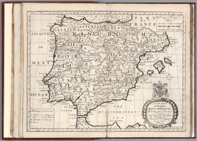
Full Title
Royaumes d'Espagne et de Portugal. Par M. Bonne Ingenieur - Hydrographe de la Marine. A' Venise 1790. Par P. Santini. (to accompany) Atlas portatif a l'usage des colleges, pour servir a l'intelligence des auteurs classiques. 21.
List No
11172.024
Note
Copper engraved outline hand colored map of Kingdoms of Spain and Portugal. Showing administrative boundaries, towns, roads, forts, lakes and rivers. Prime meridians are Spain and Ferro. Relief shown pictorially.
Author
[Grenet, Abbe, Bonne, Rigobert]
Full Title
La France par gouvernements, dressee par Mr. Bonne Ingenieur - Hydrographe de la Marine. A' Venise 1789. Par P. Santini. (to accompany) Atlas portatif a l'usage des colleges, pour servir a l'intelligence des auteurs classiques. 22.
List No
11172.025
Note
Copper engraved outline hand colored map. Showing administrative boundaries, towns, roads, forts, lakes and rivers. Prime meridians are Paris and Ferro. Relief shown pictorially.
Author
[Grenet, Abbe, Bonne, Rigobert]
Full Title
Gouvernement de Lorraine, Et Celui D'Alsace avec une partie de la Champagne. Par M. Bonne Ingenieur - Hydrographe de la Marine. A' Venise 1793. Par Santini. (to accompany) Atlas portatif a l'usage des colleges, pour servir a l'intelligence des auteurs classiques. 23.
List No
11172.026
Note
Copper engraved outline hand colored map. Showing administrative boundaries, towns, roads, forts, lakes and rivers. Prime meridians are Paris and Ferro. Relief shown pictorially.
Author
[Grenet, Abbe, Bonne, Rigobert]
Full Title
Les Gouvernements De Flandre, De Picardie, D'Artois, De L'Isle De France, Et De Champagne. Par M. Bonne Ingenr. Hydrographe de la Marine. A' Venise Par P. Santini 1793.(to accompany) Atlas portatif a l'usage des colleges, pour servir a l'intelligence des auteurs classiques. 24.
List No
11172.027
Note
Copper engraved outline hand colored map. Showing administrative boundaries, towns, roads, forts, lakes and rivers. Prime meridians are Paris and Ferro. Relief shown pictorially.
Author
[Grenet, Abbe, Bonne, Rigobert]
Full Title
Carte des Sept Provinces-Unies des Pays-Bas, Connues sous le Nom General de Hollande. Avec les Provinces Autrichiennes Situees dans le Meme Pays. Par M. Bonne Ingenieur Hydrographe de la Marine. A' Venise Par P. Santini 1789.(to accompany) Atlas portatif a l'usage des colleges, pour servir a l'intelligence des auteurs classiques. 25.
List No
11172.028
Note
Copper engraved outline hand colored. Detailed map of the Low Countries shows the area from the islands off the coast of Friesland and Embden in the north to Luxembourg in the south. The seventeen provinces are named, as are several rivers and towns, including major cities such as Amsterdam, Rotterdam, the Hague, Bruges, Brussels and Luxembourg. Prime meridians are Paris and Ferro. Relief shown pictorially.
Author
[Grenet, Abbe, Bonne, Rigobert]
Full Title
L'Empire d'Allemagne, divise en ses cercles, avec le royaume de Boheme, la Silesie, & c. Par M. Bonne Ingenieur Hydrographe de la Marine. A' Venise 1789 Par P. Santini. (to accompany) Atlas portatif a l'usage des colleges, pour servir a l'intelligence des auteurs classiques. 26.
List No
11172.029
Note
Copper engraved outline hand colored. Covers the Empire of Germany Divided into ten Circles, Kingdom of Bohemia, the Duchy of Silesia. Showing boundaries, rivers, cities and towns. Prime meridians are Paris and Ferro. Relief shown pictorially.
Author
[Grenet, Abbe, Bonne, Rigobert]
Full Title
Cercle d'Autriche. Par M. Bonne Ingenieur Hydrographe de la Marine. A' Venise, Par P. Santini. (to accompany) Atlas portatif a l'usage des colleges, pour servir a l'intelligence des auteurs classiques. 27.
List No
11172.030
Note
Copper engraved outline hand colored. Showing boundaries, rivers, cities and towns. Prime meridians are Paris and Ferro. Relief shown pictorially.
Author
[Grenet, Abbe, Bonne, Rigobert]
Full Title
Royaume de Hongrie; avec la Partie la plus Septentrionale de la Turquie d'Europe. Par M. Bonne Ingenieur Hydrographe de la Marine. A' Venise 1788, Par P. Santini. (to accompany) Atlas portatif a l'usage des colleges, pour servir a l'intelligence des auteurs classiques. 28.
List No
11172.031
Note
Copper engraved outline hand colored. Covers Kingdom of Hungary to northern Turkey. Showing boundaries, rivers, cities and towns. Prime meridians are Paris and Ferro. Relief shown pictorially.
Author
[Grenet, Abbe, Bonne, Rigobert]
Full Title
Royaume de Pologne et Duche de Lithuanie. Par M. Bonne Ingenieur Hydrographe de la Marine. A' Venise, Par P. Santini. (to accompany) Atlas portatif a l'usage des colleges, pour servir a l'intelligence des auteurs classiques. 29.
List No
11172.032
Note
Copper engraved outline hand colored. Covers Kingdom of Poland and Duchy of Lithuania. Showing boundaries, rivers, cities and towns. Prime meridians are Paris and Ferro. Relief shown pictorially.
Author
[Grenet, Abbe, Bonne, Rigobert]
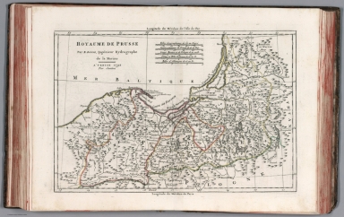
Full Title
Royaume de Prusse. Par M. Bonne Ingenieur Hydrographe de la Marine. A' Venise, Par P. Santini. (to accompany) Atlas portatif a l'usage des colleges, pour servir a l'intelligence des auteurs classiques. 30.
List No
11172.033
Note
Copper engraved outline hand colored. Showing boundaries, rivers, cities and towns. Prime meridians are Paris and Ferro. Relief shown pictorially.
Author
[Grenet, Abbe, Bonne, Rigobert]
Full Title
Carte generale de l'Asie : par M. Bonne, ingen. Hydrographe de la Marine. A' Venise, Par P. Santini 1789. (to accompany) Atlas portatif a l'usage des colleges, pour servir a l'intelligence des auteurs classiques. 31
List No
11172.034
Note
Copper engraved outline hand colored. Showing political boundaries, rivers, major cities and towns. Prime meridians are Paris and Ferro. Relief shown pictorially.
Author
[Grenet, Abbe, Bonne, Rigobert]
Full Title
Empire de la Chine, Rme. de Coree et Isles du Japon. Par M. Bonne, ingr. Hydrographe de la Marine. A' Venise, 1792 Par P. Santini. (to accompany) Atlas portatif a l'usage des colleges, pour servir a l'intelligence des auteurs classiques. 32.
List No
11172.035
Note
Copper engraved outline hand colored. Showing political boundaries, rivers, major cities and towns. Prime meridians are Paris and Ferro. Relief shown pictorially.
Author
[Grenet, Abbe, Bonne, Rigobert]
Full Title
Carte moderne de l'Asie Mineure. Par M. Bonne, ingen. Hydrographe de la Marine. A' Venise, 1792 Par P. Santini. (to accompany) Atlas portatif a l'usage des colleges, pour servir a l'intelligence des auteurs classiques. 33.
List No
11172.036
Note
Copper engraved outline hand colored. Showing political boundaries, rivers, major cities and towns. Prime meridians are Paris and Ferro. Relief shown pictorially.
Author
[Grenet, Abbe, Bonne, Rigobert]
Full Title
Carte moderne de la Perse, hors la partie la plus Occidentale de ce Royaume. Par M. Bonne, ingenieur Hydrographe de la Marine. A' Venise, 1790 Par P. Santini. (to accompany) Atlas portatif a l'usage des colleges, pour servir a l'intelligence des auteurs classiques. 34.
List No
11172.037
Note
Copper engraved outline hand colored modern Map of Persia, excluding the most Western part of that Kingdom. Showing boundaries, rivers, major cities, towns and villages. Prime meridians are Paris and Ferro. Relief shown pictorially.
Author
[Grenet, Abbe, Bonne, Rigobert]
Full Title
Carte moderne de la Majeure partie de la turquie d'Asie, avec les pays circonvoisins. Par M. Bonne, ingenieur Hydrographe de la Marine. A' Venise, 1790 Par P. Santini. (to accompany) Atlas portatif a l'usage des colleges, pour servir a l'intelligence des auteurs classiques. 35.
List No
11172.038
Note
Copper engraved outline hand colored modern map of major part of Turkey in Asia, with adjacent countries. Showing boundaries, rivers, major cities, towns and villages. Prime meridians are Paris and Ferro. Relief shown pictorially.
Author
[Grenet, Abbe, Bonne, Rigobert]
Full Title
Carte des Indes en Deca et au Dela du Gange; avec les Isles de la Sonde, Borneo, les Moluqes et les Philippines partie Orientale. Par M. Bonne, ingenieur Hydrographe de la Marine. A' Venise, Par P. Santini 1790. (to accompany) Atlas portatif a l'usage des colleges, pour servir a l'intelligence des auteurs classiques. 36.
List No
11172.039
Note
Copper engraved outline hand colored map. Showing boundaries, rivers, major cities, towns and villages. Prime meridians are Paris and Ferro. Relief shown pictorially.
Author
[Grenet, Abbe, Bonne, Rigobert]
Full Title
Carte des Indes en Deca et au Dela du Gange; avec les Isles de la Sonde, Borneo, les Moluques et les Philippines partie Occidentale. Par M. Bonne, ingenieur Hydrographe de la Marine. A' Venise, Par P. Santini 1791. (to accompany) Atlas portatif a l'usage des colleges, pour servir a l'intelligence des auteurs classiques. 37
List No
11172.040
Note
Copper engraved outline hand colored map. Showing boundaries, rivers, major cities, towns and villages. Prime meridians are Paris and Ferro. Relief shown pictorially.
Author
[Grenet, Abbe, Bonne, Rigobert]
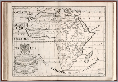
Full Title
Carte generale de l'Afrique. Par M. Bonne, ingenieur - Hydrographe de la Marine. A' Venise 1790, Par P. Santini. (to accompany) Atlas portatif a l'usage des colleges, pour servir a l'intelligence des auteurs classiques. 38.
List No
11172.041
Note
Copper engraved outline hand colored map. Showing boundaries, rivers, major cities, towns and villages. Prime meridians are Paris and Ferro. Relief shown pictorially.
Author
[Grenet, Abbe, Bonne, Rigobert]
Full Title
Carte des royaumes de Fez, d'Alger, de Tunis, et de Tripoli. Par M. Bonne, ingenr. Hydrographe de la Marine. A' Venise 1791, Par P. Santini. (to accompany) Atlas portatif a l'usage des colleges, pour servir a l'intelligence des auteurs classiques. 39.
List No
11172.042
Note
Copper engraved outline hand colored map of North Africa from the Straits of Gibraltar over to Tripoli. Showing boundaries, rivers, major cities, towns and villages. Prime meridians are Paris and Ferro. Relief shown pictorially.
Author
[Grenet, Abbe, Bonne, Rigobert]
Full Title
Carte de l'Egypte moderne, Avec la partie Orientale des etats de Tripoli. Par M. Bonne, ingenieur - Hydrographe de la Marine. A' Venise 1791, Par P. Santini. (to accompany) Atlas portatif a l'usage des colleges, pour servir a l'intelligence des auteurs classiques. 40.
List No
11172.043
Note
Copper engraved outline hand colored map. Showing boundaries, rivers, major cities, towns and villages. Prime meridians are Paris and Ferro. Relief shown pictorially.
Author
[Grenet, Abbe, Bonne, Rigobert]
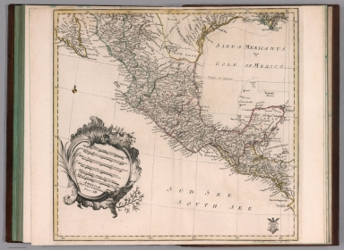
Full Title
Carte generale de l'Amerique Septentrionale. Par M. Bonne, ingenr. Hydrographe de la Marine. A' Venise, Par P. Santini 1790. (to accompany) Atlas portatif a l'usage des colleges, pour servir a l'intelligence des auteurs classiques. 41.
List No
11172.044
Note
Copper engraved outline hand colored map of North America, showing the Sea of the West in Northwestern part of America. Sea of the West first appeared on the maps of Jean Baptiste Nolin circa 1700, which were drawn from manuscript maps by Guillaume De L'Isle, although De L'Isle himself never published a printed map with this configuration. The myth reached the height of its popularity in the second half of the 18th Century, following the reports of French cartographers Guillaume de l’Isle and Phillipe Buache. Under Buache and De l’Isle’s influence, the Sea of the West, Mer de L’Ouest, or Baye de l’Ouest reached its fullest expression and commonly appeared on maps from the 1740s until the results of Captain James Cook's explorations along the Northwest Coast of America became well known. Map showing boundaries, rivers, major cities, towns and villages. Prime meridians are Paris and Ferro. Relief shown pictorially.
Author
[Grenet, Abbe, Bonne, Rigobert]
Full Title
Les etats Unis de l'Amerique septentrionale, contenant en outre, les Isles Royale, de Terre Neuve, de St. Jean et l'Acadie; avec partie du Canada, de la Louisiane et de la Floride. Par M. Bonne, ingenieur - Hydrographe de la Marine. A' Venise, Par P. Santini. (to accompany) Atlas portatif a l'usage des colleges, pour servir a l'intelligence des auteurs classiques. 42.
List No
11172.045
Note
Copper engraved outline hand colored map. Shows the United States confined to east of the Appalachians, to the west is Louisiane. Map showing boundaries, numerous cities and towns. Prime meridians are Paris and Ferro. Relief shown pictorially.
Author
[Grenet, Abbe, Bonne, Rigobert]
Full Title
Carte generale de l'Amerique Meridionale. Par M. Bonne, ingenir. Hydrographe de la Marine. A' Venise, 1789 Par P. Santini. (to accompany) Atlas portatif a l'usage des colleges, pour servir a l'intelligence des auteurs classiques. 43.
List No
11172.046
Note
Copper engraved outline hand colored map. Map showing boundaries, numerous cities and towns. Prime meridians are Paris and Ferro. Relief shown pictorially.
Author
[Grenet, Abbe, Bonne, Rigobert]
Full Title
Carte des Isles de Cuba et de la Jamaique. Par M. Bonne, ingenieur - Hydrographe de la Marine. A' Venise, Par P. Santini. (to accompany) Atlas portatif a l'usage des colleges, pour servir a l'intelligence des auteurs classiques. 44.
List No
11172.047
Note
Copper engraved outline hand colored map. Prime meridians are Paris and Ferro. Relief shown pictorially.
Author
[Grenet, Abbe, Bonne, Rigobert]
Full Title
Carte des Isles de St. Domingue et de Porto-Rico. Par M. Bonne, ingenieur - Hydrographe de la Marine. A' Venise 1790 Par P. Santini. (to accompany) Atlas portatif a l'usage des colleges, pour servir a l'intelligence des auteurs classiques. 45.
List No
11172.048
Note
Copper engraved outline hand colored map. Prime meridians are Paris and Ferro. Relief shown pictorially.
Author
[Grenet, Abbe, Bonne, Rigobert]
Full Title
Isles Antilles ou du Vent, avec les Isles Sous le Vent. Par M. Bonne, Ingenieur - Hydrographe de la Marine. A' Venise 1790 Par P. Santini. (inset) Supplement pour les isles occidentales sous le vent. (to accompany) Atlas portatif a l'usage des colleges, pour servir a l'intelligence des auteurs classiques. 46.
List No
11172.049
Note
Copper engraved outline hand colored map. Prime meridians are Paris and Ferro. Relief shown pictorially.
Author
[Grenet, Abbe, Bonne, Rigobert]
Full Title
Orbis Vetus. A Rto. Bona, Primario Hydrographo Navali. Venetiis Apud P. Santini 1788. (to accompany) Atlas portatif a l'usage des colleges, pour servir a l'intelligence des auteurs classiques. 47.
List No
11172.050
Note
Copper engraved outline hand colored map. Prime meridians are Paris and Ferro. Relief shown pictorially.
Author
[Grenet, Abbe, Bonne, Rigobert]
Full Title
Mappa Hispaniae Antiquae. Descripta a Rto. Bona., Primario Hydrographo Navali. Venetiis 1789 Apud P. Santini. (to accompany) Atlas portatif a l'usage des colleges, pour servir a l'intelligence des auteurs classiques. 48.
List No
11172.051
Note
Copper engraved outline hand colored map. Prime meridians are Paris and Ferro. Relief shown pictorially.
Author
[Grenet, Abbe, Bonne, Rigobert]
Full Title
Mappa Galliae Antiquae descripta a R. Bona., Primario Hydrographo Navali. Venetiis 1789 Apud P. Santini. (to accompany) Atlas portatif a l'usage des colleges, pour servir a l'intelligence des auteurs classiques. 49.
List No
11172.052
Note
Copper engraved outline hand colored map. Prime meridians are Paris and Ferro. Relief shown pictorially.
Author
[Grenet, Abbe, Bonne, Rigobert]
Full Title
Mappa Insularum Britannicarum Antiquarum a R. Bona Primario Hydrographo Navali. Venetiis 1788 Apud P. Santini. (to accompany) Atlas portatif a l'usage des colleges, pour servir a l'intelligence des auteurs classiques. 50.
List No
11172.053
Note
Copper engraved outline hand colored map. Prime meridians are Paris and Ferro. Relief shown pictorially.
Author
[Grenet, Abbe, Bonne, Rigobert]
Full Title
Mappa Germaniae magnae, Vindeliciae, Rhaetiae et Norici. Autore Rto. Bona, Primario Hydrographo Navali. Venetiis Apud P. Santini 1789. (to accompany) Atlas portatif a l'usage des colleges, pour servir a l'intelligence des auteurs classiques. 51.
List No
11172.054
Note
Copper engraved outline hand colored map. Prime meridians are Paris and Ferro. Relief shown pictorially.
Author
[Grenet, Abbe, Bonne, Rigobert]
Full Title
Pannoniae Daciae Illyrici et Mcesiae tabula geographica. Autore Rto. Bona, Primario Hydrographo Navali. Venetiis Apud P. Santini 1789. (to accompany) Atlas portatif a l'usage des colleges, pour servir a l'intelligence des auteurs classiques. 52.
List No
11172.055
Note
Copper engraved outline hand colored map. Prime meridians are Paris and Ferro. Relief shown pictorially.
Author
[Grenet, Abbe, Bonne, Rigobert]
Full Title
Mappa Italiae antique descripta A Rto. Bona, Primario Hydrographo Navali. Venetiis Apud P. Santini 1791. (to accompany) Atlas portatif a l'usage des colleges, pour servir a l'intelligence des auteurs classiques. 53.
List No
11172.056
Note
Copper engraved outline hand colored map. Prime meridians are Paris and Ferro. Relief shown pictorially.
Author
[Grenet, Abbe, Bonne, Rigobert]
Full Title
Mappa Greciae Antiquae et vicinarum regionum descripta a Rto. Bona, Primario Hydrographo Navali. Venetiis 1789 Apud P. Santini. (to accompany) Atlas portatif a l'usage des colleges, pour servir a l'intelligence des auteurs classiques. 54.
List No
11172.057
Note
Copper engraved outline hand colored map. Prime meridians are Paris and Ferro. Relief shown pictorially.
Author
[Grenet, Abbe, Bonne, Rigobert]
Full Title
Asia Minor, descripta a Rto. Bona, Primario Hydrographo Navali. Venetiis 1790 Apud P. Santini. (to accompany) Atlas portatif a l'usage des colleges, pour servir a l'intelligence des auteurs classiques. 55.
List No
11172.058
Note
Copper engraved outline hand colored map. Prime meridians are Paris and Ferro. Relief shown pictorially.
Author
[Grenet, Abbe, Bonne, Rigobert]
Full Title
Duodecim tribus Israelis, sive Terra Sancta. Autore Rto. Bona, Primario Hydrographo Navali. Venetiis 1789 Apud P. Santini. (to accompany) Atlas portatif a l'usage des colleges, pour servir a l'intelligence des auteurs classiques. 56.
List No
11172.059
Note
Copper engraved outline hand colored map of twelve tribes of Israel. Prime meridians are Paris and Ferro. Relief shown pictorially.
Author
[Grenet, Abbe, Bonne, Rigobert]
Full Title
Palestina et Syria. Autore Rto. Bona, Primario Hydrographo Navali. Venetiis 1789 Apud P. Santini. (to accompany) Atlas portatif a l'usage des colleges, pour servir a l'intelligence des auteurs classiques. 57.
List No
11172.060
Note
Copper engraved outline hand colored map. Prime meridians are Paris and Ferro. Relief shown pictorially.
Author
[Grenet, Abbe, Bonne, Rigobert]
Full Title
Imperii Parthorum Tabula. Pars Occidentalis. Autore Rto. Bona, Primario Hydrographo Navali. Venetiis Apud P. Santini. (to accompany) Atlas portatif a l'usage des colleges, pour servir a l'intelligence des auteurs classiques. 58.
List No
11172.061
Note
Copper engraved outline hand colored map of Parthian Empire, west of Caspian sea. Prime meridians are Paris and Ferro. Relief shown pictorially.
Author
[Grenet, Abbe, Bonne, Rigobert]
Full Title
Imperii Parthorum Tabula. Pars Orientalis. Autore Rto. Bona, Primario Hydrographo Navali. Venetiis Apud P. Santini. (to accompany) Atlas portatif a l'usage des colleges, pour servir a l'intelligence des auteurs classiques. 59.
List No
11172.062
Note
Copper engraved outline hand colored map of Parthian Empire, east of Caspian sea. Prime meridians are Paris and Ferro. Relief shown pictorially.
Author
[Grenet, Abbe, Bonne, Rigobert]
Full Title
Africa Propria, Numidia et Mauritania. Autore Rto. Bona, Primario Hydrographo Navali. Venetiis Apud P. Santini 1790. (to accompany) Atlas portatif a l'usage des colleges, pour servir a l'intelligence des auteurs classiques. 61.
List No
11172.063
Note
Copper engraved outline hand colored map of North Africa. Prime meridians are Paris and Ferro. Relief shown pictorially.
Author
[Grenet, Abbe, Bonne, Rigobert]
Full Title
Mappa Aegypti antiquae descripta a Rto. Bona, Primario Hydrographo Navali. Venetiis Apud P. Santini 1791. (to accompany) Atlas portatif a l'usage des colleges, pour servir a l'intelligence des auteurs classiques. 61.
List No
11172.064
Note
Copper engraved outline hand colored map. Prime meridians are Paris and Ferro. Relief shown pictorially.
Author
Wells, Edward, 1667-1727
Full Title
A new map of the terraqueous globe according to the ancient discoveries and most general divisions of it into continents and oceans. Delin. M. Burghers Sculp. Univ. Oxon. (to accompany) A new sett of maps both of antient and present geography. 1.
List No
11181.004
Note
Double hemispherical map of the ancient world with decorative border. Copper engraved double page map. Shows California as an Island, an incomplete New Holland attached to N. Guinea, partial New Zealand Coast line and no Southern Continent. Extensive annotations in North and South America, including a suggestion that the Americas might have been the lost continent of Atlantis, stating: "This Continent with the adjoining islands is generally supposed to have been Anciently unknown though there are not wanting some, who will have even the Continent itself to be no other than the Insula Atlantis of the Ancients." Includes abbreviations.
Author
Wells, Edward, 1667-1727
Full Title
A new map of the terraqueous globe according to the latest discoveries and most general divisions of it into continents and oceans. Delin. M. Burghers Sculp. Univ. Oxon. (to accompany) A new sett of maps both of antient and present geography. 2.
List No
11181.005
Note
Double hemispherical map of the present world with decorative border. Copper engraved double page map. Shows California as an Island, an incomplete New Holland attached to N. Guinea, partial New Zealand Coast line and no Southern Continent. Includes abbreviations.
Author
Wells, Edward, 1667-1727
Full Title
A new map of Europe according its Ancient general divisions and names of its countries together with their chief cities rivers mountains & c. Delin. MBurg sculp. Sculp. (to accompany) A new sett of maps both of antient and present geography. 3.
List No
11181.006
Note
Copper engraved double page map. Shows ancient political divisions. Includes abbreviations. Relief shown pictorially.
Author
Wells, Edward, 1667-1727
Full Title
A new map of Europe according to the present general divisions and names of its countries together with their capital cities chief rivers mountains & c. Delin. MBurg sculp. Sculp. (to accompany) A new sett of maps both of antient and present geography. 4.
List No
11181.007
Note
Copper engraved double page map. Shows present political divisions. Includes abbreviations. Relief shown pictorially.
Author
Wells, Edward, 1667-1727
Full Title
A new map of Iberia Europaea alias Celtiberia, or Ancient Spain, shewing its principal divisions, cheif cities, townes, rivers, mountains &c. R. Spofforth sculp. (to accompany) A new sett of maps both of antient and present geography. 5.
List No
11181.008
Note
Copper engraved double page map. Shows ancient administrative divisions. Includes abbreviations. Relief shown pictorially.
Author
Wells, Edward, 1667-1727
Full Title
A new map of present Spain & Portugal. Shewing their principal divisions, cheif cities, townes, ports, rivers, mountains &c. R. Spofforth sculp. (to accompany) A new sett of maps both of antient and present geography. 6.
List No
11181.009
Note
Copper engraved double page map. Shows present political and administrative divisions. Includes abbreviations. Relief shown pictorially.
Author
Wells, Edward, 1667-1727
Full Title
A new map of ancient Gaul or Gallia Transalpina shewing the divisions thereof by Augustus Caesar together with its principal people cities townes rivers mountains &c. R. Spofforth sculp. (inset) Gallia divided according to Julius Caesar's Commentaries. (to accompany) A new sett of maps both of antient and present geography. 7.
List No
11181.010
Note
Copper engraved double page map with inset. Shows ancient political and administrative divisions. Includes abbreviations. Relief shown pictorially.
Author
Wells, Edward, 1667-1727
Full Title
A new map of France shewing its principal divisions cheif cities, townes, ports, rivers, mountains &c. R. Spofforth sculp. (to accompany) A new sett of maps both of antient and present geography. 8.
List No
11181.011
Note
Copper engraved double page map. Shows administrative divisions. Includes abbreviations. Relief shown pictorially.
Author
Wells, Edward, 1667-1727
Full Title
A new map of Netherlands, or Low Countries, shewing their principal divisions, cities, townes, rivers &c. Sutton Nicholls sculp. (inset) A draught of the sea coasts of Holland and parts adjoining, as they are supposed to have been in antient times. (to accompany) A new sett of maps both of antient and present geography. 9.
List No
11181.012
Note
Copper engraved double page map with inset. Covers the Netherlands, Belgium, Luxemburg, and part of Germany. Shows administrative divisions. Includes abbreviations.
Author
Wells, Edward, 1667-1727
Full Title
A new map of the Brittish Isles shewing their antient people, cities, and towns of note, in the time of the Romans. Sutton Nicholls sculp. (to accompany) A new sett of maps both of antient and present geography. 10
List No
11181.013
Note
Copper engraved double page map. Shows ancient political and administrative divisions. Includes explanations. Relief shown pictorially.
Author
Wells, Edward, 1667-1727
Full Title
A new map of the Brittish Isles shewing their present genl. divisions, cities, and such other towns, or places, as answer to the towns of note in the time of the Romans. Sutton Nicholls sculp. (to accompany) A new sett of maps both of antient and present geography. 11.
List No
11181.014
Note
Copper engraved double page map. Shows present political and administrative divisions. Includes explanations. Relief shown pictorially.
Author
Wells, Edward, 1667-1727
Full Title
A new map of antient Germany, Rhaeia, Vindelicia, and Noricum. Shewing their principal people, tribes, cities, towns, rivers, mountains, &c. Sutton Nicholls sculp. (to accompany) A new sett of maps both of antient and present geography. 12.
List No
11181.015
Note
Copper engraved double page map. Shows ancient political and administrative divisions. Includes explanations. Relief shown pictorially.
Author
Wells, Edward, 1667-1727
Full Title
A new map of Germany, shewing its principal divisions, cities, towns, rivers, mountains, &c. Sutton Nicholls sculp. (to accompany) A new sett of maps both of antient and present geography. 13.
List No
11181.016
Note
Copper engraved double page map. Shows administrative divisions. Includes explanations. Relief shown pictorially.
Author
Wells, Edward, 1667-1727
Full Title
A new map of antient Italy, together with the adjoyning islands of Sicily, Sardinia, and Corsica, shewing their principal divisions, cities, towns, rivers, mountains &c. Sutton Nicholls sculp. (to accompany) A new sett of maps both of antient and present geography. 14.
List No
11181.017
Note
Copper engraved double page map. Shows ancient administrative divisions. Includes abbreviations. Relief shown pictorially.
Author
Wells, Edward, 1667-1727
Full Title
A new map of present Italy, together with the adjoyning islands of Sicily, Sardinia, and Corsica, shewing their principal divisions, cities, towns, rivers, mountains &c. Sutton Nicholls sculp. (to accompany) A new sett of maps both of antient and present geography. 15.
List No
11181.018
Note
Copper engraved double page map. Shows present administrative divisions. Includes explanations. Relief shown pictorially.
Author
Wells, Edward, 1667-1727
Full Title
A new map of Gallia Cisalpina & Graecia Magna : shewing their cheif divisions, people, cities, towns &c. Sutton Nicholls sculp. (to accompany) A new sett of maps both of antient and present geography. 16.
List No
11181.019
Note
2 copper engraved double page maps on 1 sheet. Shows administrative divisions. Includes explanations and compass rose. Relief shown pictorially.
Author
Wells, Edward, 1667-1727
Full Title
A New Map of Latium Etruria and as much of Antient Italy as lay Between Gallia Cisalpina and Graecia Magna, Shewing its Principal Divisions, Cities, Towns, Rivers &c. Sutton Nicholls sculp. (to accompany) A new sett of maps both of antient and present geography. 17.
List No
11181.020
Note
Copper engraved double page map of central Italy. Shows administrative divisions. Includes explanations and compass rose. Relief shown pictorially.
Author
Wells, Edward, 1667-1727
Full Title
A new map of antient Greece, Thrace, Moesia, Illyricum, and the Isles adjoyning. Ed. Smith sculp. (to accompany) A new sett of maps both of antient and present geography. 18.
List No
11181.021
Note
Copper engraved double page map. Shows political and administrative divisions. Relief shown pictorially.
Author
Wells, Edward, 1667-1727
Full Title
A new map of Turky in Europe and parts adjoyning shewing their principal divisions and chiefe cities, towns, rivers, mountains &c. Ed. Smith sculp. (to accompany) A new sett of maps both of antient and present geography. 19.
List No
11181.022
Note
Copper engraved double page map. Shows political and administrative divisions. Relief shown pictorially. Includes abbreviations.
Author
Wells, Edward, 1667-1727
Full Title
A new map of the So. & mid. parts of antient Greece viz. Epirus, Hellas, or Graecia Propria, and Peloponnesus, together with the adjoyning islands. Ed. Smith sculp. (to accompany) A new sett of maps both of antient and present geography. 20.
List No
11181.023
Note
Copper engraved double page map. Shows political and administrative divisions. Relief shown pictorially. Includes explanations.
Author
Wells, Edward, 1667-1727
Full Title
A new map of antient Thrace : as also of the northern parts of old Greece, viz. Macedonia and Thessalia. Sutton Nicholls sculp. (to accompany) A new sett of maps both of antient and present geography. 21.
List No
11181.024
Note
Copper engraved double page map. Shows political and administrative divisions. Relief shown pictorially. Includes explanations and compass rose.
Author
Wells, Edward, 1667-1727
Full Title
A new map of the islands of the Aegaean Sea, together with the island of Crete, and the adjoining isles, Sutton Nicholls sculp. (to accompany) A new sett of maps both of antient and present geography. 22.
List No
11181.025
Note
Copper engraved double page map. Relief shown pictorially. Includes explanations and compass rose.
Author
Wells, Edward, 1667-1727
Full Title
A new map of Sarmatia, Europaea Pannonia and Dacia shewing their principal divisions, people, cities, towns, rivers, mountains &c. Benj. Cole sculp. (inset) A draught of the North Parts of Europe according to the erroneous opinion of some of the Ancients. (to accompany) A new sett of maps both of antient and present geography. 23.
List No
11181.026
Note
Copper engraved double page map. Showing political divisions. Relief shown pictorially. Includes explanations.
Author
Wells, Edward, 1667-1727
Full Title
A new map of present Poland, Hungary, Walachia, Moldavia, Little Tartary &c. shewing their principall divisions, chief cities, towns, rivers &c. B. Cole sculp. (to accompany) A new sett of maps both of antient and present geography. 24.
List No
11181.027
Note
Copper engraved double page map. Showing political divisions. Relief shown pictorially. Includes explanations.
Author
Wells, Edward, 1667-1727
Full Title
A new map of ancient Scandinavia together with as much more of ye northern part of ancient Europe as answers to present Denmark & Moscovia. (inset) Present Denmark with the adjoining parts of Sweden and Germany. (to accompany) A new sett of maps both of antient and present geography. 25.
List No
11181.028
Note
Copper engraved double page map. Showing political divisions. Relief shown pictorially. Includes abbreviations.
Author
Wells, Edward, 1667-1727
Full Title
A new map of Denmark, Norway, Sweden & Moscovy, shewing their present general divisions, cheif cities or towns, rivers, mountains &c. J. Moxon sculp. (to accompany) A new sett of maps both of antient and present geography. 26.
List No
11181.029
Note
Copper engraved double page map. Showing political divisions. Relief shown pictorially. Includes abbreviations.
Author
Wells, Edward, 1667-1727
Full Title
A new map of ancient Asia. delin. M Burg. sculp. Univ. Oxon. (to accompany) A new sett of maps both of antient and present geography. 27.
List No
11181.030
Note
Copper engraved double page map. Showing political divisions. Relief shown pictorially. Includes abbreviations.
Author
Wells, Edward, 1667-1727
Full Title
A new map of present Asia. Present Asia distinguisht into its general divisions or countries together with their capital cities, chief rivers, mountains, &c. delin. M Burg. sculp. Univ. Ox. (to accompany) A new sett of maps both of antient and present geography. 28.
List No
11181.031
Note
Copper engraved double page map. Showing political divisions. Relief shown pictorially. In cartouche, upper left: A new map of ancient Asia. Includes abbreviations.
Author
Wells, Edward, 1667-1727
Full Title
A new map of Great Tartary, and China : with the adjoyning parts of Asia, taken from M. de Fers Map of Asia. Sutton Nicholls sculp. (insets) This draught of the country to the NE of China is made according to the memory of Martini the Jesuite &c. (with) This draught of the country to the NNE and East of China is according to the memory of Verbiest the Jesuite. (to accompany) A new sett of maps both of antient and present geography. 29.
List No
11181.032
Note
Copper engraved double page map. Showing political divisions. Relief shown pictorially. Includes notes, compass rose and explanations. Prime meridians are Ferro and London.
Author
Wells, Edward, 1667-1727
Full Title
A new map of the East Indies, taken from Mr. de Fer's map of Asia, shewing their cheif divisions, cities, towns, ports, rivers, mountains &c. Sutton Nicholls sculp. (to accompany) A new sett of maps both of antient and present geography. 30.
List No
11181.033
Note
Copper engraved double page map. Showing political divisions. Relief shown pictorially. Includes compass rose and explanations. Prime meridians are Ferro and London.
Author
Wells, Edward, 1667-1727
Full Title
A New Map of the Western parts of Asia Minor largely taken: shewing their antient divisions, countries or people, chiefe cities, towns, rivers, mountains etc. R. Spofforth sculp. (to accompany) A new sett of maps both of antient and present geography. 31.
List No
11181.034
Note
Copper engraved double page map. Showing political divisions. Relief shown pictorially. Includes abbreviations.
Author
Wells, Edward, 1667-1727
Full Title
A new map of the eastern parts of Asia Minor largely taken as also of Syria, Armenia, Mesopotamia &c. shewing their antient divisions, countries or people, chiefe cities, towns, rivers, mountains &c. R. Spofforth sculp. (to accompany) A new sett of maps both of antient and present geography. 32.
List No
11181.035
Note
Copper engraved double page map. Showing political divisions. Relief shown pictorially. Includes abbreviations.
Author
Wells, Edward, 1667-1727
Full Title
A new map shewing the travels of the Patriarchs, as also of the children of Israel, from Egypt through the wildnerness, to the Land of Canaan. Sutton Nicholls sculp. (inset) This draught shews the several countries or people lying most remote from the Holy Land and mentioned in the Old Testament. (to accompany) A new sett of maps both of antient and present geography. 33.
List No
11181.036
Note
Copper engraved double page map of the Holy Land, with an inset map of the travels of the Patriarchs. Showing political divisions. Inset covers Mediterranean and the Near East, from Spain to Persia. Relief shown pictorially. Includes abbreviations.
Author
Wells, Edward, 1667-1727
Full Title
A new map of the Land of Canaan and parts adjoining shewing the division thereof among the twelve tribes of Israel. Sutton Nicholls sculp. (to accompany) A new sett of maps both of antient and present geography. 34.
List No
11181.037
Note
Copper engraved double page map. Inset: continuation map at a smaller scale of the Kingdom of Zobah, north of Syria. Map shows the shoreline of Zidon to River of Egypt. Jordan River is not shown. Relief shown pictorially. Includes explanation and compass rose.
Author
Wells, Edward, 1667-1727
Full Title
A new map shewing all the severall countries, cities, towns, and other places mentioned in the New Testament. Sutton Nicholls sculp. (with) New map showing all the several countries, cities, towns, and other places mentioned in the New Testament. (with) This draught shews the severall regions mentioned in the New Testamt. together with the cities & towns most remote from ye Holy Land, as in Italy, Mesopotamia &c. (to accompany) A new sett of maps both of antient and present geography. 35.
List No
11181.038
Note
3 copper engraved double page maps on 1 sheet. Note in map 1: This draught shews such places ... as were in the Holy Land, and parts adjoining. Relief shown pictorially. Includes notes.
Author
Wells, Edward, 1667-1727
Full Title
A new map of Libya or old Africk shewing its general divisions, most remarkable countries or people, cities, townes, rivers, mountains &c. R. Spofforth sculp. (to accompany) A new sett of maps both of antient and present geography. 36.
List No
11181.039
Note
Copper engraved double page map of ancient Africa. Relief shown pictorially. Includes abbreviations.
Author
Wells, Edward, 1667-1727
Full Title
A new map of Africk shewing its present divisions, cheif cities or townes, rivers, mountains &c. R. Spofforth sculp. (to accompany) A new sett of maps both of antient and present geography. 37.
List No
11181.040
Note
Copper engraved double page map of present Africa. Relief shown pictorially. Includes abbreviations.
Author
Wells, Edward, 1667-1727
Full Title
A new map of the north part of antient Africa shewing the chiefe people, cities, towns, rivers, mountains, &c. in Mauritania, Numidia, Africa Propria, Libya Propria and Egypt. R. Spofforth sculp. (to accompany) A new sett of maps both of antient and present geography. 38.
List No
11181.041
Note
Copper engraved double page map of North Africa. Relief shown pictorially. Includes abbreviations and compass rose.
Author
Wells, Edward, 1667-1727
Full Title
A new map of North America shewing its principal divisions, chief cities, townes, rivers, mountains &c. Delin. M. Burg., sculpt., Univ. Oxon. (to accompany) A new sett of maps both of antient and present geography. 39.
List No
11181.042
Note
Copper engraved double page map of North America. Showing many of the early English settlements and American Colonial cities. Relief shown pictorially. Includes abbreviations. and annotations and dates of discovery.
Author
Wells, Edward, 1667-1727
Full Title
A new map of South America shewing its general divisions, chief cities, towns, rivers, mountains &c. Delin. B. Cole, sculpt., Univ. Oxon. (to accompany) A new sett of maps both of antient and present geography. 40.
List No
11181.043
Note
Copper engraved double page map of South America. Relief shown pictorially. Includes abbreviations.
Author
Wells, Edward, 1667-1727
Full Title
A new map of the most considerable plantations of the English in America. Sutton Nicolls sculp. (insets) New Scotland. (with) I. of Jamaica. (with) I. of Barbados. (with) Bermudaz or Sommers Isles. (with) Carolina. (to accompany) A new sett of maps both of antient and present geography. 41.
List No
11181.044
Note
Copper engraved double page map of the British Colonies in North America at the beginning of the 1700s. Includes explanations.
Author
[Euler, Leonhard, 1707-1783, Sauerbrey, Nicolaus Friedrich, Rhode, Johann Christoph]
Full Title
Mappa Geographica Utriusque Terrae. Hemisphaerii ad emendatiora exempla adhuc edita jusfu Acad Regiae Scient et Eleg Litt Borus-Sicae desoripta. (to accompany) Atlas geographicus omnes orbis terrarum regiones = Atlas geographique representant en XLI cartes toutes les regions de la terre ... Berolini : Ex officina Michaelis MDCCLIII (1753).
List No
11392.009
Note
Outline hand colored double hemisphere map of the World on 2 sheets. Showing the ocean currents near the equator. Includes 4 hemisphere insets showing various projections of the earth's surface. Relief shown pictorially. In lower right corner: 19. Globus generalis.
Author
[Euler, Leonhard, 1707-1783, Sauerbrey, Nicolaus Friedrich]
Full Title
Tabula Geographica utriusque Hemisphaerii Terrestris exhibens declinationem acus magneticae pro singulis locis globi terraquei ad A. C. 1744. Iussu Acad: Reg: Scient: et El: Litt: Bor: descripta. N.F. Sauerbrey fecit. (to accompany) Atlas geographicus omnes orbis terrarum regiones = Atlas geographique representant en XLI cartes toutes les regions de la terre ... Berolini : Ex officina Michaelis MDCCLIII (1753).
List No
11392.010
Note
Outline hand colored double hemisphere map of the World on 2 sheets. Showing magnetic declination lines. Relief shown pictorially. Includes descriptive text in lower panel. In lower right corner: 9. Declination der magnet nadel.
Author
[Euler, Leonhard, 1707-1783, Rhode, Johann Christoph]
Full Title
Tabula geographica Hemisphaerii Borealis : ad emendatiora quae adhuc prodierunt exempla, jussu Acad. Reg. Scient. et Eleg. Litt. Boruss. descripta ; I.C. Rhode delin. (to accompany) Atlas geographicus omnes orbis terrarum regiones = Atlas geographique representant en XLI cartes toutes les regions de la terre ... Berolini : Ex officina Michaelis MDCCLIII (1753).
List No
11392.011
Note
Hand colored copperplate engraving map of Northern Hemisphere on 2 sheets. Relief shown pictorially. Shows extensive river system connecting it with the Great Lakes and thus forming a Northwest Passage. In lower right corner: 23. Hemisphaerium Boreale. Prime meridian is Ferro.
Author
[Euler, Leonhard, 1707-1783, Rhode, Johann Christoph]
Full Title
Tabula geographica hemisphaerii Australis : ad emendatiora quae adhuc prodierunt exempla, jussu Acad. Reg. Scient. et Eleg. Litt. Boruss. descripta ; I.C. Rhode delin. (to accompany) Atlas geographicus omnes orbis terrarum regiones = Atlas geographique representant en XLI cartes toutes les regions de la terre ... Berolini : Ex officina Michaelis MDCCLIII (1753).
List No
11392.012
Note
Hand colored copperplate engraving map of Southern Hemisphere on 2 sheets. Relief shown pictorially. Shows Tasmania and New Guinea still joined to Australia, South Africa, South America. In lower right corner: 22. Hemisphaerium Australe. Prime meridian is Ferro.
Author
[Euler, Leonhard, 1707-1783, Rhode, Johann Christoph]
Full Title
Mappa Mundi generalis : ad emendatiora exempla adhuc edita , jussu Acad. Reg. Scient. et Eleg. Litt. Boruss. Descripta ; I.C. Rhode delin. Sauerbrey Sculp. (to accompany) Atlas geographicus omnes orbis terrarum regiones = Atlas geographique representant en XLI cartes toutes les regions de la terre ... Berolini : Ex officina Michaelis MDCCLIII (1753).
List No
11392.013
Note
Hand colored copperplate engraving map on 2 sheets. Shows North America the Northwest coast is blank and a river provides passage between the Great Lakes and the Pacific. Australia and New Zealand are depicted with partially completed coastlines. Relief shown pictorially. Prime meridian is Ferro. Includes two large explanation tables. In lower right corner: 27. Mappa Mundi Generalis.
Author
[Euler, Leonhard, 1707-1783, Rhode, Johann Christoph, Berger]
Full Title
Carte des differentes operations faites pour determiner la figure de la terre. Carte de l'arc du meridien mesure au Perou par les Academiciens de Paris. Carte de l'arc du meridien mesure au Cercle Polaire par les Academiciens de Paris.--Carte de l'arc du meridien mesure en France par Mons. Picard. des. par I.C.R. Grave par Berger a Berlin. (to accompany) Atlas geographicus omnes orbis terrarum regiones = Atlas geographique representant en XLI cartes toutes les regions de la terre ... Berolini : Ex officina Michaelis MDCCLIII (1753).
List No
11392.014
Note
Hand colored copperplate engraving map on 2 sheets. Showing various operations conducted to determine the shape of the Earth. Relief shown pictorially. Includes explanation text. In lower right corner: Von figur der Erde.
Author
Euler, Leonhard, 1707-1783
Full Title
Tab. Geogr. Europae ad emendatiora quoe ad huc prodierunt exempla jussu Acad. Reg Scient eceleg. Litt. Pruss descripta. (to accompany) Atlas geographicus omnes orbis terrarum regiones = Atlas geographique representant en XLI cartes toutes les regions de la terre ... Berolini : Ex officina Michaelis MDCCLIII (1753).
List No
11392.015
Note
Hand colored copperplate engraving map on 2 sheets. Showing mountains, rivers, lakes, geographical and coastal features, political boundaries, cities, and principal towns. Relief shown pictorially. In lower right corner: 11. Europa.
Author
[Euler, Leonhard, 1707-1783, Sauerbrey, Nicolaus Friedrich]
Full Title
Tabula Geographica Europae ad emendatiora exempla adhuc edita jussu Acad. Reg. scient. et litt. eleg. Boruss descripta. (to accompany) Atlas geographicus omnes orbis terrarum regiones = Atlas geographique representant en XLI cartes toutes les regions de la terre ... Berolini : Ex officina Michaelis MDCCLIII (1753).
List No
11392.016
Note
1 map on 4 sheets. In lower right corner: 12. Europa. Hand colored copperplate engraving map on 2 sheets. Covers Northern Europe, Norway, most of Great Britain, Ireland, Iceland, and a long stretch of Greenland's eastern coast. Showing mountains, rivers, lakes, geographical and coastal features, political boundaries, cities, and principal towns. Relief shown pictorially. Prime meridian is Ferro.
Author
[Euler, Leonhard, 1707-1783, Sauerbrey, Nicolaus Friedrich]
Full Title
Tabula Geographica Europae ad emendatiora exempla adhuc edita jussu Acad. Reg. scient. et litt. eleg. Boruss descripta. Sauerbrey sculp. (to accompany) Atlas geographicus omnes orbis terrarum regiones = Atlas geographique representant en XLI cartes toutes les regions de la terre ... Berolini : Ex officina Michaelis MDCCLIII (1753).
List No
11392.017
Note
1 map on 4 sheets. In lower right corner: 13. Europa. Hand colored copperplate engraving map on 2 sheets. Covers Northern Europe. Showing mountains, rivers, lakes, geographical and coastal features, political boundaries, cities, and principal towns. Relief shown pictorially. Prime meridian is Ferro.
Author
[Euler, Leonhard, 1707-1783, Sauerbrey, Nicolaus Friedrich]
Full Title
Tabula Geographica Europae ad emendatiora exempla adhuc edita jussu Acad. Reg. scient. et litt. eleg. Boruss descripta. Sauerbrey sculp. (to accompany) Atlas geographicus omnes orbis terrarum regiones = Atlas geographique representant en XLI cartes toutes les regions de la terre ... Berolini : Ex officina Michaelis MDCCLIII (1753).
List No
11392.018
Note
1 map on 4 sheets. In lower right corner: 14. Europa. Hand colored copperplate engraving map on 2 sheets. Covers Western Europe. Showing mountains, rivers, lakes, geographical and coastal features, political boundaries, cities, and principal towns. Relief shown pictorially. Prime meridian is Ferro.
Author
[Euler, Leonhard, 1707-1783, Sauerbrey, Nicolaus Friedrich]
Full Title
Tabula Geographica Europae ad emendatiora exempla adhuc edita jussu Acad. Reg. scient. et litt. eleg. Boruss descripta. Sauerbrey sculp. (to accompany) Atlas geographicus omnes orbis terrarum regiones = Atlas geographique representant en XLI cartes toutes les regions de la terre ... Berolini : Ex officina Michaelis MDCCLIII (1753).
List No
11392.019
Note
1 map on 4 sheets. In lower right corner: 15. Europa. Hand colored copperplate engraving map on 2 sheets. Covers Southern Europe. Showing mountains, rivers, lakes, geographical and coastal features, political boundaries, cities, and principal towns. Relief shown pictorially. Prime meridian is Ferro.
Author
Euler, Leonhard, 1707-1783
Full Title
Tab. Geogr. Hispaniae ad emendatiora exempla adhuc edita jussu Acad. Reg. scient. et eleg. litt. Boruss descripta. Sauerbrey sculp. (to accompany) Atlas geographicus omnes orbis terrarum regiones = Atlas geographique representant en XLI cartes toutes les regions de la terre ... Berolini : Ex officina Michaelis MDCCLIII (1753).
List No
11392.021
Note
Hand colored copperplate engraving map on 2 sheets. Showing mountains, rivers, lakes, geographical and coastal features, political boundaries, cities, and principal towns. Relief shown pictorially. In lower right corner: 38 Spanien u. Portugal.
Author
[Euler, Leonhard, 1707-1783, Claussen, I.C. G.]
Full Title
Tabula geogr: Galliae ad emendatiora que adhuc prodierunt exemple jussu quae adhuc edita jussu Acad. Reg. scient. et eleg. litt. Boruss descripta. I.C.G. Claussen del. (to accompany) Atlas geographicus omnes orbis terrarum regiones = Atlas geographique representant en XLI cartes toutes les regions de la terre ... Berolini : Ex officina Michaelis MDCCLIII (1753).
List No
11392.022
Note
Hand colored copperplate engraving map on 2 sheets. Showing mountains, rivers, lakes, geographical and coastal features, administrative boundaries, cities, and principal towns. Relief shown pictorially. In lower right corner: 17. Franckreich.
Author
[Euler, Leonhard, 1707-1783, Sauerbrey, Nicolaus Friedrich]
Full Title
Tabula geographica Italiae ad emendatiora exampla adhuc edita jussu Acad. Reg. scient. et eleg. litt. Boruss descripta. N.F. Sauerbrey sculpsit Berolin. (to accompany) Atlas geographicus omnes orbis terrarum regiones = Atlas geographique representant en XLI cartes toutes les regions de la terre ... Berolini : Ex officina Michaelis MDCCLIII (1753).
List No
11392.023
Note
Hand colored copperplate engraving map on 2 sheets. Showing mountains, rivers, lakes, geographical and coastal features, administrative boundaries, cities, and principal towns. Relief shown pictorially. In lower right corner: 26 Italien.
Author
Euler, Leonhard, 1707-1783
Full Title
Tabula geograph: Britanniae ad emendatiora exampla adhuc edita jussu Acad. Reg. scient. et eleg. litt. Prussiae descripta. (to accompany) Atlas geographicus omnes orbis terrarum regiones = Atlas geographique representant en XLI cartes toutes les regions de la terre ... Berolini : Ex officina Michaelis MDCCLIII (1753). (inset) Orcades Insvlae.
List No
11392.024
Note
Hand colored copperplate engraving map on 2 sheets. Showing mountains, rivers, lakes, geographical and coastal features, administrative boundaries, cities, and principal towns. Relief shown pictorially. Includes explanation table. In lower right corner: 21 Gross Brittanien.
Author
[Euler, Leonhard, 1707-1783, Sauerbrey, Nicolaus Friedrich]
Full Title
Tabula geographica Angliae et Walliae ad emendatiora exampla adhuc edita jussu Acad. Reg. scient. et eleg. litt. Boruss descripta. Sauerbrey sculp. (to accompany) Atlas geographicus omnes orbis terrarum regiones = Atlas geographique representant en XLI cartes toutes les regions de la terre ... Berolini : Ex officina Michaelis MDCCLIII (1753). (inset) Orcades Insvlae.
List No
11392.025
Note
Hand colored copperplate engraving map on 2 sheets. Showing mountains, rivers, lakes, geographical and coastal features, administrative boundaries, cities, and principal towns. Relief shown pictorially. In lower right corner: 10. Engeland 1 Theil.
Author
Euler, Leonhard, 1707-1783
Full Title
Tabvla geographca Scotia ad emendatiora que adhuc prodierunt exampla jussu ACAD. Reg. Scient. et eleg. litter: descripta. (to accompany) Atlas geographicus omnes orbis terrarum regiones = Atlas geographique representant en XLI cartes toutes les regions de la terre ... Berolini : Ex officina Michaelis MDCCLIII (1753). (inset) Great Britain.
List No
11392.026
Note
Hand colored copperplate engraving map on 2 sheets. Showing mountains, rivers, lakes, geographical and coastal features, administrative boundaries, cities, and principal towns. Relief shown pictorially. In lower right corner: 35. Schottland. 1 T.
Author
Euler, Leonhard, 1707-1783
Full Title
Mappa geographica Regni Hiberniae ad emendatiora que adhuc prodierunt exampla jussu ACAD. Reg. Scient. et eleg. litter: descripta. (to accompany) Atlas geographicus omnes orbis terrarum regiones = Atlas geographique representant en XLI cartes toutes les regions de la terre ... Berolini : Ex officina Michaelis MDCCLIII (1753). (inset) Great Britain.
List No
11392.027
Note
Hand colored copperplate engraving map on 2 sheets. Showing mountains, rivers, lakes, geographical and coastal features, administrative boundaries, cities, and principal towns. Relief shown pictorially. In lower right corner: 25. Irrland. 1 T.
Author
Euler, Leonhard, 1707-1783
Full Title
Tabula geogr: Belgii Universi VII Provinc ad emendatiora exampla adhuc jussu Acad. Reg. Scient. et Eleg. litter. Boruss: descripta. (to accompany) Atlas geographicus omnes orbis terrarum regiones = Atlas geographique representant en XLI cartes toutes les regions de la terre ... Berolini : Ex officina Michaelis MDCCLIII (1753).
List No
11392.028
Note
Hand colored copperplate engraving map on 2 sheets. Showing administrative boundaries, mountains, rivers, lakes, geographical and coastal features, cities, and principal towns. Relief shown pictorially. Includes explanation table. Prime meridian is Ferro. In lower right corner: 29. Niederlande.
Author
Euler, Leonhard, 1707-1783
Full Title
Tab. Geo. Imperia Rom. Germanicia ad emendatiora adhuc edita exempla jussu Acad. Reg. Scient. et eleg. Litter Borussiae descript. (to accompany) Atlas geographicus omnes orbis terrarum regiones = Atlas geographique representant en XLI cartes toutes les regions de la terre ... Berolini : Ex officina Michaelis MDCCLIII (1753).
List No
11392.029
Note
Hand colored copperplate engraving map on 2 sheets. Showing administrative boundaries, mountains, rivers, lakes, geographical and coastal features, cities, and principal towns. Relief shown pictorially. In lower right corner: 39. Teutschland.
Author
Euler, Leonhard, 1707-1783
Full Title
Mappa geograph. circuli Westphalici, Rhenani superioris, Belgii Foederati et catholici ad emendatoria exemplaria adhuc edita jussu Acad. Reg. Scient. et Eleg. Litt. descript. (to accompany) Atlas geographicus omnes orbis terrarum regiones = Atlas geographique representant en XLI cartes toutes les regions de la terre ... Berolini : Ex officina Michaelis MDCCLIII (1753).
List No
11392.030
Note
Hand colored copperplate engraving map on 2 sheets. Showing administrative boundaries, mountains, rivers, lakes, geographical and coastal features, cities, and principal towns. Relief shown pictorially. In lower right corner: 24. Holland, Niederlandwe, Westphalen, Hessen.
Author
Euler, Leonhard, 1707-1783
Full Title
Tabula Geographica Circ. Saxoniae Superioris et Inferioris : Ad Emendatiora Exemplaria Adhuc Edita jussu Acad. Reg. Scient. Et Eleg. Litt. Descripta. (to accompany) Atlas geographicus omnes orbis terrarum regiones = Atlas geographique representant en XLI cartes toutes les regions de la terre ... Berolini : Ex officina Michaelis MDCCLIII (1753).
List No
11392.031
Note
Hand colored copperplate engraving map on 2 sheets. Showing administrative boundaries, mountains, rivers, lakes, geographical and coastal features, cities, and principal towns. Relief shown pictorially. In lower right corner: 34. Ober und Nieder Sachsen.
Author
Euler, Leonhard, 1707-1783
Full Title
Mappa geographica Sveviae, Helvetiae, Lotharingiae, et adjacentium Regionum ad emendatiora exempla adhuc edita jussu Reg. Acad. Scient. et Eleg. Litter. descripta. (to accompany) Atlas geographicus omnes orbis terrarum regiones = Atlas geographique representant en XLI cartes toutes les regions de la terre ... Berolini : Ex officina Michaelis MDCCLIII (1753).
List No
11392.032
Note
Hand colored copperplate engraving map on 2 sheets. Showing Political and administrative boundaries, mountains, rivers, lakes, geographical and coastal features, cities, and principal towns. Relief shown pictorially. In lower right corner: 36. Schwaben, Schweitz, Lothringen.
Author
Euler, Leonhard, 1707-1783
Full Title
Tab: Geogr: Circ. Franconiae Dimid. Saxoniae Superioris Regni Bohemiae March Lusatiae Ac Duc Silesiae, ad emendatiora quae adhuc prodierunt exempla jussu Reg Acad Scient et Eleg Litt. Boruss descripta. (to accompany) Atlas geographicus omnes orbis terrarum regiones = Atlas geographique representant en XLI cartes toutes les regions de la terre ... Berolini : Ex officina Michaelis MDCCLIII (1753).
List No
11392.033
Note
Hand colored copperplate engraving map on 2 sheets. Covers part of Poland, Germany and the Czech Republic. Showing Political and administrative boundaries, mountains, rivers, lakes, cities, and principal towns. Relief shown pictorially. In lower right corner: 16. Francken, Bohmen, Maehren, Schlesien, Lausnitz.
Author
Euler, Leonhard, 1707-1783
Full Title
Tabula geographica circulorum Austriaci et Bavarici imperii Romano-Germanici : ad emendatiora exempla adhuc edita jussu Academiae Regiae Scientiarum et eleg. Litt. Borussicae descripta. (to accompany) Atlas geographicus omnes orbis terrarum regiones = Atlas geographique representant en XLI cartes toutes les regions de la terre ... Berolini : Ex officina Michaelis MDCCLIII (1753).
List No
11392.034
Note
Hand colored copperplate engraving map on 2 sheets. Covers Austria and Bavaria. Showing Political and administrative boundaries, mountains, rivers, lakes, forests, cities, and principal towns. Relief shown pictorially. In lower right corner: 30. Oesterreich- und Bayerischer Creis.
Author
[Euler, Leonhard, 1707-1783, Rhode, Johann Christoph, Berger, Friedrich Gottlieb]
Full Title
Tabula geographica principatus Anhaltini et Finitimarum regionum ; Kartenmaterial ; correctior reddita jussu Academ. Reg. Scient. et Elegant Litt. Boruss. per I.C.R. Berger, sculpsit. (to accompany) Atlas geographicus omnes orbis terrarum regiones = Atlas geographique representant en XLI cartes toutes les regions de la terre ... Berolini : Ex officina Michaelis MDCCLIII (1753).
List No
11392.035
Note
Hand colored copperplate engraving map on 2 sheets. Showing administrative boundaries, mountains, rivers, lakes, forest, cities, and principal towns. Relief shown pictorially.
Author
[Euler, Leonhard, 1707-1783, Rhode, Johann Christoph, Berger, Friedrich Gottlieb]
Full Title
Mappa Geographica Landgrav, Thuringia cum Regionibus Adiacentibuts.
List No
11392.036
Note
Showing administrative boundaries, mountains, rivers, lakes, forest, cities, and principal towns. Relief shown pictorially.
Author
[Euler, Leonhard, 1707-1783, Rhode, Johann Christoph, Sauerbrey, Nicolaus Friedrich]
Full Title
Tabula Geographica Marchionat. Misniae et Lusatiae : jussu Acedem. Reg. Scient. et Elegant. Litter Boruss. correctior reddita a I. C. R. Sauerbrey sculpsit. (to accompany) Atlas geographicus omnes orbis terrarum regiones = Atlas geographique representant en XLI cartes toutes les regions de la terre ... Berolini : Ex officina Michaelis MDCCLIII (1753).
List No
11392.037
Note
Hand colored copperplate engraving map on 2 sheets. Showing administrative boundaries, mountains, rivers, lakes, forest, cities, and principal towns. Relief shown pictorially.
Author
[Euler, Leonhard, 1707-1783, Rhode, Johann Christoph, Berger, Friedrich Gottlieb]
Full Title
Borussia regia et Ducalis : jussu ACAD. Reg. Scient. et El. Litt. exactissime descripta a I. C.R.A.G., Berger sc. (to accompany) Atlas geographicus omnes orbis terrarum regiones = Atlas geographique representant en XLI cartes toutes les regions de la terre ... Berolini : Ex officina Michaelis MDCCLIII (1753).
List No
11392.038
Author
Euler, Leonhard, 1707-1783
Full Title
Tabula Geographica Regni Poloniae : ad emendatiora adhuc edita exempla jussu Acad: Reg: Scient: et Eleg: Litt: Borussicae descripta. (to accompany) Atlas geographicus omnes orbis terrarum regiones = Atlas geographique representant en XLI cartes toutes les regions de la terre ... Berolini : Ex officina Michaelis MDCCLIII (1753).
List No
11392.039
Note
Hand colored copperplate engraving map on 2 sheets. Showing administrative boundaries, mountains, rivers, lakes, forest, cities, and principal towns. Relief shown pictorially. In lower right corner: 31. Pohlen.
Author
Euler, Leonhard, 1707-1783
Full Title
Tabula Geographica Regni Hungariae cum finitimis Regionibus : ad emendatiora Exempla ad huc edita jussu Academiae Regiae Scient. et Eleg. litt. Borussicae descripta. (to accompany) Atlas geographicus omnes orbis terrarum regiones = Atlas geographique representant en XLI cartes toutes les regions de la terre ... Berolini : Ex officina Michaelis MDCCLIII (1753).
List No
11392.040
Note
Hand colored copperplate engraving map on 2 sheets. Showing administrative boundaries, mountains, rivers, lakes, forest, cities, and principal towns. Relief shown pictorially. Prime meridian is Paris. In lower right corner: 41. Ungern.
Author
Euler, Leonhard, 1707-1783
Full Title
Tab. Geogr. Graeciae et Romaniae : ad Exempla emendatiora ad huc edita jussu Acad. Regiae Scient. et eleg. Litt. Borussicae descripta. (to accompany) Atlas geographicus omnes orbis terrarum regiones = Atlas geographique representant en XLI cartes toutes les regions de la terre ... Berolini : Ex officina Michaelis MDCCLIII (1753).
List No
11392.041
Note
Hand colored copperplate engraving map on 2 sheets. Showing administrative boundaries, mountains, rivers, lakes, forest, cities, and principal towns. Relief shown pictorially. In lower right corner: 20. Griecenland.
Author
[Euler, Leonhard, 1707-1783, Sauerbrey, Nicolaus Friedrich]
Full Title
Tabula Geographica Imperii Turcici : ad emendatiora Exempla adhuc edita jussu Academ. Reg. scient. et litt. eleg. Boruss. descripta. N. F. Sauerbrey sculp. Berlin. (to accompany) Atlas geographicus omnes orbis terrarum regiones = Atlas geographique representant en XLI cartes toutes les regions de la terre ... Berolini : Ex officina Michaelis MDCCLIII (1753).
List No
11392.042
Note
Hand colored copperplate engraving map on 2 sheets. Showing administrative boundaries, mountains, rivers, lakes, forest, cities, and principal towns. Relief shown pictorially. In lower right corner: 40. Turkey.
Author
[Euler, Leonhard, 1707-1783, Sauerbrey, Nicolaus Friedrich]
Full Title
Tabula Geographica Regni Dania.
List No
11392.043
Note
Hand colored copperplate engraving map on 2 sheets. Showing administrative boundaries, mountains, rivers, lakes, forest, cities, and principal towns. Relief shown pictorially. In lower right corner: 40. Turkey.
Author
[Euler, Leonhard, 1707-1783, Sauerbrey, Nicolaus Friedrich]
Full Title
Tabula Geographica Regnorum Sveciae Daniae et Norwegiae : ad emendatiora Exempla adhuc edita jussu Acad. Reg. scient. et litter. eleg. Boruss. descripta. Sauerbrey sculp. (to accompany) Atlas geographicus omnes orbis terrarum regiones = Atlas geographique representant en XLI cartes toutes les regions de la terre ... Berolini : Ex officina Michaelis MDCCLIII (1753).
List No
11392.044
Note
Hand colored copperplate engraving map on 2 sheets. Showing administrative boundaries, mountains, rivers, lakes, forest, cities, and principal towns. Relief shown pictorially. In lower right corner: 55. Schweden.
Author
Euler, Leonhard, 1707-1783
Full Title
Tab: Geogr: Imperii Rvssici : ad emendatiora adhuc edita exempla jussu Acad. Reg. Scient. et eleg. Litt. Boruss. descripta. (to accompany) Atlas geographicus omnes orbis terrarum regiones = Atlas geographique representant en XLI cartes toutes les regions de la terre ... Berolini : Ex officina Michaelis MDCCLIII (1753).
List No
11392.045
Note
Hand colored copperplate engraving map on 2 sheets. Showing administrative boundaries, mountains, rivers, lakes, forest, cities, and principal towns. Relief shown pictorially. In lower right corner: 33. Russland.
Author
Euler, Leonhard, 1707-1783
Full Title
Tab. geogr. Asiae : ad emendatiora, quae adhuc prodierunt, exempla jussu Acad. Reg. Scient. et Eleg. Litt. Boruss. descripta. (to accompany) Atlas geographicus omnes orbis terrarum regiones = Atlas geographique representant en XLI cartes toutes les regions de la terre ... Berolini : Ex officina Michaelis MDCCLIII (1753).
List No
11392.046
Note
Hand colored copperplate engraving map on 2 sheets. Showing political boundaries, mountains, rivers, lakes, cities, and principal towns. Relief shown pictorially. In lower right corner: 7. Asia.
Author
Euler, Leonhard, 1707-1783
Full Title
Tab. geogr. Palaestinae : ad emendatiora quae adhuc prodierunt exempla jussu Acad. Reg. Scient. et eleg. litt. Pruss. descripta. (to accompany) Atlas geographicus omnes orbis terrarum regiones = Atlas geographique representant en XLI cartes toutes les regions de la terre ... Berolini : Ex officina Michaelis MDCCLIII (1753). (inset) Conspectus terrae Canaan uti a priseis incolis fuit inhabitata.
List No
11392.047
Note
Hand colored copperplate engraving map on 2 sheets. Showing political boundaries, geographic features, mountains, rivers, lakes, cities, and principal towns. Relief shown pictorially. In lower right corner: 18. Gelobte Land.
Author
[Euler, Leonhard, 1707-1783, Gericke, I.E.]
Full Title
Tab. Geogr. Africae : ad emendatiora : quae ad huc prodierunt exempla jusu Acad. Reg. Scient. et eleg. Litt. Pruss. descripta. I.E. Gericke, sc. Berol. (to accompany) Atlas geographicus omnes orbis terrarum regiones = Atlas geographique representant en XLI cartes toutes les regions de la terre ... Berolini : Ex officina Michaelis MDCCLIII (1753).
List No
11392.048
Note
Hand colored copperplate engraving map on 2 sheets. Showing political boundaries, geographic features, mountains, rivers, lakes, cities, and principal towns. Relief shown pictorially. In lower right corner: 1. Africa.
Author
Euler, Leonhard, 1707-1783
Full Title
Tab. Geogr. Americae : ad emendatiora quae adhuc prodierunt exempla jussu Acad. Reg. Scient. et Eleg. Litt. Boruss. descripta. (to accompany) Atlas geographicus omnes orbis terrarum regiones = Atlas geographique representant en XLI cartes toutes les regions de la terre ... Berolini : Ex officina Michaelis MDCCLIII (1753).
List No
11392.049
Note
Hand colored copperplate engraving map on 2 sheets. Showing political boundaries, geographic features, mountains, cities, and principal towns. Showing rivers and lakes, including Lacus Ouinipigon, appear to make way for a Northwest Passage in North America. The northern part of California is labeled Nova Albion. Relief shown pictorially. In lower right corner: 2. America.
Author
Euler, Leonhard, 1707-1783
Full Title
Americae septentrionalis pars I. (to accompany) Atlas geographicus omnes orbis terrarum regiones = Atlas geographique representant en XLI cartes toutes les regions de la terre ... Berolini : Ex officina Michaelis MDCCLIII (1753). (inset: Greenland to New Britain along Baffin Bay and Hudson Bay).
List No
11392.050
Note
Part 1 of 4 part map of North America. Hand colored copperplate engraving map on 2 sheets. Covers the region from the Mississippi River valley through the American Southwest.Showing French Louisania and the Spanish possessions in New Mexico, Tecas (Texas) in between. Inset map includes numerous English notations concerning discoveries in the region, covers Hudson and Baffin Bays. Showing geographic features, rivers, lakes, mountains, cities, and principal towns. Relief shown pictorially. In lower right corner: 3. Novell America 1. theil.
Author
Euler, Leonhard, 1707-1783
Full Title
Mappa geographica Americae Septentrionalis : ad emendatiora exemplaria adhuc edita jussu Acad. Reg. Scient. et Eleg. litt. descripta. pars. II. (to accompany) Atlas geographicus omnes orbis terrarum regiones = Atlas geographique representant en XLI cartes toutes les regions de la terre ... Berolini : Ex officina Michaelis MDCCLIII (1753).
List No
11392.051
Note
Part 2 of 4 part map of North America. Hand colored copperplate engraving map on 2 sheets. Covers colonies from St. Lawrence Gulf to Lake Superior and James Bay to Georgia. Shows names and locations of various Indian tribes. Showing geographic features, rivers, lakes, mountains, cities, and principal towns. Relief shown pictorially. In lower right corner: 4. Novell America 2. theil.
Author
Euler, Leonhard, 1707-1783
Full Title
Americae septentrionalis pars III. (to accompany) Atlas geographicus omnes orbis terrarum regiones = Atlas geographique representant en XLI cartes toutes les regions de la terre ... Berolini : Ex officina Michaelis MDCCLIII (1753).
List No
11392.052
Note
Part 3 of 4 part map of North America. Hand colored copperplate engraving map on 2 sheets. Covers the region from the Gulf Coast of the U.S. through Mexico to Honduras. Showing geographic features, rivers, lakes, mountains, cities, and principal towns. Relief shown pictorially. In lower right corner: 5. Novell America 3. theil.
Author
Euler, Leonhard, 1707-1783
Full Title
Americae septentrionalis pars IV. (to accompany) Atlas geographicus omnes orbis terrarum regiones = Atlas geographique representant en XLI cartes toutes les regions de la terre ... Berolini : Ex officina Michaelis MDCCLIII (1753).
List No
11392.053
Note
Part 4 of 4 part map of North America. Hand colored copperplate engraving map on 2 sheets. Covers Caribbean and Central America, extending north to Cumberland Island, Georgia and west to Pensacola, Florida. Showing geographic features, rivers, lakes, mountains, cities, and principal towns. Relief shown pictorially. In lower right corner: 6. Novell America 4. theil.
Author
Kiepert, Heinrich, 1818-1899
Full Title
Imperia Persarum et Macedonum. Auctore Henrico Kiepert Berolinensi. C. Ohmann, lith. Berlin D. Reimer 1858. (to accompany) Atlas Antiquus. Eight maps of the ancient world for schools and colleges, by Dr. Heinrich Kiepert M.R. Acad. Berlin. Williams and Norgate, London and Edinburgh. Berlin: Dietrich Reimer. 1859.
List No
11687.003
Note
Outline hand colored map of Persian Empire and Macedonia. Relief shown by hachures. Prime meridians are Paris and Greenwich.
Author
Kiepert, Heinrich, 1818-1899
Full Title
Asia citerior. Auctore Henrico Kiepert Berolinensi. Kraatz, L. lith. Berlin D. Reimer 1858. (to accompany) Atlas Antiquus. Eight maps of the ancient world for schools and colleges, by Dr. Heinrich Kiepert M.R. Acad. Berlin. Williams and Norgate, London and Edinburgh. Berlin: Dietrich Reimer. 1859.
List No
11687.004
Note
Outline hand colored map. Relief shown by hachures. Prime meridians are Paris and Greenwich.
Author
Kiepert, Heinrich, 1818-1899
Full Title
Graecia cum insulis et oris maris Aegaei. Auctore Henrico Kiepert Berolinensi. V. Geyer. lith. Berlin D. Reimer. (to accompany) Atlas Antiquus. Eight maps of the ancient world for schools and colleges, by Dr. Heinrich Kiepert M.R. Acad. Berlin. Williams and Norgate, London and Edinburgh. Berlin: Dietrich Reimer. 1859.
List No
11687.005
Note
Outline hand colored map by region. Relief shown by hachures. Prime meridians are Paris and Greenwich.
Author
Kiepert, Heinrich, 1818-1899
Full Title
Graecia. Auctore Henrico Kiepert Berolinensi. V. Geyer. lith. Berlin D. Reimer. (to accompany) Atlas Antiquus. Eight maps of the ancient world for schools and colleges, by Dr. Heinrich Kiepert M.R. Acad. Berlin. Williams and Norgate, London and Edinburgh. Berlin: Dietrich Reimer. 1859. (insets) Athenae. (with: Athens and surroundings).
List No
11687.006
Note
Outline hand colored map by region. Relief shown by hachures. Prime meridians are Paris and Greenwich.
Author
Kiepert, Heinrich, 1818-1899
Full Title
Italia. Auctore Henrico Kiepert Berolinensi. L. Kraatz lith. Berlin D. Reimer. (to accompany) Atlas Antiquus. Eight maps of the ancient world for schools and colleges, by Dr. Heinrich Kiepert M.R. Acad. Berlin. Williams and Norgate, London and Edinburgh. Berlin: Dietrich Reimer. 1859. (inset) Undecim regiones Italiae ab Augusto Imp. institutae.
List No
11687.007
Note
Outline hand colored map by administrative divisions. Relief shown by hachures. Prime meridians are Paris and Greenwich.
Author
Kiepert, Heinrich, 1818-1899
Full Title
Italiae pars media. ad illustrandum potissimum antiquiorem Romanorum historiam duplici ad tabulam totius Italiae modulo descripta. Auctore Henrico Kiepert Berolinensi. J. Sulzer. lith. Berlin D. Reimer. (to accompany) Atlas Antiquus. Eight maps of the ancient world for schools and colleges, by Dr. Heinrich Kiepert M.R. Acad. Berlin. Williams and Norgate, London and Edinburgh. Berlin: Dietrich Reimer. 1859. (insets) Roma Urbs. (with) Reciones proximae circa Urbem Romam. (with) Regio campaniae Neapolitana.
List No
11687.008
Note
Outline hand colored map by administrative divisions. Relief shown by hachures. Prime meridians are Paris and Greenwich. Includes index.
Author
Kiepert, Heinrich, 1818-1899
Full Title
Gallia, Britannia, Germania. C. Ohmann et J. Sulzer. lith. Berlin D. Reimer. 1858. (to accompany) Atlas Antiquus. Eight maps of the ancient world for schools and colleges, by Dr. Heinrich Kiepert M.R. Acad. Berlin. Williams and Norgate, London and Edinburgh. Berlin: Dietrich Reimer. 1859.
List No
11687.009
Note
Outline hand colored map by political divisions. Covers United Kingdom, France and Germany. Relief shown by hachures. Prime meridians are Paris and Greenwich. Includes legend.
Author
Kiepert, Heinrich, 1818-1899
Full Title
Imperium Romanum. Auctore Henrico Kiepert Berolinensi. C. Ohmann lith. Berlin D. Reimer. 1858. (to accompany) Atlas Antiquus. Eight maps of the ancient world for schools and colleges, by Dr. Heinrich Kiepert M.R. Acad. Berlin. Williams and Norgate, London and Edinburgh. Berlin: Dietrich Reimer. 1859.
List No
11687.010
Note
Outline hand colored map of ancient Roman Empire. Relief shown by hachures. Prime meridians are Paris and Greenwich. Includes legend and notes.
Author
[Kiepert, Heinrich, 1818-1899, Rand McNally and Company]
Full Title
Orbis terrarum antiquis notus : altero p. Chr. saeculo antiquis notus. Auctore Henrico Kiepert Berolinensi. Copyright 1892 by Dietrich Reimer (Ernst Vohsen). Geographische Verlagshandlung Dietrich Reimer (E. Vohsen) Berlin. (to accompany) Atlas antiquus ... Rand, McNally & Co., Chicago and New York. (insets) Regna orientis antiquissima. (with) Orbis Terrarum secundum Erathoshenem (ca. 200 a. Chr.) (with) Orbis Terrarum secundum Ptolemaeum Alexandrinum (ca. 150 p. Chr.).
List No
11690.003
Note
Color map of the ancient world. Color coded by regions. Relief shown by hachures. Includes legend.
Author
[Kiepert, Heinrich, 1818-1899, Rand McNally and Company]
Full Title
Imperia Persarum et Macedonum. Auctore Henrico Kiepert Berolinensi. Copyright 1892 by Dietrich Reimer (Ernst Vohsen). Geographische Verlagshandlung Dietrich Reimer (E. Vohsen) Berlin. (to accompany) Atlas antiquus ... Rand, McNally & Co., Chicago and New York. (insets) Regna Diadochorum. (with) Regna Graecorum.
List No
11690.004
Note
Color map of the Persian Empire and Macedonia. Color coded by regions. Relief shown by hachures. Includes legend.
Author
[Kiepert, Heinrich, 1818-1899, Rand McNally and Company]
Full Title
Aegyptus. Phoenice et Palaestina. Auctore Henrico Kiepert Berolinensi. Copyright 1892 by Dietrich Reimer (Ernst Vohsen). Geographische Verlagshandlung Dietrich Reimer (E. Vohsen) Berlin. (to accompany) Atlas antiquus ... Rand, McNally & Co., Chicago and New York. (insets) Alexandria. (with) XII tribus Israelitarum. (with) Tyrus. (with) Hierosolyma..
List No
11690.005
Note
2 color maps of Egypt and Palestine. Scale of Phoenice et Palaestina 1:1,250,000. Relief shown by hachures. Includes legend and notations.
Author
[Kiepert, Heinrich, 1818-1899, Rand McNally and Company]
Full Title
Asia citerior. Auctore Henrico Kiepert Berolinensi. Copyright 1892 by Dietrich Reimer (Ernst Vohsen). Geographische Verlagshandlung Dietrich Reimer (E. Vohsen) Berlin. (to accompany) Atlas antiquus ... Rand, McNally & Co., Chicago and New York.
List No
11690.006
Note
Color map. Relief shown by hachures. Prime meridians are Paris and Greenwich. Includes legend and notes.
Author
[Kiepert, Heinrich, 1818-1899, Rand McNally and Company]
Full Title
Graecia cum insulis et oris maris Aegaei. Auctore Henrico Kiepert Berolinensi. Copyright 1892 by Dietrich Reimer (Ernst Vohsen). Geographische Verlagshandlung Dietrich Reimer (E. Vohsen) Berlin. (to accompany) Atlas antiquus ... Rand, McNally & Co., Chicago and New York. (inset) Troas et Hellespontus.
List No
11690.007
Note
Color map. Relief shown by hachures. Prime meridians are Paris and Greenwich. Includes legend and notes.
Author
[Kiepert, Heinrich, 1818-1899, Rand McNally and Company]
Full Title
Graecia. Auctore Henrico Kiepert Berolinensi. Copyright 1892 by Dietrich Reimer (Ernst Vohsen). Geographische Verlagshandlung Dietrich Reimer (E. Vohsen) Berlin. (to accompany) Atlas antiquus ... Rand, McNally & Co., Chicago and New York. (insets) Athenae. (with) Regiones proximae circa urbem Athenas.
List No
11690.008
Note
Color map. Relief shown by hachures. Prime meridians are Paris and Greenwich. Includes legend and notes.
Author
[Kiepert, Heinrich, 1818-1899, Rand McNally and Company]
Full Title
Italia. Auctore Henrico Kiepert Berolinensi. Copyright 1892 by Dietrich Reimer (Ernst Vohsen). Geographische Verlagshandlung Dietrich Reimer (E. Vohsen) Berlin. (to accompany) Atlas antiquus ... Rand, McNally & Co., Chicago and New York. (inset) Undecim regiones Italiae ab Augusto Imp. institutae.
List No
11690.009
Note
Color map. Relief shown by hachures. Prime meridians are Paris and Greenwich.
Author
[Kiepert, Heinrich, 1818-1899, Rand McNally and Company]
Full Title
Italiae pars media. Auctore Henrico Kiepert Berolinensi. Copyright 1892 by Dietrich Reimer (Ernst Vohsen). Geographische Verlagshandlung Dietrich Reimer (E. Vohsen) Berlin. (to accompany) Atlas antiquus ... Rand, McNally & Co., Chicago and New York. (insets) Magna Graecia sive Italia Inferior cum Sicilia. (with) Syracusae. (with) Latium antiquissimum. (with) Neapolis.
List No
11690.010
Note
Color map. Relief shown by hachures. Prime meridians are Paris and Greenwich.
Author
[Kiepert, Heinrich, 1818-1899, Rand McNally and Company]
Full Title
Roma urbs ab Augusti Imp. tempore cum muris ab Aureliano et Honorio conditis. Copyright 1892 by Dietrich Reimer (Ernst Vohsen). Geographische Verlagshandlung Dietrich Reimer (E. Vohsen) Berlin. (to accompany) Atlas antiquus ... Rand, McNally & Co., Chicago and New York. (insets) Forum Romanum quo statu tempore liberae reipublicae fuisse videtur. (with) Forum Romanum et fora Caesarum cum Capitolio et regione circumiacente quadruplici maioris tabulae modulo descripta. (with) Roma urbs tempore liberae reipublicae.
List No
11690.011
Note
Outline color map. Relief shown by hachures. Shows buildings, landmarks, roads, rivers and mountains. Included index.
Author
[Kiepert, Heinrich, 1818-1899, Rand McNally and Company]
Full Title
Hispania, Mauretania et Africa. Auctore Henrico Kiepert Berolinensi. Copyright 1892 by Dietrich Reimer (Ernst Vohsen). Geographische Verlagshandlung Dietrich Reimer (E. Vohsen) Berlin. (to accompany) Atlas antiquus ... Rand, McNally & Co., Chicago and New York. (insets) Carthago. (with) Provinciae Carthaginensibus subditae.
List No
11690.012
Note
Color map. Shows color coded political divisions. Relief shown by hachures. Prime meridians are Paris and Greenwich. Includes legend.
Author
[Kiepert, Heinrich, 1818-1899, Rand McNally and Company]
Full Title
Gallia, Britannia, Germania. Auctore Henrico Kiepert Berolinensi. Copyright 1892 by Dietrich Reimer (Ernst Vohsen). Geographische Verlagshandlung Dietrich Reimer (E. Vohsen) Berlin. (to accompany) Atlas antiquus ... Rand, McNally & Co., Chicago and New York.
List No
11690.013
Note
Color map by political divisions. Inset: Continuation of map. Relief shown by hachures. Prime meridian is Paris. Includes legend.
Author
[Kiepert, Heinrich, 1818-1899, Rand McNally and Company]
Full Title
Imperium Romanum. Auctore Henrico Kiepert Berolinensi. Copyright 1892 by Dietrich Reimer (Ernst Vohsen). Geographische Verlagshandlung Dietrich Reimer (E. Vohsen) Berlin. (to accompany) Atlas antiquus ... Rand, McNally & Co., Chicago and New York. (inset) Imperium Romanum in praefecturas, dioceses, provincias divisum.
List No
11690.014
Note
Color map by political divisions. Relief shown by hachures. Includes legend and index.
Author
[Michelot, Auguste Jean Charles, 1792-1854, Meissas, Achille, 1799-1874]
Full Title
Europe apres la conversion de Clovis, vers l'An 500. Par M.M. Achille Meissas et Michelot. 1841. Grave sur acier par Hte. Bonvalet. Ecrit par P. Rousset. A la Librairie de L. Hachette. Charl del. (to accompany) Petit atlas de geographie du moyen age et des principales epoques des temps modernes ...1842.
List No
11731.011
Note
Colored double page steel engraving map of Europe after the conversion of Clovis, towards the year 500. Showing political divisions, major cities, rivers and mountains. Relief shown by hachures. In upper right: Atlas Complet. No. 43.
Author
[Michelot, Auguste Jean Charles, 1792-1854, Meissas, Achille, 1799-1874]
Full Title
Europe vers l'An 600. Par M.M. Achille Meissas et Michelot. 1841. Grave sur acier par Hte. Bonvalet. Ecrit par P. Rousset. A la Librairie de L. Hachette. Charl del. (to accompany) Petit atlas de geographie du moyen age et des principales epoques des temps modernes ...1842.
List No
11731.012
Note
Colored double page steel engraving map of Europe towards the Year 600. Showing political divisions, major cities, rivers and mountains. Relief shown by hachures. In upper right: Atlas Complet. No. 44.
Author
[Michelot, Auguste Jean Charles, 1792-1854, Meissas, Achille, 1799-1874]
Full Title
Europe vers l'An 814. Par M.M. Achille Meissas et Michelot. 1841. Grave sur acier par Hte. Bonvalet. Ecrit par P. Rousset. A la Librairie de L. Hachette. Charl del. (to accompany) Petit atlas de geographie du moyen age et des principales epoques des temps modernes ...1842.
List No
11731.013
Note
Colored double page steel engraving map of Europe towards the Year 814. Showing political divisions, major cities, rivers and mountains. Relief shown by hachures. In upper right: Atlas Complet. No. 45.
Author
[Michelot, Auguste Jean Charles, 1792-1854, Meissas, Achille, 1799-1874]
Full Title
Europe vers l'An 1100, apres la 1ere, Croisad. Par M.M. Achille Meissas et Michelot. 1841. Grave sur acier par Hte. Bonvalet. Ecrit par P. Rousset. A la Librairie de L. Hachette. Charl del. (to accompany) Petit atlas de geographie du moyen age et des principales epoques des temps modernes ...1842. (inset) Islande.
List No
11731.014
Note
Colored double page steel engraving map of Europe towards the Year 1,100, after the 1st, Crusade. Showing political divisions, major cities, rivers and mountains. Relief shown by hachures. In upper right: Atlas Complet. No. 46.
Author
[Michelot, Auguste Jean Charles, 1792-1854, Meissas, Achille, 1799-1874]
Full Title
Europe vers l'An 1270, apres la mort de St. Louis. Par M.M. Achille Meissas et Michelot. 1841. Grave sur acier par Hte. Bonvalet. Ecrit par P. Rousset. A la Librairie de L. Hachette. Charl del. (to accompany) Petit atlas de geographie du moyen age et des principales epoques des temps modernes ...1842.
List No
11731.015
Note
Colored double page steel engraving map of Europe towards the Year 1270, after the death of St. Louis. Showing political divisions, major cities, rivers and mountains. Relief shown by hachures. In upper right: Atlas Complet. No. 47.
Author
[Michelot, Auguste Jean Charles, 1792-1854, Meissas, Achille, 1799-1874]
Full Title
Europe vers 1547, la mort de Francois 1er. Par M.M. Achille Meissas et Michelot. 1841. Grave sur acier par Hte. Bonvalet. Ecrit par P. Rousset. A la Librairie de L. Hachette. Charl del. (to accompany) Petit atlas de geographie du moyen age et des principales epoques des temps modernes ...1842.
List No
11731.016
Note
Colored double page steel engraving map of Europe around 1547, the death of Francois 1st. Showing political divisions, major cities, rivers and mountains. Relief shown by hachures. In upper right: Atlas Complet. No. 48.
Author
[Michelot, Auguste Jean Charles, 1792-1854, Meissas, Achille, 1799-1874]
Full Title
Allemagne : Divisee en 10 Cercles. Pendant les 16e. 17e. et 18e. Siecles. Par M.M. Achille Meissas et Michelot. 1841. Grave sur acier par Hte. Bonvalet. Ecrit par P. Rousset. A la Librairie de L. Hachette. Charle del. (to accompany) Petit atlas de geographie du moyen age et des principales epoques des temps modernes ...1842.
List No
11731.017
Note
Colored and outline double page steel engraving map of Germany's 10 Circle divisions, during the 16th. 17th. And 18th. centuries. Showing administrative divisions, major cities, rivers and mountains. Relief shown by hachures. In upper right: Atlas Complet. No. 49.
Author
[Michelot, Auguste Jean Charles, 1792-1854, Meissas, Achille, 1799-1874]
Full Title
Gouvernements de la France : avec leurs principales Subdivisions avant 1789. Par M.M. Achille Meissas et Michelot. 1841. Grave sur acier par Hte. Bonvalet. Ecrit par P. Rousset. A la Librairie de L. Hachette. Charl del. (to accompany) Petit atlas de geographie du moyen age et des principales epoques des temps modernes ...1842. (inset) Corse.
List No
11731.018
Note
Colored and outline double page steel engraving map of France with subdivisions, before 1789. Showing administrative divisions, major cities, rivers and mountains. Relief shown by hachures. In upper right: Atlas Complet. No. 50.
Author
[Michelot, Auguste Jean Charles, 1792-1854, Meissas, Achille, 1799-1874]
Full Title
Europe en 1789. Par M.M. Achille Meissas et Michelot. 1841. Grave sur acier par Hte. Bonvalet. Ecrit par P. Rousset. A la Librairie de L. Hachette. Charl del. (to accompany) Petit atlas de geographie du moyen age et des principales epoques des temps modernes ...1842.
List No
11731.019
Note
Colored and outline double page steel engraving map of Europe in 1789. Showing administrative divisions, major cities, rivers and mountains. Relief shown by hachures. In upper right: Atlas Complet. No. 51.
Author
[Michelot, Auguste Jean Charles, 1792-1854, Meissas, Achille, 1799-1874]
Full Title
Empire Francais en 1812. Par M.M. Achille Meissas et Michelot. 1841. Grave sur acier par Hte. Bonvalet. Ecrit par P. Rousset. A la Librairie de L. Hachette. Charl del. (to accompany) Petit atlas de geographie du moyen age et des principales epoques des temps modernes ...1842.
List No
11731.020
Note
Colored and outline double page steel engraving map of French Empire in 1812. Showing administrative divisions, major cities, rivers and mountains. Relief shown by hachures. In upper right: Atlas Complet. No. 52.
Author
[Meissas, Achille, 1799-187, Michelot, Auguste Jean Charles, 1792-1854]
Full Title
Mappe-Monde : pour la Petite geographie methodique et le Manuel de geographie de MM. Achille Meissas et Auguste Michelot. A la Librairie de L. Hachette ... 1856. Grave sur Acier, par Dumortier, Ecrit par P.Rousset - Charle del. (to accompany) Petit atlas universel de geographie Ancienne du Moyen Age et Moderne et de geographie sacree.
List No
11740.006
Note
Double Hemisphere map, steel engraving map of the world on 2 sheets, hand colored in outline by continents. Relief shown by hachures. In upper right: Atlas Complet. No. 1.
Author
[Meissas, Achille, 1799-187, Michelot, Auguste Jean Charles, 1792-1854]
Full Title
Mappe-Monde : pour la Petite geographie methodique et le Manuel de geographie de MM. Achille Meissas et Auguste Michelot. 1854. Pl.1 bis. A la Librairie de L. Hachette. Chale Dt. Dumortier St. (to accompany) Petit atlas universel de geographie Ancienne du Moyen Age et Moderne et de geographie sacree.
List No
11740.007
Note
Double Hemisphere outline map of the world on 2 sheets, Supplement to Pl. 1. Relief shown by hachures.
Author
[Meissas, Achille, 1799-187, Michelot, Auguste Jean Charles, 1792-1854]
Full Title
Europe : pour la Petite geographie methodique et le Manuel de geographie de MM. Achille Meissas et Auguste Michelot. 1860. A la Librairie de L. Hachette. Grave sur Acier, par Dumortier, Ecrit par P.Rousset - Charle del. (to accompany) Petit atlas universel de geographie Ancienne du Moyen Age et Moderne et de geographie sacree.
List No
11740.008
Note
Colored in outline double page steel engraving map of Europe. Showing political divisions, capitals, major cities, rivers and mountains. Relief shown pictorially. In upper right: Atlas Complet. No. 2. Includes legend.
Author
[Meissas, Achille, 1799-187, Michelot, Auguste Jean Charles, 1792-1854]
Full Title
Europe : pour la Petite geographie methodique et le Manuel de geographie de MM. Achille Meissas et Auguste Michelot. 1859. A la Librairie de L. Hachette. Charle del. Dumortier, Sculp. (to accompany) Petit atlas universel de geographie Ancienne du Moyen Age et Moderne et de geographie sacree.
List No
11740.009
Note
Outline map of Europe on 2 sheets, Supplement to Pl. 2. Political and administrative divisions, capitals and major cities are marked. Relief shown Pictorially. Includes legend.
Author
[Meissas, Achille, 1799-187, Michelot, Auguste Jean Charles, 1792-1854]
Full Title
Europe Centrale: pour la Petite geographie methodique et le Manuel de geographie de MM. Achille Meissas et Auguste Michelot. 1860. A la Librairie de L. Hachette. Grave sur Acier, par Dumortier, Ecrit par P.Rousset - Charle del. (to accompany) Petit atlas universel de geographie Ancienne du Moyen Age et Moderne et de geographie sacree.
List No
11740.010
Note
Colored in outline double page steel engraving map of Central Europe. Showing political divisions, capitals, major cities, rivers and mountains. Relief shown pictorially. In upper right: Atlas Complet. No. 3. Includes legend.
Author
[Meissas, Achille, 1799-187, Michelot, Auguste Jean Charles, 1792-1854]
Full Title
Europe Centrale: pour la Petite geographie methodique et le Manuel de geographie de MM. Achille Meissas et Auguste Michelot. 1860. A la Librairie de L. Hachette. Charle del. Dumortier Sculp. (to accompany) Petit atlas universel de geographie Ancienne du Moyen Age et Moderne et de geographie sacree.
List No
11740.011
Note
Outline map of Central Europe on 2 sheets, Supplement to Pl. 3. Political and administrative divisions, capitals and major cities are marked. Relief shown Pictorially. Includes legend.
Author
[Meissas, Achille, 1799-187, Michelot, Auguste Jean Charles, 1792-1854]
Full Title
Asie: pour la Petite geographie methodique et le Manuel de geographie de MM. Achille Meissas et Auguste Michelot. 1856. A la Librairie de L. Hachette. Grave sur Acier, par Dumortier, Ecrit par P.Rousset - Charle del. (to accompany) Petit atlas universel de geographie Ancienne du Moyen Age et Moderne et de geographie sacree.
List No
11740.012
Note
Colored in outline double page steel engraving map of Asia. Showing political divisions, capitals, major cities, rivers and mountains. Relief shown pictorially. In upper right: Atlas Complet. No. 4.
Author
[Meissas, Achille, 1799-187, Michelot, Auguste Jean Charles, 1792-1854]
Full Title
Asie: pour la Petite geographie methodique et le Manuel de geographie de MM. Achille Meissas et Auguste Michelot. 1854. A la Librairie de L. Hachette. Charle dt. Dumortier, St. (to accompany) Petit atlas universel de geographie Ancienne du Moyen Age et Moderne et de geographie sacree.
List No
11740.013
Note
Outline map of Asia on 2 sheets, Supplement to Pl. 4. Political and administrative divisions, capitals and major cities are marked. Relief shown Pictorially.
Author
[Meissas, Achille, 1799-187, Michelot, Auguste Jean Charles, 1792-1854]
Full Title
Afrique: pour la Petite geographie methodique et le Manuel de geographie de MM. Achille Meissas et Auguste Michelot. 1856. A la Librairie de L. Hachette. Grave sur Acier, par Dumortier, Ecrit par P.Rousset - Charle del. (to accompany) Petit atlas universel de geographie Ancienne du Moyen Age et Moderne et de geographie sacree.
List No
11740.014
Note
Colored in outline double page steel engraving map of Africa. Showing political divisions, capitals, major cities, rivers and mountains. Relief shown pictorially. In upper right: Atlas Complet. No. 5. Includes legend.
Author
[Meissas, Achille, 1799-187, Michelot, Auguste Jean Charles, 1792-1854]
Full Title
Afrique: pour la Petite geographie methodique et le Manuel de geographie de MM. Achille Meissas et Auguste Michelot. 1856. A la Librairie de L. Hachette. Charle del. Dumortier, Sculp. (to accompany) Petit atlas universel de geographie Ancienne du Moyen Age et Moderne et de geographie sacree.
List No
11740.015
Note
Outline map of Africa on 2 sheets, Supplement to Pl. 5. Political and administrative divisions, capitals and major cities are marked. Relief shown Pictorially. Includes legend.
Author
[Meissas, Achille, 1799-187, Michelot, Auguste Jean Charles, 1792-1854]
Full Title
Amerique: pour la Petite geographie methodique et le Manuel de geographie de MM. Achille Meissas et Auguste Michelot. 1856. A la Librairie de L. Hachette. Grave sur Acier, par Dumortier, Ecrit par P.Rousset - Charle del. (to accompany) Petit atlas universel de geographie Ancienne du Moyen Age et Moderne et de geographie sacree.
List No
11740.016
Note
Colored in outline double page steel engraving map of America. Showing political divisions, capitals, major cities, rivers and mountains. Relief shown pictorially. In upper right: Atlas Complet. No. 6. Includes legend.
Author
[Meissas, Achille, 1799-187, Michelot, Auguste Jean Charles, 1792-1854]
Full Title
Amerique: pour la Petite geographie methodique et le Manuel de geographie de MM. Achille Meissas et Auguste Michelot. 1860. A la Librairie de L. Hachette. Charle del. Dumortier, Sculp. (to accompany) Petit atlas universel de geographie Ancienne du Moyen Age et Moderne et de geographie sacree.
List No
11740.017
Note
Outline map of America on 2 sheets, Supplement to Pl. 6. Political and administrative divisions, capitals and major cities are marked. Relief shown Pictorially. Includes legend.
Author
[Meissas, Achille, 1799-187, Michelot, Auguste Jean Charles, 1792-1854]
Full Title
Oceanie : Par MM. Achille Meissas et Auguste Michelot. 1860. A la Librairie de L. Hachette. Grave sur acier par Dumortier, Ecrit par P.Rousset. (to accompany) Petit atlas universel de geographie Ancienne du Moyen Age et Moderne et de geographie sacree.
List No
11740.018
Note
Colored in outline double page steel engraving map of Oceania. Showing political divisions, capitals, major cities, rivers and mountains. Relief shown pictorially.
Author
[Meissas, Achille, 1799-187, Michelot, Auguste Jean Charles, 1792-1854]
Full Title
Oceanie : Par MM. Achille Meissas et Auguste Michelot. 1853. A la Librairie de L. Hachette. Grave sur acier par Dumortier. Chale, del. (to accompany) Petit atlas universel de geographie Ancienne du Moyen Age et Moderne et de geographie sacree.
List No
11740.019
Note
Outline map of Oceania on 2 sheets, Supplement to Pl. 7. Relief shown Pictorially.
Author
[Meissas, Achille, 1799-187, Michelot, Auguste Jean Charles, 1792-1854]
Full Title
France et Suisse : Par MM. Achille Meissas et Auguste Michelot. 1860. A la Librairie de L. Hachette. Grave sur acier par Dumortier, Ecrit par P.Rousset. (to accompany) Petit atlas universel de geographie Ancienne du Moyen Age et Moderne et de geographie sacree. (inset) C. Corse.
List No
11740.020
Note
Colored in outline double page steel engraving map of France and Switzerland. Showing political divisions, capitals, major cities, landmarks, roads, railroads, rivers, canals and mountains. Relief shown pictorially and by hachures.
Author
[Meissas, Achille, 1799-187, Michelot, Auguste Jean Charles, 1792-1854]
Full Title
France et Suisse : Par MM. Achille Meissas et Auguste Michelot. 1860. A la Librairie de L. Hachette. Grave sur acier par Dumortier. Charle del. (to accompany) Petit atlas universel de geographie Ancienne du Moyen Age et Moderne et de geographie sacree. (inset) C. Corse.
List No
11740.021
Note
Outline map of France and Switzerland on 2 sheets, Supplement to Pl. 8. Political and administrative divisions, capitals and major cities are marked. Regions Relief shown Pictorially. Include legend and color coded regions.
Author
[Meissas, Achille, 1799-187, Michelot, Auguste Jean Charles, 1792-1854]
Full Title
Iles Britanniques, Hollande et Belgique : Par MM. Achille Meissas et Auguste Michelot. 1854. A la Librairie de L. Hachette. Charle, del. Grave sur acier par Dumortier, Ecrit par P.Rousset. (to accompany) Petit atlas universel de geographie Ancienne du Moyen Age et Moderne et de geographie sacree. (inset) Iles Shetland.
List No
11740.022
Note
Colored in outline double page steel engraving map. Showing political divisions, capitals, major cities, landmarks, roads, railroads, rivers, canals and mountains. Relief shown pictorially and by hachures. Includes legend.
Author
[Meissas, Achille, 1799-187, Michelot, Auguste Jean Charles, 1792-1854]
Full Title
Russie et etats secondaires de la Confederation Germanique : Par MM. Achille Meissas et Auguste Michelot. 1854. A la Librairie de L. Hachette. Charle, del. Grave sur acier par Dumortier, Ecrit par P.Rousset. (to accompany) Petit atlas universel de geographie Ancienne du Moyen Age et Moderne et de geographie sacree.
List No
11740.023
Note
Colored in outline double page steel engraving map of Russia and Germanic Confederation. Showing political divisions, capitals, major cities, landmarks, roads, railroads, rivers, canals and mountains. Relief shown pictorially and by hachures. Includes table of the German states.
|