|
Author
Faden, William, 1749-1836
Full Title
Orbis Romani Pars Orientalis. Published by W. Faden. Jany 1, 1819. Hatchett, sc. (to accompany) Atlas minimus universalis, or, A geographical abridgement ancient and modern of the several parts of the earth ... Second edition. Jan 1, 1821.
List No
13243.019
Note
Double page outline hand color engraved map of the Eastern part of the Roman Empire. Show towns, mountains, rivers, lakes, bays, islands, etc. Relief shown pictorially.
Author
Faden, William, 1749-1836
Full Title
Britanniae Facies Antiqua. Published by W. Faden. Jany 1, 1819. Hatchett, sc. (to accompany) Atlas minimus universalis, or, A geographical abridgement ancient and modern of the several parts of the earth ... Second edition. Jan 1, 1821.
List No
13243.021
Note
Double page outline hand color copperplate engraved ancient map of the British Isles. Relief shown pictorially.
Author
Faden, William, 1749-1836
Full Title
Galliae Antiquae Conspectus. Published by W. Faden. Jany 1, 1819. Hatchett, sc. (to accompany) Atlas minimus universalis, or, A geographical abridgement ancient and modern of the several parts of the earth ... Second edition. Jan 1, 1821.
List No
13243.022
Note
Double page outline hand color copperplate engraved ancient map of France. Relief shown pictorially.
Author
Faden, William, 1749-1836
Full Title
Hispania Vetus. Published by W. Faden. Jany 1, 1819. Foot Sculpt. (to accompany) Atlas minimus universalis, or, A geographical abridgement ancient and modern of the several parts of the earth ... Second edition. Jan 1, 1821.
List No
13243.023
Note
Double page outline hand color copperplate engraved map. Relief shown pictorially.
Author
Faden, William, 1749-1836
Full Title
Italiae Veteris Delineatio. Published by W. Faden. Jany 1, 1819. Hatchett, sc. (to accompany) Atlas minimus universalis, or, A geographical abridgement ancient and modern of the several parts of the earth ... Second edition. Jan 1, 1821.
List No
13243.024
Note
Double page outline hand color copperplate engraved map. Shows the major islands and includes some regions of Europe. Relief shown pictorially.
Author
Faden, William, 1749-1836
Full Title
Graeciae Antiquae et Aegaei Maris Tabula. Published by W. Faden. Jany 1, 1819. Palmer, sc. (to accompany) Atlas minimus universalis, or, A geographical abridgement ancient and modern of the several parts of the earth ... Second edition. Jan 1, 1821.
List No
13243.025
Note
Double page outline hand color copperplate engraved ancient map of Greece and Aegean Sea Region. Covers from Macedonia to the Peloponnesus. Relief shown pictorially.
Author
Faden, William, 1749-1836
Full Title
Brevis Asiae Minoris Descriptio. Published by W. Faden. Jany 1, 1819. Hatchett, sc. (to accompany) Atlas minimus universalis, or, A geographical abridgement ancient and modern of the several parts of the earth ... Second edition. Jan 1, 1821.
List No
13243.026
Note
Double page outline hand color copperplate engraved map. Relief shown pictorially.
Author
Faden, William, 1749-1836
Full Title
Palaestina quae et Chanaan et Terra Promissionis vel Terra Sancta. Published by W. Faden. Jany 1, 1819. Hatchett, sc. (to accompany) Atlas minimus universalis, or, A geographical abridgement ancient and modern of the several parts of the earth ... Second edition. Jan 1, 1821.
List No
13243.027
Note
Double page outline hand color copperplate engraved map, with insets: XII Tribus and Jerusalem. Shows major cities, mountain ranges, lakes, and rivers. Relief shown pictorially.
Author
Faden, William, 1749-1836
Full Title
Aegyptus Antiqua. Published by W. Faden. Jany 1, 1819. Hatchett, sc. (to accompany) Atlas minimus universalis, or, A geographical abridgement ancient and modern of the several parts of the earth ... Second edition. Jan 1, 1821.
List No
13243.028
Note
Double page outline hand color copperplate engraved ancient map of Egypt, with inset: Cheopis vel Chemnis quce et Major Pyramis. Shows major cities, mountain ranges, lakes, and rivers. Relief shown pictorially.
Author
Faden, William, 1749-1836
Full Title
Southern Hemisphere. Published by W. Faden. Jany. 1821. Palmer Sculp. (to accompany) Atlas minimus universalis, or, A geographical abridgement ancient and modern of the several parts of the earth ... Second edition. Jan 1, 1821.
List No
13243.032
Note
Double page outline hand color copperplate engraved circular map on sheet 12x16.
Author
Faden, William, 1749-1836
Full Title
Northern Hemisphere . Published by W. Faden. Jany. 1821. Palmer Sculp. (to accompany) Atlas minimus universalis, or, A geographical abridgement ancient and modern of the several parts of the earth ... Second edition. Jan 1, 1821.
List No
13243.033
Note
Double page outline hand color copperplate engraved circular map on sheet 12x16.
Author
Faden, William, 1749-1836
Full Title
Europe : According to the Treaty of Paris, 1815. Published by W. Faden. Jany. 1821. T. Starling Sculp. (to accompany) Atlas minimus universalis, or, A geographical abridgement ancient and modern of the several parts of the earth ... Second edition. Jan 1, 1821.
List No
13243.034
Note
Double page outline hand color copperplate engraved map. Shows political boundaries.
Author
Faden, William, 1749-1836
Full Title
United Kingdom of Great Britain and Ireland with the adjacent Islands. Published by W. Faden. Jany. 1,1819. W. Palmer sculp. (to accompany) Atlas minimus universalis, or, A geographical abridgement ancient and modern of the several parts of the earth ... Second edition. Jan 1, 1821.
List No
13243.035
Note
Double page outline hand color copperplate engraved map. Shows political boundaries. Prime meridian is London. Relief shown pictorially.
Author
Faden, William, 1749-1836
Full Title
England and Wales or South Britain. Published by W. Faden. Jany. 1,1819. W. Palmer sculp. (to accompany) Atlas minimus universalis, or, A geographical abridgement ancient and modern of the several parts of the earth ... Second edition. Jan 1, 1821.
List No
13243.036
Note
Double page outline hand color copperplate engraved map. Shows political boundaries. Prime meridian is London. Relief shown pictorially.
Author
Faden, William, 1749-1836
Full Title
Scotland or North Britain. Published by W. Faden. Jany. 1,1819. W. Palmer sculp. (to accompany) Atlas minimus universalis, or, A geographical abridgement ancient and modern of the several parts of the earth ... Second edition. Jan 1, 1821.
List No
13243.037
Note
Double page outline hand color copperplate engraved map, with inset: Shetland Isles. Shows administrative boundaries. Prime meridian is London. Relief shown pictorially.
Author
Faden, William, 1749-1836
Full Title
Ireland divided into provinces and counties. Published by Willm. Faden. Jany. 1,1819. Palmer sculp. (to accompany) Atlas minimus universalis, or, A geographical abridgement ancient and modern of the several parts of the earth ... Second edition. Jan 1, 1821.
List No
13243.038
Note
Double page outline hand color copperplate engraved map, Shows administrative boundaries. Prime meridian is London. Relief shown pictorially.
Author
Faden, William, 1749-1836
Full Title
France, divided into military governments as in 1700. Published by W. Faden. Jany. 1,1819. Palmer sculp. (to accompany) Atlas minimus universalis, or, A geographical abridgement ancient and modern of the several parts of the earth ... Second edition. Jan 1, 1821.
List No
13243.039
Note
Double page outline hand color copperplate engraved map, Shows administrative boundaries. Prime meridian is London. Relief shown pictorially.
Author
Faden, William, 1749-1836
Full Title
The Kingdom of France, according to the Treaty of Paris Novn. 20th. 1815. Published by W. Faden. Jany. 1,1819. Palmer sculp. (to accompany) Atlas minimus universalis, or, A geographical abridgement ancient and modern of the several parts of the earth ... Second edition. Jan 1, 1821.
List No
13243.040
Note
Double page outline hand color copperplate engraved map, Shows administrative boundaries. Prime meridian is London. Relief shown pictorially.
Author
Faden, William, 1749-1836
Full Title
The Kingdom of the Netherlands 1818. Published by W. Faden. Jany. 1,1819. Palmer sculp. (to accompany) Atlas minimus universalis, or, A geographical abridgement ancient and modern of the several parts of the earth ... Second edition. Jan 1, 1821.
List No
13243.041
Note
Double page outline hand color copperplate engraved map, Shows administrative boundaries. Prime meridian is Greenwich. Includes reference to administrative divisions.
Author
Faden, William, 1749-1836
Full Title
Denmark and Holstein. Published by W. Faden. Jany. 1,1819. Palmer sculp. (to accompany) Atlas minimus universalis, or, A geographical abridgement ancient and modern of the several parts of the earth ... Second edition. Jan 1, 1821.
List No
13243.042
Note
Double page outline hand color copperplate engraved map, Shows administrative boundaries. Prime meridian is London.
Author
Faden, William, 1749-1836
Full Title
Kingdom of Sweden including Norway. Published by W. Faden. Jany. 1,1819. (to accompany) Atlas minimus universalis, or, A geographical abridgement ancient and modern of the several parts of the earth ... Second edition. Jan 1, 1821.
List No
13243.043
Note
Double page outline hand color copperplate engraved map, Shows political boundaries. Prime meridian is London. Relief shown pictorially.
Author
Faden, William, 1749-1836
Full Title
Russian dominion in Europe : Including the Kingdom of Poland 1819. Published by W. Faden. Jany. 1,1819. D. Henwood, Sculp. (to accompany) Atlas minimus universalis, or, A geographical abridgement ancient and modern of the several parts of the earth ... Second edition. Jan 1, 1821.
List No
13243.044
Note
Double page outline hand color copperplate engraved map, Shows political boundaries. Prime meridian is Greenwich. Relief shown pictorially.
Author
Faden, William, 1749-1836
Full Title
The Kingdom of Poland with its ancient & present limits. 1819. Published by W. Faden. Jany. 1,1819. T. Starling, Sculp. (to accompany) Atlas minimus universalis, or, A geographical abridgement ancient and modern of the several parts of the earth ... Second edition. Jan 1, 1821.
List No
13243.045
Note
Double page outline hand color copperplate engraved map, Shows political boundaries. Relief shown pictorially. Note: "The outer red line describes the Ancient boundary, and the inner Do. its present limits ..."
Author
Faden, William, 1749-1836
Full Title
The Germanic States or Empire of Germany as in 1800. Published by W. Faden. Jany. 1,1819. W. Palmer, Sculp. (to accompany) Atlas minimus universalis, or, A geographical abridgement ancient and modern of the several parts of the earth ... Second edition. Jan 1, 1821.
List No
13243.046
Note
Double page outline hand color copperplate engraved map, Shows administrative boundaries. Relief shown pictorially. Prime meridian is London.
Author
Faden, William, 1749-1836
Full Title
The Kingdom of Hanover with the Grand Duchy of Mecklenburg 1818. Published by W. Faden. Jany. 1,1819. D. Henwood, Sculp. (to accompany) Atlas minimus universalis, or, A geographical abridgement ancient and modern of the several parts of the earth ... Second edition. Jan 1, 1821.
List No
13243.047
Note
Double page outline hand color copperplate engraved map, Shows administrative boundaries. Prime meridian is Greenwich.
Author
Faden, William, 1749-1836
Full Title
The Kingdom of Prussia as confirmed by the Treaty of Paris Novr. 20th. 1815. Published by W. Faden. Jany. 1,1819. D. Henwood, Sculp. (to accompany) Atlas minimus universalis, or, A geographical abridgement ancient and modern of the several parts of the earth ... Second edition. Jan 1, 1821.
List No
13243.048
Note
Double page outline hand color copperplate engraved map, with inset: Continuation of map. Shows administrative boundaries. Prime meridian is Greenwich.
Author
Faden, William, 1749-1836
Full Title
The Kingdom of Saxony, Bavaria, and Wirtemburg with adjacent states, 1818. Published by W. Faden. Jany. 1,1819. Engraved by D. Henwood. (to accompany) Atlas minimus universalis, or, A geographical abridgement ancient and modern of the several parts of the earth ... Second edition. Jan 1, 1821.
List No
13243.049
Note
Double page outline hand color copperplate engraved map. Shows administrative boundaries. Prime meridian is Greenwich. Relief shown pictorially.
Author
Faden, William, 1749-1836
Full Title
The Empire of Austria by the Treaty of Paris 1815. Published by W. Faden. Jany. 1,1819. D. Henwood, Sculp. (to accompany) Atlas minimus universalis, or, A geographical abridgement ancient and modern of the several parts of the earth ... Second edition. Jan 1, 1821.
List No
13243.050
Note
Double page outline hand color copperplate engraved map. Shows administrative boundaries. Prime meridian is Greenwich. Relief shown pictorially.
Author
Faden, William, 1749-1836
Full Title
Republic of Switzerland with the new limits. Published by W. Faden. Jany. 1,1819. Engd. by D. Henwood. (to accompany) Atlas minimus universalis, or, A geographical abridgement ancient and modern of the several parts of the earth ... Second edition. Jan 1, 1821.
List No
13243.051
Note
Double page outline hand color copperplate engraved map. Shows administrative boundaries. Prime meridian is Greenwich. Relief shown pictorially.
Author
Faden, William, 1749-1836
Full Title
Spain and Portugal. Published by W. Faden. Jany. 1,1819. Engd. by W. Palmer. (to accompany) Atlas minimus universalis, or, A geographical abridgement ancient and modern of the several parts of the earth ... Second edition. Jan 1, 1821.
List No
13243.052
Note
Double page outline hand color copperplate engraved map. Shows political and administrative boundaries. Prime meridian are Ferro and London. Relief shown pictorially. Includes manuscript log on right margin.
Author
Faden, William, 1749-1836
Full Title
Italy divided into its respective states. 1815. Published by W. Faden. Jany. 1,1819. W. Palmer, Sculp. (to accompany) Atlas minimus universalis, or, A geographical abridgement ancient and modern of the several parts of the earth ... Second edition. Jan 1, 1821.
List No
13243.053
Note
Double page outline hand color copperplate engraved map. Shows political and administrative boundaries. Prime meridian are Ferro and London. Relief shown pictorially. Includes note.
Author
Faden, William, 1749-1836
Full Title
The states of Upper Italy. Published by W. Faden. Jany. 1,1819. (to accompany) Atlas minimus universalis, or, A geographical abridgement ancient and modern of the several parts of the earth ... Second edition. Jan 1, 1821.
List No
13243.054
Note
Double page outline hand color copperplate engraved map. Shows administrative boundaries. Prime meridian is London. Relief shown pictorially. Includes note.
Author
Faden, William, 1749-1836
Full Title
Turkish Dominions in Europe, or European Turkey. Published by W. Faden. Jany. 1,1819. (to accompany) Atlas minimus universalis, or, A geographical abridgement ancient and modern of the several parts of the earth ... Second edition. Jan 1, 1821.
List No
13243.055
Note
Double page outline hand color copperplate engraved map. Shows administrative boundaries. Prime meridian is London. Relief shown pictorially. Includes manuscript log in upper margin.
Author
Faden, William, 1749-1836
Full Title
Greece and Archipelago with Part of Anadoli. Published by W. Faden. Jany. 1,1819. W. Palmer, Sculp. (to accompany) Atlas minimus universalis, or, A geographical abridgement ancient and modern of the several parts of the earth ... Second edition. Jan 1, 1821.
List No
13243.056
Note
Double page outline hand color copperplate engraved map. Shows political and administrative boundaries. Relief shown pictorially.
Author
Faden, William, 1749-1836
Full Title
Asia with the latest discoveries. Published by W. Faden. Jany. 1,1819. (to accompany) Atlas minimus universalis, or, A geographical abridgement ancient and modern of the several parts of the earth ... Second edition. Jan 1, 1821.
List No
13243.057
Note
Double page outline hand color copperplate engraved map. Shows political boundaries and exploration routes. Prime meridians are Ferro and London. Relief shown pictorially. Includes manuscript log in right margin.
Author
Faden, William, 1749-1836
Full Title
Russian Dominions in Asia. Published by W. Faden. Jany. 1,1819. (to accompany) Atlas minimus universalis, or, A geographical abridgement ancient and modern of the several parts of the earth ... Second edition. Jan 1, 1821.
List No
13243.058
Note
Double page outline hand color copperplate engraved map. Shows administrative boundaries. Prime meridian is London. Relief shown pictorially. Includes note.
Author
Faden, William, 1749-1836
Full Title
Turkish Dominions in Asia or Asiatic Turkey. Published by W. Faden. Jany. 1,1819. (to accompany) Atlas minimus universalis, or, A geographical abridgement ancient and modern of the several parts of the earth ... Second edition. Jan 1, 1821.
List No
13243.059
Note
Double page outline hand color copperplate engraved map. Prime meridian is London. Relief shown pictorially. Includes manuscript log in right margin and notes.
Author
Faden, William, 1749-1836
Full Title
Persia and Arabia. Published by W. Faden. Jany. 1,1819. D. Henwood, Sculp. (to accompany) Atlas minimus universalis, or, A geographical abridgement ancient and modern of the several parts of the earth ... Second edition. Jan 1, 1821.
List No
13243.060
Note
Double page outline hand color copperplate engraved map. Prime meridian is Greenwich. Relief shown pictorially. Includes manuscript log in margins.
Author
Faden, William, 1749-1836
Full Title
The East Indies according to the general acceptation. Published by W. Faden. Jany. 1,1819. T. Foot, Sculp. (to accompany) Atlas minimus universalis, or, A geographical abridgement ancient and modern of the several parts of the earth ... Second edition. Jan 1, 1821.
List No
13243.061
Note
Double page outline hand color copperplate engraved map. Prime meridian is Greenwich. Relief shown pictorially. Includes manuscript log in right margin.
Author
Faden, William, 1749-1836
Full Title
Hind : Hindoostan of India. Published by W. Faden. Jany. 1,1819. T. Foot, Sculp. (to accompany) Atlas minimus universalis, or, A geographical abridgement ancient and modern of the several parts of the earth ... Second edition. Jan 1, 1821.
List No
13243.062
Note
Double page outline hand color copperplate engraved map. Prime meridian is London. Relief shown pictorially. Includes manuscript log in upper margin.
Author
Faden, William, 1749-1836
Full Title
China and Chinese Tataria : with Tunquin, Corea, and Japan. Published by W. Faden. Jany. 1,1819. Hatchett, Sc. (to accompany) Atlas minimus universalis, or, A geographical abridgement ancient and modern of the several parts of the earth ... Second edition. Jan 1, 1821.
List No
13243.063
Note
Double page outline hand color copperplate engraved map. Prime meridian is London. Relief shown pictorially. Includes manuscript log in margins.
Author
Faden, William, 1749-1836
Full Title
Africa according to the latest exploration. Published by W. Faden. Jany. 1,1819. Hatchett, Sc. (to accompany) Atlas minimus universalis, or, A geographical abridgement ancient and modern of the several parts of the earth ... Second edition. Jan 1, 1821.
List No
13243.064
Note
Double page outline hand color copperplate engraved map. Map 48 bound before map 47. Prime meridian is London. Relief shown pictorially.
Author
Faden, William, 1749-1836
Full Title
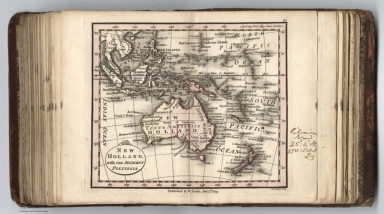
New Holland, with the adjacent Polynesia. Published by W. Faden. Jany. 1,1819. W. Palmer, Sc. (to accompany) Atlas minimus universalis, or, A geographical abridgement ancient and modern of the several parts of the earth ... Second edition. Jan 1, 1821.
List No
13243.065
Note
Double page outline hand color copperplate engraved map. Map 48 bound before map 47. Prime meridian is London. Relief shown pictorially. Includes manuscript log in right margin.
Author
Faden, William, 1749-1836
Full Title
Egypt - 1819. Published by Wm. Faden. Jany. 1,1819. T. Starling, Sculpt. (to accompany) Atlas minimus universalis, or, A geographical abridgement ancient and modern of the several parts of the earth ... Second edition. Jan 1, 1821.
List No
13243.066
Note
Double page outline hand color copperplate engraved map, with inset mao: Alexadnria. Prime meridian is Greenwich. Relief shown pictorially.
Author
Faden, William, 1749-1836
Full Title
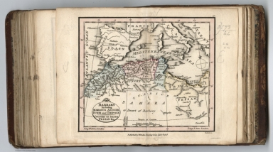
Barbary including Marocco, Algier, Tunis and Tripoly : Country of dates Fezzan &ca. Published by Wm. Faden. Jany. 1,1819. Hatchett, Sc. (to accompany) Atlas minimus universalis, or, A geographical abridgement ancient and modern of the several parts of the earth ... Second edition. Jan 1, 1821.
List No
13243.067
Note
Double page outline hand color copperplate engraved map, Prime meridian is London. Relief shown pictorially. Includes manuscript log in right margin.
Author
Faden, William, 1749-1836
Full Title
Nigritia and Guinea, with the African coast from Cape Blanco to Cape Lopo-Gonsalve. Published by Wm. Faden. Jany. 1,1819. Palmer, Sc. (to accompany) Atlas minimus universalis, or, A geographical abridgement ancient and modern of the several parts of the earth ... Second edition. Jan 1, 1821.
List No
13243.068
Note
Double page outline hand color copperplate engraved map, of western Africa, covers the west coast of Africa. Prime meridian is London. Relief shown pictorially.
Author
Faden, William, 1749-1836
Full Title
Colony of the Cape of Good Hope with the course of the Orange River. Published by Wm. Faden. Jany. 1,1819. D. Henwood, Sculp. (to accompany) Atlas minimus universalis, or, A geographical abridgement ancient and modern of the several parts of the earth ... Second edition. Jan 1, 1821.
List No
13243.069
Note
Double page outline hand color copperplate engraved map. Shows districts, settlements, rivers, etc. Prime meridian is Greenwich. Relief shown pictorially.
Author
Faden, William, 1749-1836
Full Title
North America, including the West Indies. Published by Wm. Faden. Jany. 1st.,1821. (to accompany) Atlas minimus universalis, or, A geographical abridgement ancient and modern of the several parts of the earth ... Second edition. Jan 1, 1821.
List No
13243.070
Note
Double page outline hand color copperplate engraved map. Covers polar region, Alaska, Canada, Iceland, Greenland, the West Indies and parts of Colombia. Shows boundaries, major cities and towns. Upper California includes the northern part of California is labeled Albion, the River Colorado, and the mythical Lake Teguayo. Prime meridian is London. Relief shown pictorially. Includes manuscript log in right margin.
Author
Faden, William, 1749-1836
Full Title
British possessions in North America with the United States 1818. Published by Wm. Faden. Jany. 1st.,1819. W. Palmer, Sculp. (to accompany) Atlas minimus universalis, or, A geographical abridgement ancient and modern of the several parts of the earth ... Second edition. Jan 1, 1821.
List No
13243.071
Note
Double page outline hand color copperplate engraved map. Covers the area from the Gulf of St. Lawrence south to Florida and Louisiana. Shows political and administrative boundaries, cities and towns. Prime meridian is London. Relief shown pictorially.
Author
Faden, William, 1749-1836
Full Title
Mexico of Spanish Territories in North America. Published by Wm. Faden. Jany. 1st.,1819. T. Starling, Sculp. (to accompany) Atlas minimus universalis, or, A geographical abridgement ancient and modern of the several parts of the earth ... Second edition. Jan 1, 1821.
List No
13243.072
Note
Double page outline hand color copperplate engraved map, With inset: Continuation Southward. Prime meridian is Greenwich. Relief shown pictorially. Includes manuscript log in right margin.
Author
Faden, William, 1749-1836
Full Title
West India Islands. Published by Wm. Faden. Jany. 1st.,1819. W. Palmer, Sculp. (to accompany) Atlas minimus universalis, or, A geographical abridgement ancient and modern of the several parts of the earth ... Second edition. Jan 1, 1821.
List No
13243.073
Note
Double page outline hand color copperplate engraved map, Prime meridians are Ferro and London. Relief shown pictorially.
Author
Faden, William, 1749-1836
Full Title
South America from the latest Spanish and Portuguese surveys. Published by Wm. Faden. Jany. 1,1819. W. Palmer, Sculp. (to accompany) Atlas minimus universalis, or, A geographical abridgement ancient and modern of the several parts of the earth ... Second edition. Jan 1, 1821.
List No
13243.074
Note
Double page outline hand color copperplate engraved map,. Shows political divisions, major cities and towns. Prime meridians and Ferro and London. Relief shown pictorially.
Author
Faden, William, 1749-1836
Full Title
Nea-Polynesia or the Islands newly discover’d in the Pacific Ocean. Published by Wm. Faden. Jany. 1,1819. W. Palmer, Sculp. (to accompany) Atlas minimus universalis, or, A geographical abridgement ancient and modern of the several parts of the earth ... Second edition. Jan 1, 1821.
List No
13243.075
Note
Double page outline hand color copperplate engraved map. Shows expedition tracks of the Captain James Cook and Perouse in Pacific Ocean. Prime meridian is London. Relief shown pictorially.
Author
Stieler, Adolf
Full Title
Ostliche Halbkugel. (to accompany) Atlas ofver alla verldens delar. Upsala, Palmblad & Co. 1825.
List No
13428.004
Note
Engraved hand colored in outline circular map of the Eastern Hemisphere.
Author
Stieler, Adolf
Full Title
Westliche Halbkugel. (to accompany) Atlas ofver alla verldens delar. Upsala, Palmblad & Co. 1825.
List No
13428.005
Note
Engraved hand colored in outline circular map of the Western Hemisphere.
Author
Stieler, Adolf
Full Title
Europa : zugl. als K. von Russland. (to accompany) Atlas ofver alla verldens delar. Upsala, Palmblad & Co. 1825.
List No
13428.006
Note
Engraved hand colored in outline map. Shows political boundaries. including Russia, Poland, Hungary, Prussia, etc.
Author
Stieler, Adolf
Full Title
Physische karte von Europa 1826. Gestochen von Jon Carl Ausfeld Schnepfenthal bey Gotha. (to accompany) Atlas ofver alla verldens delar. Upsala, Palmblad & Co. 1825.
List No
13428.007
Note
Engraved physical map. Relief shown by hachures.
Author
Stieler, Adolf
Full Title
Spanien und Portugal : gez von Stulpnagel. 1825. Madel, Sc. (to accompany) Atlas ofver alla verldens delar. Upsala, Palmblad & Co. 1825.
List No
13428.008
Note
Engraved hand colored in outline map. Shows political and administrative boundaries.
Author
Stieler, Adolf
Full Title
Frankreich. (to accompany) Atlas ofver alla verldens delar. Upsala, Palmblad & Co. 1825.
List No
13428.009
Note
Engraved hand colored in outline map. Shows administrative boundaries. Includes note.
Author
Stieler, Adolf
Full Title
Italien : auch Illyrien, Croatien, Dalmat. (to accompany) Atlas ofver alla verldens delar. Upsala, Palmblad & Co. 1825.
List No
13428.010
Note
Engraved hand colored in outline map of Balkan States. Shows administrative and political boundaries.
Author
Stieler, Adolf
Full Title
Die Brittischen Inseln 1825. (to accompany) Atlas ofver alla verldens delar. Upsala, Palmblad & Co. 1825.
List No
13428.011
Note
Engraved hand colored in outline map. Shows administrative and political boundaries.
Author
Stieler, Adolf
Full Title
Sodra delen af Sverige och Norrige med tilgransande Lander Finland, Dannemark &c. forfattad af Adolf Stieler utgifven af Justus Perthes I Gotha I Saxonia 1825. L v. Stulpnagel del. Grav L. Thiel (to accompany) Atlas ofver alla verldens delar. Upsala, Palmblad & Co. 1825.
List No
13428.012
Note
1 engrave hand colored in outline map. VIIIa: covers southern Scandinavia. Shows administrative and political boundaries. Includes color coded reference.
Author
Stieler, Adolf
Full Title
Norra delen af Sverige och Norrige &c. : utgifven af Justus Perthes I Gotha 1825. (to accompany) Atlas ofver alla verldens delar. Upsala, Palmblad & Co. 1825.
List No
13428.013
Note
1 engrave hand colored in outline map. VIIIb: covers northern Scandinavia. Shows administrative and political boundaries. Includes color coded reference and list of "Bergen".
Author
Stieler, Adolf
Full Title
Daenemark mit Holstein u. Lauenburg. (to accompany) Atlas ofver alla verldens delar. Upsala, Palmblad & Co. 1825.
List No
13428.015
Note
Engraved hand colored in outline map. Shows administrative and political boundaries.
Author
Stieler, Adolf
Full Title
Deutschland, Niederlande und Schweiz. (to accompany) Atlas ofver alla verldens delar. Upsala, Palmblad & Co. 1825.
List No
13428.016
Note
Engraved hand colored in outline map. Shows administrative and political boundaries.
Author
Stieler, Adolf
Full Title
Nordwestl. Deutschland und Niederlande. (to accompany) Atlas ofver alla verldens delar. Upsala, Palmblad & Co. 1825.
List No
13428.017
Note
Engraved hand colored in outline map of the Netherlands and northwest of Germany. Shows administrative and political boundaries. Includes lists of provinces.
Author
Stieler, Adolf
Full Title
Nordostl. Deutschland. (to accompany) Atlas ofver alla verldens delar. Upsala, Palmblad & Co. 1825.
List No
13428.018
Note
Engraved hand colored in outline map of Northeast Germany. Shows administrative and political boundaries. Includes lists of provinces.
Author
Stieler, Adolf
Full Title
Sudwestl. Deutschland and Schweiz. (to accompany) Atlas ofver alla verldens delar. Upsala, Palmblad & Co. 1825.
List No
13428.019
Note
Engraved hand colored in outline map of Southwest of Germany and Switzerland. Shows administrative and political boundaries. Includes lists of provinces.
Author
Stieler, Adolf
Full Title
Sudostl. Deutschland : enthalt die Oesterreichischen Lande. (to accompany) Atlas ofver alla verldens delar. Upsala, Palmblad & Co. 1825.
List No
13428.020
Note
Engraved hand colored in outline map of Southeast of Germany. Shows administrative and political boundaries.
Author
Stieler, Adolf
Full Title
Preussen, Polen, Galizien, Ungarn, Siebenburgen. (to accompany) Atlas ofver alla verldens delar. Upsala, Palmblad & Co. 1825.
List No
13428.022
Note
Engraved hand colored in outline map. Shows administrative and political boundaries.
Author
Stieler, Adolf
Full Title
Die Europaeische Turkey. (to accompany) Atlas ofver alla verldens delar. Upsala, Palmblad & Co. 1825.
List No
13428.023
Note
Engraved hand colored in outline map. Shows administrative and political boundaries.
Author
Stieler, Adolf
Full Title
Asia. (to accompany) Atlas ofver alla verldens delar. Upsala, Palmblad & Co. 1825.
List No
13428.024
Note
Engraved hand colored in outline map. Shows political boundaries.
Author
Stieler, Adolf
Full Title
Physische karte von Asia. 1826. (to accompany) Atlas ofver alla verldens delar. Upsala, Palmblad & Co. 1825.
List No
13428.025
Note
Engraved. Shows political boundaries, rivers and mountains. Releif shown by hachures.
Author
Stieler, Adolf
Full Title
Vorder Asien und Nordost-Africa : Gotha b. J. Perthes 1826. (to accompany) Atlas ofver alla verldens delar. Upsala, Palmblad & Co. 1825.
List No
13428.026
Note
Engraved hand colored in outline map. Shows political boundaries.
Author
Stieler, Adolf
Full Title
Africa. Grz. v. Stulpnagel. Gest. v. L. Thiel. (to accompany) Atlas ofver alla verldens delar. Upsala, Palmblad & Co. 1825.
List No
13428.027
Note
Engraved hand colored in outline map. Shows political boundaries. Includes color reference to European possessions in Africa.
Author
Stieler, Adolf
Full Title
Nord - America. (to accompany) Atlas ofver alla verldens delar. Upsala, Palmblad & Co. 1825.
List No
13428.028
Note
Engraved hand colored in outline map, including Canada, the United States and Central America. Inset: Nordostl. theil der verein staaten. Shows political boundaries. and northeastern states.
Author
Stieler, Adolf
Full Title
Sud America. (to accompany) Atlas ofver alla verldens delar. Upsala, Palmblad & Co. 1825.
List No
13428.029
Note
Engraved hand colored in outline map. Shows political boundaries. Includes list of Brasil administrative division.
Author
Ikbal Kutuphanesi Sahibi Huseyin
Full Title
Avrupa = Europe. Katabikhanih Ikbal. (to accompany) Tajadud maktab atlasi = New school atlas. 1927-1345.
List No
13435.005
Note
Political map of Europe. Shows capitals and major cities.
Author
Ikbal Kutuphanesi Sahibi Huseyin
Full Title
Asiya = Asia. (to accompany) Tajadud maktab atlasi = New school atlas. 1927-1345.
List No
13435.006
Note
Political map of Asia. Shows capitals and major cities.
Author
Ikbal Kutuphanesi Sahibi Huseyin
Full Title
Afrika = Africa. (to accompany) Tajadud maktab atlasi = New school atlas. 1927-1345.
List No
13435.007
Note
Political map of Africa. Shows capitals and major cities.
Author
Ikbal Kutuphanesi Sahibi Huseyin
Full Title
Somali Aamerika = North America. (to accompany) Tajadud maktab atlasi = New school atlas. 1927-1345.
List No
13435.008
Note
Political map. Shows capitals and major cities. Shows Central America and part of South America.
Author
Ikbal Kutuphanesi Sahibi Huseyin
Full Title
Janubii Aamerika = South America. (to accompany) Tajadud maktab atlasi = New school atlas. 1927-1345.
List No
13435.009
Note
Political map. Shows capitals and major cities.
Author
Ikbal Kutuphanesi Sahibi Huseyin
Full Title
Okyanusya = Oceania. Katabikhanih Ikbal. (to accompany) Tajadud maktab atlasi = New school atlas. 1927-1345.
List No
13435.010
Note
Political map of Oceania. Shows capitals and major cities.
Author
Ikbal Kutuphanesi Sahibi Huseyin
Full Title
Balkan hukumetliri = Balkan Governments. Katabikhanih Ikbal. (to accompany) Tajadud maktab atlasi = New school atlas. 1927-1345.
List No
13435.012
Note
Political map of Balkan States. Shows capitals and major cities.
Author
Ikbal Kutuphanesi Sahibi Huseyin
Full Title
Kavkasieh = Caucasus. Katabikhanih Ikbal. (to accompany) Tajadud maktab atlasi = New school atlas. 1927-1345.
List No
13435.013
Note
Political map of Caucasus. Shows political boundaries, capitals and major cities.
Author
Meḥmed Remzi
Full Title
Kure Mustaha = Flat globe. Cografya-yi ʻumumī atḷasi. stanbul : Mekteb-i Funun-ı Harbiye-i Sahanesi Matbaası, 1905=1323 h.
List No
13436.002
Note
Hand colored double hemisphere map by continent on 2 pages. Includes inset and view of comparative heights of mountains in the world. Includes manuscript geographical names.
Author
Meḥmed Remzi
Full Title
Kure Mustaha = Flat globe. Cografya-yi ʻumumī atḷasi. stanbul : Mekteb-i Funun-ı Harbiye-i Sahanesi Matbaası, 1905=1323 h.
List No
13436.003
Note
Black and white double hemisphere outline map by continent on 2 pages. Includes inset and view of comparative heights of mountains in the world.
Author
Meḥmed Remzi
Full Title
Mustatili kure Mustaha. Cografya-yi ʻumumī atḷasi. stanbul : Mekteb-i Funun-ı Harbiye-i Sahanesi Matbaası, 1905=1323 h.
List No
13436.004
Note
Hand colored map of the world on 2 pages, with manuscript geographical names.
Author
Meḥmed Remzi
Full Title
Mustatili kure Mustaha. Cografya-yi ʻumumī atḷasi. stanbul : Mekteb-i Funun-ı Harbiye-i Sahanesi Matbaası, 1905=1323 h.
List No
13436.005
Note
Black and white outline map of the world on 2 pages.
Author
Meḥmed Remzi
Full Title
Avrupa = Europe. Cografya-yi ʻumumī atḷasi. stanbul : Mekteb-i Funun-ı Harbiye-i Sahanesi Matbaası, 1905=1323 h.
List No
13436.006
Note
Hand color outline map of Europe on 2 pages, with manuscript geographical names.
Author
Meḥmed Remzi
Full Title
Avrupa = Europe. Cografya-yi ʻumumī atḷasi. stanbul : Mekteb-i Funun-ı Harbiye-i Sahanesi Matbaası, 1905=1323 h.
List No
13436.007
Note
Black and white outline map on 2 pages.
Author
Meḥmed Remzi
Full Title
Avrupa = Europe. Cografya-yi ʻumumī atḷasi. stanbul : Mekteb-i Funun-ı Harbiye-i Sahanesi Matbaası, 1905=1323 h.
List No
13436.008
Note
Black and white outline map on 2 pages.
Author
Meḥmed Remzi
Full Title
İtalya = Italy. Cografya-yi ʻumumī atḷasi. stanbul : Mekteb-i Funun-ı Harbiye-i Sahanesi Matbaası, 1905=1323 h.
List No
13436.009
Note
Hand color map on 2 pages, with manuscript geographical names. Includes 2 insets of Naples and Venice.
Author
Meḥmed Remzi
Full Title
Avrupa Osmanı - Romanya - Sırbistan -Yunanistan = European Turkey - Romania - Serbia - Greece. Cografya-yi ʻumumī atḷasi. stanbul : Mekteb-i Funun-ı Harbiye-i Sahanesi Matbaası, 1905=1323 h.
List No
13436.010
Note
Hand color map on 2 pages, with manuscript geographical names. Includes 2 insets of Dardanelles and Athens and Piraeus.
Author
Meḥmed Remzi
Full Title
Avrupa Osmanı - Romanya - Sırbistan -Yunanistan = European Turkey - Romania - Serbia - Greece. Cografya-yi ʻumumī atḷasi. stanbul : Mekteb-i Funun-ı Harbiye-i Sahanesi Matbaası, 1905=1323 h.
List No
13436.011
Note
Black and white outline map of Balkan States on 2 pages. Includes 2 insets of Dardanelles and Athens and Piraeus.
Author
Meḥmed Remzi
Full Title
Rusya = Russia. Cografya-yi ʻumumī atḷasi. stanbul : Mekteb-i Funun-ı Harbiye-i Sahanesi Matbaası, 1905=1323 h.
List No
13436.012
Note
Hand color map on 2 pages, with manuscript geographical names. Includes inset map of Saint Petersburg.
Author
Meḥmed Remzi
Full Title
Avrupa Osmanı - Romanya - Sırbistan -Yunanistan = European Turkey - Romania - Serbia - Greece. Cografya-yi ʻumumī atḷasi. stanbul : Mekteb-i Funun-ı Harbiye-i Sahanesi Matbaası, 1905=1323 h.
List No
13436.013
Note
Black and white outline map of Balkan States on 2 pages. Includes 2 insets of Dardanelles and Athens and Piraeus.
Author
Meḥmed Remzi
Full Title
Rusya = Russia. Cografya-yi ʻumumī atḷasi. stanbul : Mekteb-i Funun-ı Harbiye-i Sahanesi Matbaası, 1905=1323 h.
List No
13436.014
Note
Black and white outline map of Russia on 2 pages. Includes inset map of Saint Petersburg.
Author
Meḥmed Remzi
Full Title
Rusya = Russia. Cografya-yi ʻumumī atḷasi. stanbul : Mekteb-i Funun-ı Harbiye-i Sahanesi Matbaası, 1905=1323 h.
List No
13436.015
Note
Black and white outline map of Russia on 2 pages. Includes inset map of Saint Petersburg.
Author
Meḥmed Remzi
Full Title
Rusya Macaristan = Hungary. Cografya-yi ʻumumī atḷasi. stanbul : Mekteb-i Funun-ı Harbiye-i Sahanesi Matbaası, 1905=1323 h.
List No
13436.016
Note
Hand color map on 2 pages, with manuscript geographical names. Includes inset map of Vienna.
|