|
REFINE
Browse All : Roads of Georgia
1-9 of 9
Author
Treasure Map
Full Title
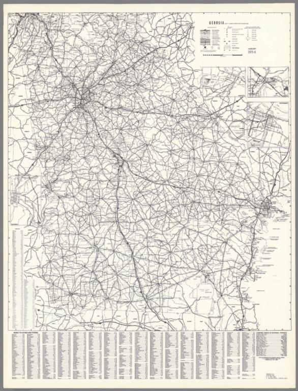
Georgia : state highway system and connections. January 1975-6. Produced by : Treasure Map. Daytona Beach, Florida. (insets) Savannah. (with) Macon. (with) Augusta. (with) Columbus. (on verso map) Home of Jimmy Carter, our 39th Pres. Plains, GA. Copyright 1976.
List No
11764.002
Note
2 maps on one sheet, both sides. Including: Uncolored map of Georgia highway system. Showing administrative boundaries, cities, towns, roads, railways, etc. Includes lists of counties, camping areas and index to cities and towns. On verso: Pictorial map of Plains, Georgia, the hometown of former president Jimmy Carter, issued as a souvenir for his presidential inauguration on January 20, 1977. The map has illustrations of his home, shops, schools, a railroad, and other buildings. The circular cartouche lower right bears the seal of the United States and states that the map shows the town as it appeared as of December 5, 1976. Text in upper left, is addressed to the citizens of Plains, Georgia, with recommended behavior at the inaugural in Washington ...
Author
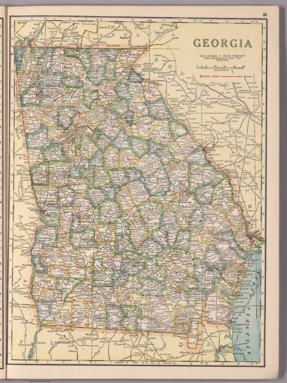
[George F. Cram Company collection 1845-1955, National Highways Association]
Full Title
Georgia. The George F. Cram Company, Chicago. (to accompany) Auto trails and commercial survey of the United States.
List No
13688.025
Note
State of Georgia showing administrative boundaries and electric lines in red.
Author
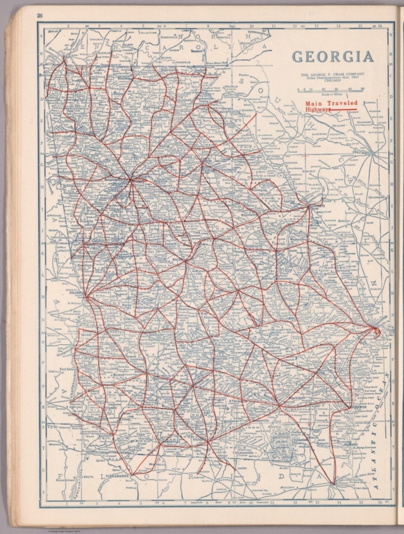
[George F. Cram Company collection 1845-1955, National Highways Association]
Full Title
Georgia. The George F. Cram Company, Chicago. (to accompany) Auto trails and commercial survey of the United States.
List No
13688.026
Note
State of Georgia. Showing main traveled highways.
Author
Rand McNalley & Company
Full Title
Rand McNally road map : Georgia.
List No
14003.019
Note
Road map of Georgia, showing interstate and state highways, paved and dirt roads, as well as drainage and ports, and state and national parks. Includes compass rose, time zones, and bar scale with scale statement: One inch equals approximately 19 miles. Features legend indicating population. Copyright by Rand McNally & Company, Chicago, Ill. Lithographed in the U.S.A.
Author
Mid-West Map Company
Full Title
Highway map & guide of Georgia. Mid-West Map Co. Aurora, Mo.
List No
14412.002
Note
Pocket road map for the state of Georgia. Shows state boundaries, cities, highways, roads, airports, topography, bodies of water, drainage, swamps, coastline and islands. Relief shown with hachures. Includes explanatory text, a legend, bar scale given in miles, and compass rose with north oriented toward top of sheet. Indexed, with key on verso. Advertisements in margins. Printed in blue. Map is 53 x 40 cm, on sheet 56 x 44 cm.
Author
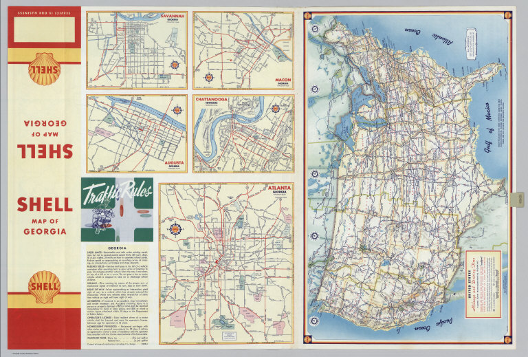
Shell Oil Company
Full Title
Shell Map of Georgia (cover title). Shell Highway Map of Georgia. 7-DD-1956-2.
List No
5840.025
Author
Shell Oil Company
Full Title
Savannah. Augusta. Macon. Chattanooga (Tennessee). Atlanta. (Verso to) Shell Highway Map of Georgia.
List No
5840.026
Author
Shell Oil Company
Full Title
Metropolitan Atlanta and Vicinity. (Verso to) Shell Street Map of Atlanta.
List No
5840.112
Author
[State Farm Insurance Companies Travel Bureau, Rand McNally and Company]
Full Title
Rand McNally Road map, Georgia. Copyright by Rand McNally & Company, Chicago, Ill. Lithographed in the U.S.A. (to accompany) State Farm Road Atlas: United States, Canada, Mexico,Central and South America. Copyright 1940 by Rand McNally & Company, Chicago, Ill.
List No
5969.027
Note
Color map. U.S. interstate highways shown in red. Shows roads, capitals, population of cities and towns, etc. Relief shown by hachures and spot heights. On the lower corner: v.3620.
1-9 of 9
|