|
REFINE
Browse All : Railroad of Mexico from 1884
1-4 of 4
Author
Mitchell, Samuel Augustus Jr.
Full Title
Map of Mexico, Central America, and the West Indies. (with) Map of the Bermuda Islands. (with) Map of the island of Jamaica. (with) Map of the proposed ship rail road route across the isthmus of Tehuantepec. (with) Map of the Panama Railroad and proposed canal. (with) Map of the proposed Nicaragua Canal route. Copyright by S. Augustus Mitchell 1884.
List No
0592.053
Note
Hand colored map with 5 insets. Relief shown by hachures. Shows states, settlements, railroads, rivers, etc. Prime meridians: Greenwich and Washington.
Author
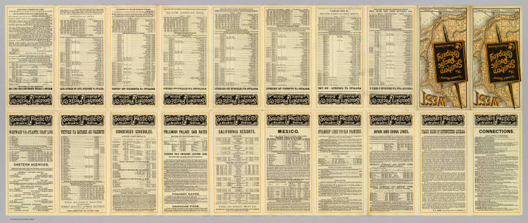
Southern Pacific Company
Full Title
(Covers to) "Sunset Route" The Southern Pacific Company Atlantic System. West. Poole Bros. Printers and Engravers, Chicago. (1884)
List No
5234A
Note
Folded to pocket map size. Verso has timetables. In full printed color, folding, self wrappers.
Author
Southern Pacific Company
Full Title
(Text Page to) "Sunset Route" The Southern Pacific Company Atlantic System. West. Poole Bros. Printers and Engravers, Chicago. (1884)
List No
5234B
Note
(20) p. on 1 sheet. Includes text, timetables and fare information.
Author
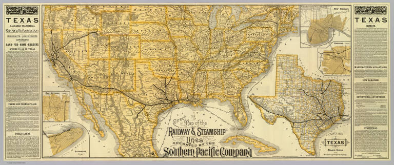
Southern Pacific Company
Full Title
Correct map of the railway & steamship lines operated by the Southern Pacific Company. (with) County map of Texas showing the Atlantic System of the Southern Pacific Company. (with) New Orleans. (with) Houston, Texas. (with) San Antonio, Texas. (with) Galveston, Texas. (1884)
List No
5234.001
Note
Relief shown by hachures. Covers most of the United States and northern and central Mexico, with shipping routes to Havana. Texas map at (ca. 1:4,800,000) scale. City maps are small scale showing street patterns, railroad, stations, etc. Text in side panels.
1-4 of 4
|