|
REFINE
Browse All : Railroad from 1847
1-4 of 4
Author
Knipe, James Alexander
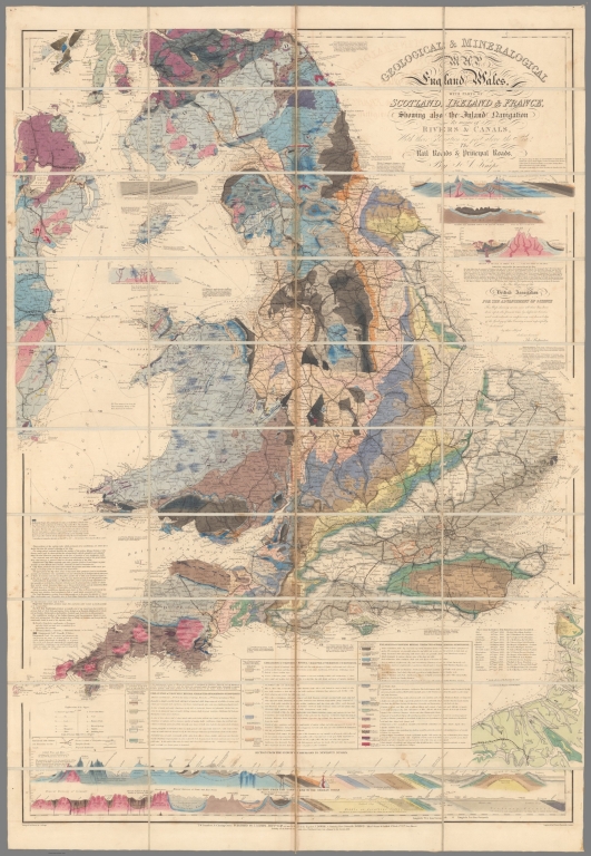
Full Title
Geological & Mineralogical Map Of England And Wales, With Parts Of Scotland, Ireland & France, Showing also the Inland Navigation By means of Rivers & Canals, With their Elevation in feet above the Sea, The Rail Roads & Principal Roads, By J.A. Knipe ... T.W. Saunders, 6, Charing Cross) Published By J.A. Knipe, Jany. 1st 1847, and may be had of the Engraver, J. Dower, 6, Cumming Place, Pentonville, London. (Messrs. Grant & Griffith St. Pauls Ch. Yd. (late Harris). Designed and Drawn by J.A. Knipe. Engraved by I. Dower, Pentonville, London. (with 7 inset profiles).
List No
2051.002
Author
Smith, J. Calvin
Full Title
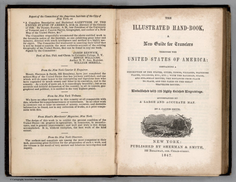
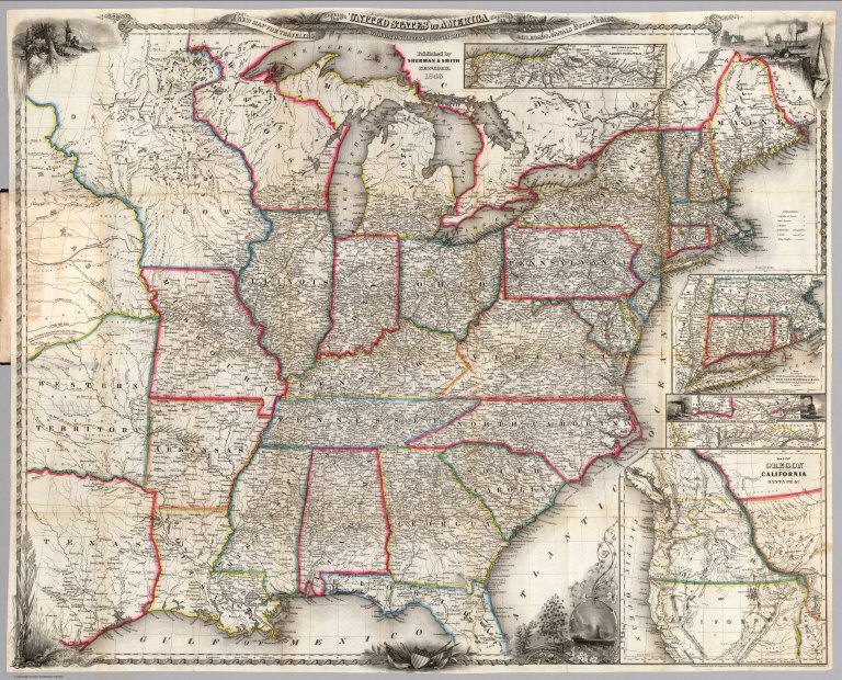
(Covers to) The Illustrated Hand-Book, A New Guide for Travelers Through The United States of America... Embellished with 125 highly finished Engravings. Accompanied By A Large and Accurate Map. By J. Calvin Smith. New York: Published By Sherman & Smith, 122 Broadway, N.W. Cor. Cedar-St. 1847. Entered ...1846, by Sherman & Smith ... (with) A New Map For Travellers Through the United States of America Showing the Railroads, Canals & Stage Roads, With The Distances, by J. Calvin Smith. Published by Sherman & Smith, New-York. 1846. Entered ... 1846, by J. Calvin Smith ... (inset) Map Of Oregon Northern California Santa Fe &c. (4 additional inset maps).
List No
3689.001
Note
Second edition of the book, first edition of the map. The first edition of the book and map was 1846; Howes lists editions of 1847, 1848, 1849, 1850 - undoubtedly there were others (see our 1856). The map was also issued separately (see our #4954, 4955). On the map, five vignettes and a decorative border are in the best Smith engraved style. 233 pages of text, black cloth patterned boards 14.5x9.5, with "The Illustrated Hand Book For Travelers Through The United States Of America" in gilt and blind stamped. Map colored in outline.
Author
Smith, J. Calvin
Full Title
(Title Page to) The Illustrated Hand-Book, A New Guide for Travelers Through The United States of America... Embellished with 125 highly finished Engravings. Accompanied By A Large and Accurate Map. By J. Calvin Smith. New York: Published By Sherman & Smith, 122 Broadway, N.W. Cor. Cedar-St. 1847. Entered ...1846, by Sherman & Smith ... (with) A New Map For Travellers Through the United States of America Showing the Railroads, Canals & Stage Roads, With The Distances, by J. Calvin Smith. Published by Sherman & Smith, New-York. 1846. Entered ... 1846, by J. Calvin Smith ... (inset) Map Of Oregon Northern California Santa Fe &c. (4 additional inset maps).
List No
3689.002
Note
Second edition of the book, first edition of the map. The first edition of the book and map was 1846; Howes lists editions of 1847, 1848, 1849, 1850 - undoubtedly there were others (see our 1856). The map was also issued separately (see our #4954, 4955). On the map, five vignettes and a decorative border are in the best Smith engraved style. 233 pages of text, black cloth patterned boards 14.5x9.5, with "The Illustrated Hand Book For Travelers Through The United States Of America" in gilt and blind stamped. Map colored in outline.
Author
Smith, J. Calvin
Full Title
The Illustrated Hand-Book, A New Guide for Travelers Through The United States of America... Embellished with 125 highly finished Engravings. Accompanied By A Large and Accurate Map. By J. Calvin Smith. New York: Published By Sherman & Smith, 122 Broadway, N.W. Cor. Cedar-St. 1847. Entered ...1846, by Sherman & Smith ... (with) A New Map For Travellers Through the United States of America Showing the Railroads, Canals & Stage Roads, With The Distances, by J. Calvin Smith. Published by Sherman & Smith, New-York. 1846. Entered ... 1846, by J. Calvin Smith ... (inset) Map Of Oregon Northern California Santa Fe &c. (4 additional inset maps).
List No
3689.003
Note
Second edition of the book, first edition of the map. The first edition of the book and map was 1846; Howes lists editions of 1847, 1848, 1849, 1850 - undoubtedly there were others (see our 1856). The map was also issued separately (see our #4954, 4955). On the map, five vignettes and a decorative border are in the best Smith engraved style. 233 pages of text, black cloth patterned boards 14.5x9.5, with "The Illustrated Hand Book For Travelers Through The United States Of America" in gilt and blind stamped. Map colored in outline.
1-4 of 4
|