|
Author
Keeler, William J.
Full Title
(Title page to) (Covers to) Notes To Accompany Keeler's Map of the U.S. Territory, From The Mississippi River To The Pacific Ocean, Containing Authentic Information Connected With The Territories, And The Different Railroad Routes To The Pacific Ocean.
List No
4695.001
Author
[Koch, Wilhelm, Opitz, C.]
Full Title
(Index Page to) Ubersichtsplan zu Dr. W.Koch und C. Opitz : Eisenbahn und verkehrs - Atlas vom Deutschen Reich. 1. Erklarungen. Eisenbahn und verkehrsatlas von Europa. Section 1. Deustches Reich.
List No
13679.009
Note
Index map and title page of railway and traffic of the German Empire. Includes list of inset maps.
Author
Mayer, Alexander
Full Title
(Title Page to) Post- und Eisenbahn-Karte der Osterreichisch-Ungarischen Monarchie. Herausgegeben vom Post-Cours-Boureau des K.K. Handelsministeriums In XVI. Blättern, im Maasse 1: 576,000. Entworfen vom k.k. Postrathe A. Mayer. Gezeichnet von K. K. Postloffizialen Joh. Gottwald u. Jos. Broditzky. Druck u. verlag v. R. v. Walheim in Wien.
List No
13387.003
Note
Title page and part of map of Germany.
Author
Tanner, Henry S.
Full Title
(Title Page to) A Connected View of The Whole Internal Navigation of the United States; ... Corrected and Improved From the Edition of 1826, And Much Enlarged, ... With A Sheet Map, ... The Map Has Been Engraved For the Purpose ... On A Reduced Scale, From Tanner's Excellent Four Sheet Map of the United States, Recently Published. ... By a Citizen of the United States. Philadelphia: Published by the Author ... Printed by Lydia R. Bailey. 1830. (on verso) ...on the seventeenth day of April ... 1830, George Armroyd ... hath deposited ... a Book ... Pennsylvania.
List No
3067A
Author
Associated Railway Land Dept of Florida
Full Title
(Title Page to) Township map of Peninsular Florida issued by the Associated Railway Land Department of Florida. 1890 ... Copyright, 1890, for the Associated Railway Land Department of Florida, By D.H. Elliott, General Land Agent. Matthews, Northrup & Co. Buffalo, New York.
List No
4100B
Note
List of companies and board of managers of the Department inside front cover.
Author
Breese, Sidney
Full Title
(Title Page to) Reports of Committees, Printed by Order of the Senate of the United States, during the Second Session of the Thirtieth Congress, begun and held at the City of Washington, December 4, 1848 ... Containing Reports from No. 244 to No. 331. Washington: 1849. Accompanied with Skeleton Map Showing the Railroads completed and in Progress in the United States, and those projected through the Public Lands and their connection with the principal Harbours on the Lakes and on the Seaboard. Printed by order of the Senate of the United States the 9th Sess: 31st Congress 1848-9.
List No
0091.001
Note
Very early U.S. Gov't Railroad Map. With proposed and existing railway lines in color. Bound with the "Reports of Committees, Printed by Order of the Senate of the United States, during the Second Session of the Thirtieth Congress, begun and held at the City of Washington, December 4, 1848 ... Containing Reports from No. 244 to No. 331. Washington: 1849." In full leather covers 23x15 with "Senate Reports 2d S. 30th C." on spine.
Author
Hayward, James
Full Title
(Title Page to) Report of the Board of Commissioners, of Internal Improvement in Relation to the Examination of Sundry Routes for a Railway from Boston to Providence. With a Memoir of the Survey. Senate No. 4. Boston: Dutton & Wentworth...Printers to the State ... 1828. (with) Plan of A Survey For the Proposed Boston and Providence Rail-Way. by James Hayward. Jan. 1828. Annin & Smith.
List No
0324.001
Note
Earliest Rairoad map in LOC collection. Sabin provides report publication data. Map is uncolored and measures 19x106 at a scale of 1:63,360 (1 inch=1 mile).
Author
Leahy, J.F.
Full Title
(Title Page to) Leahy's Hotel Guide and Railway Distance Maps of America. The Green book, It Shows the Way. Published by American Hotel Register Company. Leahy Building 228-234 W. Ontario street, Chicago, Ill. Established Nearly Half Century. Revised Edition No. 59, Copyrighted Jan. 1934. Price of this book, complete $5.00. Subscription, Five Years .... $20.00, Combined Guide and Map of any Individual State 25 cents.
List No
0425.005
Note
A guide to accompany the revised edition No. 59 of Leahy's Hotel Guide and Railway Distance Maps of America. It lists the Hotels of the town with the number of rooms of each, their rates per day and the population of the town. It includes the name of the railroads entering the town and where the town can be found on the map. Maps of each state are opposite the State lists of towns and hotels making it easy and convenient to refer from the one to the other. The maps give the railroad distance between towns. The Guide includes Index, explanation of Hotel listing, and explanatory map, the Provinces of Canada, as well as the United States. The railroad distance maps of Europe, Mexico, South and Central America ... Maps printed without color, Railroad lines shown in red on some maps. The Guidebook is bound in Green paper covers with title in gold: Leahy's Hotel Guide and R.R. Distance Maps. Southern Pacific Lines.
Author
Mitchell, Samuel Augustus
Full Title
(Title Page to) Mitchell's Compendium Of The Internal Improvements Of The United States; Comprising General Notices Of All The Most Important Canals and Rail-Roads... Philadelphia: Published By Mitchell & Hinman, No. 6, North-Fifth Street. 1838. (on verso) Entered ... 1835, by Mitchell & Hinman ... Pennsylvania. Stereotyped by John Fagan ... Philadelphia. (with) Mitchell's Map Of The United States Showing the Principal Travelling, Turnpike and Common Roads ... Philadelphia: Published By S. Augustus Mitchell. 1838. Sold by Mitchell & Hinman. No. 6 North Fifth Street. Entered ... 1835, by S. Augustus Mitchell... Pennsylvania. (with 8 inset maps).
List No
0521.002
Note
The second edition. No obvious changes noted from the 1835 edition of the map. Full color. 84 Page book is bound into patterned teal blue cloth covers with "The American Traveller, And Guide Through The United States." on cover label. Four page catalogue of Mitchell's maps.
Author
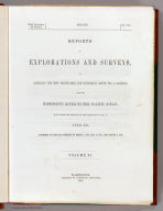
[Pacific Railroad Survey, Warren, Gouverneur Kemble, 1830-1882]
Full Title
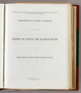
(Title Page to) Reports of Explorations and Surveys, to Ascertain the Most Practicable and Economical Route for a Railroad From the Mississippi River to the Pacific Ocean. Made Under the Direction of the Secretary of War, In 1853-56, According to Acts of Congress of March 3, 1853, May 31, 1854, and August 5, 1854. Volume XI. Washington: George W. Bowman, Printer. 1861. 36th Congress, 2d Session, Senate, Ex. Doc.
List No
0693B
Note
This Quarto issue of the report is the House issue, except for volume XI which is the Senate issue. W. Heckrotte has an unusual copy of the Warren U.S. map found in this report. It is dissected on linen and is an earlier version of the map published with the Quarto report. It has 40 authorities vs. 42 in the quarto issue map, shorter note to left of authorities, lots of plate differences, especially: nothing in Owyhee area, differences in N.M., Calif., etc. Looks like someone asked for the map before it was finished -see the Lack of ocean lines in the top half south of Gray's Harbor. In 13 volumes. Bound in full leather with "Explorations and Surveys for a Railroad to the Pacific Ocean" and the volume number on the spine in gold.
Author
[Pacific Railroad Survey, Warren, Gouverneur Kemble, 1830-1882]
Full Title
(Title Page to) Memoir to accompany the Map of the territory of the United States from the Mississippi River to the Pacific Ocean, giving a brief account of each of the exploring expeditions since A.D. 1800, with a detailed description of the method adopted in compiling the general map. By Lieut. Gouverneur K. Warren, Corps of Topographical Engineers, U.S.A. 1859.
List No
0693D
Author
[Pacific Railroad Survey, Warren, Gouverneur Kemble, 1830-1882]
Full Title
(Title Page to) Topographical maps, profiles, and sketches to illustrate the various Reports of Surveys for railroad routes from the Mississippi River to the Pacific Ocean. Washington, D.C., 1861.
List No
0693F
Author
Rand McNally and Company
Full Title
(Title Page to) Rand, McNally & Co.'s California. Rand, McNally & Co., Map Publishers and Engravers, Chicago, 1899. Rand, McNally & Co.'s New Business Atlas Map of California. Copyright, 1898, ... 1895 ... (untitled inset map of Central California). (untitled inset map of coastal Southern California). (with 83 page index) Rand McNally & Co.'s Indexed County And Railroad Pocket Map And Shippers' Guide Of California ... Chicago And New York: Rand, McNally & Co. ... (on verso) Copyright, 1899, by Rand, McNally & Co., Chicago.
List No
0774.002
Note
Map used in Large Indexed Atlas. Covers are brown card board 17x10.5 printed same as index title page. Printed color showing county borders, mountain ranges, water, and railroad stations. Includes index to California Chief Cities and List of California Railroads. The numbers in the list correspond to the numbers on the map. Prime meridian is Greenwich. Relief shown by shadings.
Author
Rand McNally and Company
Full Title
(Title Page to) Ohio. Rand McNally & Co., Map Publishers and Engravers, Chicago, 1911. Rand, McNally & Co.'s New Business Atlas Map of Ohio. Copyright, 1911, ... 1902 ... (inset) Map Of Hamilton Co., Ohio. (with 110 page index) The Rand-McNally Indexed County And Railroad Pocket Map And Shippers' Guide Of Ohio ... Chicago And New York: Rand, McNally & Co. ... (on verso) Copyright, 1911, Rand, McNally & Co., Chicago.
List No
0789.002
Note
Full printed color by county. Map is folded into tan card board covers 17x10.5 with same title as index, but publisher information is given as "Rand McNally & Company, Chicago, New York, Los Angeles." Includes index to Ohio Chief Cities and the list of Ohio Railroads. The numbers in the list correspond to the numbers on the map.
Author
Tanner, Henry S.
Full Title
(Title Page to) A Description of the Canals and Railroads of the United States, Comprehending Notices of all the Works of Internal Improvement Throughout the Several States. By H.S. Tanner. New York: T.R. Tanner & J. Disturnell, 124 Broadway. 1840. (on verso) Entered ... 1840, by T.R. Tanner and J. Disturnell ... New York.
List No
0979.002
Note
Enlarged edition, 1st was 1834; G.K. Warren copy. Maps of New York State and Pennsylvania added to this edition. Catalog of Tanner and Disturnell in back of book. Maps show canals and roads in color, otherwise are uncolored. Bound with cloth covered boards, title on the spine and an embossed train and canal on the cover.
Author
Stummer, Joseph
Full Title
(Covers/Title Page to) Bildliche Darstellung der Geschichte der ausschl. privil. Kaiser Ferdinand`s Nordbahn vom Beginn des Betriebes bis zum abgelaufenen Jahre. Entworfen end bearbeitet von Josef. Stummer, Lithographie und farbendrund von H. Engle. Wien 1855. (Pictorial representation of the history of Emperor Ferdinand's Northern Railway from the beginning of its operation until the past year. Designed by Josef. Mute, lithograph and full color by H. Engle. Vienna 1855.)
List No
13248.001
Author
[Koch, Wilhelm, Opitz, C.]
Full Title
(Index Page to) Ubersichtskarte von der Schweiz. Eisenbahn und verkehrsatlas von Europa. Section 27. Schweiz. Section 1.
List No
13679.037
Note
Index map and title page of Switzerland railway and traffic system. Includes list of abbreviations and text.
Author
[Koch, Wilhelm, Opitz, C.]
Full Title
(Index Page to) Eisenbahn und verkehrsatlas von Europa. Section 31. Frankreich. Section 1.
List No
13679.043
Note
Index map and title page of France railway and traffic. Includes explanation of the map of Paris and surroundings.
Author
[Koch, Wilhelm, Opitz, C.]
Full Title
(Index Page to) Ubersichtskarte von Belgien. Eisenbahn und verkehrsatlas von Europa. Section 38. Belgien. Section 1.
List No
13679.053
Note
Index map and title page of Belgium railway and traffic. Includes legend and list of insets at scale of 1:120,000..
Author
[Koch, Wilhelm, Opitz, C.]
Full Title
(Index Page to) Eisenbahn und verkehrsatlas von Europa. Section 41. Russland. Section 1.
List No
13679.058
Note
Railways and traffic map of Russia, with 2 insets of continuation of northern part. Prime meridian is Greenwich. Includes list of state and private railways.
Author
[Koch, Wilhelm, Opitz, C.]
Full Title
(Index Page to) Uberichtskarte von Italien. Eisenbahn und verkehrsatlas von Europa. Section 62. Italien. Section 1.
List No
13679.086
Note
Index map and title page of Italy railway and traffic system.
Author
[Koch, Wilhelm, Opitz, C.]
Full Title
(Index Page to) Ubersichtskarte von Osterreich-Ungarn. Eisenbahn und verkehrsatlas von Europa. Section 67. Osterreich - Ungarn. Section 1.
List No
13679.095
Note
Index map and title page of Austria and Hungary railway and traffic system.
Author
Whitney, Asa
Full Title
(Title Page to) A Project For A Railroad To The Pacific. By Asa Whitney, of New York. With Reports of Committees of Congress, Resolutions of State Legislatures, Etc., with other Facts Relating Thereto. New York: Printed by George W. Wood, No. 15 Spruce Street. 1849.
List No
1466.001
Note
Two untitled maps: 1) A world map on a Mercator Projection showing the US as a central point linking Europe and Asia. 2) A map of North America showing possible rail routes across the continent. Bound report with cloth covered boards and "Railroad to the Pacific" with author and date on spine.
Author
Davis, Charles Henry
Full Title
(Title Page to) Report on Interocean Railroads & Canals between the waters of the Atlantic and Pacific Oceans. {Senate} 39th Congress, 1st Session. Ex. Doc. No. 62.
List No
1789.001
Note
Early issue. Maps are uncolored. Also includes profile views of potential canal sites. All maps bound in cloth covered boards with title on the spine. "Interoceanic railroads and canals. 1866".
Author
Western Rail Road Corporation
Full Title
(Title Page to) Reports of The Engineers of the Western Railroad Corporation, Made to the Directors, in 1836-7. Springfield: Printed by Merriam, Wood and Co. 1838.
List No
2038.001
Note
Important early connection from Albany to Boston. This line was completed in 1843 according to Modelski. Two maps: "Route of the Western Rail Road. West of Connecticut River. 1837." and "Route of Western Rail Road. East of Connecticut River. 1837." Both uncolored and bound into the back of the report.
Author
[Cram, George, Farrington, E.C.]
Full Title
(Title Page to) Farrington's Map Of Maine, Together with the Index and Appendix Of Information ... E.C. Farrington, Augusta, Maine. (on verso) Index to State Map Of Maine. (with) Map Of The State Of Maine Showing Railroads, Towns, Plantations and Wild Lands. 1900. 61-63 Plymouth Place, Chicago, Ill. 130 Fulton Street, New York. Revised By Frank E. Oak, State Land Office, Augusta, Me. Copyright 1900 By E.C. Farrington, Augusta, Maine.
List No
2052.002
Note
With a 36 page index. Printed outline color. In dark blue cloth covers 17x11 stamped with "Farrington's Railroad and Township Map Of Maine 1900" in gilt.
Author
Tanner, Henry S.
Full Title
(Title Page to) The American Traveller; Or Guide Through the United States. Containing Brief Notices of the Several States, Cities, Principal Towns ... Alphabetically arranged, Eighth Edition. By H.S. Tanner. Philadelphia: Published by H. Tanner, Jr. New York: T.R. Tanner. 1842. (on verso) Entered ... 1839, by H.S. Tanner ... Pennsylvania. With direct References to the accompanying Map "The Travellers Guide or Map of the Roads, Canals, and Railways of the United States. With the distances from place to place by H.S. Tanner.
List No
2528.002
Note
8th edition, published by H. Tanner Jr. in Philadelphia and T.R. Tanner in New York, both presumably H. Tanner senior's sons. The large map appears unchanged from the 1840 edition. Large outline color map bound in back entitled, "The Travellers Guide or Map of the Roads, Canals & Rail Roads of the United States, With the distances from place to place by H.S. Tanner." At bottom of map, "Entered ... 1834, by H.S. Tanner ... Pennsylvania." Book bound with linen and with title embossed on cover, "Tanner's American Traveller or Guide through the United States with Maps, Plans &c. 1842."
Author
[Mitchell, Samuel Augustus, Drake, Ira S.]
Full Title
(Title Page to) Mitchell's New Traveller's Guide Through The United States, Containing The Principal Cities, Towns &c. ... Illustrated By An Accurate Map Of The United States. Philadelphia: Thomas, Cowperthwait & Co. 1849. (on verso) Entered ... 1848, by Thomas, Cowperthwait & Co. ... Pennsylvania. Stereotyped by J. Fagan. Printed by Smith & Peters. (with map) Mitchell's New Traveller's Guide Through The United States, Showing the Rail Roads, Canals, Stage Roads &c. ... Drawn and Engraved by Ira S. Drake. Philadelphia 1849 Published by Thomas, Cowperthwait & Co. Entered ... 1848, by Thomas, Cowperthwait, & Co. ... Pennsylvania. (with 5 inset maps).
List No
2766.002
Note
This is a major revision of the guide with an entirely new map by Ira S. Drake (about whom we find nothing) with five inset maps entitled - "Vicinity Of Niagara Falls", "Map Of The Copper Mine Region", "Map of the Gold and Quicksilver district of California", "Map of the Maritime and Overland Routes to California", and "Map Of New England Or Eastern States". The map emphasis on the California gold rush is clear, although the 128 pages of expanded text do not yet list routes to the gold fields, while they do add routes west from St. Louis and Independence. The main map is larger than the earlier Mitchell/Young maps, but shows roughly the same area on a somewhat larger scale. An "Advertisement" (actually a preface) dated Nov. 1, 1848, states: "The following work is similar in design to 'Mitchell's Traveller's Guide,' first published about twelve years ago, and which has been so extremely patronized, that it may be safely asserted no book of the kind ever printed in this country has met with so wide a circulation." Covers are black stamped leather with "Mitchell's New Traveller's Guide Through The United States" and a beautiful illustration of a steam boat and train stamped in gilt. Map is outline color. Catalogue of Thomas, Cowperthwait School Books included in the text.
Author
Mitchell, Samuel Augustus
Full Title
(Title Page to) Mitchell's Compendium Of The Internal Improvements Of The United States; Comprising General Notices Of All The Most Important Canals and Rail-Roads... Philadelphia: Published By Mitchell & Hinman, No. 6 North-Fifth Street. 1835. (on verso) Entered ... 1835, by Mitchell & Hinman ... Pennsylvania. Stereotyped by John Fagan ... Philadelphia. (with) Mitchell's Map Of The United States Showing the Principal Travelling, Turnpike and Common Roads ... Philadelphia: Published By S. Augustus Mitchell. 1835. Sold by Mitchell & Hinman No. 6 North Fifth Street. Entered ... 1835, by S. Augustus Mitchell... Pennsylvania. (with 8 inset maps).
List No
2869.002
Note
1st edition. This guide is scarcer than Mitchell's Traveller's Guide. The outline color map is very similar to the Traveller's Guide Map - it is probably from the same plate, but covers slightly more area, has eight inset maps (the Traveller's map drops the Hartford /New Haven inset and adds two - Niagara Falls and New Orleans) instead of nine, and has a table of distances below the title. The 84 page text in this guide is a descriptive listing of Canals, Railroads, etc.; the Traveller's Guide text functions as a route book and was certainly more generally useful and had many more editions. There was only one other edition of this Compendium, in 1838 (see our #521). The map was issued separately in 1839 (see our #4950) and a printing on silk was issued in 1835 (see our #4544). Book is bound into black leather covers with "Mitchell's Compendium Of Canals & Railroads" and a decorative border stamped in gilt. Four page catalogue of Mitchell's maps.
Author
Cram, George Franklin
Full Title
(Title Page to) New Rail Road And Township Map Of Iowa Engraved From Official Draughts of each County. Published By George F. Cram, Dealer In: Maps, Charts, Lithographic Pictures, Steel Engravings, Photographs &c. &c. 134 Lake St. Chicago, Ill. 1868. Entered ... 1868 by George F. Cram ... Illinois. Chas. Shober & Co. Lith. Chicago, Ill.
List No
3022.002
Note
1st edition, 1st year of operation for Cram's business. Everything about this map is different from Cram's later productions: it is his first year of operation, at 134 Lake Street, and the style of the cover, the map and the cartouche all have an "early" and unsophisticated look. Charles Shober is listed as Lithographer. Cram also produced the Guide Map to Chicago in 1868 (see our copy). Surviving pre fire maps by Cram are rare. Karrow shows 1869 maps for Missouri, Missouri and Kansas together, and Illinois, (all engraved by Pfeiffer, not Shober), but he shows no 1868 maps other than this Iowa and the Chicago maps. So this may be Cram's first state pocket map. It is copyright 1868. There is a view of a steam engine in the cartouche; this does not appear in later Cram maps. A 10 page index lists principal towns and counties, and gives a brief history of the state. Full color. Map is folded into stamped dark green cloth covers 14x9 with "New Township Map Of Iowa" in gilt.
Author
Rand McNally and Company
Full Title
(Title Page to) The Rand McNally New Commercial Atlas Map Of New Mexico ... Copyright by Rand McNally & Co. (on verso) New Mexico Automobile Road Map.(with 27 page index) Rand McNally Indexed Pocket Map Tourists' And Shippers' Guide Of New Mexico ... Rand McNally & Company, Chicago 536 South Clark St., New York 42 East 22nd St. (on verso) Copyright, 1920, by Rand McNally & Co., Chicago.
List No
3183.002
Note
The map is from the Commercial Atlas of the U.S. On the verso of the main map is "New Mexico Automobile Road Map" with Auto Roads shown in red on a base map that is the same as the main map. The main map is in full printed color. Covers are brown card board 17x11 printed with "New Mexico. Rand McNally Indexed Pocket Map Tourists' And Shippers' Guide ... Price 35 Cents. Rand McNally & Company ..." Includes index to New Mexico Principal Cities and the list of New Mexico Railroads. The numbers in the list correspond to the numbers on the map. Prime meridian is Greenwich. Relief shown by hachures.
Author
Rand McNally and Company
Full Title
(Title Page to) Oregon. Rand, McNally & Co., Map Publishers and Engravers, Chicago, 1909. Rand, McNally & Co.'s New Business Atlas Map of Oregon. Copyright, 1909, ... 1906 ... (with 25 page index) Rand McNally & Co.'s Indexed County And Railroad Pocket Map And Shippers' Guide Of Oregon ... Chicago And New York: Rand, McNally & Co. ... (on verso) Copyright, 1909, Rand, McNally & Co., Chicago.
List No
3184.002
Note
Map is from the New Business Atlas. Map has full printed color by county and is folded into brown card board covers 17x10.5 printed same as index title page. Includes index to Oregon Chief Cities and the list of Railroads. The number in the list correspond to the number on the map. Prime meridian is Greenwich.
Author
Rand McNally and Company
Full Title
(Title Page to) Rand McNally & Co.'s Iowa. Rand McNally & Co., Map Publishers and Engravers, Chicago, 1894. Rand McNally & Co.'s New Business Atlas of Iowa. Copyright, 1889, by Rand McNally & Co. (with 46 page index) Rand McNally & Co.'s Indexed County And Township Pocket Map And Shippers' Guide Of Iowa... (on verso) Copyright, 1894, by Rand, McNally & Co., Chicago.
List No
3185.002
Note
Map is from the New Business Atlas. Full printed color by county. Folded into tan card board covers 16.5x11 printed with same title as index title page. Prime meridian is Greenwich.
Author
Rand McNally and Company
Full Title
(Title Page to) Rand McNally Standard Map Of New York. The Rand McNally New Commercial Atlas Map of New York. Copyright by Rand McNally & Co. (inset) Northern Portion Of New York. (inset) Long Island Extension. (on verso) Rand McNally Main Highway Map Of New York ... (with 86 page index) Rand McNally Indexed Pocket Map Tourists' And Shippers' Guide Of New York ... Rand McNally & Company, Chicago 536 S. Clark St., New York 42 E. 22 St. (on verso) Copyright, 1921, by Rand, McNally & Co., Chicago.
List No
3186.002
Note
The map is from the New Commercial Atlas of the U.S. On the verso of the main map is "Rand McNally Main Highway Map of New York" with Auto Roads shown in green on a base map that is the same as the main map. A note says "For complete auto road information, purchase Rand McNally Official Auto Trails Maps." This notice does not appear on the 1920 New Mexico map, so we assume 1921 was the first year of issue for the auto trails maps. Printed in full color, folded into tan card board covers 17x10.5 printed with "New York. Rand McNally Indexed Pocket Map Tourists' And Shippers' Guide ... Price 35 Cents. Rand McNally & Company, Chicago 536 South Clark St., New York 42 E. Twenty second St." Includes index to New York Principal Cities and the list of New York Railroads. The numbers in the list correspond to the numbers on the map. Prime meridian is Greenwich. Relief shown by hachures.
Author
Rand McNally and Company
Full Title
(Title Page to) Rand, McNally & Co.'s Colorado. Rand McNally & Co., Map Publishers and Engravers, Chicago, 1907. Rand, McNally & Co.'s New Business Atlas Map of Colorado. Copyright, 1906, ... 1904 ... (with 33 page index) Rand, McNally & Co.'s Indexed County And Township Pocket Map And Shippers' Guide Of Colorado ... Chicago And New York: Rand, McNally & Co. ... (on verso) Copyright, 1907, by Rand, McNally & Co., Chicago.
List No
3379.002
Note
Same map as used in the New Business Atlas. 28 Colorado railroads shown. Catalogue for Rand McNally's "Indexed Pocket Maps of Foreign Countries," and their pocket maps of the United States and Canada. Full printed color by county, folded into brown card board covers 16.5x10.5 titled same as index. Includes index to Colorado Chief Cities and List of Colorado Railroads. The numbers in the list correspond to the numbers on the map. Prime meridian is Greenwich. Relief shown by hachures.
Author
Rand McNally and Company
Full Title
(Title Page to) Rand, McNally & Co.'s Colorado. Rand McNally & Co., Map Publishers and Engravers, Chicago, 1912. The Rand-McNally & Co.'s New Commercial Atlas Map of Colorado. Copyright by Rand-McNally & Co. (with 62 page index) Rand McNally & Co.'s Indexed County And Township Pocket Map And Shippers' Guide Of Colorado ... Chicago And New York: Rand McNally & Co. ... (on verso) Copyright, 1912, by Rand, McNally & Co., Chicago.
List No
3380.002
Note
Same map as used in the New Commercial Atlas. 32 Colorado railroads shown. Many ads for railroads, etc. after the index. Full printed color by county, folded into brown card board covers 17x10.5 printed with "The Rand-McNally Indexed County And Township Pocket Map And Shippers' Guide Of Colorado ... Rand McNally & Company Chicago, New York, Los Angeles." Includes index to Colorado Chief Cities and List of Colorado Railroads. The numbers in the list correspond to the numbers on the map. Prime meridian is Greenwich. Relief shown by hachures.
Author
Rand McNally and Company
Full Title
(Title Page to) Rand, McNally & Co.'s Wyoming. Rand, McNally & Co., Map Publishers and Engravers, Chicago, 1909. Rand, McNally & Co.'s Indexed Atlas of the World Map of Wyoming. Copyright, 1909, ... 1895 ... (with 15 page index) Rand McNally & Co.'s Indexed County And Railroad Pocket Map And Shippers' Guide Of Wyoming ... Chicago And New York: Rand McNally & Co. ... (on verso) Copyright, 1909, Rand, McNally & Co., Chicago.
List No
3381.002
Note
Same map as used in the Indexed Atlas of the World. Full printed color by county. Map is folded into brown card board covers 16.5x10.5 printed same as index title page. Includes index to Wyoming Chief Cities and the list of Railroads. The number in the list correspond to the number on the map. Prime meridian is Greenwich. Relief shown by hachures.
Author
Smith, J. Calvin
Full Title
(Title Page to) The Illustrated Hand-Book, A New Guide for Travelers Through The United States of America... Embellished with 125 highly finished Engravings. Accompanied By A Large and Accurate Map. By J. Calvin Smith. New York: Published By Sherman & Smith, 122 Broadway, N.W. Cor. Cedar-St. 1847. Entered ...1846, by Sherman & Smith ... (with) A New Map For Travellers Through the United States of America Showing the Railroads, Canals & Stage Roads, With The Distances, by J. Calvin Smith. Published by Sherman & Smith, New-York. 1846. Entered ... 1846, by J. Calvin Smith ... (inset) Map Of Oregon Northern California Santa Fe &c. (4 additional inset maps).
List No
3689.002
Note
Second edition of the book, first edition of the map. The first edition of the book and map was 1846; Howes lists editions of 1847, 1848, 1849, 1850 - undoubtedly there were others (see our 1856). The map was also issued separately (see our #4954, 4955). On the map, five vignettes and a decorative border are in the best Smith engraved style. 233 pages of text, black cloth patterned boards 14.5x9.5, with "The Illustrated Hand Book For Travelers Through The United States Of America" in gilt and blind stamped. Map colored in outline.
Author
Tehuantepec Railway Company
Full Title
(Title Page to) The Tehuantepec Railway, Its Location, Features and Advantages Under the La Sere Grant of 1869. D. Appleton & Co ... 1869. (on verso) Entered ... 1869, by The Tehuantepec Railway Company ... New York. Baker & Godwin, Printers, Printing House Square, N.Y.
List No
3909.001
Note
Inscribed by the President of the Tehuantepec Railway, Simon Stevens. The book consists of the La Sere Grant in Spanish and in English, plus two interesting maps in outline color, folded to 26x16, showing the World on Mercator's Projection and the Isthmus of Tehuantepec. Henry Stevens adds a section entitled "Historical and Geographical Notes 1453-1869." Cloth covered boards lacking any title.
Author
Rand McNally and Company
Full Title
(Title Page to) Rand McNally & Co's Historical Description And Guide Map Of Chicago ... Chicago: Rand, McNally & Co., Printers And Engravers, 77 and 79 Madison Street. (on verso) Entered ... 1879, by Rand, McNally & Co. ... Washington. (with) Map Showing The Boulevards And Park System And Twelve Miles of Lake Frontage Of The City Of Chicago. Engraved By Rand, McNally & Co. ... Entered ... 1879, by Rand, McNally & Co. ... Washington, D.C. ...
List No
4079.003
Note
First edition of Rand McNally's first map of Chicago, and 53 page guide book. On the inside front cover is a Map of Chicago and Alton Railroad lines. There are various catalogue listings for Rand McNally publications interspersed with the index. Folded into light blue card board covers printed with "Rand, McNally & Co's Historical Description And Guide Map Of Chicago With A Complete Street and Avenue Guide to the Entire City."
Author
[Mitchell, Samuel Augustus, Drake, Ira S.]
Full Title
(Title Page to) Mitchell's New Traveller's Guide Through The United States, Containing The Principal Cities, Towns &c. ... Illustrated By An Accurate Map Of The United States. Philadelphia: Thomas, Cowperthwait & Co. 1853. (on verso) Entered ... 1848, by Thomas, Cowperthwait & Co. ... Pennsylvania. Stereotyped by J. Fagan. Printed by Smith & Peters. (with map) Mitchell's New Traveller's Guide Through The United States, Showing the Rail Roads, Canals, Stage Roads &c. ... Drawn and Engraved by Ira S. Drake. Philadelphia 1854. Published by Thomas, Cowperthwait & Co. Entered ... 1848, by Thomas, Cowperthwait, & Co. ... Pennsylvania. (with 5 inset maps).
List No
4196.002
Note
The text is not changed from the 1850 edition, nor are any major changes noted on the map from the 1851 edition map (even though this map is dated 1854). The catalogue of Thomas, Cowperthwait is enlarged from the 1850 edition, with an excellent description of the Mitchell New Universal Atlas: "The results of the latest geographical and nautical discoveries are to be found on the Maps, including those of the most recent date by Wilkes, Nicollet, and Fremont." Outline color. Bound in black stamped leather covers with "Mitchell's New Traveller's Guide Through The United States" and a beautiful illustration of a steam boat and train stamped in gilt.
Author
[Mitchell, Samuel Augustus, Young, James H., Drake, Ira S., Hazzard, John L.]
Full Title
(Title page to) Mitchell's New Traveller's Guide Through The United States and the Canadas, Containing The Principal Cities And Towns. Alphabetically Arranged, Together with Rail Road, Steamboat, Stage, and Canal Routes, With table of Places, and Distances from Place to Place. Illustrated By An Accurate Map Of The United States, Showing the Lines of Finished Rail Roads, And their More Important Connections. Philadelphia: Charles Desilver, 253 Market Street. 1856. (on verso) Entered ... 1855, by Charles Desilver ... Pennsylvania.
List No
4226.002
Note
Guide Book, 124 p., includes: Index to Rail Roads and Index to General Routes. The contents calls for only one map but a second new map is added of the entire U.S., from the Mitchell Universal Atlas plate. The Drake1856 map adds J.L. Hazzard to the title and compared to the 1855 issue shows several new proposed railroads, particularly in the area west of the Missouri River (possibly the proposed Pacific Railroad routes). The Mitchell/Young U.S. map is slightly different from the same map in the 1856 Universal Atlas, in its showing of the Pacific Railroad routes. Bound in dark green leather covers with "Mitchell's New Traveler's Guide Through The United States" and a beautiful illustration stamped in gilt. The two insets in the first map are titled "Gold Region Of California" and "District Of Columbia". Both maps in outline color. Prime meridians are in Washington D.C. and Greenwich.
Author
State Farm Insurance Companies Travel Bureau
Full Title
(Title Page to) State Farm Road Atlas United States. Canada. Mexico. Copyright by Rand McNally & Company, Chicago. Printed in U.S.A.
List No
4246.0032
Note
Rand McNally published this for State Farm. "This 1944 State Farm Road Atlas is designed and complied by the State Farm Travel Bureau ... This road atlas is not for sale but is distributed exclusively through authorized State Farm Agents." Includes: Table of Contents, Military map of the World, State and Province maps, City maps. On opposite page: Imprint and State Farm Insurance Company advertisements.
Author
Rand McNally and Company
Full Title
(Title Page to) Mexico. Rand, McNally & Co.'s Mexico. Rand, McNally & Co., Map Publishers and Engravers, Chicago, Ill. ... Copyright, 1898, ... 1891 ... (inset) Map Of The Valley Of Mexico. (with 61 page index) Rand, McNally & Co.'s Indexed Map Of Mexico ... Chicago And New York: Rand, McNally & Co. ... (on verso) Copyright, 1899, by Rand, McNally & Co., Chicago.
List No
4501.002
Note
The map is the same as the one that appears in the Rand McNally Indexed Atlas of 1899. Folded into dark green cloth covers 17x11 with "Rand McNally & Co.'s Index Map of Mexico." stamped in gold. Printed color showing railroad lines in red and water in blue. Prime meridian is Greenwich. Relief shown by hachures.
Author
Tanner, Henry S.
Full Title
(Title Page to) The American Traveller; Or Guide Through the United States. Containing Brief Notices of the Several States, Cities, Principal Towns ... By H.S. Tanner. Philadelphia: Published by the Author, Shakespeare Buildings. 1834. (on verso) Entered ... 1834, by H.S. Tanner ... Pennsylvania.
List No
4542.002
Note
The first edition. This is the only edition of the map to have a date on it; we can find no other changes to the maps in the 1836 and 1837 editions. Includes references to Capitals, important towns ... roads canals and railroads. In the 1842 edition many of the upper left inset maps are dropped to allow better coverage of Iowa. There is an extra map of Pennsylvania tipped in that is the Anthony Finley 1834 double page atlas map of Pennsylvania, but with Tanner's name as publisher and printed on thin folding paper. Included are four small maps of Baltimore, Philadelphia, New York and Boston. With a catalogue of Tanner's works. Linen covered boards with label affixed to the cover with title, "Tanner's American Traveller, or Guide Through the United States."
Author
Rand McNally and Company
Full Title
(Title Page to) Rand, McNally & Co.'s Nebraska. Copyright, 1886, by Rand, McNally & Co., Map Publishers, Chicago ... (with 22 page index) Rand, McNally & Co.'s Indexed County And Township Pocket Map And Shippers' Guide Of Nebraska ... Chicago And New York: Rand, McNally & Co. ... (on verso) Entered ... 1886, by Rand, McNally & Co. ... Washington.
List No
4567.002
Note
This is an updated version of the map that appears first in the Indexed Atlas of the World, 1881. Full printed color by county. Folded into tan card board covers 17x11 with same title as index. Prime meridians are Greenwich and Washington D.C.
Author
Rand McNally and Company
Full Title
(Title Page to) Rand, McNally & Co.'s Arkansas. Copyright, 1879, Rand, McNally & Co., Chicago, Ill. (with 19 page index) Rand, McNally & Co.'s Indexed Map Of Arkansas Showing The Railroads In The State ... Chicago: Rand, McNally & Co., Printers And Engravers, 77 and 79 Madison Street. (on verso) Entered ... 1879, by Rand, McNally & Co. ... Washington.
List No
4889.002
Note
The second edition. Folded into yellow card board covers 15.5x9 with "Rand, McNally & Co's Indexed Map of Arkansa With A New and Original Compilation and Index ... Chicago: Rand, McNally & Co., Printers And Engravers, 77 and 79 Madison Street." Printed outline color by county.
Author
Rand McNally and Company
Full Title
(Title Page to) Mexico. Rand, McNally & Co.'s Mexico. Copyright, 1881, by Rand, McNally & Co., Chicago, Ill. ... (with 16 page index) Rand, McNally & Co.'s Indexed Map Of Mexico Showing The Railroads, States And Territories, Lakes and Rivers ... Chicago: Rand, McNally & Co., Map Publishers And Engravers, 148 to 154 Monroe Street. (on verso) Entered ... 1881, by Rand, McNally & Co. ... Washington.
List No
4890.002
Note
The map is from the Indexed Atlas of 1881. Covers are dark blue cloth 15.5x9 with "Rand, McNally & Co's Indexed Map of Mexico." stamped in gold. Full printed color. Prime meridians are Greenwich and Washington D.C. Relief shown by hachures, depth shown by isolines.
Author
Rand McNally and Company
Full Title
(Title Page to) Rand, McNally & Co.'s Railroad, County and Township Map Of Pennsylvania. Rand, McNally & Co., Map Publishers and Engravers, Chicago. Copyright, 1883, By Rand, McNally & Co., Chicago. ... (with 134 page index) Rand, McNally & Co.'s Indexed County And Township Map Of Pennsylvania ... Chicago, U.S.A.: Rand, McNally & Co. ... (on verso) Entered ... 1882, by Rand, McNally & Co. ... Washington.
List No
4891.002
Note
The map has a slightly different title: "Rand McNally & Co.'s Railroad, County and Township Map of Pennsylvania." The same map appeared in the Indexed Atlas. Outline color by county and township. In dark green cloth covers 17.5x10.5 stamped in gold with title "Rand, McNally & Co's Indexed County And Township Map Of Pennsylvania." Prime meridian is Washington D.C.
Author
Rand McNally and Company
Full Title
(Title page to) Mexico. Rand, McNally & Co.'s Mexico. Rand, McNally & Co., Map Publishers and Engravers, Chicago, 1903 ... Copyright, 1903, ... 1891 ... (inset) Map Of The Valley Of Mexico. (with 68 page index) Rand, McNally & Co.'s Indexed Map And Shippers' Guide Of Mexico ... Chicago And New York: Rand, McNally & Co. ... (on verso) Copyright, 1903, by Rand, McNally & Co., Chicago.
List No
4896.002
Note
The map is from the Business Atlas. Full printed color, folded into light brown card board covers 17x10.5 cm. with same title as index printed in black. Includes index to Mexico Chief Cities. Prime meridians are Greenwich and Washington D.C. Relief shown by hachures.
|