|
REFINE
Browse All : Railroad and Case Map of United States
1-23 of 23
Author
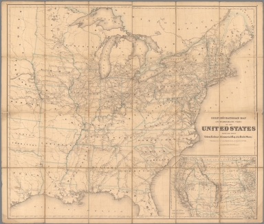
Colton, G.W. & C.B.
Full Title
Colton's Railroad Map (Intermediate Size) Of The United States. Reduced Fom "Colton's Railroad & Commercial Map of the United States." Published By G.W. And C.B. Colton & Co. 172 William St. New York. Entered .. 1870 by G.W. & C.B. Colton & Co. ... New York. (inset) Plan Of The Western Portion of the United States.
List No
2689.000
Author
Keeler, William J.
Full Title
National Map Of The Territory Of The United States From The Mississippi River To The Pacific Ocean. Made by the authority of the Hon. O.H. Browning Secretary of the Interior. In the Office of the Indian Bureau Chiefly For Government Purposes under the direction of the Hon. N.G. Taylor Commisr. of Indian affairs & Hon. Chas. E. Mix Chief Clerk of the Indian Bureau; Compiled from authorized explorations of Pacific Rail Road Routes, Public Surveys, and other reliable data from the Departments from the Government at Washington, D.C., by W.J. Keeler, Civil Engineer. 1867. N. DuBois Draughtsman. J.F. Gedney, Lithographer, Engraver & Plate Printer, Washington, D.C. Entered ... 1867 by Wm. J. Keeler ... District of Columbia.
List No
4737.002
Author
Keeler, William J.
Full Title
National Map Of The Territory Of The United States From The Mississippi River To The Pacific Ocean. Made by the authority of the Hon. O.H. Browning Secretary of the Interior. In the Office of the Indian Bureau Chiefly For Government Purposes under the direction of the Hon. N.G. Taylor Commisr. of Indian affairs & Hon. Chas. E. Mix Chief Clerk of the Indian Bureau; Compiled from authorized explorations of Pacific Rail Road Routes, Public Surveys, and other reliable data from the Departments from the Government at Washington, D.C., by W.J. Keeler, Civil Engineer. 1867. N. DuBois Draughtsman. J.F. Gedney, Lithographer, Engraver & Plate Printer, Washington, D.C. Entered ... 1867 by Wm. J. Keeler ... District of Columbia.
List No
0397.002
Author
Keeler, William J.
Full Title
National Map Of The Territory Of The United States From The Mississippi River To The Pacific Ocean. Made by the authority of the Hon. O.H. Browning Secretary of the Interior. In the Office of the Indian Bureau Chiefly For Government Purposes under the direction of the Hon. N.G. Taylor Commisr. of Indian affairs & Hon. Chas. E. Mix Chief Clerk of the Indian Bureau; Compiled from authorized explorations of Pacific Rail Road Routes, Public Surveys, and other reliable data from the Departments from the Government at Washington, D.C., by W.J. Keeler, Civil Engineer. 1867. N. DuBois Draughtsman. J.F. Gedney, Lithographer, Engraver & Plate Printer, Washington, D.C. Entered ... 1867 by Wm. J. Keeler ... District of Columbia.
List No
4694.002
Author
Lloyd, James T.
Full Title
NW Sheet Lloyd's American Railroad Map, Showing the Whole Seat of War.
List No
10543.001
Author
Lloyd, James T.
Full Title
NE Sheet Lloyd's American Railroad Map, Showing the Whole Seat of War.
List No
10543.002
Author
Lloyd, James T.
Full Title
SW Sheet Lloyd's American Railroad Map, Showing the Whole Seat of War.
List No
10543.003
Author
Lloyd, James T.
Full Title
SE Sheet Lloyd's American Railroad Map, Showing the Whole Seat of War.
List No
10543.004
Author
Lloyd, James T.
Full Title
(Composite map of) NW, NE, SW, SE Sheets Lloyd's American Railroad Map, Showing the Whole Seat of War
List No
10543.005
Author
Rand McNally and Company
Full Title
(Composite Map of) Rand, McNally & Co.'s New Shippers' Railroad Map of the United States. Scale: 8 miles to one inch. Showing all railroads, each in a separate color, and all railroad stations in large, plain type. This is the El Paso section only, of the above named map. (Below the neatline) Rand, McNally & Co.'s New Shippers' Railroad Map of the United States, Copyright, 1888 by Rand, McNally & Co. Copyright, 1891 by Rand, McNally & Co.
List No
5802.017
Note
This is a composite of all 13 maps. The owner of the 13 maps did not include the 2 western maps in this group for some reason, roughly Dakota and Indian Territory, or they may have been lost over time. Each set of these maps was made to order custom by Rand McNally so it is possible that these 13 maps comprise the entire set. The other 2 maps of the western US to the pacific are in the set but they are at a smaller scale so they are not in this composite image.
Author
Canada Government Railways
Full Title
(Covers to) Map Shewing the Railways of Canada to Accompany Annual Report on Railway Statistics. 1886. Collingwood Schreiber, Chief Engineer and General Manager of Government Railways. Office Of The Chief Engineer And General Manager Of Government Railways. Compiled by E.V. Johnson, M.C.S.C.E., In charge of Draughting Offices. Drawn by A.M. Edmonds. The Burland Lithographic Co. Montreal. (seal) Department Of Railways And Canals Canada. (in red) Railways Of Canada. In Operation And Under Construction. 31st December, 1886 ...
List No
0121A
Note
Accompanies the Annual Report on Railway Statistics. With full printed color, the railways shown in red. The map is in two sheets, each dissected into 54 sections. The map sheets are folding with marbled end sheets and a brown cloth slip case 21x14 with a label reading "Canadian Dominion. London: Edward Stanford, Wholesale & Retail Mapseller, &c. 55, Charing Cross. Schreiber ..."
Author
Canada Government Railways
Full Title
Map Shewing the Railways of Canada to Accompany Annual Report on Railway Statistics. 1886. Collingwood Schreiber, Chief Engineer and General Manager of Government Railways. Office Of The Chief Engineer And General Manager Of Government Railways. Compiled by E.V. Johnson, M.C.S.C.E., In charge of Draughting Offices. Drawn by A.M. Edmonds. The Burland Lithographic Co. Montreal. (seal) Department Of Railways And Canals Canada. (in red) Railways Of Canada. In Operation And Under Construction. 31st December, 1886 ...
List No
0121.001
Note
Accompanies the Annual Report on Railway Statistics. With full printed color, the railways shown in red. The map is in two sheets, each dissected into 54 sections. The map sheets are folding with marbled end sheets and a brown cloth slip case 21x14 with a label reading "Canadian Dominion. London: Edward Stanford, Wholesale & Retail Mapseller, &c. 55, Charing Cross. Schreiber ..."
Author
Watson, Gaylord
Full Title
(Covers to) Watson's New County and Railroad Map of the United States and the Dominion of Canada Compiled From the Latest Official Sources, 1874. Published by Gaylord Watson, 16 Beekman St., New York. Entered ... 1871, by Gaylord Watson ... Washington. (with) 5 inset maps: Routes of the Union, Central & Kansas Pacific Railroad; Vicinity of Boston; Vicinity of Philadelphia; Vicinity of New York; Lower Part of Florida.
List No
2540A
Note
5 inset maps, Vignette of Locomotive under title. Shows the route of the "Proposed Atlantic and Great Western Canal." Also an inset of the Union, Central & Kansas Pacific Railroad. Population tables, statistics, etc. Highly detailed map showing railroads and counties and cities in the eastern part of the U.S. and Canada. Has "United States" on the cover and is the companion map to the Map of the Western States... with "Territories" (see #2539.000) on its cover. Copyright date is 1871. For some reason, Modelski does not list all these early Watson maps, but only a few maps dated 1874 and later; perhaps Watson did not deposit all his maps with the LOC.
Author
Watson, Gaylord
Full Title
Watson's New County and Railroad Map of the United States and the Dominion of Canada Compiled From the Latest Official Sources, 1874. Published by Gaylord Watson, 16 Beekman St., New York. Entered ... 1871, by Gaylord Watson ... Washington. (with) 5 inset maps: Routes of the Union, Central & Kansas Pacific Railroad; Vicinity of Boston; Vicinity of Philadelphia; Vicinity of New York; Lower Part of Florida.
List No
2540.001
Note
5 inset maps, Vignette of Locomotive under title. Shows the route of the "Proposed Atlantic and Great Western Canal." Also an inset of the Union, Central & Kansas Pacific Railroad. Population tables, statistics, etc. Highly detailed map showing railroads and counties and cities in the eastern part of the U.S. and Canada. Has "United States" on the cover and is the companion map to the Map of the Western States... with "Territories" (see #2539.000) on its cover. Copyright date is 1871. For some reason, Modelski does not list all these early Watson maps, but only a few maps dated 1874 and later; perhaps Watson did not deposit all his maps with the LOC.
Author
Rand McNally and Company
Full Title
Rand McNally & Co.'s New Railroad Junction Point And County Map Of The Eastern & Middle States. Prepared from the Latest Government Surveys, and Verified by the Working Time Tables of the Various Railroads. Drawn, Engraved, Printed, Colored By Hand And Published By Rand McNally & Co., Chicago. The Railroads on this Map are bought up to date of September 1885. Copyright, 1882, By Rand, McNally & Co. (inset) General Map Of The United States Of America Showing The Relative Geographical Position Of The Several States And Territories.
List No
3117.000
Note
Copyright 1882. Inset map of the United States. 1 of six sections. Very large map of the northeast and middle coastal areas, which, although complete by itself, was also part of a twelve sheet map in six parts (two sheets to each part) that extended west to the 105th parallel and south to Florida and measured 10x15 feet (see Modelski). All the existing railroads are shown in great detail at a scale of six miles to one inch. Because of it great size, the map was hand colored. Dissected into 49 sections and backed with linen. See our 5802.000 for a related map. Folds into dark blue cloth covered boards 31x23.
Author
[Lubrecht, Charles, Rosa, R.]
Full Title
(Covers to) The American Continent. Topographical and railroad map of the United States, British Possessions, West Indies, Mexico and Central America. Compiled from the best authorities, by R. Rosa, late Col. 46th Regt. N.Y.S. Vol. Published by Ch. Lubrecht & Co., 12 Frankfort Street, New York. 1864. Agents For Great Britain: Bacon & Co., 48 Paternoster Row, London, England. For Germany, Switzerland And Italy: Fr. Volkmar, Leipsic. Lubrecht & Co., Stuttgart. Revised Edition. Entered ... 1864, by Ch. Lubrecht & Co. ... New York. (with) Central America.
List No
3127A
Note
1st edition. 2nd edition was1865, another edition in 1869 (Karrow 1-1683). German edition published in 1864. (Karrow 1-1655). Inset of Central America, text on top of map describing British American Possessions, Time Tables, and U.S. Census for 1860. We can find no earlier edition of this map, so the "Revised Edition" is puzzling. Lubrecht lists three foreign publishers for this map: Bacon in London, Volkmar in Leipsic, and Lubrecht & Co. in Stuttgart. An edition in German is described in Karrow. Later, this map became the more elaborate 1871 "American Union Railroad Map of the United States..." by Hassis & Lubrecht, also published by D.L. Gurnsey (see our copy, WH's copy, and Heaston Cat. 19 for a reproduction). The Proposed transcontinental railroad is shown going south of Salt Lake City, Wyoming is still part of Dakota, and a Proposed Southern Pacific Railroad runs from Fort Smith to Sacramento. Full color by state. Map is dissected into 24 sections and mounted on linen. Folded into black paper covered boards 24.5x21 with "The American Continent" stamped in gilt. Relief shown by hachures.
Author
[Lubrecht, Charles, Rosa, R.]
Full Title
The American Continent. Topographical and railroad map of the United States, British Possessions, West Indies, Mexico and Central America. Compiled from the best authorities, by R. Rosa, late Col. 46th Regt. N.Y.S. Vol. Published by Ch. Lubrecht & Co., 12 Frankfort Street, New York. 1864. Agents For Great Britain: Bacon & Co., 48 Paternoster Row, London, England. For Germany, Switzerland And Italy: Fr. Volkmar, Leipsic. Lubrecht & Co., Stuttgart. Revised Edition. Entered ... 1864, by Ch. Lubrecht & Co. ... New York. (with) Central America.
List No
3127.001
Note
1st edition. 2nd edition was1865, another edition in 1869 (Karrow 1-1683). German edition published in 1864. (Karrow 1-1655). Inset of Central America, text on top of map describing British American Possessions, Time Tables, and U.S. Census for 1860. We can find no earlier edition of this map, so the "Revised Edition" is puzzling. Lubrecht lists three foreign publishers for this map: Bacon in London, Volkmar in Leipsic, and Lubrecht & Co. in Stuttgart. An edition in German is described in Karrow. Later, this map became the more elaborate 1871 "American Union Railroad Map of the United States..." by Hassis & Lubrecht, also published by D.L. Gurnsey (see our copy, WH's copy, and Heaston Cat. 19 for a reproduction). The Proposed transcontinental railroad is shown going south of Salt Lake City, Wyoming is still part of Dakota, and a Proposed Southern Pacific Railroad runs from Fort Smith to Sacramento. Full color by state. Map is dissected into 24 sections and mounted on linen. Folded into black paper covered boards 24.5x21 with "The American Continent" stamped in gilt. Relief shown by hachures.
Author
Colton, J. H.
Full Title
(Covers to) Colton's New Railroad & County Map Of The United States, The Canadas &c. Published By J.H. Colton, No. 172 William St., New York 1862. Entered ... 1861 by J.H. Colton ... New York. (inset) Colton's Map of the United States Showing the Proposed Railroad Routes To The Pacific Ocean. (inset) Southern Part Of Florida.
List No
3358A
Author
Colton, J. H.
Full Title
Colton's New Railroad & County Map Of The United States, The Canadas &c. Published By J.H. Colton, No. 172 William St., New York 1862. Entered ... 1861 by J.H. Colton ... New York. (inset) Colton's Map of the United States Showing the Proposed Railroad Routes To The Pacific Ocean. (inset) Southern Part Of Florida.
List No
3358.001
Note
Civil War map - Confederacy green, North red, border states yellow. A pasted down sheet in the bottom margin explains the color coding and gives population statistics for the three regions. There is an ad for "Colton's...Complete Series of War Maps" on the verso of the cover and a pasted down list of Union and Confederate Political and Military leaders on the verso of the map. The map was sold in London by Sampson Low, Son & Co., by arrangement with Colton. All the prices quoted for Colton's maps on the paste down are in pounds. There was great demand in England for maps of the American Civil War, and Colton exploited it by providing his maps to English map sellers. W.H. has an identical copy of this map sold by Crutchly. Stanford also sold this map under his imprint. Full color. Dissected into 32 sections. Folds into dark green cloth covers 23x14.5 with a green paper label reading "Colton's Map Of Thr (sic) The United States Of America And The Canadas."
Author
Colton, J. H.
Full Title
(Composite of) Colton's New Railroad & County Map Of The United States, The Canadas &c. Published By J.H. Colton, No. 172 William St., New York 1862. Entered ... 1861 by J.H. Colton ... New York. (inset) Colton's Map of the United States Showing the Proposed Railroad Routes To The Pacific Ocean. (inset) Southern Part Of Florida.
List No
3358.002
Note
A composite version joining all the separate panels. Civil War map - Confederacy green, North red, border states yellow. A pasted down sheet in the bottom margin explains the color coding and gives population statistics for the three regions. There is an ad for "Colton's...Complete Series of War Maps" on the verso of the cover and a pasted down list of Union and Confederate Political and Military leaders on the verso of the map. The map was sold in London by Sampson Low, Son & Co., by arrangement with Colton. All the prices quoted for Colton's maps on the paste down are in pounds. There was great demand in England for maps of the American Civil War, and Colton exploited it by providing his maps to English map sellers. W.H. has an identical copy of this map sold by Crutchly. Stanford also sold this map under his imprint. Full color. Dissected into 32 sections. Folds into dark green cloth covers 23x14.5 with a green paper label reading "Colton's Map Of Thr (sic) The United States Of America And The Canadas."
Author
Watson, Gaylord
Full Title
(Covers to) Watson's new rail-road and distance map of the United States and Canada. Compiled from the latest official sources. Published by Gaylord Watson, 16 Beekman Street, New York. 1871. Entered ... 1868, by Gaylord Watson ... New York. Engraved by Fisk & Russell, N. York. (with) Routes Of The Union Pacific Railroads. (with) Vicinity of New York. (with) Vicinity of Philadelphia. (with) Vicinity of Boston.
List No
3436A
Note
With the railroad engine "San Francisco" as the cartouche. Shows railroad lines of the eastern half of the U.S. going west to Nebraska and Texas. Includes 4 inset maps. Copyrighted in 1868, although Modelski shows no earlier edition than 1871. With lists of all the railroads in the United States, length of track and cost of road and equipment. The style of the map is very different from the later Watson maps of the mid 1870's -- it is more diagrammatic, showing only the railroads and drainage and political boundaries. Catalogue of Watson's maps on inside front cover. Outline color by state; covers are dark brown cloth 18 x 12 stamped with "Watson's rail-road and distance map of United States and Canada." Prime meridians: Greenwich and Washington.
Author
Watson, Gaylord
Full Title
Watson's new rail-road and distance map of the United States and Canada. Compiled from the latest official sources. Published by Gaylord Watson, 16 Beekman Street, New York. 1871. Entered ... 1868, by Gaylord Watson ... New York. Engraved by Fisk & Russell, N. York. (with) Routes Of The Union Pacific Railroads. (with) Vicinity of New York. (with) Vicinity of Philadelphia. (with) Vicinity of Boston.
List No
3436.001
Note
With the railroad engine "San Francisco" as the cartouche. Shows railroad lines of the eastern half of the U.S. going west to Nebraska and Texas. Includes 4 inset maps. Copyrighted in 1868, although Modelski shows no earlier edition than 1871. With lists of all the railroads in the United States, length of track and cost of road and equipment. The style of the map is very different from the later Watson maps of the mid 1870's -- it is more diagrammatic, showing only the railroads and drainage and political boundaries. Catalogue of Watson's maps on inside front cover. Outline color by state; covers are dark brown cloth 18 x 12 stamped with "Watson's rail-road and distance map of United States and Canada." Prime meridians: Greenwich and Washington.
Author
Haasis & Lubrecht
Full Title
The American Union Railroad Map Of The United States, British Possessions, West Indies, Mexico, And Central America. 1871. Published by Haasis & Lubrecht, 107 Liberty Street, New York. Smith & McDougal, Electrotypers, 82 Beekman Street, New York. (inset) Central America.
List No
3822.000
Note
This is a reworking of the Lubrecht and Rosa map "The American Continent" of 1864, and the first edition, first issue in a new format. Statistics at the top of the 1864 map are here replaced with a view "From the Atlantic to the Pacific Ocean" emphasizing the recently completed transcontinental railroad. Also, an elaborate title and view of a steam engine and train station have replaced the more subdued 1864 title. Population tables of the United States are added to the left and right sides of the map. The map itself has been updated to show political and some topographical changes of the ensuing seven years. Projected railroad lines are shown running everywhere in the west. The coloring is very bright, to match the decidedly optimistic (expansionist) flavor of the map. D.L. Guernsey published editions of 1871 and 1874 in Concord New Hampshire, with no major changes in the map. WH has an 1873 edition by Haasis and Lubrecht that adds text next to the population figures, more railroads, no changes in topography. Issued in a cover with a label in German from Wilhelm Lubrecht in Stuttgart, Germany, indicating it may have been sold to emigrants. Full color. Map has green paper edging, is dissected into 16 sections, and fold into a new gray cloth folding case 35x27 with "American Union Railroad Map Haasis & Lubrecht 1871" stamped in gilt on the spine.
1-23 of 23
|