|
REFINE
Browse All : Railroad and Atlas Map of Canada
1-21 of 21
Author
شكوفه مقبل [Şukufe Mukbil]
Full Title
(North and Central America with Railroads)
List No
10992.038
Note
Dimensions are sheet size.
Author
[Canada. Department of Mines and Technical Surveys, Nicholson, N. L. (Norman Leon), Comtois, Paul]
Full Title
(83) Railways : (Railways in Western Canada) -- (Railways in Eastern Canada). Compiled from information supplied by the Geographical Branch, (Canada) Department of Mines and Technical Surveys.
List No
14001.172
Note
2 maps showing railways in Canada. Each 23 x 64 cm. Includes key and legend. Features distance table: Railway mileage. With 3 insets: Railway in the Whitehorse vicinity (5 x 5 cm) -- Railway in the Churchill vicinity (7 x 5 cm) -- Railway in the Schefferville to the Sept-Iles vicinities (12 x 5 cm). Scale 1:5,000,000 or one inch to 78.91 miles. Lambert Conformal Conic Projection Standard Parallels 49˚N and 77˚N. Descriptive text on verso: This plate shows the location of Canadian railways as of 1957 ...
Author
[Canada. Department of Mines and Technical Surveys, Nicholson, N. L. (Norman Leon), Comtois, Paul]
Full Title
(84) Railway freight traffic : (Railway freight traffic in Western Canada) -- (Railway freight traffic in Eastern Canada). Compiled from information supplied by the Geographical Branch, (Canada) Department of Mines and Technical Surveys.
List No
14001.174
Note
2 maps showing railway freight traffic in Canada. Each 23 x 64 cm. Includes legend. With 3 insets: Railway freight traffic in the Whitehorse vicinity (5 x 5 cm) -- Railway freight traffic in the Churchill vicinity (7 x 7 cm) -- Railway freight traffic in the Schefferville to the Sept-Iles vicinities (13 x 5 cm). Scale 1:5,000,000 or one inch to 78.91 miles. Lambert Conformal Conic Projection Standard Parallels 49˚N and 77˚N. Descriptive text on verso: The data for this plate, which are for 1954, were supplied to the Geographical Branch by the railway companies ...
Author
[Ministere des Travaux Publics, Cheysson, Émile]
Full Title
Mouvement Sur les Chemins de Fer du Monde Pendant L'Annee 1883. (Movement on the railroads of the world in 1883.)
List No
12516.014
Note
Graph type: concentric circle.
Author
[Ministere des Travaux Publics, Cheysson, Émile]
Full Title
Resultats D'Exploitation des Chemins de Fer du Monde Pendant L'Annee 1883. (Turnover of the railroads of the world in 1883.)
List No
12516.017
Note
Graph type: divided concentric circle.
Author
Andreas, A. T. (Alfred Theodore), 1839-1900
Full Title
New railroad map of the United States, the Dominion of Canada, Mexico and the West Indies. (Published by the Andreas Atlas Co., Lakeside Building, Chicago, Ills. Engraved & printed by Chas. Shober & Co., Props. of Chicago Lithographing Co.)
List No
0018.012
Note
Hand col. lithographed map. Relief shown by hachures. Title includes view. Prime meridians: Washington and Greenwich.
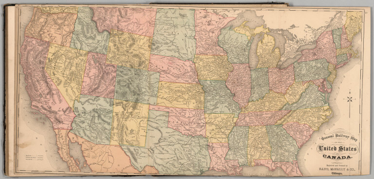
Author
Higgins, Belden & Co.
Full Title
General Railway Map of the United States and Canada, Engraved and Printed by Rand, McNally & Co., Chicago.
List No
3739.092
Author
[Andreas, A. T. (Alfred Theodore), 1839-1900, Baskin, Forster and Company]
Full Title
New railroad map of the United States and Dominion of Canada. (Published by Baskin, Forster & Co. Lakeside Building Chicago, Ills. 1876. Engraved & Printed by Chas. Shober & Co. Props. of Chicago Lithographing Co.)
List No
0019.006
Note
Lithographed map. Hand col. Relief shown by hachures. Includes farm scene below title.
Author
[White, James, Canada. Department of Interior]
Full Title
Department of Interior : Atlas of Canada, No.17, Railways: Quebec and Maritime Provinces. (to accompany) Department of the Interior, Canada ... 1906.
List No
1645.030
Note
Full color map. With list of railways, mileage, etc. and color coded legend.
Author
[White, James, Canada. Department of Interior]
Full Title
Department of Interior : Atlas of Canada, No.18, Railways: Ontario and Quebec. (to accompany) Department of the Interior, Canada ... 1906. (inset) Continuation of map.
List No
1645.031
Note
Full color map. With list of railways, mileage, etc. and color coded legend.
Author
[White, James, Canada. Department of Interior]
Full Title
Department of Interior : Atlas of Canada, No.19, Railways: Manitoba, Saskatchewan and Alberta. (to accompany) Department of the Interior, Canada ... 1906. (inset) Continuation of map.
List No
1645.032
Note
Full color map. With list of railways, mileage, etc. and color coded legend.
Author
[White, James, Canada. Department of Interior]
Full Title
Department of Interior : Atlas of Canada, No. 20, Railways: British Columbia and Yukon. (to accompany) Department of the Interior, Canada ... 1906. (inset) White Pass & Yukon.
List No
1645.033
Note
Full color map. With list of railways, mileage, etc. and color coded legend.
Author
[White, James, Canada. Department of Interior]
Full Title
Department of Interior : Atlas of Canada, No. 21 : Transcontinental railways. (to accompany) Department of the Interior, Canada ... 1906.
List No
1645.034
Note
Full color map. Includes legend and notes.
Author
[Canada. Department of Interior, Chalifour, J.E.]
Full Title
Transcontinental Railways. (on upper right margin) Atlas of Canada. (to accompany) Department of the Interior Canada. Atlas Of Canada, 1915.
List No
1646.033
Note
Color map. Shows major cities, rivers, etc. Includes table of routes and names of transcontinental railroad companies. Includes color coded legend indicates existing and proposed lines in Canada, Pacific railways and Grand Trunk Railway System.
Author
[Canada. Department of Interior, Chalifour, J.E.]
Full Title
Quebec and Maritime Provinces railway territories. (on upper right margin) Atlas of Canada. (to accompany) Department of the Interior Canada. Atlas Of Canada, 1915.
List No
1646.034
Note
Color map. Shows major cities, rivers, etc. Includes table of routes and names of railroad companies. Includes color coded legend indicates existing and proposed lines in Quebec and Maritime Provinces, Pacific railways and Grand Trunk Railway System.
Author
[Canada. Department of Interior, Chalifour, J.E.]
Full Title
Manitoba, Saskatchewan and Alberta railway territories. (on upper right margin) Railways. Atlas of Canada. (to accompany) Department of the Interior Canada. Atlas Of Canada, 1915.
List No
1646.036
Note
Color map. Shows major cities, rivers, etc. Includes table of routes and names of railroad companies. Includes color coded legend indicates existing and proposed lines in Ontario and Quebec, Pacific railways and Grand Trunk Railway System.
Author
[Canada. Department of Interior, Chalifour, J.E.]
Full Title
Alberta, British Columbia and Yukon railway territories. (on upper right margin) Railways. Atlas of Canada. (to accompany) Department of the Interior Canada. Atlas Of Canada, 1915. (inset) Continuation of map.
List No
1646.037
Note
Color map. Shows major cities, rivers, etc. Includes table of routes and names of railroad companies. Includes color coded legend indicates existing and proposed lines in Ontario and Quebec, Pacific railways and Grand Trunk Railway System.
Author
Rand McNally and Company
Full Title
Commercial Atlas of America. Rand McNally Standard Map of Dominion of Canada.
List No
5028.154
Note
Shows railroads and distances. Includes tables of principal cities and railroads, keyed to map.
Author
Fullarton, A. & Co.
Full Title
British North America. Sheet II, West. Canada with part of United States. Compiled by J. Hugh Johnson, F.R.G.S. XXXVII. Engraved at Stanford's Geographical Establishment, 6 Charing Cross, London. A. Fullarton & Co. Edinburgh, London & Dublin.
List No
3007.038
Note
In full color with the railways shown in red.
Author
[Union Atlas Co., Warner & Beers]
Full Title
New railroad map of the United States, and Dominion of Canada. (Union Atlas Co., Warner & Beers, Proprietors. Lakeside Building Cor: of Clark & Adams Sts. Chicago. 1876. Entered ... 1876 by Warner & Beers ... Washington D.C.)
List No
1159.144
Note
Col. lithographed map. Relief shown by hachures. Includes small view below title.
Author
[Canada. Department of Interior, Chalifour, J.E.]
Full Title
Ontario and Quebec railway territories. (on upper right margin) Railways. Atlas of Canada. (to accompany) Department of the Interior Canada. Atlas Of Canada, 1915. (inset) Continuation of map.
List No
1646.035
Note
Color map. Shows major cities, rivers, etc. Includes table of routes and names of railroad companies. Includes color coded legend indicates existing and proposed lines in Ontario and Quebec, Pacific railways and Grand Trunk Railway System.
1-21 of 21
|