|
Author
[United States. Post Office Department, Von Haake, A.]
Full Title
(Covers to) Post Route Map of the State of Maine.
List No
15921.001
Author
United States. Post Office Department
Full Title
(Covers to) Post Route Map of the States of Massachusetts, Rhode Island and Connecticut.
List No
15924.001
Author
United States. Post Office Department
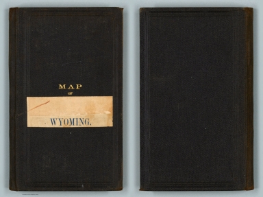
Full Title
(Covers to) Post Route Map of the States of Montana, Idaho, and Wyoming. Frank H. Hitchcock... David M. Hildreth.
List No
15912.001
Author
United States. Post Office Department
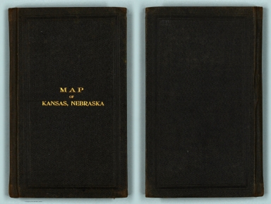
Full Title
(Covers to) Post Route Map of the States of Kansas and Nebraska.
List No
15913.001
Note
Date estimated.
Author
United States. Post Office Department
Full Title
(Covers to) (Post Route Map of the States of Kansas and Nebraska.)
List No
15914.001
Note
Date estimated.
Author
United States. Post Office Department
Full Title
(Covers to) Post Route Map of the State of Oklahoma and Indian Territories.
List No
15915.001
Author
United States. Post Office Department
Full Title
(Covers to) Post Route Map of the State of Ohio.
List No
15918.001
Author
United States. Post Office Department
Full Title
(Covers to) Post Route Map of the State of Indiana.
List No
15922.001
Author
Rand McNally and Company
Full Title
(Covers to) Rand McNally standard map of Illinois. with air trails. Copyright by Rand McNally & Company, Chicago. (cover title) Advance copy : Rand McNally Air trails map of Illinois. (inset) Chicago and Vicinity.
List No
13004.001
Author
Bayer, Herbert
Full Title
(Covers to) Das Juwel des Reichssportfeldes. Dietrich-Eckart-Bühne.
List No
15820.001
Author
Rand McNally and Company
Full Title
(Covers to) The Rand McNally New Library Atlas Map of Brazil and Guiana.
List No
15825.001
Author
Zippel, Giovanni
Full Title
(Covers to) Pianta Topografica di Trento. [Topographic map of Trento.]
List No
15827.001
Author
Bianconi, F.
Full Title
(Covers to) Nouvelle carte physique et minière du Transvaal, de l’Etat Libre d’Orange et des Pays Sud-Africains (Possessions Anglaises et Portugaises) par F. Bianconi.
List No
15855.001
Author
Mid-West Map Company
Full Title
(Covers to) Highway map and guide of New York. Mid-West Map Company, Aurora, Mo.
List No
14428.001
Note
Covers to Highway map and guide of New York, folded. Front cover includes title and imprint, as well as vignettes of tourist scenes. Printed in blue.
Author
Mid-West Map Company
Full Title
(Covers to) Highway map and guide of Texas. Mid-West Map Company, Aurora, Mo.
List No
14436.001
Note
Covers to Highway map and guide of Texas, folded. Front cover includes title and imprint, as well as vignettes of tourist scenes. Printed in blue.
Author
Mid-West Map Company
Full Title
(Covers to) Highway map and guide of Washington & Oregon. Mid-West Map Company, Aurora, Mo.
List No
14440.001
Note
Covers to Highway map and guide of Washington & Oregon, folded. Front cover includes title and imprint, as well as vignettes of tourist scenes. Printed in blue.
Author
Mid-West Map Company
Full Title
(Covers to) Highway map and guide of Wyoming. Mid-West Map Company, Aurora, Mo.
List No
14442.001
Note
Covers to Highway map and guide of Wyoming, folded. Front cover includes title and imprint, as well as vignettes of tourist scenes. Printed in blue.
Author
[Ricksecker, L.E., Denny, Edward & Co.]
Full Title
(Covers to) Denny’s pocket map of Sonoma County, California and portions of Lake, Napa and Marin counties. Compiled from the official county maps by L.E. Ricksecker, C.E.
List No
15314.001
Author
George Philip & Son
Full Title
(Covers to) Mexico and Central America.Philips' Authentic Imperial Maps for Tourists & Travellers
List No
15724.001
Note
Date estimated.
Author
Cluerg, George
Full Title
(Covers to) Plano de Mexico D. F. (on verso) Panorama-mapa, Valle de Mexico (inset)Vera Cruz. Cluerg del., 27. (cover title) New 1928 ed. Indexed street map of the City of Mexico : Including subdivisions. Also a new panorama map of federal district and coast section from Mexico to Vera Cruz. American Book & Printing Co. Mexico, D.F.
List No
130100.001
Note
2 color maps on 1 sheet, both sides on sheet 63x90, folded into heavy paper covers. Accompanied by advertisement and 20 pages of new street index of the City of Mexico. Relief on maps on verso shown by hachures and spot heights. In English and Spanish.
Author
[Bagavia, Luis (1882-1940), Ferrer, Elmilo (1899-1962), Cento de Atraccion Turismo]
Full Title
(Covers to) Plan and Guide of San Sebastian (Spain)
List No
15710.001
Author
Kalimedia (Firm)
Full Title
(Cover title) Land of the settlement. (cover title) Atlas of true names : Etymological map, Canada. Editor : Kalimedia. Lubeck/Germany 2013.
List No
11910.001
Note
Map of Canada on sheet 40x56 folded to 20x7. Shows major cities, towns, mountains, lakes, rivers, and boundaries. On verso: Placenames index, list of abbreviations, bibliography and text: "The country reveals a blend of Native American place names, an assortment of placenames of all European settlers and explorers, flavored with those of Latin, Greek, Hebrew, Arabic, Old Egyptian and Phoenician origin." Relief shown by shadings. Includes compass rose.
Author
[Kalimedia (Firm), Fink, Major.]
Full Title
(Covers to) Hansestadt Lubeck : stadtkartenwerk Lubeck. T eil 4: Lueck im Jahre 1872. Kalimedia. gezeichnet von Major Fink, 1872 ... Digital aufbereitung Kalimedia.
List No
11900.001
Note
Detailed map of Lubeck, Germany 39x49, folded to 20x10. Drawn by Major Fink, 1872. Digital processing by Kalimedia, Lubeck. Title from cover. Shows rivers, bridges, forests, buildings within the city wall, classified by age and type. Includes brief historical notes and advertisements. Date estimated.
Author
[McCarty, Lea, Sonoma County (Calif.). Board of Supervisors]
Full Title
(Covers to) Sonoma County. Its highlights fill this cartograph. Cartography by Lea McCarty. (cover title) Historic Sonoma County in California's redwood empire wonderland :Fascinating Sonoma County. In California's Redwood Empire Wonderland. Published by Sonoma County Board of Supervisors and Associated Chambers of Commerce. Sonoma County.
List No
11903.001
Note
Pictorial map of Sonoma County, 46x28 on sheet 46x56, folded into pictorial self wrappers 23x10. With statistical information "Its Yardsticks appear below" with such figures as population (1950), assessed valuation (1951), weather, transportation, Value Agricultural Production (1950) etc. Agricultural products are noted throughout the state with grapes and wine being noted, but also prunes, apples, walnuts etc. Map showing major cities, highways, rivers, farms, livestock, recreational activities, buildings and landmarks. Relief shown pictorially. On recto of map text: "Things to do. Sights to see. For everyone". and "Seven flags". On verso: text and photos.
Author
Wyld, James, 1812-1887
Full Title
(Covers to) Wyld's new map of gold fields of Transvaal. James Wyld, Geographer to the Queen, 11 & 12, Charing Cross, S.W. and 2, Royal Exchange, E.C.
List No
14268.001
Note
Covers to Wyld's new map of gold fields of Transvaal, published in London, circa 1890. Brown board covers. With title and imprint printed on paper pasted to front cover, as well as a pasted spine title: Goldfields of Transvaal. Unfolded to 18 x 26 cm. Verso of front cover has advertisement for various map series by Wyld. Front cover torn apart from item on this copy. (Date taken from map.)
Author
Henn, Williams & Co.
Full Title
(Covers to) A sectional map of Iowa : compiled from the official surveys of the United States and the public records of the state & counties and from personal reconnoissance
List No
15414.001
Author
Dripps, M.
Full Title
(Covers to) Map of New York City South of 132d St.
List No
12308.001
Note
Dark brown covers with embossed pattern on front and identically blind stamped on back. Front has text in gilt, "Dripp's Map of N.Y. City". Date estimated.
Author
Chapman, Silas
Full Title
(Covers to) Chapman;s Sectional Map of Illinois
List No
15450.001
Note
Sold by Matthew Wallace, Chicago Ill.
Author
Keeler, William J.
Full Title
(Covers to) National Map Of The Territory Of The United States From The Mississippi River To The Pacific Ocean. Made by the authority of the Hon. O.H. Browning, Secretary of the Interior. ... Compiled from authorized explorations of Pacific Rail Road Routes, Public Surveys, and other reliable data from the Departments of the Government at Washington, D.C. by W.J. Keeler, Civil Engineer. 1868. Entered ... 1867 by Wm. J. Keeler ... Columbia. N. DuBois Draughtsman.
List No
4640A
Author
Tribune Publishing Company
Full Title
(Covers to) Oakland Daily & Weekly Tribune Map Of Alameda County. Compiled From The Most Reliable Surveys, And Corrected To Date. Presented by the Tribune Publishing Company. Copyrighted 1880. M.G. King, C.E. W.E. Dargie, Manager. T.T. Dargie, Secretary. Address, Tribune Publishing Co. Oakland, Cal. Lith. Waldstein, S.F.
List No
1013.001
Author
Journeaux
Full Title
(Covers to) Nouveau Plan Routier de la Ville et Faubourgs Paris Divise en Douze Mairie Annee 1819. Chez Journeaux l'aine, Md. d'Estampes, Hotel des Monnaies A Paris. Dep. a la direction de l'Imprimerie et de la Librairie.
List No
0697.001
Author
Reynolds, James
Full Title
(Covers to) The Oarman's And Angler's Map Of The River Thames From Its Source To London Bridge. One Inch to a Mile. London: Published by James Reynolds & Sons, 174, Strand. April 4th 1881.
List No
0850.001
Author
Appert, G.
Full Title
(Covers to) Carte Du Japon. Sous La Feodalite (Les divisions de Mutsu et Dewa datent de 1868). G. Appert. Grave par Getsurei. (inset) Yezo en 1850.
List No
1480.001
Author
J. & C. Walker
Full Title
(Covers to) Surrey. By J. & C. Walker ... London, Published by J. & C. Walker 9 Castle Street Holborn.
List No
1140.001
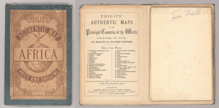
Author
Philip, George
Full Title
(Covers to) Africa. George Philip & Son, London & Liverpool.
List No
2272.001
Note
Date estimated
Author
Compania Litografica y Tipografica
Full Title
(Covers to) Plano Oficial de La Ciudad De Mexico. Aumentado y rectificado con todos lo ultimos datos recogidos de la Direccion de Obras Publicas y de la Oficina Tecnica del Saneamiento. Detallado ampliamente y publicado por la "Compania Litografica y Tipografica" S.A. Antigua casa Montauricol. Mexico. 1900. Este plano es propiedad de la "Compania Litografica Tipografica" S.A., Asegurada Comforme a la Ley.
List No
15402.001
Author
[Oficina Cartográfica Ludwig, Cannizzaro, A., Ludwig, Pablo]
Full Title
(Covers to) Plano De La Ciudad De Buenos Aires Y Sus Alrededores.
List No
15396.001
Note
Includes index book 16 pages.
Author
Mid-West Map Company
Full Title
(Covers to) Highway map and guide of California & Nevada. Mid-West Map Company, Aurora, Mo.
List No
14409.001
Note
Covers to Highway map and guide of California & Nevada, folded. Front cover includes title and imprint, as well as vignettes of tourist scenes. Printed in blue.
Author
Mid-West Map Company
Full Title
(Covers to) Highway map and guide of Colorado. Mid-West Map Company, Aurora, Mo.
List No
14410.001
Note
Covers to Highway map and guide of Colorado, folded. Front cover includes title and imprint, as well as vignettes of tourist scenes. Printed in blue.
Author
Mid-West Map Company
Full Title
(Covers to) Highway map and guide of Florida. Mid-West Map Company, Aurora, Mo.
List No
14411.001
Note
Covers to Highway map and guide of Florida, folded. Front cover includes title and imprint, as well as vignettes of tourist scenes. Printed in blue.
Author
Mid-West Map Company
Full Title
(Covers to) Highway map of the United States : Showing United States inter-state highways. Mid-West Map Co. Aurora, Mo.
List No
14443.001
Note
Covers to Highway map of the United States : Showing United States inter-state highways, folded. Front cover includes title and imprint, as well as a vignette of a tourist scene. Printed in blue.
Author
[Tanner, Henry Schenck, 1786-1858, Melish, John]
Full Title
(Covers to) A Map of Philadelphia County Constructed by virtue of an Act of the Legislature of Pennsylvania
List No
15333.001
Note
The depiction of railroads around Philadelphia is very early and many lines are prospective.
Author
Conference of Local Airlines
Full Title
(Covers to) Fly all the way to 500 cities and towns served by local airlines. Conference of Local Airlines. 800 World Center Building, Washington 6, D.C.
List No
14446.001
Note
Covers to Fly all the way to 500 cities and towns served by local airlines, folded. Front cover includes title, as well as an illustration of an airport with planes in flight. Printed in red and black.
Author
Air France
Full Title
(Covers to) Air France.
List No
14447.001
Note
Covers to Air France : Réseau aérien mondial, folded. Front cover includes an illustration of a scene within an airplane. Printed in color.
Author
Union Aéromaritime de Transport
Full Title
(Covers to) U.A.T. Sert l'Afrique par Jet DC8. Jep et Carre, Paris. Impriné en France.
List No
14448.001
Note
Covers to U.A.T. Sert l'Afrique par Jet DC8, folded. Front cover includes title. Title translates to: U.A.T. Serves Africa by Jet DC8. Printed in color.
Author
[Aryiss, Linda, Lewis, Susan, Blake, Aaron]
Full Title
(Covers to) The literary map of Los Angeles. (1)
List No
14449.001
Note
Covers to The literary map of Los Angeles, folded. Front cover includes title, as well as an illustration of authors in Los Angeles. Printed in color.
Author
[Aryiss, Linda, Ladner, Brian, Blake, Aaron]
Full Title
(Covers to) The literary map of the American South. (1)
List No
14450.001
Note
Covers to The literary map of the American South, folded. Front cover includes title, as well as an illustration of authors in the South. Printed in color.
Author
Trivella, Amerglio
Full Title
(Covers to) Itinerari di Venezia.
List No
14451.001
Note
Covers to Itinerari di Venezia, folded. Front cover includes title, as well as a scene from Venice, Italy. Printed in color.
Author
Kopač
Full Title
(Covers to) Carte touristique de la Yougoslavie.
List No
14452.001
Note
Covers to Carte touristique de la Yougoslavie, folded. Front cover includes title and imprint, as well as a map of Europe. Printed in color.
Author
Imperial Oil Limited
Full Title
(Covers to) Imperial oil map number 1 : Canada, from coast to coast.
List No
14453.001
Note
Covers to Dominion of Canada with Newfoundland & Labrador, folded. Front cover includes a cover title. Printed in color.
|


![Covers: Pianta Topografica di Trento. [Topographic map of Trento.]](https://www.davidrumsey.com/rumsey/Size1/RUMSEY~8~1/213/15827001.jpg)