Fisher, Joseph R.; Planters Peanuts (Fir... Maryland : The old line state -- Virgini... 1950 14374.006 Related Author
[Fisher, Joseph R., Planters Peanuts (Firm)]
Full Title
Maryland : The old line state -- Virginia : The old dominion -- North Carolina : The tar heel state -- South Carolina : The palmetto state.
List No
14374.006
Note
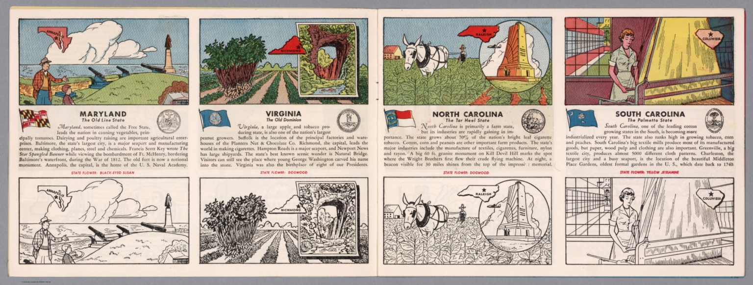
Four views, representing Maryland, Virginia, North Carolina and South Carolina. Views show examples of the landscape and natural resources. Each view includes an inset map of the state, which marks the location of the capital city with a star. Accompanied by descriptive text, the state flags, seals and flowers: black-eyed Susan, dogwood, dogwood and yellow jessamine, respectively. The view of each state appears both in color (on top) and in black and white (bottom), the latter inviting coloration. Together, views are 18 x 52 cm, on two sheets 20 x 54 cm.
Author
[Bates, Ernest Sutherland, 1879-1939, Schiff, Herman S., Reeves, Norman, Smith, Robert E.]
Full Title
Maryland, 1632.
List No
14244.015
Note
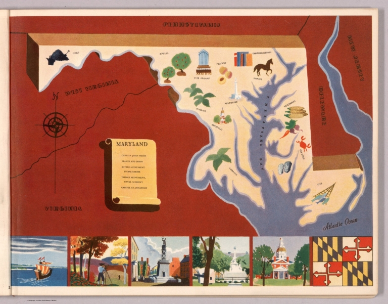
Pictorial map of Maryland, showing political boundaries with bordering states and coastline. Features natural resources and manufactured items (including coal, apples, horses and pipe organs). Includes a compass rose and a scroll listing notable places - such as Tripoli Monument - which are pictured in vignettes below map, in order of listing. Map is 18 x 29 cm, on sheet 23 x 29 cm. Accompanied by historical text on facing page.
Author
Arbuckle Bros.
Full Title
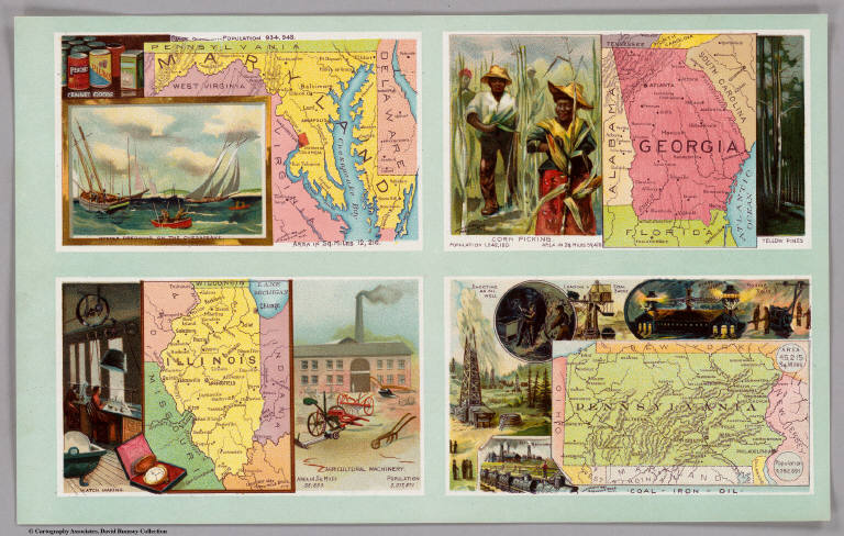
Maryland, Georgia, Illinois, Pennsylvania. Copyright 1889 Arbuckle Bros. N.Y.
List No
0027.006
Note
Sheet with maps of four states in full color. On the card for Illinois, it is noted that the inhabitants of Chicago are "probably the most energetic people in the world." Pennsylvania is noted for being second only to New York in manufacturing. Each card measures 7.5 x 12.5 cm.
Author
Asher & Adams
Full Title
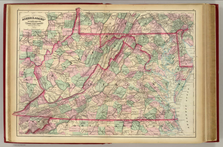
Asher & Adams' Delaware, Maryland, Virginia, West Virginia & District of Columbia. Entered according to Act of Congress in the year 1874 by Asher & Adams ... at Washington. (New York, 1874)
List No
0041.008
Note
Hand col. engraved map. Relief shown by hachures. Shows distances along railroads, etc. Prime meridians: Greenwich and Washington.
Author
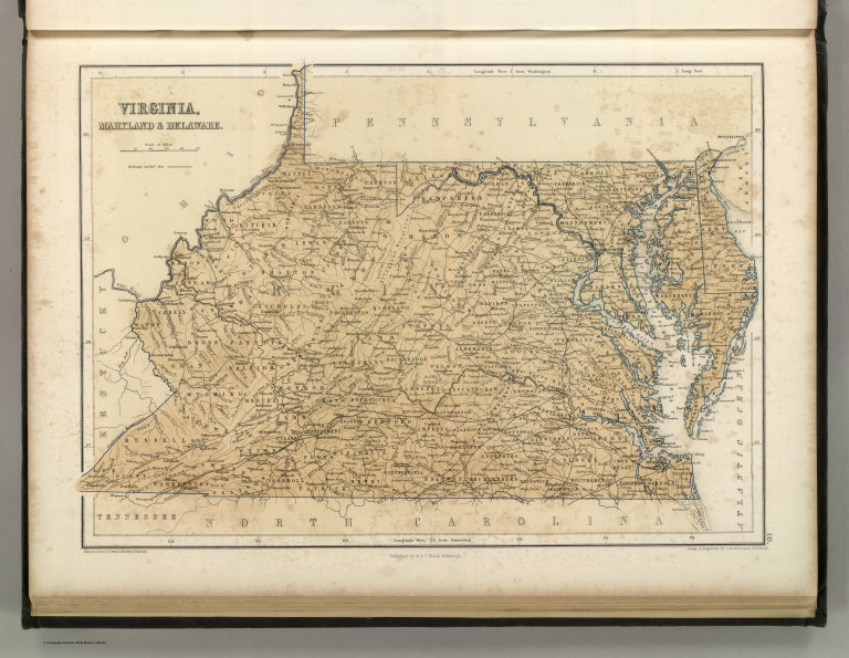
[Bartholomew, John, Black, Adam & Charles]
Full Title
Virginia, Maryland & Delware. Published by A. & C. Black. Edinburgh. Printed in Colours by Schenck & Macfariane. Edinburgh. Drawn & Engraved by J. Bartholomew, Edinburgh.
List No
0073.010
Note
States outlined in color. Land tinted.
Author
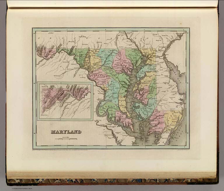
Bradford, Thomas G.
Full Title
Maryland. (inset) Western section of Maryland. Entered ... 1838, by T.G. Bradford ... Massachusetts. Engraved by G.W. Boynton.
List No
0089.023
Note
In full color.
Author
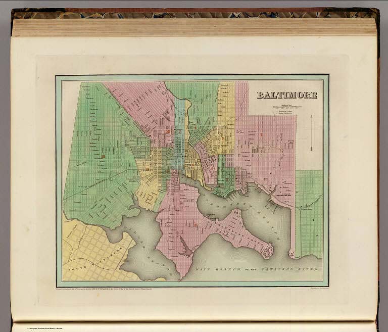
Bradford, Thomas G.
Full Title
Baltimore. Entered ... 1838, by T.G. Bradford ... Massachusetts. Engraved by G.W. Boynton.
List No
0089.024
Note
In full color. Baltimore College and Battle Monument are noted.
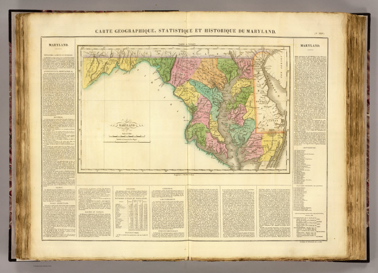
Full Title
Carte geographique, statistique et historique du Maryland. Maryland. Fonderie et Imprimerie de J. Carez. (1825)
List No
0102.020
Note
Hand colored engraved map. Relief shown by hachures. Text and tables at sides and bottom. Prime meridians: Washington and Paris.
Author
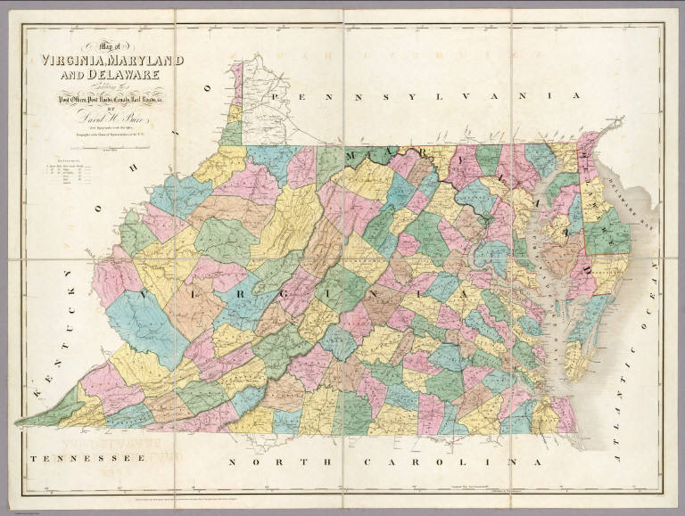
Burr, David H., 1803-1875
Full Title
Map of Virginia, Maryland and Delaware Exhibiting the Post Offices, Post Roads, Canals, Rail Roads, &c. By David H. Burr. (Late Topographer to the Post Office.) Geographer to the House of Representatives of the U.S. John Arrowsmith. Entered ... July 10th, 1839, by David H. Burr ... District of Columbia.
List No
0104.005
Note
In full color by county. Postal routes by coach, stage, sulkey, cross, rail roads and canals shown. In 8 sections mounted on linen. Label on back states "No. 5. Delaware, Maryland, Virginia."
Author
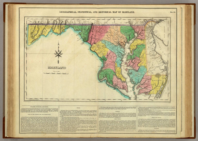
[Carey, H. C., Lea, I.]
Full Title
Geographical, Historical, And Statistical Map Of Maryland. Maryland. No. 20. Drawn by F. Lucas Jr. Boyd Sc.
List No
0122.015
Note
In full color by county surrounded by text.
Author
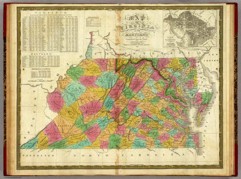
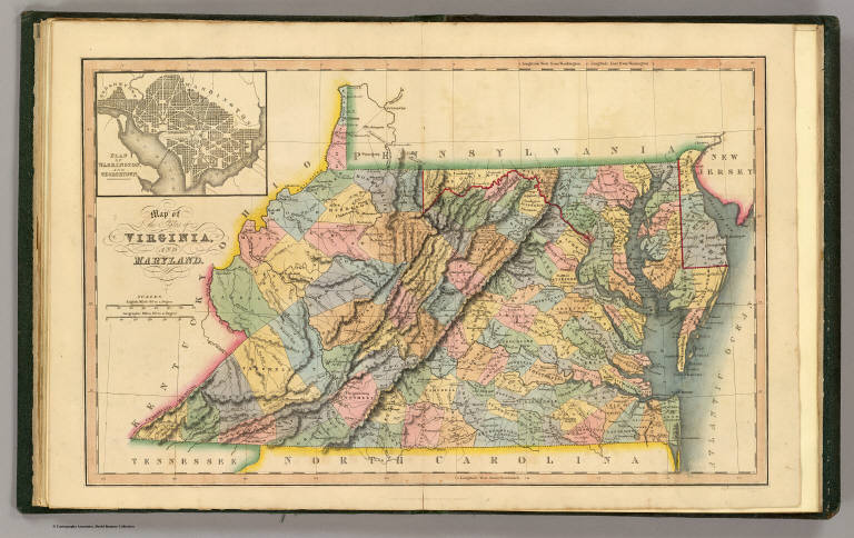
Finley, Anthony
Full Title
Map Of Virginia And Maryland Contrusted from the Latest Authorities. 1825. (with) Plan Of Washington City & Georgetown. Drawn by D.H. Vance. Engraved by J.H. Young. Published by A. Finley Philada. 1824.
List No
0278.007
Note
In full color by county with inset map uncolored. Statistical tables details the population in 1820 of "White, Free Black & Slave Population" by county.
Author
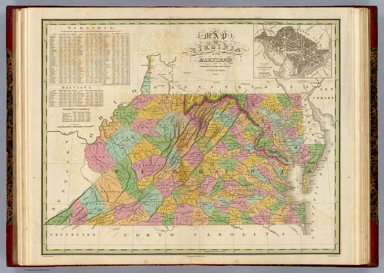
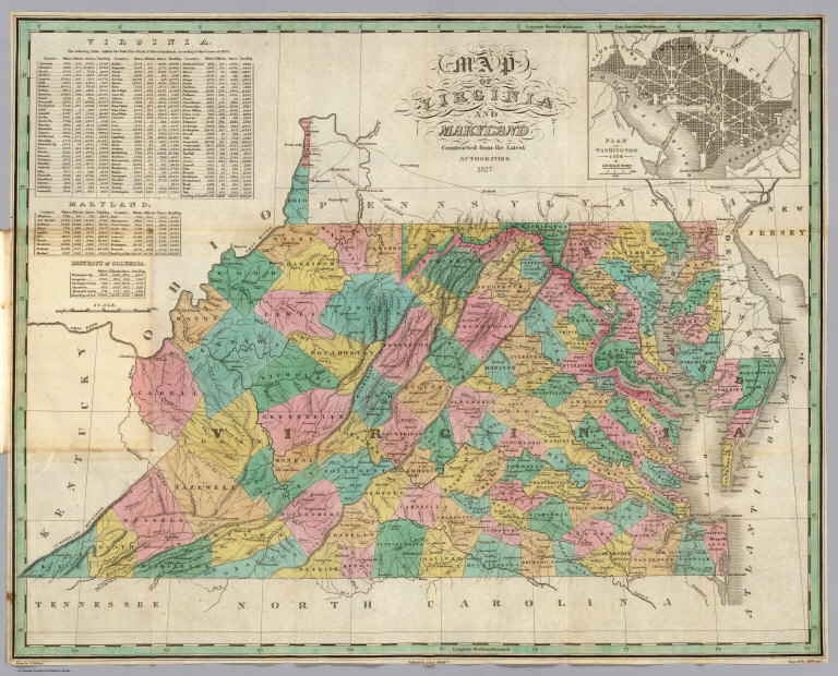
Finley, Anthony
Full Title
Map of Virginia and Maryland, Constructed from the Latest Authorities, 1827. (inset) Plan of Washington City & Georgetown.
List No
0279.011
Author
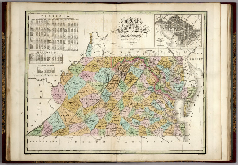
Finley, Anthony
Full Title
Map of Virginia and Maryland, Constructed from the Latest Authorities. 1827. (inset) Plan of Washington City & Georgetown. Drawn by D.H. Vance. Published by A. Finley, Philada. Engraved by J.H. Young.
List No
0280.007
Note
Relief shown by hachures. Prime meridian Washington. Statistical tables for each state.
Author
[Gray, Frank A., Gray, O.W.]
Full Title
Maryland, Delaware and the District of Columbia by Frank A. Gray. Copyright 1876 by O.W. Gray & Son. (inserts) Washington (D.C.). Wilington, Delaware. Annapolis. Annapolis Harbor and Environs.
List No
0312.020
Jefferys, Thomas; Fry, Joshua, 1700 (ca.... Map of the most Inhabited part of Virgin... 1776 0346.023 Related Author
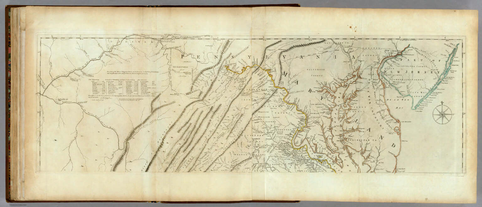
[Jefferys, Thomas, Fry, Joshua, 1700 (ca.)-1754, Jefferson, Peter, 1708-1754]
Full Title
A Map of the most Inhabited part of Virginia containing the whole province of Maryland with Part of Pensilvania, New Jersey and North Carolina. Drawn by Joshua Fry & Peter Jefferson in 1775. Printed for Robt. Sayer ... London. (Northern Section)
List No
0346.023
Note
Map in two sections this being the northern one. Distances and directions shown on chart derived by J. Dalrymple in 1755. Map in outline color by state. Title cartouche on lower half.
Author
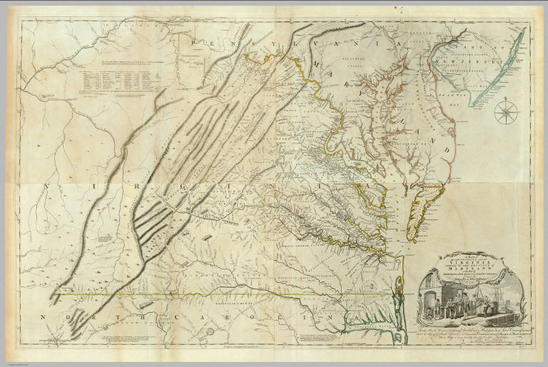
[Jefferys, Thomas, Fry, Joshua, 1700 (ca.)-1754, Jefferson, Peter, 1708-1754]
Full Title
(Composite of) A Map of the most Inhabited part of Virginia containing the whole province of Maryland with Part of Pensilvania, New Jersey and North Carolina. Drawn by Joshua Fry & Peter Jefferson in 1775. Printed for Robt. Sayer ... London.
List No
0346.025
Note
Distances and directions shown on chart derived by J. Dalrymple in 1755. Note below cartouche states: "To the Right Honourable, George Dunk Earl of Halifax First Lord Commissioner; and to the Rest of the Right Honourable and Honourable Commissioners, for Trade and Plantations. This Map is most humbly Inscribed to their Lordships, By their Lordship's Most Obedient & most devoted humble Servt. Thos. Jefferys." Survey lines are noted and explained. In outline color by state.
Author
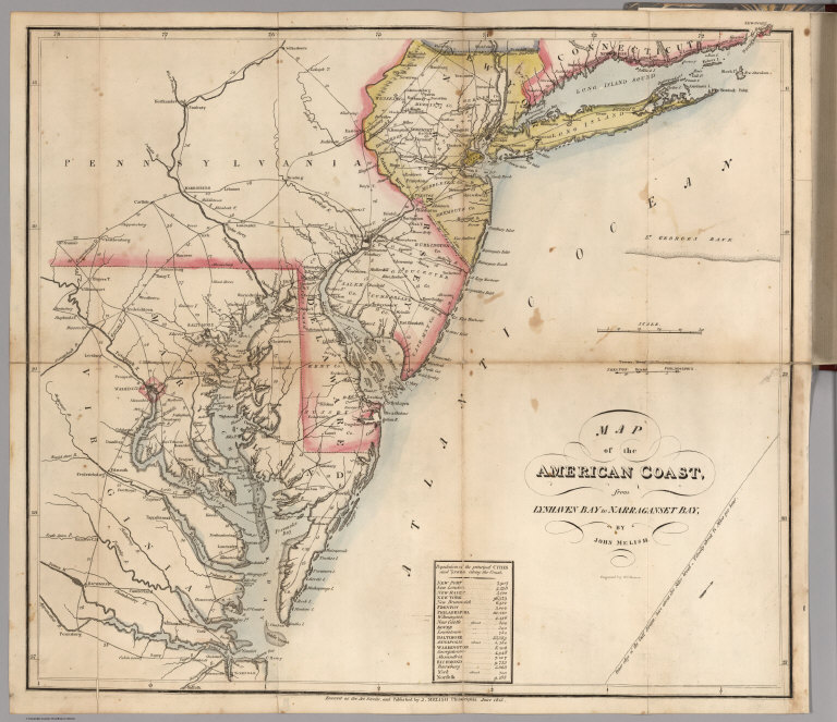
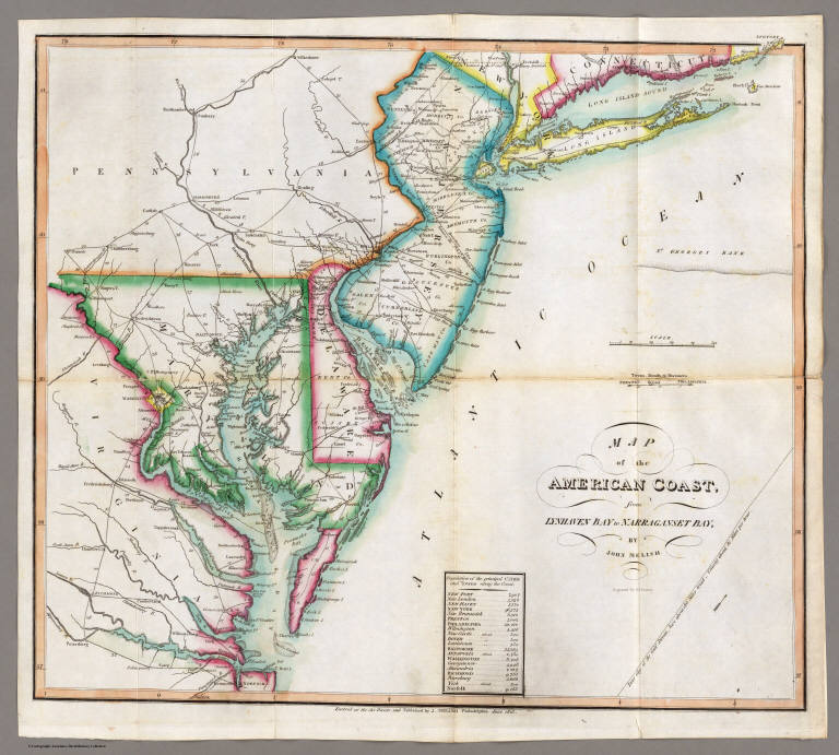
Melish, John
Full Title
Map of the American Coast, from Lynhaven Bay to Narraganset Bay, by John Melish.
List No
0495.002
Note
Fold-out map in outline color stretching from Long Island Sound to Norfolk, Virginia.
Author
[Reid, John, Winterbotham, W.]
Full Title
The States of Maryland and Delaware, from the latest Surveys. 1795. D. Martin scupt. Published by Wayland, Reid & Smith. (with inset) Continuation of the Potowmac River from Fort Cumberland.
List No
0845.013
Note
Uncolored.
Author
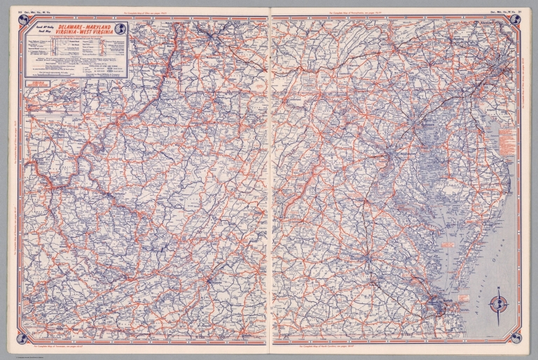
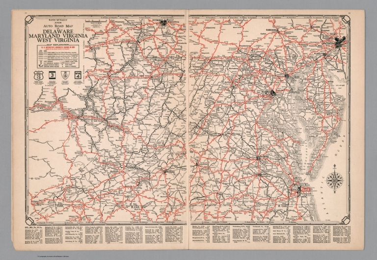
Rand McNalley & Company
Full Title
Rand McNally road map : Delaware -- Maryland -- Virginia -- West Virginia.
List No
14003.017
Note
Road map of Delaware, Maryland, Virginia and West Virginia, showing interstate and state highways, paved and dirt roads, ferries and boatlines, as well as state and national parks. Includes compass rose, time zones, and bar scale with scale statement: One inch equals approximately 19.5 miles. Features legend indicating population. Copyright by Rand McNally & Company, Chicago, Ill. Lithographed in the U.S.A.
Author
Bradstreet Company
Full Title
Delaware, Maryland. (to accompany) Bradstreet's Pocket Atlas Of The United States. Published Exclusively for Macullar, Parker & Company, Boston, Massachusetts ... New York: The Bradstreet Company, 1885. (on verso) Entered ... 1879, by The Bradstreet Company ... Washington.
List No
2054.025
Note
Full color map. Relief shown by hachures. Prime meridian is Washington, D.C.
Author
Rand McNally and Company
Full Title
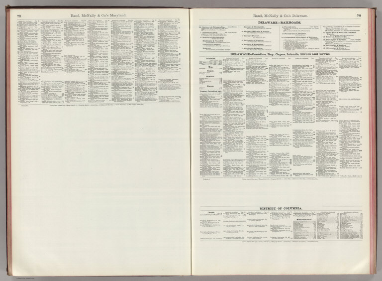
(Text Page) Maryland.
List No
2094AI
Note
List of geographical features indexed to map.
Author
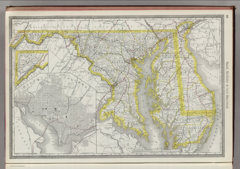
Rand McNally and Company
Full Title
Rand, McNally & Co.'s Maryland. (with) District of Columbia.
List No
2094.023
Note
Counties outlined in color. Meridians Washington and Greenwich. Railroads highlighted. One inset. Relief shown by hachures.
Author
Rand McNally and Company
Full Title
(Text Page) Maryland.
List No
2094AJ
Note
List of geographical features indexed to map.
Author
Rand McNally and Company
Full Title
(Text Page) Maryland. Delaware. District of Columbia.
List No
2094AK
Note
List of geographical features indexed to map.
Author
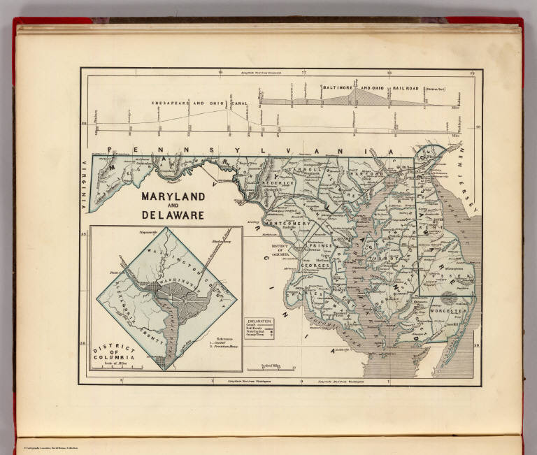
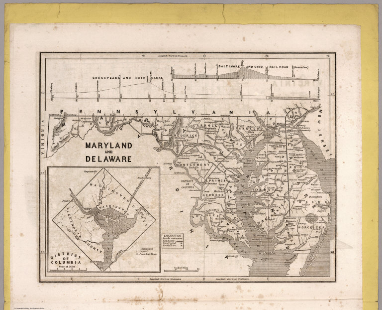
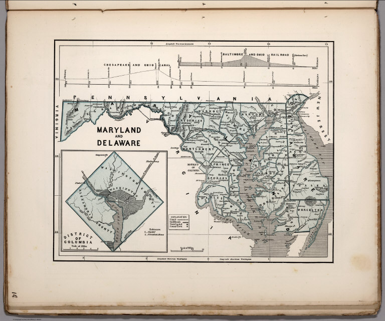
[Breese, Samuel, 1802-1873, Morse, Sidney E. (Sidney Edwards), 1794-1871]
Full Title
Maryland and Delaware. (with) District of Columbia. (By Sidney E. Morse and Samuel Breese. New York: Published by Harper & Brothers, 1845)
List No
2301.017
Note
Col. wax engraved map. Relief shown by hachures. Includes profiles of the Baltimore and Ohio Canal and Baltimore and Ohio Railroad. Prime meridians: Greenwich and Washington.
Author
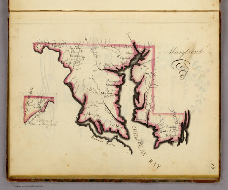
Henshaw, Frances A.
Full Title
Maryland.
List No
2501.010
Note
State in outline color.
Author
Henshaw, Frances A.
Full Title
(Description of) Maryland.
List No
2501L
Note
Frances notes that the wealthiest place in the nation is Annapolis.
Author
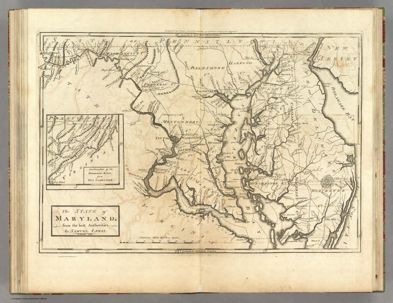
[Carey, Mathew, Lewis, Samuel]
Full Title
The State of Maryland, from the best Authorities by Samuel Lewis. W. Barker sculp. Engraved for Carey's American Edition of Guthrie's Geography improved.
List No
2542.012
Note
Uncolored.
Author
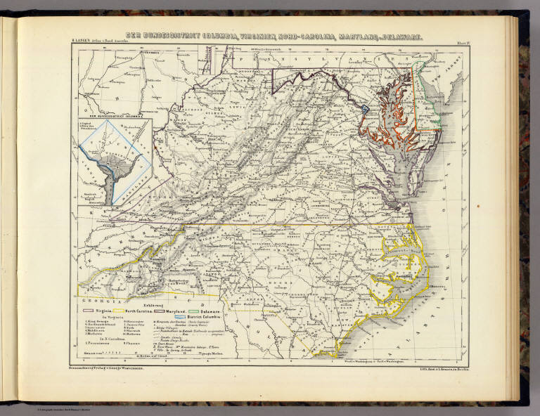
Lange, Henry, 1821-1893.
Full Title
Der Bundesdistrict Columbia, Virginien, Nord-Carolina, Maryland, u. Delaware. (with inset map) Der Bundesdistrict Columbia. H. Lange's Atlas v. Nord Amerika Blatt IV. Braunschweig: Verlag v. George Westermann. Lith. Anst. von L. Kraatz in Berlin.
List No
2743.004
Note
Engraved map. Borders hand col. Shows roads, canals, railroads, etc. Relief shown by hachures. Scale of inset map (ca. 1:370,000)
Author
Tanner, Henry S.
Full Title
Virginia, Maryland And Delaware. (to accompany) A New Pocket Atlas of the United States With The Roads and Distances, Designed For the Use of Travelers. By H.S. Tanner. Philadelphia: Published by the Author. 1828. (on verso) ...on the seventeenth day of November ... 1828, Henry S. Tanner ... hath deposited ... a book ... Pennsylvania.
List No
2782.008
Note
Outline colored map. Prime meridian is Washington, D.C. Rare. Same maps used in Darby's View of U.S. Although this appears in Tanner's catalogues for several years after 1828, it must not have sold well, as few copies have survived. Bound with half leather and paper covered boards. "Pocket Atlas" embossed on spine.
Author
Melish, John
Full Title
Map of the American Coast, from Lynhaven Bay to Narraganset Bay, by John Melish.
List No
2788.006
Note
Fold-out map in outline color stretching from Long Island Sound to Norfolk, Virginia.
Author
Rand McNally and Company
Full Title
(Text Page) Rand, McNally Co.'s Maryland.
List No
2844AL
Note
Tables of railroads and geographical features keyed to map.
Author
Rand McNally and Company
Full Title
Rand, McNally & Co.'s Maryland, D.C. and Delaware. (with) Baltimore and Environs.
List No
2844.027
Note
Relief shown by hachures. Railroads and chief cities listed and keyed to map.
Author
Rand McNally and Company
Full Title
(Text Page) Rand, McNally Co.'s Maryland.
List No
2844AM
Note
Tables of geographical features keyed to map.
Author
Rand McNally and Company
Full Title
Rand, McNally & Co.'s Baltimore. (with) Map of Baltimore and Environs.
List No
2844.028
Note
Relief shown by hachures. Railroads and chief cities listed and keyed to map. One inset.
Author
Rand McNally and Company
Full Title
(Text Page) Rand, McNally Co.'s Maryland.
List No
2844AN
Note
Tables of geographical features keyed to map.
Author
Smith, J. Calvin
Full Title
(Ohio, Pennsylvania, New York, Maryland).
List No
3471.007
Note
Estimated Date. Part of a sixteen piece map combined digitally as a composite in final map of series.
Author
Mitchell, Samuel Augustus
Full Title
Map Of Virginia And Maryland Constructed from the Latest Authorities. Published by S. Augustus Mitchell Philadelphia. 1831. J.H. Young Sc. (inset) Plan Of Washington City & Georgetown.
List No
3884.007
Note
Full color by county.
Author
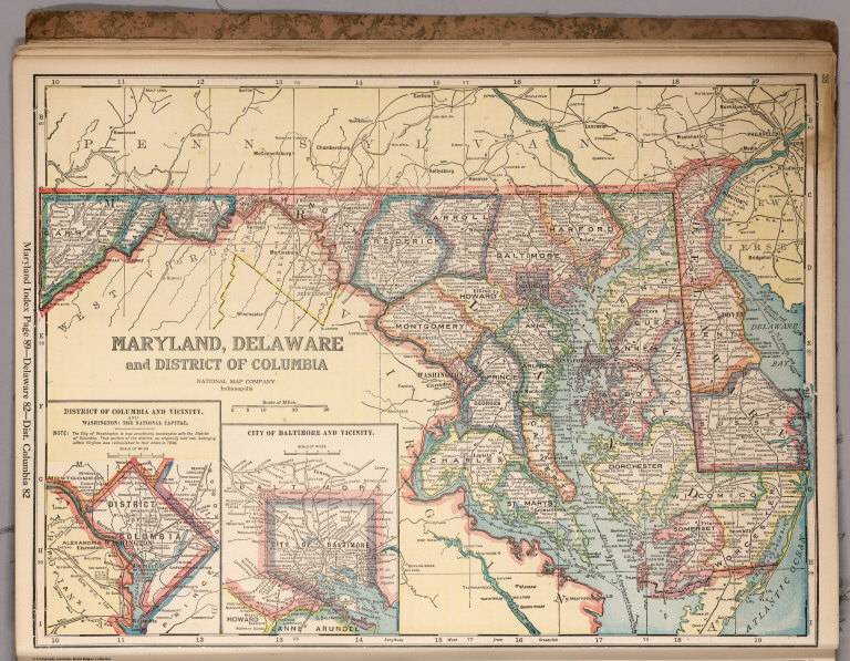
National Map Company
Full Title
Maryland, Delaware and District of Columbia. (Copyrighted by) National Map Company, Indianapolis. (to accompany) Official Paved Road and Commercial Survey of the United States. (insets) District of Columbia and vicinity. And Washington: the National Capital ; City of Baltimore and vicinity.
List No
4048.025
Note
Outline color map with 2 insets. Shows administrative divisions, roads, rivers, etc. Prime meridian is Greenwich.
Author
[Morse, Sidney E. (Sidney Edwards), 1794-1871, Breese, S.]
Full Title
Maryland and Delaware. (to accompany) Supplement To The New-York Observer. The Cerographic Atlas Of The United States. By Sidney E. Morse, A.M. And Samuel Breese, A.M. New-York: Published By Sidney E. Morse & Co. 1842. [Entered ... 1841, by Sidney E. Morse and Samuel Breese ... New-York.] (inset) District of Columbia.
List No
4180.007
Note
Uncolored map. Shows state capital, county, towns, roads, railroads, rivers, canals, etc. Relief shown by hachures. Prime meridian is Washington. Includes explanation.
Author
Rand McNally and Company
Full Title
Rand McNally Junior Auto Road Map of Dealware, Maryland, Virginia, West Virginia. Copyright by Rand McNally & Company. Chicago, Ill. Made in U.S.A. P.1033.
List No
4245.007
Note
Color map. Includes explanation, and alphabetical index of cities and towns, giving populations and Key to map. U.S. interstate highways shown in red. Shows Highway markers.
State Farm Insurance Companies Travel Bu... State Farm Road map: Delaware - Maryland... 1944 4246.018 Related Author
State Farm Insurance Companies Travel Bureau
Full Title
State Farm Road map: Delaware - Maryland - Virginia - West Virginia. Copyright by Rand McNally & Company, Chicago, Ill. Lithographed in U.S.A. Z.3617. (on upper corners) Del., Md., Va., W. Va. (inset) Western Virginia.
List No
4246.018
Note
Color map. Shows roads, points of interest, distances, time zone boundaries, populations, etc. U.S. interstate and principal state highways shown in red.
Author
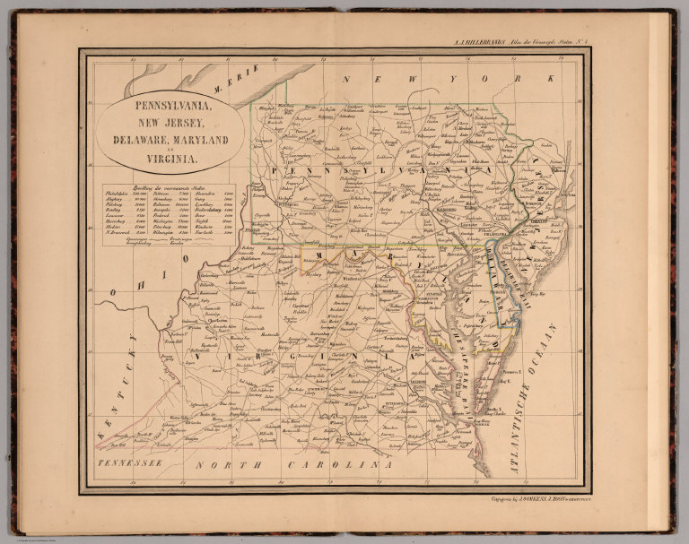
Hillebrands, A.J.
Full Title
Atlas de Vereenigde Staten No. 4. Pennsylvania, New Jersey, Delaware, Maryland en Virginia.
List No
4323.006
Note
A scarce small atlas of ten maps published in Holland, but authored by a school teacher from the Dutch Colony in Holland, Michigan. It was most likely sold to Dutch Americans and those in Holland planning to emigrate or who had relatives in America. The date is estimated by Phillips and Koeman. Koeman lists an earlier edition of 1849, with five maps. There is a double page of text at the end of the maps, with lists of distances by steamboat and railroad. The copy listed in Phillips has a cover title, not present here. Maps are hand painted with outline color.
Author
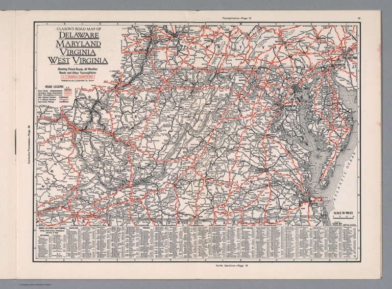
Clason Map Company
Full Title
Clason's Road Map of Delaware, Maryland, Virginia, West Virginia. Showing paved roads, All weather roads and other throughfares. (U.S. Highways shown in red.) Published by the Clason Map Co., Denver. Copyrighted Clason Map. All rights reserved. Map No. R-274 A.
List No
4423.016
Note
Color map. Includes road legend, and Index of cities and towns giving 1930 Census populations and Key to map.
Author
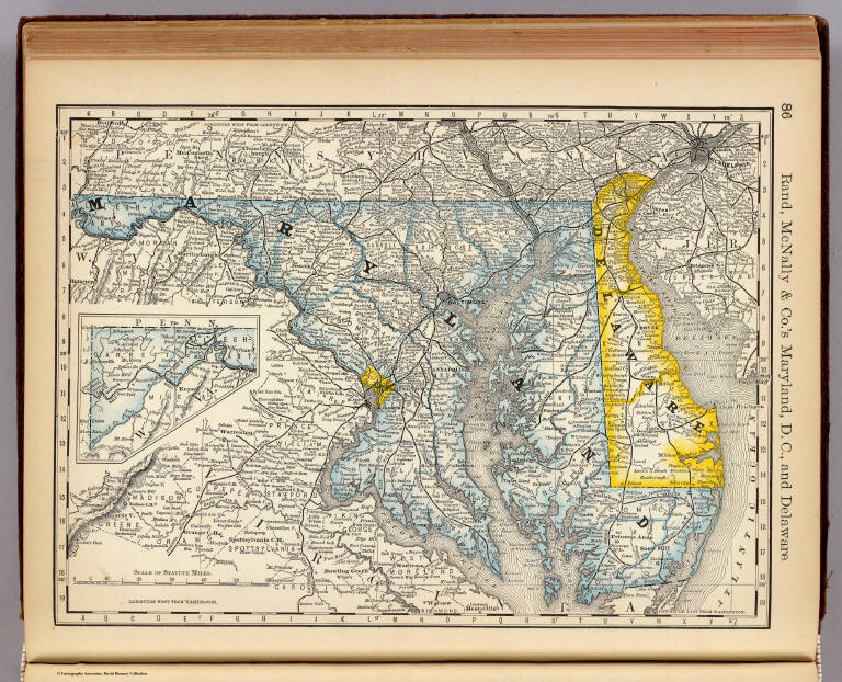
Rand McNally and Company
Full Title
Rand, McNally & Co.'s Maryland, D.C., and Delaware.
List No
4520.019
Note
In outline color. Inset map of western Maryland. Shows named railroads. Prime meridians: Greenwich and Washington
Author
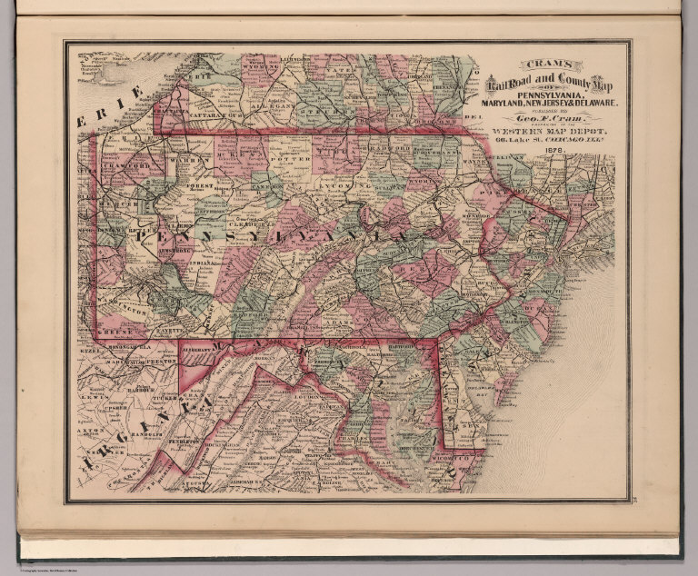
Cram, George Franklin
Full Title
Cram's Rail Road & County Map of Pennsylvania, Maryland, New Jersey & Delaware.
List No
4533.023
Author
[Morse, Sidney E. (Sidney Edwards), 1794-1871, Breese, Samuel]
Full Title
Maryland and Delaware. (inset) District of Columbia. (By Sidney E. Morse and Samuel Breese. New York: Published by Harper & Brothers, 1845). (to accompany) Morse's Cerographic Maps. No. VIII.
List No
4861.065
Note
Color wax engraved map. Shows capitals, towns, road, railroads, rivers, canals, etc. Includes explanation and profiles of the Baltimore and Ohio Canal and Baltimore and Ohio Railroad. Relief shown by hachures. Prime meridians are Greenwich and Washington.
Author
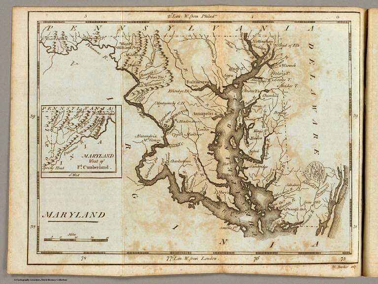
Carey, Mathew
Full Title
Maryland. (with) Maryland West of Ft. Cumberland. W. Barker sculp.
List No
4865.013
Note
Uncolored.
Full Title
Virginia, Maryland and Delaware. (with District of Columbia). (with Baltimore and vicinity). N. & S.S. Jocelyn Sc. (New-Haven: N. & S.S. Jocelyn. 1823)
List No
4869.006
Note
Engraved map with 2 insets and facing index page. Outline hand color. Relief shown by hachures. Prime meridians: Washington and Greenwich.
Author
[Hinton, Isaac Taylor, 1799-1847, Simpkin & Marshall]
Full Title
Map of the states of Virginia and Maryland. (with) Plan of Washington and Georgetown. London, published Sept. 1, 1831, by I.T. Hinton & Simpkin & Marshall. Engraved & printed by Fenner Sears & Co. (1832)
List No
4966.010
Note
Hand col. engraved map. Relief shown by hachures. Covers also Delaware. Prime meridians: Washington and Greenwich. "66."
|