|
REFINE
Browse All : Mining and Composite Map
1-4 of 4
Author
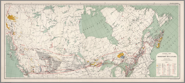
[Canada. Department of Interior, Chalifour, J.E.]
Full Title
(Composite map of) Mineral map of Dominion of Canada. Information from the Department of Mines. Minerals. Atlas of Canada. (to accompany) Department of the Interior Canada. Atlas Of Canada, 1915.
List No
1646.089
Note
Composite of east and west sheets. Color map. Shows railroads, rivers, etc. Includes color coded legend representing ores and minerals.
Author
Wyld, James, 1812-1887
Full Title
(Composite of) Gold Region of Australia (East Division) ; Western Australia (West Division). Published by James Wyld, Geographer to the Queen, Charing Cross East 457 Strand. 11&12 Charing Cross, London. (to accompany) An Atlas of the World, Comprehending Separate Maps of its various Countries, Constructed & drawn from the latest Astronomical & Geographical Observations. By James Wyld, Geographer to Her Majesty and H. Late R.H. Prince Albert. London. Published by James Wyld (Successor to Mr. Faden) Charing Cross East. 1864.
List No
2225.034
Note
2 maps, outline hand colored boundaries. showing gold deposits. Includes a list of the counties in Queensland. "Atlas of the World" printed on the upper right corner. A late edition of this atlas, published as early as 1836 (see our copy). Several new maps of Australia and South Africa are added and the other maps have been updated to show railroad development. The American maps have been updated, but inadequately so in the West - the River Buenaventura is still flowing out of Salt Lake on the Mexico Map. Half leather cloth-covered boards with stamped title "Wyld's General Atlas" on cover in gold. Relief shown by hachures.
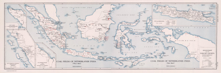
Full Title
(Composite) Coal Fields of Netherlands India. Overzichtskaart van den Indischen Archipel. Coal Resources of the World. (inset) Gouvt. Atjeh en Onderhoorigheden. (inset) Gouvt. Sumatra's Westkust en de Residentie Tapanoeli. (inset) Het Noordelijk Deel van de Residentie Oostkust van Sumatra. (inset) Java en Madoera.
List No
2249.012
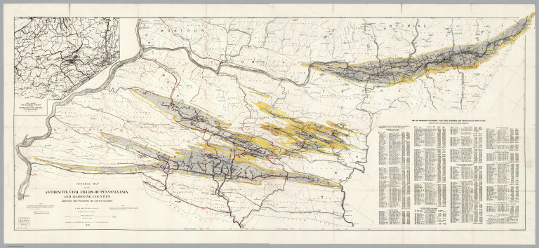
Author
[Smith, J.L., Smith, A. DW.]
Full Title
(Composite of) General Map Of The Anthracite Coal Fields Of Pennsylvania And Adjoining Counties Showing The Position Of Each Colliery. By A. DW. Smith, Mining Engineer. Wilkes-Barre, Penna. Published by J.L. Smith, Map Publisher, 27 S. 6th St., Philadelphia 1899. Copyrighted 1899 By A. DW. Smith. (inset) Map Showing The Railroad Outlets Of The Anthracite Coal Regions Of Pennsylvania.
List No
5069.003
Note
Late, detailed map of the Pennsylvania coal fields. On the map is a note: "This map is a revised copy of the 'General Map of the Anthracite Coal Fields' published by the Pennsylvania Geological Survey in 1890; and is republished by permission of the Board of Commissioners." Includes a "List of operating collieries, with their shipment and production in Tons in 1898". Prime meridian is Washington.
1-4 of 4
|