|
REFINE
Browse All : Military of Europe from World War II
1-47 of 47
Author
News Map of the Week, Inc.
Full Title
World News of the Week : Monday, May 8, 1944. Covering period Apr. 28 to May 4. Volume 6, No. 36. Published and copyrighted (weekly), 1944, by News Map of the Week, Inc., 1512 Orleans Street, Chicago, Illinois. Published in two sections : Section one. Lithographed in U. S. A.
List No
14170.000
Note
Lithographed world map, in color. Shows political boundaries and military events of World War II, from April 28 to May 4, 1944. Relief illustrated with hachures. Descriptive text throughout, e.g.: Ft. Norman - Whitehorse oil pipeline opened. Map indexed according to historical notes beneath map. Features photographs, illustrations, and international time zones. With inset map: (European communication networks). Also, with two diagrams: (Photo flash bomb) -- Bombing tons dropped on Axis Europe. Map is 56 x 115 cm, on sheet 89 x 120 cm, folded to 31 x 23 cm.
Author
News Map of the Week, Inc.
Full Title
World News of the Week : Monday, May 15, 1944. Covering period May 5 to May 11. Volume 6, No. 37. Published and copyrighted (weekly), 1944, by News Map of the Week, Inc., 1512 Orleans Street, Chicago, Illinois. Published in two sections : Section one. Lithographed in U. S. A.
List No
14172.000
Note
Lithographed world map, in color. Shows political boundaries and military events of World War II, from May 5 to 11, 1944. Relief illustrated with hachures. Includes a key indicating the alignment of warring nations (United, Axis, and neutral). Descriptive text throughout, e.g.: Nazis note Anzio activities; flood Pontine Marshes. Map indexed according to historical notes beneath map. Features photographs, illustrations, and international time zones. With four inset maps: (Where Allies concentrate bombers in Europe) -- (Pontine Marshes) -- (China) -- Great Britain and Land-Lease in reverse. Map is 56 x 115 cm, on sheet 89 x 120 cm, folded to 31 x 23 cm.
Author
News Map of the Week, Inc.
Full Title
World News of the Week : Monday, Nov. 22, 1943. Covering period Nov. 12 to Nov. 18. Volume 6, No. 12. Published and copyrighted (weekly), 1943, by News Map of the Week, Inc., 1512 Orleans Street, Chicago, Illinois. Published in two sections : Section one. Lithographed in U. S. A.
List No
14144.000
Note
Lithographed world map, in color. Shows political boundaries and military events of World War II, from November 12 to 18, 1943. Relief illustrated with hachures. Includes a key indicating the alignment of warring nations (United, Axis, and neutral). Descriptive text throughout, e.g.: Nazis capture Leros island. Map indexed according to historical notes beneath map. Features photographs, illustrations, and international time zones. With two inset maps: Bougainville close-up -- Hitler's headache. Map is 56 x 115 cm, on sheet 89 x 120 cm, folded to 31 x 23 cm.
Author
London Geographical Institute
Full Title
Dunkirk to Berlin, June 1940 - July 1945 : Journeys undertaken by the Rt. Honble. Winston S. Churchill, O.M., C.H., F.R.S., M.P., Prime Minister of Great Britain, in defence of the British Commonwealth and Empire. Printed and published in Great Britain by George Philip & Son, LTD., 32 Fleet Street, London, E.C.4, in association with "Time & Tide". The London Geographical Institute. 1947.
List No
14468.002
Note
Case map of Winston Churchill's journeys during World War II, spanning the east coast of the United States, Europe, North Africa and the Middle East. Shows political boundaries, countries, cities, bodies of water, drainage, coastlines and islands. Includes latitudinal and longitudinal lines, as well as a legend, two bar scales, given in miles and kilometers. Indexed to indicate vessels of transportation for each route, with key beneath map. Key comprised of descriptive text and views, beginning with: 1. "Atlantic Charter" : At Placentia Bay, Newfoundland. President Roosevelt in U.S.A. Destroyer "McDougal" visits the Prime Minister on board H.M.S. "Prince of Wales". Colored lithograph. Map is 46 x 106 cm, on sheet 92 x 118 cm.
Author
[Oganisation Todt., Machemer, Heinrich, Schwarz, Richard]
Full Title
Der Generalinspektor für das deutsche Straẞwessen Organisation Todt / Zentrale Kraftstoff- Einsatz / Büro Dr. Machemer Berlin / Tankstellennetz Stand 1. November 1941 / Maẞtab 1:6000000. [The General Inspector for German Roadways, Organization Todt / Central Fuel Deployment / Office of Dr. Machemer, Berlin / Petrol Station Network as of November 1, 1941 / Scale 1: 6000000].
List No
10826.000
Author
News Map of the Week, Inc.
Full Title
World News of the Week : Monday, May 4, 1942. Covering period Apr. 24 to 30. Volume 4, No. 35. Published and copyrighted (weekly), 1942, by News Map of the Week, Inc., 1512 Orleans Street, Chicago, Illinois. Published in two sections : Section one. Lithographed in U. S. A.
List No
14097.000
Note
Lithographed world map, in color. Shows political boundaries and military events of World War II, from April 24 to 30, 1942. Relief illustrated with hachures. Includes a legend indicating control by the Free French and Vichy France. Descriptive text throughout, e.g.: Area subject to semi-blackout. Map indexed according to historical notes beneath map. Features photographs, illustrations, and international time zones. With inset map: The War moves northward with the sun. Also, with diagram: Factory wages; Food prices; Income taxes; Installment buying. Map is 56 x 115 cm, on sheet 89 x 120 cm, folded to 31 x 23 cm.
Author
News Map of the Week, Inc.
Full Title
World News of the Week : Monday, Sept. 14, 1942. Covering period Sept. 4 to Sept. 10. Volume 5, No. 2. Published and copyrighted (weekly), 1942, by News Map of the Week, Inc., 1512 Orleans Street, Chicago, Illinois. Published in two sections : Section one. Lithographed in U. S. A.
List No
14104.000
Note
Lithographed world map, in color. Shows political boundaries and military events of World War II, from September 4 to 10, 1942. Relief illustrated with hachures. Descriptive text throughout, e.g.: Allies complete vital railroad. Map indexed according to historical notes beneath map. Features photographs, illustrations, and international time zones. With six inset maps: How warring Germany has changed the face of Europe : 1914 -- 1919 -- 1939, Mar. 22 -- 1940, Sept. 1 -- 1941, Sept. 1 -- 1942, Sept. 1. Map is 56 x 115 cm, on sheet 89 x 120 cm, folded to 31 x 23 cm.
Author
News Map of the Week, Inc.
Full Title
World News of the Week : Monday, Dec. 15, 1941. Covering period Dec. 5 to Dec. 11. Volume 4, No. 15. Published and copyrighted (weekly), 1941, by News Map of the Week, Inc., 1512 Orleans Street, Chicago, Illinois. Published in two sections : Section one. Lithographed in U. S. A.
List No
14082.000
Note
Lithographed world map, in color. Shows political boundaries and military events of World War II, from December 5 to 11, 1941. Relief illustrated with hachures. Includes a legend indicating national sovereignty, including colonies. Descriptive text throughout, e.g.: Route over which Mexican forces will travel to Lower California. Map indexed according to historical notes beneath map. Features photographs, illustrations, and international time zones. With three inset maps: The Philippine Islands -- Japanese target -- Hitler's Best bets for winter. Also, with diagram: Aliens in America. Map is 56 x 115 cm, on sheet 89 x 120 cm, folded to 31 x 23 cm.
Author
Blake, F. Donald
Full Title
Gran Bretagna - la posizione avanzata dell'attacco. F. Donald Blake. (Printed in England by Alf Cooke Ltd., Leeds and London.)
List No
14075.000
Note
Pictorial military map of the Great Britain, and part of Europe. Shows battle sites and locations of resources, such as electric power, coal and tanks. Includes a legend and descriptive text, as well as a decorative title cartouche. With inset: (Turin; Milan; Genoa). Map is 45 x 70 cm, on sheet 51 x 76 cm. For English edition of map in Collection, see Pub List No. 14074.000. (Imprint taken from 14074.000. Date estimated.)
Author
Chapin, Jr., R.M.
Full Title
Winter projection. TIME map by R.M. Chapin, Jr. For report documenting above map see TIME, November 22, 1943 issue.
List No
11768.000
Note
Map of Western Europe. "Enlargement of original map drawn for TIME The weekly magazine." Showing the military movements and occupied areas. R.M. Chapin Jr. was a prominent Cold War cartographer who worked for Time Magazine. Relief shown by shading.
Author
Chapin, Jr., R.M.
Full Title
Routes to Berlin. TIME map by R.M. Chapin, Jr. For report documenting above map see TIME, June 21, 1943 issue.
List No
11769.000
Note
Map of Europe. "Enlargement of original map drawn for TIME The weekly magazine." Showing the military movements and occupied areas. R.M. Chapin Jr. was a prominent Cold War cartographer who worked for Time Magazine. Relief shown by shading.
Author
SPK
Full Title
Confiance ... ses Amputations se Poursuivent Methodiquement (Be reassured, the amputations (of his tentacles) are proceeding methodically).
List No
9750.000
Author
[Los Angeles Examiner, Burke, Howard]
Full Title
The Russian Spider Sits Atop the World and Watches for More Victims. Soviet Russia, under the Dictator Stalin, has cast aside all regard for international law and prepares to follow the Finland grab with a policy of international piracy over all Eurasia, by conquest and subversive activity.
List No
8869.000
Author
Los Angeles Times
Full Title
Germans, backing toward "Inner Fortress" plan to make peace costly. Los Angeles Times. Monday, November 15, 1943.
List No
11002.000
Note
Color map, packed with information on battle fields and allied activities. Shows boundaries, major cities, railroads, and distances. Relief shown pictorially. Includes notes and text: "Germany has drawn a ring around in inner most possessions, the arc including Poland to the east, the top of Italy, and Alps to the south The Siegfried Line of West Wall to the west ..."
Author
Los Angeles Times
Full Title
France. (Los Angeles Times. 1943).
List No
11009.000
Note
Color map, packed with information on invasion of France and allies activities. Published in Los Angeles Times. Date estimated. Shows boundaries, major cities, railroads, battle fields and distances. Relief shown pictorially. Includes notes and text:" With the Brittany Peninsula sealed of and left behind for mopping up, the fast-breading American take forces yesterday were swinging deep into the heart of France, turning the entire left flank of the German army ..."
Author
[Los Angeles Times, Owens, Charles H.]
Full Title
Sustained attacks push bomb-sowing level to new high. By Charles Owens, Los Angeles Times. Los Angeles Times, Monday, March 29, 1943.
List No
11024.000
Note
Color map, with detailed view air strikes at upper panel. Shows lines of air attack, major cities, ports, etc. Relief shown pictorially. Includes historical notes and text: "This map by times Staff Artist Charles H. Owens shows targets and dates of major Allied raids since the present offensive began late in February. Raids are indicated by red arrows sweeping out of the general English area where bombing squadrons are based."
Author
Anonymous
Full Title
Saishin Oshu daichizu : tsuketari rekkyo kokusei kokubo ichiran. Kingu Henshukyoku. Showa 10 (1935). (at upper margin) Kingu dai 20-kan dai 1-go furoku.
List No
11109.000
Note
Color map. Covers North Atlantic Ocean, Europe, North Africa, part of Asia, with 3 insets. of double Hemispheres, and Europe. Published as supplement to vol.20, no.1 of magazine 'Kingu'. Sows political divisions, major cities, military figures, air and sea routes and distances, roads, railroads, etc.. includes charts, graphs, and legend. Relief shown by hachures.
Author
Sundberg, Edwin L.
Full Title
The New Lineup. September 1, 1940.
List No
12254.000
Author
Sundberg, Edwin L.
Full Title
Quadruple Threat to Japan. September 3, 1944.
List No
12269.000
Author
Sundberg, Edwin L.
Full Title
Inside the Inner Fortress. December 17, 1944.
List No
12273.000
Author
Sundberg, Edwin L.
Full Title
One Year After. May 5, 1946.
List No
12284.000
Author
Sundberg, Edwin L.
Full Title
The 4th Reich? March 9, 1947.
List No
12290.000
Author
Owens, Charles
Full Title
(Europe : World War II). By Charles Owens, Los Angeles Times. Oregon Journal Sunday, July 25, 1943.
List No
13238.000
Note
Pictorial map from the July 24, 1943 issue of Oregon Journal. By Los Angeles Times artist Charles Owens. Depicts the latest war developments in Europe with arrows and text pointing our strategic places and events. Shows a large swastika marking Germany as bomber airplanes fan out from London toward Denmark, Berlin, Nuremberg, Turin and Brest. Relief shown pictorially. Includes text.
Author
Fuchida, Tadayoshi
Full Title
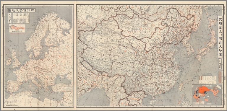
最新世界大地図 = Saishin sekai daichizu. Shina zendo narabi fukin daichizu. Oshū gensei daichizu = Latest World Map. (on verso) Map of the Whole of China. Current Map of Europe. Fuchida Tadayoshi. Kingu, Volume 15, no.1. Tokyo, Dainihon Yūbenkai Kōdansha, Showa 14 (1940).
List No
13462.003
Note
2 color maps on 1 sheet. Map of the Whole of China, at scale of 1:5,600,000 and Current Map of Europe, at scale of 1:12,000,000. yoshi
Author
Turner, Stanley
Full Title
War in Europe Dated Events. Keep up-to-date. 6th edition. Win the war in 1944. (on verso: Map of the Pacific Arena). Stanley Turner. International Circulation Company, Inc., New York City. Copyright, Canada and U.S.A. 1944, C.C. Petersen, Publishing and advertising, Toronto, Ont.
List No
13489.002
Author
Turner, Stanley
Full Title
War in Europe Dated Events. (WWII Pacific theaters of War). Stanley Turner. Printed in U.S.A. International circulation Company, Inc., New York City. Copyright, Canada and U.S.A. 1944, C.C. Peterson, publishing and advertising, Toronto, ONT.
List No
13579.001
Author
[Československá akademie věd., Klíma, Jan]
Full Title
Přehled operací v prvním období velké vlastenecké války Sovétského Svazu (22.6. 1941 - 18.11.1942). Československý vojenský atlas.
List No
13684.255
Note
Timeline map, with 2 inset maps of Northern and Southeastern Europe. Includes text and legend. Showing the operations in the first period of the Great Patriotic War of the Soviet Union.
Author
Rand McNally & Co.
Full Title
Rand McNally map of the European battle areas. Copyright by Rand McNally & Company, Chicago.
List No
14065.002
Note
Pocket military map of Europe during World War II, in color. Shows political boundaries, battle areas, as well as air and sea distances.. Includes a legend and a bar scale. (Maps of Eastern Hemisphere and the South Pacific on verso.) Map is 48 x 65 cm, on sheet 50 x 68 cm, folded to 23 x 10 cm.
Author
[Rand McNally & Co., Richfield Oil Corporation]
Full Title
Richfield news map of Europe. Copyright by Rand McNally & Company, Chicago. Made in U.S.A. Edited as of Feb. 11, 1942.
List No
14066.002
Note
Pocket military map of Europe during World War II, in color. Shows political boundaries, air and naval bases, fortifications, blockades, mining areas and oil fields. Includes a legend and a bar scale. Descriptive text throughout, e.g.: French Colonial Army in French Northern Africa under Command of Lt. Gen. Juin. (Maps of the world, Asia, the North Sea and English Channel on verso.) With inset: Northern Scandinavia). Map is 50 x 68 cm, on sheet 54 x 72 cm, folded to 24 x 18 cm.
Author
News Map of the Week, Inc.
Full Title
World News of the Week : Monday, Mar. 23, 1942. Covering period Mar. 13 to Mar. 19. Volume 4, No. 29. Published and copyrighted (weekly), 1942, by News Map of the Week, Inc., 1512 Orleans Street, Chicago, Illinois. Published in two sections : Section one. Lithographed in U. S. A.
List No
14091.000
Note
Lithographed world map, in color. Shows political boundaries and military events of World War II, from March 13 to 19, 1942. Relief illustrated with hachures. Descriptive text throughout, e.g.: Captured by Russians. Map indexed according to historical notes beneath map. Features photographs, illustrations, and international time zones. With two inset maps: Australia -- Is this the road back? Also, with diagram: The world's income tax. Map is 56 x 115 cm, on sheet 89 x 120 cm, folded to 31 x 23 cm.
Author
News Map of the Week, Inc.
Full Title
World News of the Week : Monday, Mar. 27, 1944. Covering period Mar. 17 to Mar. 23. Volume 6, No. 30. Published and copyrighted (weekly), 1944, by News Map of the Week, Inc., 1512 Orleans Street, Chicago, Illinois. Published in two sections : Section one. Lithographed in U. S. A.
List No
14165.000
Note
Lithographed world map, in color. Shows political boundaries and military events of World War II, from March 17 to 23, 1944. Relief illustrated with hachures. Descriptive text throughout, e.g.: Red drive into Rumania threatens all Balkans. Map indexed according to historical notes beneath map. Features photographs, illustrations, and international time zones. With four inset maps: Hukawng Valley -- Mili -- (Cassino) -- Russia's drive into Rumania. Map is 56 x 115 cm, on sheet 89 x 120 cm, folded to 31 x 23 cm.
Author
[Bauer, Hubert A. (Hubert Anton), 1886-, American Airlines Inc., Carl Byoir & Associates, News Map of the Week, Inc.]
Full Title
World News of the Week : Monday, Sept. 4, 1944. Covering period Aug. 25 to Aug 31. Volume 7, No. 1. Published and copyrighted (weekly), 1944, by News Map of the Week, Inc., 1512 Orleans Street, Chicago, Illinois. Published in three sections : Section one. Cartographer, H. A. Bauer. Base map copyrighted by American Airlines, Inc. Photos from Amertrop by Carl Byoir and Associates.
List No
14176.000
Note
Lithographed world map, in color. Shows political boundaries and military events of World War II, from August 25 to 31, 1944. Relief illustrated with hachures. "This map - an azimuthal projection focused upon the geographical center of the United States - was developed by air-age education research of American Airlines, Inc." Descriptive text throughout, e.g.: France air, sea war. Map indexed according to historical notes in margins surrounding map. Features photographs. With five inset maps (all boundaries as of January 1, 1938): Five years of war : 1940 Sept. 1 -- 1941 Sept. 1 -- 1942 Sept. 1 -- 1943 Sept. 1 -- 1944 Sept. 1. Also, with two diagrams: Man-days of labor lost through strikes -- World petroleum production; Synthetic petroleum production. Map is 61 x 64 cm, on sheet 89 x 120 cm, folded to 31 x 23 cm.
Author
News Map of the Week, Inc.
Full Title
World News of the Week : Monday, Sept. 11, 1944. Covering period Sept. 1 to Sept. 7. Volume 7, No. 2. Published and copyrighted (weekly), 1944, by News Map of the Week, Inc., 1512 Orleans Street, Chicago, Illinois. Published in two sections : Section one. Lithographed in U. S. A.
List No
14178.000
Note
Lithographed world map, in color. Shows political boundaries and military events of World War II, from September 1 to 7, 1944. Relief illustrated with hachures. Includes a chronology: Highlights of five years of war. Descriptive text throughout, e.g.: Allies land in North Africa. Map indexed according to historical notes beneath map. Features photographs, illustrations, and international time zones. With inset map: The noose tightens. Map is 56 x 115 cm, on sheet 89 x 120 cm, folded to 31 x 23 cm.
Author
News Map of the Week, Inc.
Full Title
World News of the Week : Monday, Sept. 25, 1944. Covering period Sept. 15 to Sept. 21. Volume 7, No. 4. Published and copyrighted (weekly), 1944, by News Map of the Week, Inc., 1512 Orleans Street, Chicago, Illinois. Published in two sections : Section one. Lithographed in U. S. A.
List No
14179.000
Note
Lithographed world map, in color. Shows political boundaries and military events of World War II, from Sept. 15 to 21, 1944. Relief illustrated with hachures. Descriptive text throughout, e.g.: British 2nd joins with sky army. Map indexed according to historical notes beneath map. Features photographs, illustrations, and international time zones. With four inset maps: Palau Islands -- (Finland) -- (Border between Belgium and Germany) -- The China front. Map is 56 x 115 cm, on sheet 89 x 120 cm, folded to 31 x 23 cm.
Author
[Harrison, Richard Edes, Army Information Branch, Army Service Forces]
Full Title
Newsmap. (War front near Florence, Italy. Guam, Agiguwant, Tinian and Saipan. Pacific Island Groups). Monday, July 31, 1944. ... Vol. III No. 15F. Prepared and Distributed by the Army Information Branch, Army Service Forces. Navy Distribution by Educational Services Section, BuPers, Navy Dept., Washington D.C. U.S. Government Printing Office: 1944 - 591000.
List No
6767.002
Note
Three maps, four photographs and summary text on five war fronts.
Author
[Manning, F.E., Army Orientation Course, Special Service Division Army Service Forces]
Full Title
Target Berlin. Newsmap. Monday, October 25, 1943. ... Vol. II No. 27. Prepared and Distributed by the Army Orientation Course. Special Service Division Army Service Forces, War Dept.,2E581 Pentagon Bldg., Washington D.C. U.S. Government Printing Office: 1943 - 538110.
List No
6770.001
Note
Shaded relief map centered on Berlin, Germany. Has a cut-away scale for measuring distances from Tokyo or, alternatively one can use the concentric rings. Some flight routes and mileages shown. Hemispherical view.
Author
Richfield Oil Corporation
Full Title
Richfield Reporter : War Map : Compiled through the facilities of the United Press. Complement of your Richfield Dealer. (c) 1939, Richfield Oil Corporation. Printed in U.S.A.
List No
8249.000
Note
Map printed on newsprint sheet with column on the war, including table, "Population and area of European Countries." Shows territorial changes, naval bases, ports, distance from place to place, Richfield Reporter time in United States and Europe, cities, industries, railroads, etc. Relief shown pictorially. Includes Richfield Products logo.
Author
C.S. Hammond & Co.
Full Title
Hammond's Map of The Mediterranean, Europe and Northern Africa. (inset) Invasion Coasts (English Channel).
List No
8758.003
Note
Date estimated. Includes 90 cut-out flags of combatant countries for marking battle scenes, military movements, and occupied areas. Shows major strategic product production areas. Has large ad for Standard Feed Milling Company.
Author
Hagstrom Company Incorporated
Full Title
Hagstrom's Map of the Aleutian Islands, Alaska, Southwest Pacific, Europe, Mediterranean, North Africa.
List No
8911.002
Author
[ADSEC Engineers Section, Ciofalo, John, Helstrom, Cliff]
Full Title
ADSEC (Advance Section) in Action from Thames to Rhine. Feed the Flame. Brig. Gen. Edwart G. Plank, Commanding.
List No
8919.001
Note
ADSEC is U.S. Army, First Army, Advance Section, Communications Zone, European Theater of Operations, set up to supply the combat troops.
Author
MacKechnie
Full Title
42nd Inf. (Infantry), Rainbow Div. (Division), (U.S. Army).
List No
8920.000
Note
Sites of World War II action. Major General Harry J. Collins, commanding.
Author
1104 Engineer Combat Group, U.S. Army
Full Title
1104 Engineer Combat Group from "D" Day to the Elbe.
List No
8931.000
Note
Date estimated.
Author
Williams, Christopher
Full Title
4th Armored Division, (U.S. Third Army).
List No
8968.000
Author
George Philip & Son, Ltd.
Full Title
Daily Express War Map, Western Zone. (inset) Norway and Sweden.
List No
9124.002
Note
Includes portraits of Allied commanders. Some black arrows, representing advances of U.S. forces, added after initial printing.
Author
Turner, Stanley
Full Title
Dated Events World War Map. (insets) Western Hemisphere. Part of the Eastern Hemisphere.
List No
9794.001
Note
Includes a panel stating, "Allyn and Bacon, Publishers of the Stull-Hatch Global Geographies".
Author
[MacMillan, Henry J., United States. Army. 62d Engineer Topographic Company]
Full Title
XIX Corps in action. XIX Corps : From D Day (June 6 1944) to Germany. Maj. Gen. Charles H. Corlet - Commanding. Brig. Gen. George D. Shea- Artillary Commander. Brig. Gen H.E. McGuire - Chief of Staff. Drawn by T/5 Henry J. MacMillan. Reproduced by 62nd. Engr. Top. Co. US Army Nov. 1944. (On verso) Tomahawk XIX Corps cracks Siegfried Line : special edition, volume 2, Number 6. XIX Corps cracks Siegfried Line.
List No
9865.002
Note
Pictorial map of 9th Corps in action, on sheet 56x73. Text on verso. Map depicts movements of military units from Normandy France to Heerlen, Holland in the European Theater of Operations in 1944-1945. Includes explanation to historical events.
Author
[MacMillan, Henry J., United States. Army. 62d Engineer Topographic Company]
Full Title
XIX Corps in action from Siegfried Line to victory : XIX Corps : Maj. Gen. Raymond S. McLain - Commander. Brig. Gen. George Shea - - Artillary Commander. Brig. Gen H.E. McGuire - Chief of Staff. Drawn by T/5 Henry J. MacMillan. Reproduced by 62nd. Engr. Top. Co. US Army May 1945. (On verso) The Tomahawk strikes from Siegfried Line to victory.
List No
9866.002
Note
Pictorial map on sheet 59x73. Depicting the path of 9th. Corps as it fought across Germany in the spring of 1945 under the command of major general Raymond S. McLain. Annotations mark heavy fighting, battles, liberation of concentration camps, and the junction with the Red Army at Wittenburg.
1-47 of 47
|