|
REFINE
Browse All : Military from 1859
1-6 of 6
Martineau, Harriet; Nightingale, Florenc... Diagram of the Causes of Mortality in th... 1859 10563.002 Related Author
[Martineau, Harriet, Nightingale, Florence]
Full Title
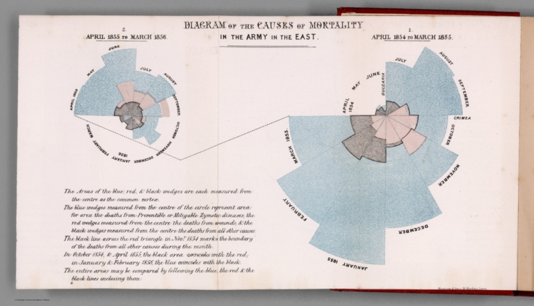
Diagram of the Causes of Mortality in the Army in the East.
List No
10563.002
Note
Colored.
Martineau, Harriet; Nightingale, Florenc... Diagram Representing the Mortality in th... 1859 10563.004 Related Author
[Martineau, Harriet, Nightingale, Florence]
Full Title
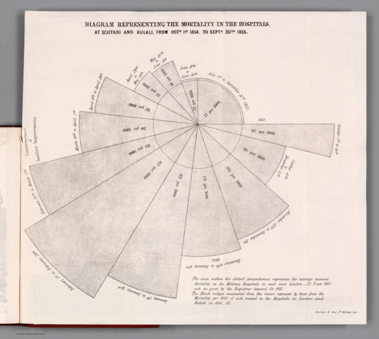
Diagram Representing the Mortality in the Hospitals.
List No
10563.004
Note
Black and White.
Martineau, Harriet; Nightingale, Florenc... Diagram of the Causes of Mortality in th... 1859 10563.005 Related Author
[Martineau, Harriet, Nightingale, Florence]
Full Title
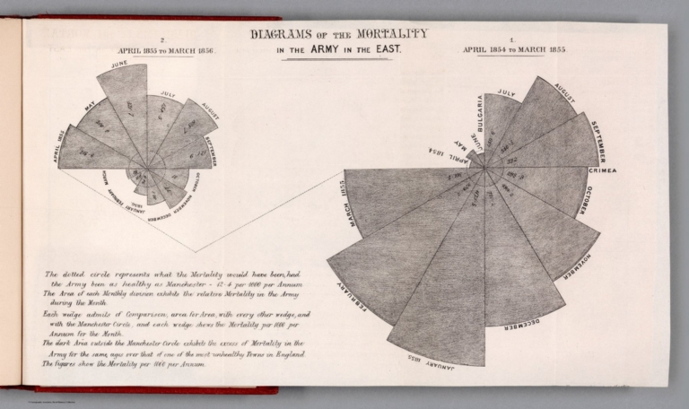
Diagram of the Causes of Mortality in the Army in the East.
List No
10563.005
Author
Warren, Gouverneur Kemble, 1830-1882
Full Title
Military Map of Nebraska and Dakota...From the Explorations made by him in 1855, 6...and in 1857...
List No
2932.000
Note
Best regional map of its area for the period; shows the Black Hills. Karrow lists three states of this map, the earliest dated 1858?, lithographed by J. Bien; the second state, same date, no Bien credit, hand colored, with "Engraving carefully revised" note; the third state, same as the second, except for an engraving credit to N. Peters, Washington, no color, and the date Karrow gives of 1859? Our copy is the third state. Karrow states that it is to accompany an unnamed Senate Ex. Document of the 35th Congress, 1st session, 1857-58. Wheat calls this map "a landmark of the period of 1859." Shows "Gold Field" in Colorado, around Auraria, which may make this one of the earliest maps to show the Colorado gold rush of 1859. The lower part of this map was reprinted in 1859 by J.H. Colton and included in his printing of Redpath's and Hinton's "Hand-Book to Kansas Territory and the Rocky Mountain's Gold Region," see our #4872. See our 1867 later edition of the same map.
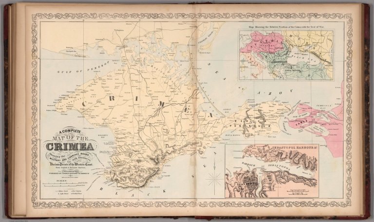
Author
Mitchell, Samuel Augustus
Full Title
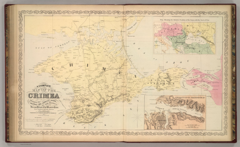
A Complete Map of the Crimea Showing the Military and Carriage Roads with Distances from Various Points of the Western Coast From English & Russian Surveys. Philadelphia. Published by Charles Desilver, 251 Market St. Herline & Co. Lith., 7th & Chesnut Sts., Philadelphia. Entered according to Act of Congress in the year 1856 by Charles Desilver in the Clerk's office if the District Court of the Eastern District of Pennsylvania.
List No
4557.057
Note
Fold out map. Relief shown by hachures. Insets of Sebastopol Harbour, and Map Showing the relative Position of the Crimea with the Seat of War.
Author
Mitchell, Samuel Augustus
Full Title
A Complete Map of the Crimea Showing the Military and Carriage Roads with Distances from Various Points of the Western Coast From English & Russian Surveys. Philadelphia. Published by Charles Desilver, 251 Market St. Herline & Co. Lith., 7th & Chesnut Sts., Philadelphia. Entered according to Act of Congress in the year 1856 by Charles Desilver in the Clerk's office if the District Court of the Eastern District of Pennsylvania.
List No
8065.080
Note
Double page map. Relief shown by hachures. Insets of Sebastopol Harbour, and Map Showing the relative Position of the Crimea with the Seat of War.
1-6 of 6
|