|
Author
Bacler d'Albe, Louis-Albert-Ghislain, 1761-1824
Full Title
(Composite map of) Feuilles No. 1-24 Carte Générale des Royaumes de Naples, Sicile & Sardaigne
List No
15716.034
Author
Bacler d'Albe, Louis-Albert-Ghislain, 1761-1824
Full Title
Feuille No. XXVI Carte Générale du théâtre de la guerre en Italie et dans les Alpes
List No
15716.002
Author
Bacler d'Albe, Louis-Albert-Ghislain, 1761-1824
Full Title
Petit Tableau d'Assemblage de la Carte Générale du théâtre de la guerre en Italie.
List No
15716.003
Author
Bacler d'Albe, Louis-Albert-Ghislain, 1761-1824
Full Title
Feuille No. I (with) Feuille No. VI Carte Générale du théâtre de la guerre en Italie et dans les Alpes
List No
15716.004
Author
Bacler d'Albe, Louis-Albert-Ghislain, 1761-1824
Full Title
Feuille No. XI (with) Feuille No. XVI Carte Générale du théâtre de la guerre en Italie et dans les Alpes
List No
15716.005
Author
Bacler d'Albe, Louis-Albert-Ghislain, 1761-1824
Full Title
Feuille No. XXI Carte Générale du théâtre de la guerre en Italie et dans les Alpes
List No
15716.006
Author
Bacler d'Albe, Louis-Albert-Ghislain, 1761-1824
Full Title
Feuille No. II (with) Feuille No. VII Carte Générale du théâtre de la guerre en Italie et dans les Alpes
List No
15716.007
Author
Bacler d'Albe, Louis-Albert-Ghislain, 1761-1824
Full Title
Feuille No. XII (with) Feuille No. XVII Carte Générale du théâtre de la guerre en Italie et dans les Alpes
List No
15716.008
Author
Bacler d'Albe, Louis-Albert-Ghislain, 1761-1824
Full Title
Feuille No. XXII (with) Feuille No. XXVII Carte Générale du théâtre de la guerre en Italie et dans les Alpes
List No
15716.009
Author
Bacler d'Albe, Louis-Albert-Ghislain, 1761-1824
Full Title
Feuille No. III (with) Feuille No. VIII Carte Générale du théâtre de la guerre en Italie et dans les Alpes
List No
15716.010
Author
Bacler d'Albe, Louis-Albert-Ghislain, 1761-1824
Full Title
Feuille No. XIII (with) Feuille No. XVIII Carte Générale du théâtre de la guerre en Italie et dans les Alpes
List No
15716.011
Author
Bacler d'Albe, Louis-Albert-Ghislain, 1761-1824
Full Title
Feuille No. XXIII (with) Feuille No. XXVIII Carte Générale du théâtre de la guerre en Italie et dans les Alpes
List No
15716.012
Author
Bacler d'Albe, Louis-Albert-Ghislain, 1761-1824
Full Title
Feuille No. IV (with) Feuille No. IX Carte Générale du théâtre de la guerre en Italie et dans les Alpes
List No
15716.013
Author
Bacler d'Albe, Louis-Albert-Ghislain, 1761-1824
Full Title
Feuille No. XIV (with) Feuille No. XIX Carte Générale du théâtre de la guerre en Italie et dans les Alpes
List No
15716.014
Author
Bacler d'Albe, Louis-Albert-Ghislain, 1761-1824
Full Title
Feuille No. XXIV (with) Feuille No. XXIX Carte Générale du théâtre de la guerre en Italie et dans les Alpes
List No
15716.015
Author
Bacler d'Albe, Louis-Albert-Ghislain, 1761-1824
Full Title
Feuille No. V (with) Feuille No. X Carte Générale du théâtre de la guerre en Italie et dans les Alpes
List No
15716.016
Author
Bacler d'Albe, Louis-Albert-Ghislain, 1761-1824
Full Title
Feuille No. XV (with) Feuille No. XX Carte Générale du théâtre de la guerre en Italie et dans les Alpes
List No
15716.017
Author
Bacler d'Albe, Louis-Albert-Ghislain, 1761-1824
Full Title
Feuille No. (XXV) La Grece Ancienne, et Moderne ou Carte Generale (with) Feuille No. XXX Abrege Historique Carte Générale du théâtre de la guerre en Italie et dans les Alpes
List No
15716.018
Note
Sheet XXX has been updated to add campaigns of 1799 in a sixth column of text.
Author
Bacler d'Albe, Louis-Albert-Ghislain, 1761-1824
Full Title
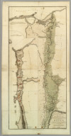
Feuille No. 1 Carte Générale des Royaumes de Naples, Sicile & Sardaigne
List No
15716.020
Author
Bacler d'Albe, Louis-Albert-Ghislain, 1761-1824
Full Title
Tableau D'Assemblage (with) Canevas Generale Carte générale des Royaumes de Naples, Sicile & Sardaigne
List No
15716.021
Author
Bacler d'Albe, Louis-Albert-Ghislain, 1761-1824
Full Title
Feuille No. 4 (with) Feuille No. 5 Carte Générale des Royaumes de Naples, Sicile & Sardaigne
List No
15716.022
Author
Bacler d'Albe, Louis-Albert-Ghislain, 1761-1824
Full Title
Feuille No.12 (with) Feuille No. 13 Carte Générale des Royaumes de Naples, Sicile & Sardaigne
List No
15716.023
Author
Bacler d'Albe, Louis-Albert-Ghislain, 1761-1824
Full Title
Feuille No.20 (with) Feuille No. 21 Carte Générale des Royaumes de Naples, Sicile & Sardaigne
List No
15716.024
Author
Bacler d'Albe, Louis-Albert-Ghislain, 1761-1824
Full Title
Feuille No.3 (with) Feuille No. 6 Carte Générale des Royaumes de Naples, Sicile & Sardaigne
List No
15716.025
Author
Bacler d'Albe, Louis-Albert-Ghislain, 1761-1824
Full Title
Feuille No.11 (with) Feuille No. 14 Carte Générale des Royaumes de Naples, Sicile & Sardaigne
List No
15716.026
Author
Bacler d'Albe, Louis-Albert-Ghislain, 1761-1824
Full Title
Feuille No.19 (with) Feuille No. 22 Carte Générale des Royaumes de Naples, Sicile & Sardaigne
List No
15716.027
Author
Bacler d'Albe, Louis-Albert-Ghislain, 1761-1824
Full Title
Feuille No. 2 (with) Feuille No. 7 Carte Générale des Royaumes de Naples, Sicile & Sardaigne
List No
15716.028
Author
Bacler d'Albe, Louis-Albert-Ghislain, 1761-1824
Full Title
Feuille No. 10 (with) Feuille No. 15 Carte Générale des Royaumes de Naples, Sicile & Sardaigne
List No
15716.029
Author
Bacler d'Albe, Louis-Albert-Ghislain, 1761-1824
Full Title
Feuille No. 18 (with) Feuille No. 23 Carte Générale des Royaumes de Naples, Sicile & Sardaigne
List No
15716.030
Author
Bacler d'Albe, Louis-Albert-Ghislain, 1761-1824
Full Title
Feuille No. 8 Carte Générale des Royaumes de Naples, Sicile & Sardaigne
List No
15716.031
Author
Bacler d'Albe, Louis-Albert-Ghislain, 1761-1824
Full Title
Feuille No. 9 (with) Feuille No. 16 Carte Générale des Royaumes de Naples, Sicile & Sardaigne
List No
15716.032
Note
Feuille 16 includes top third of Carte Generale du Royaume Sardaigne
Author
Bacler d'Albe, Louis-Albert-Ghislain, 1761-1824
Full Title
Feuille No.17 (with) Feuille No. 24 Carte Générale des Royaumes de Naples, Sicile & Sardaigne
List No
15716.033
Note
Feuilles 17 and 24 include the bottom two thirds of Carte Generale du Royaume Sardaigne
Author
Luffman, John, 1756-1846
Full Title
Cadiz Harbour. Engraved for Luffman's Select plans of the principal cities, ports, harbours, forts, &c. in the world. London, - Engraved and published July 1. 1799, by John Luffman.
List No
13189.003
Note
Hand colored chart. Relief shown by hachures. Depth shown by soundings. Includes historical text at the foot of map.
Author
Luffman, John, 1756-1846
Full Title
Port Royal in Jamaica. Engraved for Luffman's Select plans of the principal cities, ports, harbours, forts, &c. in the world. London, - Engraved and published July 1. 1799, by John Luffman.
List No
13189.005
Note
Hand colored chart. Relief shown by hachures. Depth shown by soundings. Prime meridian is London. Includes historical text at the foot of map.
Author
Luffman, John, 1756-1846
Full Title
Fort Louis. Engraved for Luffman's Select plans of the principal cities, ports, harbours, forts, &c. in the world. London, - Engraved and published July 1. 1799, by John Luffman.
List No
13189.006
Note
Hand colored plan of the city and fortification. Relief shown by hachures. Prime meridian is London. Includes historical text at the foot of map.
Author
Luffman, John, 1756-1846
Full Title
Turin. Engraved for Luffman's Select plans of the principal cities, ports, harbours, forts, &c. in the world. London, - Engraved and published July 1. 1799, by John Luffman.
List No
13189.009
Note
Hand colored plan of the city and fortifications. Includes numbered key to the important sites on the map. Prime meridian is London.
Author
Luffman, John, 1756-1846
Full Title
Hunningen. Engraved for Luffman's Select plans of the principal cities, ports, harbours, forts, &c. in the world. London, - Engraved and published by John Luffman. London. Aug. 1t.1799.
List No
13189.010
Note
Hand colored plan of the city and fortifications. Prime meridian is London. Includes historical text at the foot of map.
Author
Arrowsmith, Aaron
Full Title
Plan of the Operations of the British & Ottoman Forces in Egypt, From the 8th of March to the 2d. of Septr. 1801, when the French were Finally expelled from that Country. Composed from materials furnished by the Quarter Master Generals Department. London, Published by A. Arrowsmith, 1st. September 1802 No. 24 Rathbone Place. Engraved by S.J. Neele 352 Strand. (inset) Plate 1: (Alexandria peninsula on an enlarged scale.)
List No
0029.000
Note
S.J.Neele is the engraver. This copy was probably removed from a book, however, it was published separately and is in Arrowsmith's catalogue. How many battle maps did Arrowsmith do? This may be one of only a few. See Map Collector 9, p22 for Arrowsmith catalogue showing this map with the Egypt maps. No other battle plans listed. Map in full color with battle positions in red and yellow. Relief shown by hachures. Upper right corner: plate 2.
Author
Luffman, John, 1756-1846
Full Title
The North-West part of Italy. Engraved for Luffman's Select plans of the principal cities, ports, harbours, forts, &c. in the world. London, - Engraved and published July 1. 1799, by John Luffman.
List No
13189.004
Note
Hand colored map. Relief shown pictorially. Prime meridian is London.
Author
Luffman, John, 1756-1846
Full Title
Brest Harbour. Engraved for Luffman's Select plans of the principal cities, ports, harbours, forts, &c. in the world. London, - Engraved and published July 1. 1799, by John Luffman.
List No
13189.007
Note
Hand colored chart. Relief shown by hachures. Depth shown by soundings. Prime meridian is London. Includes historical text at the foot of map.
Author
Luffman, John, 1756-1846
Full Title
The North-East part of Italy. Engraved for Luffman's Select plans of the principal cities, ports, harbours, forts, &c. in the world. London, - Engraved and published July 1. 1799, by John Luffman.
List No
13189.008
Note
Hand colored map. Relief shown pictorially. Prime meridian is London.
Author
Luffman, John, 1756-1846
Full Title
Toulon Harbour. Engraved for Luffman's Select plans of the principal cities, ports, harbours, forts, &c. in the world. London, - Engraved and published Septr. 1, 1799, by John Luffman.
List No
13189.011
Note
Hand colored chart. Relief shown by hachures. Depth shown by soundings. Prime meridian is London. Includes historical text at the foot of map.
Author
Luffman, John, 1756-1846
Full Title
The Strait and Bay of Gibraltar. Engraved for Luffman's Select plans of the principal cities, ports, harbours, forts, &c. in the world. London, - Engraved and published Septr. 1, 1799, by John Luffman.
List No
13189.013
Note
Hand colored chart. Relief shown by hachures. Depth shown by soundings. Prime meridian is London. Includes historical text at the foot of map.
Author
Luffman, John, 1756-1846
Full Title
Coni. Engraved for Luffman's Select plans of the principal cities, ports, harbours, forts, &c. in the world. London, - Engraved and published Septr. 1, 1799, by John Luffman.
List No
13189.014
Note
Hand colored map of the city and fortifications. Relief shown by hachures. Includes historical text at the foot of map, and numbered key to the important sites on the map
Author
Luffman, John, 1756-1846
Full Title
The Port of Lisbon. Engraved for Luffman's Select plans of the principal cities, ports, harbours, forts, &c. in the world. London, - Engraved and published Septr. 1, 1799, by John Luffman.
List No
13189.015
Note
Hand colored chart. Shows fortifications. Relief shown by hachures. Depth shown by soundings. Includes historical text at the foot of map.
Author
Luffman, John, 1756-1846
Full Title
The Southern part of the United Provinces. Engraved for Luffman's Select plans of the principal cities, ports, harbours, forts, &c. in the world. London, - Engraved and published Oct. 1, 1799, by John Luffman.
List No
13189.016
Note
Hand colored map. Prime meridian is London.
Author
Luffman, John, 1756-1846
Full Title
Corfu. Engraved for Luffman's Select plans of the principal cities, ports, harbours, forts, &c. in the world. London. Engraved and published by John Luffman. Octr. 1, 1799.
List No
13189.017
Note
Hand colored map. Relief shown pictorially. Prime meridian is London. Includes compass rose and historical text at the foot of map.
Author
Luffman, John, 1756-1846
Full Title
Seringapatam. Engraved for Luffman's Select plans of the principal cities, ports, harbours, forts, &c. in the world. London. Engraved and published Octr. 1, 1799, by John Luffman.
List No
13189.018
Note
Hand colored plan. Shows fortifications. Relief shown by hachures. Prime meridian is London. Includes historical text at the foot of map.
Author
Luffman, John, 1756-1846
Full Title
The Bay of Acre. Engraved for Luffman's Select plans of the principal cities, ports, harbours, forts, &c. in the world. London. Engraved and published Novr. 1, 1799, by John Luffman.
List No
13189.019
Note
Hand colored chart of the Bay of Acre, from Cape Carmel to Cape Blanco. Shows fortifications. Depth shown by soundings. Relief shown by pictorially. Prime meridian is London. Includes historical text at the foot of map.
Author
Luffman, John, 1756-1846
Full Title
Mysore. Engraved for Luffman's Select plans of the principal cities, ports, harbours, forts, &c. in the world. London. Engraved and published Novr. 1, 1799, by John Luffman.
List No
13189.020
Note
Hand colored map of Karnataka, originally known as the State of Mysore. Relief shown by pictorially. Prime meridian is London. Includes explanation key.
|