|
REFINE
Browse All : Military and Separate Map from 1950
1-16 of 16
Author
Zaichikov’, V. T.
Full Title
Korea. Soubor Politickych map č.1
List No
15362.002
Author
Zaichikov’, V. T.
Full Title
(Text page to) Korea. Soubor Politickych map č.1
List No
15362.003
Author
U.S. Atomic Energy Commission
Full Title
Atomic Airspace Reservations. PLEASE POST IN A CONSPICUOUS PLACE.
List No
10557.000
Author
[Bauer, Hubert A. (Hubert Anton), 1886-, American Airlines Inc., News Map of the Week, Inc.]
Full Title
World News of the Week : Monday, Jan. 30, 1950. Covering period Jan. 20 to Jan. 26. Volume 12, No. 22. Published and copyrighted (weekly), 1950, by News Map of the Week, Inc., 1512 Orleans Street, Chicago, Illinois. Published in two sections : Section one. Cartographer, H. A. Bauer. Base map copyrighted by American Airlines, Inc.
List No
14198.000
Note
Lithographed world map, in color. Shows political boundaries and significant events from January 20 to 26, 1950. Relief illustrated with hachures. "This map - an azimuthal projection focused upon the geographical center of the United States - was developed by air-age education research of American Airlines, Inc." Includes information on pig production across the globe (as compared to pre-war figures), with explanatory text. Map indexed according to historical notes in margins surrounding map. Features photographs. With inset map: America's mothball Navy. Also, with diagram: Excise taxes : Before the war and now; as well as chronology: The British Labor Party. Map is 61 x 64 cm, on sheet 89 x 120 cm, folded to 31 x 23 cm.
Author
[Denoyer-Geppert Company, News Map of the Week, Inc.]
Full Title
World News of the Week : Monday, Mar. 27, 1950. Covering period Mar. 17 to Mar. 23. Volume 12, No. 30. Published and copyrighted (weekly), 1950, by News Map of the Week, Inc., 1512 Orleans Street, Chicago, Illinois. Published in two sections : Section one. Base map copyrighted by Denoyer-Geppert Company.
List No
14199.000
Note
Lithographed world map in spherical western and eastern hemispheres, in color. Shows political boundaries and significant events from March 17 to 23, 1950. Relief illustrated with color codes, and hachures. Includes a legend indicating elevation, in feet. "This two-hemisphere globular projection has meridians equally spaced along the equator and parallels equally spaced at the periphery and along the central meridian. It overcomes the exaggeration (or reduction) of areas near the center which is encountered in certain other types of similar projections, emphasizes the spheric shape of the world." Also includes information on Secretary Achieson's 7-Point Peace Proposal, as it relates to locations across the globe, with explanatory text, as well as descriptive text throughout, e.g.: Point 2 : Russia could withdraw its military and police forces from all of the satellite countries. Map indexed according to historical notes beneath map. Map is 49 x 115 cm (each hemisphere 49 x 57 cm), on sheet 89 x 120 cm, folded to 31 x 23 cm.
Author
News Map of the Week, Inc.
Full Title
World News of the Week : Monday, Apr. 17, 1950. Covering period Apr. 7 to Apr. 13. Volume 12, No. 33. Published and copyrighted (weekly), 1950, by News Map of the Week, Inc., 1512 Orleans Street, Chicago, Illinois. Published in two sections : Section one. Lithographed in U. S. A.
List No
14200.000
Note
Lithographed world map, in color. Shows political boundaries and significant events from April 7 to 13, 1950. Relief illustrated with hachures. Includes information on "Troubled Southeast Asia," with explanation, as well as descriptive text throughout, e.g.: Indonesia : The second rebellion against the young Indonesian republic seemed ended when rebels, who had seized Makassar, in the Celebes, surrendered under threat of naval bombardment. Map indexed according to historical notes beneath map. Features photographs, illustrations, and international time zones. With two inset maps: Air defense areas -- Trouble spots in India. Also, with diagram: U. S. wheat output. Map is 56 x 115 cm, on sheet 89 x 120 cm, folded to 31 x 23 cm.
Author
[Denoyer-Geppert Company, News Map of the Week, Inc.]
Full Title
World News of the Week : Monday, May 22, 1950. Covering period May 12 to May 18. Volume 12, No. 38. Published and copyrighted (weekly), 1950, by News Map of the Week, Inc., 1512 Orleans Street, Chicago, Illinois. Published in two sections : Section one. Lithographed in U. S. A. Semi-elliptical map projection used by permission of Denoyer-Geppert Company.
List No
14201.000
Note
Lithographed world map, in color. Shows political boundaries and significant events from May 12 to 18, 1950. Relief illustrated with hachures. "This semi-elliptical projection may be termed a compromise between the two-dimensional Mercator and the three-dimensional presentation of the globe. It reduces distortion in areas near the pole and maintains a close approximation of proportion in the land and sea areas ... " Includes information on the Ottoman Empire, with explanatory text, as well as descriptive text throughout, e.g.: Western Turkistan : The original home of the Ottoman Turks was in western Turkistan, from where they were driven in 1220 by the Mongols of Genghis Kahn. Map indexed according to historical notes beneath map. With inset map: Truman's travels. Also, with diagram: Women in industry. Map is 47 x 115 cm, on sheet 89 x 120 cm, folded to 31 x 23 cm. (See Copy 1 - Pub List No. 14189.000.)
Author
News Map of the Week, Inc.
Full Title
World News of the Week : Monday, Oct. 16, 1950. Covering period Oct. 6 to Oct. 12. Volume 13, No. 7. Published and copyrighted (weekly), 1950, by News Map of the Week, Inc., 1512 Orleans Street, Chicago, Illinois. Published in two sections : Section one. Lithographed in U. S. A.
List No
14203.000
Note
Lithographed world map, in color. Shows political boundaries and significant events from October 6 to 12, 1950. Relief illustrated with hachures. Includes information on foreign travels of President Truman, with explanation, as well as descriptive text throughout, e.g.: Mexico City : On a state visit to President Aleman of Mexico in March, 1947, President Truman made a speech in which he assured the Latin American countries that the United States would adhere to a policy of non-intervention in their affairs. Map indexed according to historical notes beneath map. Features photographs, illustrations, and international time zones. With two inset maps: Another war theater in Asia -- A view of the Korean War. Also, with diagram: Criminal arrests (by age groups) in the United States (1947). Map is 51 x 115 cm, on sheet 89 x 120 cm, folded to 31 x 23 cm.
Author
News Map of the Week, Inc.
Full Title
World News of the Week : Monday, Sept. 25, 1950. Covering period Sept. 15 to Sept. 21. Volume 13, No. 4. Published and copyrighted (weekly), 1950, by News Map of the Week, Inc., 1512 Orleans Street, Chicago, Illinois. Published in two sections : Section one. Lithographed in U. S. A.
List No
14205.000
Note
Lithographed world map, in color. Shows political boundaries and significant events from September 15 to 21, 1950. Relief illustrated with hachures. Includes information on steel production, with explanatory text. Map indexed according to historical notes beneath map. Features photographs, illustrations, and international time zones. With four inset maps: Four phases of the Korean War : Reds occupied one-half of South Korea, June 25 to July 20 -- MacArthur-Walker forces made a strategic retreat, July 21 to Aug. 5 -- Pusan Beachhead withstood all blows, Aug. 6 to Sept. 14 -- The U. N. counter-offensive began, Sept. 15. Also, with diagram: Six year record of polio cases. Map is 51 x 115 cm, on sheet 89 x 120 cm, folded to 31 x 23 cm.
Author
[Denoyer-Geppert Company, News Map of the Week, Inc.]
Full Title
World News of the Week : Monday, Oct. 2, 1950. Covering period Sept. 22 to Sept. 28. Volume 13, No. 5. Published and copyrighted (weekly), 1950, by News Map of the Week, Inc., 1512 Orleans Street, Chicago, Illinois. Published in two sections : Section one. Lithographed in U. S. A. Semi-elliptical map projection used by permission of Denoyer-Geppert Company.
List No
14206.000
Note
Lithographed world map, in color. Shows political boundaries and significant events from September 22 to 28, 1950. "Relief illustrated with hachures. This semi-elliptical projection may be termed a compromise between the two-dimensional Mercator and the three-dimensional presentation of the globe. It reduces distortion in areas near the pole and maintains a close approximation of proportion in the land and sea areas ... " Includes information on the "transcontinental smoke blanket" caused by forest fires in Western Canada, with explanatory text. Map indexed according to historical notes beneath map. With inset map: (South Korea). Also, with two diagrams: Average cost of educating a pupil in public schools; States in which the most and least money is spent on a child's education -- Social security. Map is 47 x 115 cm, on sheet 89 x 120 cm, folded to 31 x 23 cm.
Author
[Denoyer-Geppert Company, News Map of the Week, Inc.]
Full Title
World News of the Week : Monday, Oct. 23, 1950. Covering period Oct. 13 to Oct. 19. Volume 13, No. 8. Published and copyrighted (weekly), 1950, by News Map of the Week, Inc., 1512 Orleans Street, Chicago, Illinois. Published in two sections : Section one. Base map copyrighted by Denoyer-Geppert Company.
List No
14208.000
Note
Lithographed world map in spherical western and eastern hemispheres, in color. Shows political boundaries and significant events from October 13 to 19, 1950. Relief illustrated with color codes, and hachures. Includes a legend indicating elevation, in feet. "This two-hemisphere globular projection has meridians equally spaced along the equator and parallels equally spaced at the periphery and along the central meridian. It overcomes the exaggeration (or reduction) of areas near the center which is encountered in certain other types of similar projections, emphasizes the spheric shape of the world." Also includes information on "areas of potential Soviet aggression" across the globe, with explanatory text, as well as descriptive text throughout, e.g.: Burma : The fear of Chinese Communist invasion of Burma where the government has been unable to suppress the Red-aided Karen rebellion is believed to be influencing India's foreign policy. Map indexed according to historical notes beneath map. With three inset maps: Belgium -- National vote on King's return -- The War in Korea. Also, with two diagrams: Railroad -- The government. Map is 49 x 115 cm (each hemisphere 49 x 57 cm), on sheet 89 x 120 cm, folded to 31 x 23 cm.
Author
News Map of the Week, Inc.
Full Title
World News of the Week : Monday, Oct. 30, 1950. Covering period Oct. 20 to Oct. 26. Volume 13, No. 9. Published and copyrighted (weekly), 1950, by News Map of the Week, Inc., 1512 Orleans Street, Chicago, Illinois. Published in two sections : Section one. Lithographed in U. S. A.
List No
14213.000
Note
Lithographed world map, in color. Shows political boundaries and significant events from October 20 to 26, 1950. Relief illustrated with hachures. Includes information on "five years of U. N. action" across the globe, with explanation, as well as descriptive text throughout, e.g.: Palestine : Through the efforts of Mediator Ralph Bunche a cease-fire order and conciliation ended the war between Israel and Arab states. Map indexed according to historical notes beneath map. With two diagrams: U. S. losses in Korean War -- Cost of living price index. Map is 56 x 115 cm, on sheet 89 x 120 cm, folded to 31 x 23 cm.
Author
[Denoyer-Geppert Company, News Map of the Week, Inc.]
Full Title
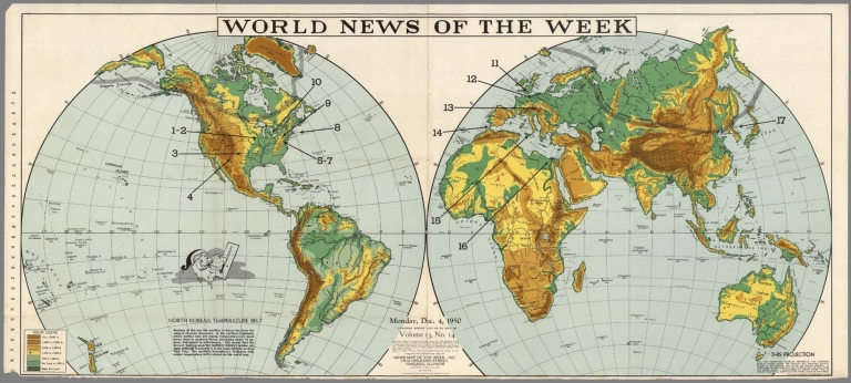
World News of the Week : Monday, Dec. 4, 1950. Covering period Nov. 24 to Nov. 30. Volume 13, No. 14. Published and copyrighted (weekly), 1950, by News Map of the Week, Inc., 1512 Orleans Street, Chicago, Illinois. Published in two sections : Section one. Base map copyrighted by Denoyer-Geppert Company.
List No
14214.000
Note
Lithographed world map in spherical western and eastern hemispheres, in color. Shows political boundaries and significant events from November 24 to 30, 1950. Relief illustrated with color codes, and hachures. Includes a legend indicating elevation, in feet. "This two-hemisphere globular projection has meridians equally spaced along the equator and parallels equally spaced at the periphery and along the central meridian. It overcomes the exaggeration (or reduction) of areas near the center which is encountered in certain other types of similar projections, emphasizes the spheric shape of the world." Also includes information on the "North Korean temperature belt" across the globe, with explanation. Map indexed according to historical notes beneath map. With two inset maps: Northeast lashed by winter storms -- United States : Cold and warm fronts ... Map is 49 x 115 cm (each hemisphere 49 x 57 cm), on sheet 89 x 120 cm, folded to 31 x 23 cm.
Author
[Denoyer-Geppert Company, News Map of the Week, Inc.]
Full Title
World News of the Week : Monday, Dec. 18, 1950. Covering period Dec. 8 to Dec. 14. Volume 13, No. 16. Published and copyrighted (weekly), 1950, by News Map of the Week, Inc., 1512 Orleans Street, Chicago, Illinois. Published in two sections : Section one. Lithographed in U. S. A. Semi-elliptical map projection used by permission of Denoyer-Geppert Company.
List No
14216.000
Note
Lithographed world map, in color. Shows political boundaries and significant events from December 8 to 14, 1950. Relief illustrated with hachures. "This semi-elliptical projection may be termed a compromise between the two-dimensional Mercator and the three-dimensional presentation of the globe. It reduces distortion in areas near the pole and maintains a close approximation of proportion in the land and sea areas ... " Includes information on iron ore, with explanation, as well as descriptive text throughout, e.g.: Australia : 2,500,000 tons. Map indexed according to historical notes beneath map. With inset map: (North Korea : Battleline Nov. 25; Battleline Dec. 2; Present battleline). Map is 47 x 115 cm, on sheet 89 x 120 cm, folded to 31 x 23 cm.
Author
News Map of the Week, Inc.
Full Title
World News of the Week. Monday, Dec. 4, 1950, covering period Nov. 24 to Nov. 30, Volume 13, No. 14. Published and copyrighted, 1950 by News Map of the Week, Inc. 1512 Orleans Street, Chicago, Illinois. Published in two sections. Section one. A member of the United Press Association. Base map copyrighted by Denoyer Geppert Company.
List No
8148.000
Note
Color lithograph map of double hemispheres. Depicts the North Korean Temperature Belt followed by a discussion of fighting. Includes notes on projection and text:"Single copy price when accompanied by cash $1.00". Shows countries and major cities. Relief shown by shadings and spot heights.
Author
Carlson, W.
Full Title
A Cartoon map of Fort Ord and its recreational facilities or "How to find the "P.X." Dreamed & drawn by W. PFCS. Carlson & Nelson of Panorama.
List No
9893.000
Note
Uncolored pictorial map Of Fort Ord Army Base, Monterey California. Date estimated. Artistic representation of local scenes and soldiers, cartoons depicting the lighter side of military life. Many aspects of military training are depicted, from military units, training to weaponry. Shows public buildings, roads, recreational facilities and activities around Fort Ord Reservation and Monterey Bay. Includes compass rose oriented with the north to the lower left margin.
1-16 of 16
|