|
REFINE
Browse All : Half Title Page
1-247 of 247
Author
[Spruner von Merz, Karl, 1803-1892, Menke, Theodor 1819-1892]
Full Title
(Half Title Page to) Dr. Karl von Spruner's Historisch-geographischer Hand-Atlas : erste abtheilung : Atlas antiquus. Sieben und Zwanzig in Kupfer gestochene colorirte Karten mit Vier und Sechzig Nebenkarten nebst erlauternden Vorbemerkungen. Atlas antiquus delineavit Dr. C. Spruner. XXVII tabulas coloribus illustratas et alias LXIV tabellas in margines illarum inclusas continens. Editio secunda. Gothae: Sumitibus Justi perthes. Anno MDCCCLV (1855). (half title page) (Cover title) Spruneri Atlas- Antiquus. XXVII Tab.
List No
11676.002
Author
[Bonner, Mary Graham, 1890-1974, Price, Luxor]
Full Title
(Half Title Page to) The Magic Map, by Mary Graham Bonner, Illustrated by Luxor Price. New York, the Macaulay Company. Copyright, 1927, by the Macaulay Company. Printed in the United States of America.
List No
11562.004
Note
First edition of "The Magic Map" 1927, written by Mary Graham Bonner, teaching concepts of geography as fascinating and as adventurous as travel and actual exploration. Illustrated by Luxor Price in his distinctive style of map making and yet are full of whimsical fun and fact. It introduced young people to the fun of learning geography by humanizing in his illustrations the Atlantic Ocean, Latitude & Longitude, Cape Horn, etc. Published by the Macaulay Company in New York. In 238 pages of descriptive text with imprint on verso of title page and 16 illustrations, printed in blue and black. Includes colorful frontispiece and dust jacket depicting North and South America as people between oceans filled with peculiar fish. Includes flap text on the inside front and back of the dust jacket. Bound in orange cloth hard cover boards with black lettering and illustrations on the front board and spine. Illustrated end paper in black, white, and aqua, signed by Luxor Price affixed to the front and back, with inscription dated Dec. 25, 1930 in the front.
Author
[Panckoucke, C. L. F. (Charles Louis Fleury), 1780-1844, France. Commission des sciences et arts d'Egypte]
Full Title
(Title page to) Description De L'Égypte.
List No
10404.002
Note
Antiquites I
Author
[Ulloa, Antonio de, 1716-1795, Juan, Jorge, 1713-1773]
Full Title
(Half Title Page to) Relacion historica del viage hecho de orden de S. Mag. a la America Meridional. Primera parte, Tomo primero.
List No
14378.003
Note
Half title page to the first volume of Relacion historica del viage hecho de orden de S. Mag. a la America Meridional. Title translates to: Historical relation of the voyage made by order of S. Mag. to South America.
Author
Montanus, Arnoldus, 1625-1683
Full Title
(Half Title Page to) Ambassades Memorables de la Compagnie des Indes Orientales des Provinces Unies, vers les empereurs du Japon. Contenant plusieurs choses remarquables arriveìes pendant le voyage des ambassadeurs ; et deplus, la description des villes, bourgs ... Le tout enrichi de figures ... & tireì des memoires des ambassadeurs de la Compagnie. A Amsterdam, Ches Jacob de Meurs, Merchand Librarire. M. DC. LXXX (1680).
List No
13390.002
Note
Part 1: Engraved frontispiece, title page.
Author
[Willard, Emma, Woodbridge, William C.]
Full Title
(Half title page to) Ancient Geography, As Connected with Chronology...
List No
10894.002
Author
[Grigorovich, Alexander S., Sautin, Ivan V., Ivanitsky, Ivan P., Podgornova, Valentina M., Lissitzky, Lazar M.]
Full Title
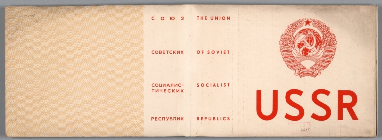
(Half title Page to) USSR. Soiuz Sovetskikh Sotsialisticheskikh Respublik = Union of Soviet Socialist Republics. Scientific Publishing Institute of Pictorial Statistics. USSR : An album illustrating the state organization and national economy of the U.S.S.R. Editors of the album: Ivan V. Sautin ; Ivan P. Ivanitsky. Compilors: Valentina M. Podgornova ; Valentine S. Iuniev ; Georgi N. Serebrebikov. Artists: Alexander S. Grigorovich ; Lazar M. Lisitsky ; Mikhail V. Nikolaev.
List No
13675.003
Note
Half title page in Russian and English. Includes state emblem of the Soviet Union.
Author
Tassin, Christophe Nicolas, 1660-1641
Full Title
(Half Title Page to) Prouinces contenues en ceste premiere partie : Picardie. Bretagne. Champagne Normandie. Isle de France Loraine, Brie. (to accompany) Les plans et profils de tovtes les principales villes et lievx considerables de France ... Par le Sieur Tassin. A Paris, M. DC. XXXVI (1636).
List No
13303.023
Note
Title page to the 1st. part.
Author
Tassin, Christophe Nicolas, 1660-1641
Full Title
(Half Title Page to) Plans et profilz des principalles villes de la province de Picardie : auec la carte generale & les particuliéres de chascun gouuernement d'icelles. (to accompany) Les plans et profils de tovtes les principales villes et lievx considerables de France ... Par le Sieur Tassin. A Paris, M. DC. XXXVI (1636).
List No
13303.025
Note
Title page to plans and views of Picardy.
Author
[Merian, Kasper, 1593-1650, Zeiller, Martin 1589-1661]
Full Title
(Half Title Page to) Topographia Galliae dat is eene algemeene en bysondere naukeurige landt en plaets beschrivinge, vant machtige Koninckrijck Vranckrijck ... Alles uyt de beste en beroemste soo oude als heedens daeghsche France als andere schryvers by een vergadert. Het eerste deel. Amsterdam : By de Weduw van Ioost Broersz en Casper Meriaen, 1660.
List No
13088.003
Note
Title page of the 1st. volume of Topographia Galliae. "t'Amsterdam, Gedruckt by de Weduwe van Wijlen Joost Broersz. en Caspar Merian, Anno 1660."
Author
Beron, Pierre, 1800-1871
Full Title
(Frontispiece) Atlas meteorologique : I. Atmospherologie ... II. Climatologie ... III. Magnetism Terrestre ... IV. Potamologie. Par Pierre Beron. Paris. Mallet - Bachelier , Gendre Et Successeur De Bachelier. 1860.
List No
11862.002
Note
First edition of Atlas Meteorologique, by Pierre Beron, to accompany Beron's "Text des explications des faits contenus dans l'atlas meteorologique ..." Atlas includes letterpress title page listing the contents, elaborate pictorial frontispiece "Cosmobiographie" and 11 full color chromolithographed plates, seven printed in blue and white. Plates showing a wide range of meteorological theories, including the origin of clouds and whirlwinds, lighting and thunder rain, heat wind, terrestrial magnetism, magnetic currents and origin of land and sea currents. Covers are half red leather marbled paper covered boards with title on spine is embossed with gilt.
Author
Coronelli, Vincenzo (1650-1718)
Full Title
(Half Title Page) Gli Argonauti.
List No
12186.006
Author
[Doppelmayr, Johann Gabriel, 1677-1750, Homann, Johann Baptist, 1663-1724]
Full Title
(Frontispiece and Half Title Page) Atlas Coelestis.
List No
12129.002
Author
Andreas, A. T. (Alfred Theodore), 1839-1900
Full Title
(Half Title Page to) A.T. Andreas' illustrated historical atlas of the State of Iowa. 1875. (7th Congressional District ed.). The Lakeside Press, Clark and Adams Streets, Chicago. (Published by the Andreas Atlas Co., Lakeside Building, Chicago, Ills. Engraved & printed by Chas. Shober & Co., Props. of Chicago Lithographing Co.)
List No
0018B
Note
Edition with views from the 7th Congressional District. Andreas made 9 separate editions of this atlas, one for each of the 9 Congressional Districts; each district ed. had special views of that district. See the reprint ed. by the Iowa Historical Society for a complete reproduction of all district views, as well as a discussion of the marketing technique in the preface. A second title page precedes the illustrated title page reading "A.T. Andreas' illustrated historical atlas of the State of Iowa. 1875. The Lakeside Press, Clark and Adams Streets, Chicago." Full color, both hand painted and printed. Bound in half leather embossed dark brown cloth covered boards with "Illustrated historical atlas of the State of Iowa 1875." in gilt; title is also blind stamped on the back cover. Not in Phillips Maps of America. Irregular paging.
Author
Burr, David H., 1803-1875
Full Title
(Half Title Page to) An atlas of the State of New York, containing a map of the State and of the several counties ... under the superintendance & direction of Simeon DeWitt, Surveyor General, pursuant to an Act of the Legislature, and also the physical geography of the State & of the several counties & statistical tables of the same, by David H. Burr. New York, published by David H. Burr. 1829. Engravd. by Rawdon, Clark & Co. Albany & Rawdon, Wright & Co., New York.
List No
0103B
Note
This atlas is the second atlas published in the 19th century of one of the individual states in the U.S., preceded only by Mill's Atlas of South Carolina, issued in 1825, and followed closely, also in 1829, by Greenleaf's Atlas of the State of Maine (Ristow, p96). This copy is the 1st edition, second state, actually published in 1832. Howard Welsh rescued this copy which was obviously about to be broken up and disbound. When we acquired it from his estate it was completely disbound; subsequently we had it rebound and restored. The Map of the City and County of New York is dated 2nd. ed., 1832 ; Haskell 725 lists this as appearing in the 1829 ed. of the Atlas. Therefore, we can presume that there are two 1829 eds., the first state with this map dated 1829 (Haskell 721) and the second state which is this copy with the 1832 map (Haskell 725). The Map of New York State is also dated 1832. All other maps are dated 1829. Full hand painted color. Bound in half leather marbled paper covered boards with "New York Atlas" stamped in gilt on the spine.
Author
Burr, David H., 1803-1875
Full Title
(Half Title Page) Atlas of the State of New-York.
List No
0105.003
Author
Colton, G.W.
Full Title
(Half Title Page to) Colton's Atlas Of The World, Illustrating Physical And Political Geography. By George W. Colton. Accompanied By Descriptions Geographical, Statistical, And Historical, By Richard Swainson Fisher, M.D. Complete In One Volume. New York: J.H. Colton And Company, No. 172 William, Corner Beekman Street. London: Trubner And Company, No. 12 Paternoster Row. 1856. Entered ... One Thousand Eight Hundred and Fifty-five, by J.H. Colton And Company ... New York.
List No
0149B
Note
This large one volume 1856 edition is scarcer than the two volume edition. Initially, Colton's atlas was published by subscription (see our subscribers salesman's book) and in parts, then in a two volume edition with the first volume (North and South America) issued in 1855 and the second volume (Europe, Asia, etc.)in 1856. This atlas was the first world atlas produced by Colton, after many years of issuing pocket maps, wall maps, guides, and maps for books. The atlas was one of the finest and most accurate of the period - it had a long publishing run, continuing for over thirty years (with the title changed to Colton's General Atlas after 1856). In this issue, the Texas map is single page, 2nd state. New Mexico and Utah 2nd state. Bound into quarter leather embossed brown cloth covered boards with "Colton's Atlas Of The World" and an illustration stamped in gold. The same title is stamped on the spine. Full color maps.
Author
[Dower, John, Higgins, W.M.]
Full Title
(Half Title Page) A General Descriptive Atlas Of The Earth.
List No
0247.003
Author
Humboldt, Alexander von, 1769-1859
Full Title
(Half Title Page to) Atlas Geographique Et Physique Du Royaume De La Nouvelle-Espagne, Fonde Sur Des Observations Astronomiques, Des Mesures Trigonometriques Et Des Nivellemens Barometriques. Par Al. De Humboldt. Paris, Chez F. Schoell, Rue Des Fosses-Saint-Germain-L'Auxerrois, No. 29. 1811. De L'Imprimerie De J.H. Stone.
List No
0328B
Note
With the stamp of Russian Imperial Library at Tsarkoe Selo above the half-title.
Author
Johnson, A.J.
Full Title
(Half Title Page to) Johnson's New Illustrated (Steel Plate) Family Atlas, With Physical Geography, And With Descriptions Geographical, Statistical, And Historical ... By Richard Swainson Fisher, M.D. ... Maps Compiled, Drawn, And Engraved Under The Supervision Of J.H. Colton And A.J. Johnson. New York: Johnson And Ward, Successors To Johnson And Browning (Successors To J.H. Colton And Company,) No. 113 Fulton Street. 1864. Entered ... One Thousand Eight Hundred and Sixty-four, by A.J. Johnson ... New York.
List No
0352.002
Note
Vignette title page reads "American Atlas" and is accompanied by an illustration of Indians on a bluff overlooking a river, steamboat, factory, town and homestead.
Author
Johnston, Alexander Keith, 1804-1871
Full Title
(Half Title Page to) The royal atlas of modern geography, exhibiting, in a series of entirely original and authentic maps, the present condition of geographical discovery and research in the several countries, empires, and states of the world by Alexander Keith Johnston ... With a special index to each map. William Blackwood and Sons, Edinburgh and London. MDCCCLXI.
List No
0373B
Note
First edition. This atlas was one of the best world atlases published in England in the second half of the 19th century. The North America map shows Colorado as a Territory - very up to date on U.S. political changes (most U.S. atlases do not show Colorado until 1862) for an English Atlas. Also shows Nevada, and a horizontal Arizona. However, the western U.S. map shows none of this -- its layout is pre-1860. Maps have a mixture of hand colored outline and printed blue color for water. Covers are half leather brown cloth covered boards with "Keith Johnston's royal atlas of modern geography" stamped in gilt on the cover, and "The Royal Atlas. Keith Johnston. W. Blackwood & Sons" on the spine.
Author
Johnston, Alexander Keith
Full Title
(Half Title to) The Royal Atlas Of Modern Geography Exhibiting, In A Series Of Entirely Original And Authentic Maps, The Present Condition Of Geographical Discovery And Research In The Several Countries, Empires, And States Of The World By Alexander Keith Johnston ... With A Special Index To Each Map. A New Edition. W.& A.K. Johnston, Edinburgh And London, MDCCCLXXIX.
List No
0377B
Author
[Johnston, Joseph E., Marcy, R. B., Simpson. James H., Whiting, W.H.C.]
Full Title
(Title Page to) Reports of the secretary of war, with reconnaissances of routes from San Antonio to El Paso, by Brevet Lt. Col. J. E. Johnston; Lieutenant W. F. Smith; Lieutenant F. T. Bryan; Lieutenant N. H. Michler; and Captain S. G. French, of Q'rmaster's dep't. Also, the report of Capt. R. B. Marcy's route from Fort Smith to Santa Fe; and the report of Lieut. J. H. Simpson of an expedition into the Navajo country; and the report of Lieutenant W. H. C. Whiting's reconnaissances of the western frontier of Texas. July 24, 1850. Washington: Printed at the Union Office. 1850. [Senate.] 31st Congress, 1st Session. Ex. Doc. No. 64.
List No
0380.003
Author
Larousse
Full Title
(Half Title Page) Atlas Larousse Illustre. 42 Cartes. - 1158 Reproductions photographiques.
List No
0418.002
Author
Martin de Moussy, V. (Victor), 1810-1869
Full Title
(Half Title Page to) Description geographique et statistique de la Confederation Argentine par V. Martin de Moussy ... Deuxieme edition atlas. Paris Librairie de Firmin Didot Freres, Fils et Cie. Imprimeurs de l'Institut, Rue Jacob, 56. 1873. Imprimerie Adolphe Laine, Rue des Saints-Peres, 19.
List No
0464B
Note
Lithographed decorative title page. Black and sepia. "Bachelier Lith. Gve. Sanier, del. Imp. Lemercier & Cie., Paris.
Author
Johnson, A.J.
Full Title
(Half Title Page to) Johnson's New Illustrated (Steel Plate) Family Atlas, With Physical Geography, And With Descriptions Geographical, Statistical, And Historical Including the Latest Federal Census, A Geographical Index, and a Chronological History of the Civil War in America. By Richard Swainson Fisher, M.D. ... Maps Compiled, Drawn, And Engraved Under The Supervision Of J.H. Colton And A.J. Johnson... New York: Johnson And Ward, Successors To Johnson And Browning Who Were (Successors To J.H. Colton And Company,) No. 113 Fulton Street. 1865. Entered ... One Thousand Eight Hundred and Sixty-four, by A.J. Johnson ... New York.
List No
0535.002
Note
Title on page reads "American Atlas" and is accompanied by an illustration of Indians on a bluff overlooking a river, steamboat, factory, town and homestead.
Author
[Petermann, Augustus., Milner, Thomas]
Full Title
(Half Title Page to) The Atlas Of Physical Geography: Constructed By Augustus Petermann, F.R.G.S. ... With Descriptive Letter-Press, Embracing A General View Of The Physical Phenomena Of The Globe. By The Rev. Thomas Milner, M.A., F.R.G.S. ... Illustrated by One Hundred and Thirty Vignettes on Wood. London: Wm. S. Orr And Co., Amen-Corner, Paternoster-Row. MDCCCL.
List No
0710.002
Author
Stanford, Edward
Full Title
(Half Title Page) London atlas of universal geography.
List No
0949.002
Author
[Touring club italiano, Funk & Wagnalls Company.]
Full Title
(Half Title Page to) Atlante internazionale del Touring club italiano. (3. ed.). Centosettanta tavole principali, centrotrenta carte parziali e di suiluppo. Opera redatta ed eseguita nell'Ufficio cartografico del T.C.I. sotto la direzione di L.V. Bertarelli, O. Marinelli, P. Corbellini. Milano: Touring club italiano. MDCCCCXXIX/VII.
List No
1012AB
Author
[Touring club italiano, Funk & Wagnalls Company.]
Full Title
(Text Page to) Atlante internazionale del Touring club italiano. (3. ed.). Centosettanta tavole principali, centrotrenta carte parziali e di suiluppo. Opera redatta ed eseguita nell'Ufficio cartografico del T.C.I. sotto la direzione di L.V. Bertarelli, O. Marinelli, P. Corbellini. Milano: Touring club italiano. MDCCCCXXIX/VII.
List No
1012AG
Note
Introduction (continued) with title page to "Indice delle tavole ..." on facing page.
Author
Lanciani, Rudolfo
Full Title
(Title page to) Forma Urbis Romae.
List No
10199.002
Author
Nicolosi, Giovanni Battista, 1610-1670
Full Title
(Half Title to) Hercole Di Gio. Battista Nicolosi.
List No
10254.002
Author
[Robert de Vaugondy, Didier, 1723-1786, Diderot, Denis]
Full Title
(Title page to) Recueil de planches, pour la nouvelle édition de dictionnaire raisonné des sciences, des arts et des métiers, avec leur explication. Tome Troisieme.
List No
10402.002
Author
[Gorkin, Aleksandr Fedorovich, Kutafʹev, S. A.]
Full Title
(Half Title Page to) Bolshoi Sovetskii Atlas Mira II : Proletarii vsekh stran soyedinyaytes'. Moskva 1939. Izdan po postanovleniyu Tsentralnogo Ispolnitelnogo kommiteta i Soveta Narodnikh Komissarov Soiuza SSR ot 17 Dekabri 1933 g. Glavnym Upravleniyem Geodezii i Kartografii pri SNK SSSR.
List No
11008.188
Note
Atlas issued by Narodnikh Komissarov Soiuza SSR and Glavnym Upravleniyem Geodezii i Kartografii pri SNK SSSR.
Author
[Gorkin, Aleksandr Fedorovich, Kutafʹev, S. A.]
Full Title
(Half Title Page to) Bolshoi Sovietskii Atlas Mira II : Proletarii vsekh stran soyedinyaytes'. Moskva 1939. Pod obshchei red. A. F. Gorkin; O. Y. Shmidta; A. N. Baranova; V. E. Motylev; I. V. Sautina; B. M. Shaposhnikova. Otvetstvennyi redaktor II Toma : S. A. Kytafev.
List No
11008.189
Note
Vol. 2 of atlas edited by A.F. Gorkin and S.A. Kutafev et al.
Author
Venezuela-British Guiana Boundary Commission
Full Title
(Half Title Page) Venezuelan Boundary Commission. Report and Accompanying Papers ... Volume 4. Atlas.
List No
1122.002
Note
Pasted in: 55th Congress, 2d Session, Senate Doc. No. 91, Part 4.
Author
Lohrmann, Wilhelm Gotthelf
Full Title
(Half Title Page to) Topographie der Sichtabaren Mondoberflache von William Gotthelf Lohrmann; Inspector Bei Der K.S. Cameral-Vermessung. Erste Abtheilung mit VI kupfertafeln. Auf kosten des Verfassers. Dresden bei Demselben. leipzig Bei Joh. friedr. Hartknoch. 1824. (cover title) Topographie der sichtbaren Mondoberflache. Erste Abtheilung.
List No
11245.003
Note
Half title. First edition lunar atlas with 6 copperplate engraved plates, of which 4 comprise sections of a moon map, by Lohrmann a professional cartographer and surveyor who undertook a lunar map based on his own micrometric measurements. Using a small Fraunhofer refractor, he determined the exact position of a number of control points on the moon, from which the positions of all other lunar features could be determined. He divided his map into twenty-four sections, and in 1824 he published the first four of these sections, along with an explanation of his methods. Although he worked for sixteen more years, and finished drawing all the sections, Lohrmann never did publish the remainder of the atlas. Fortunately, his great successor, Julius Schmidt, completed Lohrmann's atlas and published it in 1878. 'One of the most attractive features of Lohrmann's maps is the use of multiple levels of shading to indicate light and dark areas of the moon' (Ashworth). Includes hachures to indicate the length and steepness of the slopes of the various features and shadings to indicate the light and dark areas of the moo
Author
[Mazuyer, Gabriel, Lecomte, Georges (1867-1958), Boucher, Lucien (1889-1971)]
Full Title
(Half Title Page to) Les Etablissements Antoine Chiris dans le monde; Preface de Georges Lecomte de l'Academie Francaise; Texte historique de G. Mazuyer ; accompagne de 5 cartes illustrees de Lucien Boucher. Edite par les Etablissements Antoine Chiris, 1931.
List No
11452.003
Note
Atlas published by Antoine Chiris Establishments in Paris. With 4 pages of foreword by Georges Lecomte; 9 pages of historical text by G. Mazuyer and 5 accompanied maps illustrated by Lucien Boucher. Bound in paper covered boards with pictorial paste down label. Maps are in full color. On recto of title page: "Il a ete tire de cet ouvrage douze exemplaires sur japon imperial Exemplaire numerotes de I a XII, et mille exemplaires ... Exemplaire No. 329".
Author
[Valverde Alvarez, Emilio (1848-1894), Alfaro, J., Soler, A.]
Full Title
(Half Title page to) Atlas geografico descriptivo de la Peninsula Iberica, Islas Baleares, Canarias y posesiones espanolas de ultramar. Por el comandante graduado capitan de infanteria, Emilio Valverde y Alvarez. Ano 1880. 1a. Edicion. (Half title) Atlas geografico descriptivo de la Peninsula Iberica, Islas Baleares, Canarias y posesiones espanolas de ultramar. Descripcion general. Madrid: 1880. Lithografia e imprenta de la Biblioteca Universal.
List No
11468.002
Note
1st. edition, administrative and historical atlas of Iberian Peninsula, with 116 unnumbered plates, 6 pages of text, 60 sheets lithographic double page color maps with descriptive text, by Emilio Alvarez Valverde (Manila, 1848 - Leganes, 1894), military, cartographer, geographer and Spanish writer, author of travel guides. Bound in half leather embossed dark brown paper covered boards with title embossed in gilt on the front cove, and half title on the spin reads "Atlas Geografico. Emilio Valverde", also a decorative stamp with mapping instruments and globe on the back cover in gilt. It includes pictorial colored title page, a general map of Spain with the Philippine Islands, the Spanish possessions in the Gulf of Guinea, the Spanish Antilles, Ceuta, Melilla and the Canary Islands. Shows political and administrative boundaries, with a number indicating the population of the area next to the provincial capitals. Maps drawn by A. Soler and A. Alfaro, showing administrative boundaries, cities, villages, roads, landmarks, rivers and mountains.
Author
Lopez de Vargas Machuca, Tomas (1730-1802)
Full Title
(Half Title Page to) Atlas geografico de Espana : que comprende el mapa general de la peninsula, todos los particulares de nuestras provincias, y el del reyno de Portugal. por Don Tomas Lopez, geógrafo que fue de los dominios de S.M. e individuo de varias academias y sociedades. Tomo Primero. Ano 1810. Se hallara en Madrid, Calle de Atocha frente a la plazuela del Angel no. 1, y a la casa de los Gremios no. 3.
List No
11510.004
Note
Second edition of the geographic atlas of Spain, published in 1810, with half title page, 4 pages of index, contents and text. Comprising 38 maps on 98 sheets, Madrid (sheet 99) added later by owner, along with three other maps later removed. Some maps on multiple sheets. Maps dated 1765 - 1802. Contains the general map of the peninsula, all the provinces, and the kingdom of Portugal By Don Tomas Lopez. Maps are engraved outline hand colored, with decorative title cartouche, text and tables, showing administrative divisions, major cities, towns, villages, landmarks, public buildings, roads, rivers, canals and mountains. Bound in half leather marbled paper covers with title " Atlas geografico de Espana I” on spine in gilt. Relief shown pictorially. Don Tomas Lopez (1730-1802) a Spanish cartographer, began his studies at the Imperial College of the Spanish capital. In 1752 he went to continue his training in Paris to learn cartography with the great French mapmaker Jean Baptiste Bourguignon d'Anville (1697-1782). In Paris he was accompanied by, among others, Juan de la Cruz Cano y Olmedilla, Manuel Salvador Carmona and Alonso Cruzado. In 1804, Lopez published his “Atlas Geographic of Spain”, the first atlas of Spain that produced by a Spaniard. The children of Lopez reposted this work in a new edition in 1810 and again in 1830.
Author
[Sleigh, Bernard, Dent, Robert K., Ellis, I. A., Kynoch Press]
Full Title
(Half Title Page to) A picture map of the city of Birmingham in the year 1730. Imagined and designed by Bernard Sleigh from official records. Printed by the Kynoch Press A.D. 1924. and published by Cornish Bros. Limited 39 New Street. (Half title page) A picture map of the city of Birmingham in the year 1730. Imagined and designed by Bernard Sleigh; With an introductory note by Bernard Sleigh and historical notes by Robert K. Dent. (on verso) Printed and made in England at the Kynoch Press. (map) A picture map of Birmingham in 1730. Imagined & drawn from city records by Bernard Sleigh and lettered by I.A. Ellis. 1923.
List No
11558.003
Note
Pictorial panoramic map of the city of Birmingham 32x47, with 6 pages of introductory note and woodblock illustration of the old Crown Inn by Bernard Sleigh and historical note by Robert K. Dent, bound in blue paper cover boards with half leather spine. Map is in full color, with decorative borders. Showing Birmingham in 18th. Century, by B. Sleigh and lettered by I.A. Ellis, depicting buildings, landmarks, roads, rivers, and farms. Includes coat of arms and historical notes.
Author
[Zatta, Antonio, active 1757-1797, Zuliani, Giuliano, Novelli, Pietro Antonio, Pitteri, Giovanni Marco, Busching, Anton Friedrich]
Full Title
(Half Title Page to) Catalog delle carte gepgrafiche, et topografiche e dell Atlante Novossomo, stampate dalla calcografia di Antonio Zatta e figli, diviso in Tomi quatrro. (to accompany) Atlante novissimo Tomo I. Venezia. MDCCLXXIX (1779). Presso Antonio Zatta. Con privilegio dell Eccelimo Senato. (tomo I-IV).
List No
11598.006
Note
Volume 1 of Zatta's atlas in 4 volumes, dated MDCCLXXIX - MDCCLXXXIV (1779-1784). Bound in half leather marbled covered boards with "Atlante novissi. To. I . Venez, 1788 P.A. Zat." stamped in gold on spine.
Author
Canina, Luigi, 1795-1856
Full Title
(Half Title Page to) Indicazione topografica di Roma antica : distribuita nelle XIV regioni. dell'architetto Cav. Luigi Canina. Terza edizione. Roma dai tipi dello Stesso Canina 1841.
List No
11602.002
Note
3rd. edition of the topography of the ancient Rome, in 527 pages of the ancient architecture described and demonstrated with plans and views of monuments, by Luigi Canina, Italian architect and archeologist, who wanted to be continually updated with works which were both the latest archaeological discoveries of the nineteenth century and theories on the restoration and the depiction on the ancient monuments. Views are uncolored and decorated with ornaments and figures. Bound in brown hard covers with title "Canina Roma Antica" in gold on spine. Luigi Canina, an architect and archaeologist, born in Casale Monferrato on Oct. 23, 1795, died in Florence on October 17, 1856. He studied in Turin with Ferdinando Bonsignore.
Author
Pissis, Aime, 1812-1889
Full Title
(Half Title Page to) Geografia fisica de la Republica de Chile. Por A. Pissis. Miembro de la Universidad y Jefe de la Comision Topografica de Chile. Instituto Geografico de Paris, Ch. Delagrave, editor de la Sociedad Geografica, 1875. (with) Atlas de la geografia fisica de la Republica de Chile.
List No
11610.002
Note
1875 edition of Geografia fisica de la Republica de Chile, includes an atlas: Atlas de la Geografia fisica de la Republica de Chile. Text: 22 x14 in 536 pages (Page 356 incorrectly numbered 536), with "Pissis -- Geografia fisica de la Republica de Chile" on spine in gilt. In this work he describes in detail the Chilean terrain, comparing it with other South American countries. It also refers to geological formations and meteorology, details the hydrographic basins from Copiapo to Reloncavi, and finally, botanical geography and national fauna. On recto of title page: Corbeil. - Imprenta de Crete Hijo. Atlas: 31x44, includes index,14 sheets of views, some color, 1 table and 7 profiles, with title "Pissis -- "Atlas de la geografia fisica de la Republica de Chile" in gilt on spine. Both volumes bound in red hard covers with vignette of coat of arms of Chile on front cover. Pierre Joseph Aimé Pissis (in Spanish Pedro José Amadeo Pissis), was a French geologist who studied at the School of Mines, the Polytechnic and at the Museum of Natural History in Paris. He carried out geological and mineralogical works in Brazil and Bolivia, then he moved to Chile. In this work he spent 20 years, Between 1848 and 1868, toured the country, emphasizing his recognition of the Atacama Desert. In 1875 he published in Paris his most important work, Physical Geography of the Republic of Chile.
Author
[Thiers, Adolphe, 1797-1877, Dyonnet, Charles, Duvotenay, Jean Theodore Thunot]
Full Title
(Half Title Page to) Atlas des campagnes de la Revolution Francaise de A. Thiers : Dresse par Th. Duvotenay. Grave par Ch. Dyonnet. Paris: Furne, Jouvet et Cie, Editeurs.
List No
11637.002
Author
Nihon Shoin
Full Title
(Half Title Page to) The Atlas of Japan. Tokyo 1956.
List No
11674.002
Note
Atlas of Japan, consists of introduction, explanatory text, legend, table of contents and 164 maps, some on double sheets and index map. On half title page "The atlas of Japan" is stamped. Maps are in full color, showing geological and natural features, administrative divisions, principal cities, towns, seaports, rivers, hot springs, mountains, volcanoes, roads, railroads and forests. Includes elevation charts. The atlas is bound in half leather red paper covered boards with title on the front cover and on spine in gilt. Relief shown by hachures, gradient tints, contours and spot heights. Depths shown by isolines, soundings and bathymetric tints.
Author
Kiepert, Heinrich, 1818-1899
Full Title
(Half Title Page to) Topographisch-historischer Atlas von Hellas und den hellenischen Colonien : in 24 Blattern; unter Mitwirkung des Professors Carl Ritter bearbeitet von H. Kiepert. Berlin. In der Nicolaischen Buchhandlung. 1846.
List No
11692.002
Note
First edition of Topographical-historical Atlas of Greece and the Greek Colonies, with 24 maps, 6 pages of text, including 2 pages of forward by Prof. Carl Ritter inserted in, and 4 pages of explanatory text by H. Kiepert. Half title page pasted on inside front cover. Title page includes table of contents. Bound in half-calf and corners with marbled board covers. Maps are engraved by Delius, H., hand colored, showing political and administrative boundaries, cities, towns, villages, rivers, lakes, canals and mountains. Relief shown by hachures and spot heights. Heinrich Kiepert (1818-1899) is known as one of the most important scholarly cartographers of the second half of the 19th century. Ritter and Kiepert produced the topographical-historical Atlas of Hellas and the Hellenic Colonies in 24 sheets (1840-1846) plus several additional compilations of maps of the classical world. In 1845 he became a cartographer of the Bertuchian Geographical Institute in Weimar, and in 1852 he moved to Berlin in the same capacity at Dietrich Reimer. Kiepert contributed to Carl Ritters' work on maps of the General Geography (1852-54), and designed maps for the Berlin Society for Geography.
Author
Marmocchi, Francesco Constantino, 1805-1858
Full Title
(Half Title Page to) Atlante di geografia universale : preceduto da un vocabolario de nomi tecnici della geografia, corredato da specchi statistici delle divisioni politiche della terra, ed arricchito d'illustrazioni e di una bilancia politica del Globo per servire al corso di geografia universale. Di F.C. Marmocchi. Firenze : per Vincenzo Batelli e Compagni 1842.
List No
11713.002
Note
Marmocchi's Atlas of universal geography in 101 pages, consists of vocabulary of the technical terms in geography, statistical geography, political and administrative divisions, Globe Political Scale and Statistical Scale, 58 plates, including maps, views, cross-sections, and diagrams. The first part, Cosmography, The second, Physical Geography, subdivided as follows: Globes mappings, in different projections, different contours of the continents and the comparative height of the mountains and the length of river currents. Rose of the Winds and geography of the burning and extinct volcanoes. Maps are mostly hand colored, some plates folded, dated 1832-1846. Engraved in copper and finished in color. Showing political and administrative divisions, cities, towns, roads, railroads, rivers and mountains. Relief shown by hachures and pictorially. Some maps include title cartouche, the national flags and coat of arms. Bound in half leather, with title "Atlante" on spine in gilt. Marmocchi was an Italian geographer, cartographer and patriot, born in Poggibonsi in 1805, died in 1858. He studied natural sciences, especially geography. In 1829 he published the first of his many works "The animal kingdom described according to the observations of the most famous naturalists". He dedicate himself to his discipline, attending the GS Vieusseux Cabinet in Florence and creating a Universal Geography Course developed in one hundred lessons, reissued several times. In 1847 he directed the weekly Florentine Sabatino and later collaborated with the Florentine newspaper L'Alba. In 1848 he became deputy in the Tuscan Parliament, and then held the office of Secretary of the Interior under Guerrazzi. He was one of the pioneers to design an interesting planisphere with fossils of vertebrates and invertebrates. His works cover all aspects of "sciences": geography, archeology, history, paleontology, economics, public and private law, commerce, finance and merchant science.
Author
Bartholomew, John, 1831-1893
Full Title
(Half Title Page to) A descriptive hand atlas of the world. By J. Bartholomew, F.R.G.S. A. Fullarton & Co., London and Edinburgh.
List No
11730.135
Note
Decorative pictorial title page in Part 15.
Author
[Michelot, Auguste Jean Charles, 1792-1854, Meissas, Achille, 1799-1874]
Full Title
(Half Title Page to) Petit atlas de geographie du moyen age et des principales epoques des temps modernes: pour servir a l'histoire de l'Europe depuis l'invasion des barbares jusqu'a nos jours. Par MM. A. Meissas et Michelot. Adoptes par l'universite. (10 cartes, precedees de notices historiques) Paris, chez les Auteurs, et chez L. Hachette, Libraire de l'Universite Royale de France, 1842.
List No
11731.002
Author
[Meissas, Achille, 1799-187, Michelot, Auguste Jean Charles, 1792-1854]
Full Title
(Half Title Page to) Petit atlas universel de geographie Ancienne du Moyen Age et Moderne et de geographie sacree par MM. Achille Meissas et Auguste Michelot ... Paris, chez L. Lachette et Cie.
List No
11740.002
Author
Estevanez, Nicolas, 1838-1914
Full Title
(Half Title Page to) Atlas geografico de America : comprende los mapas de la America del sur, Republica Argentina, Uruguay, Paraguay, Chile, Bolivia, Brasil, Peru, Colombia y Ecuador, Venezuela, America Central (Guatemala, San Salvador, Honduras, Nicaragua y Costa Rica), Antillas, Isla de Cuba, Isla de Santo Domingo, America del Norte, Mejico y Estados Unidos ... Por N. Estevanez. Paris : Libreria de Garnier Hermanos. 1885.
List No
11936.002
Note
Atlas of America, 24 pages of text and 17 color maps. Engraved by E. Guillot. Printed by Dufrenoy (Firm) and published by Garnier Freres. Maps printed on single or double page, showing political and administrative boundaries, capitals, cities, towns, rivers, roads and railways. Relief shown by hachures and shadings. Includes index and table of contents. Bound in half leather hard cover beige paper with title "Atlas de America" in gilt on spine and pictorial back cover.
Author
Mendes, Candido, 1818-1881
Full Title
(Half Title Page to) Atlas do imperio do Brazil : comprehendendo as respectivas divisoes administrativas, ecclesiasticas, eleitoraes e judiciarias dedicado a sua Magestade o Imperador o Senhor D. Pedro II : destinado a instrucçao publica no imperio com especialidade a dos alumnos do Imperial Collegio de Pedro II. Organisado por Candido Mendes de Almeida. Rio de Janeiro : Lithographia do Instituto Philomathico. 1868.
List No
11946.002
Note
This is the first atlas of Brazil and a landmark of Brazilian cartography, by Candido Mendes. It served as the basis for later works. Consists of 24 maps of the provinces of the time and its regions, and 36 pages of descriptive text to portray the border issues in Brazil, the geographical information, it includes statistics of the Brazilian population, and various administrative, electoral and ecclesiastical data. Maps are colored, showing provinces, capitals, cities, villages, military bases, parishes, rivers and mountains. Relief shown by hachures. Covers are tan paper covered boards. Some maps include compass rose, and penciled notation.
Author
[Far Eastern Geographical Establishment, Dingle, John Edwin]
Full Title
(Half Title Page) The New Atlas and Commercial Gazetteer of China.
List No
12042.002
Note
Also in Chinese.
Author
[Weiss, Pierre, Boucher, Lucien]
Full Title
(Half Title Page) Trans-Atlantic.
List No
12054.002
Note
Includes presentation text.
Author
[Lancaster (Tennant), Lilian, 1852-1939, Harvey, William (pseudonym "Aleph") 1796-1873]
Full Title
(Half Title Page) Geographical Fun: Being Humourous Outlines of Various Countries.
List No
12069.002
Note
The plates in this volume are based on pictures drawn by Lilian Lancaster in her fifteenth year to amuse and entertain her sick brother. Lilian had a very successful stage career but eventually returned to illustration under her married name, L. Tennant. She illustrated the 1912 volume "Stories of Old" by E.L. Hoskyn, see Pub List No. 12068.000.
Author
[Mentelle, Edme, 1730-1815, Malte-Brun, Conrad, 1775-1826, Poirson, J.B.]
Full Title
(Half Title Page) Atlas de la Geographie, Mathematique, Physique et Politique de Toutes les Parties du Monde.
List No
12100.002
Note
An atlas of 45 maps with numerous unusual additional maps from various sources and dates bound in. Additional maps have pages numbers labeled "... bis ...". Most have outline color. 1804 assigned to any undated sheet. Relief shown by sketches.
Author
[Humboldt, Alexander von, 1769-1859, Bonpland, Aime]
Full Title
(Half Title Page) Voyage de Humboldt et Bonpland. Premiere Partie. Relation Historique. Atlas Geographique et Physique.
List No
12125.002
Author
[Humboldt, Alexander von, 1769-1859, Bonpland, Aime]
Full Title
(Half Title Page) Atlas Geographique et Physique de Nouveau Continent.
List No
12125.014
Author
[Humboldt, Alexander von, 1769-1859, Bonpland, Aime]
Full Title
(Half Title Page) Atlas Geographique et Physique de Nouveau Continent.
List No
12125.017
Author
Ball, Robert Stawell
Full Title
(Half Title Page) An Atlas of Astronomy.
List No
12131.002
Author
Coronelli, Vincenzo (1650-1718)
Full Title
(Half Title Page) Gli Argonauti, In Venetia, 1693.
List No
12186.002
Note
This is the first atlas volume of the Atlante Veneto. "The Atlante Veneto (1690-1701) was a comprehensive atlas published by the Franciscan geographer Vincenzo Maria Coronelli and intended as a continuation of the Blaeu Atlas Maior. This monumental work was published in thirteen folios and provided a wealth of detail covering ancient and modern cartographers and geographers, together with astronomical and historical data. These maps were engraved in a bold style and printed on fine white paper, the more important ones spread over two sheets, allowing for great detail. The first part comprises an introduction to geography with engravings of globes, wind roses, and cosmographic systems through the ages from Ptolemy, Copernicus and Tycho Brahe to Descartes. The second part deals exclusively with the earth, starting with a map by Ptolemy, and two modern maps, each covering a hemisphere, followed by two double-page maps of Europe, Asia, Africa, North and South America, ending with maps of the North and South Pole. The third part deals with hydrography - the oceans, rivers, lakes and deltas. Here are to be found maps of the Pacific and Atlantic Oceans, the Bosporus, Gulf of Venice and rivers such as the Niger River, Amazon River, Rhine, Danube, and Volga. The final part describes the ships that explored these waters.Black and white. Relief shown by sketches." (Wikipedia).
Author
Coronelli, Vincenzo (1650-1718)
Full Title
(Half Title Page) Atlante Veneto.
List No
12186.003
Author
[Behaim, Martin, 1459-1507, Ravenstein, Ernest George, 1834-1913]
Full Title
(Half Title Page) Martin Behaim, his Life and his Globe.
List No
12237.002
Author
Auldjo, John (1805-1886)
Full Title
(Half Title Page) London: Printed by A. & R. Spottiswoode.
List No
12242.004
Author
[Bartholomew, J.G., Clarke, W. Eagle, Grimshaw, Percy H.]
Full Title
(Half Title Page) Physical Atlas, Volume V.
List No
12429.002
Author
[Bartholomew, J.G., Herbertson, A.J., Buchan, Alexander]
Full Title
(Half Title Page) Physical Atlas. Volume III.
List No
12430.003
Author
[Alphand, Adolphe, Le Vayer, Paul, Petre, Augustin]
Full Title
(Half Title Page) Atlas des Anciens Plans de Paris.
List No
12431.002
Author
Maire, N.M.
Full Title
(Half Title Page) Atlas Administratif de Paris.
List No
12433.002
Author
Du Val, Pierre, 1619-1683
Full Title
(Half Title Page) La Geographie du Temps. M.DC.LXXXII. Par P. Du-Val, Geographe Ordinaire du Roy.
List No
12503.003
Author
[Ministere des Travaux Publics, Cheysson, Émile]
Full Title
(Half Title) Album de Statistique Graphique.
List No
12510.002
Author
[Ministere des Travaux Publics, Cheysson, Émile]
Full Title
(Half Title) Album de Statistique Graphique.
List No
12511.002
Author
[Ministere des Travaux Publics, Cheysson, Émile]
Full Title
(Half Title Page) Album de Statistique Graphique.
List No
12512.002
Author
[Ministere des Travaux Publics, Cheysson, Émile]
Full Title
(Half Title Page) Album de Statistique Graphique.
List No
12513.002
Author
[Ministere des Travaux Publics, Cheysson, Émile]
Full Title
(Half Title) Album de Statistique Graphique.
List No
12514.002
Author
[Cheysson, Émile, Ministere des Travaux Publics]
Full Title
(Half Title Page) Album de Statistique Graphique.
List No
12515.002
Author
[Ministere des Travaux Publics, Cheysson, Émile]
Full Title
(Half Title Page) Album de Statistique Graphique.
List No
12516.002
Author
[Ministere des Travaux Publics, Cheysson, Émile]
Full Title
(Half Title) Album de Statistique Graphique.
List No
12517.002
Author
[Ministere des Travaux Publics, Cheysson, Émile]
Full Title
(Half Title) Album de Statistique Graphique.
List No
12518.002
Author
[Ministere des Travaux Publics, Cheysson, Émile]
Full Title
(Half Title Page) Album de Statistique Graphique.
List No
12519.002
Author
[Ministere des Travaux Publics, Cheysson, Émile]
Full Title
(Half Title Page) Album de Statistique Graphique.
List No
12520.002
Author
[Ministere des Travaux Publics, Cheysson, Émile]
Full Title
(Half Title Page) Album de Statistique Graphique.
List No
12521.002
Author
[Ministere des Travaux Publics, Cheysson, Émile]
Full Title
(Half Title Page) Album de Statistique Graphique.
List No
12522.002
Author
[Ministere des Travaux Publics, Cheysson, Émile]
Full Title
(Half Title Page) Album de Statistique Graphique.
List No
12523.002
Author
[Ministere des Travaux Publics, Cheysson, Émile]
Full Title
(Half Title Page) Album de Statistique Graphique.
List No
12524.002
Author
[Ministere des Travaux Publics, Cheysson, Émile]
Full Title
(Half Title Page) Album de Statistique Graphique.
List No
12525.002
Author
[Ministere des Travaux Publics, Cheysson, Émile]
Full Title
(Half Title Page) Album de Statistique Graphique.
List No
12526.002
Author
[Selves, Henry Antoine Auguste, France. Conseil Royal de l'instruction publique]
Full Title
(Half Title Page to) Atlas geographique dresse sous la direction du Conseil Royal de l'instruction publique pour l'usage des colleges. Ouvrage adopte pour l'enseignement public. 3eme partie, Geographie moderne actuelle. A Paris : Imprimerie de Selves fils, lithographe de l'Universite. 1823.
List No
13006.002
Author
Maire, Nicolas M.
Full Title
(Half Title Page to) La topographie de Paris, ou, Plan detaille de la ville de Paris et de ses faubourgs : compose de vingt feuilles, d'un tableau d'assemblage, et d'une table alphabetique et statistique des rues, ruelles, culs-de-sac, passages, quais, places, carres, carrefours ... : compose de vingt feuilles, d'un tableau d'assemblage, et d'une table alphabetique et statistique ... Dediee a Mme Maret, ... Par Maire. A Paris, Chez l'Auteur, rue de Tournon, no 7 : Et chez les principaux libraires. M DCCC VIII (1808).
List No
13045.002
Author
Perrot, Aristide Michel, 1793-1879
Full Title
(Half Title Page to) Petit atlas pittoresque des quarante-huit quartiers de la ville de Paris; Par A. M. Perrot, Engenieur. A Paris, Chez E. Garnot, Libraire, Rue Pavee Saint-Andre des Arcs,No. 7. 1834.
List No
13046.004
Author
Minard, Charles Joseph, 1781-1870
Full Title
(Half Title Page to) Cours de construction des ouvrages qui etablissent la navigation des rivieres et des canaux, professe a l'Ecole des Ponts et Chaussees de 1832 a 1841. Par M. Minard. Paris. Carilian-Goeury et Vor Dalmont, Editeurs. 1841.
List No
13057.002
Author
Minard, Charles Joseph, 1781-1870
Full Title
(Half Title Page to) Cours de construction des ouvrages qui etablissent la navigation des rivieres et des canaux, professe a l'Ecole des Ponts et Chaussees de 1832 a 1841. Par M. Minard. Paris. Carilian-Goeury et Vor Dalmont, Editeurs. 1841.
List No
13057.020
Author
France. Ministere de l'agriculture
Full Title
(Half Title Page to) Ministere de l'Agriculture. Album de statistique agricole : resultats generaux de l'enqute de annale de 1882. Nancy : Imprimerie Administrative Berger-Levrault, M DCCCLXXXVII (1887).
List No
13085.002
Author
[Vincey, Paul, France. Ministere de l'Agriculture]
Full Title
(Half Title Page to) Ministere de l'agriculture. Prefecture de la Seine. Album de statistique agricole et carte agronomique du departement de la Seine : resultats generaux de l'enquete decennale de 1892, revisee en 1894 par M. Paul Vincey ... 1897.
List No
13087.002
Note
Atlas of agricultural, statistics and agronomic maps, the results of the decennial survey in 1892, revised in 1894 by Paul Vincey. Published in 1897 by Ministere de l'Agriculture, Departement de la Seine. Atlas contains 15 folded agronomic maps and tables, with descriptive text. Introduction text by Paul Vincey.
Author
[Merian, Kasper, 1593-1650, Zeiller, Martin 1589-1661]
Full Title
(Half Title Page to) Topographia Galliae dat is eene algemeene en bysondere naukeurige lant en plaets beschrivinge, vant machtige Koninckrijck Vranckrijck ... Het tweede deel. Amsterdam : By de Weduw van Joost Broersz en Casper Meriaen, Anno 1661.
List No
13088.123
Note
Title page of the 2nd. volume of Topographia Galliae. "t'Amsterdam, Gedruckt by de Weduwe van Wijlen Joost Broersz. en Caspar Merian, Anno 1661."
Author
[Merian, Kasper, 1593-1650, Zeiller, Martin 1589-1661]
Full Title
(Half Title Page to) Topographia Galliae dat is eene algemeene en bysondere naukeurige landt en plaets beschrivinge, vant machtige Koninckrijck Vranckrijck ...Derde deel. T. Amsterdam : By Casper Meriaen, en Broer en Ian I. Appelaer. Ao. 1662.
List No
13088.233
Note
Title page of the 3rd. volume of Topographia Galliae. "T'Amsterdam. Gedruckt by Casper Meriaen en Broer en Jan Joosten Appelaer, boeck-verkoopers inde ... Anno 1662."
Author
[Merian, Kasper, 1593-1650, Zeiller, Martin 1589-1661]
Full Title
(Half Title Page to) Topographia Galliae dat is eene algemeene en bysondere naukeurige landt en plaets beschrivinge, vant machtige Koninckrijck Vranckrijck ... t'Vierde en Laeste Deel. T'Amsterdam : By Casper Meriaen, en Broer en Ian I. Appelaer. Ao. 1663.
List No
13088.291
Note
Title page of the 4th. and last volume of Topographia Galliae. "t'Amsterdam, Gedruckt by Casper Meriaen, en Broer en Jan Appelaar. Anno. 1663."
Author
Muassasah i Jughrafiay i va Kartugrafi i Sahab
Full Title
(Half Title Page to) Fasl-i aval : Enqelab-e Sefid-e Iran = Chapter 1 : Iran : white revolution. (to accompany) Atlas of Iran : white revolution = Atlas-i Enqelab-e Sefid-e Iran. Third revised edition. Sahab Geographic & Drafting Institute, Tehran, Iran.
List No
13114.013
Note
1st. chapter of the White Revolution. On recto includes summary of the series of reforms in Iran, in Persian.
Author
Muassasah i Jughrafiay i va Kartugrafi i Sahab
Full Title
(Half Title Page to) Eslahat-e Arzi = Land reform and the abolition of the peasant - landlord, tenure - system. (to accompany) Atlas of Iran : white revolution = Atlas-i Enqelab-e Sefid-e Iran. Third revised edition. Sahab Geographic & Drafting Institute, Tehran, Iran.
List No
13114.015
Note
Land reform.
Author
Muassasah i Jughrafiay i va Kartugrafi i Sahab
Full Title
(Half Title Page to) Melli kardan Jangalha va Marate = Nationalization of forests and pastures. (to accompany) Atlas of Iran : white revolution = Atlas-i Enqelab-e Sefid-e Iran. Third revised edition. Sahab Geographic & Drafting Institute, Tehran, Iran.
List No
13114.025
Note
The public ownership of all forest lands.
Author
Muassasah i Jughrafiay i va Kartugrafi i Sahab
Full Title
(Half Title Page to) Forush-e saham karkhanehaye doulati = Sale of shares in government factories to landlords ... (to accompany) Atlas of Iran : white revolution = Atlas-i Enqelab-e Sefid-e Iran. Third revised edition. Sahab Geographic & Drafting Institute, Tehran, Iran.
List No
13114.031
Note
Incentives to increase labor productivity by means of profit sharing.
Author
Muassasah i Jughrafiay i va Kartugrafi i Sahab
Full Title
(Half Title Page to) Eslah-e Ghanoon-e Entekhabat ... = The amendment of the electoral law and equal rights for women. (to accompany) Atlas of Iran : white revolution = Atlas-i Enqelab-e Sefid-e Iran. Third revised edition. Sahab Geographic & Drafting Institute, Tehran, Iran.
List No
13114.036
Note
The amendment of the electoral law.
Author
Muassasah i Jughrafiay i va Kartugrafi i Sahab
Full Title
(Half Title Page to) Sepah e Behdasht = Health Corps. (to accompany) Atlas of Iran : white revolution = Atlas-i Enqelab-e Sefid-e Iran. Sahab G. D. I.
List No
13114.049
Note
The formation of the Health Corps.
Author
Muassasah i Jughrafiay i va Kartugrafi i Sahab
Full Title
(Half Title Page to) Sepah e Tarveej va Apadani = Reconstruction and Development Corps. (to accompany) Atlas of Iran : white revolution = Atlas-i Enqelab-e Sefid-e Iran. Sahab G. D. I.
List No
13114.054
Note
Reconstruction and Development Corps.
Author
Muassasah i Jughrafiay i va Kartugrafi i Sahab
Full Title
(Half Title Page to) Khanehaye-Ensaf = Houses of Justice (Houses of equality). (to accompany) Atlas of Iran : white revolution = Atlas-i Enqelab-e Sefid-e Iran. Sahab G. D. I.
List No
13114.057
Note
Houses of Justice.
Author
Muassasah i Jughrafiay i va Kartugrafi i Sahab
Full Title
(Half Title Page to) Melli kardan e abha = Nationalization of water resources. (to accompany) Atlas of Iran : white revolution = Atlas-i Enqelab-e Sefid-e Iran. Sahab G. D. I.
List No
13114.060
Note
Nationalization of water resources.
Author
Muassasah i Jughrafiay i va Kartugrafi i Sahab
Full Title
(Half Title Page to) Noshazi kishvar = Urban & rural reconstruction : Enghlabe edari va amoozeshi = Administrative and educational reforms. (to accompany) Atlas of Iran : white revolution = Atlas-i Enqelab-e Sefid-e Iran. Sahab G. D. I.
List No
13114.065
Note
Reconstruction and Administrative and educational reforms.
Author
Muassasah i Jughrafiay i va Kartugrafi i Sahab
Full Title
(Half Title Page to) Fasle dovom : Pishraft haye Iran = Chapter II : Iran achievements. (to accompany) Atlas of Iran : white revolution = Atlas-i Enqelab-e Sefid-e Iran. Sahab G. D. I.
List No
13114.072
Note
Chapter II : Iran achievements
Author
Muassasah i Jughrafiay i va Kartugrafi i Sahab
Full Title
(Half Title Page to) Amoozesh va parvaresh = Education. (to accompany) Atlas of Iran : white revolution = Atlas-i Enqelab-e Sefid-e Iran. Sahab G. D. I.
List No
13114.079
Note
Education in Iran.
Author
Muassasah i Jughrafiay i va Kartugrafi i Sahab
Full Title
(Half Title Page) Keshavarzi = Agriculture. (to accompany) Atlas of Iran : white revolution = Atlas-i Enqelab-e Sefid-e Iran. Sahab G. D. I.
List No
13114.091
Note
Agriculture
Author
Muassasah i Jughrafiay i va Kartugrafi i Sahab
Full Title
(Half Title Page to) Behdasht = Health. (to accompany) Atlas of Iran : white revolution = Atlas-i Enqelab-e Sefid-e Iran. Sahab G. D. I.
List No
13114.123
Note
Health.
Author
Muassasah i Jughrafiay i va Kartugrafi i Sahab
Full Title
(Half Title Page to) Sanate naft = Oil industry. (to accompany) Atlas of Iran : white revolution = Atlas-i Enqelab-e Sefid-e Iran. Sahab G. D. I.
List No
13114.146
Note
Oil industry.
Author
[Ministere des Travaux Publics, Cheysson, Émile]
Full Title
(Half Title Page to) Ministere des Travaux Publics. Album de Statistique Graphique. De 1897-1899. Paris. Imprimerie Nationale. MDCCCC (1900).
List No
13188.002
Author
[Lapie, Pierre, M. 1779-1850, Lapie, Alexandre Emile]
Full Title
(Half Title Page to) Atlas Universel de Geographie ancienne et moderne, predede d'un Abrege de Geographie physique et historique, par M. Lapie ... et M. Lapie fils ... Paris : P. C. Lehuby, Libtaire-Editeur, 1851.
List No
13244.002
Author
[Chatelain Henri, 1684-1743, Gueudeville, Nicolas]
Full Title
(Half Title Page to) Suplement a l'Atlas historique, contenant diverses pieces de chronologie, de genealogie, d'histoire et d'autres sciences, qui avoient été omises dans les precedens volumes ... Mr. C.*** ; avec des dissertations sur chaque sujet, par Mr. H.P. de Limiers Docteur en droit. Tome VII. & dernier. (to accompany) Atlas Historique ... A Amsterdam, chez L'Honore & Chatelain Libraires. M DCC XX (1720).
List No
13272.755
Note
Title page to volume 7 of 7 volumes of Historical atlas by Henri Abraham Chatelain.
Author
Tassin, Christophe Nicolas, 1660-1641
Full Title
(Half Title Page) Plans et prorilz [sic] des principales villes de la province de Champagne, , avec la carte generale & les particulieres de chascun gouverneme[n]t d'icelles. (to accompany) Les plans et profils de tovtes les principales villes et lievx considerables de France ... Par le Sieur Tassin. A Paris, M. DC. XXXVI (1636).
List No
13303.071
Note
Title page to plans and views of Champagne Region.
Author
Tassin, Christophe Nicolas, 1660-1641
Full Title
(Half Title Page to) Plans et profilz des principales villes du Duche de Lorraine et Bar : avec la carte generale et les particulieres de chascun gouvernement dicette. (to accompany) Les plans et profils de tovtes les principales villes et lievx considerables de France ... Par le Sieur Tassin. A Paris, M. DC. XXXVI (1636).
List No
13303.127
Note
Title page to the plans and views of the Duchy of Lorraine and Bar. Plate: 1.
Author
Tassin, Christophe Nicolas, 1660-1641
Full Title
(Half Title Page to) Plans et profilz des principales villes de la province de Bretaigne : avec la carte generale et les particulieres de chascun gouvernement dicette. (to accompany) Les plans et profils de tovtes les principales villes et lievx considerables de France ... Par le Sieur Tassin. A Paris, M. DC. XXXVI (1636).
List No
13303.154
Note
Title page to plans and views of major cities in Bretaigne province. Plate 1.
Author
Tassin, Christophe Nicolas, 1660-1641
Full Title
(Half Title Page to) Plans et profilz des pri[n]cipales villes de la province de Normandie : avec la carte generale et les particulieres de chascun gouvernement d'icelles. (to accompany) Les plans et profils de tovtes les principales villes et lievx considerables de France ... Par le Sieur Tassin. A Paris, M. DC. XXXVI (1636).
List No
13303.182
Note
Title page to plans and views of major cities in Normandy. Plate 1.
Author
Tassin, Christophe Nicolas, 1660-1641
Full Title
(Half Title Page to) Plans et profilz des principales villes de la province de l' Isle de France : avec la carte generale et les particulieres de chascun gouvernement d'icelles. (to accompany) Les plans et profils de tovtes les principales villes et lievx considerables de France ... Par le Sieur Tassin. A Paris, M. DC. XXXVI (1636).
List No
13303.209
Note
Title page to plans and views of major cities in Ile de France. Plate 1.
Author
Tassin, Christophe Nicolas, 1660-1641
Full Title
(Half Title Page to) Plan et profilz des principales villes de la province de Brie : avec la carte generale & les particulieres de chascun gouverneme[n]t d'icelles. (to accompany) Les plans et profils de tovtes les principales villes et lievx considerables de France ... Par le Sieur Tassin. A Paris, M. DC. XXXVI (1636).
List No
13303.227
Note
Title page to plans and views of major cities in Brie region, France.
Author
Tassin, Christophe Nicolas, 1660-1641
Full Title
(Half Title Page to) Les plans et profils de tovtes les principales villes et lievx considerables de France. Ensemble les cartes generales de chacune prouince : & les particulieres de chaque gouuernement d'icelles. Par le Sieur Tassin, geographe ordinaire de le Majeste. Seconde partie. chez Melchior Tavernier, en l'isle du palais sur le quay qui regarde la megisserie, a la Sphere Royale M. DC. XXXVI (1636). Avec Privilege du Roy.
List No
13303.244
Note
Title page to the 2nd. part.
Author
Tassin, Christophe Nicolas, 1660-1641
Full Title
(Half Title Page to) Prouinces contenues en ceste seconde partie: Bourgogne, Dauphine, Prouence, Cotat et Oranges, Languedoc, Guyenne, Poictou, Riviere de Loire, Beauce & Gastinois. (to accompany) Les plans et profils de tovtes les principales villes et lievx considerables de France. Par le Sieur Tassin. Seconde partie. chez Melchior Tavernier. M. DC. XXXVI (1636).
List No
13303.267
Note
Title to France provinces. 2nd. part.
Author
Tassin, Christophe Nicolas, 1660-1641
Full Title
(Half Title Page to) Plans et profilz des principales villes de la prouince de Bovrgongne : auec la carte generale & les particulieres de chascun gouuernement d'icelles. (to accompany) Les plans et profils de tovtes les principales villes et lievx considerables de France. Par le Sieur Tassin. Seconde partie. chez Melchior Tavernier. M. DC. XXXVI (1636).
List No
13303.269
Note
Title page to the major cities and villages in Burgundy.
Author
Tassin, Christophe Nicolas, 1660-1641
Full Title
(Half Title Page) Plans et profilz des principales villes de la prouince de Davphine : auec la carte generale & les particulieres de chascun gouuernement d'icelles. (to accompany) Les plans et profils de tovtes les principales villes et lievx considerables de France. Par le Sieur Tassin. Seconde partie. chez Melchior Tavernier. M. DC. XXXVI (1636).
List No
13303.290
Note
Title page to the major cities and villages in Dauphine province.
Author
Tassin, Christophe Nicolas, 1660-1641
Full Title
(Half Title Page to) Principavte d'Oranges & contat de Venaissin. (to accompany) Les plans et profils de tovtes les principales villes et lievx considerables de France. Par le Sieur Tassin. Seconde partie. chez Melchior Tavernier. M. DC. XXXVI (1636).
List No
13303.330
Note
Title Page to Orange Principality and Comtat Venaissin, France. Plate 1.
Author
Tassin, Christophe Nicolas, 1660-1641
Full Title
(Half Title Page to) Plans et profilz des principales villes de la prouince de Provence : auec la carte generale & les particulieres de chascun gouuernement d'icelles. (to accompany) Les plans et profils de tovtes les principales villes et lievx considerables de France. Par le Sieur Tassin. Seconde partie. chez Melchior Tavernier. M. DC. XXXVI (1636).
List No
13303.335
Note
Title page to the major cities and villages in Provence region in southeastern France. Plate 1.
Author
Tassin, Christophe Nicolas, 1660-1641
Full Title
(Half Title Page to) Plans et profilz des principales villes de la prouince de Langvedoc : auec la carte generale & les particulieres de chascun gouuernement d'icelles. (to accompany) Les plans et profils de tovtes les principales villes et lievx considerables de France. Par le Sieur Tassin. Seconde partie. chez Melchior Tavernier. M. DC. XXXVI (1636).
List No
13303.354
Note
Title page to the major cities and villages in Languedoc region.
Author
Tassin, Christophe Nicolas, 1660-1641
Full Title
(Half Title Page to) Cartes generales & principales villes de Foix & Bearn. (to accompany) Les plans et profils de tovtes les principales villes et lievx considerables de France. Par le Sieur Tassin. Seconde partie. chez Melchior Tavernier. M. DC. XXXVI (1636).
List No
13303.401
Note
Title page to maps of major cities of Foix and Bearn. Plate 1.
Author
Tassin, Christophe Nicolas, 1660-1641
Full Title
(Half Title Page to) Plans et profilz des principales villes de la prouince de Gvyenne : auec la carte generale & les particulieres de chascun gouuernement d'icelles. (to accompany) Les plans et profils de tovtes les principales villes et lievx considerables de France. Par le Sieur Tassin. Seconde partie. chez Melchior Tavernier. M. DC. XXXVI (1636).
List No
13303.408
Note
Title page to the major cities and villages in Guyenne region. Plate 1.
Author
Tassin, Christophe Nicolas, 1660-1641
Full Title
(Half Title Page to) Plans et profilz des principales villes de la prouince de Poictov : auec la carte generale & les particulieres de chascun gouuernement d'icelles. (to accompany) Les plans et profils de tovtes les principales villes et lievx considerables de France. Par le Sieur Tassin. Seconde partie. chez Melchior Tavernier. M. DC. XXXVI (1636).
List No
13303.431
Note
Title page to the major cities and villages in Poitou region. Plate 1.
Author
Tassin, Christophe Nicolas, 1660-1641
Full Title
(Half Title Page to) Plans et profilz des principales villes qui sot sur la riuiere de Loire : auec la carte generale & les particulieres de chascun gouuernement d'icelles. (to accompany) Les plans et profils de tovtes les principales villes et lievx considerables de France. Par le Sieur Tassin. Seconde partie. chez Melchior Tavernier. M. DC. XXXVI (1636).
List No
13303.457
Note
Title page to the major cities and villages on the Loire River.
Author
Tassin, Christophe Nicolas, 1660-1641
Full Title
(Half Title Page to) Plans et profilz des principales villes de la prouince de Beavlce : auec la carte generale & les particulieres de chascun gouuernement d'icelles. (to accompany) Les plans et profils de tovtes les principales villes et lievx considerables de France. Par le Sieur Tassin. Seconde partie. chez Melchior Tavernier. M. DC. XXXVI (1636)
List No
13303.476
Note
Title page to the major cities and villages of Beaulce. Plate 1.
Author
Guerry, André Michel, 1802-186
Full Title
(Half Title Page to) Essai sur la statistique morale de la France, precede d'un rapport a l'Académie des Sciences, par MM. Lacroix, Silvestre et Girard : Par A. M. Guerry. A Paris, chez Crochard, Libraire, M DCCC XXXIII (1833).
List No
13320.002
Author
Khanzadyan, Zadig
Full Title
(Half Title Page to) Atlas de geographie economique de Turquie : par Z. Khanzadian. Editeur L. de Bertalot. 1924.
List No
13321.003
Author
[Meyer, Herrmann Julius, 1826-1909., Ravenstein, Ludwig]
Full Title
(Half Title Page to) Meyer's Hand-Atlas der neuesten Erdbeschreibung in 100 karten. Redigirt von L. Ravenstein. Neue Berichtigte Ausgabe. Hildburghausen, Verlag des Bibliographischen Instituts. 1872.
List No
13324.004
Note
Statistical explanation.
Author
[Englefield, Henry Charles, Sir Bart., 1752-1822, Webster, Thomas]
Full Title
(Half Title Page to) A description of principal picturesque beauties, antiquities and geological phoenomena of the isle of Wight. By Sir Henry C. Englefield, Bart. With additional observations on the strata of the island and their continuation in the adjacent parts of Dorsetshire by Thomas Webster. Illustrated by maps and numerous engravings by W. and G. Cooke from original drawings by Sir H. Englefield and T. Webster. London: Printed by William Plumber and Co., for Payne and Foss … 1816.
List No
13337.002
Author
[Arutiunian, Aramais Bagratovich, Bagdasarian, A. B.]
Full Title
(Half Title Page to) Vvodnyi razdel. Atlas Armi︠a︡nskoĭ Sovetskoĭ Sot︠s︡ialisticheskoĭ Respubliki. Erevan - Moskva 1961.
List No
13361.007
Author
[Arutiunian, Aramais Bagratovich, Baghdasaryan, Andranik Bakhsii]
Full Title
(Half Title Page to) Neratsakan bazhin. Haykakan Sovetakan Sotsʻialistakan Rhespowblikayi atlas. Erevan – Moskovyan 1961.
List No
13362.007
Author
[Cuvier, Georges, Brongniart, Alexandre]
Full Title
(Half Title Page to) Essai sur la geographie mineralogique des environs de Paris, avec une carte, geognostique, et des coupes de terrain : Par G. Cuvier, ... Et Alexandre Brongniart ... Paris. Baudouin, Imprimeur, de l' Institute de l' Imperial de France. 1811.
List No
13382.002
Author
[Hayden, Ferdinand Vandeveer, 1829-1887, Russell, Andrew Joseph, 1830-1902]
Full Title
(Half Title Page to) Sun pictures of Rocky Mountain scenery: with a description of the geographical and geological features, and some account of the resources of the Great West : containing thirty photographic views along the line of the Pacific Rail Road, from Omaha to Sacramento, by F. V. Hayden, M. D., ... New York : Julius Bien, 1870. (verso) Printed by the New York Lithographing, Engraving and Printing Company.
List No
13389.002
Author
Stieler, Adolf
Full Title
(Half Title Page to) Die berge der Schweiz : Hydrographisch geordnet ... Gotha, Justus Perthes 1823. (to accompany) Vorbemerkungen zu dem Hand-Atlas ,,, Herausgegeben und gemeinschaftlich mit C.G. Reichard bearbeitet von Adolf Stieler.
List No
13403.028
Note
Title to the Mountains of Switzerland.
Author
Olearius, Adam, 1603-1671.
Full Title
(Half Title Page to) Adam Olearius, Ausfuhrliche Beschreibung Der kundbaren Reyse Nach Muscow und Persien, So durch gelegenheit einer Holsteinischen Gesandschaft aus Gottorf aus an Michael Fedorowitz den grossen Zaar in Muscow, und Schach Sefi Konig in Persien geschehen. Worinnen die gelegenheit derer Orter und Lander, durch welche die Reyse gangen, als Liffland, Russland, Tartarien, Meden und Persien, sampt dero Einwohner Natur, Leben, Sitten, Haus- Welt- und Geistlichen Stand mit fleis auffgezeichnet, und mit vielen meist nach dem Leben gestelleten Figuren gezieret, zu befinden. Jetzo zum dritten und letzen mahl correct heraus gegeben … Schlesswig : Gedruckt in der Furstl. Druckerey durch Johan Holwein, im Jahr M DC LXIII = 1663. (Added pictorial title page) Vermehrte moscowitische und persianische Reisebeschreibung, zum andern Mahl herauss gegeben durch Adam Olearius, im Jahr 1663.
List No
13423.002
Note
engraved pictorial title page.
Author
[Glavnoe Upravlenie Navigat︠s︡ii i Okeanografii Ministerstva Oborony SSSR., Soviet Union. Voenno-Morskoĭ Flot.]
Full Title
(Half title Page to) Ministrstvo Oborony SSSR, Voenno - Morskoy Flot. Atlas okeanov : Tikhiy Okean = Atlas of the Oceans : Pacific Ocean. 1974. Glavnoe Upravlenie Navigat︠s︡ii i Okeanografii Ministerstva Oborony SSSR.
List No
13622.003
Author
[Gorshkov, Sergei Georgievich, Soviet Union. Voenno-Morskoĭ Flot]
Full Title
(Half title Page to) to) Ministrstvo Oborony SSSR, Voenno - Morskoy Flot. Atlas okeanov : Atlanticheskiy i Indiyskiy Okeany = Atlas of the Oceans : Atlantic and Indian Oceans. 1977. Glavnoe upravlenie navigat︠s︡ii i okeanografii Ministerstva Oborony SSSR.
List No
13623.003
Author
[Gorshkov, Sergei Georgievich, Soviet Union. Voenno-Morskoĭ Flot]
Full Title
(Half Title Page to) Ministrstvo Oborony SSSR, Voenno - Morskoy Flot. Atlas okeanov : Severnyy ledovityy Okean. 1980. Glavnoe upravlenie navigat︠s︡ii i okeanografii Ministerstva Oborony SSSR.
List No
13624.003
Author
[Pantoflíček, Jaroslav, Česká akademie věd a umění.]
Full Title
(Half Title Page) Atlas Republiky československé : vydala Česká akademie věd a umění ; za podpory Ministerstva zahraničních věcí Republiky Československé ; Vrchní redakci vedl Prof. Dr. Ing. Jar. Pantoflíček; Mapy technicky provedl a ofsetem vytiskl Vojenský zeměpisný ústav v Praze; O grafickou úpravu pečoval ředitel Em. Purghart; Textovou část vytiskla knihtiskárna Orbis v Praze; Vazby firmy A. Škoda; S redakční prací započato v roce 1925, tisk ukončen v roce 1935; Vyšlo nákladem akc. spol. Orbis, Praha XII = Atlas de la Republique Tchécoslovaqué : publié par l'Académie Tchéque sous les auspices du Ministère des Affaires Etrangères de la République Tchécoslovaque ; sous la direction de Jaroslav Pantoflícek ...
List No
13678.062
Note
Includes Errata.
Author
[Československá akademie věd., Klíma, Jan]
Full Title
(Half Title Page to) Ministerstvo národní obrany. Československá akademie věd. Československý vojenský atlas̊. Naše vojsko - MNO; Praha 1965.
List No
13684.003
Author
[Československá akademie věd., Klíma, Jan]
Full Title
(Half Title Page to) Ministerstvo národní obrany. Československá akademie věd. Československý vojenský atlas : Seznam názvú̊. Naše vojsko - MNO; Praha 1966.
List No
13684.301
Author
Boyaciyan Agop Matbaasında
Full Title
(Half Title Page) جغرافیای طبیعی علمنه اساس مختصر = Geography-i Natural Science Esas-i Muhtasar. استانبولده بویاجیان آغوب مطبعه سنده طبع اولنمشدر ۱۹۰۸ = İstanbulda : Boyaciyan Agop Matbaasında, 1908.
List No
13685.005
Author
Stanford, Edward, 1827-1904
Full Title
(Title Page to) London atlas of universal geography.
List No
14053.002
Note
Half title page to Stanford's London atlas of universal geography, Vol. I. Precedes full title page.
Author
Stanford, Edward, 1827-1904
Full Title
(Title Page to) London atlas of universal geography.
List No
14081.002
Note
Half title page to Stanford's London atlas of universal geography : Quarto edition. Precedes full title page.
Author
[Bates, Ernest Sutherland, 1879-1939, Schiff, Herman S., Reeves, Norman, Smith, Robert E.]
Full Title
(Half Title Page to) Pageant of the states.
List No
14244.003
Note
Half title page to Pageant of the states, which includes a bookplate: Compliments of ... The Swiss Laundry. "We endeavor to please". Harlow St. Rockville, Conn. ... One of Connecticut's finest laundries ...
Author
Decaen Editor
Full Title
(Half Title Page to) México y sus alrededores.
List No
14248.002
Note
Half title page to México y sus alrededores.
Author
Radó, Sándor, 1899-1981
Full Title
(Half Title Page to) Alex Radó. Atlas für politik Wirtschaft Arbeiterbewegung. 1. Der Imperialismus.
List No
14253.002
Note
Half title page to Atlas für politik Wirtschaft Arbeiterbewegung. Again, striking graphic design: authorship and title printed in white and appearing within a small orange circle in the upper right corner. Title translates to: Atlas for politics economy labor movement. (Page number inferred.)
Author
Duval, Henri (Henri Louis Nicolas), 1783-1854
Full Title
(Half Title Page to) Atlas universel des sciences.
List No
14254.002
Note
Half title page to Atlas universel des sciences. Title translates to: Universal Atlas of Sciences. Verso has addresses of author and booksellers: L'Auteur, Rue du Faubourg-Montmartre, No 25; H. Delloye, Libraire, Rue des Filles-St-Thomas, No 13, Place de la Bourse; Pigoreau, Rue des Grands-Augustins, No 24; Terzuolo, Libraire, Rue Madame, No 30.
Author
[Pelet, Paul, 1849-1927, Challamel, Augustin, 1818-1894]
Full Title
(Half Title Page to) Nouvel atlas des colonies Françaises.
List No
14300.002
Note
Half title page to Nouvel atlas des colonies Françaises by Paul Pelet, published in Paris, 1891. Title translates to: New atlas of the French colonies. Full title page follows on subsequent page.
Author
[France. Ministère des travaux publics. Administration des routes, France. Direction des cartes, plans et archives et de la statistique graphique]
Full Title
(Half Title Page to) Atlas des ports étrangers (1).
List No
14306.002
Note
Half title page to first section of Atlas des ports étrangers, published in Paris, 1884. Title translates to: Atlas of foreign ports. (Page number inferred.)
Author
[France. Ministère des travaux publics. Administration des routes, France. Direction des cartes, plans et archives et de la statistique graphique]
Full Title
(Half Title Page to) Atlas des ports étrangers (2).
List No
14306.032
Note
Half title page to second section of Atlas des ports étrangers, published in Paris, 1886. Title translates to: Atlas of foreign ports.
Author
[France. Ministère des travaux publics. Administration des routes, France. Direction des cartes, plans et archives et de la statistique graphique]
Full Title
(Half Title Page to) Atlas des ports étrangers (3).
List No
14306.060
Note
Half title page to third section of Atlas des ports étrangers, published in Paris, 1887. Title translates to: Atlas of foreign ports.
Author
[France. Ministère des travaux publics. Administration des routes, France. Direction des cartes, plans et archives et de la statistique graphique]
Full Title
(Half Title Page to) Atlas des ports étrangers (4).
List No
14306.088
Note
Half title page to fourth section of Atlas des ports étrangers, published in Paris, 1888. Title translates to: Atlas of foreign ports.
Author
[France. Ministère des travaux publics. Administration des routes, France. Direction des cartes, plans et archives et de la statistique graphique]
Full Title
(Half Title Page to) Atlas des ports étrangers (5).
List No
14306.115
Note
Half title page to fifth section of Atlas des ports étrangers, published in Paris, 1889. Title translates to: Atlas of foreign ports.
Author
[France. Ministère des travaux publics. Administration des routes, France. Direction des cartes, plans et archives et de la statistique graphique]
Full Title
(Half Title Page to) Atlas des ports étrangers (6).
List No
14306.141
Note
Half title page to sixth section of Atlas des ports étrangers, published in Paris, 1890. Title translates to: Atlas of foreign ports.
Author
Playfair, William, 1759-1823
Full Title
(Half Title Page to) Tableaux d'arithmétique linéaire, du commerce, des finances, et de la dette nationale de l'Angleterre.
List No
14319.002
Note
Half title page to Tableaux d'arithmétique linéaire. Title translates to: Linear arithmetic, trade, finance, and national debt tables of England. (Page number inferred.)
Author
Pittman, Philip, active 1760-1770
Full Title
(Half Title Page to) The present state of the European settlements on the Missisippi.
List No
14327.002
Note
Half title page to The present state of the European settlements on the Missisippi. (Page number inferred.)
Author
[Commercial Club of Chicago. Civic Committee, Burnham, Daniel Hudson, 1846-1912, Bennett, Edward H. (Edward Herbert), 1874-1954, Moore, Charles]
Full Title
(Half Title Page to) Plan of Chicago.
List No
14346.002
Note
Half title page to Plan of Chicago. Facing page has edition statement: One thousand six hundred and fifty copies of this edition were printed in June, nineteen hundred and nine, of which this is numbered. However, this copy is unnumbered, one of the few surviving unnumbered copies from a small print overrun (perhaps 1-2%) to allow for imperfect books. (Page number inferred).
Author
[Commercial Club of Chicago. Civic Committee, Burnham, Daniel Hudson, 1846-1912, Bennett, Edward H. (Edward Herbert), 1874-1954, Moore, Charles]
Full Title
(Half Title Page to) Plan of Chicago.
List No
14346.012
Note
Half title page (second) to Plan of Chicago. (Page number inferred).
Author
Péron, François, 1775-1810
Full Title
(Half Title Page to) Voyage de découvertes aux Terres Australes : Historique.
List No
14352.002
Note
Half title page to Voyage de découvertes aux Terres Australes : Tome I. Title translates to: Voyage to the Southern Territories : Historical.
Author
[Péron, François, 1775-1810, Freycinet, Louis Claude Desaulses de, 1779-1842]
Full Title
(Half Title Page to) Voyage de découvertes aux Terres Australes : Historique.
List No
14352.017
Note
Half title page to Voyage de découvertes aux Terres Australes : Tome II. Title translates to: Voyage to the Southern Territories : Historical. (Page number inferred.)
Author
Péron, François, 1775-1810
Full Title
(Half Title Page to) Voyage de découvertes aux Terres Australes : Navigation et géographie.
List No
14352.099
Note
Half title page to Voyage de découvertes aux Terres Australes : Navigation et géographie. Title translates to: Voyage to the Southern Territories : Navigation. (Page number inferred.)
Author
[Portugal. Ministério das Colónias, Portugal. Junta de Investigações Coloniais]
Full Title
(Half Title Page to) Atlas de Portugal ultramarino e das grandes viagens Portuguesas de descobrimento e expansão.
List No
14369.002
Note
Half title page to Atlas de Portugal ultramarino.
Author
United States. Office of War Information
Full Title
(Half Title Page to) Japanese evacuation from the West Coast, 1942 : Final report.
List No
14375.009
Note
Half title page to Japanese evacuation from the West Coast, 1942 : Final report. Includes seal of the United States of America War Office. "For sale by the Superintendent of Documents, U. S. Government Printing Office, Washington, D. C. (Page number inferred.)
Author
[Ulloa, Antonio de, 1716-1795, Juan, Jorge, 1713-1773]
Full Title
(Half Title Page to) Relacion historica del viage hecho de orden de S. Mag. a la America Meridional. Primera parte, Tomo segundo.
List No
14378.036
Note
Half title page to the second volume of Relacion historica del viage hecho de orden de S. Mag. a la America Meridional. Title translates to: Historical relation of the voyage made by order of S. Mag. to South America.
Author
[Ulloa, Antonio de, 1716-1795, Juan, Jorge, 1713-1773]
Full Title
(Half Title Page to) Relacion historica del viage hecho de orden de S. Mag. a la America Meridional. Segunda parte, Tomo tercero.
List No
14378.047
Note
Half title page to the third volume of Relacion historica del viage hecho de orden de S. Mag. a la America Meridional. Title translates to: Historical relation of the voyage made by order of S. Mag. to South America.
Author
[Ulloa, Antonio de, 1716-1795, Juan, Jorge, 1713-1773]
Full Title
(Half Title Page to) Relacion historica del viage hecho de orden de S. Mag. a la America Meridional. Segunda parte, Tomo quarto.
List No
14378.068
Note
Half title page to the fourth volume of Relacion historica del viage hecho de orden de S. Mag. a la America Meridional. Title translates to: Historical relation of the voyage made by order of S. Mag. to South America.
Author
[Dormoy, Émile, Administration des Mines]
Full Title
(Half Title Page to) Études de gites minéraux publiées par les soins de l'Administration des Mines.
List No
14382.002
Note
Half title page to Topographie souterraine du Bassin Houiller de Valenciennes. Title translates to: Studies of mineral deposits published by the Administration of Mines.
Author
[Association universitaire de recherches cartographiques et géographiques, France. Délégation à l'aménagement du territoire et à l'action régionale, Beaujea-Garnier, Jacqueline, Bastié, Jean, 1919-]
Full Title
(Half Title Page to) Atlas de Paris et de la Region Parisienne. (Text)
List No
14397.096
Note
Half title page to Atlas de Paris et de la Region Parisienne, text volume. (Page number inferred.)
Author
Bartholomew, John
Full Title
(Half Title Page to)The Times Atlas of the World. Mid-Century Edition, Edited by John Bartholomew, M.C., LL.D. Cartographer by Royal Appointment of the late King George V, Gold Medalist of the Royal Scottish Geographical Society. Volume 1, The World, Australasia & East Asia, containing maps showing various aspects of the world entire; also Australia, New Zealand, Antarctica, New Guinea, Japan, China, Korea, Mongolia, Indo-China, Thailand, Philippines, Burma, S-W Pacific, Indonesia, Malaya etc. With an Index-Gazetteer. Boston, Houghton Mifflin Company, The Riverside Press Cambridge, 1958.
List No
1552.003
Note
V.1: Full color maps, xxvii, and 24 leaves of plates. Atlas Published in 5 volumes, 1955-1959, with 122 colored double page map sheets, and a comprehensive index of over 200,000 names. Bound in red linen, with label stamped in real gold reading "The Times Atlas of the World, Mid-Century Edition."
Author
Bartholomew, John
Full Title
(Half Title Page to) The Times Atlas of the World. Mid-Century Edition, Edited by John Bartholomew, M.C., LL.D. Cartographer by Royal Appointment of the late King George V, Gold Medalist of the Royal Scottish Geographical Society. Volume II, South-West Asia & Russia, containing Afghanistan, Arabia, Arctic Ocean, Ceylon, Greenland, India, Indian Ocean, Iraq, Israel, Jordan, Lebanon, Pakistan, Syria, Turkey, and the Union of Soviet Socialist Republic, etc. With an Index-Gazetteer. Boston, Houghton Mifflin Company, The Riverside Press Cambridge, 1959.
List No
1552.069
Note
V.II: Full color maps, xv, and 24 leaves of plates. Atlas Published in 5 volumes, 1955-1959, with 122 colored double page map sheets, and a comprehensive index of over 200,000 names. Bound in red linen, with label stamped in real gold reading "The Times Atlas of the World, Mid-Century Edition." Volume II, South-West Asia & Russia, Mid-Century Edition."
Author
Bartholomew, John
Full Title
(Half Title Page to) The Times Atlas of the World, Mid-Century Edition. Edited by John Bartholomew, M.C., M.A. Cartographer by Royal Appointment of the late King George V. Volume III, Northern Europe, Containing: Iceland, Scandinavia, British Isles, Netherlands, Belgium, Poland, Czechoslovakia, Austria, Germany, Switzerland, France. With an Index-Gazetteer.Boston, Houghton Mifflin Company, 1955.
List No
1552.128
Note
V.III: Full color maps, xii, and 24 leaves of plates. Atlas Published in 5 volumes, 1955-1959, with 122 colored double page map sheets, and a comprehensive index of over 200,000 names. Bound in red linen, with label stamped in real gold reading "The Times Atlas of the World, Mid-Century Edition. Volume III, Northern Europe."
Author
Bartholomew, John
Full Title
(Half Title Page to) The Times Atlas of the World. Mid-Century Edition, Edited by John Bartholomew, M.C., M.A. Cartographer by Royal Appointment of the late King George V, Gold Medalist of the Royal Scottish Geographical Society. Volume IV southern Europe and Africa, Containing: Spain, Portugal, Italy, Danube Lands, Greece, Egypt, Mediterranean Islands, North, west, Central and East Africa, South Africa, The Atlantic Ocean. With an Index-Gazetteer. Boston, Houghton Mifflin Company, The Riverside Press Cambridge, 1956.
List No
1552.186
Note
Volume IV, the second to appear in the series of five volumes which will comprise the Mid-Century Edition of the Times Atlas. Full color maps, xii, and 24 leaves of plates. Bound in red linen, with label stamped in real gold reading "The Times Atlas of the World, Southern Europe & Africa Volume IV."
Author
Blackie, W.G.
Full Title
(Half Title) The Comprehensive Atlas & Geography Of The World.
List No
1589.002
Author
[Carey, Mathew, Lavoisne, M.]
Full Title
(Half Title Page to) A Complete Genealogical, Historical, Chronological, And Geographical Atlas; Being A General Guide To History, Both Ancient And Modern ... According To The Plan Of Le Sage, Greatly Improved. The Whole Forming A Complete System Of History And Geography. By M. Lavoisne. From The Last London Edition, Improved by C. Gros, of the University of Paris, and J. Aspin ... First American Edition, Carefully Revised And Corrected. Enlarged By The Addition Of Several New Maps Of American History And Geography Which are brought down to the beginning of the Year 1820. Philadelphia: Published By M. Carey And Son. 1820. Printed by T.H. Palmer, on the Ruthven Press, and on J. & T. Gilpin's Machine Paper. (Price Thirty Dollars, Half Bound.)
List No
1642C
Note
This is the first American edition which is based on the 1817 London edition published by J. Barfield (see our 1814 Barfield edition). Full color.
Author
[Colton, G.W., Fisher, Richard Swainson]
Full Title
(Half Title) Illustrated Cabinet Atlas and Descriptive Geography.
List No
1690.007
Author
[Bory de Saint-Vincent, M. (Jean Baptiste GeneviFve Marcellin), 1778-1846, Desmarest, Nicolas, 1725-1815, Vincent]
Full Title
(Half Title Page to) Atlas encyclopedique contenant les cartes et les planches relatives a la geographie physique. Par M. Desmarest, de l'Academie des Sciences; et par M. le Colonel Bory de St.-Vincent ... A Paris, Chez Mme. veuve Agasse, Imprimeur-Libraire, rue des Poitevins, no. 6. M.DCCCXXVII.
List No
1801B
Author
Houze, Antoine Philippe
Full Title
(Half Title Page to) Atlas universel historique et geographique compose de cent une cartes, donnant les differentes divisions et modifications territoriales des diverses nations aux principales epoques de leur histoire, avec une notice sur tous les faits importants, et l'indication des lieux ou ils se sont passes; destine a faciliter la lecture et l'intelligence de tous les ouvrages historiques, et redige d'apres les meilleures sources par A. Houze, membre de la Societe de Geographie, auteur de la Geographie universelle. Paris, Chez P. Dumenil, editeur, rue des Beaux-Arts, 10. 1844.
List No
2010B
Note
On verso: Paris, Imprimerie de Bethune et Plon, rue de Vaugirard, 36.
Author
Dutton, Clarence E. (Clarence Edward), 1841-1912
Full Title
(Half Title Page) Department of the Interior. Monographs of the United States Geological Survey, Volume II. Washington: Government Printing Office 1882.
List No
2147.003
Author
[Bayer, Herbert, Instituto Geographico di Agostini]
Full Title
(Title page to) Grand Atlante Geographic. [Spendido Atlante Geografico de Agostini, Continenti e Paesi, 1952. Geografia Illustrata nel Mondo Moderno, Commento Carte e Indice dei Nomi Prof. Dr. Luigi Visintin. Pag. 496. Tenuto Veramento Bene! Copertina Come da Foto non Esitate ....]
List No
2170.120
Author
[Lapie, Alexandre Emile, Lapie, M. (Pierre), 1779-1850]
Full Title
(Half Title Page to) Atlas universel de geographie ancienne et moderne, precede d'un abrege de geographie physique et historique. Par M. Lapie ... et M. Lapie fils. Dedie au Roi. Paris. Emery, Fruger et Cie, Libraires-Editeurs, rue Mazarine, no. 30. 1829. (1833)
List No
2174B
Note
"Paris -- Imprimerie de Casimir, rue de la Vieille-Monnaie, no. 12" on verso.
Author
[Lowry, J.W., Sharpe, J.]
Full Title
(Half Title Page to) Sharpe's Corresponding Atlas, Comprising Fifty-Four Maps, Constructed Upon A System Of Scale And Proportion, From the most Recent Authorities. Engraved On Steel By Joseph Wilson Lowry. With A Copious Consulting Index. London: Chapman And Hall, 186 Strand. MDCCCXLIX.
List No
2175B
Note
Shows bookplate with coat of arms for Walter B. Barttelot.
Author
Vandermaelen, Philippe, 1795-1869
Full Title
(Half Title Page to) Atlas universel de geographie physique, politique, statistique et mineralogique, sur l'echelle de 1/1641836 ou d'une ligne par 1900 toises, dresse par Ph. Vandermaelen, Membre de la Societe de Geographie de Paris, d'apres les meilleures cartes, observations astronomiques et voyages dans les divers Pays de la Terre; Lithographie par H. Ode, Membre de la Societe de Geographie de Paris. Premier partie. - Europe. Bruxelles. 1827.
List No
2212B
Note
A complete set of the six volume Atlas Universel in original bindings of half red leather teal cloth covered boards with title "Vandermaelen. Atlas Universel..." embossed in gold on the spine. This monumental work was the first atlas of the world with all maps on the same scale (and a large scale at that - about one inch to 26 miles) and the first lithographed world atlas. If all the maps were joined together they would form a globe of 7.75 meters in diameter (such a globe was made in Brussels). The maps were published originally in parts of ten maps each, beginning in 1825 and ending in 1827. Vandermaelen's maps are frequently misunderstood because each map is usually best comprehended in the context of its neighboring maps - the maps do not function well on their own, since they were all meant to be joined. Koeman states that "His atlases, although unique in concept and size did not possess that fine touch of cartographic style which make them attractive for a collector..." We strongly disagree - the graphic art of the maps must be appreciated in the context of lithography, a developing art at the time; as lithographs, they are very well done. For many of the areas depicted, these maps are the largest scale maps made at the time, and the most detailed (particularly in the American West). Maps are hand painted in outline color.
Author
Vandermaelen, Philippe, 1795-1869
Full Title
(Half Title Page to) Atlas universel de geographie physique, politique, statistique et mineralogique, sur l'echelle de 1/1641836 ou d'une ligne par 1900 toises, dresse par Ph. Vandermaelen, Membre de la Societe de Geographie de Paris, d'apres les meilleures cartes, observations astronomiques et voyages dans les divers Pays de la Terre; Lithographie par H. Ode, Membre de la Societe de Geographie de Paris. Deuxieme partie. - Asie. Bruxelles. 1827.
List No
2212E
Note
A complete set of the six volume Atlas Universel in original bindings of half red leather teal cloth covered boards with title "Vandermaelen. Atlas Universel..." embossed in gold on the spine. This monumental work was the first atlas of the world with all maps on the same scale (and a large scale at that - about one inch to 26 miles) and the first lithographed world atlas. If all the maps were joined together they would form a globe of 7.75 meters in diameter (such a globe was made in Brussels). The maps were published originally in parts of ten maps each, beginning in 1825 and ending in 1827. Vandermaelen's maps are frequently misunderstood because each map is usually best comprehended in the context of its neighboring maps - the maps do not function well on their own, since they were all meant to be joined. Koeman states that "His atlases, although unique in concept and size did not possess that fine touch of cartographic style which make them attractive for a collector..." We strongly disagree - the graphic art of the maps must be appreciated in the context of lithography, a developing art at the time; as lithographs, they are very well done. For many of the areas depicted, these maps are the largest scale maps made at the time, and the most detailed (particularly in the American West). Maps are hand painted in outline color.
Author
Vandermaelen, Philippe, 1795-1869
Full Title
(Half Title Page to) Atlas universel de geographie physique, politique, statistique et mineralogique, sur l'echelle de 1/1641836 ou d'une ligne par 1900 toises, dresse par Ph. Vandermaelen, Membre de la Societe de Geographie de Paris, d'apres les meilleures cartes, observations astronomiques et voyages dans les divers Pays de la Terre; Lithographie par H. Ode, Membre de la Societe de Geographie de Paris. Troisieme partie. - Afrique. Bruxelles. 1827.
List No
2212I
Note
A complete set of the six volume Atlas Universel in original bindings of half red leather teal cloth covered boards with title "Vandermaelen. Atlas Universel..." embossed in gold on the spine. This monumental work was the first atlas of the world with all maps on the same scale (and a large scale at that - about one inch to 26 miles) and the first lithographed world atlas. If all the maps were joined together they would form a globe of 7.75 meters in diameter (such a globe was made in Brussels). The maps were published originally in parts of ten maps each, beginning in 1825 and ending in 1827. Vandermaelen's maps are frequently misunderstood because each map is usually best comprehended in the context of its neighboring maps - the maps do not function well on their own, since they were all meant to be joined. Koeman states that "His atlases, although unique in concept and size did not possess that fine touch of cartographic style which make them attractive for a collector..." We strongly disagree - the graphic art of the maps must be appreciated in the context of lithography, a developing art at the time; as lithographs, they are very well done. For many of the areas depicted, these maps are the largest scale maps made at the time, and the most detailed (particularly in the American West). Maps are hand painted in outline color.
Author
Vandermaelen, Philippe, 1795-1869
Full Title
(Half Title Page to) Atlas universel de geographie physique, politique, statistique et mineralogique, sur l'echelle de 1/1641836 ou d'une ligne par 1900 toises, dresse par Ph. Vandermaelen, Membre de la Societe de Geographie de Paris, d'apres les meilleures cartes, observations astronomiques et voyages dans les divers Pays de la Terre; Lithographie par H. Ode, Membre de la Societe de Geographie de Paris. Cinquieme partie. - Amer. merid. Bruxelles. 1827.
List No
2212O
Note
A complete set of the six volume Atlas Universel in original bindings of half red leather teal cloth covered boards with title "Vandermaelen. Atlas Universel..." embossed in gold on the spine. This monumental work was the first atlas of the world with all maps on the same scale (and a large scale at that - about one inch to 26 miles) and the first lithographed world atlas. If all the maps were joined together they would form a globe of 7.75 meters in diameter (such a globe was made in Brussels). The maps were published originally in parts of ten maps each, beginning in 1825 and ending in 1827. Vandermaelen's maps are frequently misunderstood because each map is usually best comprehended in the context of its neighboring maps - the maps do not function well on their own, since they were all meant to be joined. Koeman states that "His atlases, although unique in concept and size did not possess that fine touch of cartographic style which make them attractive for a collector..." We strongly disagree - the graphic art of the maps must be appreciated in the context of lithography, a developing art at the time; as lithographs, they are very well done. For many of the areas depicted, these maps are the largest scale maps made at the time, and the most detailed (particularly in the American West). Maps are hand painted in outline color.
Author
Vandermaelen, Philippe, 1795-1869
Full Title
(Half Title Page to) Atlas universel de geographie physique, politique, statistique et mineralogique, sur l'echelle de 1/1641836 ou d'une ligne par 1900 toises, dresse par Ph. Vandermaelen, Membre de la Societe de Geographie de Paris, d'apres les meilleures cartes, observations astronomiques et voyages dans les divers Pays de la Terre; Lithographie par H. Ode, Membre de la Societe de Geographie de Paris. Sixieme partie. - Oceanique. Bruxelles. 1827.
List No
2212R
Note
A complete set of the six volume Atlas Universel in original bindings of half red leather teal cloth covered boards with title "Vandermaelen. Atlas Universel..." embossed in gold on the spine. This monumental work was the first atlas of the world with all maps on the same scale (and a large scale at that - about one inch to 26 miles) and the first lithographed world atlas. If all the maps were joined together they would form a globe of 7.75 meters in diameter (such a globe was made in Brussels). The maps were published originally in parts of ten maps each, beginning in 1825 and ending in 1827. Vandermaelen's maps are frequently misunderstood because each map is usually best comprehended in the context of its neighboring maps - the maps do not function well on their own, since they were all meant to be joined. Koeman states that "His atlases, although unique in concept and size did not possess that fine touch of cartographic style which make them attractive for a collector..." We strongly disagree - the graphic art of the maps must be appreciated in the context of lithography, a developing art at the time; as lithographs, they are very well done. For many of the areas depicted, these maps are the largest scale maps made at the time, and the most detailed (particularly in the American West). Maps are hand painted in outline color.
Author
Tanner, Henry S.
Full Title
(Half Title Page to) A New American Atlas Containing Maps Of The Several States of the North American Union, Projected and drawn on a Uniform Scale from Documents found in the public Offices of the United States and State Governments, and other Original and Authentic Information, By Henry S. Tanner ... Philadelphia: Published By H.S. Tanner. 1825. (title page only). Barralet del. Humphrys sc. Joseph Perkins, Philadelphia.
List No
2593.002
Author
Tanner, Henry S.
Full Title
(Half Title Page to) A New American Atlas Containing Maps Of The Several States of the North American Union, Projected and drawn on a Uniform Scale from Documents found in the public Offices of the United States and State Governments, and other Original and Authentic Information, By Henry S. Tanner ... Philadelphia: Published By H.S. Tanner. 1825. (title page only) Writing Drawn and Engraved by Joseph Perkins. Barralet del. Humphrys sc.
List No
2755B
Note
2nd edition, maps and title page dated 1825, except S.A. 1823. Like P3669, except S.A. dated 1823 and N.A. dated 1825. Fine copy with extra large sheets bound in full tree calf edged in gilt - the most beautiful and elegant binding we have seen of an American Atlas, stamped "Davis, Binder - Philada." The spine is titled "American Atlas" on a red leather label in gilt. Memoir dated 1825, with slight changes from the 1823 memoir. The index sheet is numbered 1-22 in two columns, vs in one column in the 1823 edition and in two columns numbered 1-17 in the 1833 editions. The maps of the World and America have Arctic discoveries not shown in earlier editions, as does the N.A. map which also shows the Russian Alaska boundary of 1824. The state maps have various updates from the earlier issues (mostly adding counties) although three (Maine etc., Penn., N. & S.Carolina) have 1825 dates with no obvious changes from the earlier issues. See our table comparing all five editions map by map. According to Wolter (Mountains & Rivers article) the 1825 S.A. map has a more elaborate mountains and rivers diagram than any earlier issues. This issue of the atlas can be truly called an edition - all the maps have 1825 dates and the geography is current; the 1823 parts issue is also an edition. Later editions were compilations - some maps were updated, others were not or were taken from out of date issues. Full color.
Author
Johnston, W. & A.K.
Full Title
(Half Title to) Johnston's Royal Atlas Of Modern Geography Exhibiting, In A Series Of Sixty Entirely Original And Authentic Maps, The Present Condition Of Geographical Discovery And Research In The Several Countries, Empires, And States Of The World With A Special Index To Each Map. W.& A.K. Johnston, Limited, Edinburgh And London, MCMXII.
List No
2763B
Author
Johnson, A.J.
Full Title
(Half Title Page to) Johnson's New Illustrated (Steel Plate) Family Atlas, With Descriptions, Geographical, Statistical, And Historical. Compiled, Drawn, and Engraved Under The Supervision Of J.H. Colton And A.J. Johnson. New York: Johnson And Browning, Formerly (Successors To J.H. Colton And Company,) No. 133 Nassau Street. 1860. Entered ... One Thousand Eight Hundred and Sixty, by Johnson & Browning ... Virginia.
List No
2905B
Note
Title on page reads "American Atlas" and is accompanied by an illustration of Indian on a bluff overlooking a river, town and homestead.
Author
Johnston, Alexander Keith
Full Title
(Half Title to) The Royal Atlas Of Modern Geography Exhibiting, In A Series Of Entirely Original And Authentic Maps, The Present Condition Of Geographical Discovery And Research In The Several Countries, Empires, And States Of The World By The Late Alexander Keith Johnston ... With Additions And Corrections To The Present Date By T.B. Johnston ... With A Special Index To Each Map. A New Edition. W.& A.K. Johnston, Edinburgh And London, MDCCCXCIII.
List No
3287B
Author
Paz Soldan, Mariano Felipe, 1821-1886
Full Title
(Half Title Page to) Atlas geografico de la Republica Argentina que contiene los mapas de cada provincia, y los del Uruguay y Paraguay compuesto en presencia de los ultimos trabajos cientificos por D.M.F. Paz Soldan ... Nueva edicion corregida y aumentada. Buenos Aires, Felix Lajouane, Editor, Calle del Peru 51 y 53. 1888. (seal) Sine Labore Nihil. FL.
List No
3690B
Author
Vivien de Saint-Martin, M.
Full Title
(Half Title Page to) Atlas dresse pour l'Histoire de la geographie et des decouvertes geographiques depuis les temps les plus recules jusqu'a nos jours par M. Vivien de Saint-Martin ... Contenant 13 cartes. Paris, Librairie Hachette et Cie, 79 Boulevard Saint-Germain, 79. 1874. Droits de propriete et de traduction reserves.
List No
3910B
Note
On verso: Paris--Imprimerie Simon Racon et Compagnie, rue d'Erfurth, 1.
Author
Duflot de Mofras, Eugene
Full Title
(Half Title Page to) Exploration Du Territoire De L'Oregon, Des Californies Et De La Mer Vermeille, Executee Pendant Les Annees 1840, 1841 Et 1842, Par M. Duflot De Mofras, Attache A La Legation De France A Mexico. Ouvrage Publie Par Ordre Du Roi, Sous Les Auspices De M. Le Marechal Soult, Duc De Dalmatie, President du Conseil, Et De M. Le Ministre Des Affaires Etrangeres. Tome Premier. Paris, Arthus Bertrand, Editeur, Libraire De La Societe De Geographie, Rue Hautefeuille, No. 23. 1844. Paris. - Typographie de Firmin Didot Freres, rue Jacob, 56 ... Tome Second ... Atlas (with map) Carte De La Cote De L'Amerique Sur L'Ocean Pacifique Septentrional comprenant Le Territoire De L'Oregon, Les Californies, La Mer Vermeille ...
List No
4119B
Author
[California Geological Survey, Whitney, J.D.]
Full Title
(Half Title Page to) The Yosemite Guide-Book: A Description of the Yosemite Valley and the Adjacent Region of the Sierra Nevada, and of the Big Trees of California, Illustrated With Maps and Woodcuts. Geological Survey of California. J.D. Whitney, State Geologist. Published by Authority of the Legislature. 1869.
List No
4212.002
Author
Paz Soldan, Mariano Felipe, 1821-1886
Full Title
(Half Title Page to) Atlas geografico del Peru, publicado a expensas del Gobierno Peruano, siendo Presidente el Libertador Gran Mariscal Ramon Castilla, por Mariano Felipe Paz Soldan ... Paris, Libreria de Augusto Durand, Calle de Gres-Sorbonne, 7. 1865. Paris. - Imprenta de Ad. Laine y J. Havard, Calle des Saints-Peres, No. 19.
List No
4363B
Author
[United States Exploring Expedition (1838-1842), Wilkes, Charles, 1798-1877]
Full Title
(Half Title Page to) Narrative of the United States Exploring Expedition During the Years 1838, 1839, 1840, 1841, 1842. By Charles Wilkes, U.S.N. Commander of the Expedition, member of the American Philosophical Society, etc. In Five Volumes, and an atlas. Vol. I. Philadelphia: Lea & Blanchard. 1845. (on verso) Entered ... 1844, By Charles Wilkes ... District of Columbia.
List No
4442E
Author
[United States Exploring Expedition (1838-1842), Wilkes, Charles, 1798-1877]
Full Title
(Half Title Page to) Narrative of the United States Exploring Expedition During the Years 1838, 1839, 1840, 1841, 1842. By Charles Wilkes, U.S.N. Commander of the Expedition, member of the American Philosophical Society, etc. In Five Volumes, and an atlas. Vol. II. Philadelphia: Lea & Blanchard. 1845. (on verso) Entered ... 1844, By Charles Wilkes ... District of Columbia.
List No
4442G
Author
[United States Exploring Expedition (1838-1842), Wilkes, Charles, 1798-1877]
Full Title
(Half Title Page to) Narrative of the United States Exploring Expedition During the Years 1838, 1839, 1840, 1841, 1842. By Charles Wilkes, U.S.N. Commander of the Expedition, member of the American Philosophical Society, etc. In Five Volumes, and an atlas. Vol. III. Philadelphia: Lea & Blanchard. 1845. (on verso) Entered ... 1844, By Charles Wilkes ... District of Columbia.
List No
4442I
Author
[United States Exploring Expedition (1838-1842), Wilkes, Charles, 1798-1877]
Full Title
(Half Title Page to) Narrative of the United States Exploring Expedition During the Years 1838, 1839, 1840, 1841, 1842. By Charles Wilkes, U.S.N. Commander of the Expedition, member of the American Philosophical Society, etc. In Five Volumes, and an atlas. Vol. IV. Philadelphia: Lea & Blanchard. 1845. (on verso) Entered ... 1844, By Charles Wilkes ... District of Columbia.
List No
4442K
Author
[United States Exploring Expedition (1838-1842), Wilkes, Charles, 1798-1877]
Full Title
(Half Title Page to) Narrative of the United States Exploring Expedition During the Years 1838, 1839, 1840, 1841, 1842. By Charles Wilkes, U.S.N. Commander of the Expedition, member of the American Philosophical Society, etc. In Five Volumes, and an atlas. Vol. V. Philadelphia: Lea & Blanchard. 1845. (on verso) Entered ... 1844, By Charles Wilkes ... District of Columbia.
List No
4442M
Author
[Gannett, Henry, 1846-1914, Hewes, Fletcher W.]
Full Title
(Half Title Page to) Scribner's statistical atlas of the United States showing by graphic methods their present condition and their political, social and industrial development. By Fletcher W. Hewes and Henry Gannett, Chief Geographer of the United States Geological Survey. Formerly Geographer of the tenth census of the United States. New York, Charles Scribner's Sons, 743 and 745 Broadway. (verso) Copyright 1883 by Charles Scribner's Sons. Struthers, Servoss & Co., Engravers, Nos. 32 and 34 Frankfort Street, New York. J.J. Little & Co., Printers, Nos. 10 to 20 Astor Place, New York. Haddon & Co., Binders, Nos. 139 to 143 Centre Street, New York.
List No
4521B
Note
The first edition. 1880 Census.
Author
[Brue, Adrien Hubert, 1786-1832, Levasseur, E.]
Full Title
(Half Title to) Atlas Universel De Geographie Physique, Politique, Ancienne Et Moderne, Contenant Les Cartes Generales Et Particulieres De Toutes Les Parties Du Monde ... Dresse par A. Brue, Geographe. Nouvelle Edition Revue Par E. Levasseur ... Comprenant 66 Cartes Et 85 Cartouches Tenant Lieu D'Autant De Cartes. Intitut Geographique De Paris. Charles Delagrave, Editeur De La Societe De Geographie De Paris, 58, Rue Des Ecoles, 58. 1875 (on opposite) Paris. - J. Claye, Imprimeur, 7, Rue Saint-Benoit. - [1922]
List No
4607B
Author
Brue, Adrien Hubert, 1786-1832
Full Title
(Half Title Page to) Grand atlas universel, ou collection de cartes encyprotypes, generales et detaillees des cinq parties du monde; dediees a monsieur, par H. Brue, Ingenieur-Geographe de S.A. Royale. A Paris, Chez Desray, Libraire-Editeur, rue Hautefeuille, no. 4. M DCCC XVI.
List No
4614B
Note
"Grant atlas universel."
Author
[Covens et Mortier, L'Isle, Guillaume de, 1675-1726]
Full Title
(Illustrated Title Page to) Atlas nouveau, contenant toutes les parties su Monde, ou sont exactement remarquees les empires, monarchies, royaumes, etats, republiques, &c. Par Guillaume de l'Isle. Premier Geographe de sa Majeste. A Amsterdam, Chez Jean Covens & Corneille Mortier, sur le Vygendam. (Has title) Atlas novus ad usum serenissimi Burgundiae Ducis. Atlas Francois a l'usage de Monseigneur le Duc de Bourgogne. Contenant les cartes et (erased) des empires, monarchies, royaumes et etats du Monde. R. de Hooghe, C.R. et J.U.D. inv. f. er. A Amsterdam, chez Jean Covens et Corneille Mortier, avec privil. (1742)
List No
4638B
Note
Engraved title page showing atlas and other figures.
Author
[Glover, E. S., Hicks-Judd Company]
Full Title
(Half Title Page to) Eddy Street. (The illustrated directory; a magazine of American cities, comprising views of business blocks, with reference to owners, occupants, professions and trades, public buildings and private residences. Vol. 1, no. 10, November, 1895. Published by the Hicks-Judd Co. Copyrighted 1895, by Eli S. Glover. O'Farrell, Ellis, Eddy, Powell, Stockton, Grant Avenue, San Francisco)
List No
4642U
Author
[Tardieu, Ambroise, Vuillemin, A., Duvotenay, Erhard, Testarode, E.]
Full Title
(Half Title Page) Atlas Universel De Geographie Ancienne et Moderne.
List No
4697.002
Author
[Schrader, Vivien St Martin, L.]
Full Title
(Half Title Page to) Vivien de Saint-Martin & Schrader, Atlas Universel de Geographie. Dresse sous la Direction de F. Schrader d'apres the sources originales et les documents les plus recents. Nouvelle Edition. Cet Atlas Publie sous Auspices du Ministere de la Guerre comprend 80 Cartes Gravees sur Cuivre et Tirees en Lithographie et un Index Alphabetique des Noms Contenus dans l'Atlas. Librarie Hachette.
List No
4730B
Author
Dussieux, L.
Full Title
(Half Title Page) Atlas General De Geographie Physique, Politique Et Historique.
List No
4759.002
Note
Date estimated.
Author
Lapie, M. (Pierre), 1779-1850
Full Title
(Half Title Page to) Atlas Classique Et Universel De Geographie Ancienne Et Moderne, Dresse pour l'Instruction de la Jeunesse, et notamment pour les Colleges Royaux, et les Ecoles Militaires. Par M. Lapie, Geographe, Directeur Du Cabinet Topographique Du Roi. Deuxieme Edition. A Paris, Chez Magimel, Anselin, Et Pochard, Libraires Pour L'Art Militaire, Rue Dauphine, No. 9; Et chez Picquet, Geographe ordinaire du Roi, et charge exclusivement de la vente des Cartes du Depot de la Guerre, place Conty, no. 17. Decembre 1816.
List No
4785.002
Note
The first edition was published in 1812. This second edition includes much updated material described by Lapie in the introduction. The North America map has been updated to show some of the Lewis and Clark mapping. These maps are similar to the maps Lapie made for the Malte Brun Atlas of 1812, but they do not have the vignettes. All the maps have the date of 1816 under the title. Outline color, some folded. Covers are half leather teal marbled paper covered boards with no title.
Author
Tanner, Henry S.
Full Title
(Half Title Page to) A New American Atlas Containing Maps Of The Several States of the North American Union, Projected and drawn on a Uniform Scale from Documents found in the public Offices of the United States and State Governments, and other Original and Authentic Information, By Henry S. Tanner ... Philadelphia: Published By Henry S. Tanner. 1825.
List No
4862B
Note
Half title page reads,"American Atlas."
Author
Asher & Adams
Full Title
(Title Page Verso to) Asher & Adams' New Columbian Rail Road Atlas and Pictorial Album of American Industry, Comprising a Series of New Copper Plate Maps Exhibiting the Thirty-Seven States ... Together With Illustrations and Descriptions of Mercantile and Manufacturing Establishments, Machinery, Works of Art, Mechanism, Trade-Marks, Etc., Etc. ... Compiled, Written, Drawn and Engraved Under the Supervision Of The Publishers, By Their Own Corps of Editors, Engineers, Topographers, and Artists.... New York: Asher & Adams, No. 59 Beekman Street. 1875
List No
4977C
Note
Entered according to the Act of Congress in the year one thousand eight hundred and seventy-four by Asher & Adams, in the Office of the Librarian of Congress at Washington. Electrotyped at the Franklin Type Foundry, Cincinnati. Engraved.
Author
Tanner, Henry S.
Full Title
(Half Title Page to) A New American Atlas Containing Maps Of The Several States of the North American Union, Projected and drawn on a Uniform Scale from Documents found in the public Offices of the United States and State Governments, and other Original and Authentic Information, By Henry S. Tanner ... Philadelphia: Published By H.S. Tanner. 1823. (title page only) Writing Drawn and Engraved by Joseph Perkins. Barralet del. Humphrys sc.
List No
5022.002
Author
Garnier, F. A., 1803-1863
Full Title
(Half Title Page to) Atlas spheroidal et universel de geographie dresse a l'aide des documents officiels, recemment publies en France et a l'etranger par M.F.A. Garnier, Membre de la Societe de Geographie, etc. Paris, Veuve Jules Renouard, Libraire, Editeur de A. Balbi, Abrege de Geographie; A. Guibert, Dictionnaire de Geographie; Dufour et Jomard, Le Globe, etc. Rue de Tournon, 6, Faubourg Saint-Germain. MDCCCLXII.
List No
5023B
Note
This atlas is exceptional for its "spheroidal" maps of the globe, showing the various continents and poles, shaded to give the effect of a sphere floating in space. The remaining maps are also very well executed and colored, mostly by hand, a few in colored litho. In recent years, this atlas has become rare in the trade. This is the only atlas that Garnier produced, according to Phillips. Tooley lists an 1860 edition. Covers are quarter leather marbled paper covered boards with a paper label; the burgundy leather spine is embossed with "F.A. Garnier. Atlas Universel et Spheroidal de Geographie" in gilt. On verso of half-title: Paris -- Imprimerie de P.-A. Bourdier et Cie., Rue Mazarine, 30.
Author
Stanford, Edward
Full Title
(Half Title Page to) Stanford's London atlas of universal geography exhibiting the physical and political divisions of the various countries of the world. Folio edition. One hundred maps, with a list of latitudes and longitudes. Second issue, revised and enlarged. London, Edward Stanford, Geographer to Her Majesty, 12, 13 & 14 Long Acre, W.C. 1901.
List No
5075B
Note
"London atlas of universal geography."
Author
Tanner, Henry S.
Full Title
(Half Title Page to) A New American Atlas Containing Maps Of The Several States of the North American Union, Projected and drawn on a Uniform Scale from Documents found in the public Offices of the United States and State Governments, and other Original and Authentic Information, By Henry S. Tanner ... Philadelphia: Published By H.S. Tanner. 1823. (title page only) Writing Drawn and Engraved by Joseph Perkins. Barralet del. Humphrys sc.
List No
5388B
Author
Colton, G.W.
Full Title
(Half Title Page to) Colton's Advertising Atlas Of America. Colton's Atlas Of America. Illustrating The Physical And Political Geography Of North And South America And The West India Islands, By George W. Colton. Accompanied By Descriptions Geographical, Statistical, And Historical, By Richard Swainson Fisher, M.D. New York: J.H. Colton And Company, No. 172 William, Corner Beekman Street. 1857. Entered ... One Thousand Eight Hundred and Fifty-five, by J.H. Colton And Company ... New York.
List No
5479B
Note
Text is "Colton's American Atlas, Published by J.H. Colton & Co. No. 172 William St. New York. C. Wise, Sc.". Illustration of Native American Indians overlooking a valley showing numerous indications of "civilization".
Author
Restrepo, Jose Manuel, 1781-1863
Full Title
(Half Title Page to) Historia de la revolucion de la Republica de Colombia, por Jose Manuel Restrepo, Secretario del Interior del poder ejecutivo de la misma Republica. Atlas. Paris, Libreria Americana, Calle del Temple, no. 69. 1827.
List No
5597B
Author
Jouvet et Cie.
Full Title
(Half Title Page to) Atlas Universel de Geographie Moderne. Physique, Politique, Historique, Industriel, Commercial et Militaire. Adopte par le Ministere de la Guerre pour L'Ecole de Saint-Cyr. Paris. Furne, Jouvet et Cie, Editeurs. Jouvet et Cie, Successeurs. 45 Rue Saint-Andre des Arts. MDCCCLXXXII. (1882)
List No
5785B
Note
Reads, "Atlas Universel de Geographie Moderne."
Author
[Bayer, Herbert, Container Corporation of America]
Full Title
(Half Title Page) World Geo-graphic Atlas.
List No
5842.003
Note
With Container Corporation of America logo.
Author
[Götz, Antonín, Československá akademie věd., Czechoslovakia. Ústřední správa geodézie a kartografie.]
Full Title
(Half Title Page) Atlas Ceskoslovenske Socialisticke Republiky. (Atlas of the Czechoslovakian Socialist Republic).
List No
6385.002
Author
[Great Britain. Ordnance Survey, James, Henry]
Full Title
(Half title Page to) Report on the Ordnance Survey of the United Kingdom for 1855-56. (Signed) Henry James, Lieutenant-Colonel Royal Engineers. (with) Ordnance Survey. Treasury minute, dated 18 May 1855, and previous papers, relating to the Ordnance Survey. (Presented to Parliament by Her Majesty's Command.) Session 1856.
List No
6892.013
Note
Two papers bound in one volume, 19 & 27 pages, 28 maps (some color) and plans. With 15 page manuscript notice demonstrating different printing methods: electrotype, photographic reduction, hill sketching, hill shading, engraving, lithography, zincography, and anastatic process. And 10 pages of insert at the end of volume. Includes indexes to the Ordnance Surveys of England and Wales, Scotland and Ireland. Bound in brown covers measuring 32.5x22, with "Report of the Ordnance Survey -- 1855-56." stamped in gold on the black leather spine. Treasury minute includes memorandum by Sir Charles Trevelyan, Lord Elcho, and Sir Henry James. Inside front cover: page signed by Henry James, L'General ... 1875. We have two copies of this volume and have combined variant images from both.
Author
Bevan, G. Phillips
Full Title
(Half Title Page) The Statistical Atlas of England, Scotland and Ireland. By G. Phillips Bevan, F.S.S., F.G.S., Etc. Containing 45 Maps with Text. W. & A.K. Johnston, Edinburgh and London, MDCCCLXXXII.
List No
6919.002
Note
Text is: "The Statistical Atlas".
Author
Oberkommando der Wehrmacht (OKW) (Nazi German Supreme Command of the Armed Forces)
Full Title
(Half title Page) Bildheft, England insgesamt (Picture Book, England).
List No
7808.076
Author
[Taylor, Frank J., White, Ruth Taylor]
Full Title
(Half Title Page) Our U.S.A., A Gay Geography.
List No
7823.003
Author
[Quinn, Vernon, Johst, Paul Spener]
Full Title
(Half Title Page) Picture Map Geography of South America.
List No
7965.004
Author
[Quinn, Vernon, Johst, Paul Spener]
Full Title
(Half Title Page) Picture Map Geography of the United States.
List No
7967.003
Author
[Johnston, Alexander Keith, Grant, Robert]
Full Title
(Half Title Page) Atlas of Astronomy.
List No
7989.002
Author
Mora, Jo (1876-1947)
Full Title
(Text Page) A Jo Mora Diary.
List No
8632.004
Note
For more information on Jo Mora's life and works, see http://www.jomoratrust.com
Author
[Taylor, Alfred, Mais, S.P.B.]
Full Title
(Half Title Page) Pictorial Britain & Ireland.
List No
8764.004
Note
Date estimated.
Author
Manning, Reginald W. (1905-1989)
Full Title
(Half Title Page) Cartoon Guide of California.
List No
8765.003
Author
[Regulo, J., Afonso, Leoncio]
Full Title
(Half Title Page) Esquema de Geografia Fisica de la Islas Canarias. (Scheme of Physical Geography of the Canary Islands.)
List No
9029.002
Author
[Berann, Heinrich Caesar (1915-1999), Graefe, Heinz A.]
Full Title
(Half Title Page) Verlag Weidlich ��� Frankfurt am Main.
List No
9125.002
Author
Bournon, Fernand (1857-1909)
Full Title
(Half Title Page) Paris-Atlas.
List No
9534.002
Author
Curtis Publishing Company
Full Title
(Half Title Page to) City Markets, A Study of Thirty-Five Cities. Advertising Department, The Curtis Publishing Company, Philadelphia, Penna. 1932.
List No
9687.003
Note
Maps are color keyed to show value of single family homes and corresponding rental rates, as well as the location of "Foreign or Colored" residents. Ostensibly for marketing purposes at the time, today the maps show vividly the segregation of 35 American cities by income levels in 1932. Refer to the text pages on how to interpret the maps - 9687.006
Author
Aviation Department, Shell Oil Company Incorporated
Full Title
(Half Title Page) Prepared in the Interest of Schwanerville, "For the Coming Age of Flight." By the Aviation Department, Shell Oil Company Incorporated.
List No
9688.002
Author
Taintor Brothers & Merrill
Full Title
(Half Title Page) Entered according to ....
List No
9731.003
Author
[LithOtype Process Company, (San Francisco Planning Commission)]
Full Title
(Half Title Page) The Following Letter ...
List No
9732.003
Note
Letter to LithOtype Process Company from San Francisco City Planning Commission.
1-247 of 247
|