|
REFINE
Browse All : Geology of Scotland and England
1-13 of 13
Author
Ravenstein, Ernest George, 1834-1913
Full Title
Geological Map of England, Wales and the Southern part of Scotland drawn from the latest authorities by E G Ravenstein F.R.G.S
List No
15125.002
Note
Date estimated.
Author
[Forbes, Edward, 1815-1854, Johnston, Alexander Keith, 1804-1871]
Full Title
(Covers to) & Palaeontological Map Of The British Islands. By A.K. Johnston, F.R.G.S. From the Sketches & Notes of Professor Edward Forbes F.R.S. Of Kings College London & Of The Government School Of Mines. President Of The Geological Society. Physical Atlas. Geology No. 5. Plate 5. William Blackwood & Sons, Edinburgh & London. Engraved by W. & A.K. Johnston.
List No
0371A
Note
Separately issued plate from the Physical Atlas. Printed in full color. Map is dissected into 12 sections, edged in red cloth and mounted on linen. Folds into black leather covers 28x23.5 with "Palaeontological Map Of The British Islands" stamped in gilt.
Author
[Forbes, Edward, 1815-1854, Johnston, Alexander Keith, 1804-1871]
Full Title
Geological & Palaeontological Map Of The British Islands. By A.K. Johnston, F.R.G.S. From the Sketches & Notes of Professor Edward Forbes F.R.S. Of Kings College London & Of The Government School Of Mines. President Of The Geological Society. Physical Atlas. Geology No. 5. Plate 5. William Blackwood & Sons, Edinburgh & London. Engraved by W. & A.K. Johnston.
List No
0371.001
Note
Separately issued plate from the Physical Atlas. Printed in full color. Map is dissected into 12 sections, edged in red cloth and mounted on linen. Folds into black leather covers 28x23.5 with "Palaeontological Map Of The British Islands" stamped in gilt.
Author
Forbes, Edward, 1815-1854
Full Title
On the Geology and Paleontology of the British Isles. I. Table of Fossiliferous Formations in the British Islands.
List No
0372R
Author
Forbes, Edward, 1815-1854
Full Title
On the Geology and Paleontology of the British Isles. I. Table of Fossiliferous Formations in the British Islands. (continued) II. Distribution of Organized Beings in Time.
List No
0372S
Author
Forbes, Edward, 1815-1854
Full Title
On the Geology and Paleontology of the British Isles. II. Distribution of Organized Beings in Time. (continued)
List No
0372T
Author
Forbes, Edward, 1815-1854
Full Title
On the Geology and Paleontology of the British Isles. II. Distribution of Organized Beings in Time.
List No
0372U
Author
Forbes, Edward, 1815-1854
Full Title
On the Geology and Paleontology of the British Isles. II. Distribution of Organized Beings in Time. (continued)
List No
0372V
Author
Forbes, Edward, 1815-1854
Full Title
On the Geology and Paleontology of the British Isles. II. Distribution of Organized Beings in Time. (continued)
List No
0372W
Author
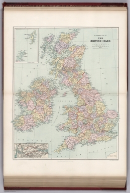
[Stanford, Edward, Woodward, H.B.]
Full Title
Geological Map of the British Isles by Edward Best. Edward Best, Geological Survey.(in set) Orkney and Shetland Islands.
List No
0949.018
Note
Shows 27 geologic units.
Author
[Stanford, Edward, Woodward, H.B.]
Full Title
A County Map of the British Isles. (inset) Orkney and Shetland Islands.
List No
0949.019
Note
Shows 27 geologic units.
Author
[Best, Edward, Edward Stanford Ltd., Stanford, Edward]
Full Title
Geological map of the British Isles by Edward Best. Edward Best, Geological Survey. London atlas series. Stanford's Geographical Establishment. London : Edward Stanford, 12, 13 & 14 Long Acre, W.C. (1901)
List No
5075.010
Note
Full color. Shows 27 geologic units. Includes inset of the Shetland and Orkney islands. "VIII.87, XI.93."
Author
Oberkommando der Wehrmacht (OKW) (Nazi German Supreme Command of the Armed Forces)
Full Title
Wehrgeologische Ubersichtskarte des sudwestenglischen und sudwestschottishen Kustengebietes (Von Rinns of Galloway bis Oban). (Geological Overview Map of the South West of England and Southwest Scottish Coastal Territory (from Von Rinns of Galloway bis Oban). (Nur fur den Dienstgebrauch! (Only for internal use!) Wehrgeologische bearbeitet durch Wa A (Wa Pruf Fest V). (Recruiting Geological edited by A Wa). Gen. St. d. H. Abt. f. Kregskarten v. Verm. Wesen (IV Mil.-Geo) II. 41.(Generalstab des Heeres. Abt. fur Kriegskarten und Vermessungswesen (General Staff of the Army. Department for War Maps and Surveying). (February, 1941).
List No
7811.015
1-13 of 13
|