|
Author
Arrowsmith, John, 1790-1873
Full Title
The inland navigation, rail roads, geology, and minerlas of England & Wales, by J. Arrowsmith. London, pubd. 15 Feby. 1842, by J. Arrowsmith, 10 Soho Square.
List No
14506.011
Note
Map representing England and Wales. Shows counties, cities, railways, topography, bodies of water, drainage, coastlines and islands. Relief shown with hachures. Includes a legend, table of geological groups, lines of navigation, and latitudinal and longitudinal lines, as well as bar scales given in geographical and English miles. Hand-colored engraving. Map is 63 x 50 cm, on double sheet 68 x 56 cm.
Author
[Sydow, Emil von., 1812-1873, Wagner, Hermann, 1840-1929]
Full Title
Tektonik und Geologie der Erde. Gotha : Justus Perthes. Sydow-Wagners method. Schul-Atlas XXIII.
List No
13559.023
Note
Tectonic map of the world, with 4 insets at the scale of 1:100,000,000. Including: North America; South America; Africa; Australia and Indonesia. Showing principal tectonic regions. Includes color coded tectonic classification for continental and oceanic.
Author
[Sydow, Emil von., 1812-1873, Wagner, Hermann, 1840-1929]
Full Title
Europa : Ubersicht des relief. Gotha : Justus Perthes. Sydow-Wagners method. Schul-Atlas. XXII.
List No
13559.039
Note
Geologic map of Europe. Bonnesche projektion.
Author
[Sydow, Emil von., 1812-1873, Wagner, Hermann, 1840-1929]
Full Title
Europa : Geologie, Tektonic. Gotha : Justus Perthes. Sydow-Wagners method. Schul-Atlas. XXIII.
List No
13559.041
Note
Geologic map of Europe, Bonnesche projektion. With inset map: Tektonische Karte. Includes color coded reference to rock formations and land features.
Author
[Sydow, Emil von., 1812-1873, Wagner, Hermann, 1840-1929]
Full Title
Tektonik und Geologie der Erde. Gotha : Justus Perthes. Sydow-Wagners method. Schul-Atlas. XXI.
List No
13557.024
Note
Tectonic map of the world, with 4 insets at the scale of 1:100,000,000: North America; South America; Africa; Australia and Indonesia. Showing principal tectonic regions. Includes color coded tectonic classification for continental and oceanic.
Author
[Sydow, Emil von., 1812-1873, Wagner, Hermann, 1840-1929]
Full Title
Europa : übersicht des relief. Gotha : Justus Perthes. Sydow-Wagners method. Schul-Atlas. XXI.
List No
13557.044
Note
Geologic map of Europe. Relief shown by gradient tints, hachures and spot heights. Depth shown by bathymetric tints, isolines and soundings. Bonnesche projektion.
Author
[Sydow, Emil von., 1812-1873, Wagner, Hermann, 1840-1929]
Full Title
Europa : Geologie, Tektonic. Gotha : Justus Perthes. Sydow-Wagners method. Schul-Atlas. XXI.
List No
13557.046
Note
Geologic map of Europe, Bonnesche projektion. With inset map: Tektonische Karte. Includes color coded reference to rock formations and land features.
Author
[Sydow, Emil von., 1812-1873, Wagner, Hermann, 1840-1929]
Full Title
Mitteleuropa : Geologische Karte. Gotha : Justus Perthes. Sydow-Wagners method. Schul-Atlas : 21 Auflage. 1940.
List No
13557.060
Note
Geologic map of Central Europe. Vereinfachte Kegelprojektion. Includes color coded reference to rock formations and land features.
Author
[Sydow, Emil von., 1812-1873, Wagner, Hermann, 1840-1929]
Full Title
Mitteleuropa : Klima, Morphologie. Gotha : Justus Perthes. Sydow-Wagners method. Schul-Atlas. XXI.
List No
13557.063
Note
4 maps of Central Europe on 1 sheet, Vereinfachte Kegelprojektion. Showing the temperature and precipitation, and structure of the land surface.
Author
Imhof, Eduard, 1895-1986
Full Title
Geologie.
List No
14401.023
Note
Map of Switzerland, featuring geology, in 1969. Shows different rock types and mineral extraction sites, as well as bodies of water and drainage. Includes a legend, bar scale and scale statement. Colored lithograph. Map is 17 x 29 cm, on sheet 22 x 33 cm. Appears in section entitled Schweiz : Thematische Karten [= Switzerland : Thematic Maps].
Author
Imhof, Eduard, 1895-1986
Full Title
Geologie.
List No
14401.030
Note
Map of the Alpine countries - Austria, France, Germany, Italy, Liechtenstein, Monaco, Slovenia, and Switzerland - featuring geology, in 1969. Also shows cities, bodies of water, drainage, coastlines, islands and water depths. Includes latitudinal and longitudinal lines, a legend, bar scale and scale statement. Colored lithograph. Map is 28 x 39 cm, on double sheet 33 x 44 cm. Appears in section entitled Alpenländer und Österreich [= Alpine countries and Austria].
Author
Society for the Diffusion of Useful Knowledge (Great Britain)
Full Title
Geological Map of England and Wales.
List No
10911.012
Author
[Gorkin, Aleksandr Fedorovich, Motylev, V.E.]
Full Title
Geologicheskaia karta SSSR. (to accompany) Bolshoi Sovietskii Atlas Mira. Moskva 1937.
List No
11008.105
Note
Color maps on 2 sheets. Showing geological formations in Soviet Union. Includes explanation and color coded reference.
Author
[Johnston, Alexander Keith, 1804-1871, Boue, Ami]
Full Title
The Geological Structure of the Globe according to Ami Boue. (insets) Elie de Beaumont's Chart of the Elevations of Mountains. Illustrations of the Synchronism if Parallel Chains. The Principal Mountains of the World.
List No
12509.011
Author
Arrowsmith, John
Full Title
The inland navigation, rail roads, geology and minerals of England & Wales, by J. Arrowsmith. London, pubd. 15 Feby. 1834 by J. Arrowsmith, 35 Essex Street, Strand.
List No
0036.005
Note
Engraved map. Geologic units hand colored. Relief shown by hachures. Includes explanation and relief profiles.
Author
Arrowsmith, John
Full Title
Scotland, by J. Arrowsmith. London, pubd. 15 Feby. 1834 by J. Arrowsmith, 35 Essex Street, Strand.
List No
0036.006
Note
Engraved map. County boundaries hand colored. Relief shown by hachures.
Author
Hitchcock, Charles H.
Full Title
Gray's Atlas Map of the United States Showing the Principal Geological Formations by Cha's. H. Hitchcock, Ph.D. Professor of Geology in Dartmouth College. 1873.
List No
0310.018
Author
Malte-Brun, Conrad, 1775-1826
Full Title
Carte Geologique d'Europe. Dressee par J.J.N. Huot, d'apres les travaux de M.M.A. Boue d'Omalius d'Halloy, de Buch et autres geologistes. No. 20 bis. Grave par Thierry. (1837)
List No
0458.023
Note
Engraved map. Geologic units listed in legend and depicted in full color. Major relief depicted with hachures. Rivers, lakes, islands, and regions shown. Includes 4 scales.
Author
Malte-Brun, Conrad, 1775-1826
Full Title
Carte Physique et Mineralogique des Isles Britanniques presentus les Bassins, les principales Montagnes, les Cours d'Eau, les Roches, et les substances Minerales. 1832. Grave par Thierry.
List No
0458.024
Note
Engraved map. Geologic units listed and described in legend and depicted in full color. Major relief depicted with hachures. Rivers, lakes, islands, and basins shown. Includes 2 scales.
Author
Malte-Brun, Conrad, 1775-1826
Full Title
Carte Physique et Mineralogique de la France presentant les Versans, les Bassins, les Montagnes, les Grandes Limites des Vegetation, la Pente des Principaux Cours d'Eau, les Roches, et les Substances Minerales, que recele son Sol. 1832. No. 21. Grave par Thierry.
List No
0458.025
Note
Engraved map. Geologic units listed and described in legend and depicted in full color. Major relief depicted with hachures. Rivers, lakes, islands, watersheds, and basins shown. Includes 2 scales. Inset of Corsica.
Author
[Desbuissons, L.E., Migeon, J.]
Full Title
France Geologique. Grave par Lecocq. Dresse Sous La Direction De J. Migeon Par Ch. Lacoste. Les Eaux par Fontaine. Ecrit par A. Bizet. (1892). Fillatreau del. and Barbier sc. (for vignette).
List No
0507.019
Note
Full color by rock type. Relief shown by hachures. Vignette of Grotte de Royat. Inset of Corsica.
Author
Polish Army Topography Service
Full Title
Geology. Tectonics. Pergamon World Atlas. Pergamon Press, Ltd. & P.W.N. Poland 1967. Sluzba Topograficzna W.P.
List No
0737.020
Note
Two maps. Lands classified by geologic periods. Tectonic features in 33 categories, both continental and oceanic.
Author
Polish Army Topography Service
Full Title
Quaternary. Geomorphology. Pergamon World Atlas. Pergamon Press, Ltd. & P.W.N. Poland 1967. Sluzba Topograficzna W.P.
List No
0737.021
Note
Two maps. Includes maximum extent of ice sheets and mountain glaciation. Shows various types of deposits such as glacial, fluvial, marine, and colluvial. Geomorphology map provides landforms such as loess, sedimentary plateaus, volcanic rocks, alpine mountains, etc.
Author
[Murchison, Roderick Impey, Sir, 1792-1871, Society for the Diffusion of Useful Knowledge (Great Britain)]
Full Title
Geological map of England and Wales. Published under the superintendence of the Society for the Diffusion of Useful Knowledge. 1843. Arranged by Roderick Impey Murchison ... S.P. Woodward del. Col(oure)d. by T. Malby. J. & C. Walker sculpt. Published by Chapman & Hall 186 Strand Decr. 15th. 1843. (1844)
List No
0890.012
Note
Engraved map. Geologic units hand col. Also shows railroads, canals, navigable rivers and dip of strata.
Author
[Andriveau-Goujon, J., Soulier, E.]
Full Title
Notions Preliminaires. Atlas Elementaire Simplifie. Publie par J. Andriveau-Goujon.
List No
0940.002
Note
Shows map projections, symbols, longitude, latitude, and molten core of the earth.
Author
[Stanford, Edward, Woodward, H.B.]
Full Title
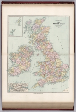
Geological Map of the British Isles by Edward Best. Edward Best, Geological Survey.(in set) Orkney and Shetland Islands.
List No
0949.018
Note
Shows 27 geologic units.
Author
[Stanford, Edward, Woodward, H.B.]
Full Title
A County Map of the British Isles. (inset) Orkney and Shetland Islands.
List No
0949.019
Note
Shows 27 geologic units.
Author
[Gorkin, Aleksandr Fedorovich, Motylev, V.E.]
Full Title
Vulkanov i vulkanizma. (with) Mirovaya karta epitsentrov katastroficheskikh i razrushitel'nykh zemletriasenii. (to accompany) Bolshoi Sovietskii Atlas Mira. Moskva 1937.
List No
11008.035
Note
2 color maps on 2 sheets. Showing volcanoes and volcanic activity of the world, with map showing the world's epicenters of catastrophic and destructive earthquakes. Includes color coded reference.
Author
[Gorkin, Aleksandr Fedorovich, Motylev, V.E.]
Full Title
Geologicheskaia karta mira. (with) Mirovaia karta mestorozhdenii poleznykh iskopaemykh. (to accompany) Bolshoi Sovietskii Atlas Mira. Moskva 1937.
List No
11008.037
Note
2 color maps on 2 sheets with inset diagram. Showing geological features and mineral deposit of the world. Includes color coded reference.
Author
[Gorkin, Aleksandr Fedorovich, Motylev, V.E.]
Full Title
Karta magnitnykh sklonenii SSSR. (with) Seysmicheskaia karta SSSR. (to accompany) Bolshoi Sovietskii Atlas Mira. Moskva 1937.
List No
11008.103
Note
2 color maps on 2 sheets. Showing distribution of the magnetic declination and seismic activities in Soviet Union. Includes explanation and color coded reference.
Author
[Gorkin, Aleksandr Fedorovich, Motylev, V.E.]
Full Title
Geologicheskaia karta Evropeyskoy chasti SSSR. (inset) Zemlia Novaia. (to accompany) Bolshoi Sovietskii Atlas Mira. Moskva 1937.
List No
11008.107
Note
Color geological map of Russia in Europe on 2 sheets. Includes inset map, geological time table, explanation and color coded reference.
Author
[Gorkin, Aleksandr Fedorovich, Motylev, V.E.]
Full Title
Chetvertichnye oledeneniia yevropeyskoy chasti SSSR. (inset) Zemlia Novaia. (with) Geomorfologicheskaia karta yevropeyskoi chasti SSSR. (to accompany) Bolshoi Sovietskii Atlas Mira. Moskva 1937.
List No
11008.111
Note
2 color maps of European Russia on 2 sheets. Showing quaternary deposits and Geomorphological features. Includes inset map, text, explanation and color coded and numeric references.
Author
[Gorkin, Aleksandr Fedorovich, Motylev, V.E.]
Full Title
Geologicheskaia karta Kavkaza. (with) Geomorfologicheskaia karta Kavkaza. (to accompany) Bolshoi Sovietskii Atlas Mira. Moskva 1937.
List No
11008.113
Note
2 color maps of Caucasus on 2 sheets. Showing geological and Geomorphological features. Includes text, explanation and color coded references.
Author
[Gorkin, Aleksandr Fedorovich, Motylev, V.E.]
Full Title
Geologicheskaia karta Urala. (with) Poleznye iskopayemye Urala. (to accompany) Bolshoi Sovietskii Atlas Mira. Moskva 1937.
List No
11008.115
Note
2 color maps on 2 sheets. Showing geological and mineral resources of Ural Mountains. Includes color coded references and color diagram.
Author
Meyer, Joseph, 1796-1856
Full Title
Mittelamerica Mit Den Specialkarten Uber : Die Vulkanreihe von Guatemala, die Landengen von Tehuantepec, Nicaragua und Panama, und die Central Vulkane der Sud See. Stahlstich (Direction v. Kleinknecht) aus der Schweinfurter Geographischen Graviranstalt des Bibliographischen Instituts zu Hildburghausen, Amsterdam, Paris und Philadelphia. (in upper margin) Meyer's Zeitung Atlas. No. 91. (to accompany) Neuester Zeitungs-Atlas fur Alte und Neue Erdkunde. Herausgegeben von J. Meyer.
List No
11652.099
Note
Engraved outline hand color map, with six elevation profiles and 8 inset maps: Gran Lago di Nicaragua. Der Isthmus von Panama. Die Landenge von Tehuantepec und Goazaculaco. Galapagos. Hawaii Archipelagus oder Sandwich Inseln. Waihu, Ostern I. Mendanas Archipelag. Societaets Inseln. Freundschaftliche Inseln. Shows boundaries, cities and towns. Relief shown by hachures. Prime meridian is Paris.
Author
Marmocchi, Francesco Constantino, 1805-1858
Full Title
Geografia Fisica. Geografia dei vulcani accesi ed estinti. (to accompany) Atlante di geografia universale ... Di F.C. Marmocchi. Firenze : per Vincenzo Batelli e Compagni 1842.
List No
11713.060
Note
Engraved hand colored map of the world. Showing active and extinct volcanoes in the world.
Author
[Ewald, Ludwig 1813-1881, Bauerkeller, Georg Leonhart]
Full Title
No. 11. Gliederung und Lagerungs verhaeltnisse der Gebirgsformationen.
List No
12189.033
Author
[Ewald, Ludwig 1813-1881, Bauerkeller, Georg Leonhart]
Full Title
No. 12. Deutschland ... Geognostische Ubersichtskarte.
List No
12189.034
Author
[Ewald, Ludwig 1813-1881, Bauerkeller, Georg Leonhart]
Full Title
No. 13. Veraenderungen der Erdoberflaeche in historischer Zeit.
List No
12189.035
Author
[Ewald, Ludwig 1813-1881, Bauerkeller, Georg Leonhart]
Full Title
No. 14. Die Gletscher der Alpen.
List No
12189.036
Note
Bottom edge shows a diagram with the lengths of the glaciers of the Alps.
Author
[Ewald, Ludwig 1813-1881, Bauerkeller, Georg Leonhart]
Full Title
No. 12. Deutschland und das Alpen-Gebiet ... Geognostische Uebersichtkarte.
List No
12189.116
Author
[Johnston, Alexander Keith, 1804-1871, Berghaus]
Full Title
The Phenomena of Volcanic Action Showing the Regions visited by Earthquakes and the Distribution of Volcanoes over the Globe. (insets) Principal Volcanic Series of the New World. Principal Volcanic Series of the Old World. Iceland. Sandwich Islands. Canary Islands. Greek Islands. Lower Italy.
List No
12509.030
Author
[Johnston, Alexander Keith, 1804-1871, von Bach, Leopold, von Humboldt, Alexander, Swinburne, C.H., Mueller, Salomon]
Full Title
Comparative Views of Remarkable Geological Phenomena. (insets) Island of Teneriffe. Vesuvius and Etna. South Keeling Islands. Crater of Cedee. Graham Island. Arthurs Seat. Ascension Island. Pichincha and Antisana.
List No
12509.034
Author
[Meyer, Herrmann Julius, 1826-1909., Ravenstein, Ludwig]
Full Title
Hohenschichten-Karte von Deutschland in 4 blattern. Bearbeitel von L. Ravenstein. L. Ravenstein dir. Corr. I. Bibliographischen Instituts zu Hildburghausen. Stich. v. F. Runge. (to accompany) Meyer's Hand-Atlas ... 1872.
List No
13324.018
Note
One of 4 sheets. Color map of the elevation layers of Germany, with inset: Ideales profil sur Erklaurung der Hohenschichten und deren Farben. Map showing mountain heights. Relief shown by gradient tints. Prime meridian is Ferro.
Author
[Meyer, Herrmann Julius, 1826-1909., Ravenstein, Ludwig]
Full Title
Hohenschichten-Karte von Deutschland, Nordostliches blatt. L. Ravenstein dir. Corr. I. Bibliographischen Instituts zu Hildburghausen. Stich. v. F. Runge. (to accompany) Meyer's Hand-Atlas ... 1872.
List No
13324.019
Note
Two of 4 sheets. Color map of the elevation layers of Germany, Northeast sheet, with inset: Ideales profil sur Erklaurung der Hohenschichten. Relief shown by gradient tints. Prime meridian is Ferro.
Author
[Meyer, Herrmann Julius, 1826-1909., Ravenstein, Ludwig]
Full Title
Hohenschichten-Karte von Deutschland, Sudwestliches blatt. L. Ravenstein dir. Corr. I. Bibliographischen Instituts zu Hildburghausen. Stich. v. F. Runge. (to accompany) Meyer's Hand-Atlas ... 1872.
List No
13324.020
Note
Three of 4 sheets. Color map of the elevation layers of Germany, Southwest sheet, with inset: Ideales profil sur Erklaurung der Hohenschichten. Relief shown by gradient tints. Prime meridian is Ferro.
Author
[Meyer, Herrmann Julius, 1826-1909., Ravenstein, Ludwig]
Full Title
Hohenschichten-Karte von Deutschland, Sudostliches blatt. L. Ravenstein dir. Corr. I. Bibliographischen Instituts zu Hildburghausen. Stich. v. F. Runge. (to accompany) Meyer's Hand-Atlas ... 1872.
List No
13324.021
Note
Four of 4 sheets. Color map of the elevation layers of Germany, Southeast sheet, with inset: Ideales profil sur Erklaurung der Hohenschichten. Relief shown by gradient tints. Prime meridian is Ferro.
Author
[Sydow, Emil von., 1812-1873, Wagner, Hermann, 1840-1929]
Full Title
Tektonik und Geologie der Erde. Gotha : Justus Perthes. Sydow-Wagners method. Schul-Atlas XXII.
List No
13558.023
Note
Tectonic map of the world, with 4 insets at the scale of 1:100,000,000: North America; South America; Africa; Australia and Indonesia. Showing principal tectonic regions. Includes color coded tectonic classification for continental and oceanic.
Author
[Sydow, Emil von., 1812-1873, Wagner, Hermann, 1840-1929]
Full Title
Europa : übersicht des relief. Gotha : Justus Perthes. Sydow-Wagners method. Schul-Atlas. XXII.
List No
13558.039
Note
Geologic map of Europe. Bonnesche projektion.
Author
[Sydow, Emil von., 1812-1873, Wagner, Hermann, 1840-1929]
Full Title
Europa : Geologie, Tektonic. Gotha : Justus Perthes. Sydow-Wagners method. Schul-Atlas. XXII.
List No
13558.041
Note
Geologic map of Europe, Bonnesche projektion. With inset map: Tektonische Karte. Includes color coded reference to rock formations and land features.
|