|
REFINE
Browse All : Geology and World Atlas of England
1-13 of 13
Author
Arrowsmith, John, 1790-1873
Full Title
The inland navigation, rail roads, geology, and minerlas of England & Wales, by J. Arrowsmith. London, pubd. 15 Feby. 1842, by J. Arrowsmith, 10 Soho Square.
List No
14506.011
Note
Map representing England and Wales. Shows counties, cities, railways, topography, bodies of water, drainage, coastlines and islands. Relief shown with hachures. Includes a legend, table of geological groups, lines of navigation, and latitudinal and longitudinal lines, as well as bar scales given in geographical and English miles. Hand-colored engraving. Map is 63 x 50 cm, on double sheet 68 x 56 cm.
Author
Society for the Diffusion of Useful Knowledge (Great Britain)
Full Title
Geological Map of England and Wales.
List No
10911.012
Author
Arrowsmith, John
Full Title
The inland navigation, rail roads, geology and minerals of England & Wales, by J. Arrowsmith. London, pubd. 15 Feby. 1834 by J. Arrowsmith, 35 Essex Street, Strand.
List No
0036.005
Note
Engraved map. Geologic units hand colored. Relief shown by hachures. Includes explanation and relief profiles.
Author
Malte-Brun, Conrad, 1775-1826
Full Title
Carte Physique et Mineralogique des Isles Britanniques presentus les Bassins, les principales Montagnes, les Cours d'Eau, les Roches, et les substances Minerales. 1832. Grave par Thierry.
List No
0458.024
Note
Engraved map. Geologic units listed and described in legend and depicted in full color. Major relief depicted with hachures. Rivers, lakes, islands, and basins shown. Includes 2 scales.
Author
[Murchison, Roderick Impey, Sir, 1792-1871, Society for the Diffusion of Useful Knowledge (Great Britain)]
Full Title
Geological map of England and Wales. Published under the superintendence of the Society for the Diffusion of Useful Knowledge. 1843. Arranged by Roderick Impey Murchison ... S.P. Woodward del. Col(oure)d. by T. Malby. J. & C. Walker sculpt. Published by Chapman & Hall 186 Strand Decr. 15th. 1843. (1844)
List No
0890.012
Note
Engraved map. Geologic units hand col. Also shows railroads, canals, navigable rivers and dip of strata.
Author
[Stanford, Edward, Woodward, H.B.]
Full Title
Geological Map of the British Isles by Edward Best. Edward Best, Geological Survey.(in set) Orkney and Shetland Islands.
List No
0949.018
Note
Shows 27 geologic units.
Author
[Stanford, Edward, Woodward, H.B.]
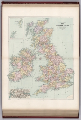
Full Title
A County Map of the British Isles. (inset) Orkney and Shetland Islands.
List No
0949.019
Note
Shows 27 geologic units.
Author
Society for the Diffusion of Useful Knowledge (Great Britain)
Full Title
Geological Map of England and Wales.
List No
2326.010
Author
Arrowsmith, John
Full Title
The Inland Navigation, Rail Roads, Geology and Minerals of England & Wales, By J. Arrowsmith. (Map) 5. London, Pubd. 15 Feby. 1842, by J. Arrowsmith, 10 Soho Square.
List No
4613.005
Note
Note on map states: "For the list of the several Geological Groups, and Divisions in this map, I have been principally indebted to the splendid Geological Map of England and Wales, by G.B. Greenough Esqr. F.G.S." In full color. Legend shows the geological groups on the map. Four sections of the line of navigation included.
Author
[Best, Edward, Edward Stanford Ltd., Stanford, Edward]
Full Title
Geological map of the British Isles by Edward Best. Edward Best, Geological Survey. London atlas series. Stanford's Geographical Establishment. London : Edward Stanford, 12, 13 & 14 Long Acre, W.C. (1901)
List No
5075.010
Note
Full color. Shows 27 geologic units. Includes inset of the Shetland and Orkney islands. "VIII.87, XI.93."
Author
[Bristow, Henry W., Letts, Son & Co.]
Full Title
Geological map of England & Wales, with leading railways by Henry W. Bristow, F.R.S., F.G.S., Director of the Geological Survey of England and Wales. Letts's popular atlas. Letts, Son & Co. Limited, London. (1883)
List No
5371.007
Note
Colored map. Includes descriptive notes and explanation.
Author
Letts, Son & Co.
Full Title
Geological map of the environs of London. Letts's popular atlas. Letts, Son & Co. Limited, London. (1883)
List No
5371.015
Note
Colored map. Relief shown by hachures. Shows railroads, radial distances from Charing Cross, explanation, etc. "This map can be purchased separately, mounted on a board and varnished for 2/6, or backed with the "Orographical Map" for 3/6.
Author
[Andree, Richard, Times (London, England)]
Full Title
England and Wales Geological map. (Published at the office of "The Times," London, 1900).
List No
6809.017
Note
Color map on 2 sheets. Shows geological formations. settlements, counties, railroads, canals, etc. Prime meridian is Greenwich.
1-13 of 13
|