|
REFINE
Browse All : Geology and World Atlas of England and Wales
1-7 of 7
Author
Arrowsmith, John, 1790-1873
Full Title
The inland navigation, rail roads, geology, and minerlas of England & Wales, by J. Arrowsmith. London, pubd. 15 Feby. 1842, by J. Arrowsmith, 10 Soho Square.
List No
14506.011
Note
Map representing England and Wales. Shows counties, cities, railways, topography, bodies of water, drainage, coastlines and islands. Relief shown with hachures. Includes a legend, table of geological groups, lines of navigation, and latitudinal and longitudinal lines, as well as bar scales given in geographical and English miles. Hand-colored engraving. Map is 63 x 50 cm, on double sheet 68 x 56 cm.
Society for the Diffusion of Useful Know... Geological Map of England and Wales. 1872 10911.012 Related Author
Society for the Diffusion of Useful Knowledge (Great Britain)
Full Title
Geological Map of England and Wales.
List No
10911.012
Author
Arrowsmith, John
Full Title
The inland navigation, rail roads, geology and minerals of England & Wales, by J. Arrowsmith. London, pubd. 15 Feby. 1834 by J. Arrowsmith, 35 Essex Street, Strand.
List No
0036.005
Note
Engraved map. Geologic units hand colored. Relief shown by hachures. Includes explanation and relief profiles.
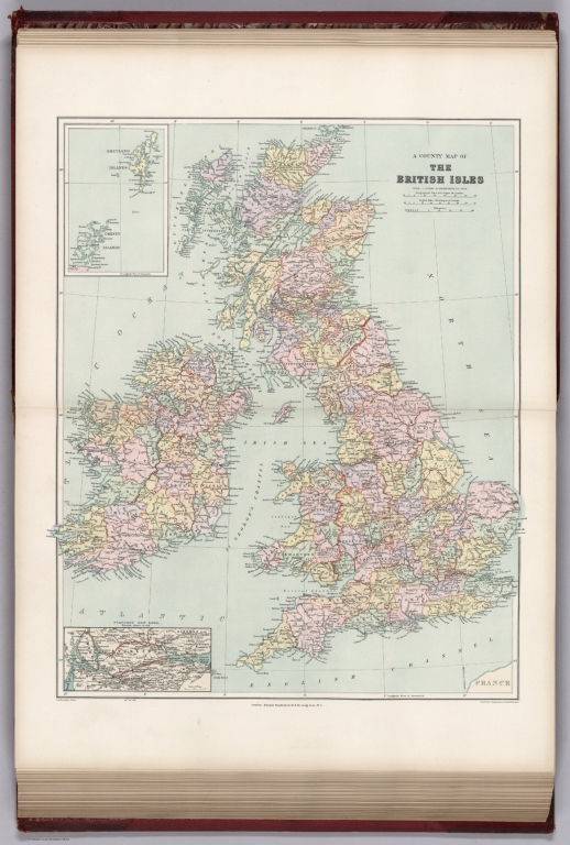
Author
[Stanford, Edward, Woodward, H.B.]
Full Title
A County Map of the British Isles. (inset) Orkney and Shetland Islands.
List No
0949.019
Note
Shows 27 geologic units.
Society for the Diffusion of Useful Know... Geological Map of England and Wales. 1865 2326.010 Related Author
Society for the Diffusion of Useful Knowledge (Great Britain)
Full Title
Geological Map of England and Wales.
List No
2326.010
Author
[Bristow, Henry W., Letts, Son & Co.]
Full Title
Geological map of England & Wales, with leading railways by Henry W. Bristow, F.R.S., F.G.S., Director of the Geological Survey of England and Wales. Letts's popular atlas. Letts, Son & Co. Limited, London. (1883)
List No
5371.007
Note
Colored map. Includes descriptive notes and explanation.
Author
[Andree, Richard, Times (London, England)]
Full Title
England and Wales Geological map. (Published at the office of "The Times," London, 1900).
List No
6809.017
Note
Color map on 2 sheets. Shows geological formations. settlements, counties, railroads, canals, etc. Prime meridian is Greenwich.
1-7 of 7
|