|
REFINE
Browse All : Geology and Physical Atlas of Oregon
1-5 of 5
Author
[Scovel, James L., O'Brien, Emmett J]
Full Title
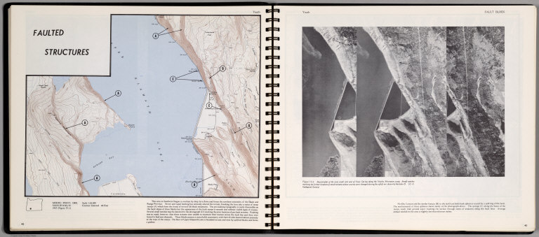
Faulted Structure. Youth. Modoc Point, Ore. (on opposite page) Stereotiplet of the area South and East Ouxy Spring along the Naylox Mountain scarp.
List No
0889.025
Note
Contour map,and stereotriplet view with text and outline location map. Relief shown by contours and spot height.
Author
[Scovel, James L., O'Brien, Emmett J]
Full Title
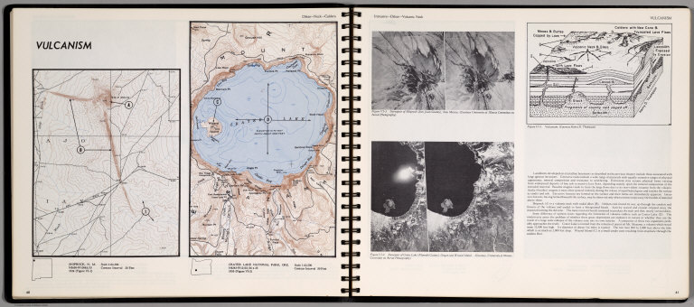
Vulcanism. Dikes-Neck-Caldera. Shiprock, N. M. Crater Lake National Park, Ore. (on opposite page) Invasive-Dikes-Volcanic Neck. Stereopair of Shiprock ... Stereopair of Great Mountain Lake ... (inset) Volcanism.
List No
0889.034
Note
Two contour maps on one page. With two stereopairs, text, and location map. Relief shown by contours and spot height. Depth shown by isolines and soundings.
Author
[Scovel, James L., O'Brien, Emmett J]
Full Title
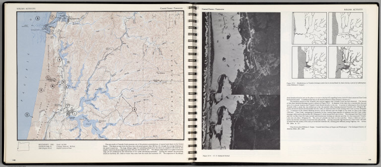
Eolian Activity. Coastal Dunes-Transverse. Reedsport, Ore. (with aerial view on opposite page).
List No
0889.078
Note
Contour color map, with location map and text. Inset: Modifications in Tenmile drainage system ... Relief shown by contours and spot heights.
Author
California. State Earthquake Investigation Commission
Full Title
Geomorphic map of California and Nevada with portions of Oregon and Idaho showing the diastrophic character of the relief, the steep descent from the sub-continental shelf to the floor of the Pacific, and the more important known faults. Earthquake Investigation Commission. Drawn by M. Solem. A. Hoen & Co., Baltimore. (Carnegie Institution of Washington, 1908)
List No
2130.001
Note
Color. Relief shown by hachures; depths by bathymetric isolines. Shows railways, towns, counties and drainage.
Author
California. State Earthquake Investigation Commission
Full Title
Map of California and Nevada showing the distribution of apparent intensity in the region affected by the earthquake of April 18, 1906. Drawn by M. Solem. Earthquake Investigation Commission. A. Hoen & Co., Baltimore. (Carnegie Institution of Washington. 1908)
List No
2130.023
Note
Color. Covers also parts of Oregon and Idaho. Rossi-Forel scale.
1-5 of 5
|