|
REFINE
Browse All : Geology and Indians
1-2 of 2
Author
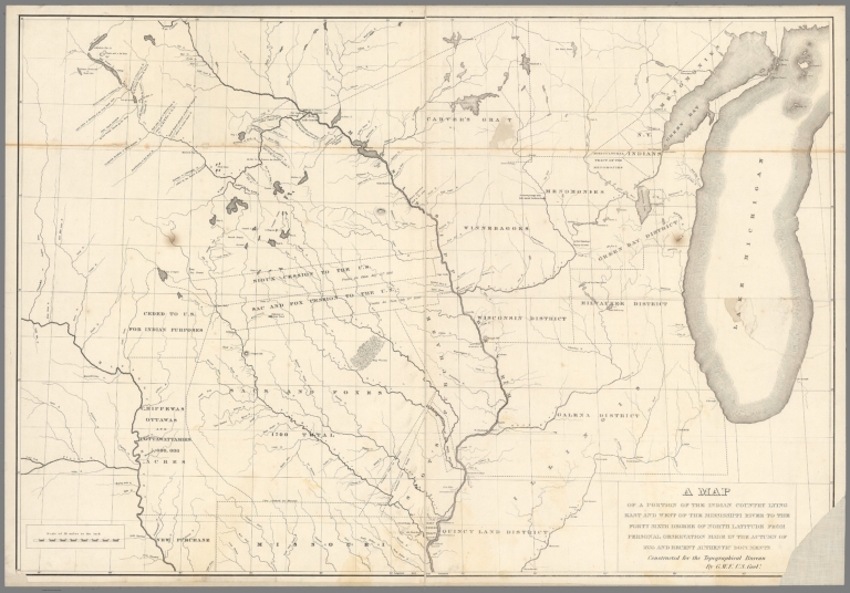
Featherstonhaugh, George William
Full Title
A map of a portion of the Indian country lying east and west of the Mississippi River to the forty sixth degree of north latitude from personal observation made in the autumn of 1835 and recent authentic documents. Constructed for the Topographical Bureau by G.W.F., U.S. Geolt.
List No
13044.000
Note
Land grants map. Shows lands ceded by Indians tribes, lands inhabitation by Indians by tribe, land grants, Indian reservations, land districts, portage points, boundary claims, towns and Indian villages, rivers and lakes.
Full Title
Sketch of Canon San Diego, Ojos Calientes & Monument Canon of the Jemez Basin. (with) Plan of ruins. (1875)
List No
2220.077
Note
Lithographed map, sepia toned. Relief shown by hachures and spot heights. Shows hot springs, site of ancient ruins, trail, etc.
1-2 of 2
|