|
REFINE
Browse All : Geology and Atlas Map of Idaho
1-6 of 6
Author
[Scovel, James L., O'Brien, Emmett J]
Full Title
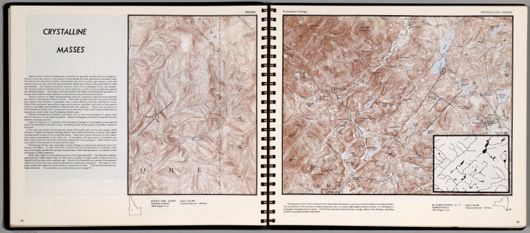
Crystalline Masses. Batholith. Rocky Bar, Idaho. (on opposite page) Rectangular Drainage. Elizabethtown, N.Y. Scale 1:62,500.(inset) Resulting in a rectangular drainage pattern.
List No
0889.030
Note
Contour map, with text, and location map. Relief shown by contours and spot height.
Author
[Scovel, James L., O'Brien, Emmett J]
Full Title
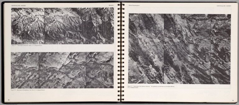
Crystalline Masses. Batholith. Stereotriplet of Rocky Bar, Idaho ... Stereotriplet of Elizabethtown, New York ... (on opposite page) Belted Metamorphic. Stereotriplet of San Andreas, California ...
List No
0889.031
Note
Three stereotriplets.
Author
[Scovel, James L., O'Brien, Emmett J]
Full Title
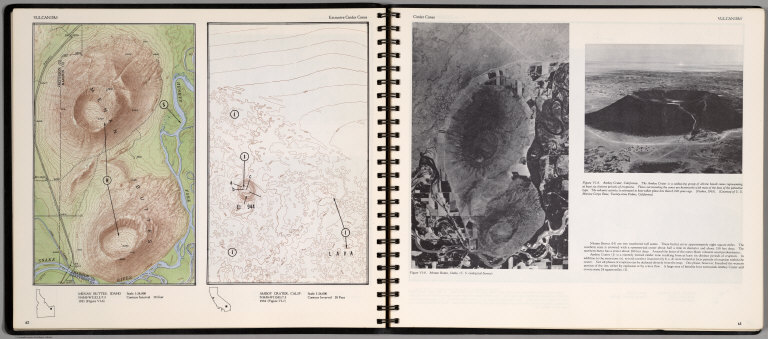
Vulcanism. Extrusive Cinder Cones. Menan Buttes, Idaho. Amboy Cratet, Calif. (on opposite page) Cinder Cones. (Views of) Manon Buttes, Idaho, and Amboy Crater, California.
List No
0889.035
Note
Two contour maps on one page. With location maps. Two views, and text on opposite page. Relief shown by contours and spot height.
Author
[Scovel, James L., O'Brien, Emmett J]
Full Title
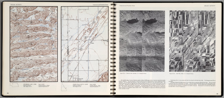
Eolian Activity. Transverse and Parabolic Dunes. Steverson Lake, Nebr. Idaho Falls South, Idaho. Scale 1:24,000. (with aerial view on opposite page) Steverson Lake Nebraska, and Idaho Falls, Idaho.
List No
0889.080
Note
Contour color maps, with location map and text. Relief shown by contours and spot heights.
Author
California. State Earthquake Investigation Commission
Full Title
Geomorphic map of California and Nevada with portions of Oregon and Idaho showing the diastrophic character of the relief, the steep descent from the sub-continental shelf to the floor of the Pacific, and the more important known faults. Earthquake Investigation Commission. Drawn by M. Solem. A. Hoen & Co., Baltimore. (Carnegie Institution of Washington, 1908)
List No
2130.001
Note
Color. Relief shown by hachures; depths by bathymetric isolines. Shows railways, towns, counties and drainage.
Author
California. State Earthquake Investigation Commission
Full Title
Map of California and Nevada showing the distribution of apparent intensity in the region affected by the earthquake of April 18, 1906. Drawn by M. Solem. Earthquake Investigation Commission. A. Hoen & Co., Baltimore. (Carnegie Institution of Washington. 1908)
List No
2130.023
Note
Color. Covers also parts of Oregon and Idaho. Rossi-Forel scale.
1-6 of 6
|