|
Author
[California. State Earthquake Investigation Commission, U.S. Geological Survey]
Full Title
California, San Jacinto quadrangle of the U.S. Geological Survey showing the San Andreas Rift, the Mission Creek Fault and the San Jacinto Fault. Earthquake Investigation Commission. Andrew B. Graham Co., Lithographers, Washington, D.C. (Carnegie Institution of Washington. 1908)
List No
2130.015
Note
Color. 30-minute topographic quadrangle. Relief shown by contours and spot heights. Covers portions of Riverside County.
Author
California. State Earthquake Investigation Commission
Full Title
Map of the city of Santa Rosa, Sonoma County, California showing the portions destroyed by the earthquake of April 18, 1906, and by the fire consequent thereto. Earthquake Investigation Commission. A. Hoen & Co., Baltimore. (Carnegie Institution of Washington. 1908)
List No
2130.016
Note
Relief shown by hachures. Shows buildings destroyed by earthquake and following fire.
Author
[California. State Earthquake Investigation Commission, Lawson, Andrew C., Wood, Harry O.]
Full Title
Geological map of the city of San Francisco by Andrew C. Lawson. To accompany the paper by H.O. Wood. Earthquake Investigation Commission. A. Hoen & Co. (Carnegie Institution of Washington. 1908)
List No
2130.017
Note
Color. Relief shown by contours and spot heights. Shows 10 geologic units and original shoreline. "Topography by the Coast and Geodetic Survey." For sections see map 18.
Author
[California. State Earthquake Investigation Commission, Wood, Harry O.]
Full Title
Geological profiles with corresponding intensity curves across the city of San Francisco. To accompany the paper by H.O. Wood. Earthquake Investigation Commission. A. Hoen & Co. (Carnegie Institution of Washington. 1908)
List No
2130.018
Note
Color. Six sections with legend and explanatory note. Shows 10 geologic units. Accompanies map 17.
Author
[California. State Earthquake Investigation Commission, Wood, Harry O.]
Full Title
Map of San Francisco showing distribution of apparent intensity of the earthquake shock by H.O. Wood. Earthquake Investigation Commission. A. Hoen & Co., Baltimore. (Carnegie Institution of Washington. 1908)
List No
2130.019
Note
Color. Relief shown by contours and spot heights. "Topography by the Coast and Geodetic Survey."
Author
California. State Earthquake Investigation Commission
Full Title
Map of the city of San Francisco showing the streets and the burnt area, 1906. Earthquake Investigation Commission. Britton & Rey, engravers, San Francisco. (Carnegie Institution of Washington. 1908)
List No
2130.020
Note
Color. Shows block numbers, tracts, railroads, original shoreline, etc.
Author
[California. State Earthquake Investigation Commission, U.S. Geological Survey]
Full Title
California, San Mateo quadrangle of the U.S. Geological Survey showing the distribution of apparent intensity, the known faults, and the routes examined. Earthquake Investigation Commission. A. Hoen & Co., Baltimore. (Carnegie Institution of Washington. 1908)
List No
2130.021
Note
Color. 15-minute topographic quadrangle. Relief shown by contours and spot heights. Covers portions of San Mateo and San Francisco counties. Rossi-Forel scale.
Author
[California. State Earthquake Investigation Commission, U.S. Geological Survey]
Full Title
California, Santa Cruz quadrangle of the U.S. Geological Survey showing the distribution of apparent intensity, the known faults, the routes examined and the numbered localities referred to in the text. Earthquake Investigation Commission. A. Hoen & Co., Baltimore. (Carnegie Institution of Washington. 1908)
List No
2130.022
Note
Color. 30-minute topographic quadrangle. Relief shown by contours and spot heights. Covers portions of San Mateo, Santa Clara and Santa Cruz counties. Rossi-Forel scale.
Author
California. State Earthquake Investigation Commission
Full Title
Map of California and Nevada showing the distribution of apparent intensity in the region affected by the earthquake of April 18, 1906. Drawn by M. Solem. Earthquake Investigation Commission. A. Hoen & Co., Baltimore. (Carnegie Institution of Washington. 1908)
List No
2130.023
Note
Color. Covers also parts of Oregon and Idaho. Rossi-Forel scale.
Author
California. State Earthquake Investigation Commission
Full Title
Map of the Coast Range Region of Middle California showing the distribution of earth movement on April 18, 1906 as revealed by the displacement of the triangulation stations of the Coast and Geodetic Surveyed, determined by resurvey, 1906-07. Drawn by M. Solem. Earthquake Investigation Commission. A. Hoen & Co., Baltimore. (Carnegie Institution of Washington. 1908)
List No
2130.024
Note
Color. Shows fault of 1906, movement of 1906, successive movements of 1868 and 1906, combined movements of 1868 and 1906, railroads, settlements, etc.
Author
California. State Earthquake Investigation Commission
Full Title
Distribution of earth movement on April 18, 1906 and in 1868 as revealed by the displacement of the triangulation stations of the Coast and Geodetic Surveyed, determined by resurvey, 1906-07. Earthquake Investigation Commission. A. Hoen & Co., Baltimore. (Carnegie Institution of Washington. 1908)
List No
2130.025
Note
Four color maps. Contents: No. 1. Point Arena and vicinity -- No. 2. Fort Ross and vicinity -- No. 3. Tomales Bay -- No. 4. Colma and vicinity.
Author
[Instituto Geographico di Agostini, Bayer, Herbert]
Full Title
Plisfero Tettonico.
List No
2170.005
Note
Elements of tectonics, seismicity, glaciation, and vulcanology shown.
Author
[Instituto Geographico di Agostini, Bayer, Herbert]
Full Title
Europa.
List No
2170.024
Note
Eight maps of Europe showing tectonics, geology, climate, peoples, and population.
Author
[Instituto Geographico di Agostini, Bayer, Herbert]
Full Title
Italia Fisica. (insets) Geologia and Densita di Popolazione.
List No
2170.027
Note
Relief shown as combined hachures, shaded relief, and hypsometric tints; bathymetry also tinted.
Full Title
Map of hot springs localities of the United States, showing their relation to the general structural divisions. (1875)
List No
2220.067
Note
Lithographed map, sepia toned.
Full Title
Sketch of Canon San Diego, Ojos Calientes & Monument Canon of the Jemez Basin. (with) Plan of ruins. (1875)
List No
2220.077
Note
Lithographed map, sepia toned. Relief shown by hachures and spot heights. Shows hot springs, site of ancient ruins, trail, etc.
Full Title
Section along 36th parallel from the Rio Grande to the Canadian Plains. Atlas sheets 69 D and 70 C. Julius Bien, lith. (1881)
List No
2220.078
Note
Lithographed geologic section in 4 segments, sepia toned. Vertical scale not given. Geologic units: Archean, Carboniferous, Jura Trias, Dakota, Colorado, Basalt and Loup Fork.
Full Title
Section along 37th parallel from the Rio Grande to San Isidro Creek. Atlas sheets 69 B & 70 A. Julius Bien, lith. (1881)
List No
2220.079
Note
Lithographed geologic section in 3 segments, sepia toned. Vertical scale not given. Geologic units: Archean, Carboniferous, Dakota, Colorado, Laramie, Basalt, Traclyte and Conglomerate.
Author
Tyson, Philip T.
Full Title
Map of Maryland and the District of Columbia, colored to illustrate the geological formations by Philip T. Tyson. L.E. Neuman, eng. , 36 Vesey St., N.Y. (Published by Stedman, Brown & Lyon, Baltimore. 1873)
List No
2239.001
Note
Hand col. lithographed map. Includes 3 sections. Prime meridian: Washington. Scale (ca. 1:633,600)
Author
[McInnes, William, Dowling, D.B., Leach, W.W.]
Full Title
Coal Resources of the World. Hemispheres. Map No. 1. Western Hemisphere. Eastern Hemisphere.
List No
2249.005
Note
Differentiates Tertiary, Mesozoic, and Paleozoic coal fields by color.
Author
Pittman, E.F.
Full Title
Coal Resources of the World. New South Wales, Australia. Map No. 2. Map of New South Wales Showing the Areas Occupied by the Coal Measures. E.F. Pittman, A.R.S.M., Government Geologist.
List No
2249.006
Note
Coal fields labeled in red.
Author
Dunstan, B.
Full Title
Coal Resources of the World. Queensland, Australia. Map No. 4. Queensland Showing Principal Coal Areas. B. Dunstan, F.G.S. Government Geologist.
List No
2249.008
Note
Shows railroads.
Author
Woodward, H.P.
Full Title
Coal Resources of the World. West Australia. Map No. 5. Collie Coalfield with Amended Boundaries of the Collie Coal Measure Basin by H.P. Woodward. Assistant Government Geologist.
List No
2249.009
Note
Covers Collie Coal Mining District. Shows locations of longitudinal sections shown on 2249.010.
Full Title
Coal Resources of the World. Coal Fields of Netherlands India. (West Sheet) (East Sheet) Overzichtskaart van den Indischen Archipel. Map No. 7.
List No
2249.011
Note
In Dutch.
Full Title
Coal Resources of the World. Netherlands India. Map No. 8. Oversichtskaart van het Ombilin Kolenveld.
List No
2249.013
Note
In Dutch.
Full Title
Coal Resources of the World. China. Map No. 9. Map Showing Distribution of Coal in China.
List No
2249.014
Note
Coal mapped in color.
Full Title
Coal Resources of the World. Corea. Map No. 10. Plate I. Map Showing the Distribution of Coal in Corea.
List No
2249.015
Note
Coal in color.
Author
[Kawasaki, H., Tamura, E.]
Full Title
Coal Resources of the World. Corea. Map No. 11. Plate II. Phyong-Yang Coal Field after H. Kawasaki, E. Tamura.
List No
2249.016
Note
In color.
Author
[Ogawa, T., Kido, C.]
Full Title
Coal Resources of the World. Manchuria. Map No. 12. Plate I. Map Showing Showing the Distribution of Coal in Manchuria. (inset) Hsing-King. Plate II. Fu-Shun Coal Field. After T. Ogawa and C. Kido.
List No
2249.017
Note
Two maps on one sheet. Fu-Shun map at 1:85,000.
Full Title
Coal Resources of the World. Japan. Map No. 14. Plate I. Map Showing the Distribution of Coal in Japan. (inset) (Vicinity map of Japan in Asia). (inset) Taiwan.
List No
2249.019
Note
Coal areas shown in color.
Author
Oinouye, Y.
Full Title
Coal Resources of the World. Japan. Map No. 15. Plate II. Ishikari Coal Fields. After Y. Oinouye.
List No
2249.020
Note
Color.
Author
[Kido, C., Suzuki, F., Matsuda, S.]
Full Title
Coal Resources of the World. Japan. Map No. 16. Plate III. Chikuho Coal Field. After F. Suzuki, C. Kido and S. Matsuda.
List No
2249.021
Author
Otsuki, Y.
Full Title
Coal Resources of the World. Japan. Map No. 17. Plate IV. Karatsu and Sasebo Coal Fields. After Y. Otsuki.
List No
2249.022
Note
Coal fields in color.
Full Title
Coal Resources of the World. India. Map No. 18. Coal Fields of India and Adjacent Countries.
List No
2249.023
Note
Coal fields in color.
Full Title
Coal Resources of the World. Turkey. Map No. 19. Asiatic Turkey Showing Location of Known Coal Fields.
List No
2249.024
Note
Coal field locations shown in color.
Author
Dowling, D.B.
Full Title
Coal Resources of the World. Canada. Map No. 21. Plate 1. Coal Areas of Canada by D.B. Dowling.
List No
2249.026
Note
Coal areas in color.
Full Title
Coal Resources of the World. Canada. Map No. 22. Plate 2. Coal Fields of Nova Scotia, New Brunswick, Canada.
List No
2249.027
Note
Coal fields shown in color.
Full Title
Coal Resources of the World. Canada. Map No. 23. Plate 3. Sydney Coal Field.
List No
2249.028
Note
Coal shown in color.
Full Title
Coal Resources of the World. Canada. Map No. 27. Plate 8. Southern Vancouver Island, British Columbia.
List No
2249.029
Note
Coal fields in color.
Author
Campbell, Marius R.
Full Title
Coal Resources of the World. United States. Map No. 28. Coal Fields of the United States by Marius R. Campbell.
List No
2249.030
Note
Coal fields shown in color.
Author
Strahan, A.
Full Title
Coal Resources of the World. England and Wales. Map No. 29. Map Showing Visible and Proved Coal Fields of England and Wales prepared under the direction of A. Strahan at the Geological Survey of Great Britain. London 1912.
List No
2249.031
Note
Coal fields in color.
Full Title
Coal Resources of the World. France. Map No. 31. Fig. 7. Coupe A A Passant par Bruay. Fig 8. Coupe de Bassin du Boulonnais.... Fig. 10. Carte du Bassin de Ronchamp. Fig. 11. Carte du Bassin de Saint Etienne. Fig. 12. Coupe Transversale du Bassin de Saint-Etienne. Fig. 13. Carte des Bassins de Blanzy, Le Creusot Bert et Forges.
List No
2249.033
Note
Scale varies.
Full Title
Coal Resources of the World. France. Map No. 32. Fig. 14. Carte du Bassin d'Autun - Epinac. Fig. 15. Carte du Bassin de Decize. Fig. 16. Bassins de Commentry, Doyet l'Aumance et Noyant. Fig. 17. Coupe du Gisement de Saint Eloy.
List No
2249.034
Note
Scale varies.
Full Title
Coal Resources of the World. France. Map No. 33. Fig. 18. Carte du Bassin d'Aubin-Decazeville. Fig. 19. Coupe A B du Bassin d'Aubin-Decazeville. Fig. 20. Carte du Bassin de Carmaux-Albi. Fig. 21. Coupe du Bassin de Carmaux-Albi. Fig. 22. Carte du Bassin de Graissessac.
List No
2249.035
Full Title
Coal Resources of the World. France. Map No. 34. Fig. 23. Carte du Bassin d'Alais. Fig. 24. Coupe du Bassin d'Alais par Molieres et la Grand Combe. Fig. 25. Carte Geologique de la Region de la Mure.
List No
2249.036
Note
Scales vary. Color.
Full Title
Coal Resources of the World. France. Map No. 35. Fig. 26. Carte du Bassin de Fuveau. Fig. 27. Coupe S T du Bassin de Fuveau.
List No
2249.037
Note
In color.
Author
de Pann, Charles
Full Title
Coal Resources of the World. Hungary. Map No. 36. Carte des gisements houillers de la Hongrie par Charles de Pann docteur es sciences, 1912. A.M. Foldtani Tarsulat Tulajdona. Metsz. es Nyomt. Posner K. L. es FIA, terkepeszeti muintezete, Budapesten.
List No
2249.038
Note
Coal fields in color.
Author
Petrascheck, W.
Full Title
Coal Resources of the World. Austria. Map No. 37. Karte 1. Ubersichtskarte der Kphlenlager van Oesterreich bearbeitet von Dr. W. Petrascheck.
List No
2249.039
Note
Coal fields in color.
Author
Petrascheck, W.
Full Title
Coal Resources of the World. Austria. Map No. 38. Karte 2. Karte des Trifailer Braunkohlenrevieres ... W. Petrascheck.
List No
2249.040
Author
Petrascheck, W.
Full Title
Coal Resources of the World. Austria. Map No. 39. Karte 3. Ubersichtskarte de Voitsberg - Koflacher Braunkohlenrevieres ... W. Petrascheck.
List No
2249.041
Author
Petrascheck, W.
Full Title
Coal Resources of the World. Austria. Map No. 40. Karte 4. Uebersichts Karte des Teplitz-Brux-Komotauer Braunkohlenrevieres ... W. Petrascheck. Flotz-Profil....
List No
2249.042
Note
Color.
Author
Frieser, A.
Full Title
Coal Resources of the World. Austria. Map No. 41. Karte 5. Flotzkarten des Falkenau-Elbogen-Karlsbader Braunkohlenrevieres ... A. Frieser. Antono Flotz. Agnes Flotz. Josefi Flotz.
List No
2249.043
Author
Frieser, A.
Full Title
Coal Resources of the World. Austria. Map No. 42. Karte 6. Flotzlagerung in den Egerer Braunkohlenmulden ... A. Frieser.
List No
2249.044
Author
Petrascheck, W.
Full Title
Coal Resources of the World. Austria. Map No. 43. Karte 7. Ubersichtskarte des Kladno-Rakonitzer Steinkohlenrevieres ... W. Petrascheck.
List No
2249.045
Note
In color.
Author
Petrascheck, W.
Full Title
Coal Resources of the World. Karte 8. Map No. 44. Karte des Ostrau - Karwin - Krakauer Steinkohlenrevieres entworfen von W. Petrascheck.
List No
2249.046
Note
In color.
Author
Milojkovitch, J.A.
Full Title
Coal Resources of the World. Servia. Map No. 45. Ubersichtskarte der Kohlenvorkommen im Konigreiche Serbien von J.A. Milojkovitch.
List No
2249.047
Full Title
Coal Resources of the World. Roumania. Map No. 46. Esquisse de la distribution des Charbons en Roumanie.
List No
2249.048
Author
Erdmann, Edvard
Full Title
Coal Resources of the World. Sweden. Map No. 47. Geological Map of Skane Compiled by Edvard Erdmann. 1909.
List No
2249.049
Author
[Nathorst, A.G., De Geer, Backlund, Bruce, Hoel]
Full Title
Coal Resources of the World. Spitzbergen (Norway). Map No. 48. Geological Map of Spitzbergen from the Maps of Nordenskiold, De Geer, Tschernyschew, Backlund, Bruce, Hoel, and personal observations by A.G. Nathorst.
List No
2249.050
Note
Color.
Author
Society for the Diffusion of Useful Knowledge (Great Britain)
Full Title
Geological Map of England and Wales.
List No
2326.010
Author
[Campbell, R.A., Worthen, Amos Henry, 1813-1888]
Full Title
Worthens new geological map of Illinois. Prepared expressly for Campbell's Illinois atlas. (Drawn by R.A. Campbell and H.F. Walling). Entered ... 1869 by R.A. Campbell ... Pennsylvania. (1870)
List No
2483.089
Note
Hand colored map. Shows 8 geologic units (Tertiary, Coal measures, Lower Carboniferous, Devonian, Upper Silurian, Cincinnati Group, Trenton Limestone and Calciferous Group). Prime meridians: Greenwich and Washington.
Author
Berghaus, Heinrich
Full Title
Europa in Geologischer Beziehung nach den Hauptmassen der Gebirgs-Formationen. 3te Abtheilung: Geologie, No. 4. Gotha, bei J. Perthes. 1843.
List No
2515.031
Note
A geologic map of Europe showing active volcanoes, and the oldest and newest mountain ranges on the continent. In full color.
Author
Berghaus, Heinrich
Full Title
Die Vulkanischen Erscheinungen Der Atlen Welt, In Und Um Den Atlantischen Ocean. 3te Abtheilung: Geologie, No. 7. Potsdam, gestochen in der geographischen Kunstschule. Gotha, bei J. Perthes, 1839.
List No
2515.034
Note
Map shows the range of volcanic and earthquake activity throughout the world. In outline color are three different earthquake regions with dates of activity ranging from 1755-1838.
Author
Berghaus, Heinrich
Full Title
Specialia vom Vulkan Gurtel des Atlantischen Oceans. 3te Abtheilung: Geologie, No. 8. Gezeichnet von F. Schelle. Gestochen von Joh. Carl Ausfeld. Gotha, J. Perthes, 1839.
List No
2515.035
Note
Thirteen maps showing volcanic activity throughout the Atlantic and Mediterranean Oceans. Detailed outline colored maps are accompanied by drawings of exploding volcanoes, calderas, and volcanic mountain ranges.
Author
Berghaus, Heinrich
Full Title
Karte von dem Vulkan Gurtel und dem Central Gruppen des Grossen Oceans; nach Leopold v. Buch; von Berghaus. Potsdam, 16 Juli 1838. 3te Abtheilung: Geologie, No. 9. Gezeichnet von F. Schelle. In Potsdam Gestochen von K. Kolbe. Gotha, J. Perthes, 1838.
List No
2515.036
Note
Map of the Pacific Ocean showing volcanic and earthquake activity. Circled regions of activity include the Philippines and Central America. In outline color.
Author
Berghaus, Heinrich
Full Title
Die Vulkanreihe von Guatemala, die Landengen von Tehuantepec, Nicaragua und Panama, und die Central Vulkane der Sud See. 3te Abtheilung: Geologie, No. 10. Potsdam, gez. u. gest. in der geogr. Kunstschule. Gotha, bei J. Perthes, 1840.
List No
2515.037
Note
Maps in outline color. Main map is of Central America. Nine inset maps detail the volcanic regions of Central America and the islands in the Pacific Ocean and South Seas. Side views of Costa Rica, Guatemala, and the isthmus of Tehuantepec are included.
Author
Berghaus, Heinrich
Full Title
Geologische Karte von Deutschland und den anlieg. Landern nach des Bergmeister's H. Credner Zusamenstellung. 1843. 3te Abtheilung: Geologie, No. 12. Gotha, bei J. Perthes.
List No
2515.039
Note
A full color geologic map of Germany accompanied by two keys.
Author
Berghaus, Heinrich
Full Title
Spezial-Karte vom Riesen-Gebirge. 3te Abtheilung: Geologie, No. 13. Gezeichnet u. gestochen in der geogr. Kunstschule zu Potsdam. Gotha, J. Perthes, 1843.
List No
2515.040
Note
Geologic map of the Reisengebirge (or Krkonose, Karkonosze or Giant Mountains) in the Czech Republic and Poland.
Author
Berghaus, Heinrich
Full Title
Geologische Profile von Deutschland im Allgemeinen u. von Riesengebirge im Besondern; Sammt Einer Karte vom Tertiar Becken von Paris. 3te Abtheil: Geologie, No. 14. Gezeichnet von H. Credner. Gest. v. E.G. Edler. Gotha, bei J. Perthes, 1845.
List No
2515.041
Note
A full color geologic map of France and numerous full color geologic cross sections of Germany. A key is included.
Author
Berghaus, Heinrich
Full Title
Vermischtes zur Geologie. 3te Abtheilung: Geologie, No. 15. Potsdam, gez. u. gest. in der geogr. Kunstschule. Gotha, bei J. Perthes, 1844.
List No
2515.042
Note
Miscellaneous geological maps, charts, and information. Some color. Maps include the Quito Plateau, the Himalayas, and the crater on Java. The heights of the Himalayan mountains are shown.
Author
Newberry, John S.
Full Title
Geological map of Ohio by J.S. Newberry, Chief Geologist, 1872. (Published by Stedman, Brown & Lyon, Cincinnati. 1872. Entered ... 1872, by H.F. Walling, and O.W. Gray, and H.H. Lloyd & Co. ... Washington)
List No
2710.002
Note
Col. lithographed map. Includes "Section through northern Ohio," "Section from Cincinnati to Marietta," and explanation of colors.
Author
Wheeler, G.M.
Full Title
Central & Western Utah Atlas Sheet Number 50. Weyss, Herman & Aguirre Del. Expeditions of 1872 & 1873, Under the Command of 1st Lieut. Geo. M. Wheeler, Corps of Engineers, U.S. Army. U.S. Geographical Surveys West Of The One Hundredth Meridian.
List No
2738.036
Note
Full color geologic formations shown in crayon on map base used in P1281-64. Salt Lake City placed outside the map border. Color legend provided at right of map.
Author
Wheeler, G.M.
Full Title
Atlas Sheet Number 58. Parts Of E. California, S.E. Nevada, N.W. Arizona & S.W. Utah. Atlas Sheet Number 66. Weyss, Herman & Aguirre, Del. Expeditions of 1872 & 1873, Under the Command of 1st. Lieut. Geo. M. Wheeler, Corps of Engineers, U.S. Army. Geological Assistants: G.K. Gilbert, A.R. Marvine and E.E. Howell. U.S. Geographical Surveys West Of The One-Hundredth Meridian.
List No
2738.045
Note
Two partial atlas sheets on one page. In crayon and showing geological formations in tints. Color legend on outside of each map.
Author
Wheeler, G.M.
Full Title
Southern And Southwestern Utah. Atlas Sheet Number 59. Weyss, Herman & Aguirre, Del's. Expeditions of 1872 & 1873 Under the Command of 1st. Lieut. Geo. M. Wheeler, Corps of Engineers, U.S. Army. Geological Assistants: G.K. Gilbert, A.R. Marvine, E.E. Howell. Explorations & Surveys West Of The One-Hundredth Meridian.
List No
2738.048
Note
In crayon and showing geological formations in full color tints. Legend to the right of map. Top left of map without geologic representation.
Author
Wheeler, G.M.
Full Title
Parts Of Northern & North Western Arizona & Southern Utah, Atlas Sheet No. 67. Weyss, Herman & Lang, Del. Expeditions of 1871, 1872, & 1873. Under the Command of 1st. Lieut. Geo. M. Wheeler, Corps of Engineers, U.S. Army. G.K. Gilbert, A.R. Marvine, E.E. Howell, Geological Assistants. U.S. Geographical Surveys West Of The 100th Meridian.
List No
2738.069
Note
Grand Canyon sheet using crayon as in P1281-118 with full color tint overlay of geologic formations. Legend to the right of the map border.
Author
Wheeler, G.M.
Full Title
Parts of Atlas Sheets Nos. 69(B), 69(D), 77(B) and 78(A). (with) Parts of North Central New Mexico ... Southern Colorado and Northern New Mexico. Issued June 30, 1881. Expeditions of 1873, 1878 and 1879 Under the Command of 1st. Lieut. Geo. M. Wheeler, Corps of Engineers, U.S. Army. Prof. John J. Stevenson, Geological Assistant. U.S. Geographical Surveys West Of The 100th Meridian.
List No
2738.073
Note
Four separate maps with hachures showing geologic formations in full color. Legend included.
Author
Wheeler, G.M.
Full Title
Parts Of Southern Colorado And Northern New Mexico, Atlas Sheet No. 70 (A.). Issued May 7th 1877. 2nd Ed. June 30th 1881. Weyss, Herman & Mahlo Del. Expeditions of 1878 & 1879 Under the Command of 1st. Lieut. Geo. M. Wheeler, Corps of Engineers, U.S. Army. Prof. John J. Stevenson, Geological Assistant. U.S. Geographical Surveys West Of The 100th Meridian.
List No
2738.078
Note
Base map P1281-128 with overlay of geologic formations in full color. Legend along bottom of map sheet.
Author
Wheeler, G.M.
Full Title
Part Of North Central New Mexico-Atlas Sheets No. 70, (C.). Issued May 7th 1877. 2nd. Ed. June 30th, 1881. Weyss, Herman & Lang Del. Expeditions of 1878 & 1879 Under the Command of 1st. Lieut. Geo. M. Wheeler, Corps of Engineers U.S. Army. Prof. John J. Stevenson, Geological Assistant. U.S. Geographical Surveys West Of The 100th Meridian.
List No
2738.081
Note
In hachures as in P1281-132 with geological formations shown in full color.
Author
Wheeler, G.M.
Full Title
Parts Of Central & Western Arizona - Atlas Sheet No. 75. Issued Feb'y. 15 1877. Weyss, Herman & Lang Del. Expeditions of 1871, 1872 & 1873, Under the Command of 1st. Lieut. Geo. M. Wheeler, Corps of Engineers, U.S. Army. Geological Assistants: Prof. Jul. Marcou, G.K. Gilbert, A.R. Marvine. U.S. Geographical Surveys West Of The 100th Meridian.
List No
2738.086
Note
Base map of P1281-140 overlaid with full color representation of geological formations.
Author
Wheeler, G.M.
Full Title
Parts Of Eastern Arizona And Western New Mexico Atlas Sheet No. 76. Issued Feb'y. 15 1877. Weyss, Herman & Lang Del. Expeditions of 1871, 1872 & 1873, Under the Command of 1st. Lieut. Geo. M. Wheeler, Corps of Engineers, U.S. Army. Geological Assistants: G.K. Gilbert, A.R. Marvine, E.E. Howell. U.S. Geographical Surveys West Of The 100th Meridian.
List No
2738.088
Note
Base map P1281-142 showing geological formations in full color. Index to features at right. Ft. Defiance placed outside the top border.
Author
Wheeler, G.M.
Full Title
Parts Of Eastern & Southeastern Arizona, Western & Southwestern New Mexico - Atlas Sheet, No. 83. Issued Feb'y. 15 1877. Weyss, Herman & Lang Del. Expeditions Of 1871 & 1873. Under the Command of 1st. Lieut. Geo. M. Wheeler, Corps of Engineers, U.S. Army. Geological Assistants: G.K. Gilbert, E.E. Howell and Dr. O. Loew. U.S. Geographical Surveys West Of The 100th Meridian.
List No
2738.098
Note
In full color showing geological formations over base map P1281-152. No geologic information for bottom left and upper left corners. C. Lowell (left) and C. Bowie (center) outside lower border. Ft. Bayard outside right border.
Author
Lange, Henry, 1821-1893.
Full Title
Michigan. (with 2 inset maps) Lake Superior (with) Geologische Karte der Isle Royale. H. Lange's Atlas v. Nord Amerika Blatt X. Braunschweig: Verlag v. George Westermann. Lith. Anst. von L. Kraatz in Berlin.
List No
2743.010
Note
Engraved map. Borders hand col. Shows roads, railroads, etc. Relief shown by hachures.
Author
[Andreas, A. T. (Alfred Theodore), 1839-1900, Winchell, N. H. (Newton Horace), 1839-1914]
Full Title
Geological map of Minnesota by N.H. Winchell, State Geologist. (with) Colored to show senatorial districts, apportionment of 1871. (with) Colored to show judicial districts. (with) Colored to show congressional districts. (Published by A.T. Andreas, Lakeside Building, Chicago, 1874. Chas. Shober & Co. Proprietors of Chicago Lith. Co.)
List No
3034.004
Note
Four col. lithographed maps. Geological map includes 2 cross sections and explanation.
Author
[Hitchcock, Charles H. (Charles Henry), 1836-1919, New Hampshire. Geological Survey]
Full Title
(General geological map of New Hampshire, embracing portions of Maine, Vermont, and Quebec. Sheet 1. Julius Bien, New York, 1878)
List No
3095.005
Note
Col. lithographed map. Sheet 1 of 6. Includes explanation and 5 cross sections. Vertical and horizontal scale 2 1/2 miles to an in. Contour inverval 100 ft. Title from Marcou. Explanation is in v. 2, p. 672 of "Geology of New Hampshire."
Author
[Hitchcock, Charles H. (Charles Henry), 1836-1919, New Hampshire. Geological Survey]
Full Title
(General geological map of New Hampshire, embracing portions of Maine, Vermont, and Quebec. Sheet 2. Julius Bien, New York, 1878)
List No
3095.006
Note
Col. lithographed map. Sheet 2 of 6. Includes explanation and 5 cross sections. Vertical and horizontal scale 2 1/2 miles to an in. Contour inverval 100 ft. Title from Marcou. Explanation is in v. 2, p. 672 of "Geology of New Hampshire."
Author
[Hitchcock, Charles H. (Charles Henry), 1836-1919, New Hampshire. Geological Survey]
Full Title
(General geological map of New Hampshire, embracing portions of Maine, Vermont, and Quebec. Sheet 3. Julius Bien, New York, 1878)
List No
3095.007
Note
Col. lithographed map. Sheet 3 of 6. Includes explanation and 4 cross sections. Vertical and horizontal scale 2 1/2 miles to an in. Contour inverval 100 ft. Title from Marcou. Explanation is in v. 2, p. 672 of "Geology of New Hampshire."
Author
[Hitchcock, Charles H. (Charles Henry), 1836-1919, New Hampshire. Geological Survey]
Full Title
(General geological map of New Hampshire, embracing portions of Maine, Vermont, and Quebec. Sheet 4. Julius Bien, New York, 1878)
List No
3095.008
Note
Col. lithographed map. Sheet 4 of 6. Includes explanation and 4 cross sections. Vertical and horizontal scale 2 1/2 miles to an in. Contour inverval 100 ft. Title from Marcou. Explanation is in v. 2, p. 672 of "Geology of New Hampshire."
Author
[Hitchcock, Charles H. (Charles Henry), 1836-1919, New Hampshire. Geological Survey]
Full Title
(General geological map of New Hampshire, embracing portions of Maine, Vermont, and Quebec. Sheet 5. Julius Bien, New York, 1878)
List No
3095.009
Note
Col. lithographed map. Sheet 5 of 6. Includes explanation and 5 cross sections. Vertical and horizontal scale 2 1/2 miles to an in. Contour inverval 100 ft. Title from Marcou. Explanation is in v. 2, p. 672 of "Geology of New Hampshire."
Author
[Hitchcock, Charles H. (Charles Henry), 1836-1919, New Hampshire. Geological Survey]
Full Title
(General geological map of New Hampshire, embracing portions of Maine, Vermont, and Quebec. Sheet 6. Julius Bien, New York, 1878)
List No
3095.010
Note
Col. lithographed map. Sheet 6 of 6. Includes explanation and 5 cross sections. Vertical and horizontal scale 2 1/2 miles to an in. Contour inverval 100 ft. Title from Marcou. Explanation is in v. 2, p. 672 of "Geology of New Hampshire."
Author
[Hitchcock, Charles H. (Charles Henry), 1836-1919, New Hampshire. Geological Survey]
Full Title
(Composite of General geological map of New Hampshire, embracing portions of Maine, Vermont, and Quebec. Julius Bien, New York, 1878)
List No
3095.011
Note
Col. lithographed map on 6 sheets. Each sheet includes explanation and 4-5 cross sections. Vertical and horizontal scale 2 1/2 miles to an in. Contour inverval 100 ft. Title from Marcou. Explanation is in v. 2, p. 672 of "Geology of New Hampshire." Covers adjacent areas of Maine, Vermont and Quebec.
Author
[Hitchcock, Charles H. (Charles Henry), 1836-1919, New Hampshire. Geological Survey]
Full Title
(Topographic and glacial feature map of New Hampshire. Sheet 1. Julius Bien, New York, 1878)
List No
3095.012
Note
Col. lithographed map. Sheet 1 of 5. Shows townships, grants, railroads, areas of glacial striae, lenticular hills, slopes of till, modified drift, etc. Scale (2 1/2 miles to an in.) Contour inverval 100 ft.
Author
[Hitchcock, Charles H. (Charles Henry), 1836-1919, New Hampshire. Geological Survey]
Full Title
(Topographic and glacial feature map of New Hampshire. Sheet 2. Julius Bien, New York, 1878)
List No
3095.013
Note
Col. lithographed map. Sheet 2 of 5. Shows townships, grants, railroads, areas of glacial striae, lenticular hills, slopes of till, modified drift, etc. Scale (2 1/2 miles to an in.) Contour inverval 100 ft.
Author
[Hitchcock, Charles H. (Charles Henry), 1836-1919, New Hampshire. Geological Survey]
Full Title
(Topographic and glacial feature map of New Hampshire. Sheet 3. Julius Bien, New York, 1878)
List No
3095.014
Note
Col. lithographed map. Sheet 3 of 5. Shows townships, grants, railroads, areas of glacial striae, lenticular hills, slopes of till, modified drift, etc. Scale (2 1/2 miles to an in.) Contour inverval 100 ft.
Author
[Hitchcock, Charles H. (Charles Henry), 1836-1919, New Hampshire. Geological Survey]
Full Title
(Topographic and glacial feature map of New Hampshire. Sheet 4. Julius Bien, New York, 1878)
List No
3095.015
Note
Col. lithographed map. Sheet 4 of 5. Shows townships, grants, railroads, areas of glacial striae, lenticular hills, slopes of till, modified drift, etc. Scale (2 1/2 miles to an in.) Contour inverval 100 ft.
Author
[Hitchcock, Charles H. (Charles Henry), 1836-1919, New Hampshire. Geological Survey]
Full Title
(Topographic and glacial feature map of New Hampshire. Sheet 5. Julius Bien, New York, 1878)
List No
3095.016
Note
Col. lithographed map. Sheet 5 of 5. Shows townships, grants, railroads, areas of glacial striae, lenticular hills, slopes of till, modified drift, etc. Scale (2 1/2 miles to an in.) Contour inverval 100 ft.
Author
[Hitchcock, Charles H. (Charles Henry), 1836-1919, New Hampshire. Geological Survey]
Full Title
Map of the Ammonoosuc Mining District. (Julius Bien, New York, 1878) The Heliotype Printing Co. 220 Devonshire St., Boston.
List No
3095.018
Note
Hand col. lithographed map. Shows geological units, mines, townships, etc. Contour inverval 100 ft. Oriented with north toward upper left.
Author
[Drioux, Claude-Joseph, Leroy, Charles]
Full Title
France : Hypsometrique : Relief du sol. Par M.Mrs. Drioux et Ch. Leroy. Dessine par Vilpou. ... Grave par F. Dufour. Librairie Classique Eugene Belin Paris. (inset) Corse. (to accompany) Atlas Universel Et Classique De Geographie ...1886. (insets) France geologique . (with inset) Corse; Coupe ideale de l'ecorce terrestre.
List No
3277.032
Note
Color hypsometric and geologic map of France. Includes cross section of the earth's crust. Relief shown by gradient tints and spot heights. Shows terrains, rivers, mountains, etc.
Author
[Blake, William P. (William Phipps), 1826-1910, Hitchcock, Charles H. (Charles Henry), 1836-1919, United States. Census Office]
Full Title
Geological map of the United States compiled by C.H. Hitchcock and W.P. Blake from sources mentioned in the text. 1874. Lith. by J. Bien, N.Y.
List No
3566.010
Note
Colored lithographed map. Shows 9 geologic units.
Author
[Warner, Higgins & Beers, Lloyd, H.H.]
Full Title
Political map of Illinois. Worthens geological and climate map of Illinois. (to accompany) Atlas of the State of Illinois To Which Is Added An Atlas Of The United States Maps of The Hemispheres &c. &c. &c. Warner, Higgins & Beers Publishers. 143 Clark St. Chicago. 1871.
List No
3749.009
Note
Two hand colored lithographed maps. Political map shows presidential vote in 1870, and Congressional districts by color. The geologic and climate map shows geological timetable and depth of rainfall in different portions of the state in inches and the average of temperature.
Author
[Gray, Ormando Willis, Hitchcock, Charles H. (Charles Henry), 1836-1919]
Full Title
Gray's Geological Map of the United States by Charles H. Hitchcock PhD, Professor of Geology in Dartmouth College. Philadelphia: O.W. Gray & SOn.
List No
3888.070
Note
Prime meridians Washington D.C. and Greenwich. Relief shown by hachures.
Author
[Fletcher, Hugh., Geological Survey of Canada]
Full Title
Province of Nova Scotia (Island of Cape Breton). Geological and Natural History Survey of Canada. Alfred R.C. Selwyn, LL.D., F.R.S. &c. Director. 1884. The Burland Lith. Company Montreal. Compiled and drawn by Hugh Fletcher, from plans made by the Admiralty, the Department of Crown Lands, Nova Scotia, and the Geological Survey. To illustrate Reports by Hugh Fletcher, 1879 to 1884. Sheet no. 1.
List No
3997.003
Note
Full color. Shows geologic units, mineral deposits, mineral springs, falls, fishing stations, buildings, land holders names, schools, parish and county boundaries, notes, etc. Relief shown by spot heights. The maps index the various geological reports. Rumsey collection maps backed on linen; protected in new blue cloth folding boards with blue cloth slip case 22 x 16.5 cm., stamped with title "Cape Breton, Nova Scotia, Geological Survey of Canada, 1884" on spine in gold.
Author
[Fletcher, Hugh., Geological Survey of Canada]
Full Title
Province of Nova Scotia (Island of Cape Breton). Geological and Natural History Survey of Canada. Alfred R.C. Selwyn, LL.D., F.R.S. &c. Director. 1884. The Burland Lith. Company Montreal. Compiled and drawn by Hugh Fletcher, from plans made by the Admiralty, the Department of Crown Lands, Nova Scotia, and the Geological Survey. To illustrate Reports by Hugh Fletcher, 1879 to 1884. Sheet no. 2.
List No
3997.004
Note
Full color. Shows geologic units, mineral deposits, mineral springs, falls, fishing stations, buildings, land holders names, schools, parish and county boundaries, notes, etc. Relief shown by spot heights. The maps index the various geological reports. Rumsey collection maps backed on linen; protected in new blue cloth folding boards with blue cloth slip case 22 x 16.5 cm., stamped with title "Cape Breton, Nova Scotia, Geological Survey of Canada, 1884" on spine in gold.
Author
[Fletcher, Hugh., Geological Survey of Canada]
Full Title
Province of Nova Scotia (Island of Cape Breton). Geological and Natural History Survey of Canada. Alfred R.C. Selwyn, LL.D., F.R.S. &c. Director. 1884. The Burland Lith. Company Montreal. Compiled and drawn by Hugh Fletcher, from plans made by the Admiralty, the Department of Crown Lands, Nova Scotia, and the Geological Survey. To illustrate Reports by Hugh Fletcher, 1879 to 1884. Sheet no. 3.
List No
3997.005
Note
Full color. Shows geologic units, mineral deposits, mineral springs, falls, fishing stations, buildings, land holders names, schools, parish and county boundaries, notes, etc. Relief shown by spot heights. The maps index the various geological reports. Rumsey collection maps backed on linen; protected in new blue cloth folding boards with blue cloth slip case 22 x 16.5 cm., stamped with title "Cape Breton, Nova Scotia, Geological Survey of Canada, 1884" on spine in gold.
Author
[Fletcher, Hugh., Geological Survey of Canada]
Full Title
Province of Nova Scotia (Island of Cape Breton). Geological and Natural History Survey of Canada. Alfred R.C. Selwyn, LL.D., F.R.S. &c. Director. 1884. The Burland Lith. Company Montreal. Compiled and drawn by Hugh Fletcher, from plans made by the Admiralty, the Department of Crown Lands, Nova Scotia, and the Geological Survey. To illustrate Reports by Hugh Fletcher, 1879 to 1884. Sheet no. 4.
List No
3997.006
Note
Full color. Shows geologic units, mineral deposits, mineral springs, falls, fishing stations, buildings, land holders names, schools, parish and county boundaries, notes, etc. Relief shown by spot heights. The maps index the various geological reports. Rumsey collection maps backed on linen; protected in new blue cloth folding boards with blue cloth slip case 22 x 16.5 cm., stamped with title "Cape Breton, Nova Scotia, Geological Survey of Canada, 1884" on spine in gold.
Author
[Fletcher, Hugh., Geological Survey of Canada]
Full Title
Province of Nova Scotia (Island of Cape Breton). Geological and Natural History Survey of Canada. Alfred R.C. Selwyn, LL.D., F.R.S. &c. Director. 1884. The Burland Lith. Company Montreal. Compiled and drawn by Hugh Fletcher, from plans made by the Admiralty, the Department of Crown Lands, Nova Scotia, and the Geological Survey. To illustrate Reports by Hugh Fletcher, 1879 to 1884. Sheet no. 5.
List No
3997.007
Note
Full color. Shows geologic units, mineral deposits, mineral springs, falls, fishing stations, buildings, land holders names, schools, parish and county boundaries, notes, etc. Relief shown by spot heights. The maps index the various geological reports. Rumsey collection maps backed on linen; protected in new blue cloth folding boards with blue cloth slip case 22 x 16.5 cm., stamped with title "Cape Breton, Nova Scotia, Geological Survey of Canada, 1884" on spine in gold.
Author
[Fletcher, Hugh., Geological Survey of Canada]
Full Title
Province of Nova Scotia (Island of Cape Breton). Geological and Natural History Survey of Canada. Alfred R.C. Selwyn, LL.D., F.R.S. &c. Director. 1884. The Burland Lith. Company Montreal. Compiled and drawn by Hugh Fletcher, from plans made by the Admiralty, the Department of Crown Lands, Nova Scotia, and the Geological Survey. To illustrate Reports by Hugh Fletcher, 1879 to 1884. Sheet no. 6.
List No
3997.008
Note
Full color. Shows geologic units, mineral deposits, mineral springs, falls, fishing stations, buildings, land holders names, schools, parish and county boundaries, notes, etc. Relief shown by spot heights. The maps index the various geological reports. Rumsey collection maps backed on linen; protected in new blue cloth folding boards with blue cloth slip case 22 x 16.5 cm., stamped with title "Cape Breton, Nova Scotia, Geological Survey of Canada, 1884" on spine in gold.
Author
[Fletcher, Hugh., Geological Survey of Canada]
Full Title
Province of Nova Scotia (Island of Cape Breton). Geological and Natural History Survey of Canada. Alfred R.C. Selwyn, LL.D., F.R.S. &c. Director. 1884. The Burland Lith. Company Montreal. Compiled and drawn by Hugh Fletcher, from plans made by the Admiralty, the Department of Crown Lands, Nova Scotia, and the Geological Survey. To illustrate Reports by Hugh Fletcher, 1879 to 1884. Sheet no. 7.
List No
3997.009
Note
Full color. Shows geologic units, mineral deposits, mineral springs, falls, fishing stations, buildings, land holders names, schools, parish and county boundaries, notes, etc. Relief shown by spot heights. The maps index the various geological reports. Rumsey collection maps backed on linen; protected in new blue cloth folding boards with blue cloth slip case 22 x 16.5 cm., stamped with title "Cape Breton, Nova Scotia, Geological Survey of Canada, 1884" on spine in gold.
Author
[Fletcher, Hugh., Geological Survey of Canada]
Full Title
Province of Nova Scotia (Island of Cape Breton). Geological and Natural History Survey of Canada. Alfred R.C. Selwyn, LL.D., F.R.S. &c. Director. 1884. The Burland Lith. Company Montreal. Compiled and drawn by Hugh Fletcher, from plans made by the Admiralty, the Department of Crown Lands, Nova Scotia, and the Geological Survey. To illustrate Reports by Hugh Fletcher, 1879 to 1884. Sheet no. 8.
List No
3997.010
Note
Full color. Shows geologic units, mineral deposits, mineral springs, falls, fishing stations, buildings, land holders names, schools, parish and county boundaries, notes, etc. Relief shown by spot heights. The maps index the various geological reports. Rumsey collection maps backed on linen; protected in new blue cloth folding boards with blue cloth slip case 22 x 16.5 cm., stamped with title "Cape Breton, Nova Scotia, Geological Survey of Canada, 1884" on spine in gold.
Author
[Fletcher, Hugh., Geological Survey of Canada]
Full Title
Province of Nova Scotia (Island of Cape Breton). Geological and Natural History Survey of Canada. Alfred R.C. Selwyn, LL.D., F.R.S. &c. Director. 1884. The Burland Lith. Company Montreal. Compiled and drawn by Hugh Fletcher, from plans made by the Admiralty, the Department of Crown Lands, Nova Scotia, and the Geological Survey. To illustrate Reports by Hugh Fletcher, 1879 to 1884. Sheet no. 9.
List No
3997.011
Note
Full color. Shows geologic units, mineral deposits, mineral springs, falls, fishing stations, buildings, land holders names, schools, parish and county boundaries, notes, etc. Relief shown by spot heights. The maps index the various geological reports. Rumsey collection maps backed on linen; protected in new blue cloth folding boards with blue cloth slip case 22 x 16.5 cm., stamped with title "Cape Breton, Nova Scotia, Geological Survey of Canada, 1884" on spine in gold.
Author
[Fletcher, Hugh., Geological Survey of Canada]
Full Title
Province of Nova Scotia (Island of Cape Breton). Geological and Natural History Survey of Canada. Alfred R.C. Selwyn, LL.D., F.R.S. &c. Director. 1884. The Burland Lith. Company Montreal. Compiled and drawn by Hugh Fletcher, from plans made by the Admiralty, the Department of Crown Lands, Nova Scotia, and the Geological Survey. To illustrate Reports by Hugh Fletcher, 1879 to 1884. Sheet no. 10.
List No
3997.012
Note
Full color. Shows geologic units, mineral deposits, mineral springs, falls, fishing stations, buildings, land holders names, schools, parish and county boundaries, notes, etc. Relief shown by spot heights. The maps index the various geological reports. Rumsey collection maps backed on linen; protected in new blue cloth folding boards with blue cloth slip case 22 x 16.5 cm., stamped with title "Cape Breton, Nova Scotia, Geological Survey of Canada, 1884" on spine in gold.
Author
[Fletcher, Hugh., Geological Survey of Canada]
Full Title
Province of Nova Scotia (Island of Cape Breton). Geological and Natural History Survey of Canada. Alfred R.C. Selwyn, LL.D., F.R.S. &c. Director. 1884. The Burland Lith. Company Montreal. Compiled and drawn by Hugh Fletcher, from plans made by the Admiralty, the Department of Crown Lands, Nova Scotia, and the Geological Survey. To illustrate Reports by Hugh Fletcher, 1879 to 1884. Sheet no. 11.
List No
3997.013
Note
Full color. Shows geologic units, mineral deposits, mineral springs, falls, fishing stations, buildings, land holders names, schools, parish and county boundaries, notes, etc. Relief shown by spot heights. The maps index the various geological reports. Rumsey collection maps backed on linen; protected in new blue cloth folding boards with blue cloth slip case 22 x 16.5 cm., stamped with title "Cape Breton, Nova Scotia, Geological Survey of Canada, 1884" on spine in gold.
Author
[Fletcher, Hugh., Geological Survey of Canada]
Full Title
Province of Nova Scotia (Island of Cape Breton). Geological and Natural History Survey of Canada. Alfred R.C. Selwyn, LL.D., F.R.S. &c. Director. 1884. The Burland Lith. Company Montreal. Compiled and drawn by Hugh Fletcher, from plans made by the Admiralty, the Department of Crown Lands, Nova Scotia, and the Geological Survey. To illustrate Reports by Hugh Fletcher, 1879 to 1884. Sheet no. 12.
List No
3997.014
Note
Full color. Shows geologic units, mineral deposits, mineral springs, falls, fishing stations, buildings, land holders names, schools, parish and county boundaries, notes, etc. Relief shown by spot heights. The maps index the various geological reports. Rumsey collection maps backed on linen; protected in new blue cloth folding boards with blue cloth slip case 22 x 16.5 cm., stamped with title "Cape Breton, Nova Scotia, Geological Survey of Canada, 1884" on spine in gold.
Author
[Fletcher, Hugh., Geological Survey of Canada]
Full Title
Province of Nova Scotia (Island of Cape Breton). Geological and Natural History Survey of Canada. Alfred R.C. Selwyn, LL.D., F.R.S. &c. Director. 1884. The Burland Lith. Company Montreal. Compiled and drawn by Hugh Fletcher, from plans made by the Admiralty, the Department of Crown Lands, Nova Scotia, and the Geological Survey. To illustrate Reports by Hugh Fletcher, 1879 to 1884. Sheet no. 13.
List No
3997.015
Note
Full color. Shows geologic units, mineral deposits, mineral springs, falls, fishing stations, buildings, land holders names, schools, parish and county boundaries, notes, etc. Relief shown by spot heights. The maps index the various geological reports. Rumsey collection maps backed on linen; protected in new blue cloth folding boards with blue cloth slip case 22 x 16.5 cm., stamped with title "Cape Breton, Nova Scotia, Geological Survey of Canada, 1884" on spine in gold.
Author
[Fletcher, Hugh., Geological Survey of Canada]
Full Title
Province of Nova Scotia (Island of Cape Breton). Geological and Natural History Survey of Canada. Alfred R.C. Selwyn, LL.D., F.R.S. &c. Director. 1884. The Burland Lith. Company Montreal. Compiled and drawn by Hugh Fletcher, from plans made by the Admiralty, the Department of Crown Lands, Nova Scotia, and the Geological Survey. To illustrate Reports by Hugh Fletcher, 1879 to 1884. Sheet no. 14.
List No
3997.016
Note
Full color. Shows geologic units, mineral deposits, mineral springs, falls, fishing stations, buildings, land holders names, schools, parish and county boundaries, notes, etc. Relief shown by spot heights. The maps index the various geological reports. Rumsey collection maps backed on linen; protected in new blue cloth folding boards with blue cloth slip case 22 x 16.5 cm., stamped with title "Cape Breton, Nova Scotia, Geological Survey of Canada, 1884" on spine in gold.
Author
[Fletcher, Hugh., Geological Survey of Canada]
Full Title
Province of Nova Scotia (Island of Cape Breton). Geological and Natural History Survey of Canada. Alfred R.C. Selwyn, LL.D., F.R.S. &c. Director. 1884. The Burland Lith. Company Montreal. Compiled and drawn by Hugh Fletcher, from plans made by the Admiralty, the Department of Crown Lands, Nova Scotia, and the Geological Survey. To illustrate Reports by Hugh Fletcher, 1879 to 1884. Sheet no. 15.
List No
3997.017
Note
Full color. Shows geologic units, mineral deposits, mineral springs, falls, fishing stations, buildings, land holders names, schools, parish and county boundaries, notes, etc. Relief shown by spot heights. The maps index the various geological reports. Rumsey collection maps backed on linen; protected in new blue cloth folding boards with blue cloth slip case 22 x 16.5 cm., stamped with title "Cape Breton, Nova Scotia, Geological Survey of Canada, 1884" on spine in gold.
Author
[Fletcher, Hugh., Geological Survey of Canada]
Full Title
Province of Nova Scotia (Island of Cape Breton). Geological and Natural History Survey of Canada. Alfred R.C. Selwyn, LL.D., F.R.S. &c. Director. 1884. The Burland Lith. Company Montreal. Compiled and drawn by Hugh Fletcher, from plans made by the Admiralty, the Department of Crown Lands, Nova Scotia, and the Geological Survey. To illustrate Reports by Hugh Fletcher, 1879 to 1884. Sheet no. 16.
List No
3997.018
Note
Full color. Shows geologic units, mineral deposits, mineral springs, falls, fishing stations, buildings, land holders names, schools, parish and county boundaries, notes, etc. Relief shown by spot heights. The maps index the various geological reports. Rumsey collection maps backed on linen; protected in new blue cloth folding boards with blue cloth slip case 22 x 16.5 cm., stamped with title "Cape Breton, Nova Scotia, Geological Survey of Canada, 1884" on spine in gold.
Author
[Fletcher, Hugh., Geological Survey of Canada]
Full Title
Province of Nova Scotia (Island of Cape Breton). Geological and Natural History Survey of Canada. Alfred R.C. Selwyn, LL.D., F.R.S. &c. Director. 1884. The Burland Lith. Company Montreal. Compiled and drawn by Hugh Fletcher, from plans made by the Admiralty, the Department of Crown Lands, Nova Scotia, and the Geological Survey. To illustrate Reports by Hugh Fletcher, 1879 to 1884. Sheet no. 17.
List No
3997.019
Note
Full color. Shows geologic units, mineral deposits, mineral springs, falls, fishing stations, buildings, land holders names, schools, parish and county boundaries, notes, etc. Relief shown by spot heights. The maps index the various geological reports. Rumsey collection maps backed on linen; protected in new blue cloth folding boards with blue cloth slip case 22 x 16.5 cm., stamped with title "Cape Breton, Nova Scotia, Geological Survey of Canada, 1884" on spine in gold.
Author
[Fletcher, Hugh., Geological Survey of Canada]
Full Title
Province of Nova Scotia (Island of Cape Breton). Geological and Natural History Survey of Canada. Alfred R.C. Selwyn, LL.D., F.R.S. &c. Director. 1884. The Burland Lith. Company Montreal. Compiled and drawn by Hugh Fletcher, from plans made by the Admiralty, the Department of Crown Lands, Nova Scotia, and the Geological Survey. To illustrate Reports by Hugh Fletcher, 1879 to 1884. Sheet no. 18.
List No
3997.020
Note
Full color. Shows geologic units, mineral deposits, mineral springs, falls, fishing stations, buildings, land holders names, schools, parish and county boundaries, notes, etc. Relief shown by spot heights. The maps index the various geological reports. Rumsey collection maps backed on linen; protected in new blue cloth folding boards with blue cloth slip case 22 x 16.5 cm., stamped with title "Cape Breton, Nova Scotia, Geological Survey of Canada, 1884" on spine in gold.
Author
[Fletcher, Hugh., Geological Survey of Canada]
Full Title
Province of Nova Scotia (Island of Cape Breton). Geological and Natural History Survey of Canada. Alfred R.C. Selwyn, LL.D., F.R.S. &c. Director. 1884. The Burland Lith. Company Montreal. Compiled and drawn by Hugh Fletcher, from plans made by the Admiralty, the Department of Crown Lands, Nova Scotia, and the Geological Survey. To illustrate Reports by Hugh Fletcher, 1879 to 1884. Sheet no. 19.
List No
3997.021
Note
Full color. Shows geologic units, mineral deposits, mineral springs, falls, fishing stations, buildings, land holders names, schools, parish and county boundaries, notes, etc. Relief shown by spot heights. The maps index the various geological reports. Rumsey collection maps backed on linen; protected in new blue cloth folding boards with blue cloth slip case 22 x 16.5 cm., stamped with title "Cape Breton, Nova Scotia, Geological Survey of Canada, 1884" on spine in gold.
Author
[Fletcher, Hugh., Geological Survey of Canada]
Full Title
Province of Nova Scotia (Island of Cape Breton). Geological and Natural History Survey of Canada. Alfred R.C. Selwyn, LL.D., F.R.S. &c. Director. 1884. The Burland Lith. Company Montreal. Compiled and drawn by Hugh Fletcher, from plans made by the Admiralty, the Department of Crown Lands, Nova Scotia, and the Geological Survey. To illustrate Reports by Hugh Fletcher, 1879 to 1884. Sheet no. 20.
List No
3997.022
Note
Full color. Shows geologic units, mineral deposits, mineral springs, falls, fishing stations, buildings, land holders names, schools, parish and county boundaries, notes, etc. Relief shown by spot heights. The maps index the various geological reports. Rumsey collection maps backed on linen; protected in new blue cloth folding boards with blue cloth slip case 22 x 16.5 cm., stamped with title "Cape Breton, Nova Scotia, Geological Survey of Canada, 1884" on spine in gold.
Author
[Fletcher, Hugh., Geological Survey of Canada]
Full Title
Province of Nova Scotia (Island of Cape Breton). Geological and Natural History Survey of Canada. Alfred R.C. Selwyn, LL.D., F.R.S. &c. Director. 1884. The Burland Lith. Company Montreal. Compiled and drawn by Hugh Fletcher, from plans made by the Admiralty, the Department of Crown Lands, Nova Scotia, and the Geological Survey. To illustrate Reports by Hugh Fletcher, 1879 to 1884. Sheet no. 21.
List No
3997.023
Note
Full color. Shows geologic units, mineral deposits, mineral springs, falls, fishing stations, buildings, land holders names, schools, parish and county boundaries, notes, etc. Relief shown by spot heights. The maps index the various geological reports. Rumsey collection maps backed on linen; protected in new blue cloth folding boards with blue cloth slip case 22 x 16.5 cm., stamped with title "Cape Breton, Nova Scotia, Geological Survey of Canada, 1884" on spine in gold.
Author
[Fletcher, Hugh., Geological Survey of Canada]
Full Title
Province of Nova Scotia (Island of Cape Breton). Geological and Natural History Survey of Canada. Alfred R.C. Selwyn, LL.D., F.R.S. &c. Director. 1884. The Burland Lith. Company Montreal. Compiled and drawn by Hugh Fletcher, from plans made by the Admiralty, the Department of Crown Lands, Nova Scotia, and the Geological Survey. To illustrate Reports by Hugh Fletcher, 1879 to 1884. Sheet no. 22.
List No
3997.024
Note
Full color. Shows geologic units, mineral deposits, mineral springs, falls, fishing stations, buildings, land holders names, schools, parish and county boundaries, notes, etc. Relief shown by spot heights. The maps index the various geological reports. Rumsey collection maps backed on linen; protected in new blue cloth folding boards with blue cloth slip case 22 x 16.5 cm., stamped with title "Cape Breton, Nova Scotia, Geological Survey of Canada, 1884" on spine in gold.
Author
[Fletcher, Hugh., Geological Survey of Canada]
Full Title
Province of Nova Scotia (Island of Cape Breton). Geological and Natural History Survey of Canada. Alfred R.C. Selwyn, LL.D., F.R.S. &c. Director. 1884. The Burland Lith. Company Montreal. Compiled and drawn by Hugh Fletcher, from plans made by the Admiralty, the Department of Crown Lands, Nova Scotia, and the Geological Survey. To illustrate Reports by Hugh Fletcher, 1879 to 1884. Sheet no. 23.
List No
3997.025
Note
Full color. Shows geologic units, mineral deposits, mineral springs, falls, fishing stations, buildings, land holders names, schools, parish and county boundaries, notes, etc. Relief shown by spot heights. The maps index the various geological reports. Rumsey collection maps backed on linen; protected in new blue cloth folding boards with blue cloth slip case 22 x 16.5 cm., stamped with title "Cape Breton, Nova Scotia, Geological Survey of Canada, 1884" on spine in gold.
Author
[Fletcher, Hugh., Geological Survey of Canada]
Full Title
Province of Nova Scotia (Island of Cape Breton). Geological and Natural History Survey of Canada. Alfred R.C. Selwyn, LL.D., F.R.S. &c. Director. 1884. The Burland Lith. Company Montreal. Compiled and drawn by Hugh Fletcher, from plans made by the Admiralty, the Department of Crown Lands, Nova Scotia, and the Geological Survey. To illustrate Reports by Hugh Fletcher, 1879 to 1884. Sheet no. 24.
List No
3997.026
Note
Full color. Shows geologic units, mineral deposits, mineral springs, falls, fishing stations, buildings, land holders names, schools, parish and county boundaries, notes, etc. Relief shown by spot heights. The maps index the various geological reports. Rumsey collection maps backed on linen; protected in new blue cloth folding boards with blue cloth slip case 22 x 16.5 cm., stamped with title "Cape Breton, Nova Scotia, Geological Survey of Canada, 1884" on spine in gold.
Author
Hague, Arnold
Full Title
Gallatin Sheet. Geology Sheet X. Monograph XXXII. Yellowstone National Park. U.S. Geological Survey. Charles D. Walcott, Director. 1904. Julius Bien & Co. Lith. N.Y. Henry Gannett, Chief Geographer. J.H. Renshawe, Geographer in charge. Triangulation by H.S. Chase. Topography by J.H. Renshawe, Frank Tweedy, H.S. Chase, and S.A. Alpin Jr. Surveyed in 1883-5. Geology by Arnold Hague, Geologist in charge, Joseph Paxson Iddings, Walter Harvey Weed, and George M. Wright, Surveyed 1883 to 91, and 93.
List No
4252.007
Note
Topography shown in 100-foot contours, overlaid in color with 26 classes of rock types, and faults. Legend.
Author
Hague, Arnold
Full Title
Shoshone Sheet. Geology Sheet XI. Monograph XXXII. Yellowstone National Park. U.S. Geological Survey. Charles D. Walcott, Director. 1904. Julius Bien & Co. Lith. N.Y. Henry Gannett, Chief Geographer. J.H. Renshawe, Geographer in charge. Triangulation by H.S. Chase. Topography by W.H. Leffingwell, Frank Tweedy, J.H. Renshawe, and S.A. Alpin Jr. Surveyed in 1884-5. Geology by Arnold Hague, Geologist in charge, Joseph Paxson Iddings, and Walter Harvey Weed, Surveyed 1883 to 91, and 1893.
List No
4252.008
Note
Topography shown in 100-foot contours, overlaid in color with 22 classes of rock types, and faults. Legend.
Author
Hague, Arnold
Full Title
Canyon Sheet. Geology Sheet XII. Monograph XXXII. Yellowstone National Park. U.S. Geological Survey. Charles D. Walcott, Director. 1904. Julius Bien & Co. Lith. N.Y. Henry Gannett, Chief Geographer. J.H. Renshawe, Geographer in charge. Triangulation by H.S. Chase. Topography by Frank Tweedy. Surveyed in 1884-5. Geology by Arnold Hague, Geologist in charge, Joseph Paxson Iddings, Walter Harvey Weed, and George M. Wright, Surveyed 1883 to 91, and 93.
List No
4252.009
Note
Topography shown in 100-foot contours, overlaid in color with 22 classes of rock types, and faults. Legend.
Author
Hague, Arnold
Full Title
Lake Sheet. Geology Sheet VII. Monograph XXXII. Yellowstone National Park. U.S. Geological Survey. Charles D. Walcott, Director. 1904. Julius Bien & Co. Lith. N.Y. Henry Gannett, Chief Geographer. J.H. Renshawe, Geographer in charge. Triangulation by H.S. Chase. Topography by J.H. Renshawe. Surveyed in 1885. Geology by Arnold Hague, Geologist in charge, Joseph Paxson Iddings, and Walter Harvey Weed, Surveyed 1883 to 89, and 93.
List No
4252.010
Note
Topography shown in 100-foot contours, overlaid in color with 22 classes of rock types, and faults. Legend.
Author
Hague, Arnold
Full Title
Crandall Sheet. Geology Sheet VIII. Monograph XXXII. Yellowstone National Park. U.S. Geological Survey. Charles D. Walcott, Director. 1904. Julius Bien & Co. Lith. N.Y. A. H. Thompson, Geographer. Triangulation and Topography by Frank Tweedy. Surveyed in 1893. Geology by Arnold Hague, Geologist in charge, Assisted by Joseph P. Iddings and Thomas A. Jaggar Jr., Surveyed in 1893 and 1897.
List No
4252.011
Note
Topography shown in 100-foot contours, overlaid in color with 15 classes of rock types, and dikes and faults. Legend.
Author
Hague, Arnold
Full Title
Ishawooa Sheet. Geology Sheet XV. Monograph XXXII. Yellowstone National Park. U.S. Geological Survey. Charles D. Walcott, Director. 1904. Julius Bien & Co. Lith. N.Y. A. H. Thompson, Geographer. Triangulation and Topography by Frank Tweedy. Surveyed in 1893. Geology by Arnold Hague, Geologist in charge, Assisted by Thomas A. Jaggar Jr., Surveyed in 1893 and 1897.
List No
4252.012
Note
Topography shown in 100-foot contours, overlaid in color with 11 classes of rock types, and dikes and faults. Legend.
Author
Hague, Arnold
Full Title
Yellowstone National Park and Portion of Yellowstone Forest Reserve. Geology Sheet XVII. Monograph XXXII. Yellowstone National Park. U.S. Geological Survey. Charles D. Walcott, Director. 1904. Julius Bien & Co. Lith. N.Y. Geology by Arnold Hague, Geologist in charge, Assisted by Joseph P. Iddings, Walter Harvey Weed, George M. Wright, and Thomas A. Jaggar Jr.
List No
4252.014
Note
Topography shown in 100-foot contours, overlaid in vibrant color with 34 classes of rock types, and dikes and faults. Legend.
Author
Hague, Arnold
Full Title
Mammoth Hot Springs and Vicinity. Geology Sheet XIX. Monograph XXXII. Yellowstone National Park. U.S. Geological Survey. Charles D. Walcott, Director. 1904. Julius Bien & Co. Lith. N.Y. Topography by Anton Karl, assisted by Joseph R. Bien. Geology by Arnold Hague, Geologist in charge and Walter Harvey Weed.
List No
4252.016
Note
Topography shown in 20-foot contours, overlaid in color with 12 classes of rock types. Legend.
Author
Hague, Arnold
Full Title
Norris Geyser Basin. Geology Sheet XXI. Monograph XXXII. Yellowstone National Park. U.S. Geological Survey. Charles D. Walcott, Director. 1904. Julius Bien & Co. Lith. N.Y. Topography by Anton Karl, assisted by Joseph R. Bien. Geology by Arnold Hague and Walter Harvey Weed.
List No
4252.018
Note
Topography shown in 10-foot contours, overlaid in color with 6 classes of rock types. Legend.
Author
Hague, Arnold
Full Title
Firehole Geyser Basin. Geology Sheet XXII. Monograph XXXII. Yellowstone National Park. U.S. Geological Survey. Charles D. Walcott, Director. 1904. Julius Bien & Co. Lith. N.Y. Topography by Anton Karl, assisted by Joseph R. Bien. Geology by Arnold Hague, Geologist in charge, and Walter Harvey Weed.
List No
4252.019
Note
Topography shown in 10-foot contours, overlaid in color with 6 classes of rock types. Legend.
Author
Hague, Arnold
Full Title
Excelsior Geyser Basin. Geology Sheet XXIII. Monograph XXXII. Yellowstone National Park. U.S. Geological Survey. Charles D. Walcott, Director. 1904. Julius Bien & Co. Lith. N.Y. Topography by Anton Karl, assisted by Joseph R. Bien. Geology by Arnold Hague and Walter Harvey Weed.
List No
4252.020
Note
Topography shown in 5-foot contours, overlaid in color with 4 classes of rock types. Legend.
Author
Hague, Arnold
Full Title
Upper Geyser Basin. Geology Sheet XXIV. Monograph XXXII. Yellowstone National Park. U.S. Geological Survey. Charles D. Walcott, Director. 1904. Julius Bien & Co. Lith. N.Y. Topography by Anton Karl, assisted by Joseph R. Bien. Geology by Arnold Hague, Geologist in charge, and Walter Harvey Weed.
List No
4252.021
Note
Topography shown in 20-foot contours, overlaid in color with 5 classes of rock types. Legend.
Author
Hague, Arnold
Full Title
Shoshone Geyser Basin. Geology Sheet XXVI. Monograph XXXII. Yellowstone National Park. U.S. Geological Survey. Charles D. Walcott, Director. 1904. Julius Bien & Co. Lith. N.Y. Topography by Anton Karl, assisted by Joseph R. Bien. Surveyed by Hayden Survey, 1878, revised and contours added by Walter Harvey Weed. Geology by Walter Harvey Weed.
List No
4252.023
Note
Topography shown in 5-foot contours, overlaid in color with 5 classes of rock types. Legend.
Author
Hague, Arnold
Full Title
The Shores of Yellowstone Lake. Geology Sheet XXVII. Monograph XXXII. Yellowstone National Park. U.S. Geological Survey. Charles D. Walcott, Director. 1904. Julius Bien & Co. Lith. N.Y. A.H. Thompson, Geographer. Topography by Frank E. Grove, Philip Sawyer under charge of Frank Tweedy. Suveryed in 1889. Arnold Hague, Geologist in charge. Geology by Walter Harvey Weed.
List No
4252.024
Note
Topography shown in 20-foot contours, overlaid in color with 7 classes of rock types. Legend. Note provided on the survey history and on the geomorphic history of Yellowstone Lake.
Author
Paz Soldan, Mariano Felipe, 1821-1886
Full Title
Linea que representa los temblores sentidos en Arequipa desde hasta 1845. Corte vertical del camino del Pacifico al Huallaga. Corte vertical del camino de Arica al Cuzco. Plano del Pongo de Manseriche. Vista segun el corte vertical. Paz Soldan. Geografia del Peru. Grabado por Delamare, Paris, Calle St. Andre des Arts 45. Paris, Imp. Janson, r. Antne. Dubois, 6. (Paris: Libreria de Augusto Durand, 1865)
List No
4363.068
Note
Lithographed graph, 2 profiles, map and view on sheet. Map shows relief by hachures and landform drawings. Scale of Pongo de Manseriche map (ca. 1:54,000)
Author
[Maw, Henry Lister, Paz Soldan, Mariano Felipe, 1821-1886]
Full Title
Lecho del Rio Amazonas segun los sondeos de Lister Maw. Corte vertical del camino de Lima al Cerro de Pasco. Paz Soldan. Geografia del Peru. Grabado por Delamare, Calle St. Andre des Arts 45, Paris. Imp. Janson - Paris. (Paris: Libreria de Augusto Durand, 1865)
List No
4363.069
Note
Two river profiles and 1 geologic section. The section is hand col.
Author
[Castelnau, Francis, comte de, 1812-1880, Paz Soldan, Mariano Felipe, 1821-1886]
Full Title
Corte geologico de la parte sud del Peru que comprende los Departamentos de Puno, Arequipa, Ica y Lima por El Conde Francisco de Castelnau. Paz Soldan. Geografia del Peru. Grabado por Delamare, calle St. Andre des Arts, 45, Paris. Paris, Imprenta Monrocq, calle Suger, 3. (Paris: Libreria de Augusto Durand, 1865)
List No
4363.071
Note
Lithographed geological section in 4 segments. Hand col. Misnumbered "LXVI."
Author
[Castelnau, Francis, comte de, 1812-1880, Paz Soldan, Mariano Felipe, 1821-1886]
Full Title
Corte geologico de la parte sud del Peru que comprende los Departamentos de Puno, Arequipa, Ica y Lima por El Conde Francisco de Castelnau. Paz Soldan. Geografia del Peru. Grabado por Delamare, Paris, Calle St. Andre des Arts, 45. Paris, Imprenta Monrocq, calle Suger, 3. (Paris: Libreria de Augusto Durand, 1865)
List No
4363.072
Note
Lithographed geological section in 4 segments. Hand col. Misnumbered "LXVII"
Author
[Berghaus, Heinrich, Berghaus, Hermann, Luddecke, R., Rohrbach, C.]
Full Title
Ubersicht der Erde. Bearbeitet v. Dr. R. Luddecke & Dr. C. Rohrbach. Ausgabe 1892. Gotha: Justus Perthes. (On upper margin) I. Abt. Geologie No. VII/VIII. Berghaus' physikal atlas No. 7/8. (to Accompany) Berghaus' Physikalischer Atlas. (Begrundet 1836 durch Heinrich Berghaus) ... Gotha: Justus Perthes. 1892. (insets) Wahrscheinliche Ausdehnung des Festlandes zur Jurazeit (nach Neumayr. (with) Verbreitung der Kohle. (with) Verbreitung der jungen Kettengebirge und des pazifischen u. atlantischen Kustentypus.
List No
4391.018
Note
Color lithograph map of the world with 3 insets. Includes statistical tables and colors explanation.
Author
[Berghaus, Heinrich, Berghaus, Hermann, Luddecke, R., Rohrbach, C.]
Full Title
Europa. Entw. v. Herm. Berghaus 1889, Ausg. 1889. Gest. v. A. Herrmann. Gotha: Justus Perthes. (On upper margin) I. Abt. Geologie No. IX. Berghaus' physikal atlas No. 9. (to Accompany) Berghaus' Physikalischer Atlas. (Begrundet 1836 durch Heinrich Berghaus) ... Gotha: Justus Perthes. 1892. (7 insets).
List No
4391.019
Note
Color lithograph map with 7 insets: Laki (Island) -- Vulcano -- Die Pyrenaeen -- Spitzbergen -- Schonen -- Der Kaukasus -- Gletscher des Adai-Choch. Showing major cities, towns, rivers and river basins. Principal geological features are shown by color or symbols. Relief shown by contours and spot heights. Depth shown by isolines and soundings. Includes table of geologic formations and abbreviations.
Author
[Berghaus, Heinrich, Berghaus, Hermann]
Full Title
Alpenlander. Entw. v. Herm. Berghaus 1889, Ausg. 1890. Gest. v. A. Herrmann. Gotha: Justus Perthes. (On upper margin) I. Abt. Geologie No. X. Berghaus' physikal atlas No. 10. (to Accompany) Berghaus' Physikalischer Atlas. (Begrundet 1836 durch Heinrich Berghaus) ... Gotha: Justus Perthes. 1892. (insets) Aus den Dolomiten n. v. Mojsisovics. (inset profiles) Durchschnitt der Ostalpan (with) Durchschnitt der Westalpen.
List No
4391.020
Note
Color lithograph map. Showing major cities, towns, rivers and river basins. Principal geological features are shown by color or symbols. Relief shown by contours and spot heights. Depth shown by isolines and soundings. Includes table of geologic formations and abbreviations. Prime meridian is Greenwich.
Author
[Berghaus, Heinrich, Berghaus, Hermann, Poppey, K., Grabhein, P.]
Full Title
Asien und Europa. Entw. v. Herm. Berghaus 1887, Ausg. 1889. Gest. v. K. Poppey u. P. Grabhein. Gotha: Justus Perthes. (On upper margin) I. Abt. Geologie No. XI. Berghaus' physikal atlas No. 11. (to Accompany) Berghaus' Physikalischer Atlas. (Begrundet 1836 durch Heinrich Berghaus) ... Gotha: Justus Perthes. 1892. (insets) Japan von Dr. Edm. Naumann, Korea von Dr. C. Gottsche. (with) Indisches Salz-Gebirge. (with) Lavastrom des Asama Jama von J.1783. (with) Java nach F. Junghulm.
List No
4391.021
Note
Color lithograph map. Showing major cities, towns, rivers, lakes and river basins. Principal geological features are shown by color or symbols. Relief shown by contours and spot heights. Depth shown by isolines and soundings. Includes table of geologic formations. Prime meridian is Greenwich.
Author
[Berghaus, Heinrich, Berghaus, Hermann, Risch, M., Reichenbecher, A., Kogel, F.]
Full Title
Afrika. Entw. v. Herm. Berghaus 1887, Ausg. 1888. 7 Nebenkarten gez. v. M. Risch, gest. v. A. Reichenbecher & F. Kogel. Gotha: Justus Perthes. (On upper margin) I. Abt. Geologie No. XII. Berghaus' physikal atlas No. 12. (to Accompany) Berghaus' Physikalischer Atlas. (Begrundet 1836 durch Heinrich Berghaus) ... Gotha: Justus Perthes. 1892. (11 insets)
List No
4391.022
Note
Color lithograph map. Insets: Pic von Tenerife -- Bu-Chail-Gebirge (Algerien) -- Kamerun-Gebirge -- Gebirgslauf des Congo -- Atlas-Lander -- Capland -- Kilima-Ndsharo -- Oase Chargeh nach K. v. Zittel -- Abyssinien -- Amba-Landschaft -- Magdala. Showing major cities, ports, canals and river basins. Principal geological features are shown by color or symbols. Relief shown by contours and spot heights. Depth shown by isolines and soundings. Includes table of geologic formations. Prime meridian is Greenwich.
Author
[Berghaus, Heinrich, Berghaus, Hermann, Risch, M.]
Full Title
Nord-Amerika. Ubersicht von Nord-Amerika. Entw. v. Herm. Berghaus 1886, Ausg. 1887. Nebenkarten gez. v. M. Risch. Gotha: Justus Perthes. (On upper margin) I. Abt. Geologie No. XIII. Berghaus' physikal atlas No. 13. (to Accompany) Berghaus' Physikalischer Atlas. (Begrundet 1836 durch Heinrich Berghaus) ... Gotha: Justus Perthes. 1892. (12 insets).
List No
4391.023
Note
Color lithograph map. Insets: Virginia-Silber-Minen -- Das Yosemite-Thal -- Landenge von Tehuantepec -- Landenge von Nicaragua -- Die Krater des Turrialba -- Landenge von Panama -- Seeboden der New-York-Bay -- Popocatepetl -- Citlaltepetl -- Canons des Colorado --Yellowstone-National -Park -- Reykjanes und Geyser. Showing major cities, towns, rivers and river basins. Principal geological features are shown by color or symbols. Relief shown by contours and spot heights. Depth shown by isolines and soundings. Includes table. Prime meridian is Greenwich.
Author
[Berghaus, Heinrich, Berghaus, Hermann, Steinmann, G., Luddecke, R., Geyer, F.]
Full Title
Sud-Amerika. Ubersicht von Nord-Amerika. Bearb. v. G. Steinmann u. H. Berghaus, red. v. R. Luddecke. Ausgabe 1891. Gest. v. F. Geyer. Gotha: Justus Perthes. (On upper margin) I. Abt. Geologie No. XIV. Berghaus' physikal atlas No. 14. (to Accompany) Berghaus' Physikalischer Atlas. (Begrundet 1836 durch Heinrich Berghaus) ... Gotha: Justus Perthes. 1892. (7 insets).
List No
4391.024
Note
Color lithograph map. Insets: Vulcan Descabezado --Cordillere von Copiapo -- Durchschnitt des Westabhanges der Cordillere von Copiapo -- Minen von Callao -- Laguna de San Rafael -- Sierra Nevada de Cocui -- Durchschnitt des Sergipe-Alagoas Beckens. Showing lakes, rivers and river basins. Principal geological features are shown by color or symbols. Relief shown by contours and spot heights. Depth shown by isolines and soundings. Includes table and text. Prime meridian is Greenwich.
Author
[Berghaus, Heinrich, Berghaus, Hermann, Luddecke, R., Geyer, F.]
Full Title
Oceanien. Entw. v. H. Berghaus 1886, Ausg. 1888. Gotha: Justus Perthes. (On upper margin) I. Abt. Geologie No. XV. Berghaus' physikal atlas No. 15. (to Accompany) Berghaus' Physikalischer Atlas. (Begrundet 1836 durch Heinrich Berghaus) ... Gotha: Justus Perthes. 1892. (19 insets).
List No
4391.025
Note
Color lithograph map. Insets: Victoria -- Tasmanien -- Landenge von Auckland -- Maunga Rei -- Das Seenland -- Hawaii-Vulkane -- Roto-Mahana -- Honolulu -- Makatea -- Bolabola -- Totoya -- Niuafu -- Tova Riff -- Vuata Vatua -- Nukufetau -- Taiara -- Washington -- Jervis -- Enderbury.Showing majorrivers and river basins. Principal geological features are shown by color or symbols. Relief shown by contours and spot heights. Depth shown by isolines and soundings. Includes table of geologic formations. Prime meridian is Greenwich.
Author
Hayden, F.V.
Full Title
Triangulation Map of Colorado. By J.T. Gardner and A.D. Wilson. Department of the Interior, U.S. Geological and Geographical Survey of the Territories, F.V. Hayden, U.S. Geologist in Charge. Sheet I.
List No
4576.001
Note
Map without color. Map shows lines radiating from the many spots used for triangulation measurements. Railroad lines are also shown.
Author
Hayden, F.V.
Full Title
Drainage Map of Colorado. Topography by A.D. Wilson, G.R. Bechler, Henry Gannett, G.B. Chittenden and S.B. Ladd. Department of the Interior, U.S. Geological and Geographical Survey of the Territories, F.V. Hayden, U.S. Geologist in Charge. March 1877. Sheet II.
List No
4576.002
Note
Map shows the drainage of the state in blue with the railroads shown in black. Drainage that is dry during the majority of the year is noted by blue dots.
Author
Hayden, F.V.
Full Title
General Geological Map of Colorado. Department of the Interior, U.S. Geological and Geographical Survey of the Territories, F.V. Hayden, U.S. Geologist in Charge. Surveyed in 1873, '74, '75 & '76. Sheet IV.
List No
4576.004
Note
Map in full color. Map also serves as an index map for the geologic maps to follow.
Author
Hayden, F.V.
Full Title
North-western Colorado and part of Utah. U.S. Geological and Geographical Survey of the Territories. F.V. Hayden in Charge. S.B. Ladd, G.R. Bechler, H. Gannett and G.B. Chittenden, Topographical Assistants. Surveyed in 1874 & '76. Sheet V.
List No
4576.005
Note
Map without color.
Author
Hayden, F.V.
Full Title
Northern Central Colorado. U.S. Geological and Geographical Survey of the Territories. F.V. Hayden in Charge. S.B. Ladd, G.R. Bechler, H. Gannett and G.B. Chittenden, Topographical Assistants. Surveyed in 1873, '74 & '75. Sheet VI.
List No
4576.006
Note
Map without color.
Author
Hayden, F.V.
Full Title
Central Colorado. U.S. Geological and Geographical Survey of the Territories. F.V. Hayden in Charge. A.D. Wilson, G.R. Bechler, H. Gannett and G.B. Chittenden, Topographical Assistants. Surveyed in 1874 & '75. Sheet VII.
List No
4576.007
Note
Map without color.
Author
Hayden, F.V.
Full Title
Western Colorado and Part of Utah. U.S. Geological and Geographical Survey of the Territories. F.V. Hayden in Charge. H. Gannett and A.D. Wilson, Topographical Assistants. Surveyed in 1874-'75 & '76. Sheet VIII.
List No
4576.008
Note
Map without color.
Author
Hayden, F.V.
Full Title
SW. Colorado and Parts of New Mexico, Arizona and Utah. U.S. Geological and Geographical Survey of the Territories. F.V. Hayden in Charge. G.B. Chittenden and A.D. Wilson, Topographical Assistants. Surveyed in 1874 & '75. Sheet IX.
List No
4576.009
Note
Map without color.
Author
Hayden, F.V.
Full Title
Southern Central Colorado and Part of New Mexico. U.S. Geological and Geographical Survey of the Territories. F.V. Hayden in Charge. A.D. Wilson, Topographical Assistant. Surveyed in 1874 & '75. Sheet X.
List No
4576.010
Note
Map without color.
Author
Hayden, F.V.
Full Title
North-western Colorado and part of Utah. U.S. Geological and Geographical Survey of the Territories. F.V. Hayden in Charge. A.R. Marvine, A.C. Peale, E.M. Endlich, and C.A. White, Geological Assistants. Surveyed in 1874 & '76. Sheet XI.
List No
4576.012
Note
Geologic map in full color.
Author
Hayden, F.V.
Full Title
Northern Central Colorado. U.S. Geological and Geographical Survey of the Territories. F.V. Hayden in Charge. A.R. Marvine, A.C. Peale, and Wm. H. Holmes, Geological Assistants. Surveyed in 1873, '74 & '75. Sheet XII.
List No
4576.013
Note
Geologic map in full color. Thermal areas, and gold and silver mining areas are noted.
Author
Hayden, F.V.
Full Title
Central Colorado. U.S. Geological and Geographical Survey of the Territories. F.V. Hayden in Charge. E.M. Endlich, A.C. Peale, and Wm. H. Holmes, Geological Assistants. Surveyed in 1873 '74 & '75. Sheet XIII.
List No
4576.014
Note
Geologic map in full color. Thermal areas, and gold and silver mining areas are noted.
Author
Hayden, F.V.
Full Title
Western Colorado and Part of Utah. U.S. Geological and Geographical Survey of the Territories. F.V. Hayden in Charge. A.C. Peale, and Wm. H. Holmes, Geological Assistants. Surveyed in 1874-'75 & '76. Sheet XIV.
List No
4576.015
Note
Geologic map in full color. Thermal areas, and gold and silver mining areas are noted.
Author
Hayden, F.V.
Full Title
SW. Colorado and Parts of New Mexico, Arizona and Utah. U.S. Geological and Geographical Survey of the Territories. F.V. Hayden in Charge. Wm. H. Holmes, and F.M. Endlich, Geological Assistants. Surveyed in 1874 & '75. Sheet XV.
List No
4576.016
Note
Geologic map in full color. Thermal areas, and gold and silver mining areas are noted.
Author
Hayden, F.V.
Full Title
Southern Central Colorado and Part of New Mexico. U.S. Geological and Geographical Survey of the Territories. F.V. Hayden in Charge. F.M. Endlich, Geological Assistant. Surveyed in 1874 & '75. Sheet XVI.
List No
4576.017
Note
Geologic map in full color. Thermal areas, and gold and silver mining areas are noted.
Author
Hayden, F.V.
Full Title
Geological Sections. U.S. Geological and Geographical Survey of the Territories. F.V. Hayden in Charge. Western Half. Sheet XVII.
List No
4576.019
Note
Includes sections to accompany sheets XI, XIV and XV. In full color.
Author
Hayden, F.V.
Full Title
Geological Sections. U.S. Geological and Geographical Survey of the Territories. F.V. Hayden in Charge. Eastern Half. Sheet XVIII.
List No
4576.020
Note
Includes sections to accompany sheets XII, XIII and XVI. In full color.
Author
Becker, George F.
Full Title
Geological Map of the Clear Lake District. U.S. Geological Survey. Monograph XIII, Atlas Sheet III. Topography compiled by C.F. Hoffmann. Giles Litho. & Liberty Printing Co. Geo. F. Becker, Geologist in charge.
List No
4580.001
Note
Shows in color six classes of rock. Streams and settlements shown including borax works. Outline of Plate IV shown.
Author
Becker, George F.
Full Title
Geological Map of the Sulphur Bank District. U.S. Geological Survey. Monograph XIII, Atlas Sheet IV. S.H. Bodfish 1882, J.D. Hoffman 1884, Topographers. Giles Litho. & Liberty Printing Co. Geo. F. Becker, Geologist in charge.
List No
4580.002
Note
Shows in color three classes of rock. Relief shown by 20-foot contour lines. Shows mines, streams, and settlements.
Author
Becker, George F.
Full Title
Geological Map of the Knoxville District. U.S. Geological Survey. Monograph XIII, Atlas Sheet V. Topography by J.D. Hoffman 1883. Geo. F. Becker, Geologist in charge. Topographical Map of the Region of Clear Lake. Compiled by C.F. Hoffmann. Geo. F. Becker, Geologist in charge.
List No
4580.003
Note
Two maps on one sheet. Knoxville District map relief shown with 25-foot contours. Shows in color five classes of rock. Longitude and latitude shown. Scale 1:15,000. Clear Lake Region map shows topography with shaded relief, streams, mines, settlements, and roads. Scale 1:95,000. Outlines of Sulphur Bank District and Knoxville District shown.
Author
Becker, George F.
Full Title
Geological Map of the New Idria District. U.S. Geological Survey. Monograph XIII, Atlas Sheet VI. J.D. Hoffman, Topographer. Giles Litho. & Liberty Printing Co. N.Y. Geo. F. Becker, Geologist in charge.
List No
4580.004
Note
Shows in color three classes of rock. Relief shown by 40-foot contour lines. Shows streams, settlements, mines, trails, and roads.
Author
Becker, George F.
Full Title
Geological Map of the New Almaden Mining District. U.S. Geological Survey. Monograph XIII, Atlas Sheet VII. Topography by S.W. Bodfish and others. Giles Litho. & Liberty Printing Co. N.Y. Geo. F. Becker, Geologist in charge.
List No
4580.005
Note
Shows in color six classes of rock. Relief shown by 20-foot contour lines. Shows streams, settlements, mines, and roads.
Author
Becker, George F.
Full Title
Ore-Bodies and Topography of Mine-Hill, New Almaden. U.S. Geological Survey. Monograph XIII, Atlas Sheet VIII. Compiled by F. Reade 1885. Giles Litho. & Liberty Printing Co. N.Y. Geo. F. Becker, Geologist in charge.
List No
4580.006
Note
Shows in topography with 10-foot contours, ore bodies with cross-hatching, mine dumps with hachures, +streams, roads, tramways, tunnels and shafts.
Author
Becker, George F.
Full Title
Plan of the New Almaden Mine. U.S. Geological Survey. Monograph XIII, Atlas Sheet IX. Compiled by F. Reade 1885. Giles Litho. & Liberty Printing Co. N.Y. Geo. F. Becker, Geologist in charge.
List No
4580.007
Note
Shows depths, tunnels, drifts, galleries, and shafts in brilliant color.
Author
Becker, George F.
Full Title
Longitudinal Section of the South Ore Channel. New Almaden Mine. U.S. Geological Survey. Monograph XIII, Atlas Sheet X. Compiled by F. Reade 1885. Giles Litho. & Liberty Printing Co. N.Y. Geo. F. Becker, Geologist in charge.
List No
4580.008
Note
Shows depths, tunnels, drifts, galleries, and shafts.
Author
Becker, George F.
Full Title
North and South Section , 550 Feet West of Randol Shaft, New Almaden Mine. North and South Section through the Randol Shaft, New Almaden Mine. U.S. Geological Survey. Monograph XIII, Atlas Sheet XI. Compiled by F. Reade 1885. Geo. F. Becker, Geologist in charge.
List No
4580.009
Note
Two vertical sections on one sheet. Shows depths, tunnels, drifts, galleries, and shafts.
Author
Becker, George F.
Full Title
East and West Vertical Section, New Almaden Mine. U.S. Geological Survey. Monograph XIII, Atlas Sheet XII. Compiled by F. Reade 1885. Geo. F. Becker, Geologist in charge.
List No
4580.010
Note
Shows depths, tunnels, drifts, galleries, and shafts.
Author
Becker, George F.
Full Title
Plan of the Clay Walls, New Almaden Mine. U.S. Geological Survey. Monograph XIII, Atlas Sheet XIII. Compiled by F. Reade 1885. Giles Litho. & Liberty Printing Co. N.Y. Geo. F. Becker, Geologist in charge.
List No
4580.011
Note
Shows alignments of clay walls.
Author
Becker, George F.
Full Title
Steam-Boat Springs, Nevada. U.S. Geological Survey. Monograph XIII, Atlas Sheet XIV. Topography by Eugene Ricksecker, 1885. Giles Litho. & Liberty Printing Co. N.Y. Geo. F. Becker, Geologist in charge.
List No
4580.012
Note
Topography shown by 20-foot contours. Ten classes of rocks shown in color. Streams, structures, railroads, roads, and benchmarks shown.
Author
[Brue, Adrien Hubert, 1786-1832, Levasseur, E.]
Full Title
Mappemonde projectee sur l'Horizon de Paris et de Antipode. Mappemonde sur la Projection Polaire. Dresse par A. Brue, Geographe. Reoue par E. Levasseur, Membre de l'Institut, Institut Geographique de Paris. Ch. Delagrave. Editeurs de la Societe de Geographie. 58 Rue des Ecoles. Atlas Universel en 67 feuilles No. 18.
List No
4607.018
Note
Two sets of hemispheres; one map of geology with hemispheres centered on Paris and its antipode; second map in polar projection showing watersheds of oceans. Relief shown by hachures.
Author
Arrowsmith, John
Full Title
The Inland Navigation, Rail Roads, Geology and Minerals of England & Wales, By J. Arrowsmith. (Map) 5. London, Pubd. 15 Feby. 1842, by J. Arrowsmith, 10 Soho Square.
List No
4613.005
Note
Note on map states: "For the list of the several Geological Groups, and Divisions in this map, I have been principally indebted to the splendid Geological Map of England and Wales, by G.B. Greenough Esqr. F.G.S." In full color. Legend shows the geological groups on the map. Four sections of the line of navigation included.
Author
Dutton, Clarence E. (Clarence Edward), 1841-1912
Full Title
Geological Map Of The Western Part Of The Plauteau Province. Sheet II. J.H. Renshawe, Del. Geology by C.E. Dutton, Geologist-in-Charge. Julius Bien, lith. N.Y. U.S. Geological Survey, Geology of the Grand Canon District.
List No
4713.001
Note
In full color with a guide below the map.
Author
Dutton, Clarence E. (Clarence Edward), 1841-1912
Full Title
Sketch Map of the Western Part of the Plateau Province showing The Faults of the Grand Canon District and High Plateaus. Sheet III. Julius Bien, lith. N.Y. C.E. Dutton, Geologist-in-Charge. U.S. Geological Survey, Geology of the Grand Canon District.
List No
4713.002
Note
Map without color.
Author
Dutton, Clarence E. (Clarence Edward), 1841-1912
Full Title
Map Of The Uinkaret Plateau. North Half. Atlas Sheet VII. Geology by C.E. Dutton. Julius Bien & Co. lith. U.S. Geological Survey, Geology of the Grand Canon District.
List No
4713.006
Note
In full color.
Author
Dutton, Clarence E. (Clarence Edward), 1841-1912
Full Title
Map Of The Uinkaret Plateau. South Half. Atlas Sheet VIII. Geology by C.E. Dutton. Julius Bien & Co. lith. U.S. Geological Survey, Geology of the Grand Canon District.
List No
4713.007
Note
In full color.
Author
Dutton, Clarence E. (Clarence Edward), 1841-1912
Full Title
Geologic Map Of The Southern Part Of The Kaibab Plateau. [Part I. North-Western Sheet.] Atlas Sheet XI. Geology by C.E. Dutton. Julius Bien & Co. lith. U.S. Geological Survey, Geology of the Grand Canon District.
List No
4713.011
Note
In full color. First of four sheets.
Author
Dutton, Clarence E. (Clarence Edward), 1841-1912
Full Title
Geologic Map Of The Southern Part Of The Kaibab Plateau. [Part II. North-Eastern Sheet.] Atlas Sheet XII. Geology by C.E. Dutton. Julius Bien & Co. lith. U.S. Geological Survey, Geology of the Grand Canon District.
List No
4713.012
Note
In full color. Second of four sheets.
Author
Dutton, Clarence E. (Clarence Edward), 1841-1912
Full Title
Geologic Map Of The Southern Part Of The Kaibab Plateau. [Part III. South-Western Sheet.] Atlas Sheet XIII. Geology by C.E. Dutton. Julius Bien & Co. lith. U.S. Geological Survey, Geology of the Grand Canon District.
List No
4713.013
Note
In full color. Third of four sheets.
Author
Dutton, Clarence E. (Clarence Edward), 1841-1912
Full Title
Geologic Map Of The Southern Part Of The Kaibab Plateau. [Part IV. South-Eastern Sheet.] Atlas Sheet XIV. Geology by C.E. Dutton. Julius Bien & Co. lith. U.S. Geological Survey, Geology of the Grand Canon District.
List No
4713.014
Note
In full color. Fourth of four sheets.
Author
Dutton, Clarence E. (Clarence Edward), 1841-1912
Full Title
Geologic Map Showing The South-Western Portion Of The Mesozoic Terraces And The Vicinity Of The Hurricane Fault. Atlas Sheet XX. Geology by C.E. Dutton. Julius Bien & Co. lith. U.S. Geological Survey, Geology of the Grand Canon District.
List No
4713.022
Note
In full color. First of four sheets.
Author
Dutton, Clarence E. (Clarence Edward), 1841-1912
Full Title
Geologic Map Of The Mesozoic Terraces Of The Grand Canon District And The Southern Portions Of The High Plateaus. Atlas Sheet XXI. Geology by C.E. Dutton. Julius Bien & Co. lith. U.S. Geological Survey, Geology of the Grand Canon District.
List No
4713.023
Note
In full color. Second of four sheets.
Author
Dutton, Clarence E. (Clarence Edward), 1841-1912
Full Title
Geologic Map Showing The Kanab, Paria And Marble Canon Platforms. Atlas Sheet XXII. Geology by C.E. Dutton. Julius Bien & Co. lith. U.S. Geological Survey, Geology of the Grand Canon District.
List No
4713.024
Note
In full color. Third of four sheets.
Author
Dutton, Clarence E. (Clarence Edward), 1841-1912
Full Title
Geologic Map Of The Colorado Plateau And San Francisco Mountains. Atlas Sheet XXIII. Geology by C.E. Dutton. Julius Bien & Co. lith. U.S. Geological Survey, Geology of the Grand Canon District.
List No
4713.025
Note
In full color. Fourth of four sheets. Map notes that the area "has been well surveyed topographically but has been reconnoitred only by the Geologists. The colors therefore are to be regarded only as an approximation to the distribution of the strata."
Author
[Walling, Henry Francis, 1825-1888, Lloyd, H.H.]
Full Title
Geological map of Ohio. By J. S. Newberry, L. L. D.Based upon that of Col. Charles Whittelsey. Published for Henry S. Stebbins By H.H. Lloyd & Co. New York. (to accompany) Atlas Of The State Of Ohio 1868.
List No
4726.008
Note
Hand colored map. Shows geologic formations, types of rock, towns, rivers, canals and railroads. Includes "Section through northern Ohio," "Section from Cincinnati to Marietta," and explanation of colors.
Author
Gray, Ormando Willis
Full Title
Gray's Atlas Map of the United States Showing the Principal Geological Formations by Cha's. H. Hitchcock, Ph.D.,Professor of Geology in Dartmouth College.
List No
4740.011
Note
Prime meridians Washington D.C. and Greenwich. Relief shown by hachures.
Author
Dussieux, L.
Full Title
64. Croquis d'une Carte Geologique de la France.
List No
4759.064
Note
Full color.
Author
[Dechen, H. von (Heinrich), 1800-1889, Hughes, William, 1817-1876, Meyer, Joseph, 1796-1856]
Full Title
Geognostische Karte von Central- und West-Europa einschlieslich der Britischen Inseln, Frankreich, Deutschland und der Nachbarlander. Mit Zugrundlage der Karte von Dr. H. von Dechen, Professor der Berliner Universitat, und der Werke der eminentesten europaischen Geologen, entworfen von W. Hughes, F.R.G.S. mit verbesserungen u. Berichtigungen von J. Meyer. 1844. Gez. v. Jos. Graessl. Stich, Druck und Verlag des Bibliographischen Instituts zu Hildburghausen, (1860)
List No
4807.011
Note
Engraved map on 2 sheets. Geologic units hand col. Relief shown by spot heights. Inset map: Forsetzung von Schottland. Some place names and geologic units also in English. Contents: I. Westl. Haelfte -- II. Oestl. Haelfte. Titles in margin: Geognostische Karte v. Mittel-Europa. "Meyer's Handatlas No. 29 ... 30." David Rumsey Collection copy mounted as 1 sheet.
Author
Johnson, A.J.
Full Title
Johnson's World, Showing the Distribution of the Characteristic Forest Trees, Principal Useful Plants and Minerals. By Prof. A. Guyot. Published by A. J. Johnson, New York. 13. Entered according to the Act of Congress, in the year 1870, by A.J. Johnson in the Clerk's Office of the District Court of the United States for the Southern District of New York.
List No
4828.018
Note
Engraved color map, and two insets of mineral distributions.
Author
Johnson, Alvin Jewett, 1827-1884.
Full Title
Johnson's physical map, showing the principal mountains, plateaus & plains of the world. No. I. By Prof. A. Guyot. Published by A.J. Johnson & Son N.Y. (inset profiles) comparative altitude of principal mountains and tablelands of the World. Johnson's world, showing the lines of equal magnetic declination. Epoch 1858. No. II. Johnson's world, showing the course of the tidal-wave in the three great oceans, and distribution of volcanoes. No. III. Johnson's world, showing the distribution of the principal races of man. By Prof. A. Guyot. Entered ... 1870, by A.J. Johnson ... New York. (to accompany) Johnson's New Illustrated Family Atlas Of The World ... MDCCCLXXX (1880).
List No
4830.057
Note
4 physical maps of the world on 1 sheet, 64x44. No. I: 31x42, showing lowlands, highlands and highest lands. Relief shown by hachures. Includes legend and inset profiles. Accompanied by three maps No. II-IV:41.5x28.5, showing world's races, ocean current and volcanoes, and magnetic declination.
Author
[Hinton, Isaac Taylor, 1799-1847, Simpkin & Marshall]
Full Title
A geological map of the United States. Engraved & printed by Fenner Sears & Co. London: Published March 15, 1832 by I.T. Hinton & Simpkin & Marshall.
List No
4966.002
Note
Hand col. engraved map. Relief shown by hachures. Shows 9 geologic units. Inset: Continuation of the western territory on a reduced scale. Prime meridians: Washington and Greenwich. "91."
Author
[Hinton, Isaac Taylor, 1799-1847, Simpkin & Marshall]
Full Title
Geological sections of the United States. Engraved & printed by Fenner Sears & Co. (London: Published March 15, 1832 by I.T. Hinton & Simpkin & Marshall).
List No
4966.004
Note
Two hand col. sections. Vertical scale varies. Contents: Northern section, at nearly 41 (degrees) north latitude -- Southern section, at nearly 35 (degrees) north latitude. Prime meridian: Washington. "90." Issued to accompany: A geological map of the United States. 1832.
Author
[Best, Edward, Edward Stanford Ltd., Stanford, Edward]
Full Title
Geological map of the British Isles by Edward Best. Edward Best, Geological Survey. London atlas series. Stanford's Geographical Establishment. London : Edward Stanford, 12, 13 & 14 Long Acre, W.C. (1901)
List No
5075.010
Note
Full color. Shows 27 geologic units. Includes inset of the Shetland and Orkney islands. "VIII.87, XI.93."
Author
[Bristow, Henry W., Letts, Son & Co.]
Full Title
Geological map of England & Wales, with leading railways by Henry W. Bristow, F.R.S., F.G.S., Director of the Geological Survey of England and Wales. Letts's popular atlas. Letts, Son & Co. Limited, London. (1883)
List No
5371.007
Note
Colored map. Includes descriptive notes and explanation.
Author
Letts, Son & Co.
Full Title
Geological map of the environs of London. Letts's popular atlas. Letts, Son & Co. Limited, London. (1883)
List No
5371.015
Note
Colored map. Relief shown by hachures. Shows railroads, radial distances from Charing Cross, explanation, etc. "This map can be purchased separately, mounted on a board and varnished for 2/6, or backed with the "Orographical Map" for 3/6.
Author
Letts, Son & Co.
Full Title
Geological map of the environs of Dublin. Letts's popular atlas. Letts, Son & Co. Limited, London. (1883)
List No
5371.024
Note
Colored map. Relief shown by hachures. Shows 14 geologic units, railroads, settlements, rivers, etc.
Author
Letts, Son & Co.
Full Title
Geological map of the environs of Edinburgh. Letts's popular atlas. Letts, Son & Co. Limited, London. (1883)
List No
5371.030
Note
Colored map. Relief shown by hachures and spot heights. Shows also railroads, roads, settlements, rivers, etc.
Author
Brown, R. T.
Full Title
New topographical atlas and gazetteer of Indiana. Lawrence, Jackson, Jennings, Washington, Scott, Jefferson, Harrison, Switzerland, Floyd, Clarke, Ohio counties. (with) Geological map of Indiana, by Prof. R.T. Brown. (Indianapolis: Higgins & Ryan, 1870)
List No
5478.002
Note
Hand colored by township. Shows settlements, roads, railroads, canals, section lines, congressional districts, etc. Includes explanation to geologic map.
Author
Jouvet et Cie.
Full Title
Carte Geologique de la Region Francaise. Atlas St. Cyr. G. Hue. Furne, Jouvet et Cie. Editeurs. Imp. Lemercier et Cie. Paris. (1882)
List No
5785.008
Note
Full color of geologic formations. Relief shown in hachures. Inset of Corsica.
Author
[Bayer, Herbert, Container Corporation of America]
Full Title
U.S.A. Physiographic.
List No
5842.037
Note
Three cross-sections.
Author
[Kartographia Winterthur, Conférence Suisse des Directeurs Cantonaux de l'instruction Publique]
Full Title
Carte Geologique des Alpes. Kartographia Winterthur S.A. Conference des Chefs des Depart. Cant. de l'Instruction Publique. Atlas Scolaire 2e. Edition.
List No
5967.012
Note
Full color map. Relief shown by shadings.
Author
California Division of Mines and Geology
Full Title
Geologic Map of California, Alturas Sheet.
List No
6347.009
Note
Full color.
Author
California Division of Mines and Geology
Full Title
Geologic Map of California, Bakersfield Sheet.
List No
6347.013
Note
Full color.
Author
California Division of Mines and Geology
Full Title
Geologic Map of California, Chico Sheet.
List No
6347.017
Note
Full color.
Author
California Division of Mines and Geology
Full Title
Geologic Map of California, Death Valley Sheet.
List No
6347.021
Note
Full color. Olaf P. Jenkins Edition.
Author
California Division of Mines and Geology
Full Title
Geologic Map of California, Fresno Sheet.
List No
6347.025
Note
Full color. Olaf P. Jenkins Edition.
Author
California Division of Mines and Geology
Full Title
Geologic Map of California, Kingman Sheet.
List No
6347.029
Note
Full color. Olaf P. Jenkins Edition.
Author
California Division of Mines and Geology
Full Title
Geologic Map of California, Long Beach Sheet.
List No
6347.033
Note
Full color. Olaf P. Jenkins Edition.
Author
California Division of Mines and Geology
Full Title
Geologic Map of California, Mariposa Sheet.
List No
6347.041
Note
Full color. Olaf P. Jenkins Edition.
Author
California Division of Mines and Geology
Full Title
Geologic Map of California, Needles Sheet.
List No
6347.045
Note
Full color. Olaf P. Jenkins Edition.
Author
California Division of Mines and Geology
Full Title
Geologic Map of California, Redding Sheet.
List No
6347.049
Note
Full color. Olaf P. Jenkins Edition.
Author
California Division of Mines and Geology
Full Title
Geologic Map of California, Sacramento Sheet.
List No
6347.053
Note
Full color. Olaf P. Jenkins Edition.
Author
California Division of Mines and Geology
Full Title
Geologic Map of California, Salton Sea Sheet.
List No
6347.057
Note
Full color. Olaf P. Jenkins Edition.
Author
California Division of Mines and Geology
Full Title
Geologic Map of California, San Bernadino Sheet.
List No
6347.061
Note
Full color. Olaf P. Jenkins Edition.
Author
California Division of Mines and Geology
Full Title
Geologic Map of California, San Diego - El Centro Sheet.
List No
6347.065
Note
Full color. Olaf P. Jenkins Edition.
Author
California Division of Mines and Geology
Full Title
Geologic Map of California, San Francisco Sheet.
List No
6347.069
Note
Full color. Olaf P. Jenkins Edition.
Author
California Division of Mines and Geology
Full Title
Geologic Map of California, San Jose Sheet.
List No
6347.073
Note
Full color. Olaf P. Jenkins Edition.
Author
California Division of Mines and Geology
Full Title
Geologic Map of California, San Luis Obisbo Sheet.
List No
6347.077
Note
Full color. Olaf P. Jenkins Edition.
Author
California Division of Mines and Geology
Full Title
Geologic Map of California, Santa Ana Sheet.
List No
6347.081
Note
Full color. Olaf P. Jenkins Edition.
Author
California Division of Mines and Geology
Full Title
Geologic Map of California, Santa Cruz Sheet.
List No
6347.085
Note
Full color. Olaf P. Jenkins Edition.
Author
California Division of Mines and Geology
Full Title
Geologic Map of California, Santa Maria Sheet.
List No
6347.089
Note
Full color. Olaf P. Jenkins Edition.
Author
California Division of Mines and Geology
Full Title
Geologic Map of California, Santa Rosa Sheet.
List No
6347.093
Note
Full color. Olaf P. Jenkins Edition.
Author
California Division of Mines and Geology
Full Title
Geologic Map of California, Trona Sheet.
List No
6347.097
Note
Full color. Olaf P. Jenkins Edition.
Author
California Division of Mines and Geology
Full Title
Geologic Map of California, Ukiah Sheet.
List No
6347.101
Note
Full color. Olaf P. Jenkins Edition.
Author
California Division of Mines and Geology
Full Title
Geologic Map of California, Walker Lake Sheet.
List No
6347.105
Note
Full color. Olaf P. Jenkins Edition.
Author
California Division of Mines and Geology
Full Title
Geologic Map of California, Weed Sheet.
List No
6347.109
Note
Full color. Olaf P. Jenkins Edition.
Author
California Division of Mines and Geology
Full Title
Geologic Map of California, Westwood Sheet.
List No
6347.113
Note
Full color. Olaf P. Jenkins Edition.
Author
[United States Army Service Forces, American Geographical Society]
Full Title
Land Forms 2.
List No
6351.016
Note
1058-G.
Author
[U.S. Geological Survey, Alpha, Tau Rho, Gerin, Marybeth, Joyce, James M.]
Full Title
Oblique Map of the Gulf of Alaska.
List No
6353.010
Author
[U.S. Geological Survey, Alpha, Tau Rho]
Full Title
The Aleutian-Kamchatka Convergence, North Pacific Ocean.
List No
6353.011
Author
[U.S. Geological Survey, Alpha, Tau Rho]
Full Title
Central Aleutian Arc, Alaska.
List No
6353.012
Author
[U.S. Geological Survey, Alpha, Tau Rho, Winegard, Charles I.]
Full Title
Eastern Aleutian Trench and Northern Gulf of Alaska.
List No
6353.013
Author
[U.S. Geological Survey, Alpha, Tau Rho]
Full Title
A Part of the Eastern Aleutian Trench.
List No
6353.014
Author
[U.S. Geological Survey, Alpha, Tau Rho, Scholl, David W., Vallier, T.L.]
Full Title
Amlia Corridor, Alaska.
List No
6353.015
Author
[U.S. Geological Survey, Alpha, Tau Rho, Morley, James M., Eittreim, Stephen]
Full Title
Barrow Canyon, Alaska.
List No
6353.016
Author
[U.S. Geological Survey, Alpha, Tau Rho, Gerin, Marybeth]
Full Title
Oblique Map of the Beaufort Sea and the Brooks Range of Alaska.
List No
6353.017
Author
[U.S. Geological Survey, Alpha, Tau Rho]
Full Title
Bering Canyon, Aleutian Islands, Alaska.
List No
6353.018
Author
[U.S. Geological Survey, Alpha, Tau Rho]
Full Title
Oblique Map of the Bering Sea.
List No
6353.019
Author
[U.S. Geological Survey, Alpha, Tau Rho]
Full Title
Northern Bering Sea.
List No
6353.020
Author
[U.S. Geological Survey, Alpha, Tau Rho]
Full Title
Physiography Bering Sea Shelf, Alaska.
List No
6353.021
Author
[U.S. Geological Survey, Alpha, Tau Rho, Scholl, D.W., Buffington, E.C.]
Full Title
Physiography and Cross Sections Bering Sea Shelf, Alaska.
List No
6353.022
|


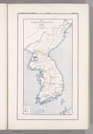


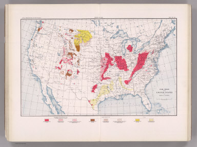


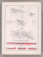


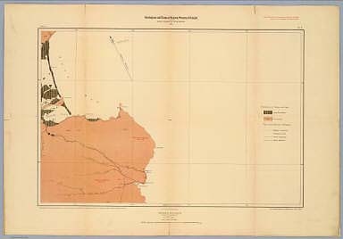


![Geologic Map Of The Southern Part Of The Kaibab Plateau. [Part I. North-Western Sheet.]](https://www.davidrumsey.com/rumsey/Size2/D0009/00092151.jpg)
![Geologic Map Of The Southern Part Of The Kaibab Plateau. [Part II. North-Eastern Sheet.]](https://www.davidrumsey.com/rumsey/Size2/D0009/00092152.jpg)
![Geologic Map Of The Southern Part Of The Kaibab Plateau. [Part III. South-Western Sheet.]](https://www.davidrumsey.com/rumsey/Size2/D0009/00092153.jpg)
![Geologic Map Of The Southern Part Of The Kaibab Plateau. [Part IV. South-Eastern Sheet.]](https://www.davidrumsey.com/rumsey/Size2/D0009/00092154.jpg)