Browse All

1970 Ángulos de las pendientes Instituto de Geografía (Aca … 13566.025 |

1970 Tipos de Costas Instituto de Geografía (Aca … 13566.028 |

1974 Rel'yef dna Severnoy chasti … Glavnoe Upravlenie Navigat︠s … 13622.029 |

1974 Morfometricheskie kharakteri … Glavnoe Upravlenie Navigat︠s … 13622.030 |

1974 Tsunami Glavnoe Upravlenie Navigat︠s … 13622.035 |

1974 Tsunami Glavnoe Upravlenie Navigat︠s … 13622.036 |

1974 Tipy Beregov Glavnoe Upravlenie Navigat︠s … 13622.041 |

1974 Donnye osadki Glavnoe Upravlenie Navigat︠s … 13622.042 |

1974 Granulometricheskiy sostav d … Glavnoe Upravlenie Navigat︠s … 13622.043 |

1977 Morfometricheskie kharakteri … Gorshkov, Sergei Georgievich … 13623.027 |

1977 Rel'yef dna yuzhnoy chasti O … Gorshkov, Sergei Georgievich … 13623.028 |

1977 Zemletryaseniia i Vulkany Gorshkov, Sergei Georgievich … 13623.031 |

1977 Tsunami Gorshkov, Sergei Georgievich … 13623.033 |

1977 Tektonika Gorshkov, Sergei Georgievich … 13623.034 |

1977 Stroyenie zemnoy kory Gorshkov, Sergei Georgievich … 13623.035 |

1977 Tipy Beregov Gorshkov, Sergei Georgievich … 13623.038 |

1977 Khimicheskie komponenty v do … Gorshkov, Sergei Georgievich … 13623.041 |

1977 Khimicheskie komponenty v do … Gorshkov, Sergei Georgievich … 13623.042 |

1980 Tipy Beregov Gorshkov, Sergei Georgievich … 13624.033 |

1980 Donnye osadki Gorshkov, Sergei Georgievich … 13624.034 |

1980 Granulometricheskiy sostav d … Gorshkov, Sergei Georgievich … 13624.035 |

1980 Poliarnye siianiia Gorshkov, Sergei Georgievich … 13624.146 |

1980 Grafiki povtoriaemosti polia … Gorshkov, Sergei Georgievich … 13624.147 |

1980 Grafiki povtoriaemosti polia … Gorshkov, Sergei Georgievich … 13624.148 |

1965 Evropa - Geologie, pudy = Eu … Československá akademie ve … 13684.034 |

1965 Geologie - Střední Evropa = … Československá akademie ve … 13684.043 |

1965 Asie - Geologie Půdy = Asia … Československá akademie ve … 13684.115 |

1965 Afrika - Geologie Půdy = Afr … Československá akademie ve … 13684.139 |

1965 Severní a Jižní Amerika - Ge … Československá akademie ve … 13684.149 |

1965 Austrálie, Nový Zéland - Geo … Československá akademie ve … 13684.171 |

1958 (13) Physiographic regions. Canada. Department of Mines … 14001.032 |

1951 (14) Physiography of Souther … Canada. Department of Mines … 14001.034 |

1958 (15) Glacial geology. Canada. Department of Mines … 14001.036 |

1956 (16) Bedrock geology. Canada. Department of Mines … 14001.038 |

1955 (17) Principal minerals. Canada. Department of Mines … 14001.040 |

1955 (73) Non-ferrous metals - Ea … Canada. Department of Mines … 14001.152 |

1887 9. A geological map of the B … Stanford, Edward, 1827-1904 14053.067 |

1895 Geology. Survey of India Department 14252.010 |
1895 Geology. Survey of India Department 14252.010 |

1972 Gesteine und Bodenschätze .. … Imhof, Eduard, 1895-1986; Ei … 14256.220 |

1977 Zentralschweiz ... Imhof, Eduard, 1895-1986; Ei … 14256.292 |

1977 Zentralschweiz ... Imhof, Eduard, 1895-1986; Ei … 14256.293 |

1968 Nordostschweiz und Graubünde … Imhof, Eduard, 1895-1986; Ei … 14256.295 |

1968 Nordostschweiz und Graubünde … Imhof, Eduard, 1895-1986; Ei … 14256.296 |

1966 Geology. Geological Survey (U.S.); Ki … 14359.054 |

1965 Glacial geology of North Ame … Geological Survey (U.S.); De … 14359.055 |

1968 Karstlands. Geological Survey (U.S.); Da … 14359.056 |

1968 Bottom sediments. Geological Survey (U.S.); Un … 14359.058 |

1967 Geologic map : Scale 1:250,0 … Geological Survey (U.S.) 14359.243 |

1970 Geologic map : Scale 1:24,00 … Geological Survey (U.S.) 14359.244 |

1968 Geologic mapping at 1:63,360 … Geological Survey (U.S.) 14359.245 |

1910 Irtonaiset maalajit = Dépôts … Suomen Maantieteellinen Seur … 14367.018 |

1910 Fennoskandia = Fennoscandia … Suomen Maantieteellinen Seur … 14367.020 |

1910 Fennoskandian irtonaiset maa … Suomen Maantieteellinen Seur … 14367.021 |

1944 Arquipélago de Cabo Verde es … Portugal. Ministério das Col … 14369.034 |

1947 Carta hipsométrica da Guiné … Portugal. Ministério das Col … 14369.042 |

1946 Esbôço geológico da Ilha de … Portugal. Ministério das Col … 14369.053 |

1948 Esbôço geológico e mineiro d … Portugal. Ministério das Col … 14369.067 |

1947 Esbôço geológico e mineiro d … Portugal. Ministério das Col … 14369.082 |

1943 Distrito de Goa esbôço geoló … Portugal. Ministério das Col … 14369.094 |

1948 Esbôço geológico da colónia … Portugal. Ministério das Col … 14369.101 |

1946 Esbôço geológico e mineiro d … Portugal. Ministério das Col … 14369.106 |

1869 Première coupe générale du B … Dormoy, Émile; Administratio … 14382.020 |

1869 Deuxième coupe générale du B … Dormoy, Émile; Administratio … 14382.021 |

1869 Troisième coupe générale du … Dormoy, Émile; Administratio … 14382.022 |

1869 Quatrième coupe générale du … Dormoy, Émile; Administratio … 14382.023 |

1869 Cinquième coupe générale du … Dormoy, Émile; Administratio … 14382.024 |

1969 Geologie. Imhof, Eduard, 1895-1986 14401.066 |

1905 Mitteleuropa, Geologische Ü … Andree, Richard; Scobel, Alb … 1463.023 |

1881 Vulkane, Koralleninseln. Andree, Richard 1494.004 |

1870 Asher & Adams' New York, Geo … Asher & Adams; Hitchcock, C. … 1510.005 |

1885 Geological map of Maine. Hitchcock, Charles H. (Charl … 1537.003 |

1882 Map of the Washoe District S … Becker, George F. 1566.001 |

1882 Geological Map of the Washoe … Becker, George F. 1566.002 |

1882 Vertical Cross Sections of t … Becker, George F. 1566.003 |

1882 Vertical Cross Sections of t … Becker, George F. 1566.004 |

1882 Vertical Cross Sections of t … Becker, George F. 1566.005 |

1882 Horizontal Section of the Co … Becker, George F. 1566.006 |

1882 Horizontal Section of the Co … Becker, George F. 1566.007 |

1882 Longitudinal Vertical Projec … Becker, George F. 1566.008 |

1882 Longitudinal Vertical Projec … Becker, George F. 1566.009 |

1882 Longitudinal Vertical Projec … Becker, George F. 1566.010 |

1882 Comstock Mine Maps. Number I … Becker, George F. 1566.011 |

1882 Comstock Mine Maps. Number I … Becker, George F. 1566.012 |

1882 Comstock Mine Maps. Number I … Becker, George F. 1566.013 |

1882 Comstock Mine Maps. Number I … Becker, George F. 1566.014 |

1882 Comstock Mine Maps. Number V … Becker, George F. 1566.015 |

1882 Comstock Mine Maps. Number V … Becker, George F. 1566.016 |

1882 Comstock Mine Maps. Number V … Becker, George F. 1566.017 |

1882 Comstock Mine Maps. Number V … Becker, George F. 1566.018 |

1882 Comstock Mine Maps. Number V … Becker, George F. 1566.019 |

1872 Geol. map N.J. Beers, F. W. (Frederick W.); … 1573.001 |

1892 Thatigkeit des Erdinnern. Berghaus, Hermann 1578.003 |

1892 Grund u. Boden. Berghaus, Hermann; Luddecke, … 1578.004 |

1892 Eisverbreitung. Berghaus, Hermann 1578.005 |

1892 Gletscherkarte. Berghaus, Hermann 1578.006 |

1892 Ubersicht der Erde. Berghaus, Hermann; Luddecke, … 1578.007 |

1892 Europa. Berghaus, Hermann 1578.008 |

1892 Alpenlander. Berghaus, Hermann 1578.009 |

1892 Asien u. Europa. Berghaus, Hermann 1578.010 |

1892 Afrika. Berghaus, Hermann 1578.011 |

1892 Nord-Amerika. Berghaus, Hermann 1578.012 |

1892 Sud-Amerika. Berghaus, Hermann; Luddecke, … 1578.013 |

1892 Oceanien. Berghaus, Hermann 1578.014 |

1851 38. Erdansichten der Alten. … Bromme, Traugott 1615.043 |

1906 No. 2, Relief map; West shee … White, James; Canada. Depart … 1645.015 |

1906 No. 3, Relief map; East shee … White, James; Canada. Depart … 1645.016 |

1906 No. 4, Geology; West sheet White, James; Canada. Depart … 1645.017 |

1906 No. 5, Geology; East sheet White, James; Canada. Depart … 1645.018 |

1915 West sheet. Geological map o … Canada. Department of Interi … 1646.014 |

1915 Eat sheet. Geological map of … Canada. Department of Interi … 1646.015 |

1964 Geology Raisz, Erwin 1790.009 |

1964 Florida's Land Forms Raisz, Erwin 1790.010 |

1827 Saxe mineralogique. Bory de Saint-Vincent, M. (J … 1801.025 |

1827 St. Pierre Plateau. Bory de Saint-Vincent, M. (J … 1801.027 |

1827 Antrim, Raghery. Bory de Saint-Vincent, M. (J … 1801.037 |

1827 Lacs volcaniques. Bory de Saint-Vincent, M. (J … 1801.042 |

1827 Lacs volcaniques. Bory de Saint-Vincent, M. (J … 1801.043 |

1827 Volcans Haute Loire. Bory de Saint-Vincent, M. (J … 1801.044 |

1827 Environs de Clermont. Bory de Saint-Vincent, M. (J … 1801.045 |

1827 Conjecturale de l'Atlantide. Bory de Saint-Vincent, M. (J … 1801.046 |

1876 Climatological and Geologica … Everts, Ensign & Everts 1828.007 |

1948 Resource-Relief Maps of: Nor … Hammond, C.S. 1954.007 |

1948 World, Europe, and Australia … Hammond, C.S. 1954.012 |

1876 Green River from the Union P … Bishop, F. M.; De Motte, B. … 2078.002 |

1876 Structure sections through t … Geological and Geographical … 2078.003 |

1876 Displacement diagrams ... th … Geological and Geographical … 2078.004 |

1876 Stereogram of the displaceme … Geological and Geographical … 2078.005 |

1876 Bird's-eye view of a part of … Geological and Geographical … 2078.006 |

1876 Stereogram of the displaceme … Geological and Geographical … 2078.007 |

1876 Structure sections, displace … Geological and Geographical … 2078.008 |

1879 Geological map of the distri … Dutton, Clarence E. (Clarenc … 2080.002 |

1879 Map of portions of Utah and … Dutton, Clarence E. (Clarenc … 2080.004 |

1879 Stereogram of displacements … Dutton, Clarence E. (Clarenc … 2080.005 |

1879 Structure sections through t … Dutton, Clarence E. (Clarenc … 2080.006 |

1879 Structure sections through t … Dutton, Clarence E. (Clarenc … 2080.007 |

1908 Geomorphic map, California, … California. State Earthquake … 2130.001 |

1908 Coast of California showing … California. State Earthquake … 2130.002 |

1908 San Andreas Rift near Fort R … California. State Earthquake … 2130.003 |

1908 San Francisco Bay showing Sa … California. State Earthquake … 2130.004 |

1908 Coast Ranges showing San And … California. State Earthquake … 2130.005 |

1908 Mt. Pinos quadrangle showing … California. State Earthquake … 2130.006 |

1908 Tejon quadrangle showing San … California. State Earthquake … 2130.007 |

1908 Palmdale quadrangle showing … California. State Earthquake … 2130.008 |

1908 Rock Creek quadrangle showin … California. State Earthquake … 2130.009 |

1908 San Antonio quadrangle showi … California. State Earthquake … 2130.010 |

1908 Hesperia quadrangle showing … California. State Earthquake … 2130.011 |

1908 San Bernardino quadrangle sh … California. State Earthquake … 2130.012 |

1908 Redlands quadrangle showing … California. State Earthquake … 2130.013 |

1908 San Gorgonio quadrangle show … California. State Earthquake … 2130.014 |

1908 San Jacinto quadrangle showi … California. State Earthquake … 2130.015 |

1908 Santa Rosa, portions destroy … California. State Earthquake … 2130.016 |

1908 Geological map San Francisco … California. State Earthquake … 2130.017 |

1908 Geological profiles, San Fra … California. State Earthquake … 2130.018 |

1908 San Francisco intensity of e … California. State Earthquake … 2130.019 |

1908 San Francisco burnt area, 19 … California. State Earthquake … 2130.020 |

1908 San Mateo quadrangle showing … California. State Earthquake … 2130.021 |

1908 Santa Cruz quadrangle showin … California. State Earthquake … 2130.022 |

1908 California, Nevada showing i … California. State Earthquake … 2130.023 |

1908 Coast Range Middle Californi … California. State Earthquake … 2130.024 |

1908 Distribution of earth moveme … California. State Earthquake … 2130.025 |

1952 Plisfero Tettonico. Instituto Geographico di Ago … 2170.005 |

1952 Europa. Instituto Geographico di Ago … 2170.024 |

1952 Italia Fisica. Instituto Geographico di Ago … 2170.027 |

1875 Map, hot springs, United Sta … Wheeler, G.M. 2220.067 |

1875 Sketch, Canon San Diego, Ojo … Wheeler, G.M. 2220.077 |

1881 Section along 36th parallel … Wheeler, G.M. 2220.078 |

1881 Section along 37th parallel, … Wheeler, G.M. 2220.079 |

1873 Map of Maryland and the Dist … Tyson, Philip T. 2239.001 |

1913 Hemispheres. Coal Resources … McInnes, William; Dowling, D … 2249.005 |

1913 New South Wales, Australia. … Pittman, E.F. 2249.006 |

1913 Queensland, Australia. Coal … Dunstan, B. 2249.008 |

1913 Collie Coalfield, West Austr … Woodward, H.P. 2249.009 |

1913 Netherlands India. Coal Reso … McInnes, William; Dowling, D … 2249.011 |

1913 Ombilin Kolenveld, Netherlan … McInnes, William; Dowling, D … 2249.013 |

1913 China. Coal Resources of the … McInnes, William; Dowling, D … 2249.014 |
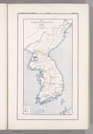
1913 Corea. Coal Resources of the … McInnes, William; Dowling, D … 2249.015 |

1913 Phyong-Yang Coal Field, Core … Kawasaki, H.; Tamura, E. 2249.016 |

1913 Manchuria. Fu-Shun. Coal Res … Ogawa, T.; Kido, C. 2249.017 |

1913 Japan. Coal Resources of the … McInnes, William; Dowling, D … 2249.019 |

1913 Ishikari, Japan. Coal Resour … Oinouye, Y. 2249.020 |

1913 Chikuho, Japan. Coal Resourc … Suzuki, F.; Kido, C.; Matsud … 2249.021 |

1913 Karatsu and Sasebo, Japan. C … Otsuki, Y. 2249.022 |

1913 India and Adjacent Countries … McInnes, William; Dowling, D … 2249.023 |

1913 Asiatic Turkey. Coal Resourc … McInnes, William; Dowling, D … 2249.024 |

1913 Canada. Coal Resources of th … Dowling, D.B. 2249.026 |

1913 Nova Scotia, New Brunswick, … McInnes, William; Dowling, D … 2249.027 |

1913 Sydney, Canada. Coal Resourc … McInnes, William; Dowling, D … 2249.028 |

1913 Southern Vancouver Island, B … McInnes, William; Dowling, D … 2249.029 |

1913 United States. Coal Resource … Campbell, Marius R. 2249.030 |

1913 England and Wales. Coal Reso … Strahan, A. 2249.031 |

1913 Coal Fields, France. Coal Re … McInnes, William; Dowling, D … 2249.033 |

1913 Coal Fields, France. Coal Re … McInnes, William; Dowling, D … 2249.034 |

1913 Coal Fields, France. Coal Re … McInnes, William; Dowling, D … 2249.035 |

1913 Coal Fields, France. Coal Re … McInnes, William; Dowling, D … 2249.036 |

1913 Coal Fields, France. Coal Re … McInnes, William; Dowling, D … 2249.037 |

1912 Hongrie. Coal Resources of t … de Pann, Charles 2249.038 |

1913 Coal Fields No. 1, Austria. … Petrascheck, W. 2249.039 |

1913 Coal Fields No. 2, Austria. … Petrascheck, W. 2249.040 |

1913 Coal Fields No. 3, Austria. … Petrascheck, W. 2249.041 |

1913 Coal Fields No. 4, Austria. … Petrascheck, W. 2249.042 |
1913 Coal Fields No. 5, Austria. … Frieser, A. 2249.043 |

1913 Coal Fields No. 6, Austria. … Frieser, A. 2249.044 |

1913 Coal Fields No. 7, Austria. … Petrascheck, W. 2249.045 |

1913 Coal Fields No. 8, Austria. … Petrascheck, W. 2249.046 |

1913 Servia. Coal Resources of th … Milojkovitch, J.A. 2249.047 |

1913 Roumanie. Coal Resources of … McInnes, William; Dowling, D … 2249.048 |

1909 Skane, Sweden. Coal Resource … Erdmann, Edvard 2249.049 |

1913 Spitzbergen, Norway. Coal Re … Nathorst, A.G.; De Geer; Bac … 2249.050 |

1865 Geological Map of England an … Society for the Diffusion of … 2326.010 |

1870 Geological map, Illinois. Campbell, R.A.; Worthen, Amo … 2483.089 |

1843 Europa in Geologischer Bezie … Berghaus, Heinrich 2515.031 |

1839 Die Vulkanischen Erscheinung … Berghaus, Heinrich 2515.034 |

1839 Specialia vom Vulkan Gurtel … Berghaus, Heinrich 2515.035 |

1838 Karte von dem Vulkan Gurtel. Berghaus, Heinrich 2515.036 |

1840 Die Vulkanreihe von Guatemal … Berghaus, Heinrich 2515.037 |

1843 Geologische Karte von Deutsc … Berghaus, Heinrich 2515.039 |

1843 Spezial-Karte vom Riesen-Geb … Berghaus, Heinrich 2515.040 |

1845 Geologische Profile von Deut … Berghaus, Heinrich 2515.041 |

1844 Vermischtes zur Geologie. Berghaus, Heinrich 2515.042 |

1872 Geological map of Ohio. Newberry, John S. 2710.002 |

1873 50. Central & Western Utah. Wheeler, G.M. 2738.036 |

1873 58, 66. Parts Of E. Californ … Wheeler, G.M. 2738.045 |

1873 59. Southern And Southwester … Wheeler, G.M. 2738.048 |

1873 67. Parts Of Northern & Nort … Wheeler, G.M. 2738.069 |

1881 69B, D, 77B, 78A. Parts of A … Wheeler, G.M. 2738.073 |

1881 70A. Parts Of Southern Color … Wheeler, G.M. 2738.078 |

1881 70C. Part Of North Central N … Wheeler, G.M. 2738.081 |

1877 75. Cent., W. Arizona. Wheeler, G.M. 2738.086 |

1877 76. Parts Of Eastern Arizona … Wheeler, G.M. 2738.088 |

1877 83. Parts Of Eastern & South … Wheeler, G.M. 2738.098 |

1854 Michigan. Lange, Henry, 1821-1893. 2743.010 |

1874 Geological map of Minnesota … Andreas, A. T. (Alfred Theod … 3034.004 |

1878 (General geological map of N … Hitchcock, Charles H. (Charl … 3095.005 |

1878 (General geological map of N … Hitchcock, Charles H. (Charl … 3095.006 |

1878 (General geological map of N … Hitchcock, Charles H. (Charl … 3095.007 |

1878 (General geological map of N … Hitchcock, Charles H. (Charl … 3095.008 |

1878 (General geological map of N … Hitchcock, Charles H. (Charl … 3095.009 |

1878 (General geological map of N … Hitchcock, Charles H. (Charl … 3095.010 |

1878 Composite: New Hampshire gen … Hitchcock, Charles H. (Charl … 3095.011 |

1878 (Topographic and glacial fea … Hitchcock, Charles H. (Charl … 3095.012 |

1878 (Topographic and glacial fea … Hitchcock, Charles H. (Charl … 3095.013 |

1878 (Topographic and glacial fea … Hitchcock, Charles H. (Charl … 3095.014 |

1878 (Topographic and glacial fea … Hitchcock, Charles H. (Charl … 3095.015 |

1878 (Topographic and glacial fea … Hitchcock, Charles H. (Charl … 3095.016 |

1878 Map of the Ammonoosuc Mining … Hitchcock, Charles H. (Charl … 3095.018 |

1886 France : Hypsometrique : Rel … Drioux, Claude-Joseph; Leroy … 3277.032 |

1874 Geological map US. Blake, William P. (William P … 3566.010 |

1871 Political map of Illinois. W … Warner, Higgins & Beers; Llo … 3749.009 |

1878 Geological Map of the United … Gray, Ormando Willis; Hitchc … 3888.070 |