|
REFINE
Browse All : Covers from 1813
1-9 of 9
Author
[Geographisches Institut (Weimar), Streit, Friedrich Wilhelm, 1772-1839]
Full Title
(Covers to) (Group of maps from) Topographisch-militairische Charte von Teutschland : in 204 Sectionen, unternommen von dem Geographisches Institut zu Weimar 1807.
List No
15616.001
Author
[Brue, Adrien Hubert, 1786-1832, Herrison, Eustache]
Full Title
(Covers to) Carte de l'Empire Francais et Des Etats Limitrophes.
List No
15569.001
Author
Tardieu, Pierre Antoine, 1784-1869
Full Title
(Covers to) Carte des routes de postes de l'Empire français, du royaume d'Italie et de la Confédération du Rhin, dressée par ordre du Conseil d'administration des postes et relais
List No
10914.001
Author
Schmidt, Ludwig
Full Title
(Covers to) Charte von dem Erzherzogthume Oesterreich ob und unter der Enns : in VI. Sectionen ; Nach allen bekannten Astronomischen und mehr als 100 neuen Trigonometrischen Ortsbestimmungen entworfen, aus ächten Aufnahmen gezogen und bearbeitet . . .
List No
10686.001
Author
Melish, John
Full Title
(Covers to) A Military and Topographical Atlas of the United States; including The British Possessions & Florida ... To Which Is Added, A List Of The Military Districts, A Register Of The Army, And A List Of The Navy Of The United States. By John Melish. Philadelphia, Printed By G. Palmer. November, 1813.
List No
0495.001
Author
[Holland, Samuel, 1728-1801, Wyld, James, 1812-1887]
Full Title
(Covers to) A New Map Of The Province Of Lower Canada, Describing all the Seigneuries, Townships, Grants of Land, &c. Compiled from Plans deposited in the Patent Office Quebec; By Samuel Holland, Esq. Surveyor General ... London. James Wyld Geographer to Her Majesty. 5 Charing Cross, Jany. 1, 1838 (Second Edition).
List No
10753.002
Note
The first edition was 1802, with later editions in 1813, 1829, 1838, 1840 and 1843. Shows Canada from just west of Montreal east to St. John in New Brunswick. The 1802 edition was based on surveys made by Samuel Holland before his death in 1801. This was a companion map (although on a larger scale) to the David Smyth/Faden/Wyld map of Upper Canada, first issued in 1800 (see our copies). With outline color. See our 5065.000 for the 1838 edition. "Important map of the Lower Province of Canada, including information concerning over 100 land grants on either side of the St. Lawrence River, including the names of Land Owners. The map has been updated to show the surveys conducted in 1796-98 along the Scoudiac and Magaguadavic Rivers, in order to ascertain the true location of the St. Croix River. This second article of the Treaty of Peace between the US and Britain included a line...From the northwest angle of Nova Scotia, viz., that angle which is formed by a line drawn due north from the source of St. Croix River to the highlands… It later became apparent that there was more than one St. Croix River, a further treaty provision in 1794 appointed a boundary comission, which detemined in 1798 that the intended St. Croix was the Schoodiac River and its northern branch Cheputnaticook. The Treaty of Ghent, concluded on December 24, 1814, agreed to provide for a final adjustment of the boundaries described in the Treaty of 1783 that had not yet been determined, which included the boundary line from the source of the River St. Croix to the most northwestern point of the Lake of the Woods. A further commission was appointe to settle the boundary from the St. Croix to the St. Lawrence. Joseph Bouchette and John Lawrence were hired to conduct the surveys and the reports submitted for resolution to a third nation and ulimately resolved by the Webster-Ashburton Treaty of 1842. A scarce and important map." (Ruderman, 2021)
Author
[Geographisches Institut (Weimar), Streit, Friedrich Wilhelm, 1772-1839]
Full Title
(Covers to) Sect. 10. Topographisch-militairische Charte von Teutschland : in 204 Sectionen, unternommen von dem Geographisches Institut zu Weimar 1807. (second title page) Sect. 10. Carte topographique et militaire de L'Allemagne : en 204 feuilles, publiee par l'Institut geographique a Weimar, 1807-1813.
List No
11803.001
Author
[Kensett, Thomas, Shelton, W.]
Full Title
(Covers to) An Improved Map of the United States. By Shelton & Kensett.
List No
4418.001
Note
This is the pocket map version of our 4417, folded into brown leather covers 16.5x7.5 with "Map U. States" stamped in gilt, with ribbon ties. The map has been trimmed to fit the covers (as issued) so that the copyright date above the neat line and the publishing date below the neat line are not present (probably the same as the Karpinski copy which he dated "1813?"). Outline color by state.
Author
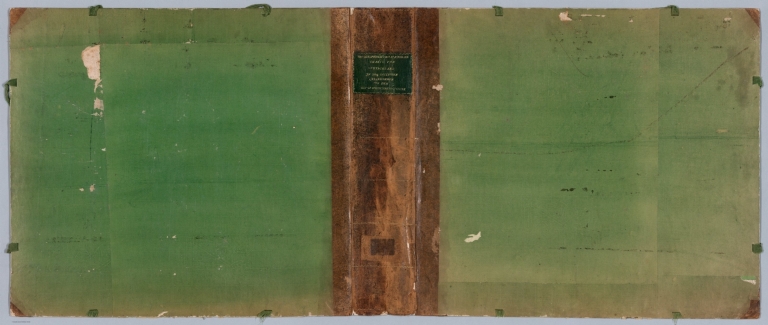
Darton, William
Full Title
(Covers to) 38 maps. Union atlas, containing new and improved maps of all the empires, kingdoms, & states, in the known world, designed as a companion to the various gazetteers & books of geography now in use, the whole clearly engraved by artists of eminence and carefully coloured. Including maps of the Roman Empire and Ancient Greece. Published Jany. 25th, 1812, by William Darton, 58 Holborn Hill, London. (1813)
List No
4767A
Note
New green marbled paper covered boards with a green leather spine and black leather label on the front reading "William Darton. Union Atlas 1812" in gilt.
1-9 of 9
|