|
Author
Andriveau-Goujon, Eugene
Full Title
(Composite Map) Carte Generale des Etats - Unis et du Mexique : Comprenant L'Amerique Centrale Et Les Antilles. E. Andriveau-Goujon, Editeur. Paris, Rue Du Bac, 21. 1862. (to accompany) Atlas classique et universel de geograparphie ancienne et moderne ... Nouvelle edition. 1863.
List No
13421.062
Note
Composite map of sheets 47-48: Etats - Unis et du Mexique.
Author
Arrowsmith, Aaron
Full Title
(Composite map of) (Sheets 1-3) Map of the Province of Malabar, Drawn from Various Surveys By A. Arrowsmith
List No
15782.004
Author
Cassini, Cesar-Francois, 1714-1784
Full Title
Composite: No. 81 (Troyes) and No. 112 (Joinville. 1763)
List No
15656.004
Author
Impr. Kappelin
Full Title
(Composite map to) Province De Constantine (Feuilles 1ere.& 2 e.)
List No
15655.004
Author
Andriveau-Goujon, E. (Eugène), 1832-1897
Full Title
(Composite map of) (North half and Southern half) Carte de l'Europe Orientale comprenant la Russie d'Europe L'Empire Ottoman et la Grèce. Paris, E. Andriveau-Goujon, éditeur, 21 Rue du Bac, 1860. Gravé le trait par Smith; la topographie par Gérin; les escritures par P. Rousset; les eaux par Mme. Fontaine
List No
15746.000
Author
Welser, Marcus
Full Title
(Composite map to) Prioris Schedae Explicatio (Peutinger Tables)
List No
15733.037
Author
[Bellerby & Co Globemakers, Bellerby, Peter]
Full Title
(Composite map of) (Sheets 1-18) 18 Blue Cassini 80cm Globe Gores Untrimmed
List No
15703.019
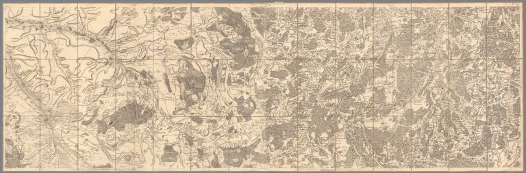
Author
Glavnoe upravlenie geodezii i kartografii pri Sovete Ministrov SSSR
Full Title
(Composite map of) (Sheets 1-6) Dal’nii Vostok [The Far East]
List No
15483.007
Note
Dimensions are full sheet size.
Author
[Verbeek, Rogier Diederik Marius (1845 - 1926), Fennema, Reinder (1849 – 1897)]
Full Title
(Composite map of) A. I - D. X Geologische kaart van Java en Madoera in 26 Bladen. Opgenomen door de Hoofdingenieurs van het Mijnwezen Dr. R.D.M. Verbeek en R. Fennema met medewerking van de Topografen J.G. de Groot en M.H.A. Voorsmit, de Opzieners bij het Mijnwezen J.F. de Corte en H.P.J. Naumann en den teekenaar A.L.E. Gaston in de jaren 1886-1894.
List No
15561.029
Author
Imperial Regio Istituto Geografico Militare
Full Title
(Composite map of) I. - VIII. Carta Topografica del Ducato di Modena
List No
15667.009
Author
Istituto Geografico Militare
Full Title
(Composite map of) I. - IX. Carta Topografica dei Ducati di Parma, Piacenza e Guastalla levata dietro misure trigonometriche negli anni 1821-1822 sotto il Governo di Sua Maestà L'Arciduchessa Maria Luigia
List No
15702.011
Author
Hoffmann, Johann
Full Title
(Composite map of) 52 images of "Europaelsch-Geographlsche Spiel-charte"
List No
15665.016
Note
This is a composite image of 52 reproductions of the "Europaelsch-Geographlsche Spiel-charte" from the collection of the National Library of Norway https://www.nb.no/en/
Author
Chesney, Francis Rawson (1789 - 1872)
Full Title
(Composite map to) (sheets) I-XII
List No
15662.013
Author
Chesney, Francis Rawson (1789 - 1872)
Full Title
(Composite map to) (sheets) I-XII
List No
15662.014
Author
Cram, George Franklin, 1841-1928
Full Title
(Composite Map to) New York : Western half. -- New York : Eastern half. 1899, by Geo. F. Cram.
List No
14372.022
Note
Composite map of New York (western and eastern halves). Shows political boundaries, counties, towns, railroads, steamship lines, topography, bodies of water, drainage, coastlines and islands. Relief shown with hachures. Includes keys with explanations, latitudinal and longitudinal lines, as well as bar scales given in miles. With alphanumeric grid corresponding to "Index of New York" on pages 27-29, 32-35, 38-41 and 44. Colored lithograph. Together, maps are 56 x 80 cm, on two double sheets 67 x 90 cm. "Index of maps" and "Index of cities" in margins, providing navigation for atlas as a whole.
Author
Cram, George Franklin, 1841-1928
Full Title
(Composite Map to) Western half of Pennsylvania. -- Eastern half of Pennsylvania. 1899, by Geo. F. Cram.
List No
14372.036
Note
Composite map of Pennsylvania (western and eastern halves). Shows political boundaries, counties, towns, railroads, steamship lines, topography, bodies of water, drainage, coastlines and islands. Relief shown with hachures. Includes keys with explanations, latitudinal and longitudinal lines, as well as bar scales given in miles. With alphanumeric grid corresponding to "Index of Pennsylvania" on pages 45-55, 58-61 and 64-67. Colored lithograph. Together, maps are 54 x 85 cm, on two double sheets 67 x 90 cm. "Index of maps" and "Index of cities" in margins, providing navigation for atlas as a whole.
Author
Cram, George Franklin, 1841-1928
Full Title
(Composite Map to) Western half of Virginia and West Virginia. -- Eastern half of Virginia and West Virginia. 1899, by Geo. F. Cram.
List No
14372.056
Note
Composite map of Virginia and West Virginia (western and eastern halves). Shows political boundaries, counties, towns, railroads, steamship lines, topography, bodies of water, drainage, coastlines and islands. Relief shown with hachures. Includes keys with explanations, latitudinal and longitudinal lines, as well as bar scales given in miles. With alphanumeric grid corresponding to "Index of Virginia" on pages 85-93 and 96-98, and "Index of West Virginia" on pages 99, 102-105 and 108-110. Colored lithograph. Together, maps are 55 x 85 cm, on two double sheets 67 x 90 cm. "Index of maps" and "Index of cities" in margins, providing navigation for atlas as a whole.
Author
Cram, George Franklin, 1841-1928
Full Title
(Composite Map to) Ohio : North half. -- Ohio : [South half]. 1899, by Geo. F. Cram.
List No
14372.067
Note
Composite map of Ohio (northern and southern halves). Shows political boundaries, counties, towns, railroads, steamship lines, topography, bodies of water, drainage, coastlines and islands. Relief shown with hachures. Includes keys with explanations, latitudinal and longitudinal lines, as well as bar scales given in miles. With alphanumeric grid corresponding to "Index of Ohio" on pages 111-113, 116-119, 122-125 and 128. Colored lithograph. Together, maps are 80 x 55 cm, on two double sheets 90 x 67 cm. "Index of maps" and "Index of cities" in margins, providing navigation for atlas as a whole.
Author
Cram, George Franklin, 1841-1928
Full Title
(Composite Map to) Western half of Texas. -- Eastern half of Texas. 1899, by Geo. F. Cram.
List No
14372.187
Note
Composite map of Texas (western and eastern halves). Shows political boundaries, counties, towns, railroads, steamship lines, topography, bodies of water, drainage, coastlines and islands. Relief shown with hachures. Includes keys with explanations, latitudinal and longitudinal lines, as well as bar scales given in miles. With alphanumeric grid corresponding to "Index of Texas" on pages 341, 344-347, 350-353 and 356. Colored lithograph. Together, map is 57 x 81 cm, on two double sheets 67 x 90 cm. "Index of maps" and "Index of cities" in margins, providing navigation for atlas as a whole.
Author
Cram, George Franklin, 1841-1928
Full Title
(Composite Map to) California and Nevada : Northern half. -- California and Nevada : Southern half. 1899, by Geo. F. Cram.
List No
14372.205
Note
Composite map of California and Nevada (northern and southern halves). Shows political boundaries, counties, towns, railroads, topography, bodies of water, drainage, coastlines and islands. Relief shown with hachures. Includes keys with explanations, latitudinal and longitudinal lines, as well as bar scales given in miles. With alphanumeric grid corresponding to "Index of Nevada" on page 371; "Index of California" on pages 374-375, 378-379 and 382. Colored lithograph. Together, maps are 82 x 57 cm, on two double sheets 90 x 67 cm. "Index of maps" and "Index of cities" in margins, providing navigation for atlas as a whole.
Author
Cram, George Franklin, 1841-1928
Full Title
(Composite Map to) Western part of Washington. -- Eastern part of Washington. 1899, by Geo. F. Cram.
List No
14372.223
Note
Composite map of Washington (western and eastern halves). Shows political boundaries, counties, towns, Indian reservations, mines, railroads, topography, bodies of water, drainage, coastlines and islands. Relief shown with hachures. Includes keys with explanations, latitudinal and longitudinal lines, as well as bar scales given in miles. With alphanumeric grid corresponding to "Index of Washington" on pages 403 and 406-407. Colored lithograph. Together, map is 55 x 80 cm, on two double sheets 67 x 90 cm. "Index of maps" and "Index of cities" in margins, providing navigation for atlas as a whole.
Author
Cram, George Franklin, 1841-1928
Full Title
(Composite Map to) Western half of Nova Scotia. -- Eastern half of Nova Scotia. 1899, by Geo. F. Cram.
List No
14372.247
Note
Composite map of Nova Scotia, Canada (western and eastern halves). Shows political boundaries, counties, towns, railroads, topography, bodies of water, drainage, coastlines and islands. Relief shown with hachures. Includes keys with explanations, latitudinal and longitudinal lines, as well as bar scales given in miles. With alphanumeric grid corresponding to "Index of Nova Scotia" on pages 435 and 438-439. Colored lithograph. Together, map is 55 x 80 cm, on double sheet 67 x 90 cm. "Index of maps" and "Index of cities" in margins, providing navigation for atlas as a whole.
Author
[Nicholson, W. L., United States. Post Office Department]
Full Title
(Composite map to) (Upper and Lower Parts) Post route map of the Territory of Dakota with adjacent parts of Montana, Wyoming, Nebraska, Iowa and Minnesota and portions of the Dominion of Canada Designed and Constructed Under The Orders Of Postmaster General David M. Key by W.L. Nicholson Topographer of P.O. Dept. 1879.
List No
15661.004
Note
1st edition 1879, updated in ms to Jan. 1, 1880. Outline color.
Author
Andriveau-Goujon, E. (Eugène), 1832-1897
Full Title
(Composite to) Carte orographique hydrographique et routière de la France comprenant le Bassin du Rhin et la Région des Alpes occidentales réduite de la nouvelle carte de France de l'État-Major dressée au Dépôt de la Guerre. Publiée par E. Andriveau-Goujon, Rue du Bac, 4, Paris, 1881. Gravé sur Acier; le trait par Smith; la topographie par Gérin; les ecritures par P. Rousset; les eaux par Fontaine; Impie. Alfred Chardon Jne.
List No
14008.013
Note
Hand-colored, engraved fold-out map of France, showing political boundaries, roads and railroads (on double plate with decorative border, on two consecutive sheets: 8 and 9). Includes legend, as well as 3 bar scales and a scale statement. With inset: (Bouches de Bonifacio).
Author
Scheuchzer, Johann Jacob (1672-1733)
Full Title
(Composite map to) (Sheets 1-4) Nouvelle Carte De La Suisse Divisees en ses Treize Cantons Ses Alliez Et Ses Sujets
List No
15629.007
Note
Part of a 4 sheet map, when all joined 90 x 120 cm. This is a later edition of our Oudinot copy, 15047.000 See also the Homann edition, our 9753.051.
Author
Chauchard, M.
Full Title
(Composite msp to) Sheets I-IV. Carte de la partie septentrionale de l'Italie, Par M. Chauchard,
List No
15629.020
Note
Four sheets that make up the map, total size 98 x 166 cm
Author
[Stagnon, Jacopo, Borgonio, Giovanni Tommaso]
Full Title
(Composite map to) 1-25. Carta Corogrfica Degli Stati di S. M. il Re di Sardegna
List No
15629.063
Note
Map in 25 sheets, when joined measuring 239 x 195cm. Originally published in 1683, updated here in 1772. Famous and monumental map of Piedmont and its borders which includes the north-western part of the Italian peninsula, as well as portions of present-day France and present-day Switzerland, including Lake Geneva. Title on trompe-l'oeil drape, Liguria with the sea enlivened by vessels, and compass rose above. It contains numerous corrections with respect to the Borgonio map, especially for the Alps, integrating for example Mont Blanc which was missing from the 1683 map. This is the reprint, expanded and updated, between 1763 and 1772, the year of the publication, of the seventeenth-century chorographic map drawn by Tommaso Borgonio and engraved by Giovanni Maria Belgrano which for a long time constituted a model also for production beyond the Alps. The work was of considerable importance and was widely circulated, first of all among the members of the court, but it was also used in the Napoleonic age, despite the presence of several errors, G. Gentile, From the "Carta generale de' Stati di SAR" , 1680, to the "Corographic map of the States of SM the King of Sardinia, 1772, in B. Bertini Casadio, I. Massabò Ricci (edited by), The engraved branches of the Court Archive: sovereigns, battles, architectures, topography , exhibition catalogue, Turin, 1981, pp. 122-167.
Author
[Dury, Andrew, Chafrion, Jose]
Full Title
(Composite map to) 1-8 A Topographical Map of The Republick Of Genua Taken from the Celebrated Spanish Map by Chaffrion; with many additions & Improvements, 1784 = Carte Topographique Des Etats de la Republique de Genes = Carta Topographica Degli Stati Della Republica Di Genova = Topographische Charte Sämbtlichen Ländern der Republie Genua.
List No
15629.074
Note
8 sheet map, when joined 182x98cm.
Author
Delamarche, Charles Francois
Full Title
(Composite map to) (1-2) Carte de la Republique Cisalpine suivant le traité conclu entre la République Française et l'empereur : divisée en 20 départemens : avec la République Ligurienne et toutes les parties adjacentes, depuis le frontières de la Rép. Franc. jusqu'au golfe de Venise; où sont tracées toutes les routes
List No
15629.077
Note
1 map on 2 sheets : hand colored ; 64 x 97 cm
Author
[Maire, Christopher, Boscovich, Ruggiero Giuseppe]
Full Title
(Composite map to)( 1-3) Nuova carta geografica dello Stato Ecclesiastico delin.ta dal p. Cristof.ro Maire d.a C.a di Gesù sulle comuni osservazioni sue e del p. Ruggiero Gius.e Boscovich d.a med.a C.a. Alla santità di N.S. papa Benedetto 14
List No
15629.081
Note
Relief shown in hachures Shows Italy's Papal States circa 1750-55 Likely that map by Maire and Boscovich was result of request by Pope Benedict XIV to measure the meridian arc between Rome and Rimini and to obtain reliable data to correct earlier Papal State maps. 3 sheets measure when joined 107 x 63 cm
Author
[Schraembl, Franz Anton, Rizzi Zannoni, Giovanni Antonio (1736-1814)]
Full Title
(Composite Map) 70-72A. Generalkarte von dem Koenigreiche Neapel oder Napoli. Verfasst von Herrn Joh. Ant. Rizzi Zannoni. Neu herausgegeben von Herrn F.A. Schraembl. MDCCLXXXIX.
List No
15629.086
Note
see our 12498.105 for the same maps in the Schraembl Atlas.
Author
Page, Stanley Henry (1885-1964)
Full Title
(Composite map of) Sheets 1 - 24 San Francisco Aerial Views.
List No
15630.025
Author
Bacler d'Albe, Louis-Albert-Ghislain, 1761-1824
Full Title
(Composite map to) Feuilles I - XXX (copy 1,2,3)
List No
15622.033
Author
[France. Service géographique de l'armée, Depot De La Guerre (France), Lapie, M. (Pierre), 1779-1850, Pelet, Jean-Jacques-Germain]
Full Title
(Composite map to) Sheets 2-168.
List No
15619.062
Author
[Geographisches Institut (Weimar), Streit, Friedrich Wilhelm, 1772-1839]
Full Title
(Composite map to) Sections 50,51,60,61,58,83,69,59,82,70,71.
List No
15616.010
Note
Composite map of all sheets.
Author
[Cassini, Cesar-Francois, 1714-1784, Andriveau-Goujon, J.]
Full Title
(Composite map of) 25,2,44,26,1,45,27,7,46 (Cassinni. Environs De Paris)
List No
15602.011
Note
Date is estimated. These sheets appear to be updated from our first edition, see 5694.000
Author
[Kolleffel, Johann Lambert, Pfeffel, Ioh Andreæ]
Full Title
(Composite map to) No. 1-No. 6. Per Inclyti Circuli Suevici : Supremorum Ordinum Celsissimorum Praesulum, Serenissimorum Principum, Reverendissimorum Abbatum, Illustrissimorum Comitum,
List No
15596.008
Note
Date estimated.
Author
[Beers, D.G., Jewell, Ross]
Full Title
(Composite map to) Bi-Centennial Map Of The Town Of Newtown Connecticut. Published Under the Direction of The Bi-Centennial Committee. Plans & Supervision by D.G. Beers. Photographs & Canvass by Ross Jewell. 1905. Charles Hart Lith. 36 Vesey St., N.Y. (inset) Newtown. (inset) Rocky Glen. (inset) Sandy Hook.
List No
0061.004
Author
Petri, Isaak Jakob von
Full Title
(Composite map to) A1-D2 Gantz Neue Und Vollstaendige Geographische General=Charte vom Gantzen Churfürstenthum Sachsen mit allen einverleibten dazu gehörigen marggraffthümern, Fürstenthümern, Grafschafften, Stifftern und Herschafften auch andern fremden angrentzenden Laendern . . . 1763 . . .
List No
15591.009
Author
Petri, Isaak Jakob von
Full Title
(Composite map to) A1-D2 Gantz Neue Und Vollstaendige Geographische General=Charte vom Gantzen Churfürstenthum Sachsen mit allen einverleibten dazu gehörigen marggraffthümern, Fürstenthümern, Grafschafften, Stifftern und Herschafften auch andern fremden angrentzenden Laendern . . . 1763 . . .
List No
15591.010
Note
Adding missing sheets from our 155292.000 copy.
Author
Petri, Isaak Jakob von
Full Title
(Composite map to) 1-15 Gantz Neue Und Vollstaendige Geographische General=Charte vom Gantzen Churfürstenthum Sachsen mit allen einverleibten dazu gehörigen marggraffthümern, Fürstenthümern, Grafschafften, Stifftern und Herschafften auch andern fremden angrentzenden Laendern . . . 1763 . . .
List No
15592.014
Author
Petri, Isaak Jakob von
Full Title
(Composite map to) 1-15 Gantz Neue Und Vollstaendige Geographische General=Charte vom Gantzen Churfürstenthum Sachsen mit allen einverleibten dazu gehörigen marggraffthümern, Fürstenthümern, Grafschafften, Stifftern und Herschafften auch andern fremden angrentzenden Laendern . . . 1763 . . .
List No
15592.015
Note
Adding missing sheets 8,9,10 from out 15591.000 set.
Author
Jaeger, Johann Wilhelm Abraham
Full Title
(Composite map to) LX-LXXXI. Carte Topographique D'Allemagne
List No
15590.011
Author
Heymann. Ignace
Full Title
(Composite map to) 1-2. Carte des Postes D'Allemagne et pays limitrophes.
List No
15589.004
Author
Heymann. Ignace
Full Title
(Composite map to) 1-2. Carte des Postes D'Allemagne et pays limitrophes.
List No
15589.005
Note
Two maps fully joined.
Author
Schraembl, Franz Anton
Full Title
(Composite map of) 73-77. Ost Preussen
List No
15571.009
Author
[Brue, Adrien Hubert, 1786-1832, Herrison, Eustache]
Full Title
(Composite map of) (Sheets 1-4) Carte de l'Empire Francais et Des Etats Limitrophes.
List No
15569.006
Author
[Pagni, Nicolo, Bardi, Luigi]
Full Title
(Compositemap of) (Sheets 1,2,4,5,6) Carta del territorio della Repubblica Cisalpina e di parte delli Stati limitrofi.
List No
15565.007
Author
[Pagni, Nicolo, Bardi, Luigi]
Full Title
(Composite map of) Carta del territorio della Repubblica Cisalpina e di parte delli Stati limitrofi.
List No
15580.003
Note
Adds northern inset to the top of the map.
Author
[Zacharia, Captain, Ziya, Captain, Mahir, Captain]
Full Title
(Composite chart of) (Sheets 1-2) بحرسفيرد ارشيپل دكزى [Bahr-i Sefid. Arşipel Denizi / The White Sea. The Sea of Archipelago]
List No
15549.003
|


![Composite: (Sheets 1-6) Dal’nii Vostok [The Far East]](https://www.davidrumsey.com/rumsey/Size2/RUMSEY~8~1/205/15483007.jpg)


![Composite Map: Ohio : North half. -- Ohio : [South half].](https://www.davidrumsey.com/rumsey/Size2/RUMSEY~8~1/205/14372067.jpg)


![(Sheets 1-2) بحرسفيرد ارشيپل دكزى [Bahr-i Sefid. Arşipel Denizi / The White Sea. The Sea of Archipelago]](https://www.davidrumsey.com/rumsey/Size1/RUMSEY~8~1/205/15549003.jpg)