|
REFINE
Browse All : Case Map of United States and Central America
1-8 of 8
Author
Williams, G. Washington
Full Title
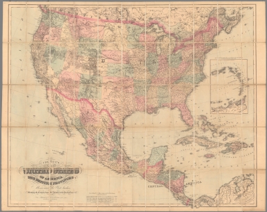
Williams' Copper - Plate Map Of The United States, Canada, Mexico, Central America, West Indies, &c. Published by John M. Atwood, 402 Locust Street, Philadelphia. Printed by F. Bourquin, 31 So. 6th Street, Phila. Copyright 1876 by G. Washington Williams.
List No
3030.002
Author
Colton, G.W. & C.B.
Full Title
Colton's Map Of The United States Of America, The British Provinces, Mexico and the West Indies. Showing the Country from the Atlantic to the Pacific Ocean. Published by G.W. And C.B. Colton & Co. 172 William St. New York. 1871. (inset) The Eastern Portion Of The West India Islands ...
List No
3323.002
Author
[Lubrecht, Charles, Rosa, R.]
Full Title
(Covers to) The American Continent. Topographical and railroad map of the United States, British Possessions, West Indies, Mexico and Central America. Compiled from the best authorities, by R. Rosa, late Col. 46th Regt. N.Y.S. Vol. Published by Ch. Lubrecht & Co., 12 Frankfort Street, New York. 1864. Agents For Great Britain: Bacon & Co., 48 Paternoster Row, London, England. For Germany, Switzerland And Italy: Fr. Volkmar, Leipsic. Lubrecht & Co., Stuttgart. Revised Edition. Entered ... 1864, by Ch. Lubrecht & Co. ... New York. (with) Central America.
List No
3127A
Note
1st edition. 2nd edition was1865, another edition in 1869 (Karrow 1-1683). German edition published in 1864. (Karrow 1-1655). Inset of Central America, text on top of map describing British American Possessions, Time Tables, and U.S. Census for 1860. We can find no earlier edition of this map, so the "Revised Edition" is puzzling. Lubrecht lists three foreign publishers for this map: Bacon in London, Volkmar in Leipsic, and Lubrecht & Co. in Stuttgart. An edition in German is described in Karrow. Later, this map became the more elaborate 1871 "American Union Railroad Map of the United States..." by Hassis & Lubrecht, also published by D.L. Gurnsey (see our copy, WH's copy, and Heaston Cat. 19 for a reproduction). The Proposed transcontinental railroad is shown going south of Salt Lake City, Wyoming is still part of Dakota, and a Proposed Southern Pacific Railroad runs from Fort Smith to Sacramento. Full color by state. Map is dissected into 24 sections and mounted on linen. Folded into black paper covered boards 24.5x21 with "The American Continent" stamped in gilt. Relief shown by hachures.
Author
[Lubrecht, Charles, Rosa, R.]
Full Title
The American Continent. Topographical and railroad map of the United States, British Possessions, West Indies, Mexico and Central America. Compiled from the best authorities, by R. Rosa, late Col. 46th Regt. N.Y.S. Vol. Published by Ch. Lubrecht & Co., 12 Frankfort Street, New York. 1864. Agents For Great Britain: Bacon & Co., 48 Paternoster Row, London, England. For Germany, Switzerland And Italy: Fr. Volkmar, Leipsic. Lubrecht & Co., Stuttgart. Revised Edition. Entered ... 1864, by Ch. Lubrecht & Co. ... New York. (with) Central America.
List No
3127.001
Note
1st edition. 2nd edition was1865, another edition in 1869 (Karrow 1-1683). German edition published in 1864. (Karrow 1-1655). Inset of Central America, text on top of map describing British American Possessions, Time Tables, and U.S. Census for 1860. We can find no earlier edition of this map, so the "Revised Edition" is puzzling. Lubrecht lists three foreign publishers for this map: Bacon in London, Volkmar in Leipsic, and Lubrecht & Co. in Stuttgart. An edition in German is described in Karrow. Later, this map became the more elaborate 1871 "American Union Railroad Map of the United States..." by Hassis & Lubrecht, also published by D.L. Gurnsey (see our copy, WH's copy, and Heaston Cat. 19 for a reproduction). The Proposed transcontinental railroad is shown going south of Salt Lake City, Wyoming is still part of Dakota, and a Proposed Southern Pacific Railroad runs from Fort Smith to Sacramento. Full color by state. Map is dissected into 24 sections and mounted on linen. Folded into black paper covered boards 24.5x21 with "The American Continent" stamped in gilt. Relief shown by hachures.
Author
Monk, Jacob
Full Title
(Covers to) Monk's new map of Central America, Yucatan & Florida including Cuba, Jamaica and the Bahama Islands, exhibiting those portions of Alabama, Mississippi, Louisiana, Texas & Mexico bordering on the Gulf of Mexico. Compiled from the latest government maps and orther (sic) authentic sources. 1857. Baltimore, drawn, engraved and printed by A. Hoen & Co. and published by Jacob Monk. Entered ... 1856 by Jacob Monk ... Maryland. (with) Map of the World on Mercator's projection, exhibiting the continent of America in central position...
List No
3936A
Note
This large and decorative map by Monk reflects the interest in Central America in the mid 50's (see Palmer, Wyld, Disturnell, and others) but adds the U.S. coast line from Florida to Texas, which is missing in most of the other maps of Central America. With a large inset map of the World, statistics on the Yucatan, boundary notes on Costa Rica, Historical Notes on Belize and the Mosquito Coast, and the usual abundance of Monk's decorative sailing ships. The inside cover lists this map, Monk's New American Map, and Monk's Railroad and Telegraph Map - which we have never heard of before (although Karrow does list an 1856 edition: 1-1612). Full color map, folded into stamped brown cloth covers 16x11 titled "Monk's New Map Of Central America, Cuba, Florida &c." Relief shown by hachures.
Author
Monk, Jacob
Full Title
Monk's new map of Central America, Yucatan & Florida including Cuba, Jamaica and the Bahama Islands, exhibiting those portions of Alabama, Mississippi, Louisiana, Texas & Mexico bordering on the Gulf of Mexico. Compiled from the latest government maps and orther (sic) authentic sources. 1857. Baltimore, drawn, engraved and printed by A. Hoen & Co. and published by Jacob Monk. Entered ... 1856 by Jacob Monk ... Maryland. (with) Map of the World on Mercator's projection, exhibiting the continent of America in central position...
List No
3936.001
Note
This large and decorative map by Monk reflects the interest in Central America in the mid 50's (see Palmer, Wyld, Disturnell, and others) but adds the U.S. coast line from Florida to Texas, which is missing in most of the other maps of Central America. With a large inset map of the World, statistics on the Yucatan, boundary notes on Costa Rica, Historical Notes on Belize and the Mosquito Coast, and the usual abundance of Monk's decorative sailing ships. The inside cover lists this map, Monk's New American Map, and Monk's Railroad and Telegraph Map - which we have never heard of before (although Karrow does list an 1856 edition: 1-1612). Full color map, folded into stamped brown cloth covers 16x11 titled "Monk's New Map Of Central America, Cuba, Florida &c." Relief shown by hachures.
Author
[Johnston, Alexander Keith, 1804-1871, Rogers, Henry Darwin]
Full Title
(Covers to) Map Of The United States, British & Central America. From State Documents and Unpublished Materials By Professor H.D. Rogers of Boston U.S. and A. Keith Johnston, F.R.S.E. Geographer To The Queen.
List No
4390A
Author
[Johnston, Alexander Keith, 1804-1871, Rogers, Henry Darwin]
Full Title
Map Of The United States, British & Central America. From State Documents and Unpublished Materials By Professor H.D. Rogers of Boston U.S. and A. Keith Johnston, F.R.S.E. Geographer To The Queen.
List No
4390.001
Note
First edition. Very large map of North America with nine inset maps of important cities. This map contains and is the basis of all the maps that appear in the Rogers and Johnston Atlas of the United States of North America, published in the same year. It is a stunning map, very detailed in the west; Wheat did not see this map, but did comment on two of the western maps in the Atlas - "This map is...notable for its clarity, though it is equally notable for the amount of information it contains. W and A.K. Johnston, of Edinburgh, were engravers who well understood their art, and their maps are outstanding." The Proposed Pacific Railway routes are shown. This map compares favorably to the large Colton and Mitchell U.S. maps of the same date (which are also on the same scale) and generally it is more accurate. Scarce, with only the later 1861 edition (title slightly changed - "Map of the United States and Mexico, with Canada...") in Karrow. This first edition is not in any references. A later edition, 1859, was issued with geological coloring (HR 13-123). The map case has Stanford's name at the bottom of the spine, indicating that he sold the map (and perhaps printed it as he did the Atlas). See also the 1861 U.S. only edition (#5405) and the full 1869 edition (#5402).
1-8 of 8
|